
Search for another town





Free U.S. delivery 7 to 10 days after you order
Alhambra, California Map Art
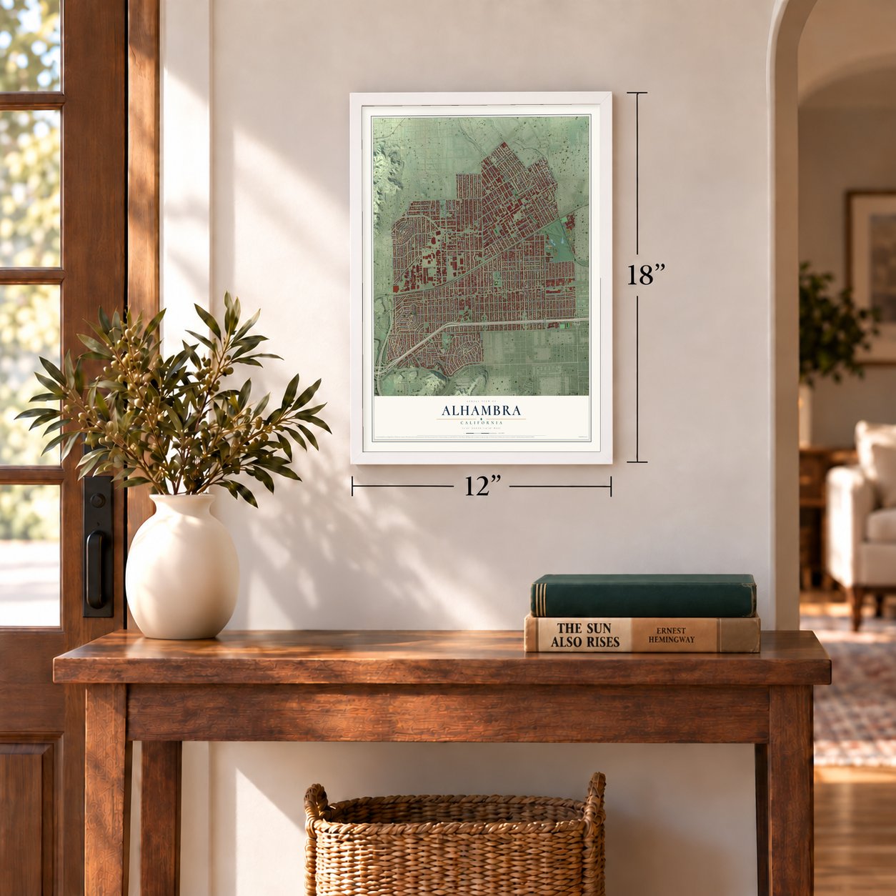
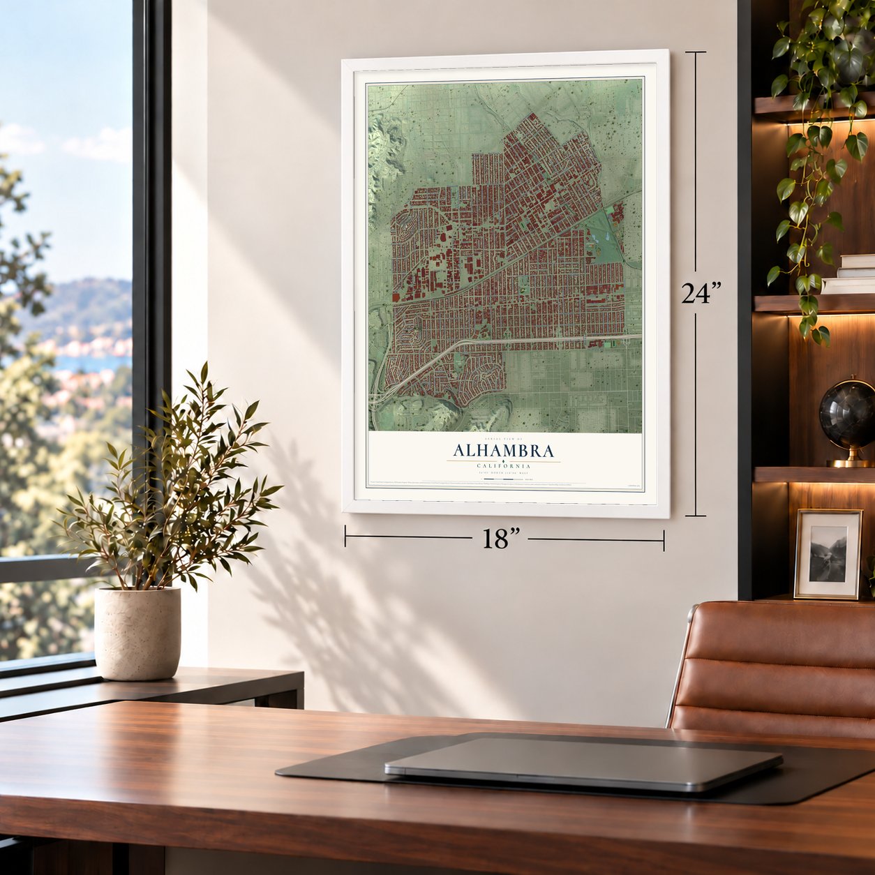
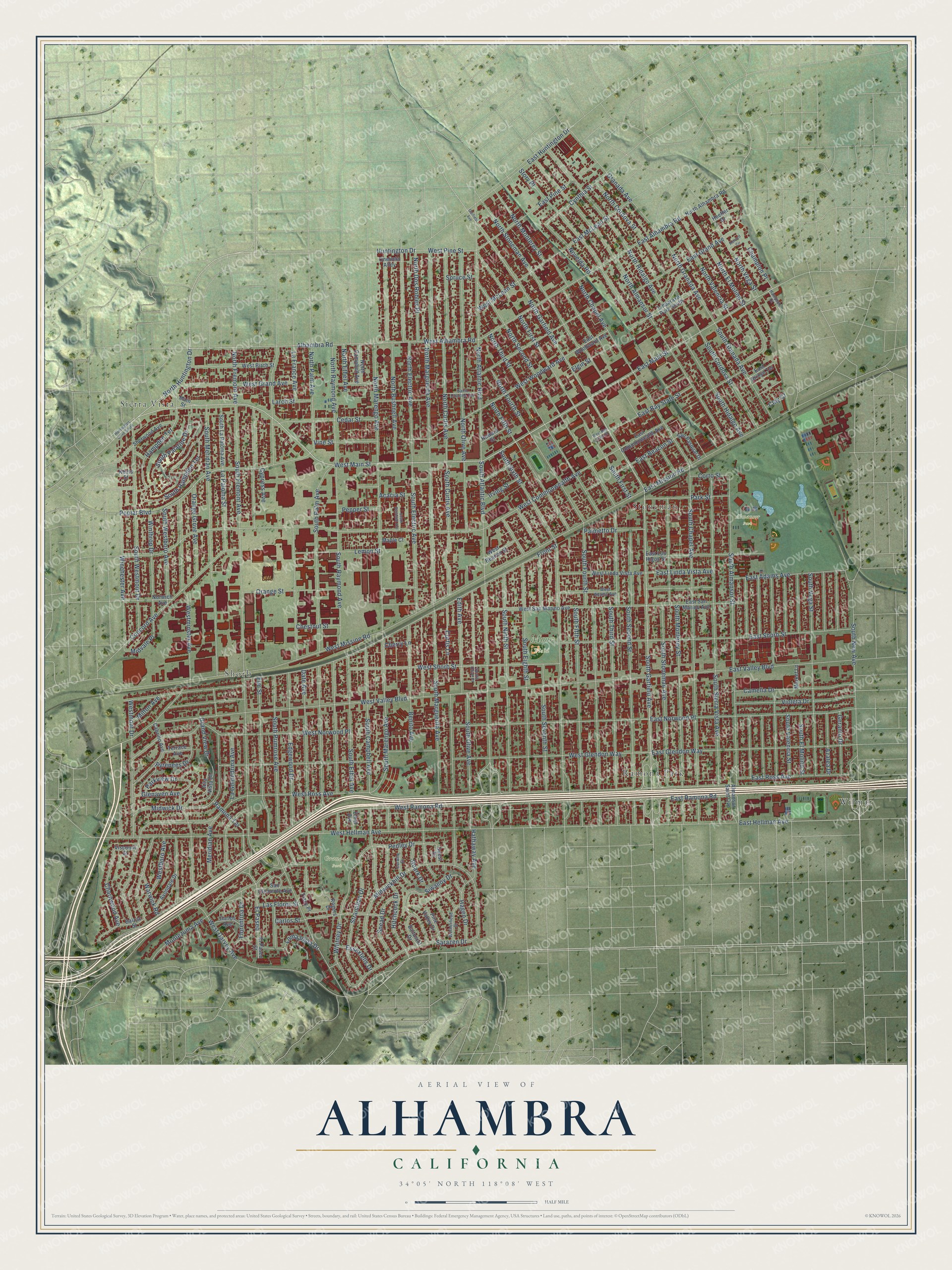
A new map of Alhambra, California, made in 2026 and printed to order on thick archival matte paper.
12" x 18" Archival Matte Print
A Map of Home. A Work of Art.
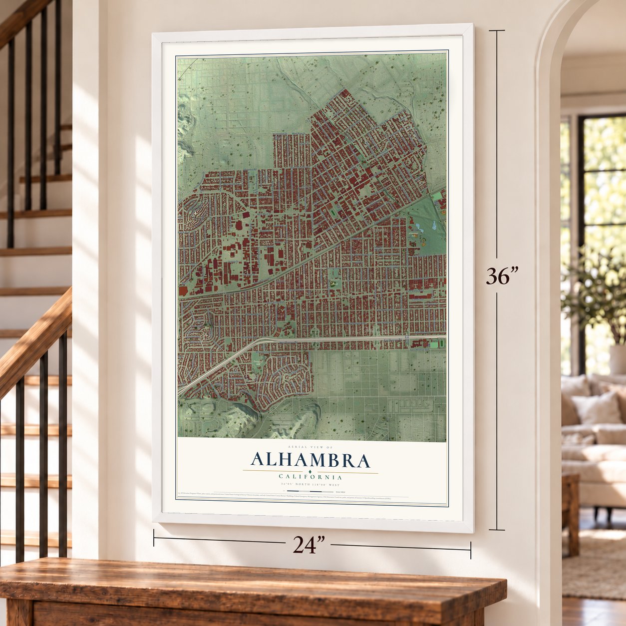
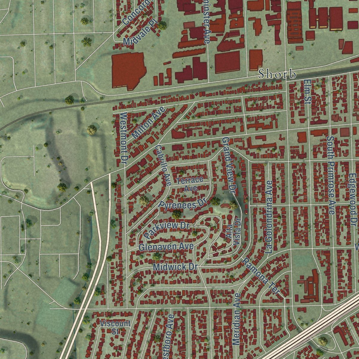
Explore Alhambra, California from a whole new perspective. Created using aerial imagery and detailed geographic data, this map captures Alhambra building by building, with labeled streets, familiar landmarks, and shaded topographical relief that highlights the natural contours of the landscape.
Combining modern data with the timeless character of a vintage atlas, this map is just as interesting up close as it is beautiful on the wall. Whether you grew up in Alhambra, spent memorable years there, or call it home today, this unique map is a great way to celebrate a place that means something to you. Zoom in on the preview to look for your street, and then order a print to put your memories on the wall.
Three ways to hang it
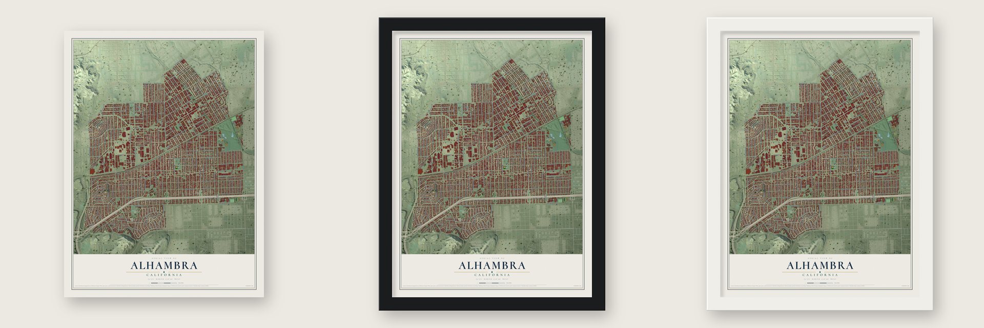
Unframed archival matte, a black wood frame or a white wood frame.
Up close
Geography Worth Displaying
This map was created using accurate cartographic data and authoritative geographic sources, including the U.S. Geological Survey and the Census Bureau. The map brings together terrain, waterways, roads, and building detail. The majority of the streets are labeled, houses are accurately depicted, and the topography is derived from government sources. Combining local data with carefully composed color and shading leads to this beautifully detailed Alhambra artwork for your wall.
Rather than simply showing street outlines, we’ve included as many of the street names as we could reasonably fit on the map while keeping their names legible. Zoom in on the high resolution preview to see exactly what’s on the map. We truly set out to create a statement piece for anyone who loves Alhambra. So whether it’s for you, or a gift for someone you love, we hope this map of Alhambra brings back fond memories.
Read the story behind this map of Alhambra, California from 2026.

About Alhambra, California
Alhambra is a city of 82,868 people in Los Angeles County, about 8 miles east of downtown Los Angeles. Spain founded the San Gabriel Mission nearby on September 8, 1771. Benjamin D. Wilson gave up a planned trip to China in 1841, and he went on to buy the land that became Alhambra. His daughter Ruth was reading Washington Irving's Tales of the Alhambra, a book about the palace in Granada, Spain, and she talked him into naming his new development after it.
One of the first businesses here was the San Gabriel Wine Company, which stood near where Main Street meets Palm today. The town grew as a suburb of Los Angeles, and its business district at Main and Garfield was taking shape by 1895. Residents incorporated the City of Alhambra on July 11, 1903, and the city started its own fire department in 1906.
- A convent school in 1890Several leading San Gabriel Valley families wanted a Catholic school for their daughters, and the family of James de Barth Shorb gave hillside land for it. On January 29, 1890, Ramona Convent dedicated its first building at Ramona Acres, and it became the town's first school. The public Alhambra High School opened in 1898.
- New neighbors on Valley BoulevardAlhambra drew Italian newcomers in the 1950s, Mexican families in the 1960s and Chinese immigrants in the 1980s. A busy Chinese business district grew along Valley Boulevard, and the corridor became a national center for Asian-owned bank headquarters. For years Alhambra and San Gabriel teamed up to hold the valley's Lunar New Year parade and festival along that street.
- A ship for the fallenA 1945 plaque explains that the S.S. Alhambra Victory carried the city's name to honor Alhambrans who died early in World War II, among them Ensign John C. England.
- The Hat since 1951The Hat opened in Alhambra in 1951 as a family-owned outdoor restaurant. That first stand grew into a small Southern California chain, and its sign at Valley Boulevard and Garfield Avenue is now a city landmark.
Find your street
Names on the Alhambra map
Every name below is printed on this map. Look for your street, your school, the park where you played, or the pond down the road.
Places and landmarks8
- Almansor Park
- Granada Park
- Moor Field
- Ramona Park
- Shorb
- Sierra Vista
- Stoneman
- Wilmar
Streets and roads228
- West Main Street
- South Garfield Avenue
- North Huntington Drive
- East Hellman Avenue
- South Almansor Street
- East Main Street
- East Ramona Road
- Hampden Terrace
- North Garfield Avenue
- Midwick Drive
- Alhambra Road
- South Atlantic Boulevard
- Ramona Terrace
- West Alhambra Road
- North Atlantic Boulevard
- West Woodward Avenue
- North Granada Avenue
- West Valley Boulevard
- West Commonwealth Avenue
- South Marengo Avenue
- East Glendon Way
- Granada Avenue
- El Paseo
- North Fremont Avenue
- West Ramona Road
- South Fremont Avenue
- West Mission Road
- West Hellman Avenue
- Front Street
- South Chapel Avenue
Show all 228 streets
- South Sixth Street
- West Norwood Place
- South Second Street
- West Glendon Way
- South Palm Avenue
- South Fourth Street
- West Shorb Street
- South Meridian Avenue
- South Marguerita Avenue
- South Stoneman Avenue
- South Sierra Vista Avenue
- Westminster Avenue
- South Raymond Avenue
- South Third Street
- South Fifth Street
- Date Avenue
- South Electric Avenue
- South Eighth Street
- South Curtis Avenue
- South Granada Avenue
- Elm Street
- South Monterey Street
- South Olive Avenue
- South Seventh Street
- South New Avenue
- South Ninth Street
- West Grand Avenue
- North Hidalgo Avenue
- North Almansor Street
- Orange Grove Avenue
- South Cordova Street
- South Hidalgo Avenue
- South Campbell Avenue
- South Primrose Avenue
- West Ross Avenue
- Westmont Drive
- North Stoneman Avenue
- South Vega Street
- East Alhambra Road
- La Paloma Street
- North Electric Avenue
- North Bushnell Avenue
- North Marguerita Avenue
- North Curtis Avenue
- North Olive Avenue
- South Westmont Drive
- Poplar Boulevard
- East Norwood Place
- East Shorb Street
- East Valley Boulevard
- Winthrop Drive
- South El Molino Street
- North Monterey Street
- Edgewood Drive
- Montezuma Avenue
- Midwickhill Drive
- Story Place
- South First Street
- East Adams Avenue
- North Cordova Street
- East Mission Road
- Whitney Drive
- North Second Street
- Concord Avenue
- Winchester Avenue
- East Grand Avenue
- North First Street
- South Valencia Street
- South Ethel Avenue
- Sarazen Drive
- Orange Street
- East Huntington Drive
- East McLean Street
- Siwanoy Drive
- Benito Avenue
- Stranahan Drive
- Geranio Drive
- Azalea Drive
- Camelia Drive
- Violeta Drive
- North Raymond Avenue
- North Marengo Avenue
- Hitchcock Drive
- East Ross Avenue
- Hathaway Avenue
- Charnwood Avenue
- North Palm Avenue
- North Vega Street
- North Valencia Street
- North El Molino Street
- North Chapel Avenue
- Carlos Street
- North Third Street
- South Hampden Terrace
- Cedar Street
- Grand View Drive
- East Pine Street
- Edith Avenue
- South Westboro Avenue
- East Bay State Street
- Parkview Drive
- Larch Street
- South Palatine Drive
- North Dos Robles Place
- Vine Street
- Lemon Street
- Westboro Avenue
- Chestnut Street
- Cynthia Street
- East Beacon Street
- West Pine Street
- North Fourth Street
- Snead Drive
- Loma Vista Drive
- Hagen Drive
- La Golondrina Avenue
- East Linda Vista Avenue
- Pedley Drive
- Roark Drive
- Meridian Avenue
- West Garvey Avenue
- Novelda Road
- Pepper Street
- Warwick Road
- Curtis Lane
- Pyrenees Drive
- Palmetto Drive
- La France Avenue
- Acacia Street
- Florentina Drive
- Elgin Street
- West McLean Street
- Midvale Place
- North Ethel Avenue
- Champion Place
- Glenaven Avenue
- North Fifth Street
- Essexfells Drive
- Cypress Avenue
- Las Flores Street
- Irving Street
- Park Street
- Huntington Drive
- Corto Street
- Milton Avenue
- Spruce Street
- Cherry Lane
- Clay Court
- Alta Vista Drive
- El Paseo Street
- West San Marino Avenue
- East Los Higos Street
- South La Paloma Avenue
- East Commonwealth Avenue
- East San Marino Avenue
- West Linda Vista Avenue
- West Birch Street
- Cabrillo Avenue
- Almansor Saint Ovp
- West Beacon Street
- Sherwood Avenue
- North Alhambra Road
- Lindaraxa Park South
- Balzac Street
- East Woodward Avenue
- Norwich Avenue
- San Clemente Avenue
- Avondale Drive
- San Pasqual Drive
- North Campbell Avenue
- Baltusrol Drive
- Pine Valley Drive
- Oneonta Alley
- Carlos Avenue
- East Arroyo Terrace
- Howard Street
- Terrace Avenue
- Rogers Drive
- Market Lane
- Hoeffer Drive
- Maple Court
- Ethel Avenue
- Guest Drive
- Viscount Street
- Tracy Place
- Keats Street
- Main Street
- West Adams Avenue
- Carwile Drive
- Wetherhead Drive
- Saint Charles Terrace
- Hampton Court
- South Olive Place
- South Bushnell Avenue
- Halsted Circle
- Huntington Drive South
- West Bay State Street
- Garfield Avenue
Names are listed as they appear on the printed map. Zoom into the product photos to find them.
The art of mapping a place
How This Map Was Made
Real places. Remarkable detail. Discover the layers that turn geographic data into a map of home.

The view from above
Aerial imagery reveals the character of the land: woodland, open fields, and the patterns of a place.

The shape of the land
Elevation data brings hills, valleys, and subtle changes in the landscape into view.

The details of home
Roads, waterways, and building footprints come together to make the map feel unmistakably local.

Geography becomes art
Considered color, shading, and typography bring the layers together in a map made for your wall.


Process illustrated with Mendon, Massachusetts. Aerial imagery: USDA NAIP. Terrain: USGS 3D Elevation Program. Map details and finished artwork: KNOWOL.
The Details
About This Print
Choose an archival matte print, or a black or white Ayous wood frame. The archival matte print is unframed.
Select your size and finish above to see the matching product image and price.
Materials & Craftsmanship
A contemporary map with the character of a classic atlas, printed on archival matte paper. Optional frames are made from Ayous wood.
Your printed map does not include the watermark shown in the full-map preview.
Shipping & Delivery
Free shipping within the United States. Every print is made to order in the USA.
Buying a gift? Add a note in your cart and we'll include it. We never put prices in the package.
Prints ship within 2 to 3 business days. Allow 7 to 10 days total from ordering for delivery. Timing may vary during holidays or periods of high order volume.
Read our shipping policy.
Returns and damaged prints
Each print is made to order. Change-of-mind refunds are not available after production.
If your print arrives damaged, misprinted or incorrect, contact support@knowol.com within 30 days of receiving it. Include your order number, photos and a description of the issue.
Read our full refund and replacement policy. For questions about your order, email support@knowol.com.
Find your town
Looking for another city?
Find a map of home in our California collection, or any town in the country.
Nearby
Maps of towns near Alhambra
Know someone from one of these towns? Their map makes a great gift.
 South Pasadena
, California
From $39.99See the map
 San Gabriel
, California
From $39.99See the map
 Monterey Park
, California
From $39.99See the map
More maps nearby: San Marino, Rosemead, South San Gabriel, East San Gabriel and East Los Angeles.