
Search for another town




Free U.S. delivery 7 to 10 days after you order
Monterey Park, California Map Art
A new map of Monterey Park, California, made in 2026 and printed to order on thick archival matte paper.
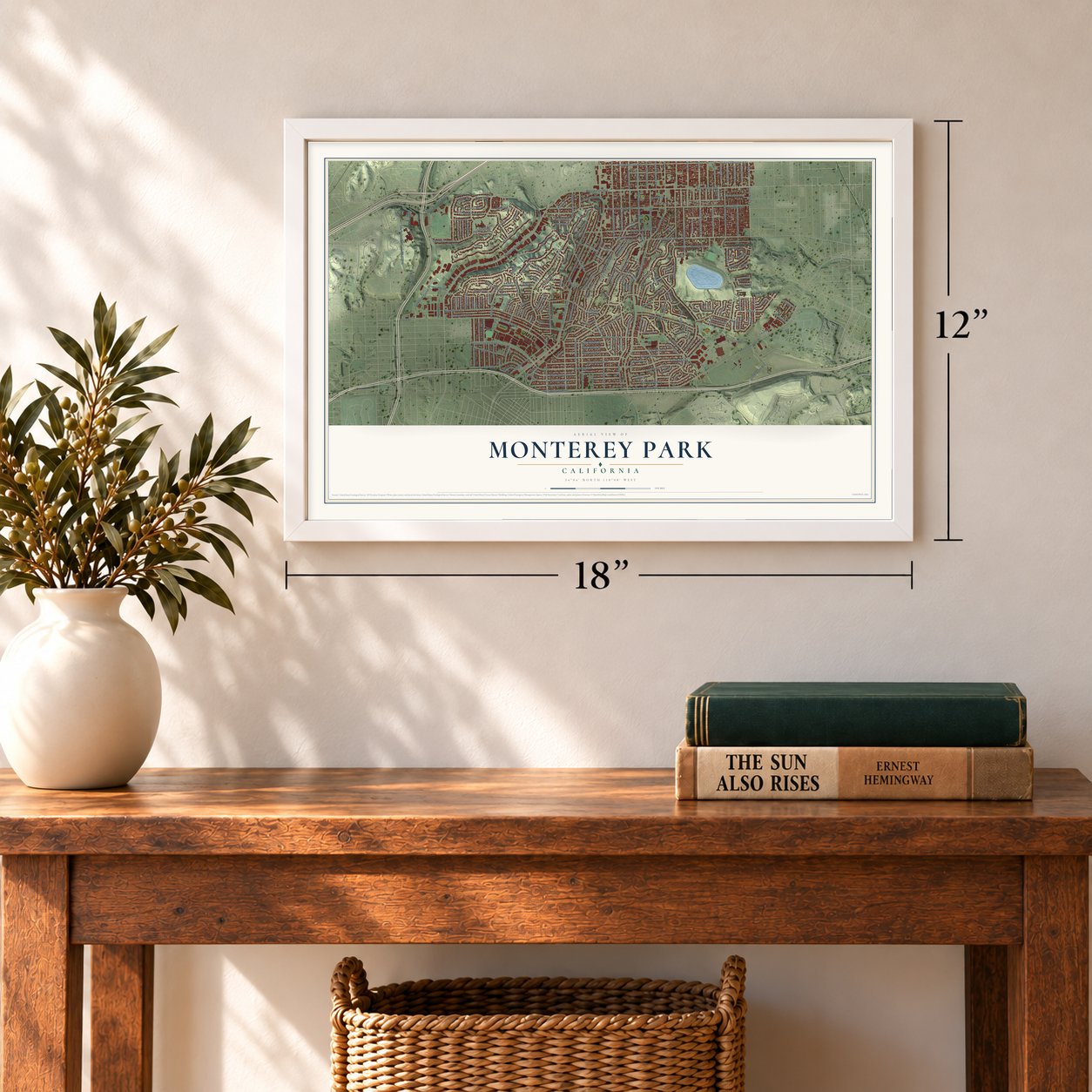
12" x 18" Archival Matte Print
A Map of Home. A Work of Art.
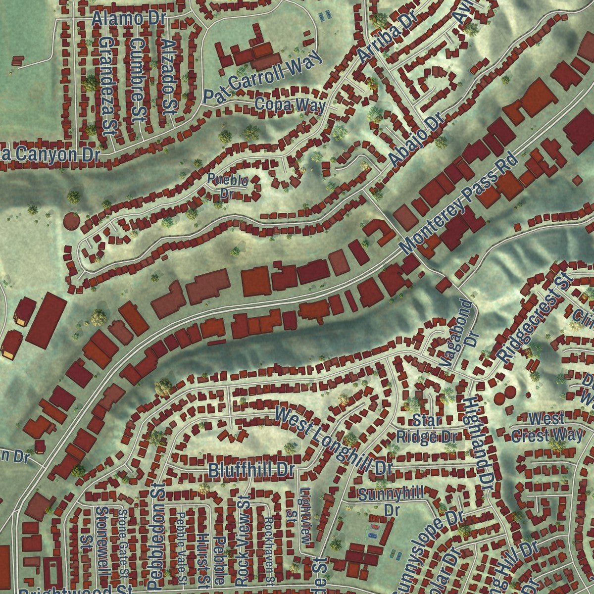
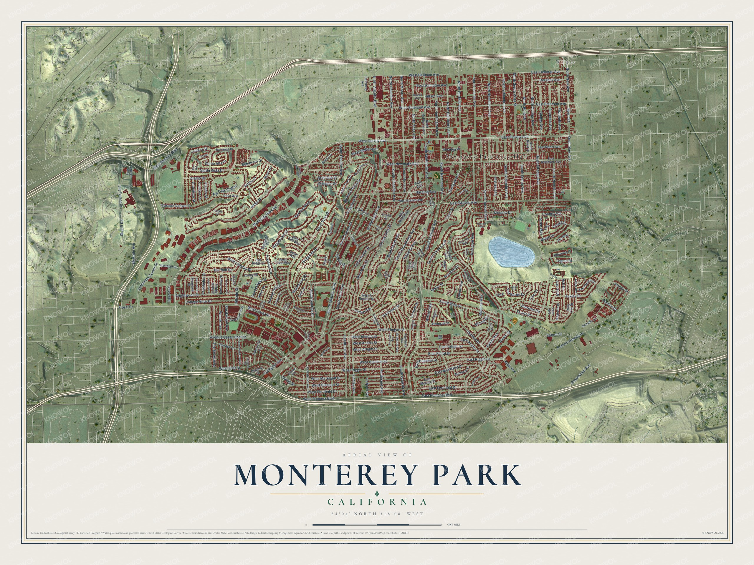
Explore Monterey Park, California from a whole new perspective. Created using aerial imagery and detailed geographic data, this map captures Monterey Park building by building, with labeled streets, familiar landmarks, and shaded topographical relief that highlights the natural contours of the landscape.
Combining modern data with the timeless character of a vintage atlas, this map is just as interesting up close as it is beautiful on the wall. Whether you grew up in Monterey Park, spent memorable years there, or call it home today, this unique map is a great way to celebrate a place that means something to you. Zoom in on the preview to look for your street, and then order a print to put your memories on the wall.
Three ways to hang it
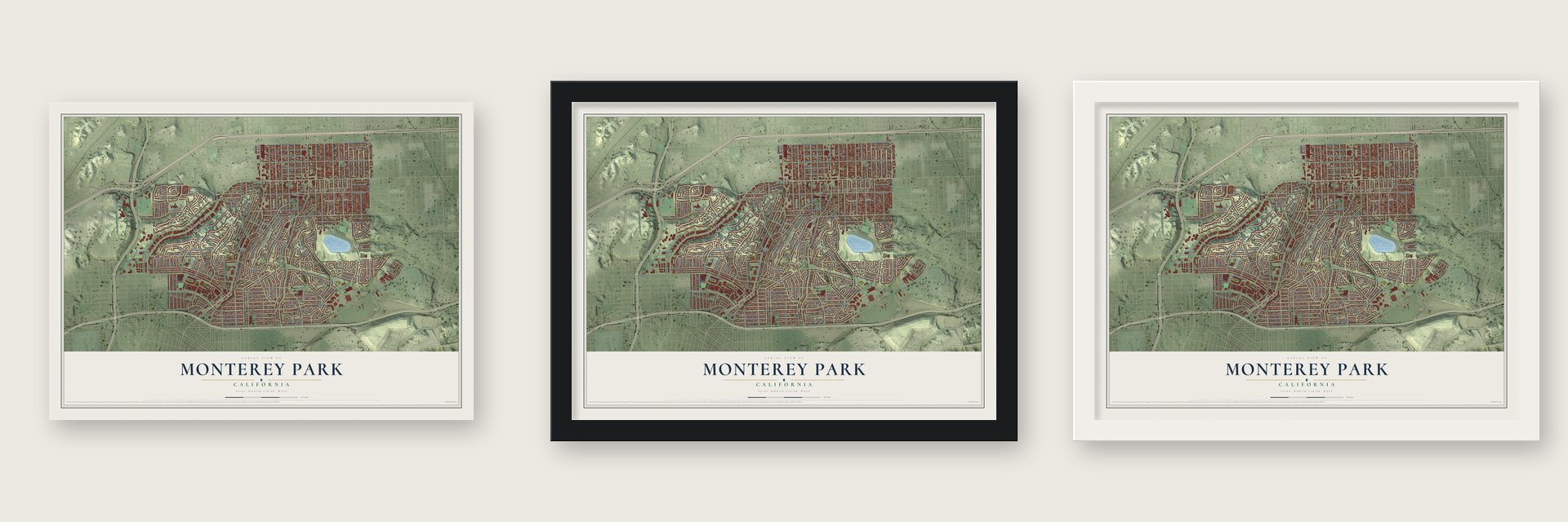
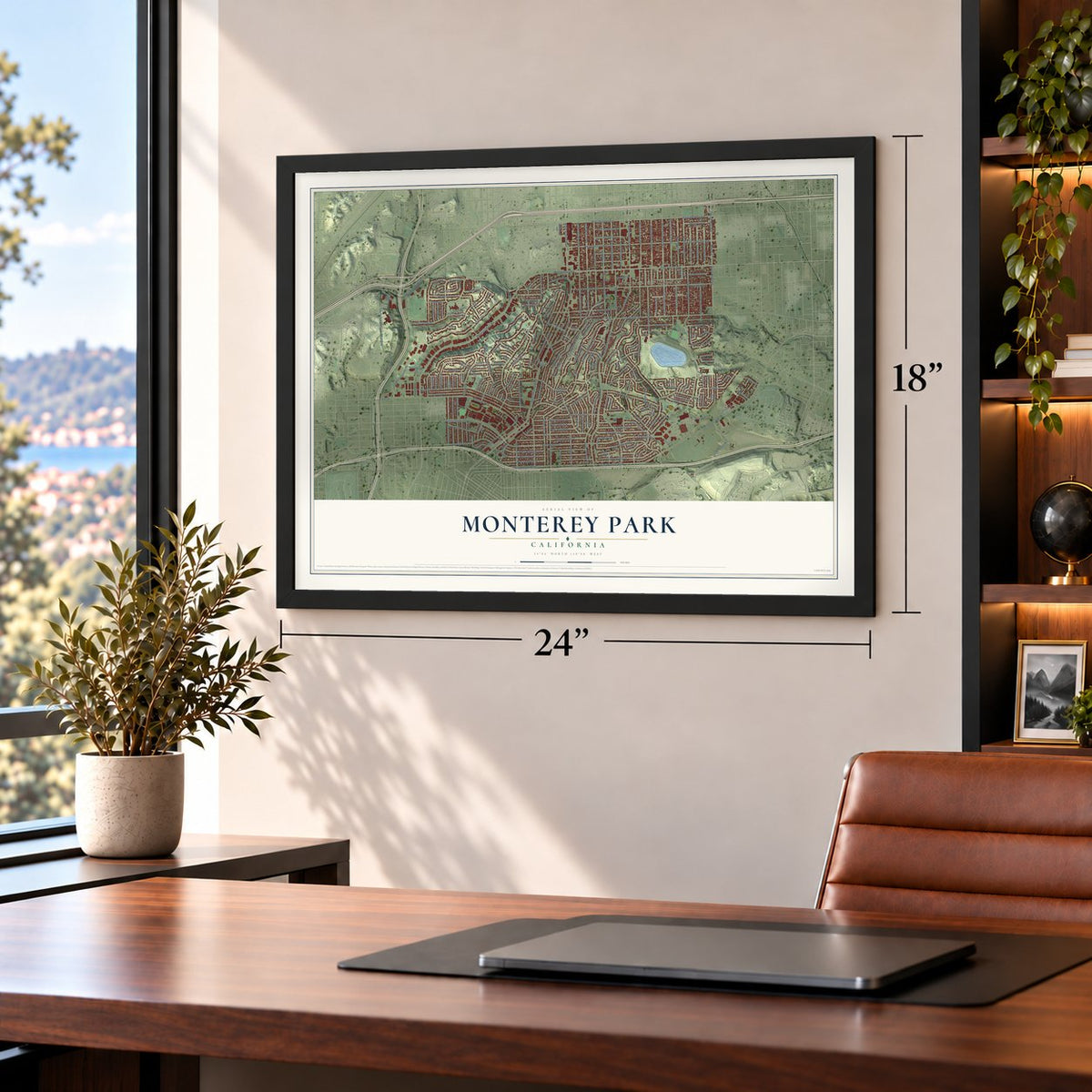
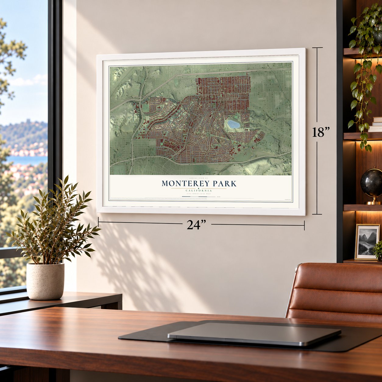
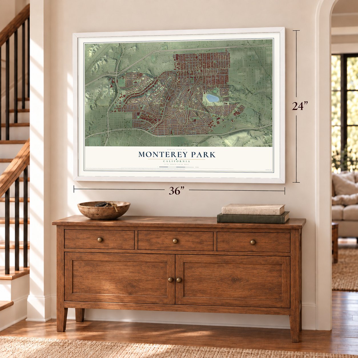
Unframed archival matte, a black wood frame or a white wood frame.
Up close
Geography Worth Displaying
This map was created using accurate cartographic data and authoritative geographic sources, including the U.S. Geological Survey and the Census Bureau. The map brings together terrain, waterways, roads, and building detail. The majority of the streets are labeled, houses are accurately depicted, and the topography is derived from government sources. Combining local data with carefully composed color and shading leads to this beautifully detailed Monterey Park artwork for your wall.
Rather than simply showing street outlines, we’ve included as many of the street names as we could reasonably fit on the map while keeping their names legible. Zoom in on the high resolution preview to see exactly what’s on the map. We truly set out to create a statement piece for anyone who loves Monterey Park. So whether it’s for you, or a gift for someone you love, we hope this map of Monterey Park brings back fond memories.
Read the story behind this map of Monterey Park, California from 2026.

About Monterey Park, California
Monterey Park is a city of 61,096 people in Los Angeles County, in the western San Gabriel Valley. The Tongva lived here for thousands of years, and the land later fell under Mission San Gabriel and then the Rancho San Antonio. After the Civil War, the Italian rancher Alessandro Repetto bought 5,000 acres of the rancho. Richard Garvey, an Army mail rider whose route crossed Monterey Pass, settled in the King's Hills, piped in spring water and built a 54-foot dam to make Garvey Lake. He sold land to pay his debts, and in 1906 Ramona Acres became the area's first subdivision.
In 1916 Pasadena, South Pasadena and Alhambra proposed a large sewage plant for the area, so the residents moved to form a city of their own. They approved cityhood on May 29, 1916, by 455 votes to 33. The new board at once banned sewage plants inside the city and chose the name Monterey Park, after an old government map that labeled the oak-covered hills as the Monterey Hills. In 1920 a large section on the south edge split off to become Montebello.
“The community is proud of its many old trees, which include the pepper, the California live-oak, pink-flowering white ironbark, Australian beech, Torrey pine, various types of palm, and several kinds of cork oak.”
- The first sealed chip bagIn 1926 Laura Scudder made the first sealed bag of potato chips near Atlantic Boulevard and Garvey Avenue. Her workers ironed sheets of wax paper into bags, filled them with chips and ironed the tops shut to keep them fresh, then delivered them to stores.
- Coyote PassBy 1920 Asian residents were growing potatoes and flowers and running nurseries in the Monterey Highlands. They built a road over the old Monterey Pass Trail to haul their crops to Los Angeles. The pass had no name and had served as a set for western movies until the pioneer Masami Abe called it Coyote Pass.
- The CascadesIn the late 1920s developer Peter N. Snyder planned Midwick View Estates as a garden community to rival Bel Air and Beverly Hills. Its center was El Encanto, a Spanish style building, with a fountain that spilled down the hillside in stepped pools. The Great Depression ended the plan, and the fountain is now Heritage Falls Park, known as the Cascades.
- First Suburban ChinatownAsian American families began moving here in the 1970s, many of them from Taiwan. In 1983 voters made Lily Lee Chen the first Chinese American woman to lead a U.S. city as mayor. By the 1990 census, Monterey Park was the first city in the continental United States where most people were of Asian descent, and Professor Timothy P. Fong called it the First Suburban Chinatown.
Find your street
Names on the Monterey Park map
Every name below is printed on this map. Look for your street, your school, the park where you played, or the pond down the road.
Places and landmarks2
- Monterey Park City Hall
- Wilmar
Streets and roads253
- Monterey Pass Road
- West Garvey Avenue
- South Garfield Avenue
- New Avenue
- East Garvey Avenue
- West Pomona Boulevard
- North New Avenue
- Garfield Avenue
- South New Avenue
- North Garfield Avenue
- East Pomona Boulevard
- East Graves Avenue
- East Hellman Avenue
- South Grandridge Avenue
- South Atlantic Boulevard
- West Ramona Boulevard
- Cielito Avenue
- West Floral Drive
- North Atlantic Boulevard
- Bradshawe Avenue
- South Orange Avenue
- Brightwood Street
- Ridgecrest Street
- Fulton Avenue
- South Ynez Avenue
- Potrero Grande Drive
- Wilcox Avenue
- Casuda Canyon Drive
- West Markland Drive
- South Lincoln Avenue
Show all 253 streets
- West Newmark Avenue
- Abajo Drive
- Crest Vista Drive
- South McPherrin Avenue
- West Riggin Street
- College View Drive
- Ackley Street
- Kempton Avenue
- De la Fuente Street
- Corporate Center Drive
- East Emerson Avenue
- East Markland Drive
- Greenwood Avenue
- West Fernfield Drive
- Isabella Avenue
- Arriba Drive
- Avenue Cesar Chavez
- Loma Verde Street
- West Gleason Street
- South Alhambra Avenue
- West Hellman Avenue
- Floral Drive
- Verde Vista Drive
- West Emerson Avenue
- South Russell Avenue
- East Fernfield Drive
- Kingsford Street
- West Hammel Street
- Harding Avenue
- East Riggin Street
- Coral View Street
- Ridgeside Drive
- Barnum Way
- Mooney Drive
- Saturn Street
- Ladera Street
- Lupine Avenue
- Mira Valle Street
- West First Street
- East Floral Drive
- Dorner Drive
- South Isabella Avenue
- West Elmgate Street
- Hendricks Avenue
- South Sefton Avenue
- Divina Vista Street
- North Chandler Avenue
- West Longhill Drive
- Keller Street
- North Huntington Avenue
- North Ynez Avenue
- North Moore Avenue
- North Baltimore Avenue
- North Orange Avenue
- North Rural Drive
- North Sierra Vista Street
- North Lincoln Avenue
- North Alhambra Avenue
- North Nicholson Avenue
- Vancouver Avenue
- Hillside Street
- Bleakwood Avenue
- El Mercado Avenue
- South Chandler Avenue
- Findlay Avenue
- South Ramona Avenue
- West Mabel Avenue
- Collegian Avenue
- East Arlight Street
- Mancha Way
- South Sunrise Drive
- Woods Avenue
- Wandering Drive
- West Almora Street
- Cecil Street
- Gladys Avenue
- Elizabeth Avenue
- Florence Avenue
- West Arlight Street
- Bluffhill Drive
- Sheriff Road
- West Hampton Avenue
- South Pomelo Avenue
- Van Buren Drive
- West Andrix Street
- East Andrix Street
- Sombrero Drive
- Heather Drive
- Alamo Drive
- Ferdinand Avenue
- Doncrest Street
- Everett Avenue
- Starbird Drive
- Pat Carroll Way
- Bloom Drive
- Arroyo Drive
- Highland Drive
- Ash Drive
- Hershey Avenue
- Taylor Drive
- Pebbledon Street
- Hillard Avenue
- McBride Avenue
- Cliffhill Drive
- Metro Drive
- Hermosa Vista Street
- Country Road
- Branham Street
- Cerco Alta Drive
- South Electric Avenue
- East Hammel Street
- Avion Drive
- Kern Avenue
- Clover Drive
- Zaring Street
- Sunnyslope Drive
- Rolling Hill Drive
- Dell Drive
- Tegner Drive
- Williams Street
- Grandeza Street
- Kenton Drive
- Jade Tree Drive
- Aztec Way
- Solar Drive
- Cumbre Street
- Harrison Road
- Knoll Drive
- Lunar Drive
- Alzado Street
- Tyler Drive
- Village Drive
- Roselyn Place
- Sevilla Street
- Atlas Avenue
- Laurel Drive
- West El Repetto Drive
- East Newmark Avenue
- North McPherrin Avenue
- Cadiz Street
- Holly Oak Drive
- Barranca Drive
- South Moore Avenue
- West Graves Avenue
- Vagabond Drive
- Graylock Avenue
- Fernbank Avenue
- East Gleason Street
- Ameron Way
- Roca Way
- Alisar Avenue
- Abe Way
- Copa Way
- Davidson Drive
- Avalanche Way
- San Patricio Drive
- Villa Monte Avenue
- Rock View Street
- Brier Cliff Way
- Bluffdale Street
- Schoolside Avenue
- City Terrace Drive
- Magnolia Drive
- East Mabel Avenue
- Aldergate Street
- Sunnyhill Drive
- Gladmar Street
- Via Norte Avenue
- Browning Place
- Pelon Way
- El Portal Place
- Stonewell Street
- West Crest Way
- Star Ridge Drive
- Langley Way
- Pebble Hurst Street
- Encanto Lane
- Hathaway Avenue
- South Rural Drive
- Triana Street
- Luy Street
- Divine Drive
- Via Venti
- Park Avenue
- Snyder Lane
- Palm Avenue
- Dover Way
- Milam Place
- Garfield Place
- Brockwell Avenue
- South Gerhart Avenue
- Hillview Avenue
- Grandridge Avenue
- South Westcott Avenue
- Trumbower Avenue
- Oakgate Street
- Montechico Drive
- Lightview Street
- McComb Way
- Bataan Place
- Lamont Drive
- Hilliard Avenue
- Graves Avenue
- Pueblo Drive
- Punta Way
- South Fremont Avenue
- Valley Vista Drive
- Pepper Street
- Moonbeam Drive
- Stone Gate Street
- Pebble Vale Street
- Rockhaven Street
- Ransom Way
- Foxglove Drive
- Sherbrook Avenue
- Triana Place
- Emerald Way
- College View Lane
- Durango Drive
- Shady Crest Lane
- Polk Way
- Vercoe Place
- Mesa Way
Names are listed as they appear on the printed map. Zoom into the product photos to find them.
The art of mapping a place
How This Map Was Made
Real places. Remarkable detail. Discover the layers that turn geographic data into a map of home.

The view from above
Aerial imagery reveals the character of the land: woodland, open fields, and the patterns of a place.

The shape of the land
Elevation data brings hills, valleys, and subtle changes in the landscape into view.

The details of home
Roads, waterways, and building footprints come together to make the map feel unmistakably local.

Geography becomes art
Considered color, shading, and typography bring the layers together in a map made for your wall.


Process illustrated with Mendon, Massachusetts. Aerial imagery: USDA NAIP. Terrain: USGS 3D Elevation Program. Map details and finished artwork: KNOWOL.
The Details
About This Print
Choose an archival matte print, or a black or white Ayous wood frame. The archival matte print is unframed.
Select your size and finish above to see the matching product image and price.
Materials & Craftsmanship
A contemporary map with the character of a classic atlas, printed on archival matte paper. Optional frames are made from Ayous wood.
Your printed map does not include the watermark shown in the full-map preview.
Shipping & Delivery
Free shipping within the United States. Every print is made to order in the USA.
Buying a gift? Add a note in your cart and we'll include it. We never put prices in the package.
Prints ship within 2 to 3 business days. Allow 7 to 10 days total from ordering for delivery. Timing may vary during holidays or periods of high order volume.
Read our shipping policy.
Returns and damaged prints
Each print is made to order. Change-of-mind refunds are not available after production.
If your print arrives damaged, misprinted or incorrect, contact support@knowol.com within 30 days of receiving it. Include your order number, photos and a description of the issue.
Read our full refund and replacement policy. For questions about your order, email support@knowol.com.
Find your town
Looking for another city?
Find a map of home in our California collection, or any town in the country.
Nearby
Maps of towns near Monterey Park
Know someone from one of these towns? Their map makes a great gift.
 South San Gabriel
, California
From $39.99See the map
 East Los Angeles
, California
From $39.99See the map
 Alhambra
, California
From $39.99See the map
More maps nearby: Montebello, Rosemead, San Gabriel, Commerce and South Pasadena.