


Search for another town


Free U.S. delivery 7 to 10 days after you order
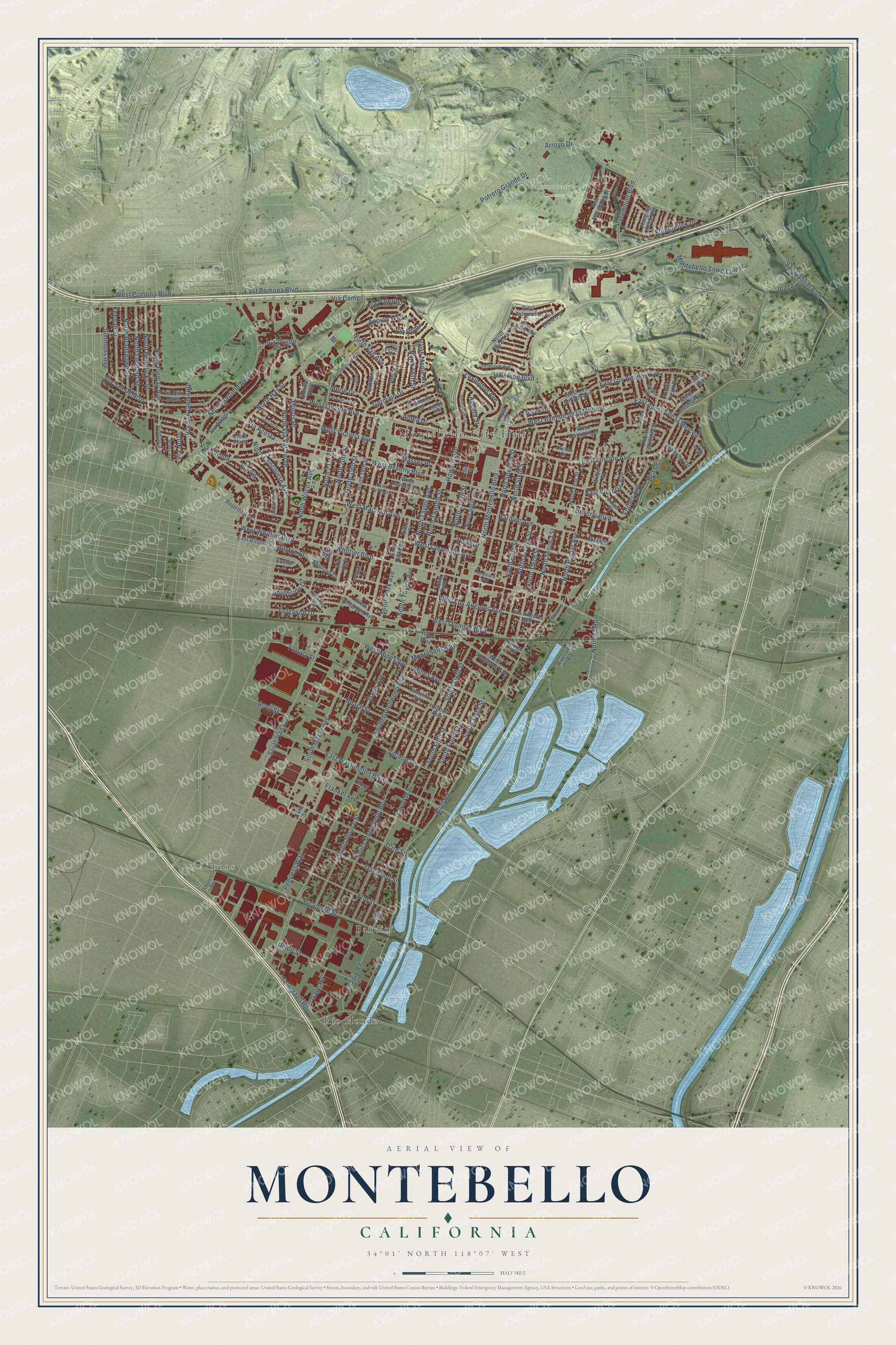
Montebello, California Map Art
Building by building, with labeled streets and shaded relief.
12" x 18" Archival Matte Print
A Map of Home. A Work of Art.
Explore Montebello, California from a whole new perspective. Created using aerial imagery and detailed geographic data, this map captures Montebello building by building, with labeled streets, familiar landmarks, and shaded topographical relief that highlights the natural contours of the landscape.
Combining modern data with the timeless character of a vintage atlas, this map is just as interesting up close as it is beautiful on the wall. Whether you grew up in Montebello, spent memorable years there, or call it home today, this unique map is a great way to celebrate a place that means something to you. Zoom in on the preview to look for your street, and then order a print to put your memories on the wall.
Three ways to hang it

Unframed archival matte, a black wood frame or a white wood frame.
Up close
Geography Worth Displaying
This map was created using accurate cartographic data and authoritative geographic sources, including the U.S. Geological Survey and the Census Bureau. The map brings together terrain, waterways, roads, and building detail. The majority of the streets are labeled, houses are accurately depicted, and the topography is derived from government sources. Combining local data with carefully composed color and shading leads to this beautifully detailed Montebello artwork for your wall.
Rather than simply showing street outlines, we’ve included as many of the street names as we could reasonably fit on the map while keeping their names legible. Zoom in on the high resolution preview to see exactly what’s on the map. We truly set out to create a statement piece for anyone who loves Montebello. So whether it’s for you, or a gift for someone you love, we hope this map of Montebello brings back fond memories.
Read the story behind this map of Montebello, California from 2026.

Find your street
Names on the Montebello map
Every name below is printed on this map. Look for your street, your school, the park where you played, or the pond down the road.
Places and landmarks5
- Montebello City Hall
- Resurrection Cemetery
- Rio Hondo
- Bandini
- Simons
Streets and roads186
- East Lincoln Avenue
- Southside Drive
- West Whittier Boulevard
- North Tenth Street
- Norman Road
- West Beverly Boulevard
- North Montebello Boulevard
- Bluff Road
- South Greenwood Avenue
- Whittier Boulevard
- West Lincoln Avenue
- South Montebello Boulevard
- West Madison Avenue
- South Maple Avenue
- North Garfield Avenue
- South Fourth Street
- West Victoria Avenue
- North Wilcox Avenue
- Via Campo
- West Cleveland Avenue
- South Vail Avenue
- West Olympic Boulevard
- North Vail Avenue
- North Poplar Avenue
- South Fifth Street
- Paramount Boulevard
- South Spruce Street
- Harding Avenue
- North Fourth Street
- North Maple Avenue
Show all 186 streets
- Montebello Town Center
- Telegraph Road
- Beach Street
- Via San Clemente
- Arroyo Drive
- South Sixth Street
- Via Corona
- North Second Street
- South Taylor Avenue
- Carob Way
- North Taylor Avenue
- Date Street
- West Los Angeles Avenue
- North Findlay Avenue
- North Sixth Street
- North Hay Street
- North Third Street
- Via San Delarro
- East Washington Boulevard
- North 21st Street
- Mines Avenue
- Sycamore Street
- South Third Street
- North Seventh Street
- West Avenue de la Merced
- West Pomona Boulevard
- North 20th Street
- North Bradshawe Street
- Howard Avenue
- Via Acosta
- North 19th Street
- North Fifth Street
- North 16th Street
- North Hendricks Street
- East Los Amigos Avenue
- North Concourse Avenue
- Frankel Avenue
- East Avenue de la Merced
- Morris Place
- Elm Street
- North Leonard Street
- North Via Val Verde
- East Pomona Boulevard
- Lexington Avenue
- Potrero Grande Drive
- Chapin Road
- Union Street
- Via Vis
- Oakwood Street
- North Twelfth Street
- Rea Drive
- South Park Avenue
- Keenan Street
- Appian Way
- Germain Drive
- East Victoria Avenue
- Gage Road
- Jefferson Boulevard
- Ellingbrook Drive
- Jacmar Drive
- Plaza
- Beverly Boulevard
- Ferguson Drive
- Simmons Avenue
- Davis Avenue
- Via Palermo
- San Gabriel Boulevard
- Aldea Drive
- Perry Street
- Allston Street
- Forbes Avenue
- Flotilla Street
- West Mines Avenue
- Montebelo Way
- Merle Drive
- Peerless Way
- Via Roma
- Masser Place
- Via Paseo
- Rancho Drive
- Adelita Street
- Acco Street
- Via Norte
- Palm Drive
- North First Street
- Los Angeles Avenue
- North 18th Street
- West Colegrove Avenue
- Neil Armstrong Street
- Via Altamira
- Hughes Avenue
- North Sanchez Street
- North Spruce Street
- Wilber Place
- Repetto Avenue
- Via San Carlo
- North Park Avenue
- West Oakmont Drive
- West Beverly Terrace
- Gardner Drive
- Marek Drive
- West Roosevelt Avenue
- El Camino Drive
- North Adobe Avenue
- Riverview Road
- North Iguala Street
- East Allston Street
- West Los Amigos Avenue
- West Ashiya Road
- Truck Way
- Libre Plaza
- Maiden Lane
- Rio Blanco Street
- Medford Drive
- Scott Avenue
- Findlay Avenue
- Hanging Rock Avenue
- North Orcutt Drive
- Easton Street
- 20th Street
- Donna Way
- Rose Lane
- Given Place
- 14th Street
- Van Norman Road
- Westmoreland Drive
- South Tenth Street
- Azalea Drive
- Yorktown Avenue
- Carmelita Avenue
- Pickering Way
- Sonora Street
- West Liberty Avenue
- Via Lucia
- Holger Drive
- Cuesta Way
- Brady Avenue
- Birch Street
- Newmark Mall
- Nelson Place
- Dochan Circle
- Darcy Drive
- Church Road
- Natasha Lane
- Carmel Court
- Allis Drive
- Jay Court
- Via Miramonte
- North Juarez Street
- West Harding Avenue
- Raywood Avenue
- South 18th Street
- Malone Drive
- San Antonio Drive
- Tampico Way
- Rio del Sol
Names are listed as they appear on the printed map. Zoom into the product photos to find them.
About Montebello, California
Montebello is a city of 62,640 people in Los Angeles County, 8 miles east of downtown Los Angeles. The Tongva people lived along the Rio Hondo long before the Franciscan fathers Angel Somera and Pedro Cambon founded Mission San Gabriel Arcángel here on September 8, 1771. Six years later a destructive flood drove the mission north to present-day San Gabriel, and the abandoned first site became known as Mission Vieja.
After the Civil War, Alessandro Repetto, an immigrant from Genoa, owned about 5,000 acres here. When he died in 1885, his brother sold the land for $60,000 to five Los Angeles businessmen, among them Harris Newmark. In May 1899 Newmark and his nephew Kaspare Cohn laid out a town on 1,200 acres of their share, with a water system planned on the advice of William Mulholland. The townsite by the railroad was called Newmark until 1920, when city leaders took Mulholland's idea and renamed it Montebello. The city incorporated on October 16, 1920.
“The City of Flowers With an Oil Well Payroll.”
- Oil in the hills, 1917The Standard Oil Company struck oil on the Baldwin and Temple properties in the Montebello hills in 1917. Oil wells soon took the place of farm fields, and the find eventually supplied one-eighth of California's crude oil. Wells kept pumping in the hills for sixty years.
- A flower show in 1912Before the oil boom, Montebello farms grew flowers, berries, fruit and vegetables. The Montebello Woman's Club sponsored the town's first public flower show in 1912, held in the high school auditorium on Whittier Boulevard, and the club joined the National Register in 1995. A red poinsettia still sits at the center of the city seal.
- A battle in 1847On January 8, 1847, U.S. forces won the Battle of Río San Gabriel, fought partly on land that is now Montebello, Whittier and Pico Rivera. The victory gave the United States control of Los Angeles and Alta California in the Mexican-American War. Two cannons and a plaque honor the battle above the river at Bluff Road and Washington Boulevard.
- The Sanchez Adobe of 1844The Juan Matias Sanchez Adobe went up in 1844 at the heart of old Rancho La Merced, in east Montebello. It is the oldest building still standing in the city, and it is now the centerpiece of Sanchez Adobe Park.
Keep exploring California
Montebello is one of 1,990 California towns we've mapped. Every dot on the map is a print of its own.
The search covers every state, California first.
Near Montebello
Order 2 or more town maps and save 10%. Shown in the size and finish you picked above, so they hang as a set.
- Pico Rivera 12" x 18" / Archival Matte Print $39.99
- South San Gabriel 12" x 18" / Archival Matte Print $39.99
- Monterey Park 12" x 18" / Archival Matte Print $39.99
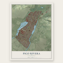
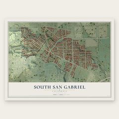
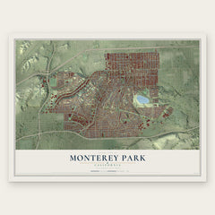
More maps nearby: Commerce, East Los Angeles, West Whittier-Los Nietos, Rose Hills and Rosemead.
The art of mapping a place
How This Map Was Made
Real places. Remarkable detail. Discover the layers that turn geographic data into a map of home.

The view from above
Aerial imagery reveals the character of the land: woodland, open fields, and the patterns of a place.

The shape of the land
Elevation data brings hills, valleys, and subtle changes in the landscape into view.

The details of home
Roads, waterways, and building footprints come together to make the map feel unmistakably local.

Geography becomes art
Considered color, shading, and typography bring the layers together in a map made for your wall.


Process illustrated with Mendon, Massachusetts. Aerial imagery: USDA NAIP. Terrain: USGS 3D Elevation Program. Map details and finished artwork: KNOWOL.
The Details
About This Print
Choose an archival matte print, or a black or white Ayous wood frame. The archival matte print is unframed.
Select your size and finish above to see the matching product image and price.
Materials & Craftsmanship
A contemporary map with the character of a classic atlas, printed on archival matte paper. Optional frames are made from Ayous wood.
Your printed map does not include the watermark shown in the full-map preview.
Shipping & Delivery
Free shipping within the United States. Every print is made to order in the USA.
Buying a gift? Add a note in your cart and we'll include it. We never put prices in the package.
Prints ship within 2 to 3 business days. Allow 7 to 10 days total from ordering for delivery. Timing may vary during holidays or periods of high order volume.
Read our shipping policy.
Returns and damaged prints
Each print is made to order. Change-of-mind refunds are not available after production.
If your print arrives damaged, misprinted or incorrect, contact support@knowol.com within 30 days of receiving it. Include your order number, photos and a description of the issue.
Read our full refund and replacement policy. For questions about your order, email support@knowol.com.