
Search for another town




Free U.S. delivery 7 to 10 days after you order
Anthem, Arizona Map Art
Building by building, with labeled streets and shaded relief.
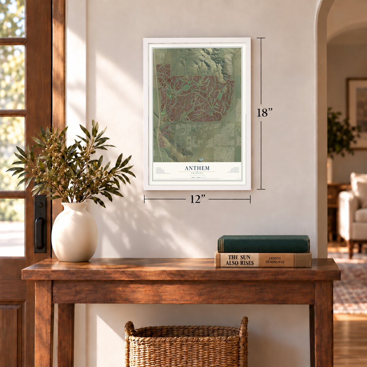
12" x 18" Archival Matte Print
A Map of Home. A Work of Art.
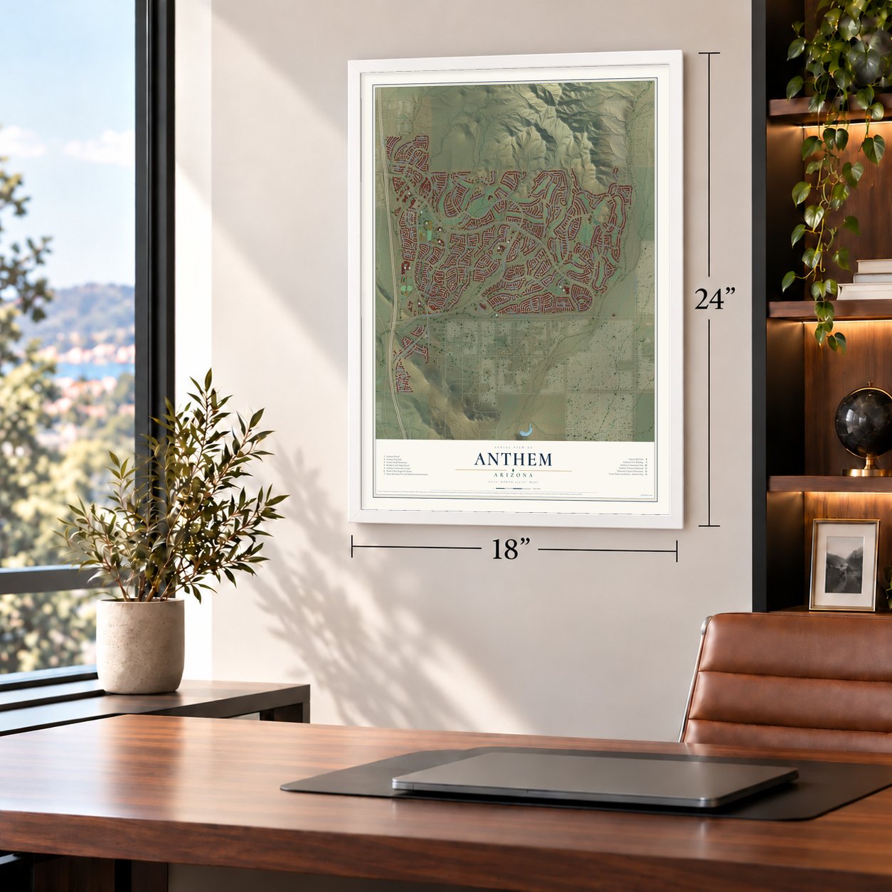
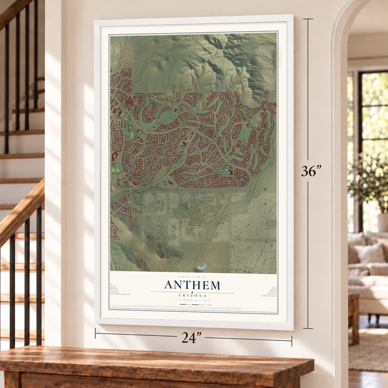
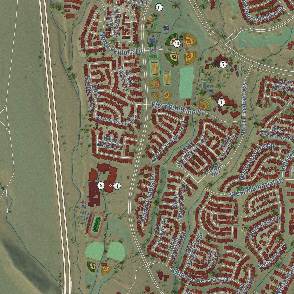
Explore Anthem, Arizona from a whole new perspective. Created using aerial imagery and detailed geographic data, this map captures Anthem building by building, with labeled streets, familiar landmarks, and shaded topographical relief that highlights the natural contours of the landscape.
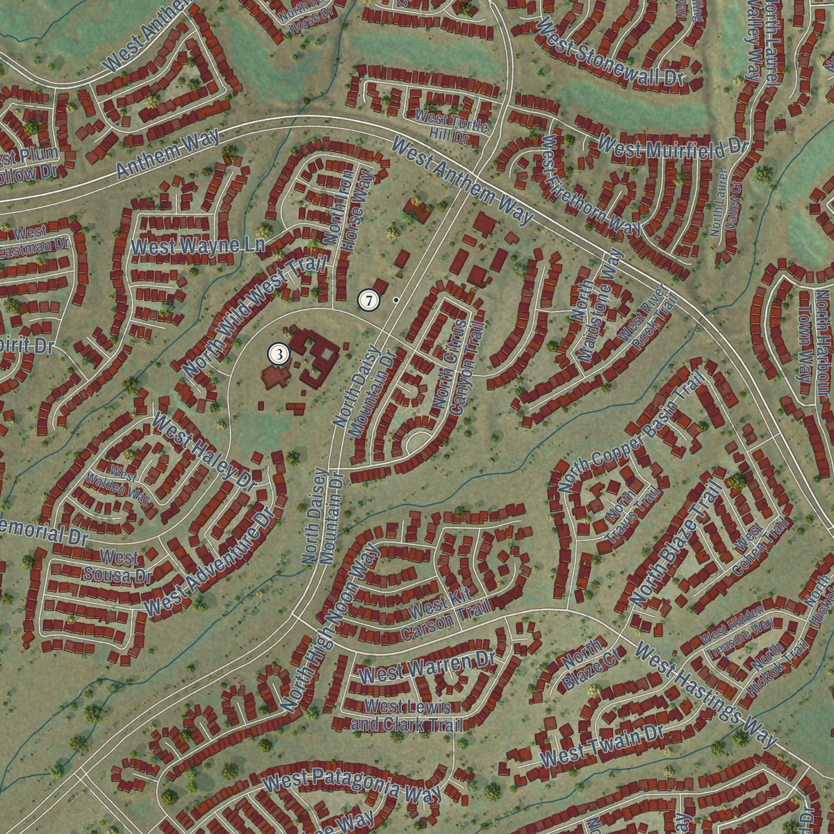
Combining modern data with the timeless character of a vintage atlas, this map is just as interesting up close as it is beautiful on the wall. Whether you grew up in Anthem, spent memorable years there, or call it home today, this unique map is a great way to celebrate a place that means something to you. Zoom in on the preview to look for your street, and then order a print to put your memories on the wall.

Three ways to hang it
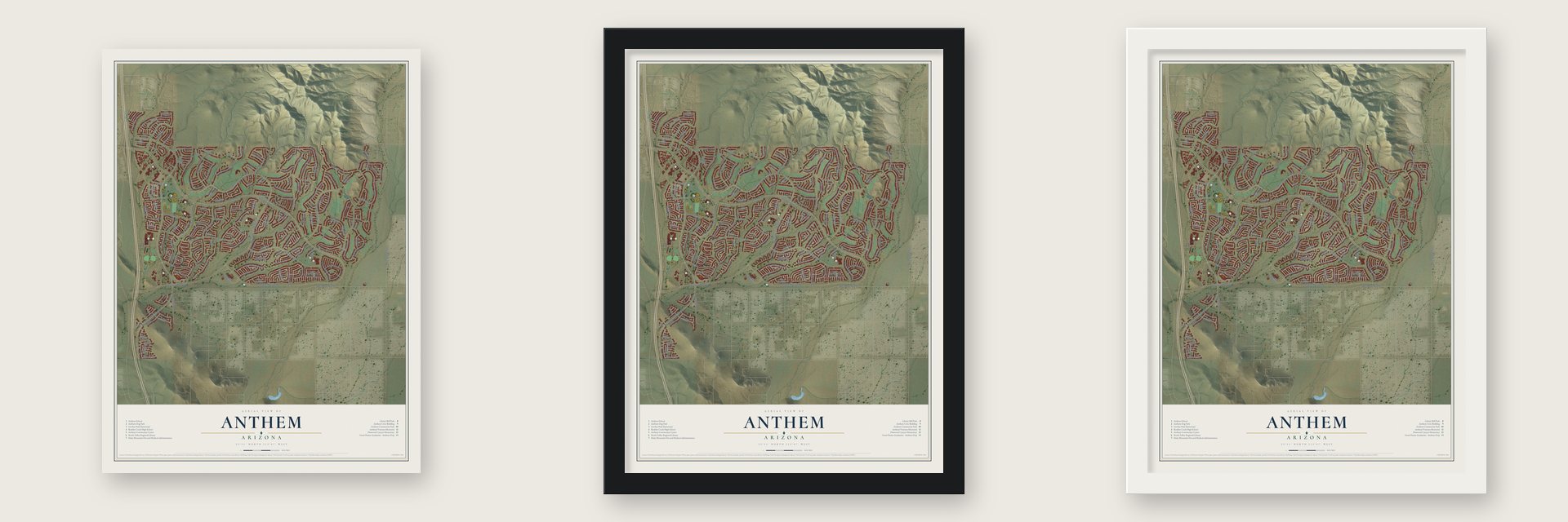
Unframed archival matte, a black wood frame or a white wood frame.
Up close
Geography Worth Displaying
This map was created using accurate cartographic data and authoritative geographic sources, including the U.S. Geological Survey (USGS) and FEMA. The map brings together terrain, waterways, roads, and building detail. The majority of the streets are labeled, houses are accurately depicted, and the topography is derived from government sources. Combining local data with carefully composed color and shading leads to this beautifully detailed Anthem artwork for your wall.
Rather than simply showing street outlines, we’ve included as many of the street names as we could reasonably fit on the map while keeping their names legible. Zoom in on the high resolution preview to see exactly what’s on the map. We truly set out to create a statement piece for anyone who loves Anthem. So whether it’s for you, or a gift for someone you love, we hope this map of Anthem brings back fond memories.
Explore the full map of Anthem, Arizona and read about the local places it shows.

Find your street
Names on the Anthem map
Every name below is printed on this map. Look for your street, your school, the park where you played, or the pond down the road.
Streets and roads186
- West Anthem Club Drive
- Anthem Way
- North Congressional Drive
- West Silver Pine Drive
- West Kuralt Drive
- West Hastings Way
- North Club Pointe Drive
- North Gavilan Peak Parkway
- West Memorial Drive
- Pagoda Lane
- West Whitman Drive
- North Vista Hills Drive
- North Seventh Avenue
- North Candlewyck Lane
- North 35th Avenue
- North Lytham Way
- West Ainsworth Drive
- North Majesty Trail
- North River Bend Road
- West Owens Way
- West Muirfield Drive
- Parker Lane
- West Anthem Way
- West Daisy Mountain Drive
- West Meridian Road
- West Desert Hills Drive
- North Anthem Hills Drive
- West Wayne Lane
- Memorial Drive
- King Drive
Show all 186 streets
- North High Noon Way
- North Venture Drive
- Wolf Run Drive
- West Links Drive
- West Twain Drive
- North Crooked Stick Road
- Independence Way
- West Spirit Drive
- North Emerald Lake Drive
- West Patagonia Way
- West Adventure Drive
- North Golf Crest Road
- West Haley Drive
- North 27th Avenue
- Navigation Way
- North Belfair Way
- North Long Cove Way
- West Legends Way
- West Dion Drive
- North Back Creek Way
- West Summit Walk Drive
- West Bisbee Way
- North Celebration Way
- North Messner Way
- West Warren Drive
- North Stonemark Drive
- North Outer Bank Drive
- North Acadia Court
- North Wild West Trail
- West Stonewall Drive
- North Blaze Trail
- North Apollo Way
- North Signal Hill Court
- West Denali Drive
- West Thoreau Lane
- West Camargo Drive
- Frontage Road
- Spirit Drive
- North Lost Legend Drive
- North Daisey Mountain Drive
- North Citrus Canyon Trail
- Desert Creek Lane
- North Daisy Mountain Drive
- West Plymouth Drive
- North Freedom Way
- Bridlewood Way
- North Courage Trail
- North Hudson Trail
- West Ashton Drive
- North Anthem Creek Drive
- West Steinbeck Drive
- North National Trail
- West Plum Hollow Drive
- West Morse Drive
- West Hemingway Lane
- North Laurel Valley Way
- West Shackleton Drive
- North Ericson Lane
- West Ravina Lane
- North Copper Basin Trail
- North Anthem Springs Road
- North Harbour Town Way
- West Rose Canyon Circle
- North Parker Lane
- North Iron Horse Way
- North Shadow Creek Way
- West Lewis and Clark Trail
- North Back Creek Court
- North Astoria Way
- North Livingstone Way
- North Integrity Trail
- West Keller Drive
- North Bent Creek Way
- Hidden Mountain Lane
- North Faith Lane
- West Sousa Drive
- West Feather Sound Court
- North Patriot Way
- North Prestancia Way
- North Lacrosse Trail
- North Noble Hawk Court
- North Sutter Lane
- North Bradon Court
- West Firethorn Way
- North Prairie Lane
- North Capra Way
- West Kit Carson Trail
- North Columbia Trail
- West Laurel Greens Drive
- North Noble Hawk Way
- West Ranier Court
- North Alistair Way
- North Maidstone Way
- North Spy Glass Drive
- North Voyage Trail
- Hudson Trail
- West Princeville Drive
- West King Drive
- North Curie Court
- North Blaze Court
- North Cedar Chase Road
- West Laurel Greens Court
- Rising Sun Road
- Ghost Flower Lane
- North Bradon Way
- West Hazelhurst Drive
- Freedom Way
- West Turtle Hill Drive
- West Eastman Drive
- West Saint Exupery Drive
- West Inspiration Drive
- West Walden Drive
- North Hawk Ridge Trail
- West Jacksonville Drive
- North Mill Creek Way
- North Cross Timbers Court
- North Crosswater Way
- West Magellan Drive
- West Eastman Court
- West Jordon Lane
- North Pinion Hills Court
- North Wisdom Way
- West River Rock Trail
- North Hickok Trail
- North Donovan Court
- North Pride Drive
- North Courage Way
- North Travis Trail
- North Barnum Way
- Aidan Lane
- Vista Hills Court
- West Cohen Trail
- North Hickok Court
- North Rolling Green Way
- North Mountain Cove Drive
- North Iron Horse Drive
- West Walden Way
- North Harbour Town Court
- North La Cantera Drive
- West Hidden Treasure Way
- West Shadow Glen Way
- North Majesty Court
- North Republic Way
- North Lytham Court
- North Laurel Valley Court
- West Shinnecock Court
- North Heavenly Way
- North Long Landing Court
- North Anthem Heights Drive
- West Princeville Court
- Whisper Court
- Ghost Flower Court
- Acadia Way
- Venture Court
- Triumph Court
- Jordan Lane
Names are listed as they appear on the printed map. Zoom into the product photos to find them.
About Anthem, Arizona
Anthem is a planned community of 23,190 people in Maricopa County, about 30 miles north of downtown Phoenix. Del Webb started building it in 1998 on 5,856 acres at the foot of Daisy Mountain and Gavilan Peak. It was first counted as a place of its own in the 2010 census.
The community is divided into Parkside, Country Club and the Village, three subdivisions that each run a homeowners association. Parkside and Country Club each choose three members of the Anthem Community Council board, and the Village chooses one. Interstate 17 splits the town. The county sheriff and the Daisy Mountain Fire Department serve the east side, while the west side is part of Phoenix.
- A Veterans Day sunbeamThe Anthem Veterans Memorial has five white pillars, one for each military branch, placed in the Department of Defense order of precedence. An oval opening in each pillar slants toward the Great Seal of the United States, so on November 11 the sun falls on the seal at exactly 11:11 in the morning.
- The storm of July 31, 2012In just 90 minutes, 5.01 inches of rain fell on Anthem. Floodwater damaged homes, and nine people had to be rescued. An investigation afterward called it a one-in-1,000 year rain catastrophe.
- Gavilan Peak, named in the 1880sThe peak north of Anthem got its name after a battle in the area between the United States Cavalry and the Apaches. Gavilan is Spanish for sparrow hawk. It is steeper than Daisy Mountain and draws far fewer climbers.
- The state's tallest fresh-cut treeThe Anthem Christmas tree is raised every holiday season at the Outlets North Phoenix. Crews spend weeks and hundreds of hours wiring and fireproofing it, then hang thousands of ornaments and 10,000 LED lights and crown it with a three-foot copper star.
Keep exploring Arizona
Anthem is one of 528 Arizona towns we've mapped. Every dot on the map is a print of its own.
The search covers every state, Arizona first.
Near Anthem
Order 2 or more town maps and save 10%. Shown in the size and finish you picked above, so they hang as a set.
- New River 12" x 18" / Archival Matte Print $39.99
- Cave Creek 12" x 18" / Archival Matte Print $39.99
- Deer Valley 12" x 18" / Archival Matte Print $39.99


More maps nearby: Peoria, Carefree, Black Canyon City, Moon Valley and Sun City West.
The art of mapping a place
How This Map Was Made
Real places. Remarkable detail. Discover the layers that turn geographic data into a map of home.

The view from above
Aerial imagery reveals the character of the land: woodland, open fields, and the patterns of a place.

The shape of the land
Elevation data brings hills, valleys, and subtle changes in the landscape into view.

The details of home
Roads, waterways, and building footprints come together to make the map feel unmistakably local.

Geography becomes art
Considered color, shading, and typography bring the layers together in a map made for your wall.


Process illustrated with Mendon, Massachusetts. Aerial imagery: USDA NAIP. Terrain: USGS 3D Elevation Program. Map details and finished artwork: KNOWOL.
The Details
About This Print
Choose an archival matte print, or a black or white Ayous wood frame. The archival matte print is unframed.
Select your size and finish above to see the matching product image and price.
Materials & Craftsmanship
A contemporary map with the character of a classic atlas, printed on archival matte paper. Optional frames are made from Ayous wood.
Your printed map does not include the watermark shown in the full-map preview.
Shipping & Delivery
Free shipping within the United States. Every print is made to order in the USA.
Buying a gift? Add a note in your cart and we'll include it. We never put prices in the package.
Prints ship within 2 to 3 business days. Allow 7 to 10 days total from ordering for delivery. Timing may vary during holidays or periods of high order volume.
Read our shipping policy.
Returns and damaged prints
Each print is made to order. Change-of-mind refunds are not available after production.
If your print arrives damaged, misprinted or incorrect, contact support@knowol.com within 30 days of receiving it. Include your order number, photos and a description of the issue.
Read our full refund and replacement policy. For questions about your order, email support@knowol.com.