
Search for another town


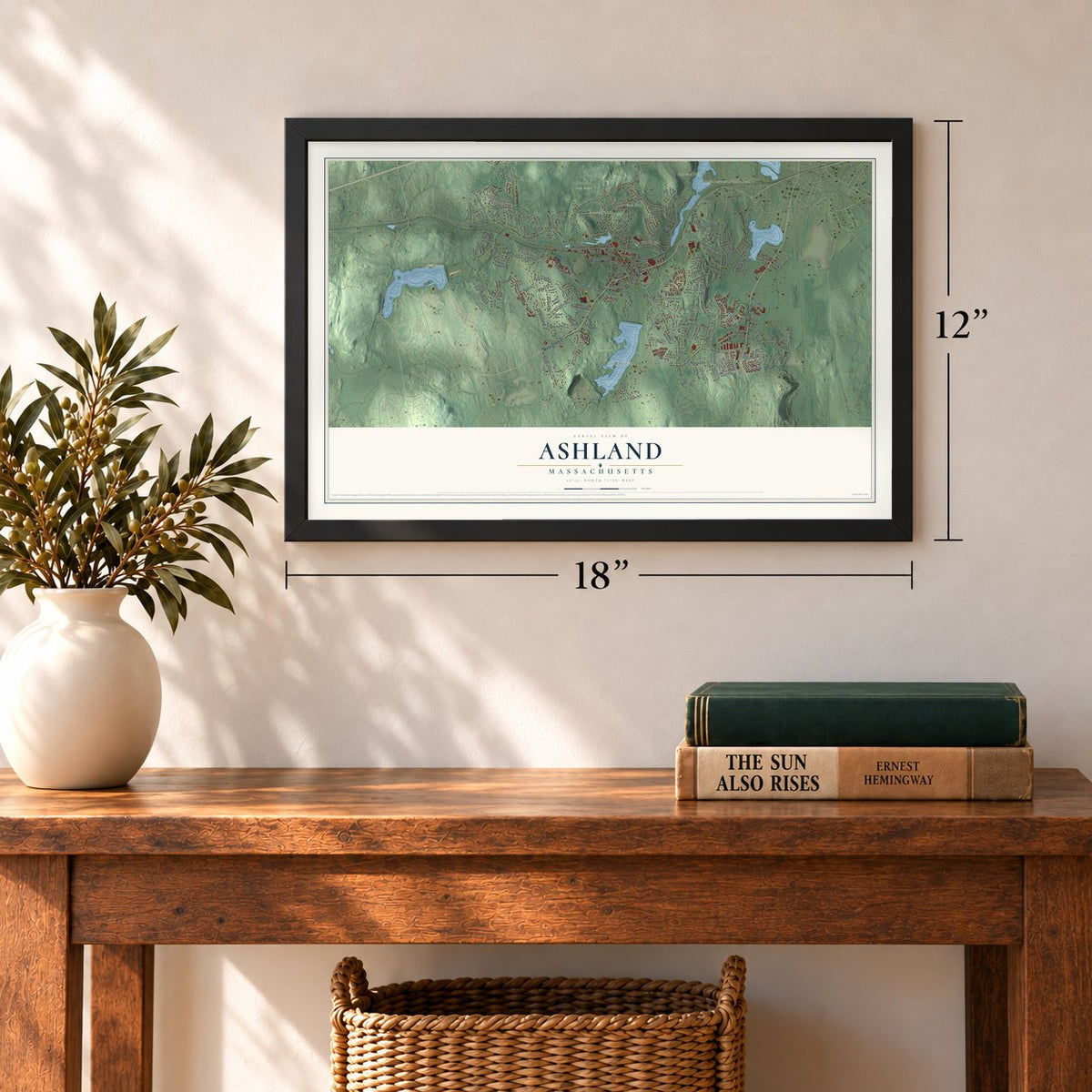
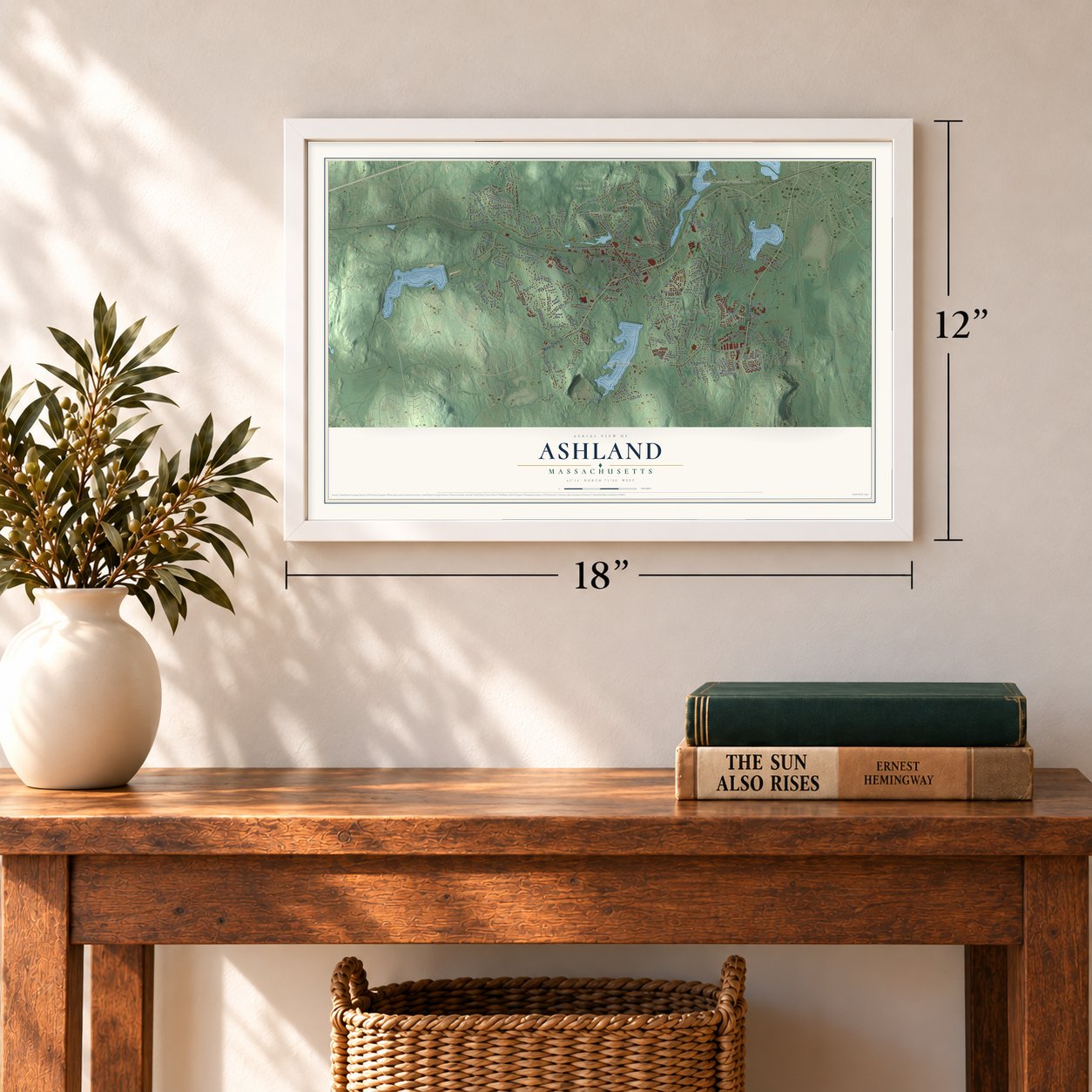
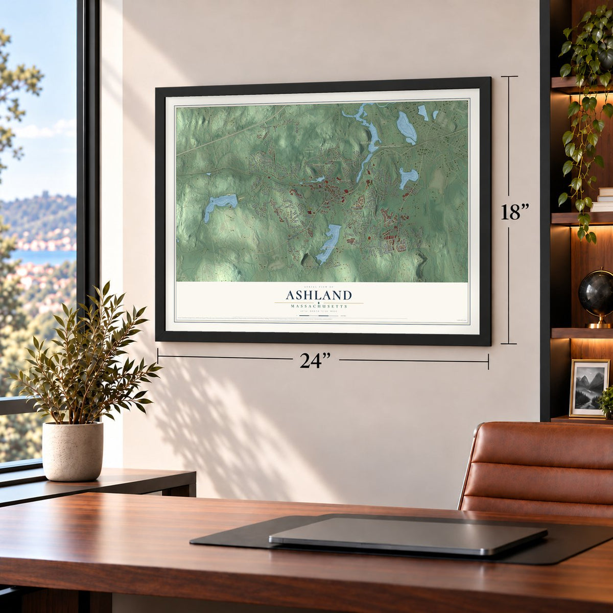
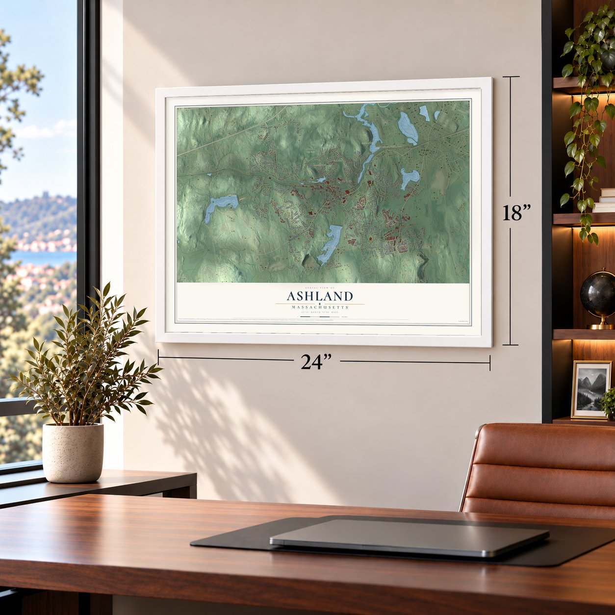

Free U.S. delivery 7 to 10 days after you order
Ashland, Massachusetts Map Art
Building by building, with labeled streets and shaded relief.
12" x 18" Archival Matte Print
A Map of Home. A Work of Art.
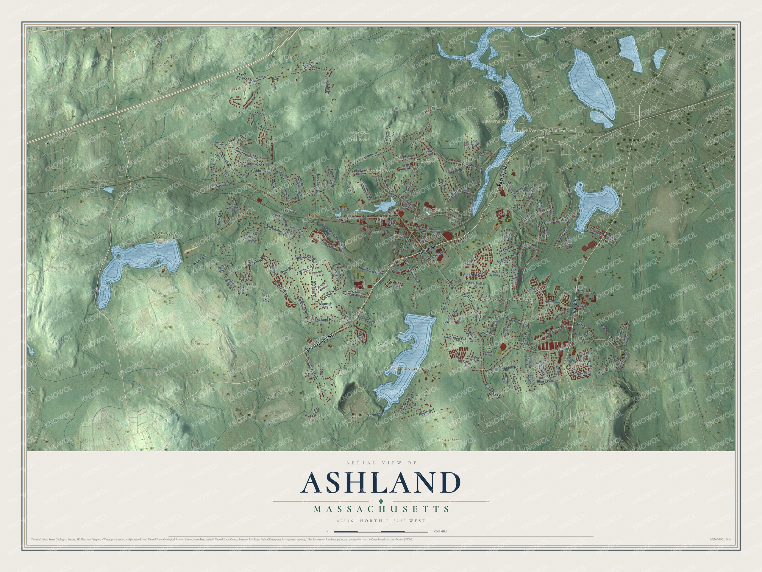
Explore Ashland, Massachusetts from a whole new perspective. Created using aerial imagery and detailed geographic data, this map captures Ashland building by building, with labeled streets, familiar landmarks, and shaded topographical relief that highlights the natural contours of the landscape.
Combining modern data with the timeless character of a vintage atlas, this map is just as interesting up close as it is beautiful on the wall. Whether you grew up in Ashland, spent memorable years there, or call it home today, this unique map is a great way to celebrate a place that means something to you. Zoom in on the preview to look for your street, and then order a print to put your memories on the wall.
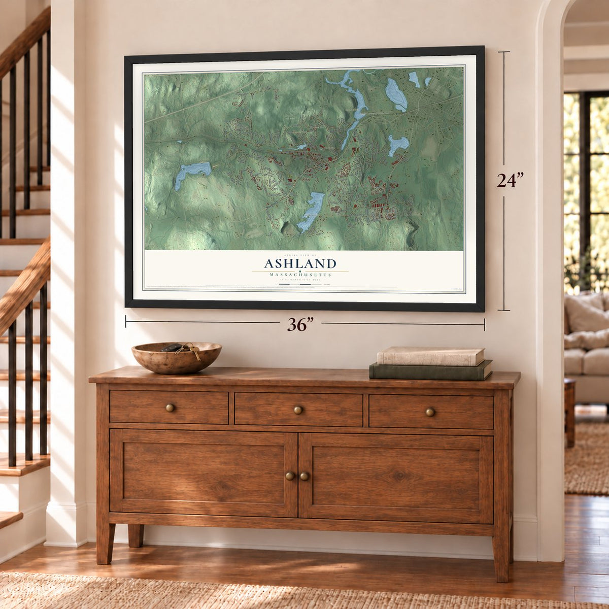
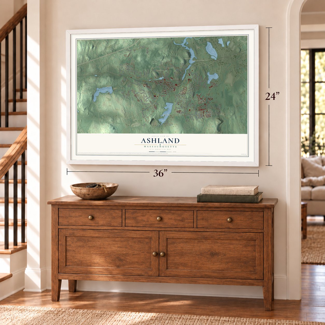
Three ways to hang it
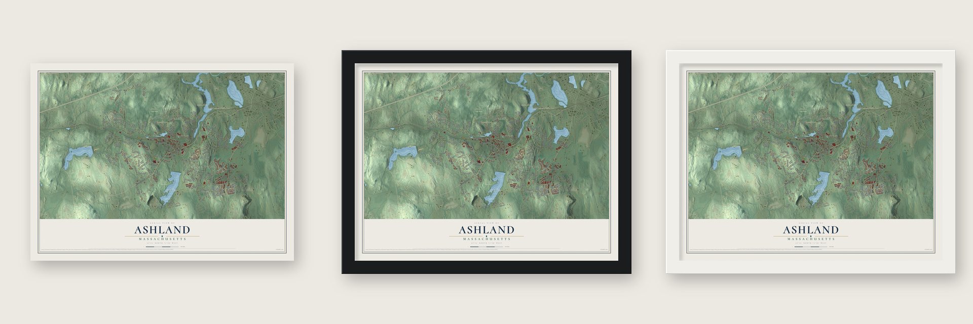
Unframed archival matte, a black wood frame or a white wood frame.
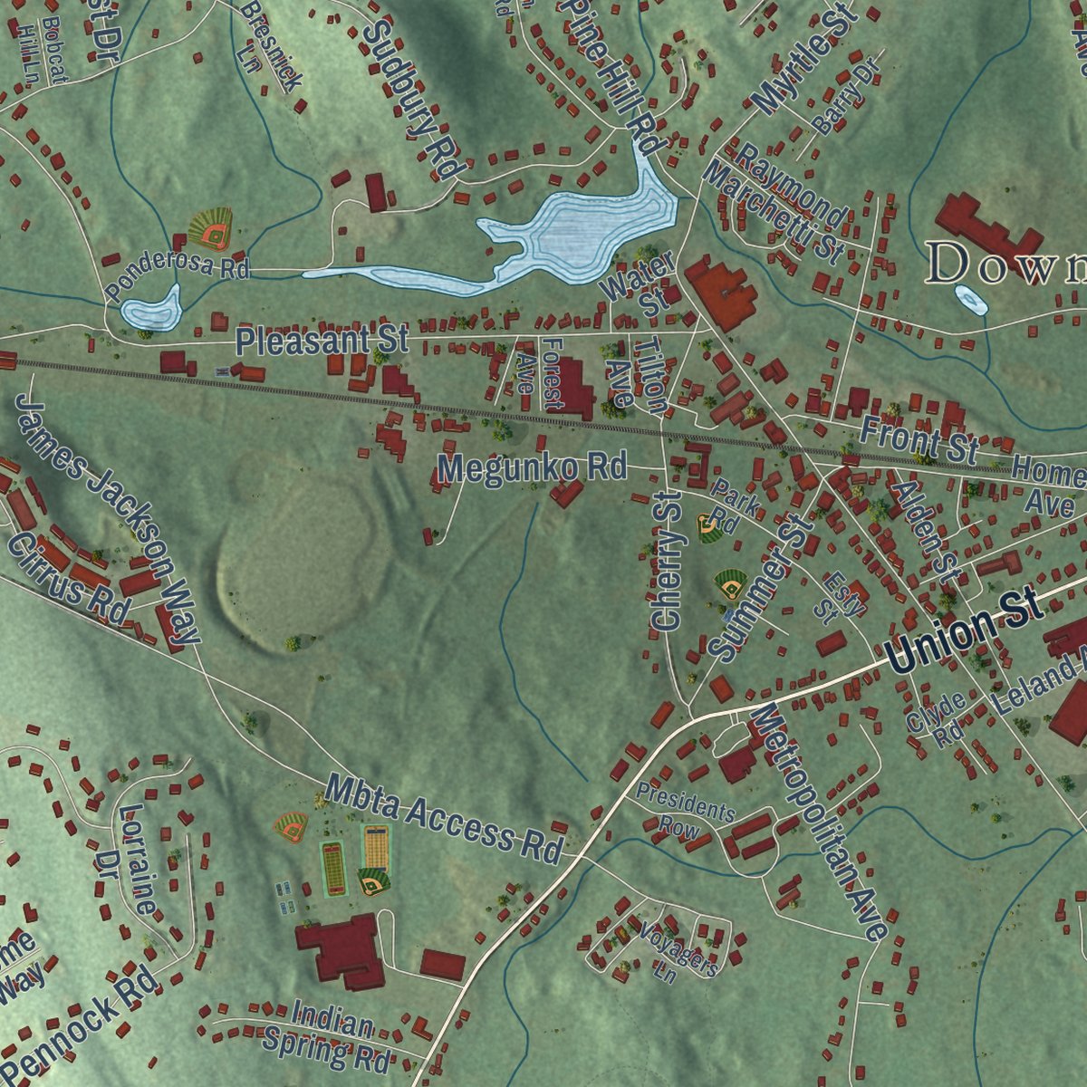
Up close
Geography Worth Displaying
This map was created using accurate cartographic data and authoritative geographic sources, including the U.S. Geological Survey (USGS) and FEMA. The map brings together terrain, waterways, roads, and building detail. The majority of the streets are labeled, houses are accurately depicted, and the topography is derived from government sources. Combining local data with carefully composed color and shading leads to this beautifully detailed Ashland artwork for your wall.
Rather than simply showing street outlines, we’ve included as many of the street names as we could reasonably fit on the map while keeping their names legible. Zoom in on the high resolution preview to see exactly what’s on the map. We truly set out to create a statement piece for anyone who loves Ashland. So whether it’s for you, or a gift for someone you love, we hope this map of Ashland brings back fond memories.
Explore the full map of Ashland, Massachusetts and read about the local places it shows.

Find your street
Names on the Ashland map
Every name below is printed on this map. Look for your street, your school, the park where you played, or the pond down the road.
Places and landmarks10
- Downtown
- Workmans Circle Camp
- Ballard Hill
- Banner Hill
- Broad Hill
- Fish Hill
- Ashland Reservoir
- Ashland Town Forest
- Ashland State Park
- Hopkinton State Park
Streets and roads184
- Union Street
- West Union Street
- Pond Street
- Waverly Street
- East Union Street
- Fountain Street
- Eliot Street
- Chestnut Street
- Cedar Street
- Oak Street
- Cordaville Road
- Winter Street
- Howe Street
- High Street
- Myrtle Street
- Olive Street
- Prospect Street
- Main Street
- Oregon Road
- Heritage Avenue
- Cross Street
- Spring Street
- Green Street
- Pleasant Street
- Pennock Road
- Grover Road
- James Jackson Way
- America Boulevard
- Hardwick Road
- Front Street
Show all 184 streets
- Thomas Street
- Whittemore Drive
- Metropolitan Avenue
- Pine Hill Road
- Sudbury Road
- Shore Road
- Fruit Street
- Woodland Road
- Blue Jay Lane
- Frankland Road
- Cirrus Road
- Mbta Access Road
- Hilldale Road
- Wadsworth Road
- Cherry Street
- Braeburn Lane
- Roberts Road
- Lincoln Road
- Wilbur Drive
- Constitution Street
- Nickerson Road
- Trailside Way
- Higley Road
- Orchard Road
- Annetta Road
- Summer Street
- Kings Row
- Fiske Hill
- Teller Drive
- Coburn Avenue
- Cutler Drive
- Tri Street
- Tudor Lane
- Russet Hill Road
- Brimstone Way
- Kathryn Drive
- Longhill Road
- Megunko Road
- Lakeview Terrace
- Larcridge Lane
- Parkhurst Drive
- Brogden Road
- Holly Lane
- Valley Road
- South Street
- Ivy Lane
- Concord Street
- Algonquin Trail
- Indian Brook Road
- Warren Road
- Homer Avenue
- Raymond Way
- Stagecoach Drive
- Jennings Road
- Ramblewood Drive
- Fatima Drive
- Rockwood Drive
- Meeting House Path
- Haven Way
- Cedar Hill Road
- Strobus Lane
- Nancy Drive
- Mountain Gate Road
- Lorraine Drive
- Leland Farm Road
- Alden Street
- Deer Ridge Road
- Albert Ray Drive
- Raymond Marchetti Street
- New Castle Road
- Rossi Lane
- Goodnow Avenue
- Indian Spring Road
- Ridgewood Street
- Fern Crossing
- Summit Lane
- Wayside Lane
- Hawthorne Road
- Byron Road
- Butterfield Drive
- Williams Road
- Davis Farm Road
- Donna Lee Lane
- Edgewood Drive
- Leland Avenue
- Acton Road
- Wesson Road
- Hundred Oaks Lane
- Adams Road
- Thurston Lane
- Fox Hill Road
- Colonial Drive
- Sewell Street
- Boulder Hill Lane
- Prospect Heights
- Wilson Circle
- Saddle Hill Lane
- Vine Street
- Winesap Way
- Femia Road
- Rome Way
- Douglas Road
- Hunters Lane
- East Bluff Road
- Parker Road
- Hunting Hill Lane
- Day Road
- Water Street
- Tilton Avenue
- Tyler Lane
- Irene Circle
- Eliot Circle
- Captain Eames Circle
- Riverview Drive
- Spyglass Hill Drive
- Old Central Turnpike
- Upland Road
- Old Connecticut Path
- Stonybrook Drive
- Loring Drive
- Ponderosa Road
- Woodridge Lane
- Washington Avenue
- Laurelton Drive
- Esty Street
- Dearth Circle
- Barry Drive
- Park Road
- Shadow Creek Lane
- Bresnick Lane
- Running Brook Circle
- Webster Road
- Tower Road
- Dale Road
- Clyde Road
- Forest Avenue
- Dustin Road
- Nikki Terrace
- Nash Avenue
- Voyagers Lane
- Arrowhead Circle
- Coburn Drive
- Presidents Row
- Queen Isabella Way
- Birch Hill Road
- Cary Drive
- Joanne Drive
- Sunset Road
- Fawn Ridge Road
- Magnolia Pointe
- Johnson Street
- Cortland Lane
- Bobcat Hill Lane
- Harris Lane
Names are listed as they appear on the printed map. Zoom into the product photos to find them.
About Ashland, Massachusetts
Ashland is a town in Middlesex County, Massachusetts, where the 2020 census recorded 18,832 residents. It was incorporated in 1846.
- 2020 populationThe census recorded 18,832 residents in Ashland.
- Incorporated in 1846It was incorporated in 1846.
- Middlesex CountyAshland is a town in this Massachusetts county.
Keep exploring Massachusetts
Ashland is one of 466 Massachusetts towns we've mapped. Every dot on the map is a print of its own.
The search covers every state, Massachusetts first.
Near Ashland
Order 2 or more town maps and save 10%. Shown in the size and finish you picked above, so they hang as a set.
- Cordaville 12" x 18" / Archival Matte Print $39.99
- Framingham 12" x 18" / Archival Matte Print $39.99
- Southborough 12" x 18" / Archival Matte Print $39.99

More maps nearby: Hopkinton, Holliston, Sherborn, Natick and Westborough.
The art of mapping a place
How This Map Was Made
Real places. Remarkable detail. Discover the layers that turn geographic data into a map of home.

The view from above
Aerial imagery reveals the character of the land: woodland, open fields, and the patterns of a place.

The shape of the land
Elevation data brings hills, valleys, and subtle changes in the landscape into view.

The details of home
Roads, waterways, and building footprints come together to make the map feel unmistakably local.

Geography becomes art
Considered color, shading, and typography bring the layers together in a map made for your wall.


Process illustrated with Mendon, Massachusetts. Aerial imagery: USDA NAIP. Terrain: USGS 3D Elevation Program. Map details and finished artwork: KNOWOL.
The Details
About This Print
Choose an archival matte print, or a black or white Ayous wood frame. The archival matte print is unframed.
Select your size and finish above to see the matching product image and price.
Materials & Craftsmanship
A contemporary map with the character of a classic atlas, printed on archival matte paper. Optional frames are made from Ayous wood.
Your printed map does not include the watermark shown in the full-map preview.
Shipping & Delivery
Free shipping within the United States. Every print is made to order in the USA.
Buying a gift? Add a note in your cart and we'll include it. We never put prices in the package.
Prints ship within 2 to 3 business days. Allow 7 to 10 days total from ordering for delivery. Timing may vary during holidays or periods of high order volume.
Read our shipping policy.
Returns and damaged prints
Each print is made to order. Change-of-mind refunds are not available after production.
If your print arrives damaged, misprinted or incorrect, contact support@knowol.com within 30 days of receiving it. Include your order number, photos and a description of the issue.
Read our full refund and replacement policy. For questions about your order, email support@knowol.com.