
Search for another town




Free U.S. delivery 7 to 10 days after you order
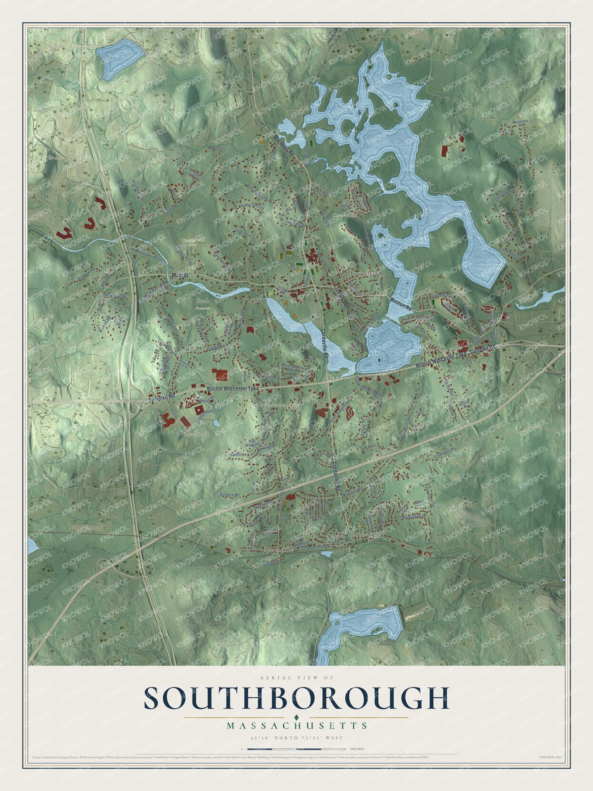
Southborough, Massachusetts Map Art
Building by building, with labeled streets and shaded relief.
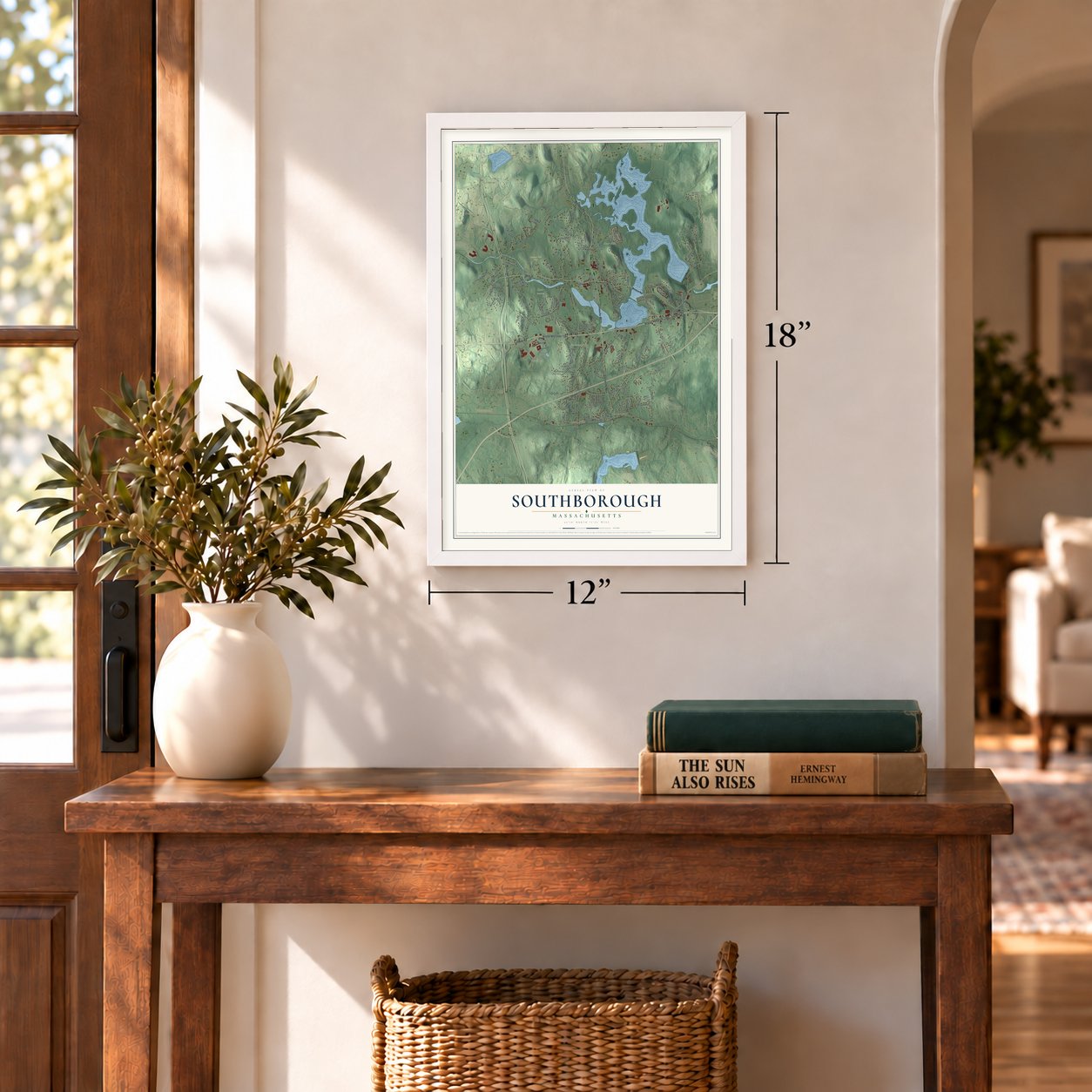
12" x 18" Archival Matte Print
A Map of Home. A Work of Art.
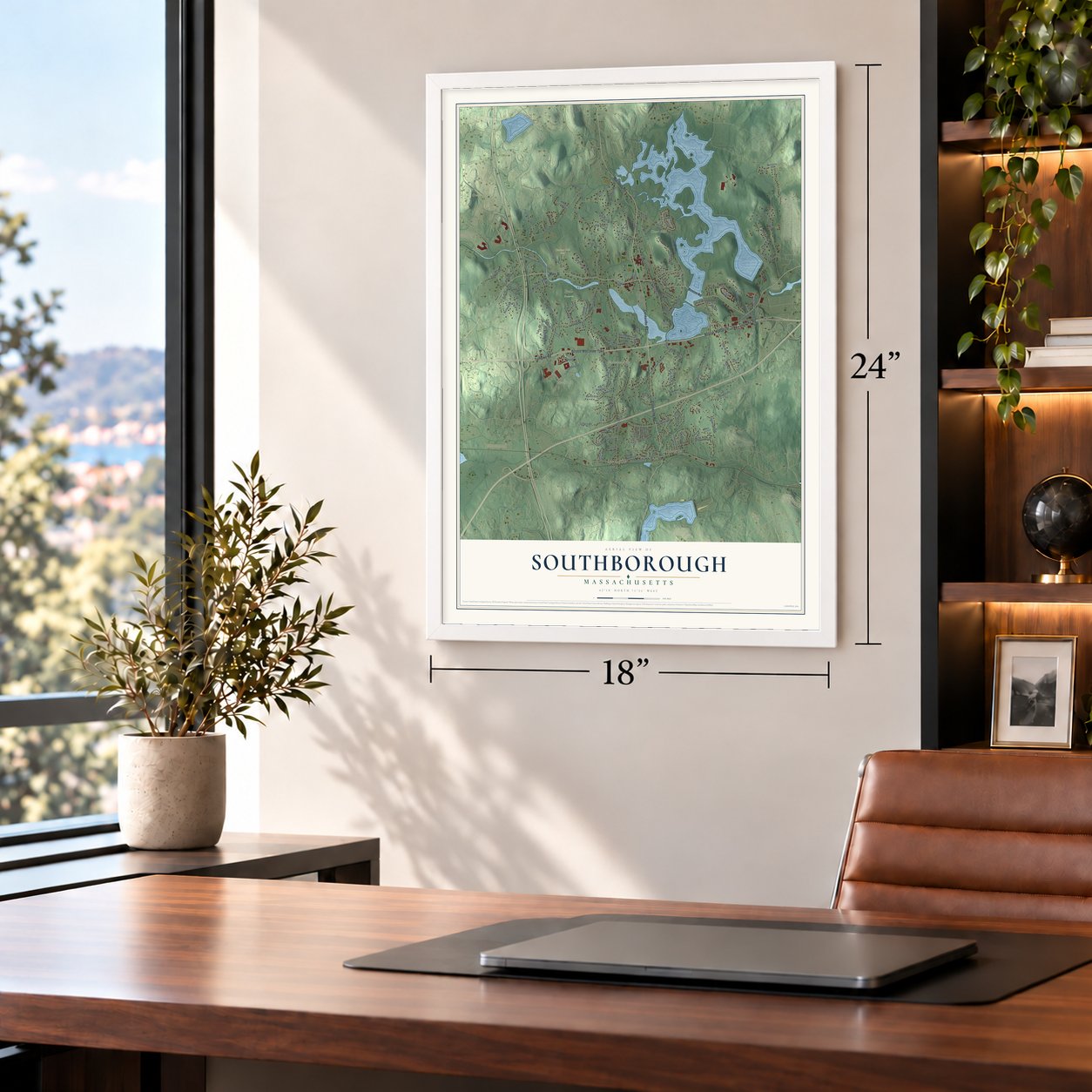
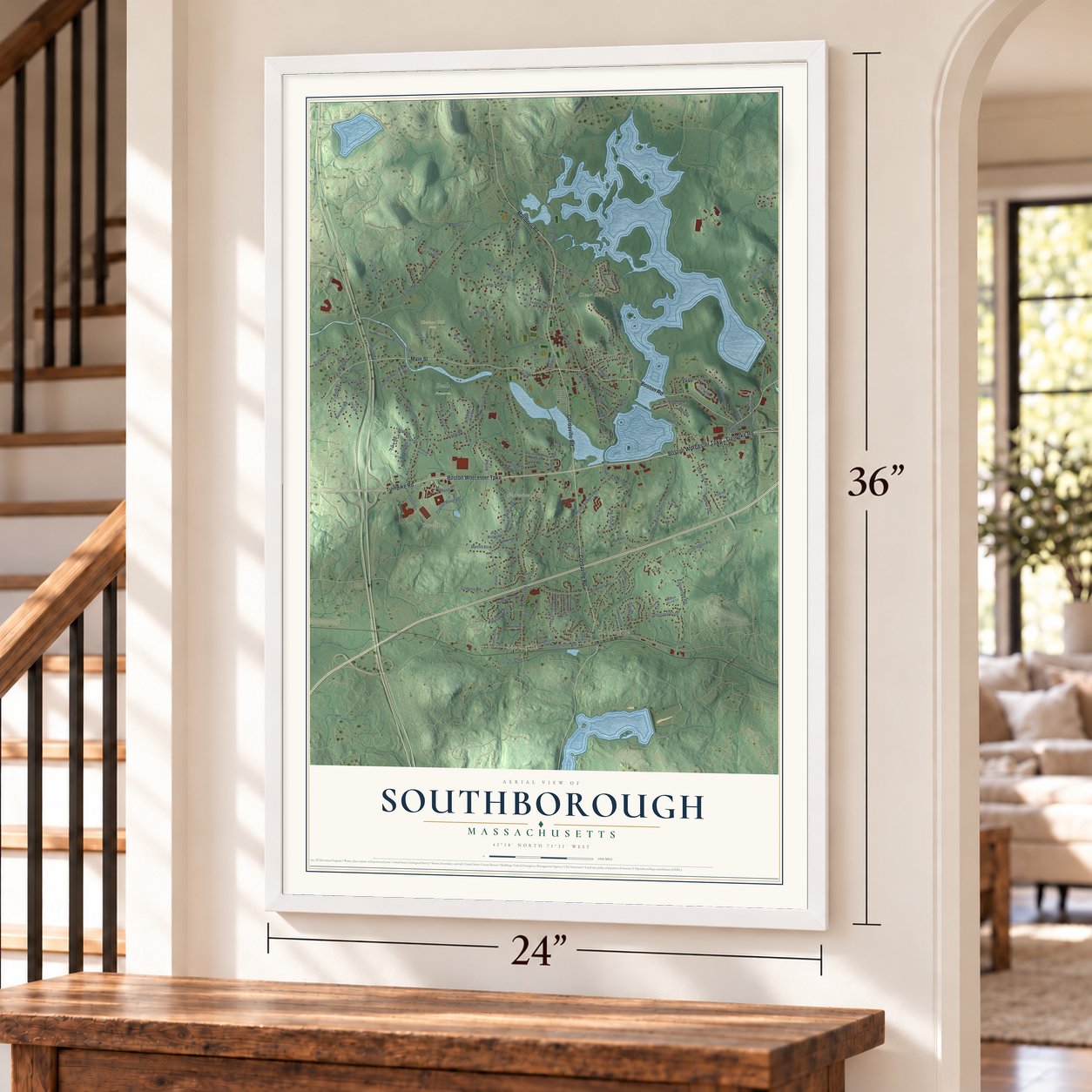
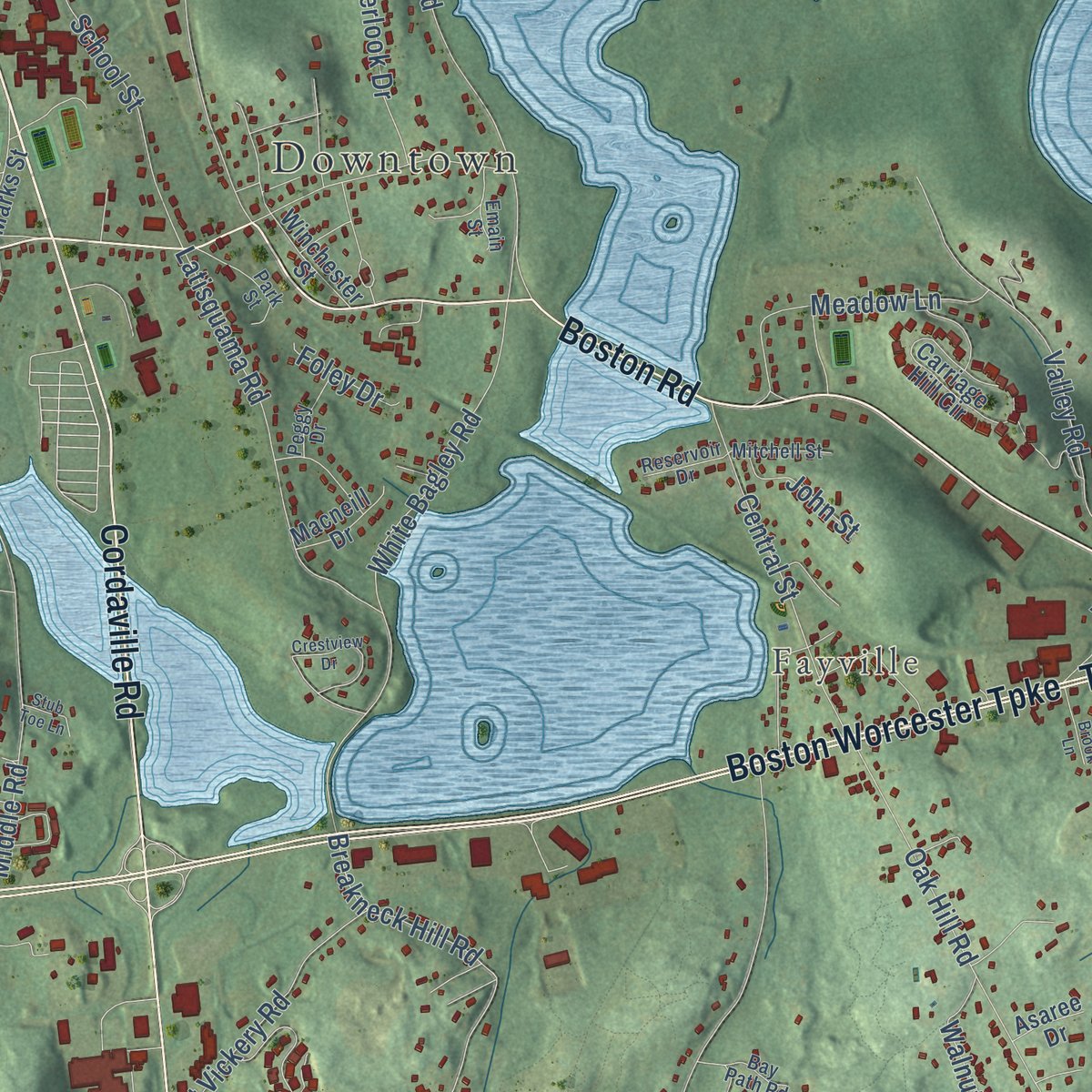
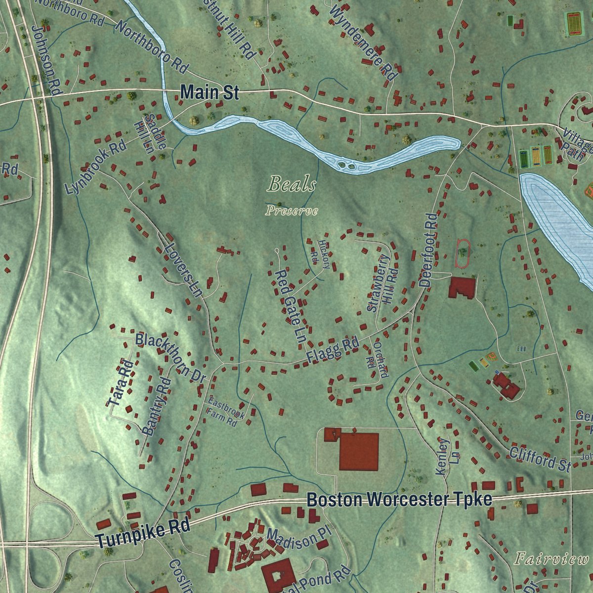
Explore Southborough, Massachusetts from a whole new perspective. Created using aerial imagery and detailed geographic data, this map captures Southborough building by building, with labeled streets, familiar landmarks, and shaded topographical relief that highlights the natural contours of the landscape.
Combining modern data with the timeless character of a vintage atlas, this map is just as interesting up close as it is beautiful on the wall. Whether you grew up in Southborough, spent memorable years there, or call it home today, this unique map is a great way to celebrate a place that means something to you. Zoom in on the preview to look for your street, and then order a print to put your memories on the wall.
Three ways to hang it
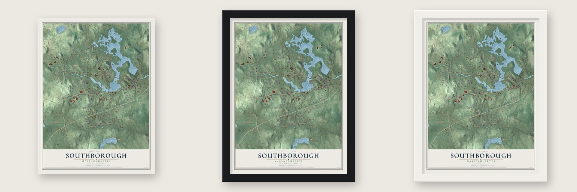
Unframed archival matte, a black wood frame or a white wood frame.
Up close
Geography Worth Displaying
This map was created using accurate cartographic data and authoritative geographic sources, including the U.S. Geological Survey (USGS) and FEMA. The map brings together terrain, waterways, roads, and building detail. The majority of the streets are labeled, houses are accurately depicted, and the topography is derived from government sources. Combining local data with carefully composed color and shading leads to this beautifully detailed Southborough artwork for your wall.
Rather than simply showing street outlines, we’ve included as many of the street names as we could reasonably fit on the map while keeping their names legible. Zoom in on the high resolution preview to see exactly what’s on the map. We truly set out to create a statement piece for anyone who loves Southborough. So whether it’s for you, or a gift for someone you love, we hope this map of Southborough brings back fond memories.
Explore the full map of Southborough, Massachusetts and read about the local places it shows.

Find your street
Names on the Southborough map
Every name below is printed on this map. Look for your street, your school, the park where you played, or the pond down the road.
Places and landmarks11
- Downtown
- Southville
- Cordaville
- Fayville
- Clear Hill
- Crane Hill
- Fairview Hill
- Jericho Hill
- Crystal Pond
- Beals Preserve
- Chestnut Hill Farm
Streets and roads142
- Marlboro Road
- Boston Road
- Main Street
- Cordaville Road
- Boston Worcester Turnpike
- Turnpike Road
- Northboro Road
- Lynbrook Road
- Jericho Hill Road
- Madison Place
- Parkerville Road
- Southville Road
- Sears Road
- Woodland Road
- Middle Road
- Pine Hill Road
- Framingham Road
- Deerfoot Road
- Presidential Drive
- Fisher Road
- Flagg Road
- Breakneck Hill Road
- Newton Street
- Mount Vickery Road
- White Bagley Road
- Richards Road
- Chestnut Hill Road
- Oregon Road
- Valley Road
- School Street
Show all 142 streets
- Lovers Lane
- Gilmore Road
- Oak Hill Road
- Latisquama Road
- Crystal Pond Road
- Ward Road
- Constitution Drive
- Bigelow Road
- Overlook Drive
- Ashley Road
- Central Street
- Atwood Street
- Burnett Road
- Meadow Lane
- Sadie Hutt Lane
- Edgewood Road
- Clifford Street
- Fairview Drive
- Southwood Lane
- Wildwood Drive
- Darlene Drive
- Coslin Drive
- Bantry Road
- High Street
- Pinecone Lane
- Acre Bridge Road
- Wyndemere Road
- Walnut Drive
- Red Gate Lane
- Tara Road
- Skylar Drive
- Granvaile Road
- Wood Street
- Clemmons Street
- Nichols Street
- Ted Lane
- Johnson Road
- Blackthorn Drive
- Joslin Lane
- Harris Drive
- John Street
- Foley Drive
- Cross Street
- Banfill Lane
- William Onthank Lane
- Highland Street
- Ledge Hill Road
- Woodbury Road
- Carriage Hill Circle
- Liberty Drive
- Sears Road Lane
- Old Northboro Road
- Rockpoint Road
- Strawberry Hill Road
- Maplecrest Drive
- General Henry Knox Road
- Summit Road
- Graystone Way
- Village Path
- Oland Lane
- Whistler Lane
- Schipper Farm Lane
- Barn Lane
- Willow Street
- Leonard Drive
- Parmenter Road
- High Ridge Road
- Saint Marks Street
- Carolyn Terrace
- Fiddleneck Lane
- Winchester Street
- Firmin Avenue
- Macneill Drive
- Foxhill Drive
- Choate Lane
- Saddle Hill Lane
- Prentiss Street
- Kenley Lane
- Sunrise Drive
- Asaree Drive
- Parker Street
- River Street
- Orchard Road
- Bryden Road
- Park Street
- Nathan Stone Lane
- Buffalo Run
- Pearl Street
- Moulton Road
- Old Harry Road
- Metcalf Lane
- Mitchell Street
- Austin Kelly Lane
- Bay Path Road
- Hubley Lane
- Peggy Drive
- Reservoir Drive
- Emain Street
- John Matthews Road
- Crestview Drive
- Hickory Road
- Eastbrook Farm Road
- Kennedy Lane
- Alexandra Circle
- Kidder Lane
- Lamb Hill Road
- Brook Lane
- Mooney Lane
- Autumn Hill Lane
- Wells Lane
- Stub Toe Lane
- Wyeth Circle
Names are listed as they appear on the printed map. Zoom into the product photos to find them.
About Southborough, Massachusetts
Southborough is a town of 10,450 people in Worcester County. Europeans began settling here in 1660, when the land was the south end of Marlborough and went by the name Stony Brook, after the stream that still crosses it. In 1727 about fifty families there asked to form a town of their own. Marlborough agreed, and the first town meeting was held on August 28 at Timothy Brigham's house.
Moses, Jacob and Ebenezer Newton petitioned that October to rejoin Marlborough, but the House refused them. The new town ordained Rev. Nathan Stone as its first minister in 1730, paying him 120 pounds a year plus thirty cords of good wood. Two years later Southborough was indicted because it lacked a schoolmaster, stocks, and weights and measures that had been sealed. On April 19, 1775, Capt. Josiah Fay led fifty-six minutemen out to Lexington and Concord.
“Fellow-citizens! Fellow-townsmen! I was born, and nurtured, and rocked, and reared in your midst.”
- A free library in 1852Col. Francis B. Fay offered his hometown $500 toward a free library in 1852. The town put up a matching sum, and the Fay Library opened. In 1860 the Rev. William J. Breed of Southborough wished that its founder might live a thousand years.
- Three villages, three storiesFayville took its name from the Fays, five of whom traded there. Col. Dexter Fay started as a butcher in a shop roughly fourteen feet on each side and grew it until yearly sales passed $125,000. Southville grew up around boot and shoe factories built about 1845. In 1846 Milton H. Sanford started a stone factory nearby and named the village Cordaville for his wife, Cordelia; after the mill burned in 1855, he rebuilt it in the same place.
- Two schools from the BurnettsJoseph Burnett founded St. Mark's School in 1865. A year later Eliza Burnett Fay and Harriet Burnett started Fay School, now the oldest junior boarding school in the nation.
- Stony Brook turned reservoirIn 1894 the Sudbury Dam, also known as the Fayville Dam, went up on the Stony Brook arm of the Sudbury River; builders shifted some 4.5 million cubic yards of earth and boulders. Sudbury Reservoir began filling on February 8, 1897, and by 1898 an aqueduct carried Nashua River water from Clinton through it toward Boston. The project ended Southborough's manufacturing. The reservoir now serves as a reserve supply, and visitors may hike its watershed and fish from shore.
- One school for two villagesBoston architect Frank Irving Cooper designed the South Union School, a Classical Revival brick building raised in 1911 and 1912 so the younger children of Cordaville and Southville could attend school together. Since 1981 it has housed the Southborough Arts Center, and it joined the National Register in 2011.
Keep exploring Massachusetts
Southborough is one of 461 Massachusetts towns we've mapped. Every dot on the map is a print of its own.
The search covers every state, Massachusetts first.
Near Southborough
Order 2 or more town maps and save 10%. Shown in the size and finish you picked above, so they hang as a set.
- Cordaville 12" x 18" / Archival Matte Print $39.99
- Marlborough 12" x 18" / Archival Matte Print $39.99
- Ashland 12" x 18" / Archival Matte Print $39.99

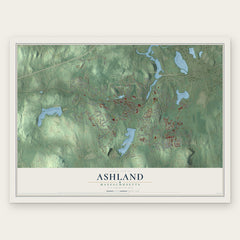
More maps nearby: Framingham, Westborough, Hopkinton, Northborough and Hudson.
The art of mapping a place
How This Map Was Made
Real places. Remarkable detail. Discover the layers that turn geographic data into a map of home.

The view from above
Aerial imagery reveals the character of the land: woodland, open fields, and the patterns of a place.

The shape of the land
Elevation data brings hills, valleys, and subtle changes in the landscape into view.

The details of home
Roads, waterways, and building footprints come together to make the map feel unmistakably local.

Geography becomes art
Considered color, shading, and typography bring the layers together in a map made for your wall.


Process illustrated with Mendon, Massachusetts. Aerial imagery: USDA NAIP. Terrain: USGS 3D Elevation Program. Map details and finished artwork: KNOWOL.
The Details
About This Print
Choose an archival matte print, or a black or white Ayous wood frame. The archival matte print is unframed.
Select your size and finish above to see the matching product image and price.
Materials & Craftsmanship
A contemporary map with the character of a classic atlas, printed on archival matte paper. Optional frames are made from Ayous wood.
Your printed map does not include the watermark shown in the full-map preview.
Shipping & Delivery
Free shipping within the United States. Every print is made to order in the USA.
Buying a gift? Add a note in your cart and we'll include it. We never put prices in the package.
Prints ship within 2 to 3 business days. Allow 7 to 10 days total from ordering for delivery. Timing may vary during holidays or periods of high order volume.
Read our shipping policy.
Returns and damaged prints
Each print is made to order. Change-of-mind refunds are not available after production.
If your print arrives damaged, misprinted or incorrect, contact support@knowol.com within 30 days of receiving it. Include your order number, photos and a description of the issue.
Read our full refund and replacement policy. For questions about your order, email support@knowol.com.