
Search for another town





Free U.S. delivery 7 to 10 days after you order
Natick, Massachusetts Map Art
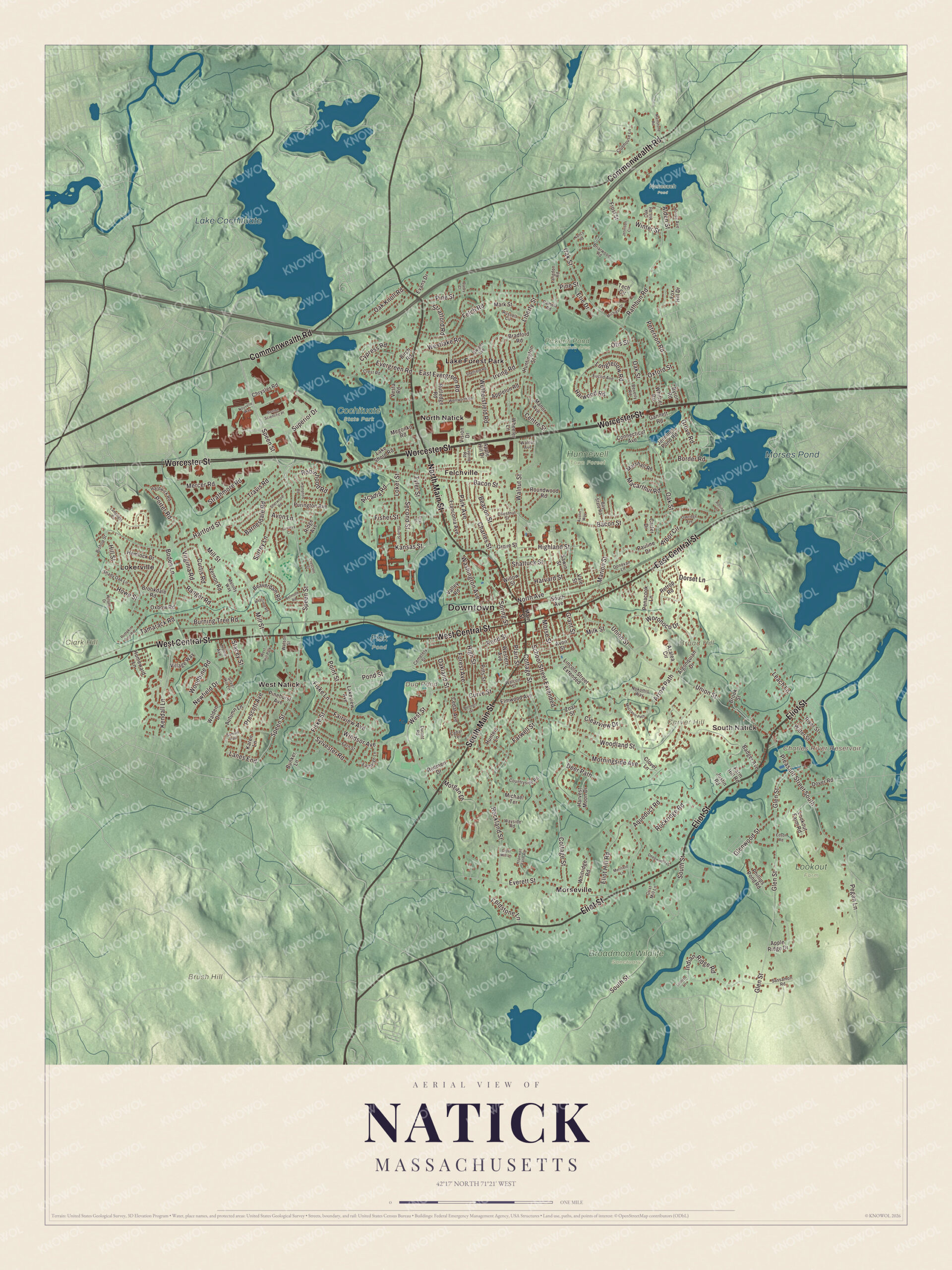
A new map of Natick, Massachusetts, made in 2026 and printed to order on thick archival matte paper.
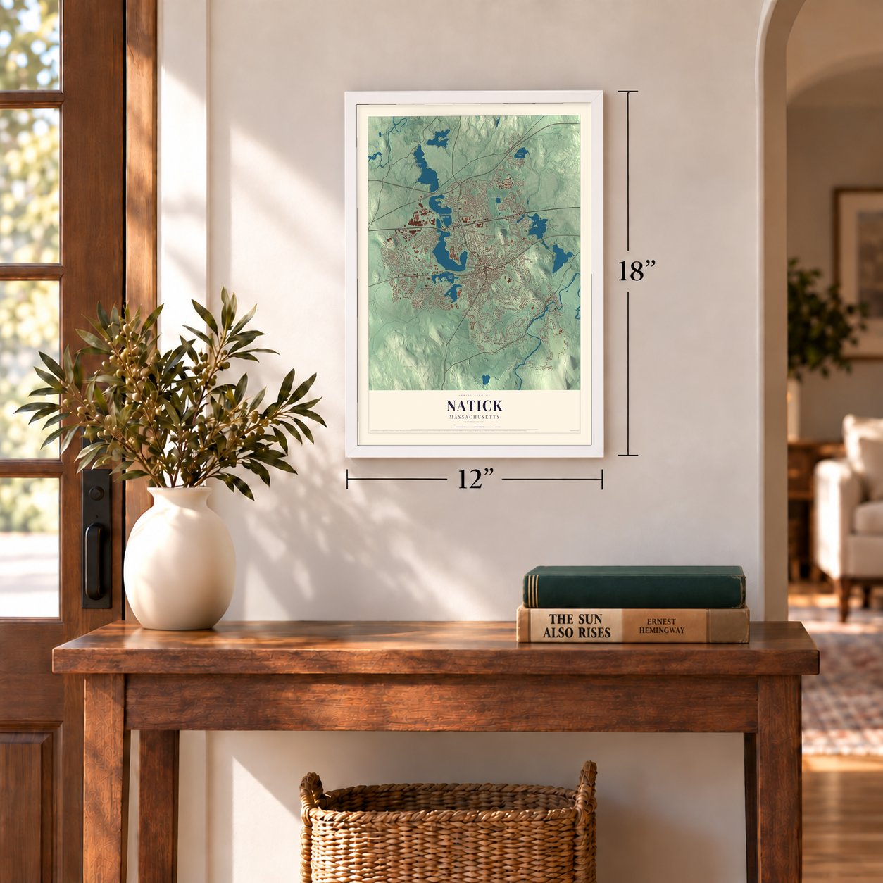
12" x 18" Archival Matte Print
A Map of Home. A Work of Art.
Bring a piece of Natick home. Whether it’s where you grew up, your current home, or simply a moment in your life, this Natick, Massachusetts map print brings those memories to your wall. Antique-inspired styling and modern geographic detail combine to create artwork that’s beautiful from across the room, with plenty to study and explore when you get up close.
Three ways to hang it
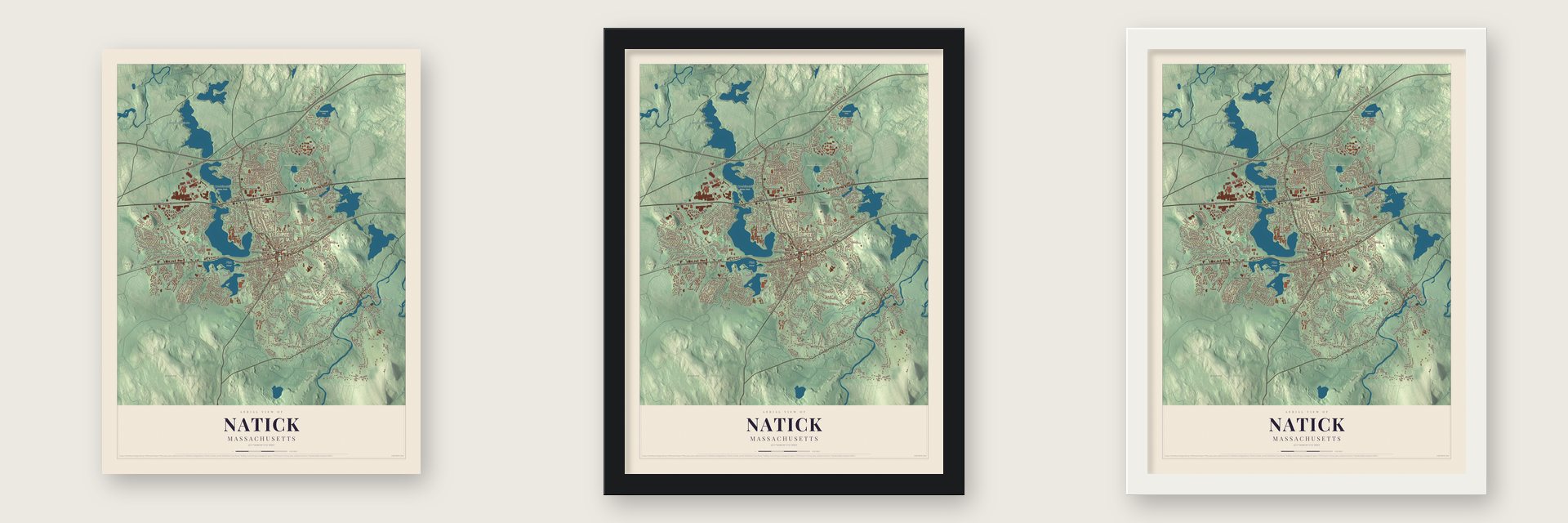
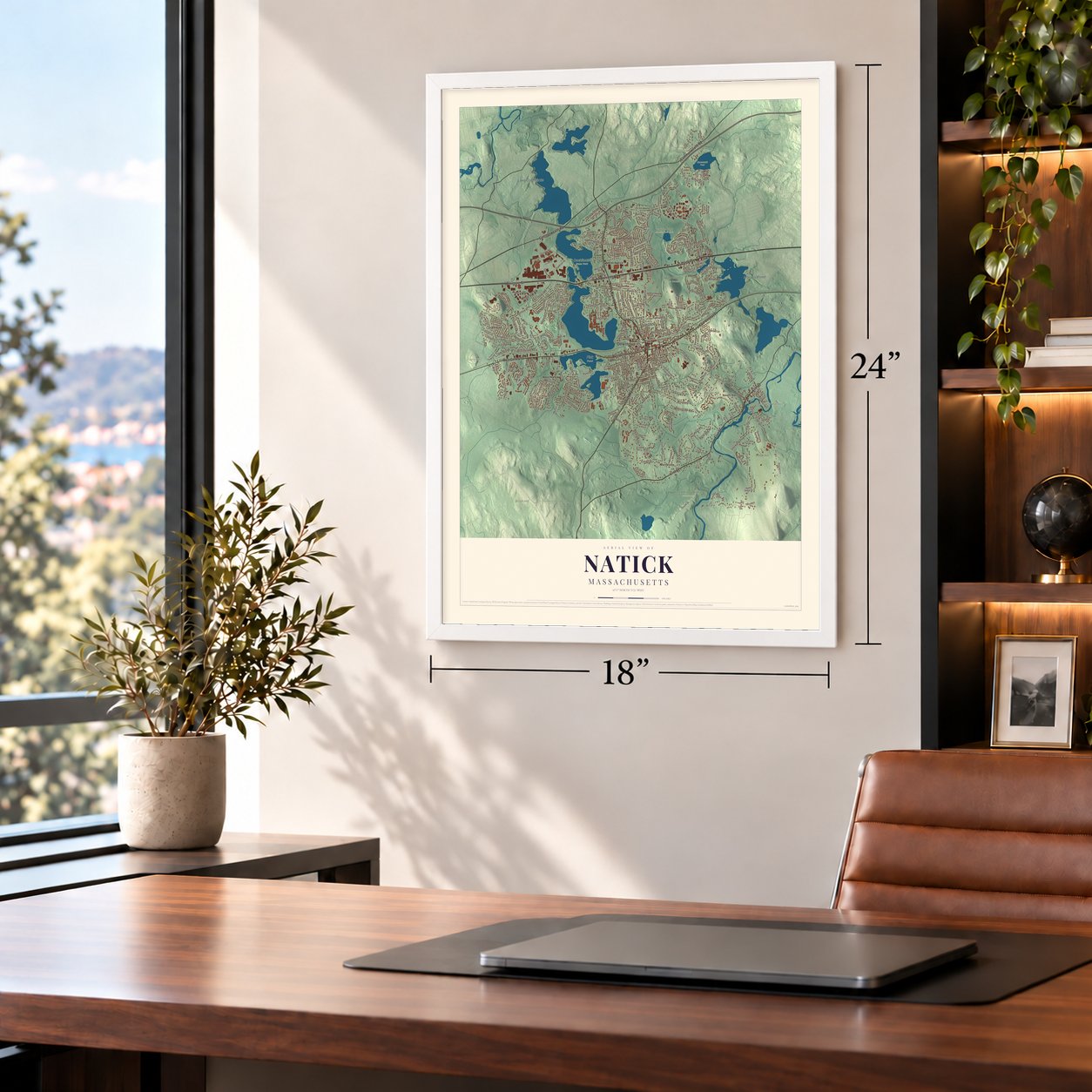
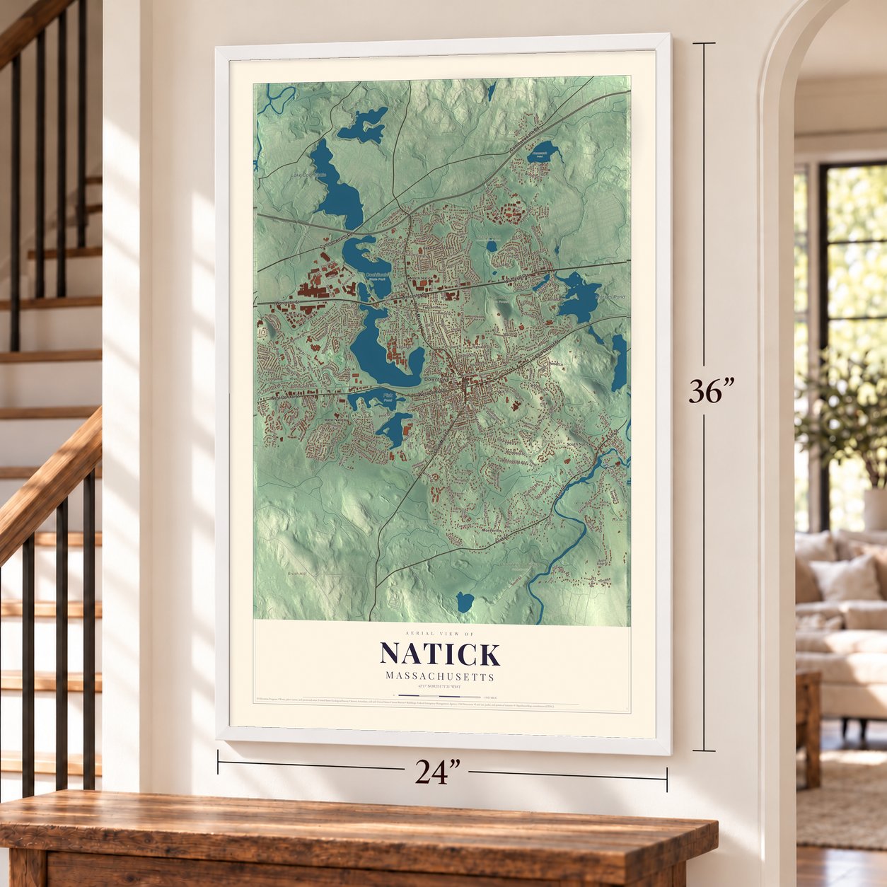
Unframed archival matte, a black wood frame or a white wood frame.
Up close
Real geography. Art worth displaying.
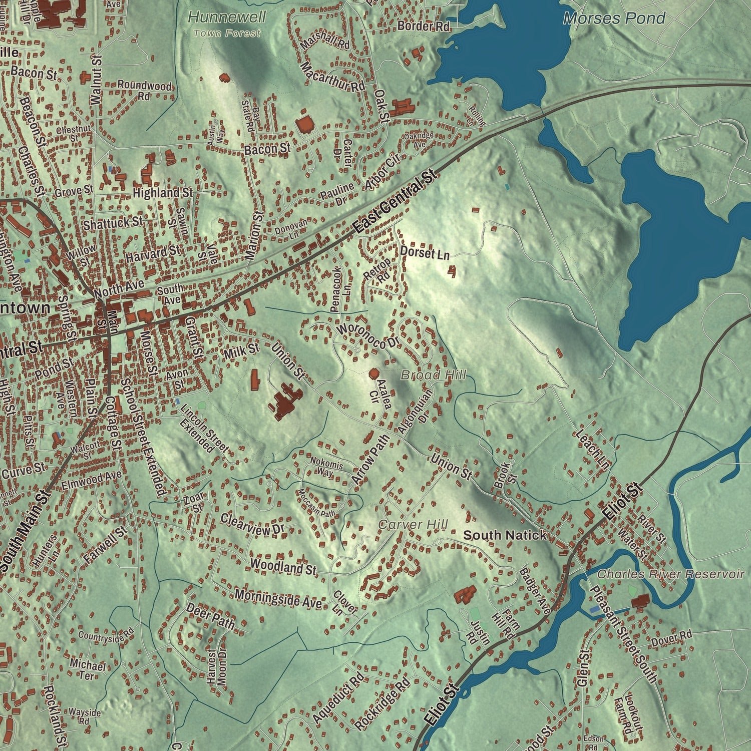
This map was created using accurate cartographic data and authoritative geographic sources, including the U.S. Geological Survey (USGS) and FEMA. The map brings together terrain, waterways, roads, and building detail. The majority of the streets are labeled, houses are accurately depicted, and the topography is derived from government sources. Combining local data with carefully composed color and shading leads to this beautifully detailed Natick artwork for your wall.
Rather than simply showing street outlines, we’ve included as many of the street names as we could reasonably fit on the map while keeping their names legible. Zoom in on the high resolution preview to see exactly what’s on the map. We truly set out to create a statement piece for anyone who loves Natick. So whether it’s for you, or a gift for someone you love, we hope this map of Natick brings back fond memories.
Explore the full map of Natick, Massachusetts and read about the local places it shows.

About Natick, Massachusetts
Natick is a community in Middlesex County, Massachusetts, where the 2020 census counted 37,006 residents. The community's documented historic places include Jenison, Robert, House and Badger, Rev. Stephen, House. Together, its census record and preserved local sites offer recognizable points in the town's civic landscape.
- 37,006 residentsThe 2020 census recorded this population.
- Middlesex CountyNatick is part of this Massachusetts county.
- Jenison, Robert, HouseThis local property appears in the town's National Register listings.
- Badger, Rev. Stephen, HouseThis local property appears in the town's National Register listings.
- Clark HousesThis local property appears in the town's National Register listings.
Find your street
Names on the Natick map
Every name below is printed on this map. Look for your street, your school, the park where you played, or the pond down the road.
Places and landmarks24
- Downtown
- South Natick
- Broad Hill
- Brush Hill
- Carver Hill
- Clark Hill
- Charles River Reservoir
- Dug Pond
- Lake Cochituate
- Morses Pond
- Broadmoor Wildlife Sanctuary
- Cochituate State Park
Show all 24 places
- Fisk Pond
- Hunnewell Town Forest
- Lookout Farm
- Nonesuch Pond
- Pickerel Pond Conservation Area
- Felchville
- Lake Forest Park
- Lokerville
- Morseville
- North Natick
- West Natick
- West Hill Park
Streets and roads261
- North Main Street
- South Main Street
- East Central Street
- West Central Street
- Worcester Street
- Eliot Street
- Commonwealth Road
- Speen Street
- Bacon Street
- Oak Street
- Union Street
- Hartford Street
- Cottage Street
- Pond Street
- Woodland Street
- Glen Street
- Mill Street
- Walnut Street
- South Street
- Everett Street
- Pleasant Street South
- Pine Street
- Eliot Hill Road
- Rockland Street
- Pegan Lane
- Winter Street
- West Street
- Morgan Drive
- Indian Ridge Road
- Rathbun Road
Show all 261 streets
- Newfield Drive
- Park Avenue
- Dorset Lane
- Macarthur Road
- Westlake Road
- Kendall Lane
- Boden Lane
- Marion Street
- Felch Road
- Charles Street
- Strathmore Road
- Farwell Street
- North Avenue
- Burning Tree Road
- Evergreen Road
- Wethersfield Road
- Ranger Road
- Centre Street
- Washington Avenue
- Woronoco Drive
- Arbor Circle
- Mercer Road
- Fisher Street
- Beacon Street
- Kansas Street
- Porter Road
- Leach Lane
- Superior Drive
- Liberty Street
- Harwood Road
- Morningside Avenue
- School Street Extended
- East Evergreen Road
- Barnesdale Road
- Fairview Avenue
- Forest Avenue
- High Street
- Irving Road
- Oak Knoll Road
- Rockridge Road
- Sylvester Road
- Cypress Road
- Fiske Street
- Grove Road
- Glenwood Street
- Curve Street
- Second Street
- Travis Road
- Robinhood Road
- Highland Street
- Windsor Avenue
- Harvard Street
- Peterson Road
- Morse Street
- Loker Street
- Curtis Road
- Longfellow Road
- Howe Street
- Erie Drive
- Border Road
- Virginia Road
- Arrow Path
- Surrey Lane
- Tamarack Road
- Woodbine Road
- Stratford Road
- Clearview Drive
- Fieldstone Lane
- Arcadia Road
- Shattuck Street
- Aqueduct Road
- Oakland Street
- Prescott Avenue
- Oxford Street
- Lanes End
- Deer Path
- Plain Street
- Point Street
- Stacey Street
- Tyler Street
- Spring Street
- Alden Street
- Milk Street
- Fiske Lane
- Avon Lane
- Otis Street
- Grant Street
- Hill Street
- Fox Hill Drive
- Farm Hill Road
- Algonquian Drive
- Apple Hill Drive
- Brookdale Road
- Bradford Road
- Lakeview Avenue
- Hemlock Drive
- Rutledge Road
- Lincoln Street Extended
- Franconia Avenue
- Pauline Drive
- Apple Ridge Drive
- Water Street
- Tech Circle
- South Avenue
- Ridge Avenue
- Lake Shore Road
- Lookout Farm Road
- Bunker Lane
- Birch Road
- Pinehurst Avenue
- Pitts Street
- Penacook Lane
- Walden Drive
- Appleton Road
- Oxbow Road
- Whitridge Road
- Phillips Pond Road
- Hunters Lane
- Sawin Street
- Jennings Pond Road
- Harvest Moon Drive
- Roundwood Road
- Elmwood Avenue
- Beaverdam Road
- Autumn Lane
- Grove Street
- Vernon Road
- Vision Drive
- Mark Street
- Purington Avenue
- Whittier Road
- Clover Lane
- Dover Road
- Badger Avenue
- Valley Road
- Brook Street
- Cedar Avenue
- Retrop Road
- Manor Avenue
- River Street
- Karen Lane
- Marshall Road
- Connecticut Avenue
- Gannett Road
- Huntington Street
- Village Way
- Megonko Road
- Chrysler Road
- Homeward Lane
- Western Avenue
- Azalea Circle
- Wheeler Lane
- Redmen Drive
- Evans Drive
- Vesta Road
- Avon Street
- Byron Road
- Frost Street
- Michael Terrace
- Willow Street
- Carter Drive
- Justin Road
- Zoar Street
- Vale Street
- Main Street
- Beverly Road
- Russell Circle
- Hardwick Road
- Fern Street
- Pamela Road
- Eastleigh Lane
- Dwight Avenue
- Clubhouse Lane
- Cedar Terrace
- Countryside Road
- Euclid Avenue
- Crest Road
- Sassamon Road
- Shady Oak Lane
- Silver Hill Lane
- Cemetery Street
- Nokomis Way
- Chestnut Street
- Donovan Lane
- Bay State Road
- Durant Road
- Langdon Road
- Bishop Street
- Walcott Street
- Briarwood Road
- Oak Hill Road
- Wayside Road
- Hovey Avenue
- Grist Mill Lane
- Melody Way
- Home Avenue
- Lupine Road
- Watson Street
- Walnut Avenue
- Hopewell Farm Road
- Oakridge Avenue
- Moccasin Path
- Bennett Street
- Sherwood Road
- Westfield Road
- Pumpkin Pine Road
- Wentworth Road
- Lamplight Circle
- Samuel Path
- Hampton Road
- Third Street
- Belmore Road
- Crescent Street
- Mainstone Road
- Boston Scientific Place
- Deepwoods Drive
- Merifield Lane
- Sheffield Road
- Michigan Drive
- Nancy Road
- Jennison Circle
- Austin Way
- Edson Road
- Lantern Lane
- Nouvelle Way
- Rolling Lane
- Fairway Circle
- Darby Court
- Cider Mill Lane
- Wilson Drive
- First Street
Names are listed as they appear on the printed map. Zoom into the product photos to find them.
The art of mapping a place
How This Map Was Made
Real places. Remarkable detail. Discover the layers that turn geographic data into a map of home.

The view from above
Aerial imagery reveals the character of the land: woodland, open fields, and the patterns of a place.

The shape of the land
Elevation data brings hills, valleys, and subtle changes in the landscape into view.

The details of home
Roads, waterways, and building footprints come together to make the map feel unmistakably local.

Geography becomes art
Considered color, shading, and typography bring the layers together in a map made for your wall.


Process illustrated with Mendon, Massachusetts. Aerial imagery: USDA NAIP. Terrain: USGS 3D Elevation Program. Map details and finished artwork: KNOWOL.
The Details
About This Print
Choose an archival matte print, or a black or white Ayous wood frame. The archival matte print is unframed.
Select your size and finish above to see the matching product image and price.
Materials & Craftsmanship
A contemporary map with the character of a classic atlas, printed on archival matte paper. Optional frames are made from Ayous wood.
Your printed map does not include the watermark shown in the full-map preview.
Shipping & Delivery
Free shipping within the United States. Every print is made to order in the USA.
Buying a gift? Add a note in your cart and we'll include it. We never put prices in the package.
Prints ship within 2 to 3 business days. Allow 7 to 10 days total from ordering for delivery. Timing may vary during holidays or periods of high order volume.
Read our shipping policy.
Returns and damaged prints
Each print is made to order. Change-of-mind refunds are not available after production.
If your print arrives damaged, misprinted or incorrect, contact support@knowol.com within 30 days of receiving it. Include your order number, photos and a description of the issue.
Read our full refund and replacement policy. For questions about your order, email support@knowol.com.
Find your town
Looking for another city?
Find a map of home in our Massachusetts collection.
Nearby
Maps of towns near Natick
Know someone from one of these towns? Their map makes a great gift.


