
Search for another town


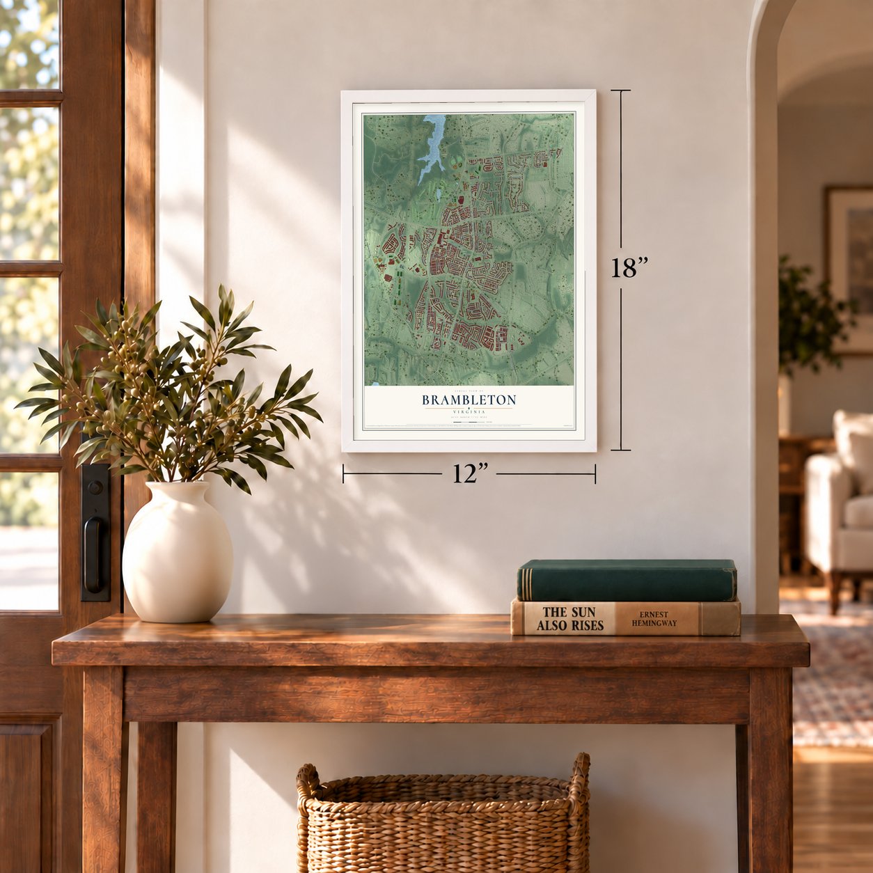
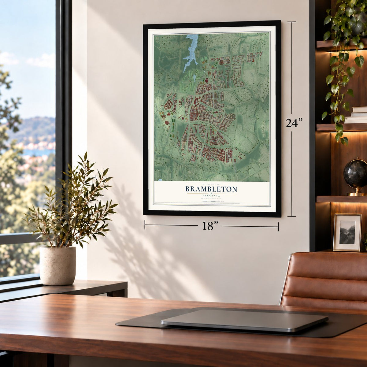
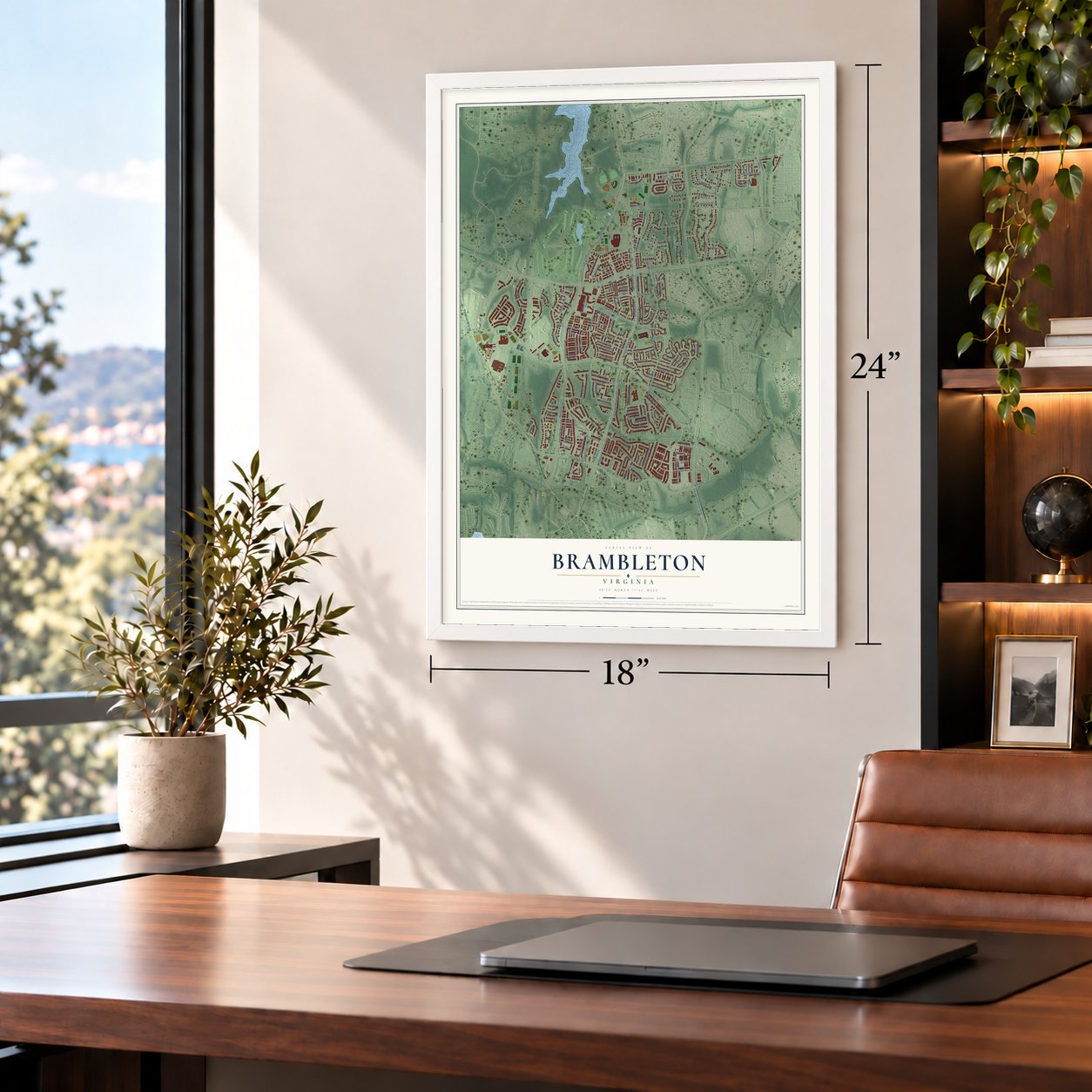

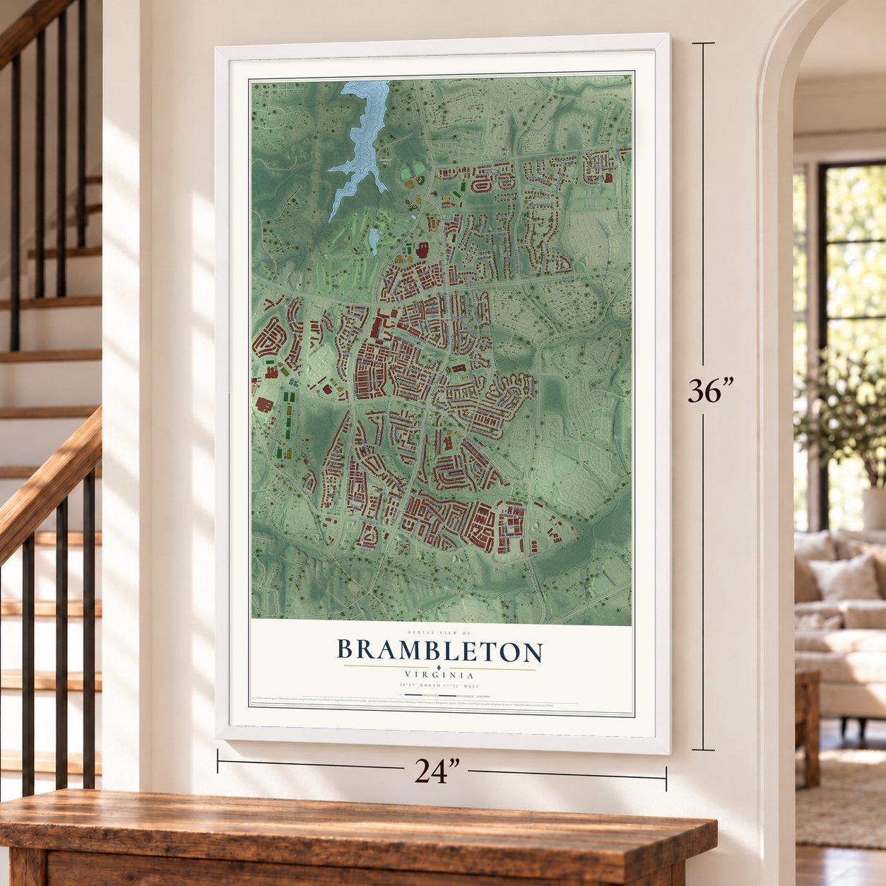

Free U.S. delivery 7 to 10 days after you order
Brambleton, Virginia Map Art
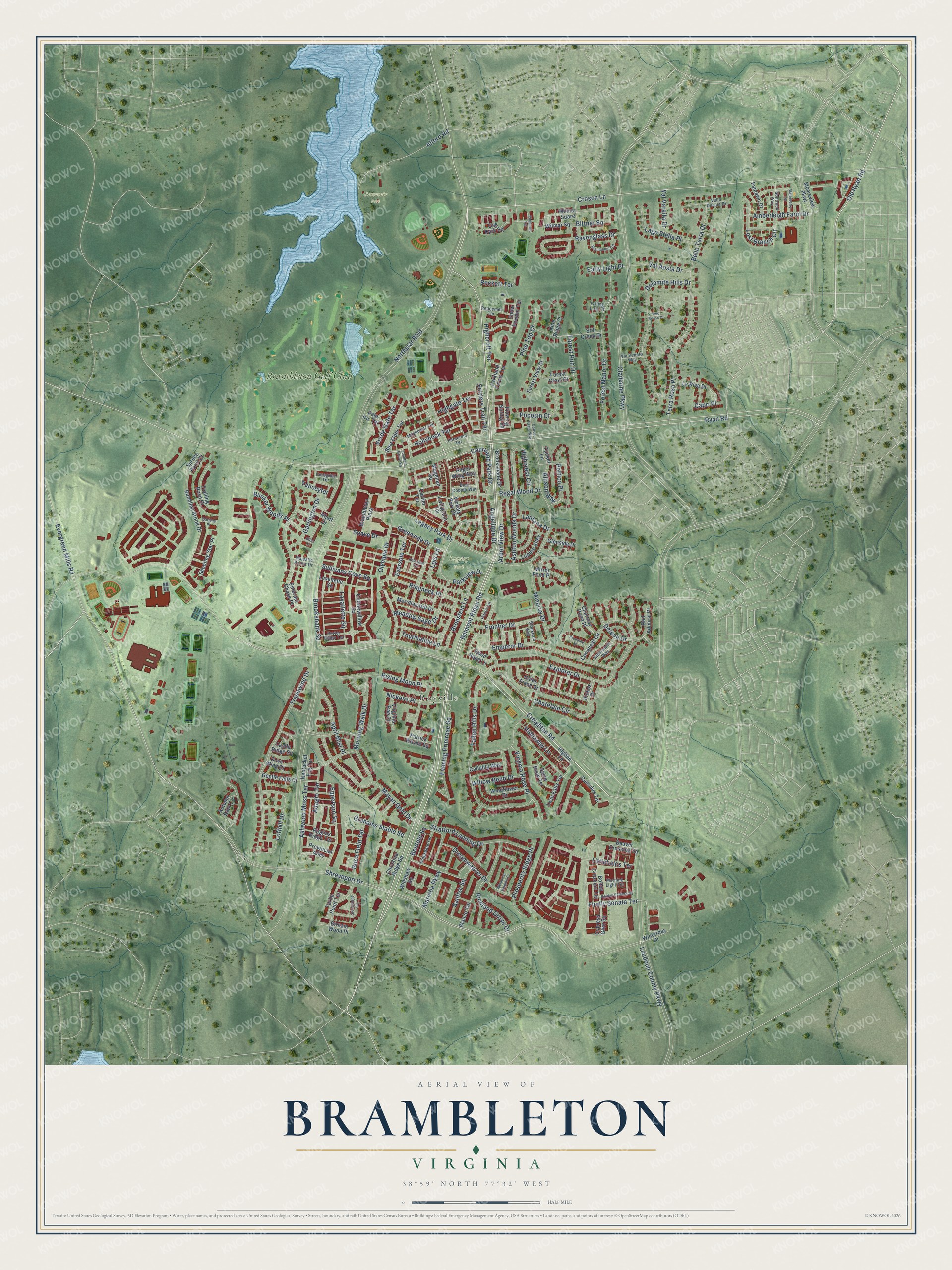
A new map of Brambleton, Virginia, made in 2026 and printed to order on thick archival matte paper.
12" x 18" Archival Matte Print
A Map of Home. A Work of Art.
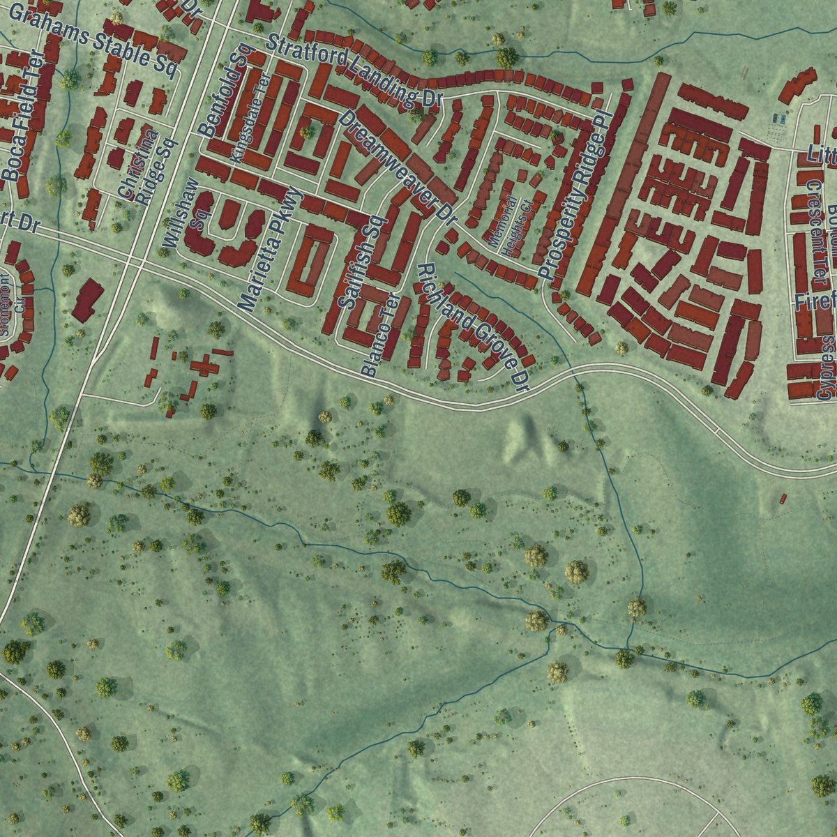
Explore Brambleton, Virginia from a whole new perspective. Created using aerial imagery and detailed geographic data, this map captures Brambleton building by building, with labeled streets, familiar landmarks, and shaded topographical relief that highlights the natural contours of the landscape.
Combining modern data with the timeless character of a vintage atlas, this map is just as interesting up close as it is beautiful on the wall. Whether you grew up in Brambleton, spent memorable years there, or call it home today, this unique map is a great way to celebrate a place that means something to you. Zoom in on the preview to look for your street, and then order a print to put your memories on the wall.
Three ways to hang it
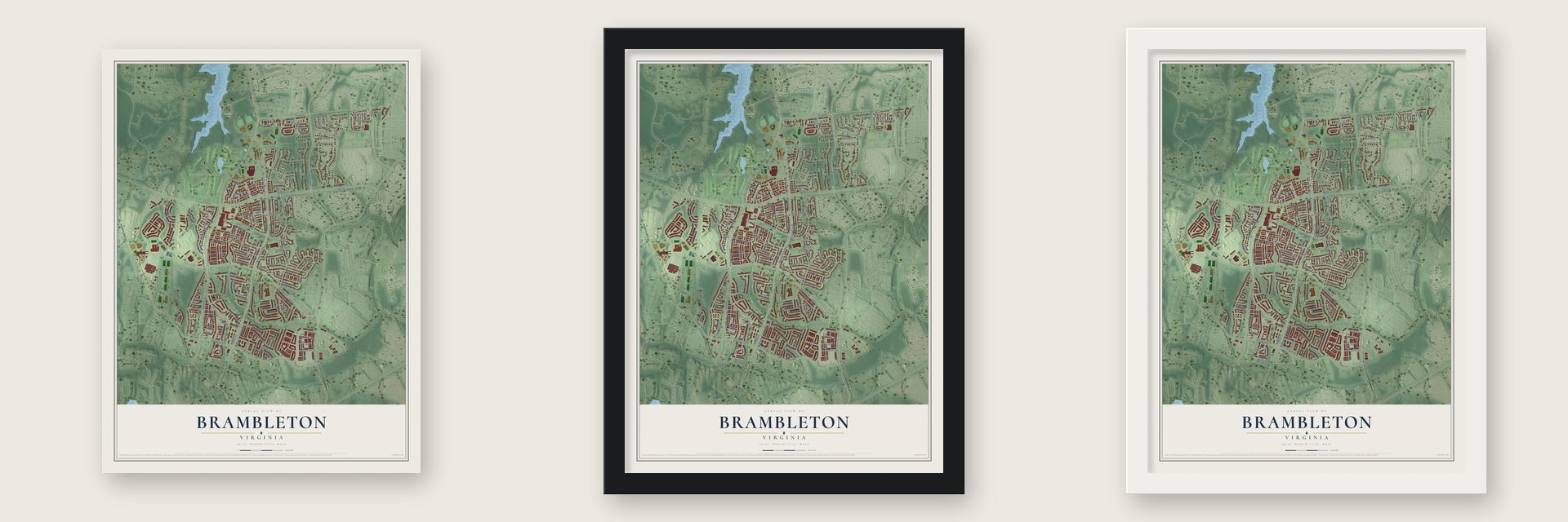
Unframed archival matte, a black wood frame or a white wood frame.
Up close
Geography Worth Displaying
This map was created using accurate cartographic data and authoritative geographic sources, including the U.S. Geological Survey and the Census Bureau. The map brings together terrain, waterways, roads, and building detail. The majority of the streets are labeled, houses are accurately depicted, and the topography is derived from government sources. Combining local data with carefully composed color and shading leads to this beautifully detailed Brambleton artwork for your wall.
Rather than simply showing street outlines, we’ve included as many of the street names as we could reasonably fit on the map while keeping their names legible. Zoom in on the high resolution preview to see exactly what’s on the map. We truly set out to create a statement piece for anyone who loves Brambleton. So whether it’s for you, or a gift for someone you love, we hope this map of Brambleton brings back fond memories.
Read the story behind this map of Brambleton, Virginia from 2026.
About Brambleton, Virginia
Brambleton is a planned community of 23,486 people in southeastern Loudoun County, about 11 miles south of Leesburg, the county seat. Before 1908, parts of this land belonged to the plantation of Thomas Lewis. By that year a small community called Royville had grown up where Belmont Ridge Road meets Creighton Road, and Brambleton now covers its site.
In 1999 the property was bought by Brambleton Group L.L.C., part of Soave Real Estate, and planning started that spring. Crews first had to improve Route 607/772 so the new community could reach Exit 7 of the Dulles Greenway by way of the Loudoun County Parkway. Construction began in 2001 on a plan of 2,500 acres with room for more than 9,000 homes.
“In 1944, the Cornelius brothers from Fairfax County moved to present-day Brambleton with a herd of 84 cows.”
- A Town Center of 50 shopsThe Town Center holds more than 50 stores and restaurants, along with offices and doctors. It hosts the annual Sizzlin' Summer Concerts, a farmers' market and the Race Brambleton Series.
- 18 miles of trailsBrambleton was laid out with walkable streets in the style of a traditional neighborhood. It now has four pools, parks, sports courts and more than 18 miles of public trails, and its land drains to Beaverdam Run and Broad Run, both in the Potomac River watershed.
- Briar Woods and IndependenceBriar Woods High School and Independence High School serve Brambleton, along with Brambleton Middle School, Watson Mountain Middle School, and the Creighton's Corner, Legacy and Madison's Trust elementary schools.
Find your street
Names on the Brambleton map
Every name below is printed on this map. Look for your street, your school, the park where you played, or the pond down the road.
Places and landmarks4
- Legacy Park
- Reservoir Park
- Royville
- Brambleton Golf Club
Streets and roads185
- Regal Wood Drive
- Hollyhock Terrace
- Belmont Ridge Road
- Courtland Park Drive
- Creighton Road
- Ryan Road
- Firefly Sonata Terrace
- Shreveport Drive
- Sullivans Cove Square
- Epperson Square
- Amberleigh Farm Drive
- Old Ryan Road
- Deleon Drive
- Lost Branch Circle
- Emperor Drive
- Northstar Boulevard
- Evergreen Mills Road
- Claiborne Parkway
- Loudoun County Parkway
- Croson Lane
- Minerva Drive
- Legacy Park Drive
- Tradewind Drive
- Morning Walk Drive
- Olympia Drive
- Dolomite Hills Drive
- Verde Gate Terrace
- Forest Manor Drive
- Benfold Square
- Explorer Drive
Show all 185 streets
- Belle Terra Drive
- Ringneck Place
- Ravenglass Drive
- Chatelain Circle
- Stratford Landing Drive
- Brooksbank Square
- Alford Road
- Evening Primrose Square
- Richland Grove Drive
- Grahams Stable Square
- Parkview Drive
- Forest Run Drive
- Lofthill Drive
- Highcrest Circle
- Dreamweaver Drive
- Bittner Square
- Meadow Sage Drive
- Fallen Hills Drive
- Rising Moon Place
- Settlers Trail Terrace
- Prosperity Ridge Place
- Adagio Terrace
- Virginia Rose Place
- Greenside Drive
- Frontier Drive
- Hideaway Lane
- Lago Stella Place
- Lois Lane
- Ashton Woods Drive
- Arbor View Drive
- Ashwood Moss Terrace
- Sailfish Square
- Angelique Drive
- Terra Rosa Place
- Bronstein Lane
- Mayan Gold Drive
- Portico Place
- April Mist Place
- Boca Field Terrace
- Val Aosta Drive
- Bunker Woods Place
- Soave Drive
- Nickens Place
- Garlington Drive
- Pocosin Court
- Beckett Terrace
- Willow Bend Drive
- Pine Top Court
- Highgate Terrace
- Lavallette Square
- Eversole Terrace
- Highcroft Terrace
- Littlehales Terrace
- Tourmaline Lane
- Allison Way
- Early Light Place
- Val Varaita Drive
- Yanceyter
- Marietta Parkway
- Lantana Drive
- Capri Place
- Vickery Park Drive
- Blue Elder Terrace
- Cartier Terrace
- Magellan Square
- Conquest Circle
- Emerald Chase Place
- Bubbling Brook Drive
- Parkland Farms Terrace
- Mooreview Parkway
- Oak Park Square
- Cumulus Terrace
- Meridian Hill Drive
- Willshaw Square
- Christina Ridge Square
- Still Creek Drive
- Higbee Lane
- Brookshade Drive
- Beaver Crossing Square
- Good Hope Lane
- Cottonwillow Square
- La Riva Drive
- Trailing Rose Court
- Castle Ridge Square
- Windflower Drive
- Lupine Alley
- Cypress Glen Square
- Wilmar Square
- Bolton Crescent Terrace
- Turtle Point Terrace
- Autumn Rain Circle
- Red Admiral Place
- Brambleton Plaza
- Shooting Star Place
- Patrick Wayne Square
- Forest Crest Court
- Gentle Falls Court
- Livingston Terrace
- Fairlawn Drive
- Forest View Court
- Winterday Drive
- Hales Trace Drive
- Callalily Way
- Riggins Ridge Terrace
- Twin Falls Terrace
- Snow Powder Terrace
- Charmay Pond Place
- Birnam Wood Place
- Virginia Rae Court
- Flowing Spring Square
- Mirror Pond Place
- Spice Bush Terrace
- Provincial Alley
- Glenside Drive
- Pine Ridge Court
- Blanco Terrace
- Lavellette Square
- Spruce Point Court
- Dove Wing Court
- Nantucket Fog Terrace
- Angel Wing Way
- Pale Iris Terrace
- Wilmar Suare
- Hickox Drive
- Rhett Drive
- Tucker Lane
- Ferncrest Terrace
- Porter Ridge Terrace
- Morning Light Terrace
- Kingsdale Terrace
- Kleinsmith Way
- Redeemer Terrace
- Mayflower Terrace
- Pecos Lane
- Splitrock Way
- Blue Copper Way
- Via Veneto Way
- Stockham Way
- Peregrine Terrace
- Valle Ducale Drive
- Majestic Knolls Drive
- Falling Leaf Court
- Fountain Grove Square
- Golden Embers Square
- Stonemont Circle
- Braemount Circle
- Redstone Terrace
- Waterberry Terrace
- Cotton Grass Way
- Klondike Court
- Memorial Heights Court
- Pinecroft Terrace
- Darlene Place
- Vino Rosso Court
- Bliss Terrace
Names are listed as they appear on the printed map. Zoom into the product photos to find them.
The art of mapping a place
How This Map Was Made
Real places. Remarkable detail. Discover the layers that turn geographic data into a map of home.

The view from above
Aerial imagery reveals the character of the land: woodland, open fields, and the patterns of a place.

The shape of the land
Elevation data brings hills, valleys, and subtle changes in the landscape into view.

The details of home
Roads, waterways, and building footprints come together to make the map feel unmistakably local.

Geography becomes art
Considered color, shading, and typography bring the layers together in a map made for your wall.


Process illustrated with Mendon, Massachusetts. Aerial imagery: USDA NAIP. Terrain: USGS 3D Elevation Program. Map details and finished artwork: KNOWOL.
The Details
About This Print
Choose an archival matte print, or a black or white Ayous wood frame. The archival matte print is unframed.
Select your size and finish above to see the matching product image and price.
Materials & Craftsmanship
A contemporary map with the character of a classic atlas, printed on archival matte paper. Optional frames are made from Ayous wood.
Your printed map does not include the watermark shown in the full-map preview.
Shipping & Delivery
Free shipping within the United States. Every print is made to order in the USA.
Buying a gift? Add a note in your cart and we'll include it. We never put prices in the package.
Prints ship within 2 to 3 business days. Allow 7 to 10 days total from ordering for delivery. Timing may vary during holidays or periods of high order volume.
Read our shipping policy.
Returns and damaged prints
Each print is made to order. Change-of-mind refunds are not available after production.
If your print arrives damaged, misprinted or incorrect, contact support@knowol.com within 30 days of receiving it. Include your order number, photos and a description of the issue.
Read our full refund and replacement policy. For questions about your order, email support@knowol.com.
Find your town
Looking for another city?
Find a map of home in our Virginia collection, or any town in the country.
Nearby
Maps of towns near Brambleton
Know someone from one of these towns? Their map makes a great gift.
 Loudoun Valley Estates
, Virginia
From $39.99See the map
 Moorefield
, Virginia
From $39.99See the map
 Arcola
, Virginia
From $39.99See the map
More maps nearby: Broadlands, Stone Ridge, Goose Creek Village, Ashburn and South Riding.