
Search for another town





Free U.S. delivery 7 to 10 days after you order
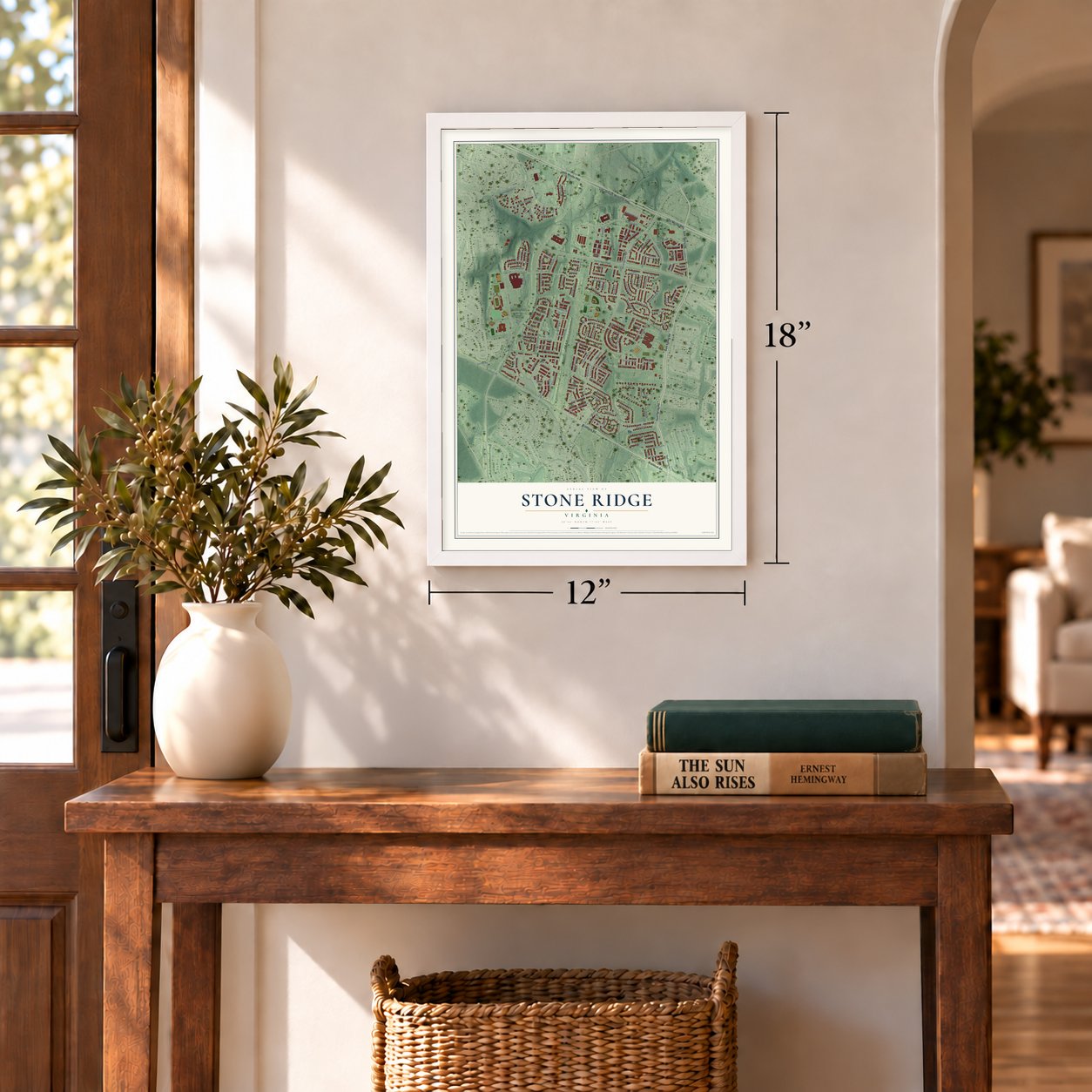
Stone Ridge, Virginia Map Art
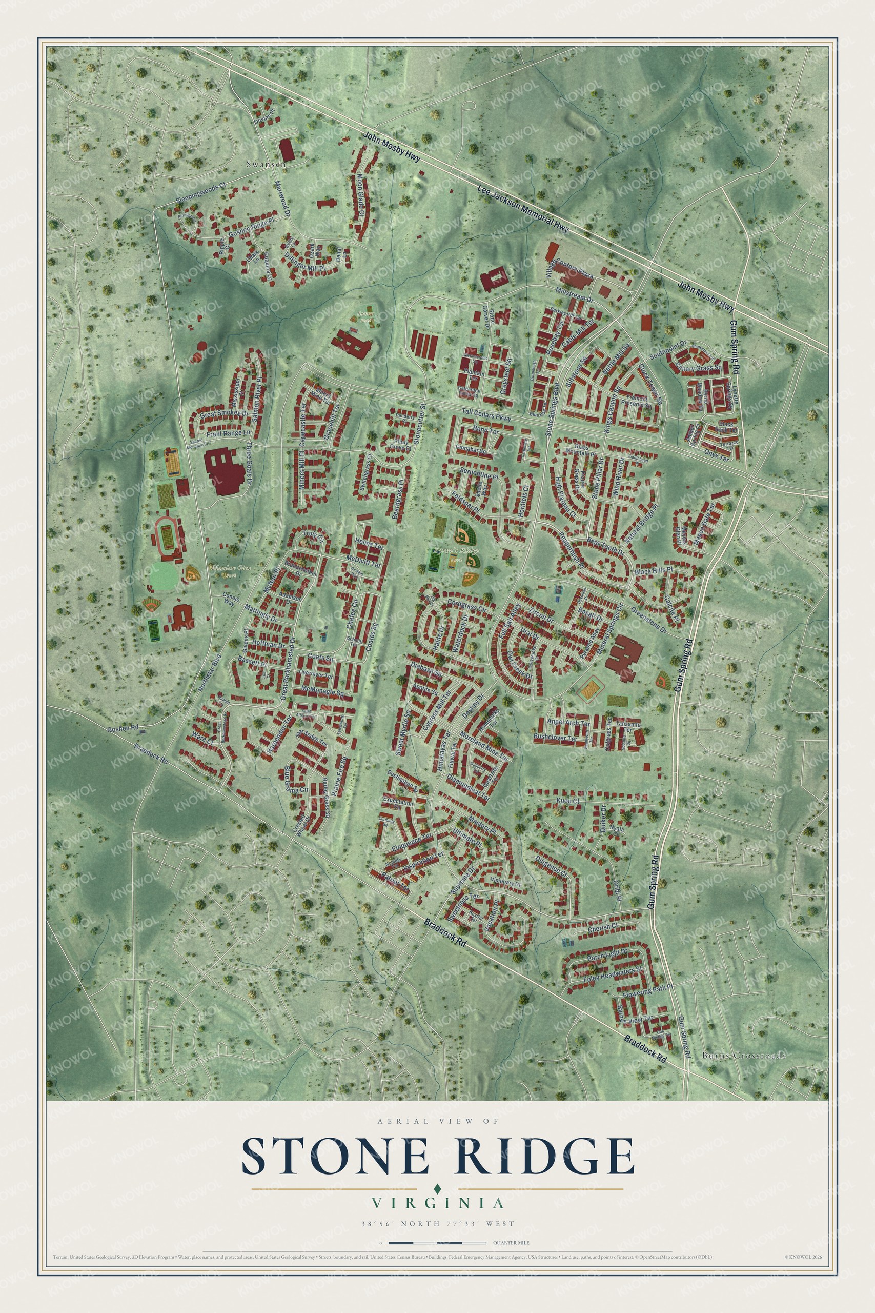
A new map of Stone Ridge, Virginia, made in 2026 and printed to order on thick archival matte paper.
12" x 18" Archival Matte Print
A Map of Home. A Work of Art.
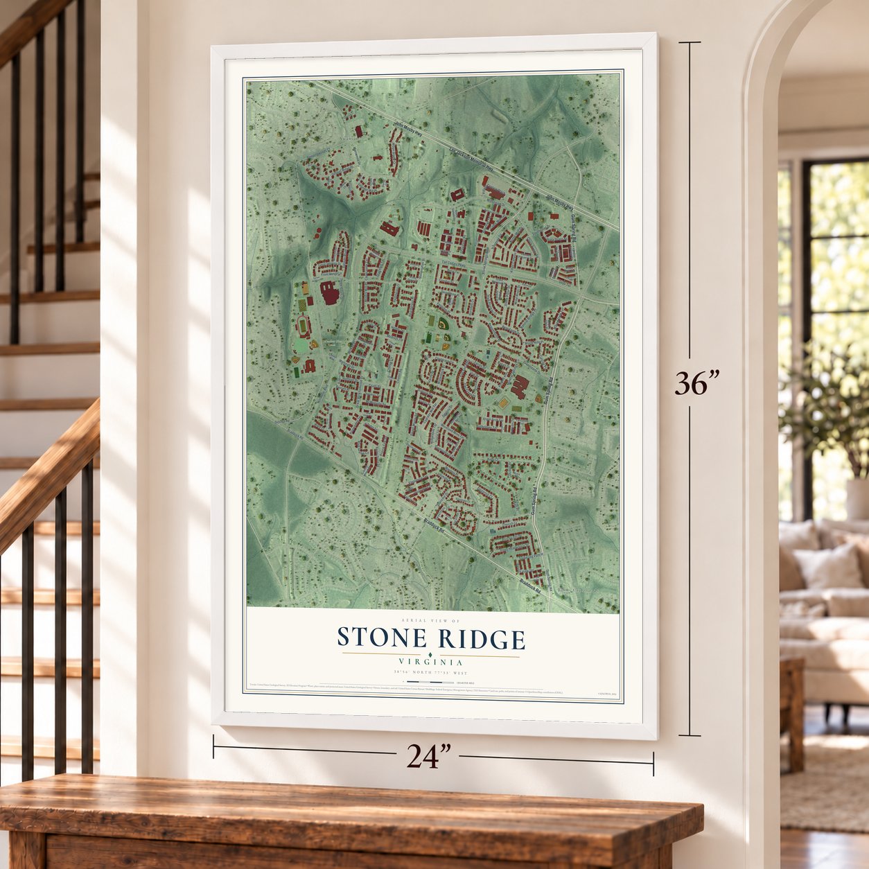
Explore Stone Ridge, Virginia from a whole new perspective. Created using aerial imagery and detailed geographic data, this map captures Stone Ridge building by building, with labeled streets, familiar landmarks, and shaded topographical relief that highlights the natural contours of the landscape.
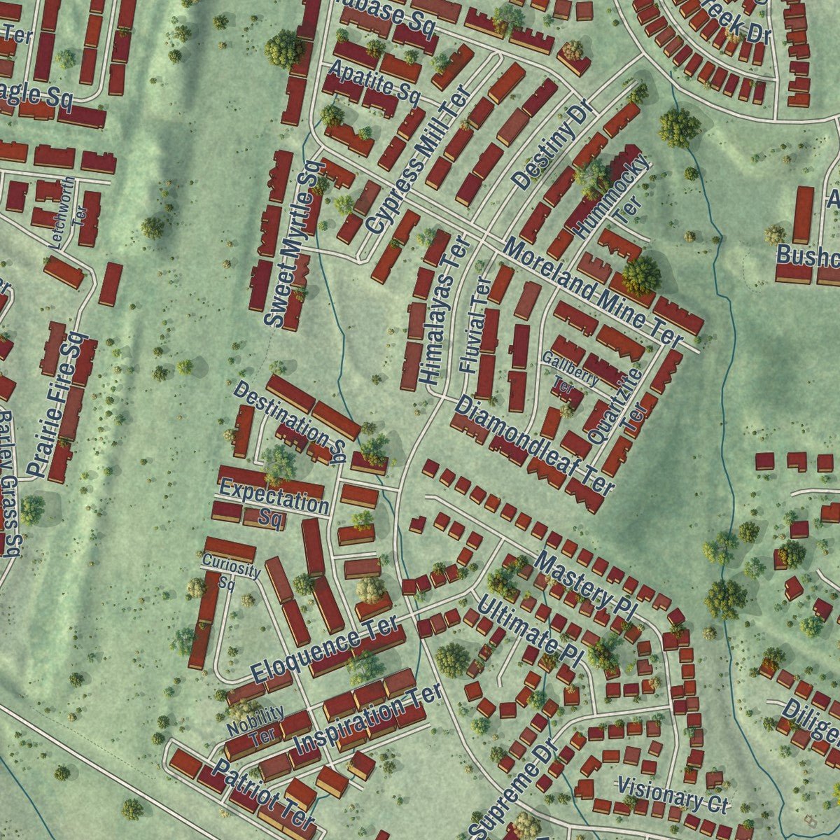
Combining modern data with the timeless character of a vintage atlas, this map is just as interesting up close as it is beautiful on the wall. Whether you grew up in Stone Ridge, spent memorable years there, or call it home today, this unique map is a great way to celebrate a place that means something to you. Zoom in on the preview to look for your street, and then order a print to put your memories on the wall.
Three ways to hang it
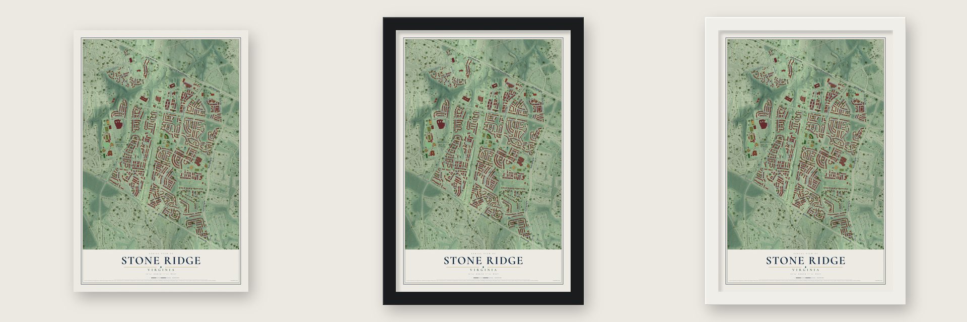
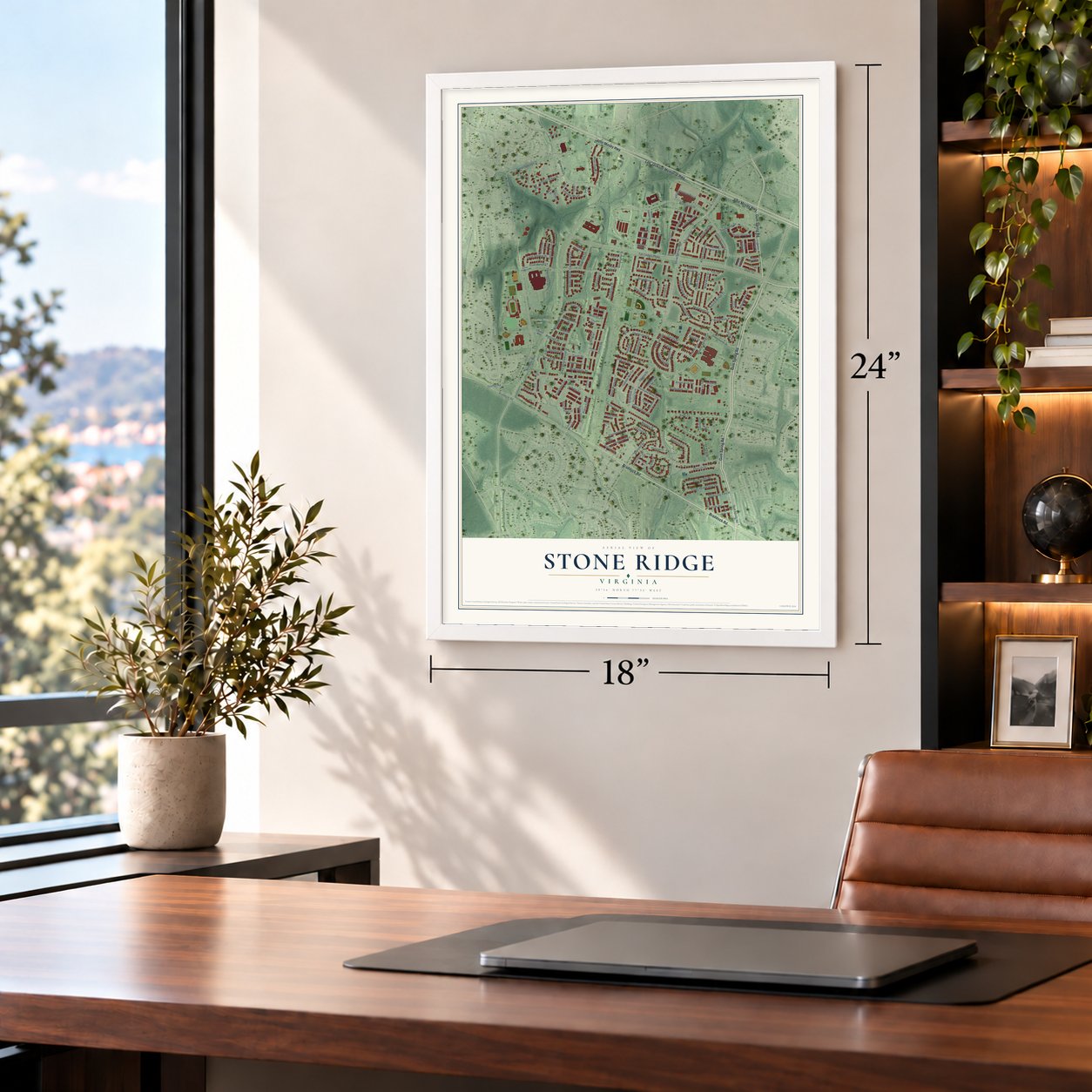
Unframed archival matte, a black wood frame or a white wood frame.
Up close
Geography Worth Displaying
This map was created using accurate cartographic data and authoritative geographic sources, including the U.S. Geological Survey and the Census Bureau. The map brings together terrain, waterways, roads, and building detail. The majority of the streets are labeled, houses are accurately depicted, and the topography is derived from government sources. Combining local data with carefully composed color and shading leads to this beautifully detailed Stone Ridge artwork for your wall.
Rather than simply showing street outlines, we’ve included as many of the street names as we could reasonably fit on the map while keeping their names legible. Zoom in on the high resolution preview to see exactly what’s on the map. We truly set out to create a statement piece for anyone who loves Stone Ridge. So whether it’s for you, or a gift for someone you love, we hope this map of Stone Ridge brings back fond memories.
Read the story behind this map of Stone Ridge, Virginia from 2026.
About Stone Ridge, Virginia
From the Stone Ridge Association: "Stone Ridge strives to maintain a small-town feel with the big city just down the road! Our picturesque community has won many national and regional landscaping awards for well-manicured streets and common areas."
Find your street
Names on the Stone Ridge map
Every name below is printed on this map. Look for your street, your school, the park where you played, or the pond down the road.
Places and landmarks5
- Byrne's Ridge Park
- Meadow Glen Park
- Bowers Field
- Burns Crossroads
- Swansen
Streets and roads170
- Gum Spring Road
- John Mosby Highway
- Lee Jackson Memorial Highway
- Braddock Road
- Stone Springs Boulevard
- Bear Tooth Drive
- Great Berkhamsted Drive
- Destiny Drive
- Village Centern Plaza
- Coats Square
- Coates Square
- Chafee Circle
- Millstream Drive
- Stone Pillar Drive
- Stonecutter Street
- Kings Canyon Square
- Tall Cedars Parkway
- Sleepingwoods Court
- Goshen Road
- Northstar Boulevard
- Mineral Springs Circle
- Greenstone Drive
- Cordgrass Circle
- Pepperbush Place
- Prairie Fire Square
- Cypress Mill Terrace
- Marrwood Drive
- Serpentine Place
- Porch Light Drive
- Siltstone Square
Show all 170 streets
- Oribi Place
- Goshen Ridge Place
- Moreland Mine Terrace
- Rosebay Terrace
- Kudu Court
- Vacation Place
- Mastery Place
- Patriot Terrace
- Full Sail Alley
- Zircon Drive
- Clock Tower Square
- Three Goals Drive
- Ural Drive
- Supreme Drive
- Southpoint Drive
- Feldspar Place
- Foley Headwaters Street
- McNair Place
- McMonagle Square
- Moon Glade Court
- Wind River Drive
- Nettle Mill Square
- Salmon River Place
- Diligence Court
- Eloquence Terrace
- Diabase Square
- Bassett Place
- Natural Bridge Place
- Great Smokey Drive
- Gracehill Terrace
- Beryl Terrace
- Blue Grama Circle
- Helms Terrace
- Greysteel Square
- High Plateau Court
- Mason Dale Terrace
- Cherish Court
- Inspiration Terrace
- Byrnes View Terrace
- Basalt Drive
- Canary Grass Square
- Owl Creek Drive
- Flowering Path Place
- Capecastle Terrace
- Miners Mill Place
- Cable Mill Terrace
- Black Hills Place
- Dillinger Mill Place
- Truly Circle
- Bushclover Terrace
- Front Range Lane
- Calcite Place
- Beardgrass Place
- Mattingly Drive
- Waterdock Drive
- Onyx Terrace
- Diamondleaf Terrace
- Sweet Myrtle Square
- Ultimate Place
- Duiker Drive
- Himalayas Terrace
- Halite Drive
- Sweetness Terrace
- Harpenden Terrace
- Hoffman Drive
- Angel Arch Terrace
- McDivitt Terrace
- Hornfels Court
- Ware Court
- Amber Spring Court
- Black Rock Terrace
- Cinnabar Square
- Lynette Springs Square
- Byrne Meadow Square
- Prairie Grass Drive
- Fremont Preserve Square
- Destination Square
- Hummocky Terrace
- Crested Wheat Drive
- Barley Grass Square
- Star Sedge Terrace
- Meyers Glen Place
- Pyramid Alley
- Overmyer Terrace
- Quartzite Terrace
- Fluvial Terrace
- Givens Place
- Moors Mine Terrace
- Glass Mountain Place
- Apatite Square
- Switchgrass Court
- Brandenstein Drive
- Mississippi Court
- Shells Way
- Adamson Drive
- Conejo Way
- Cutgrass Terrace
- Coquina Lane
- Visionary Court
- Expectation Square
- Tanzanite Terrace
- Ozark Way
- Chalk Lane
- Olivine Place
- Stone Carver Drive
- Piney Grove Court
- Plantain Terrace
- Nyala Court
- Denal Lane
- Ripple Court
- Terrazzo Terrace
- Graywacke Drive
- Nobility Terrace
- Blue Flag Terrace
- Berkley Hill Terrace
- Catherdral Valley Square
- Restful Terrace
- Penderry Court
- Schmitt Terrace
- Rutile Lane
- Great Berkhamstead Drive
- Sacred Mountain Street
- Curiosity Square
- Oak Medley Terrace
- Carbonate Terrace
- Shorecrest Terrace
- Fiddlehead Place
- Devonian Drive
- Saint Albans Terrace
- Metamorphic Square
- Pennywort Terrace
- Permian Circle
- Gallberry Terrace
- Sodalite Square
- Buttonbush Terrace
- Oswald Way
- Letchworth Terrace
- Radlett Lane
- Lind Court
- Big Belt Court
Names are listed as they appear on the printed map. Zoom into the product photos to find them.
The art of mapping a place
How This Map Was Made
Real places. Remarkable detail. Discover the layers that turn geographic data into a map of home.

The view from above
Aerial imagery reveals the character of the land: woodland, open fields, and the patterns of a place.

The shape of the land
Elevation data brings hills, valleys, and subtle changes in the landscape into view.

The details of home
Roads, waterways, and building footprints come together to make the map feel unmistakably local.

Geography becomes art
Considered color, shading, and typography bring the layers together in a map made for your wall.


Process illustrated with Mendon, Massachusetts. Aerial imagery: USDA NAIP. Terrain: USGS 3D Elevation Program. Map details and finished artwork: KNOWOL.
The Details
About This Print
Choose an archival matte print, or a black or white Ayous wood frame. The archival matte print is unframed.
Select your size and finish above to see the matching product image and price.
Materials & Craftsmanship
A contemporary map with the character of a classic atlas, printed on archival matte paper. Optional frames are made from Ayous wood.
Your printed map does not include the watermark shown in the full-map preview.
Shipping & Delivery
Free shipping within the United States. Every print is made to order in the USA.
Buying a gift? Add a note in your cart and we'll include it. We never put prices in the package.
Prints ship within 2 to 3 business days. Allow 7 to 10 days total from ordering for delivery. Timing may vary during holidays or periods of high order volume.
Read our shipping policy.
Returns and damaged prints
Each print is made to order. Change-of-mind refunds are not available after production.
If your print arrives damaged, misprinted or incorrect, contact support@knowol.com within 30 days of receiving it. Include your order number, photos and a description of the issue.
Read our full refund and replacement policy. For questions about your order, email support@knowol.com.
Find your town
Looking for another city?
Find a map of home in our Virginia collection, or any town in the country.
Nearby
Maps of towns near Stone Ridge
Know someone from one of these towns? Their map makes a great gift.
 Arcola
, Virginia
From $39.99See the map
 South Riding
, Virginia
From $39.99See the map
 Brambleton
, Virginia
From $39.99See the map
More maps nearby: Loudoun Valley Estates, Moorefield, Aldie, Bull Run Mountain Estates and Chantilly.