
Search for another town




Free U.S. delivery 7 to 10 days after you order
Brookline, Massachusetts Map Art
Building by building, with labeled streets and shaded relief.
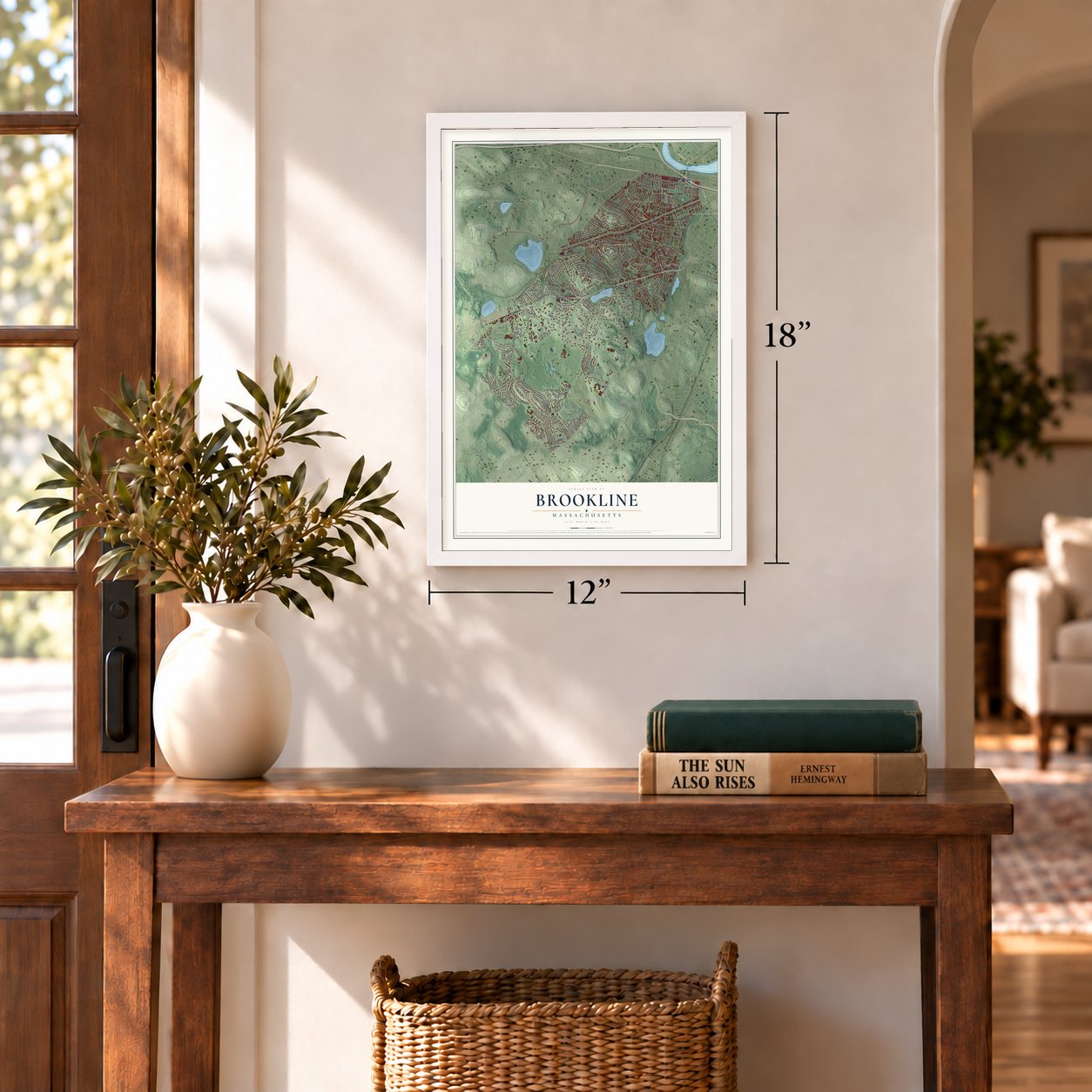
12" x 18" Archival Matte Print
A Map of Home. A Work of Art.
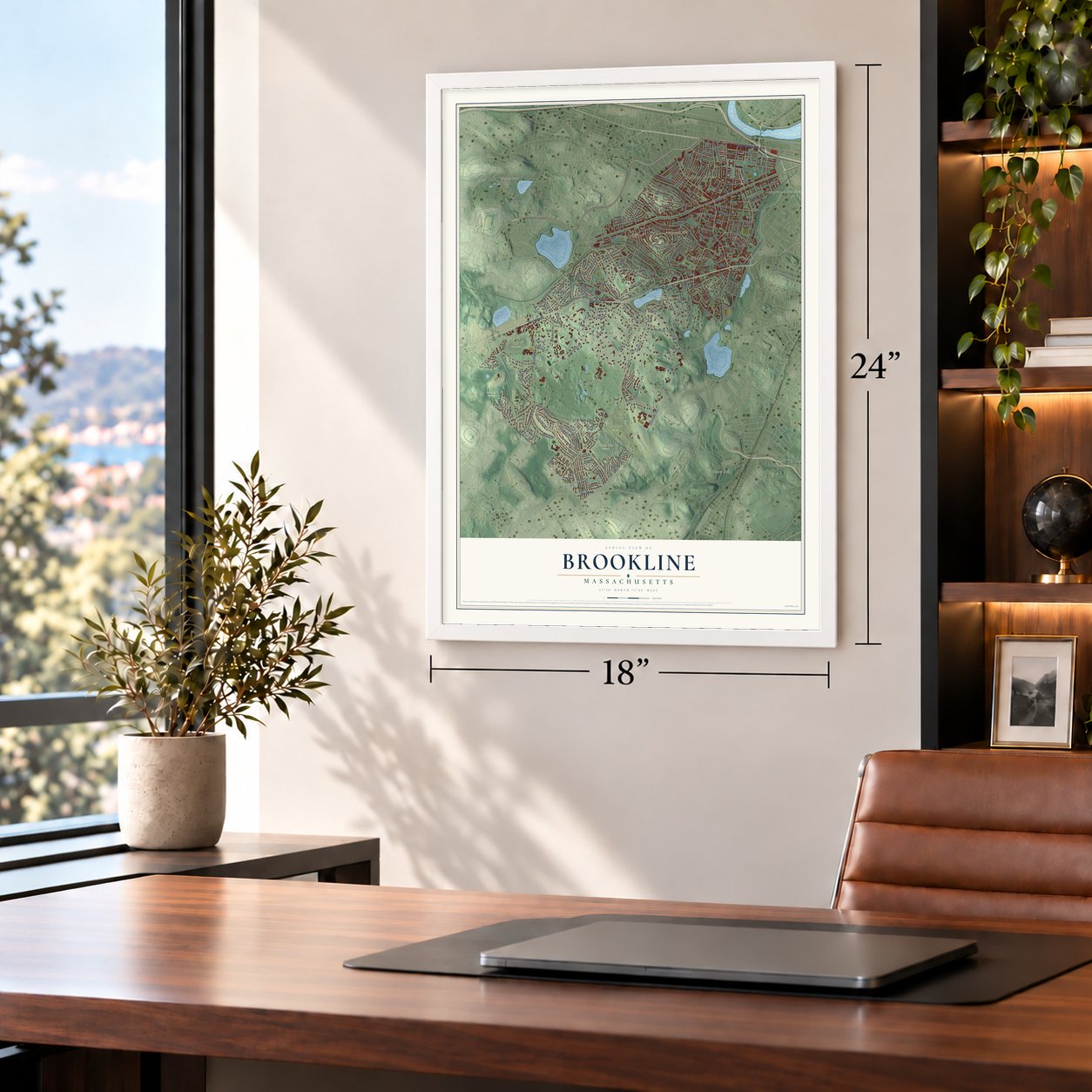
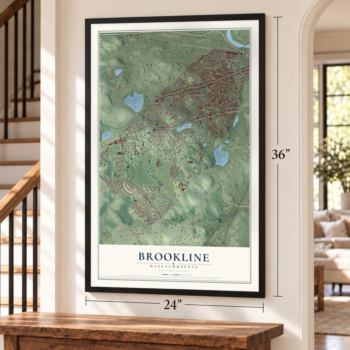
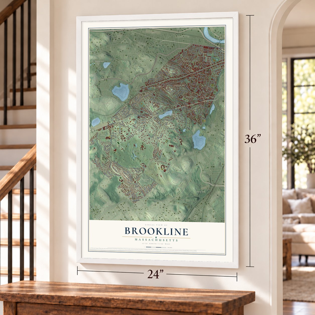
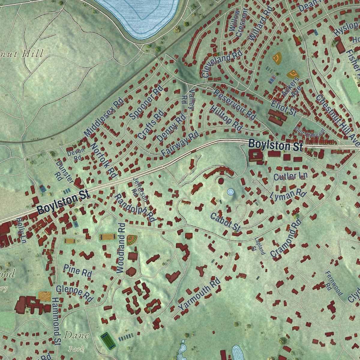
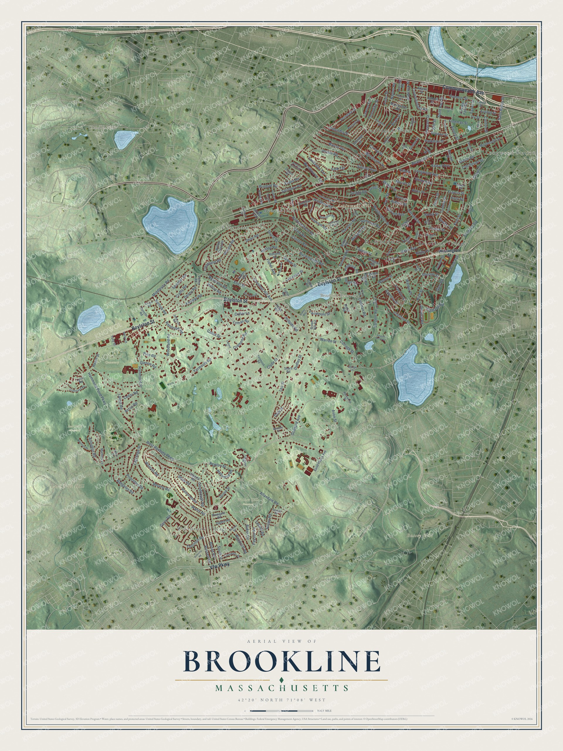
Explore Brookline, Massachusetts from a whole new perspective. Created using aerial imagery and detailed geographic data, this map captures Brookline building by building, with labeled streets, familiar landmarks, and shaded topographical relief that highlights the natural contours of the landscape.
Combining modern data with the timeless character of a vintage atlas, this map is just as interesting up close as it is beautiful on the wall. Whether you grew up in Brookline, spent memorable years there, or call it home today, this unique map is a great way to celebrate a place that means something to you. Zoom in on the preview to look for your street, and then order a print to put your memories on the wall.
Three ways to hang it
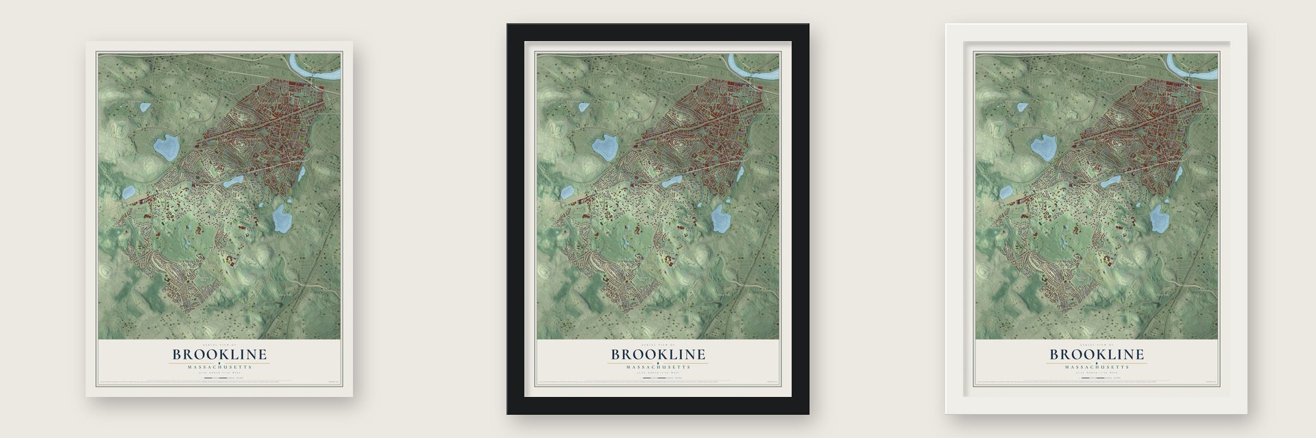
Unframed archival matte, a black wood frame or a white wood frame.
Up close
Geography Worth Displaying
This map was created using accurate cartographic data and authoritative geographic sources, including the U.S. Geological Survey (USGS) and FEMA. The map brings together terrain, waterways, roads, and building detail. The majority of the streets are labeled, houses are accurately depicted, and the topography is derived from government sources. Combining local data with carefully composed color and shading leads to this beautifully detailed Brookline artwork for your wall.
Rather than simply showing street outlines, we’ve included as many of the street names as we could reasonably fit on the map while keeping their names legible. Zoom in on the high resolution preview to see exactly what’s on the map. We truly set out to create a statement piece for anyone who loves Brookline. So whether it’s for you, or a gift for someone you love, we hope this map of Brookline brings back fond memories.
Explore the full map of Brookline, Massachusetts and read about the local places it shows.

Find your street
Names on the Brookline map
Every name below is printed on this map. Look for your street, your school, the park where you played, or the pond down the road.
Places and landmarks21
- Downtown
- Longwood Station
- Aspinwall Hill
- Bald Pate Hill
- Bussey Hill
- Chestnut Hill
- Brookline Reservoir
- Chandler Pond
- Allandale Farm
- Dane Park
- Holyhood Cemetery
- Larz Anderson Park
Show all 21 places
- Lost Pond Sanctuary
- Skyline Park
- Walnut Hills Cemetery
- Brookline Village
- Westbrook Village
- Reservoir
- Coolidge Corner
- Beaconsfield
- The Country Club
Streets and roads252
- Commonwealth Avenue
- Vfw Parkway
- Boylston Street
- Beacon Street
- Saint Marys Street
- Heath Street
- Chestnut Hill Avenue
- Harvard Street
- Kent Street
- Lee Street
- Winchester Street
- Monmouth Street
- West Roxbury Parkway
- Grove Street
- Summit Avenue
- Newton Street
- Fuller Street
- Washington Street
- Warren Street
- Clinton Road
- Walnut Street
- Hammond Street
- Saint Paul Street
- Goddard Avenue
- Woodland Road
- Clyde Street
- Tappan Street
- Buckminster Road
- South Street
- Cypress Street
Show all 252 streets
- Clark Road
- Dudley Street
- Dean Road
- Mason Terrace
- Eliot Street
- Reservoir Road
- Hammond Pond Parkway
- Beverly Road
- Pond Avenue
- Pleasant Street
- Crafts Road
- Babcock Street
- Wolcott Road
- Fisher Avenue
- Rawson Road
- High Street
- Chestnut Street
- Gardner Road
- Longwood Avenue
- Rangeley Road
- Lancaster Terrace
- Winthrop Road
- Freeman Street
- Davis Avenue
- Sargent Road
- Fairway Road
- Hyslop Road
- Naples Road
- Allandale Road
- Wallis Road
- Thorndike Street
- Laurel Road
- Bonad Road
- Arlington Road
- Russett Road
- Amory Street
- Carlton Street
- Sewall Avenue
- Shaw Road
- Willard Road
- Salisbury Road
- Lagrange Street
- Payson Road
- Seaver Street
- Sumner Road
- Middlesex Road
- Princeton Road
- Beaconsfield Road
- Jordan Road
- Dummer Street
- Yarmouth Road
- Park Street
- Cottage Street
- Columbia Street
- Brook Street
- Browne Street
- Centre Street
- Marion Street
- Gerry Road
- Griggs Road
- Westbourne Terrace
- York Terrace
- Codman Road
- Woodcliff Road
- Ivy Street
- Franklin Street
- Welland Road
- Somerset Road
- Crowninshield Road
- Perry Street
- Colchester Street
- Toxteth Street
- Fairmount Street
- Francis Street
- Cabot Street
- Beals Street
- Spooner Road
- Druce Street
- Stearns Road
- Lawton Street
- Highland Road
- Cutler Lane
- Verndale Street
- Risley Road
- Evans Road
- Lyman Road
- Leicester Street
- Randolph Road
- Vernon Street
- Linden Street
- Harvard Avenue
- Avon Street
- Hilltop Road
- Pine Road
- Walnut Place
- Hallwood Road
- Goodnough Road
- Thornton Road
- Green Street
- Windsor Road
- Parkman Street
- White Place
- Hillside Road
- Denny Road
- Norfolk Road
- Allerton Street
- Philbrick Road
- Cleveland Road
- Glen Road
- Essex Street
- Cramond Road
- Beech Road
- Dale Street
- Jamaica Road
- Auburn Street
- Cedar Road
- Euston Street
- Glenoe Road
- Alton Place
- Hedge Road
- Aston Road
- Leland Road
- Baker Circle
- Bowker Street
- Still Street
- Kent Square
- Heath Hill
- Coolidge Street
- Walnut Hill Road
- Brookline Avenue
- Holland Road
- Alberta Road
- Blake Road
- Green Hill Road
- Marshal Street
- Egmont Street
- Griggs Terrace
- Saint Paul's Avenue
- Brington Road
- Sears Road
- Valley Road
- Russell Street
- Chapel Street
- Corey Road
- Dunster Road
- School Street
- Manchester Road
- Kilsyth Road
- Willow Crescent
- Ackers Avenue
- Winslow Road
- Irving Street
- Harris Street
- Ogden Road
- Garrison Road
- Kennard Road
- Webster Street
- Cottage Farm Road
- Elm Street
- Juniper Street
- Marthas Lane
- Welch Road
- Milton Road
- Lenox Street
- Plowgate Road
- Adams Street
- Holly Lane
- James Street
- Tully Street
- Clinton Path
- Thayer Street
- Fisher Road
- Catlin Road
- Lyon Road
- Stetson Street
- Craftsland Road
- University Road
- Addington Road
- Powell Street
- Fernwood Road
- Clearwater Road
- Fairgreen Place
- John Street
- Clarence Street
- Bartlett Crescent
- Cameron Street
- Devon Road
- Jefferson Road
- Webster Place
- Rockwood Street
- Chestnut Place
- Borland Street
- Hurd Road
- Orchard Road
- Whitney Street
- Newell Road
- Conant Road
- George Lane
- Holden Street
- Sargent Crossway
- Stedman Street
- Regent Circle
- Colbourne Crescent
- Asheville Road
- Intervale Road
- Thatcher Street
- Strathmore Road
- Harrison Street
- Eliot Crescent
- Parkway Road
- Beresford Road
- Osborne Road
- Olmsted Road
- Claflin Road
- Lapland Street
- Chilton Street
- Short Street
- Warwick Road
- Royal Road
- Dudley Way
- Nelson Drive
- Perrin Road
Names are listed as they appear on the printed map. Zoom into the product photos to find them.
About Brookline, Massachusetts
Brookline is a town in Norfolk County, Massachusetts, where the 2020 census recorded 63,191 residents. Settlement began in 1638, and the community was incorporated in 1705.
- 2020 populationThe census recorded 63,191 residents in Brookline.
- Incorporated in 1705It was incorporated in 1705.
- Norfolk CountyBrookline is a town in this Massachusetts county.
Keep exploring Massachusetts
Brookline is one of 461 Massachusetts towns we've mapped. Every dot on the map is a print of its own.
The search covers every state, Massachusetts first.
Near Brookline
Order 2 or more town maps and save 10%. Shown in the size and finish you picked above, so they hang as a set.
- Jamaica Plain 12" x 18" / Archival Matte Print $39.99
- Brighton 12" x 18" / Archival Matte Print $39.99
- Mission Hill 12" x 18" / Archival Matte Print $39.99

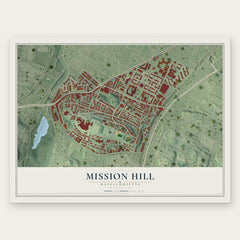
More maps nearby: Allston, Roxbury, Roslindale, Cambridgeport and West Roxbury.
The art of mapping a place
How This Map Was Made
Real places. Remarkable detail. Discover the layers that turn geographic data into a map of home.

The view from above
Aerial imagery reveals the character of the land: woodland, open fields, and the patterns of a place.

The shape of the land
Elevation data brings hills, valleys, and subtle changes in the landscape into view.

The details of home
Roads, waterways, and building footprints come together to make the map feel unmistakably local.

Geography becomes art
Considered color, shading, and typography bring the layers together in a map made for your wall.


Process illustrated with Mendon, Massachusetts. Aerial imagery: USDA NAIP. Terrain: USGS 3D Elevation Program. Map details and finished artwork: KNOWOL.
The Details
About This Print
Choose an archival matte print, or a black or white Ayous wood frame. The archival matte print is unframed.
Select your size and finish above to see the matching product image and price.
Materials & Craftsmanship
A contemporary map with the character of a classic atlas, printed on archival matte paper. Optional frames are made from Ayous wood.
Your printed map does not include the watermark shown in the full-map preview.
Shipping & Delivery
Free shipping within the United States. Every print is made to order in the USA.
Buying a gift? Add a note in your cart and we'll include it. We never put prices in the package.
Prints ship within 2 to 3 business days. Allow 7 to 10 days total from ordering for delivery. Timing may vary during holidays or periods of high order volume.
Read our shipping policy.
Returns and damaged prints
Each print is made to order. Change-of-mind refunds are not available after production.
If your print arrives damaged, misprinted or incorrect, contact support@knowol.com within 30 days of receiving it. Include your order number, photos and a description of the issue.
Read our full refund and replacement policy. For questions about your order, email support@knowol.com.