
Search for another town



Free U.S. delivery 7 to 10 days after you order
Jamaica Plain, Massachusetts Map Art
Building by building, with labeled streets and shaded relief.
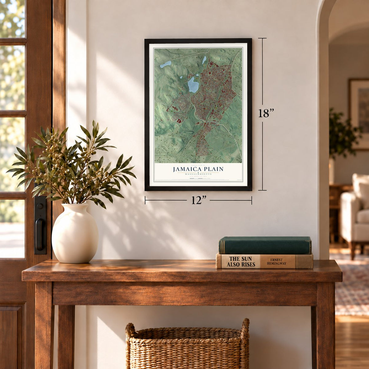
12" x 18" Archival Matte Print
A Map of Home. A Work of Art.
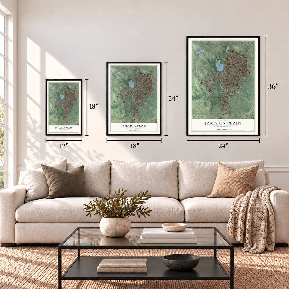
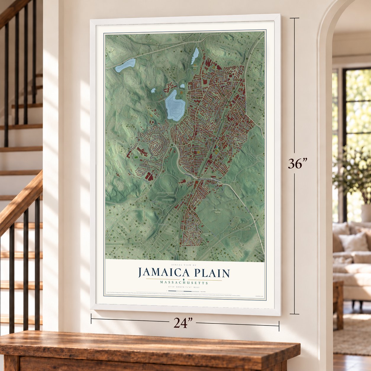
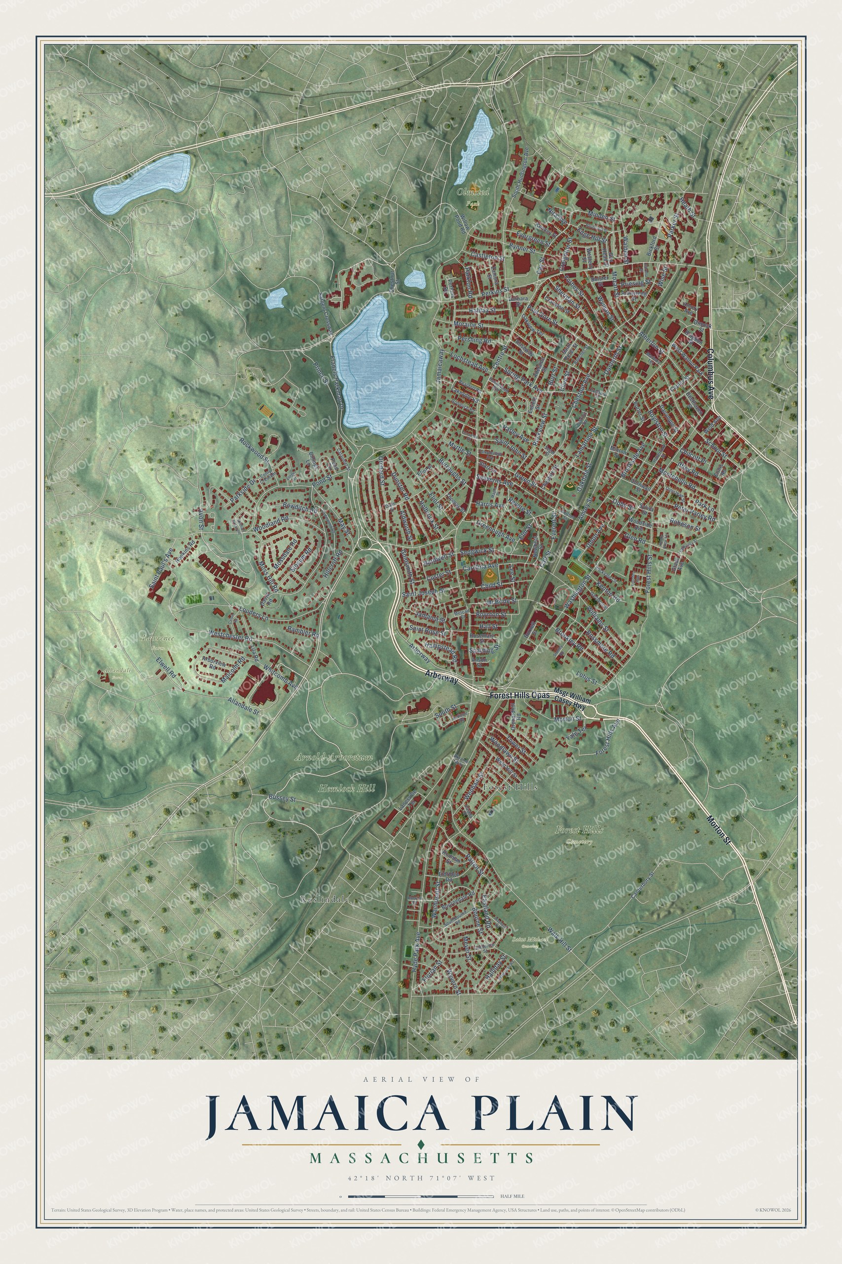
Explore Jamaica Plain, Massachusetts from a whole new perspective. Created using aerial imagery and detailed geographic data, this map captures Jamaica Plain building by building, with labeled streets, familiar landmarks, and shaded topographical relief that highlights the natural contours of the landscape.
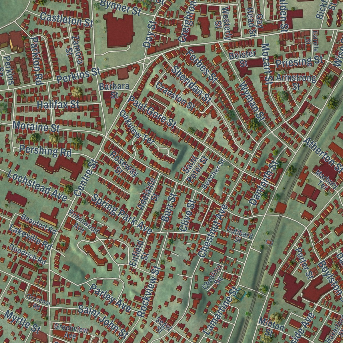
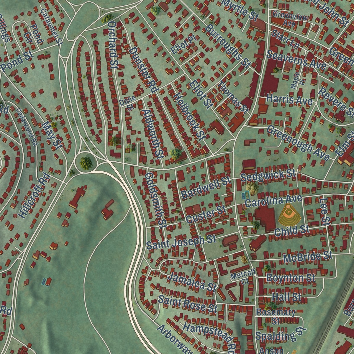
Combining modern data with the timeless character of a vintage atlas, this map is just as interesting up close as it is beautiful on the wall. Whether you grew up in Jamaica Plain, spent memorable years there, or call it home today, this unique map is a great way to celebrate a place that means something to you. Zoom in on the preview to look for your street, and then order a print to put your memories on the wall.
Three ways to hang it
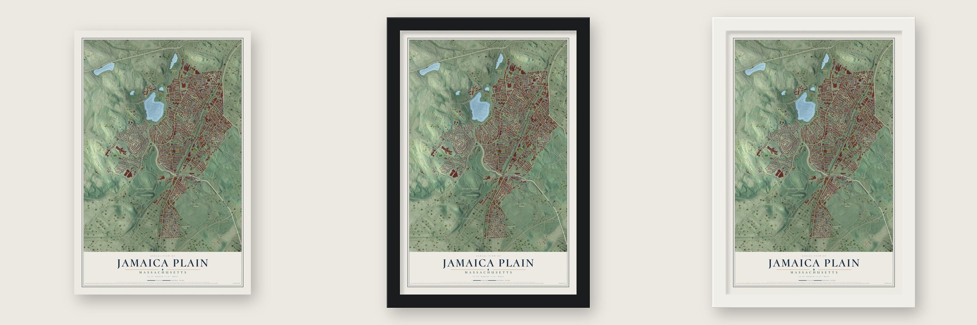
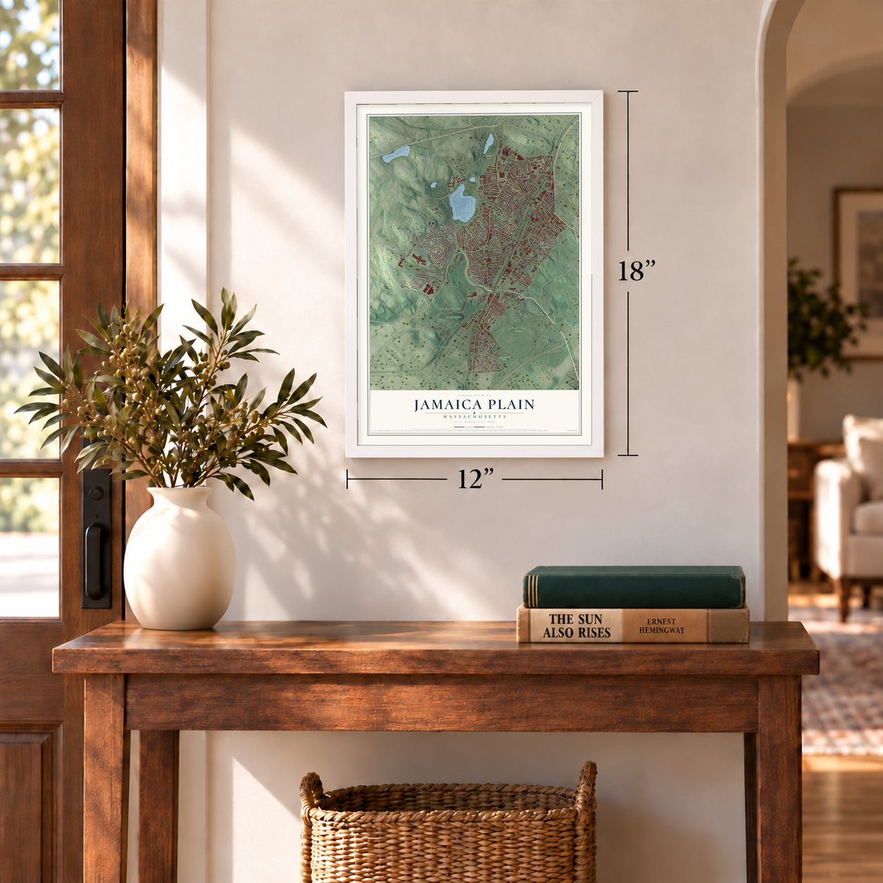
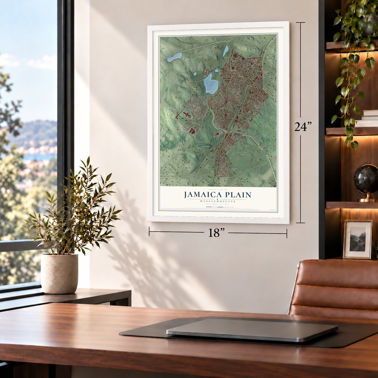
Unframed archival matte, a black wood frame or a white wood frame.
Up close
Geography Worth Displaying
This map was created using accurate cartographic data and authoritative geographic sources, including the U.S. Geological Survey and the Census Bureau. The map brings together terrain, waterways, roads, and building detail. The majority of the streets are labeled, houses are accurately depicted, and the topography is derived from government sources. Combining local data with carefully composed color and shading leads to this beautifully detailed Jamaica Plain artwork for your wall.
Rather than simply showing street outlines, we’ve included as many of the street names as we could reasonably fit on the map while keeping their names legible. Zoom in on the high resolution preview to see exactly what’s on the map. We truly set out to create a statement piece for anyone who loves Jamaica Plain. So whether it’s for you, or a gift for someone you love, we hope this map of Jamaica Plain brings back fond memories.
Read the story behind this map: Detailed Map of Jamaica Plain, Massachusetts.

Find your street
Names on the Jamaica Plain map
Every name below is printed on this map. Look for your street, your school, the park where you played, or the pond down the road.
Places and landmarks10
- Allandale Farm
- Arnold Arboretum
- Forest Hills Cemetery
- Hemlock Hill
- Lawrence Farm
- Olmsted Park
- Saint Michael Cemetery
- Roslindale
- Forest Hills
- West Walnut Park
Streets and roads223
- Arborway
- Forest Hills Opas
- Morton Street
- Columbus Avenue
- Centre Street
- Forest Hills Avenue
- Jamaicaway
- Moss Hill Road
- Westchester Road
- Glen Road
- Pond Street
- Green Street
- Everett Street
- Washington Street
- South Street
- Amory Street
- Perkins Street
- Hyde Park Avenue
- Lamartine Street
- Chestnut Avenue
- Boylston Street
- Wachusett Street
- Prince Street
- Walk Hill Street
- Allandale Street
- Louders Lane
- Forest Hills Street
- Brookside Avenue
- Bourne Street
- Heath Street
Show all 223 streets
- School Street
- Francis Parkman Drive
- Williams Street
- Whitcomb Avenue
- Jamaica Street
- Bussey Street
- Paul Gore Street
- Atherton Street
- Eliot Street
- Dunster Road
- McBride Street
- Bynner Street
- Parkside Drive
- Montebello Road
- Carolina Avenue
- Rockview Street
- Spring Park Avenue
- Saint Rose Street
- Orchard Street
- Sheridan Street
- Seaverns Avenue
- Wyman Street
- Day Street
- Eastland Road
- Mossdale Road
- Burroughs Street
- Elwell Road
- Rossmore Road
- Brookley Road
- Forbes Street
- Moraine Street
- Patten Street
- May Street
- Woodland Road
- Elm Street
- Malcolm Road
- Florian Street
- Peter Parley Road
- Sedgwick Street
- Mozart Street
- Rockwood Street
- Wenham Street
- Child Street
- Oakdale Street
- Wyvern Street
- Parley Avenue
- Walden Street
- Parkton Road
- Boynton Street
- Tower Street
- Slocum Road
- Parker Street
- Union Avenue
- Myrtle Street
- Greenough Avenue
- Woodlawn Street
- Saint Joseph Street
- Robeson Street
- Yale Terrace
- Iffley Road
- Custer Street
- Saint Paul's Avenue
- Halifax Street
- Hampstead Road
- Lochstead Avenue
- Saint John Street
- Call Street
- Pershing Road
- Meyer Street
- Danforth Street
- Holbrook Street
- Hall Street
- Goldsmith Street
- Halliday Street
- Evergreen Street
- Creighton Street
- Kenton Road
- Aldworth Street
- Minden Street
- Castleton Street
- Avon Street
- Hillcroft Road
- Bowditch Road
- Priesing Street
- Lee Street
- Harris Avenue
- Spalding Street
- Bardwell Street
- Edge Hill Street
- Rambler Road
- Chilcott Place
- Burr Street
- Ophir Street
- Park Lane
- Revere Street
- Lotus Street
- Clive Street
- Nira Avenue
- Wise Street
- Msgr William Casey Highway
- Chestnut Street
- Sargent Crossway
- Lakeville Road
- South Huntington Avenue
- Canterbury Street
- Oakview Terrace
- Weld Hill Street
- Cranston Street
- Orchardhill Road
- Eldridge Road
- Lila Road
- Burnett Street
- Cornwall Street
- Gay Head Street
- Pond Circle
- Newbern Street
- Hopkins Road
- Billings Lane
- Dalrymple Street
- Bournedale Road
- Starr Lane
- Arborview Road
- Bragdon Street
- Adelaide Street
- Minton Street
- Lanesville Terrace
- Willow Pond Road
- Zamora Street
- Rodman Street
- Perkins Square
- Beethoven Street
- Cheshire Street
- Armstrong Street
- Rosemary Street
- Roseway Street
- Saint Peter Street
- Thomas Street
- Kenney Street
- Weld Avenue
- Bickford Street
- Porter Street
- Copley Street
- Woodside Avenue
- Enfield Street
- Bolster Street
- David Road
- Westerly Street
- Amory Avenue
- Glade Avenue
- Ennis Road
- Barbara Street
- Anson Street
- Eliot Place
- Dimock Street
- Sylvia Street
- Robinwood Avenue
- Southbourne Road
- Catherine Street
- Haverford Street
- Dane Street
- Asticou Road
- Gartland Street
- Chestnut Square
- Metcalf Court
- Olmstead Street
- Conry Crescent
- Beaufort Road
- Goodrich Road
- Rockvale Circle
- Cataumet Street
- Greenview Avenue
- Gordon Street
- Beecher Street
- Hubbard Street
- Marbury Terrace
- Varney Street
- Ukraine Way
- Segel Street
- Round Hill Street
- Cedarwood Road
- Waterman Road
- Neillian Crescent
- Lourdes Avenue
- Wayburn Road
- Calvin Road
- Sigourney Street
- Grovenor Road
- Maple Place
- Stonley Road
- Estrella Street
- Jaeger Terrace
- Rocky Nook Terrace
- Blanvon Road
Names are listed as they appear on the printed map. Zoom into the product photos to find them.
About Jamaica Plain, Massachusetts
Soon after Boston and Roxbury were founded in 1630, the family of William Heath and three others settled here. Farms soon spread along Stony Brook. Joseph Weld later received 278 acres for his service in the Pequot War. His family stayed for generations, and the name Jamaica appeared on maps by the late 1650s.
The Haffenreffer brewery opened here in 1871. It drew on water from the Stony Brook aquifer and on the many German immigrants nearby. That same year a German social club, the Boylston Schul Verein, opened across the tracks.
- A founding father lived hereSamuel Adams bought the old Peacock Tavern here after he became governor of Massachusetts. In 1802, China trader James Perkins built Pinebank, a home overlooking Jamaica Pond.
Keep exploring Massachusetts
Jamaica Plain is one of 470 Massachusetts towns we've mapped. Every dot on the map is a print of its own.
The search covers every state, Massachusetts first.
Near Jamaica Plain
Order 2 or more town maps and save 10%. Shown in the size and finish you picked above, so they hang as a set.
- Brookline 12" x 18" / Archival Matte Print $39.99
- Roxbury 12" x 18" / Archival Matte Print $39.99
- Roslindale 12" x 18" / Archival Matte Print $39.99


More maps nearby: Mission Hill, Mattapan, Dorchester, West Roxbury and South End.
The art of mapping a place
How This Map Was Made
Real places. Remarkable detail. Discover the layers that turn geographic data into a map of home.

The view from above
Aerial imagery reveals the character of the land: woodland, open fields, and the patterns of a place.

The shape of the land
Elevation data brings hills, valleys, and subtle changes in the landscape into view.

The details of home
Roads, waterways, and building footprints come together to make the map feel unmistakably local.

Geography becomes art
Considered color, shading, and typography bring the layers together in a map made for your wall.


Process illustrated with Mendon, Massachusetts. Aerial imagery: USDA NAIP. Terrain: USGS 3D Elevation Program. Map details and finished artwork: KNOWOL.
The Details
About This Print
Choose an archival matte print, or a black or white Ayous wood frame. The archival matte print is unframed.
Select your size and finish above to see the matching product image and price.
Materials & Craftsmanship
A contemporary map with the character of a classic atlas, printed on archival matte paper. Optional frames are made from Ayous wood.
Your printed map does not include the watermark shown in the full-map preview.
Shipping & Delivery
Free shipping within the United States. Every print is made to order in the USA.
Buying a gift? Add a note in your cart and we'll include it. We never put prices in the package.
Prints ship within 2 to 3 business days. Allow 7 to 10 days total from ordering for delivery. Timing may vary during holidays or periods of high order volume.
Read our shipping policy.
Returns and damaged prints
Each print is made to order. Change-of-mind refunds are not available after production.
If your print arrives damaged, misprinted or incorrect, contact support@knowol.com within 30 days of receiving it. Include your order number, photos and a description of the issue.
Read our full refund and replacement policy. For questions about your order, email support@knowol.com.