


Search for another town





Free U.S. delivery 7 to 10 days after you order
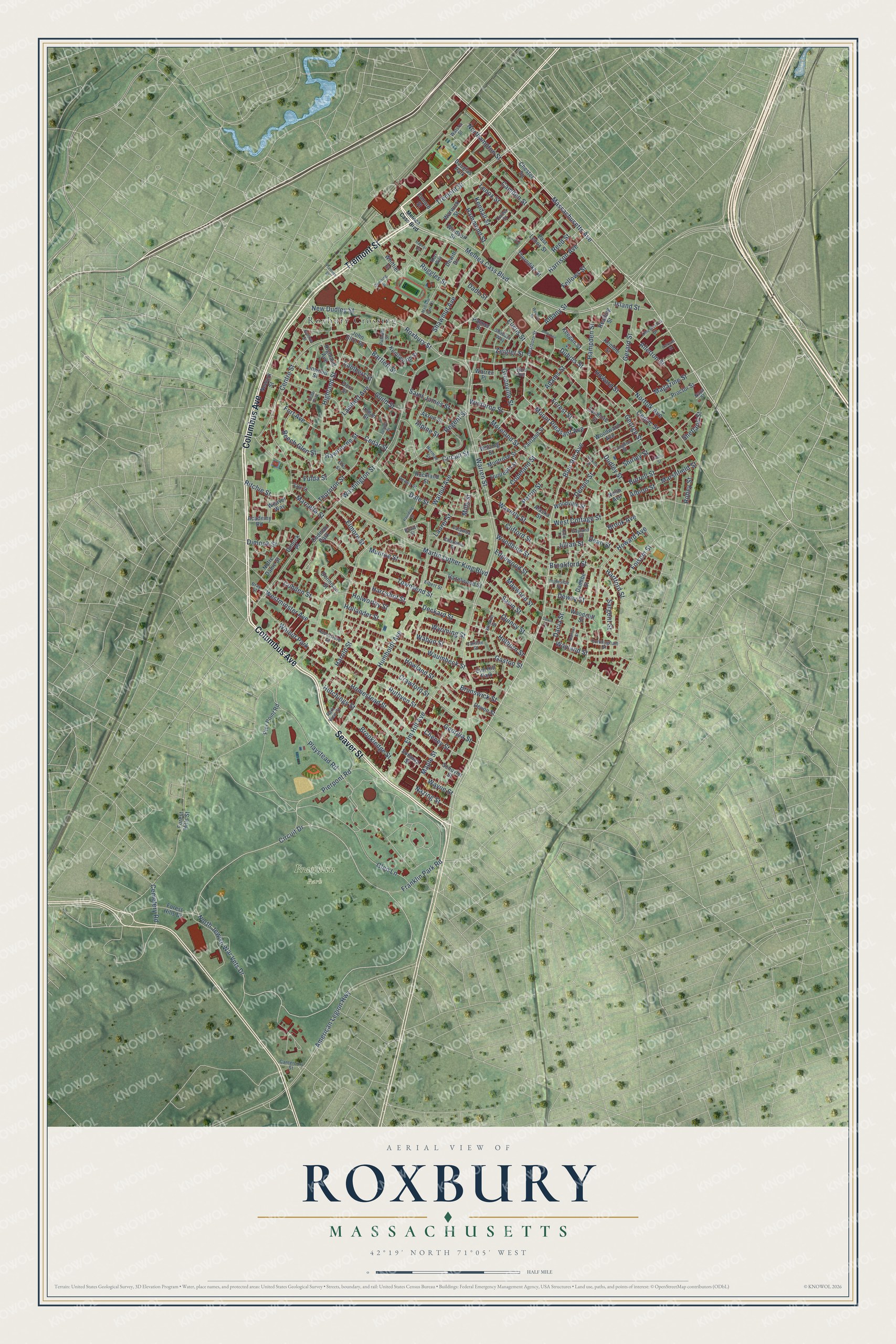
Roxbury, Massachusetts Map Art
Building by building, with labeled streets and shaded relief.
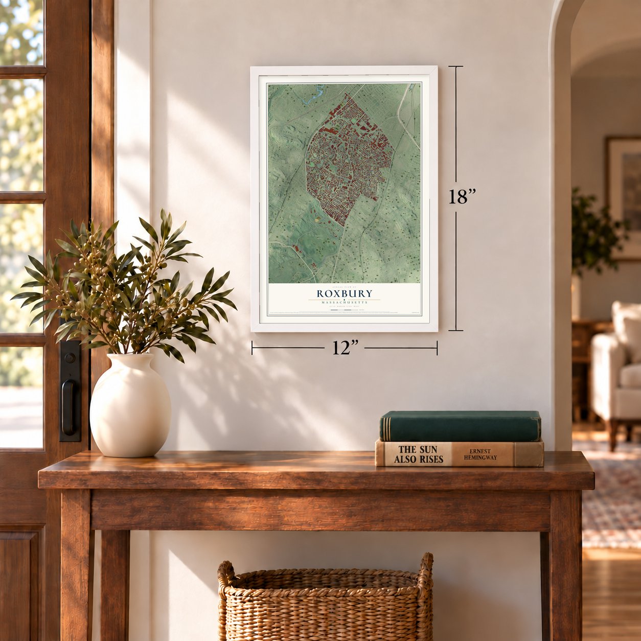
12" x 18" Archival Matte Print
A Map of Home. A Work of Art.
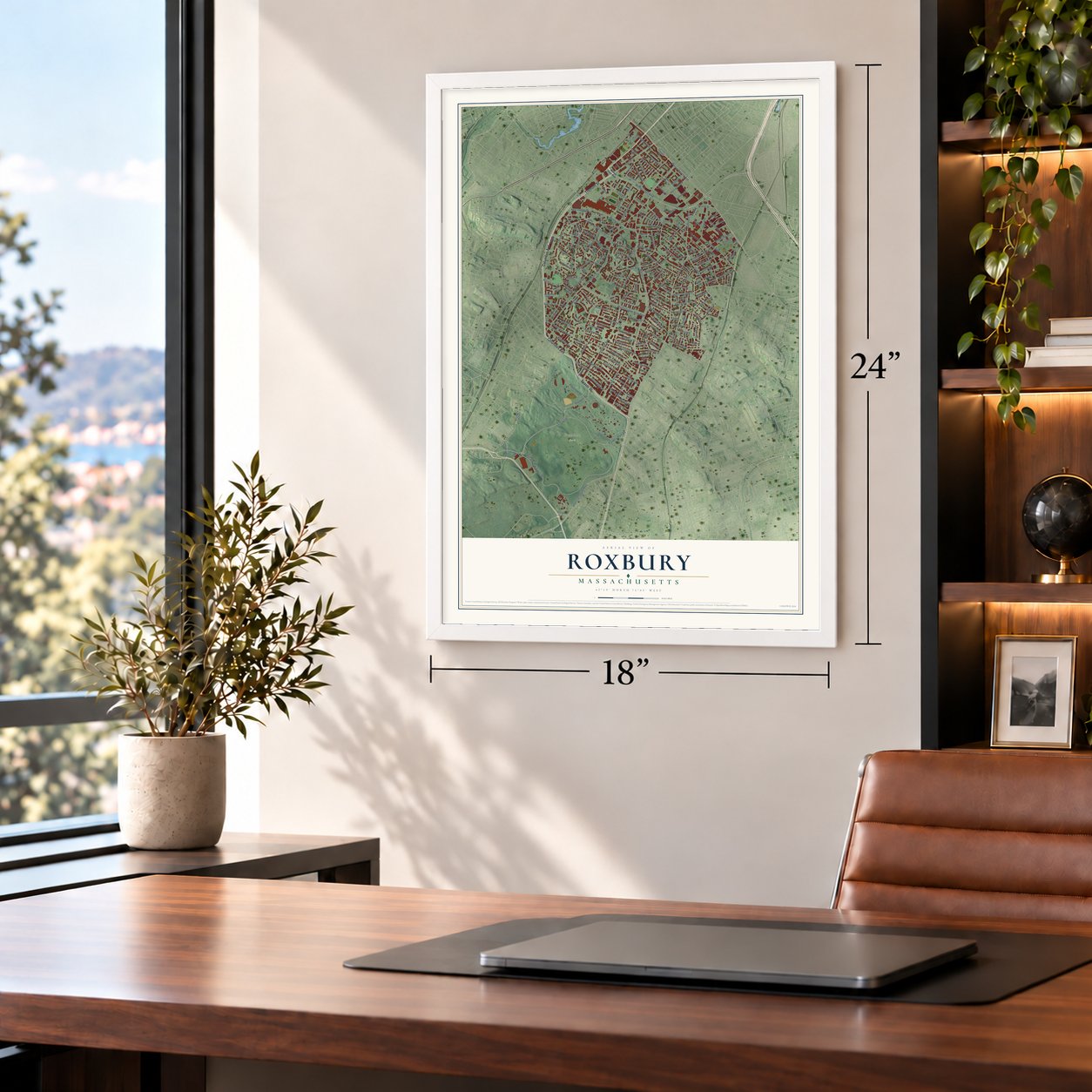
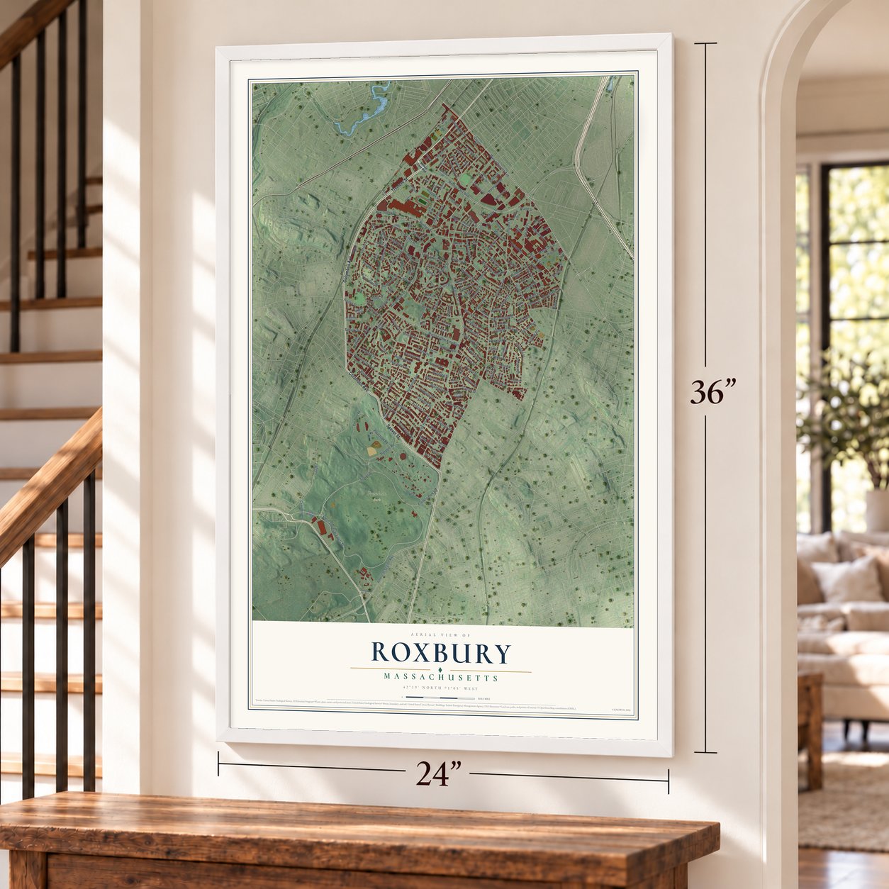
Explore Roxbury, Massachusetts from a whole new perspective. Created using aerial imagery and detailed geographic data, this map captures Roxbury building by building, with labeled streets, familiar landmarks, and shaded topographical relief that highlights the natural contours of the landscape.
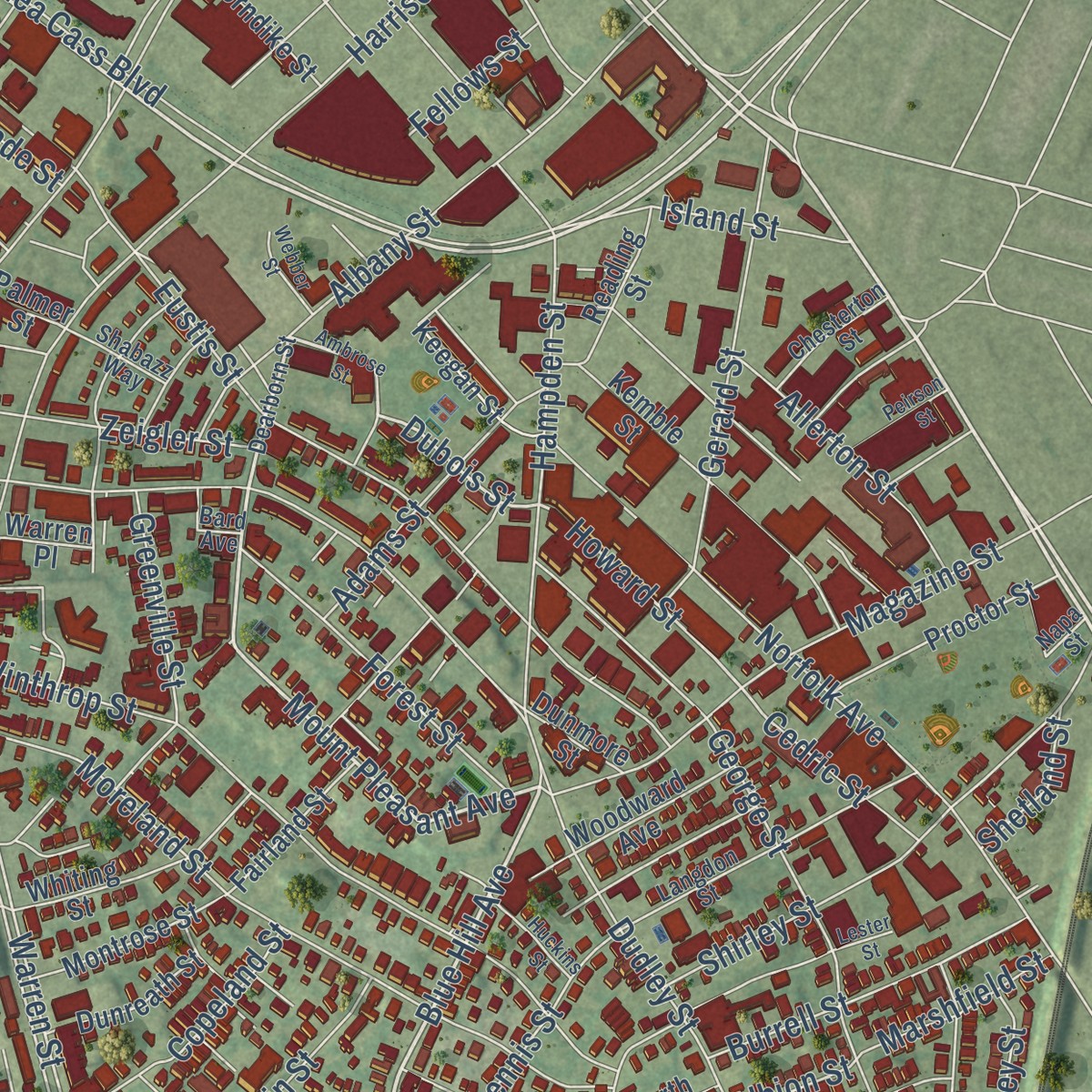
Combining modern data with the timeless character of a vintage atlas, this map is just as interesting up close as it is beautiful on the wall. Whether you grew up in Roxbury, spent memorable years there, or call it home today, this unique map is a great way to celebrate a place that means something to you. Zoom in on the preview to look for your street, and then order a print to put your memories on the wall.
Three ways to hang it
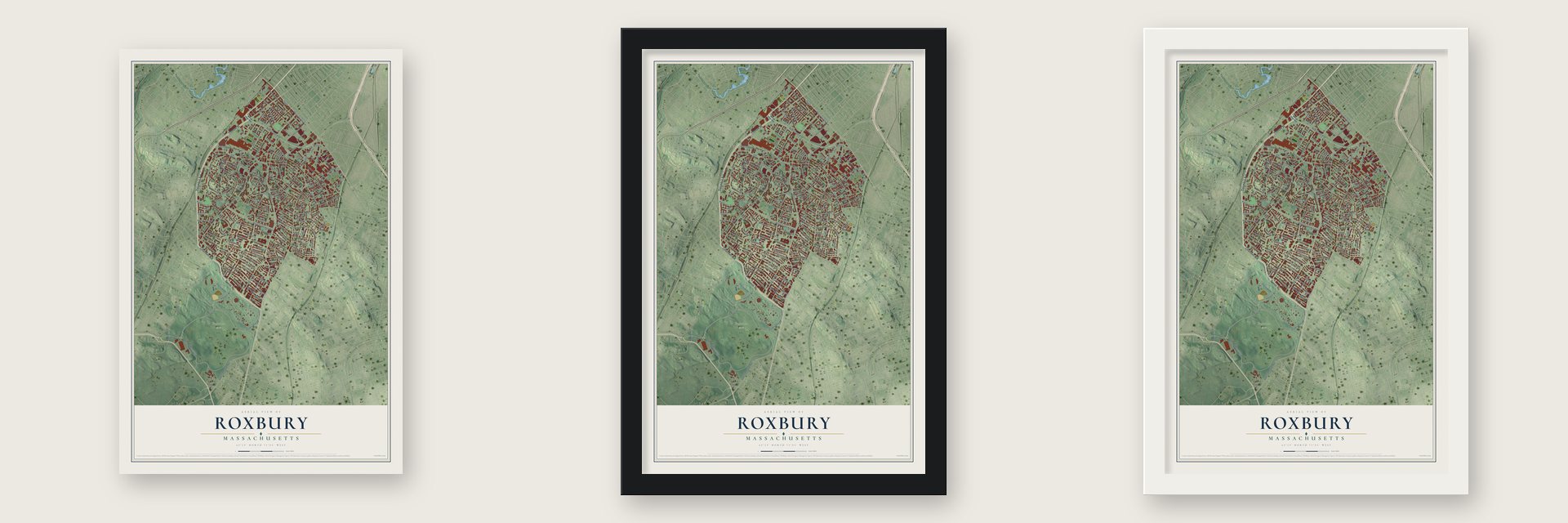
Unframed archival matte, a black wood frame or a white wood frame.
Up close
Geography Worth Displaying
This map was created using accurate cartographic data and authoritative geographic sources, including the U.S. Geological Survey and the Census Bureau. The map brings together terrain, waterways, roads, and building detail. The majority of the streets are labeled, houses are accurately depicted, and the topography is derived from government sources. Combining local data with carefully composed color and shading leads to this beautifully detailed Roxbury artwork for your wall.
Rather than simply showing street outlines, we’ve included as many of the street names as we could reasonably fit on the map while keeping their names legible. Zoom in on the high resolution preview to see exactly what’s on the map. We truly set out to create a statement piece for anyone who loves Roxbury. So whether it’s for you, or a gift for someone you love, we hope this map of Roxbury brings back fond memories.
Read the story behind this map: Detailed Map of Roxbury, Massachusetts.

Find your street
Names on the Roxbury map
Every name below is printed on this map. Look for your street, your school, the park where you played, or the pond down the road.
Places and landmarks7
- Franklin Park
- Roxbury Crossing
- Walnut Park
- Codman Park
- Elm Hill Park
- Douglas Park
- Cedar Park
Streets and roads218
- Columbus Avenue
- Seaver Street
- Tremont Street
- Melnea Cass Boulevard
- Massachusetts Avenue
- Blue Hill Avenue
- Mount Pleasant Avenue
- Dubois Street
- Howard Street
- Warren Street
- Cedric Street
- Crawford Street
- Holworthy Street
- Cemetery Road
- Hartford Street
- Munroe Street
- Deckard Street
- Brookford Street
- North Jewish War Vets Drive
- Circuit Drive
- Washington Street
- Dudley Street
- Walnut Avenue
- Martin Luther King Boulevard
- Humboldt Avenue
- Highland Street
- Glen Lane
- Northampton Street
- Shawmut Avenue
- American Legion Highway
Show all 218 streets
- Townsend Street
- Harrison Avenue
- Harold Street
- Eustis Street
- Howard Avenue
- Winthrop Street
- Roxbury Street
- Moreland Street
- Norfolk Avenue
- Centre Street
- Cedar Street
- Elm Hill Avenue
- Dale Street
- Thornton Street
- Homestead Street
- Howland Street
- Waumbeck Street
- Ruthven Street
- Marcella Street
- Shirley Street
- Hampden Street
- Albany Street
- Magazine Street
- Ruggles Street
- Circuit Street
- Camden Street
- Regent Street
- Gerard Street
- Hutchings Street
- New Dudley Street
- George Street
- Brook Avenue
- Harrishof Street
- Playstead Road
- Wayland Street
- Dacia Street
- Pierpont Road
- West Cottage Street
- Lambert Avenue
- Lenox Street
- Zeigler Street
- Maple Street
- Forest Street
- Bartlett Street
- Burrell Street
- Fort Avenue
- Waverly Street
- Savin Street
- Maywood Street
- Adams Street
- Quincy Street
- Holborn Street
- Beech Glen Street
- Allerton Street
- Hammond Street
- Clifford Street
- Island Street
- Saint James Street
- Cheney Street
- Franklin Park Road
- Julian Street
- Edgewood Street
- Brookledge Street
- Copeland Street
- Reed Street
- Sargent Street
- Georgia Street
- Kendall Street
- Perrin Street
- Woodbine Street
- Westminster Avenue
- Wyoming Street
- Gaston Street
- Dennis Street
- Brunswick Street
- Alpine Street
- Elmore Street
- Cobden Street
- Dewey Street
- Greenville Street
- Dimock Street
- Fulda Street
- Ritchie Street
- Wabon Street
- Marshfield Street
- Folsom Street
- Hawthorne Street
- Guild Street
- Hollander Street
- Fellows Street
- Nazing Street
- Lambert Street
- Shetland Street
- Wayne Street
- Robey Street
- Laurel Street
- Dade Street
- Dean Street
- Albion Street
- Mills Street
- Chester Square
- Palmer Street
- Forest Hills Street
- Dewitt Drive
- Rockland Street
- Kemble Street
- Forest Hills Drive
- Whittier Street
- Schuyler Street
- East Lenox Street
- Whiting Street
- Hazelwood Street
- Proctor Street
- Woodcliff Street
- Windsor Street
- Montrose Street
- Woodville Street
- Linwood Street
- Fairland Street
- Weaver Way
- Dennison Street
- Woodward Avenue
- Notre Dame Street
- Reading Street
- Dunreath Street
- Thorndike Street
- Keegan Street
- Pier Point Road
- Kenilworth Street
- Danube Street
- Akron Street
- Warwick Street
- Dorr Street
- Alaska Street
- Academy Road
- Sonoma Street
- Dimock Place
- Highland Avenue
- Logan Street
- North Avenue
- Dunmore Street
- Devon Street
- Newark Street
- Warren Place
- John Eliot Square
- Cunard Street
- Dearborn Street
- Langdon Street
- Abbotsford Street
- Gayland Street
- Charlame Street
- Vale Street
- Chesterton Street
- Cunningham Street
- Catawba Street
- Napa Street
- Hewes Street
- Trotter Court
- Canterbury Street
- Park View Street
- Bower Street
- Ellis Street
- Shabazz Way
- Ingleside Street
- Carlisle Street
- Watson Street
- Elbert Street
- Weldon Street
- Kerr Way
- Bard Avenue
- Putnam Street
- Bray Street
- Herman Street
- Ambrose Street
- Juniper Street
- Raynor Circle
- Madison Park Court
- Paulding Street
- Peirson Street
- Huckins Street
- Webber Street
- Downing Street
- Balfour Street
- Gardner Street
- Dove Street
- Dalin Place
- Prentiss Street
- Lester Street
Names are listed as they appear on the printed map. Zoom into the product photos to find them.
Keep exploring Massachusetts
Roxbury is one of 470 Massachusetts towns we've mapped. Every dot on the map is a print of its own.
The search covers every state, Massachusetts first.
Near Roxbury
Order 2 or more town maps and save 10%. Shown in the size and finish you picked above, so they hang as a set.
- Mission Hill 12" x 18" / Archival Matte Print $39.99
- Dorchester 12" x 18" / Archival Matte Print $39.99
- Jamaica Plain 12" x 18" / Archival Matte Print $39.99
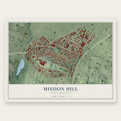
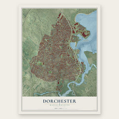

More maps nearby: South End, South Boston, Mattapan, Brookline and Roslindale.
The art of mapping a place
How This Map Was Made
Real places. Remarkable detail. Discover the layers that turn geographic data into a map of home.

The view from above
Aerial imagery reveals the character of the land: woodland, open fields, and the patterns of a place.

The shape of the land
Elevation data brings hills, valleys, and subtle changes in the landscape into view.

The details of home
Roads, waterways, and building footprints come together to make the map feel unmistakably local.

Geography becomes art
Considered color, shading, and typography bring the layers together in a map made for your wall.


Process illustrated with Mendon, Massachusetts. Aerial imagery: USDA NAIP. Terrain: USGS 3D Elevation Program. Map details and finished artwork: KNOWOL.
The Details
About This Print
Choose an archival matte print, or a black or white Ayous wood frame. The archival matte print is unframed.
Select your size and finish above to see the matching product image and price.
Materials & Craftsmanship
A contemporary map with the character of a classic atlas, printed on archival matte paper. Optional frames are made from Ayous wood.
Your printed map does not include the watermark shown in the full-map preview.
Shipping & Delivery
Free shipping within the United States. Every print is made to order in the USA.
Buying a gift? Add a note in your cart and we'll include it. We never put prices in the package.
Prints ship within 2 to 3 business days. Allow 7 to 10 days total from ordering for delivery. Timing may vary during holidays or periods of high order volume.
Read our shipping policy.
Returns and damaged prints
Each print is made to order. Change-of-mind refunds are not available after production.
If your print arrives damaged, misprinted or incorrect, contact support@knowol.com within 30 days of receiving it. Include your order number, photos and a description of the issue.
Read our full refund and replacement policy. For questions about your order, email support@knowol.com.