
Search for another town





Free U.S. delivery 7 to 10 days after you order
Dorchester, Massachusetts Map Art
Building by building, with labeled streets and shaded relief.
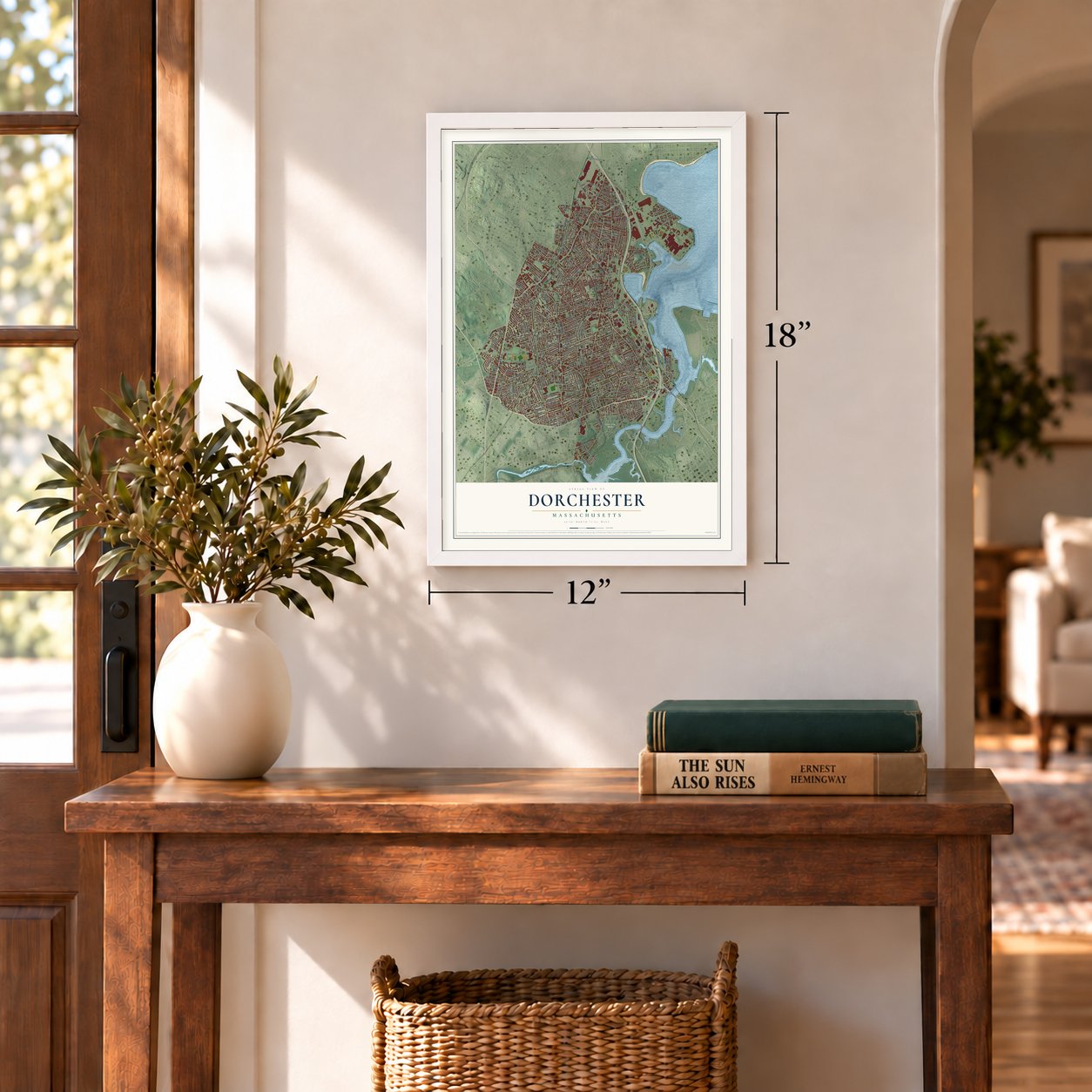
12" x 18" Archival Matte Print
A Map of Home. A Work of Art.
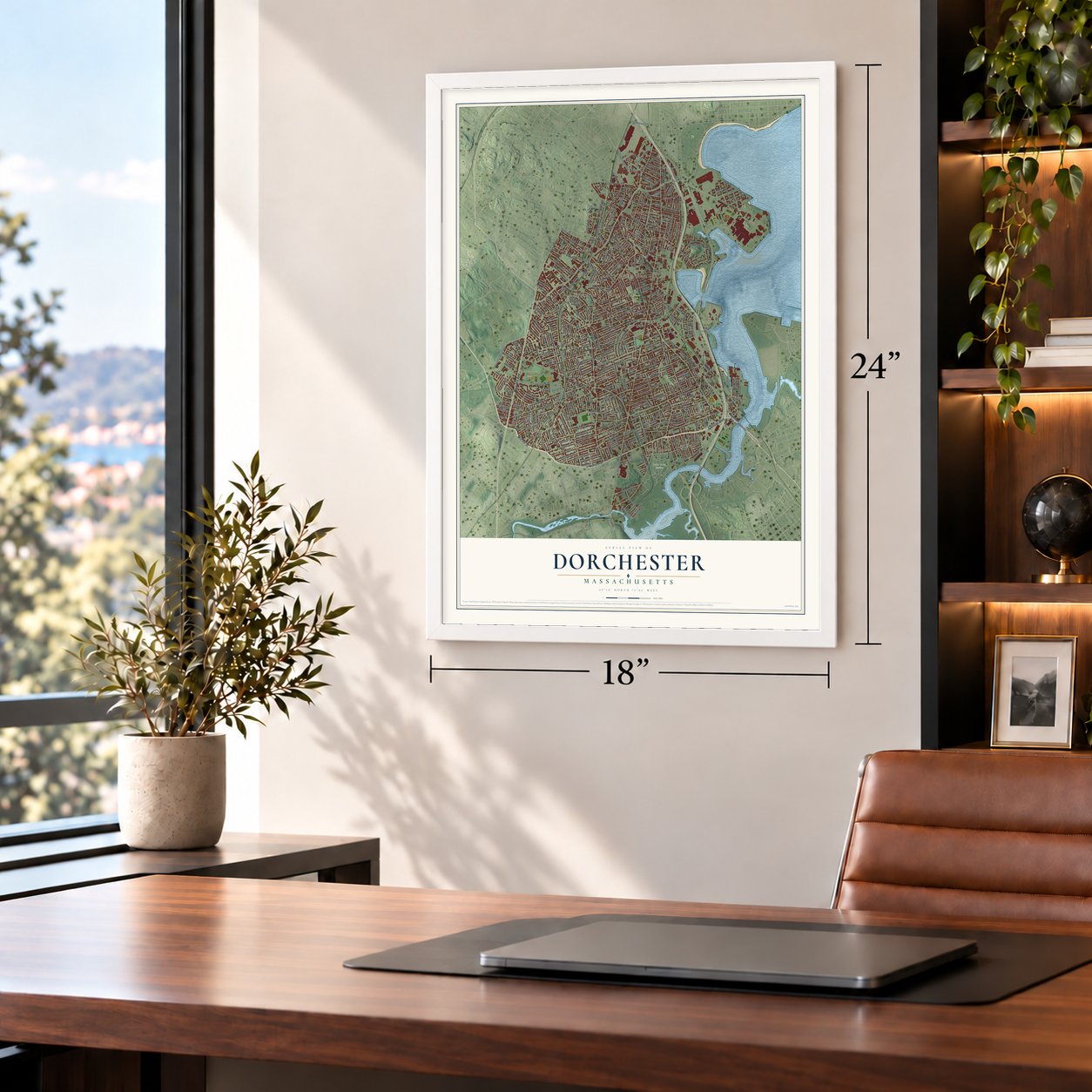
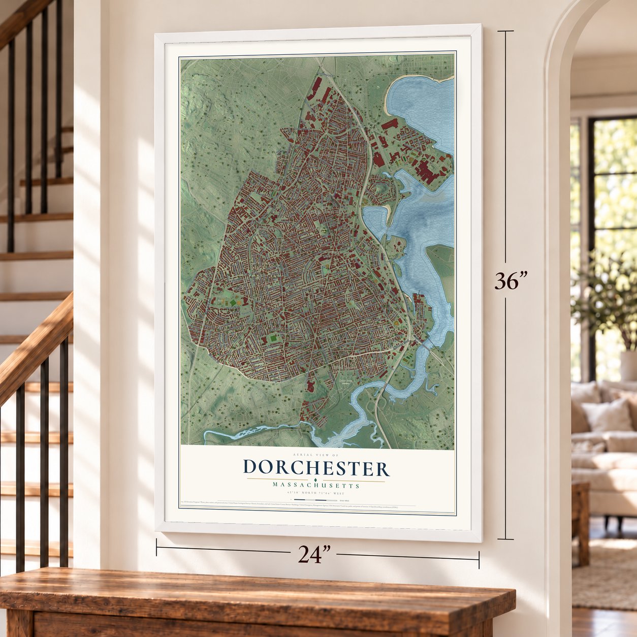
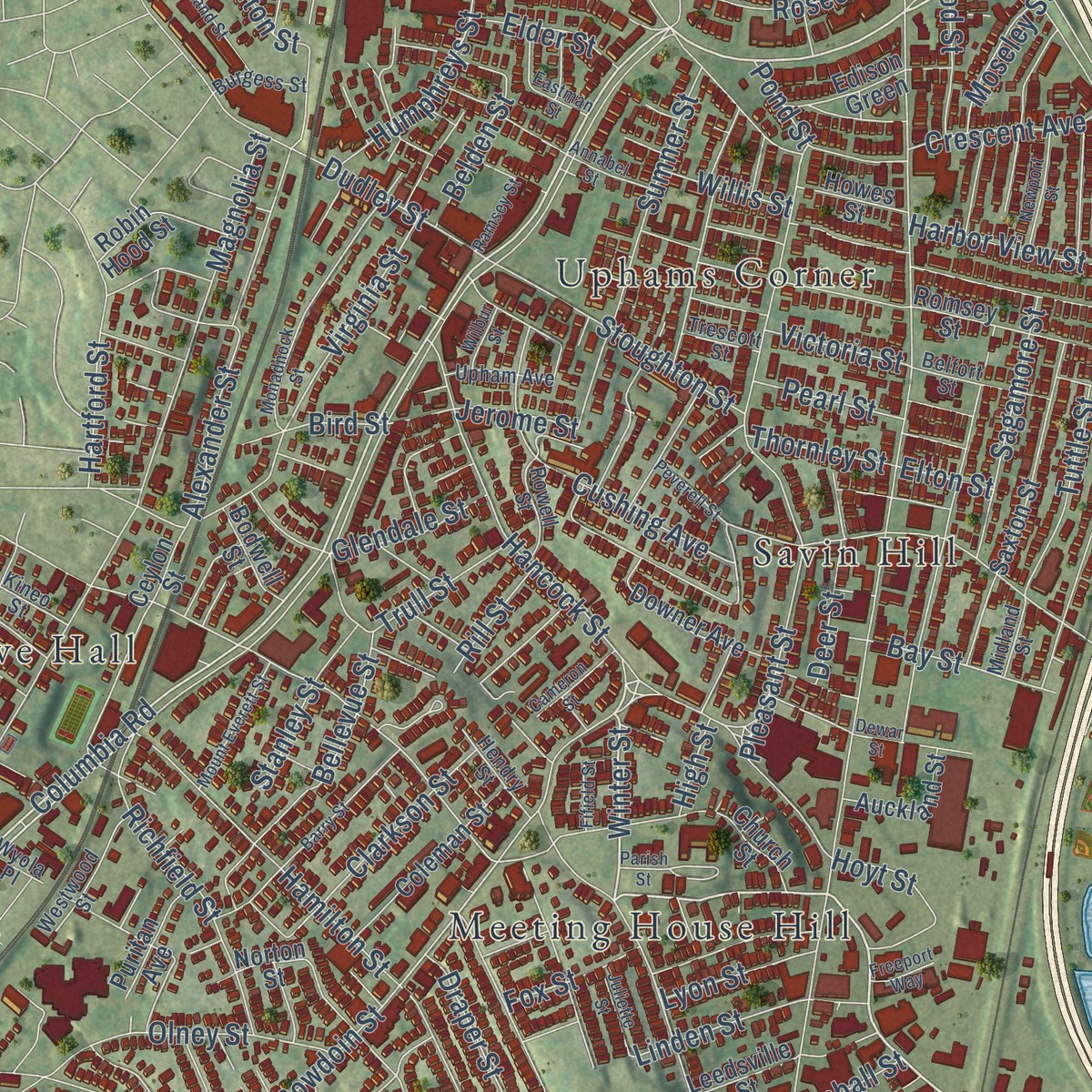
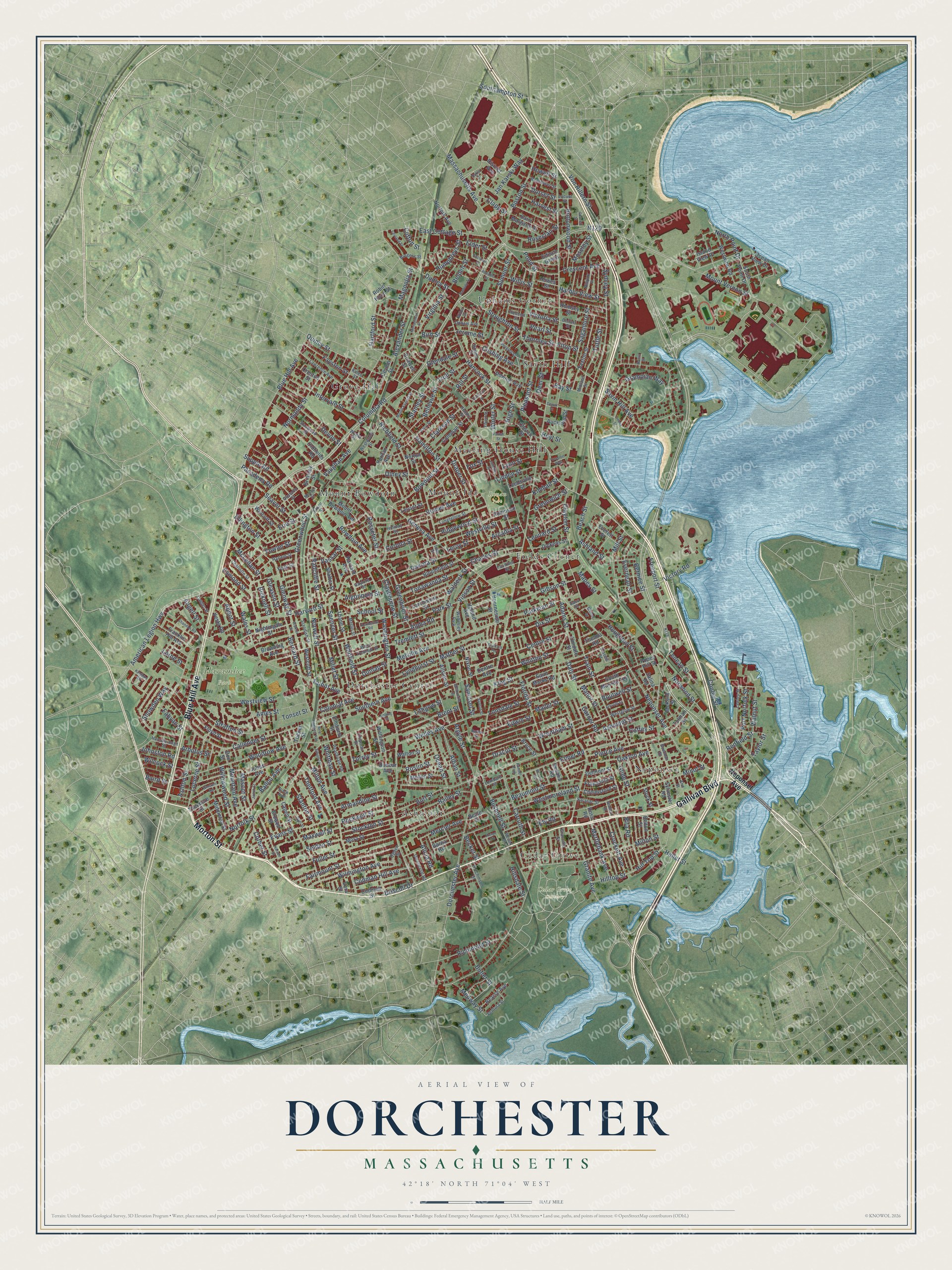
Explore Dorchester, Massachusetts from a whole new perspective. Created using aerial imagery and detailed geographic data, this map captures Dorchester building by building, with labeled streets, familiar landmarks, and shaded topographical relief that highlights the natural contours of the landscape.
Combining modern data with the timeless character of a vintage atlas, this map is just as interesting up close as it is beautiful on the wall. Whether you grew up in Dorchester, spent memorable years there, or call it home today, this unique map is a great way to celebrate a place that means something to you. Zoom in on the preview to look for your street, and then order a print to put your memories on the wall.
Three ways to hang it
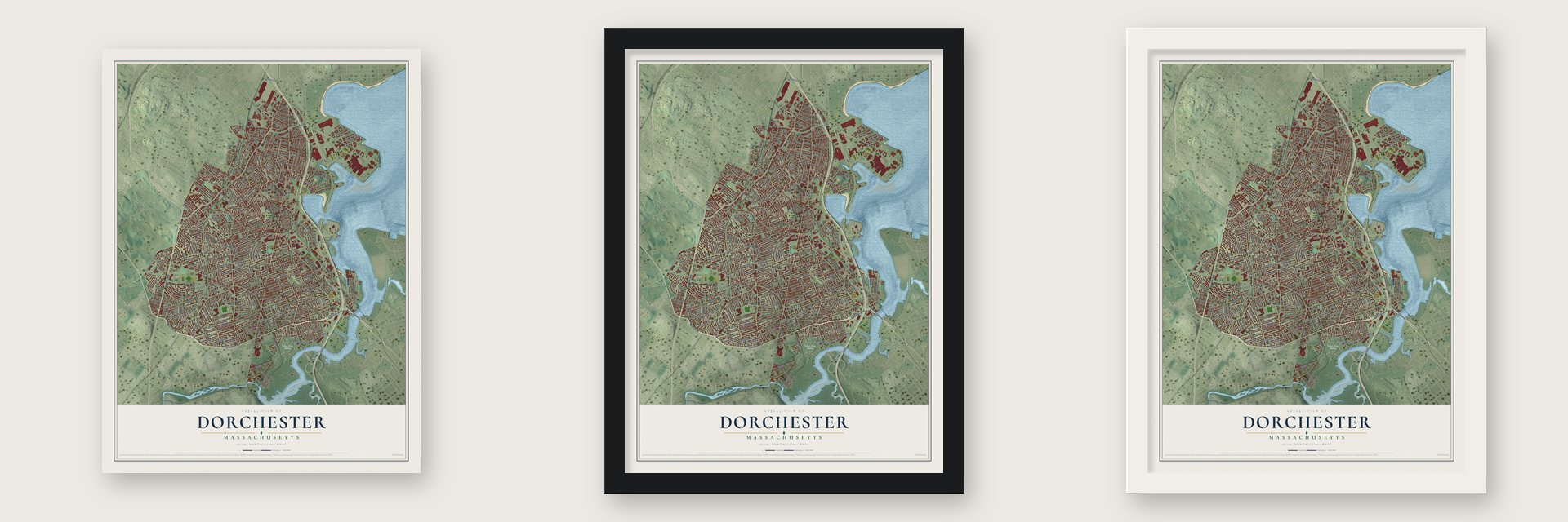
Unframed archival matte, a black wood frame or a white wood frame.
Up close
Geography Worth Displaying
This map was created using accurate cartographic data and authoritative geographic sources, including the U.S. Geological Survey and the Census Bureau. The map brings together terrain, waterways, roads, and building detail. The majority of the streets are labeled, houses are accurately depicted, and the topography is derived from government sources. Combining local data with carefully composed color and shading leads to this beautifully detailed Dorchester artwork for your wall.
Rather than simply showing street outlines, we’ve included as many of the street names as we could reasonably fit on the map while keeping their names legible. Zoom in on the high resolution preview to see exactly what’s on the map. We truly set out to create a statement piece for anyone who loves Dorchester. So whether it’s for you, or a gift for someone you love, we hope this map of Dorchester brings back fond memories.
Read the story behind this map: Detailed Map of Dorchester, Massachusetts.

Find your street
Names on the Dorchester map
Every name below is printed on this map. Look for your street, your school, the park where you played, or the pond down the road.
Places and landmarks16
- Cedar Grove Cemetery
- Harambee Park
- Ronan Park
- Neponset
- Uphams Corner
- Dorchester Center
- Mount Bowdoin
- Grove Hall
- Ashmont
- Savin Hill
- Meeting House Hill
- Fields Corner
Show all 16 places
- Cedar Grove
- Mount Ida
- Wellesley Park
- Rundel Park
Streets and roads408
- Gallivan Boulevard
- Morton Street
- Blue Hill Avenue
- Columbia Road
- Adams Street
- Freeport Street
- Winter Street
- Granite Avenue
- Mount Vernon Street
- Harvard Street
- Neponset Avenue
- Bowdoin Street
- Virginia Street
- Hilltop Street
- Bushnell Street
- Quincy Street
- Milton Street
- Bird Street
- Bay Street
- Snowden Way
- Dorchester Avenue
- Washington Street
- Park Street
- Talbot Avenue
- Savin Hill Avenue
- Geneva Avenue
- Ashmont Street
- Norfolk Street
- Fuller Street
- Minot Street
Show all 408 streets
- East Cottage Street
- Centre Street
- Boston Street
- Norwell Street
- Milton Avenue
- Massachusetts Avenue
- Woodrow Avenue
- Magnolia Street
- Hancock Street
- Victory Road
- Sydney Street
- Pleasant Street
- American Legion Highway
- Normandy Street
- Callender Street
- Melville Avenue
- Hamilton Street
- King Street
- Westville Street
- Grampian Way
- Fairmount Street
- Glenway Street
- Train Street
- Millet Street
- Evans Street
- Hallet Street
- Cushing Avenue
- Greenwood Street
- Bernard Street
- Welles Avenue
- Devon Street
- Westview Street
- Wrentham Street
- Bellevue Street
- Stratton Street
- Ballou Avenue
- Wales Street
- Spencer Street
- Conley Street
- Homes Avenue
- Walnut Street
- Lucerne Street
- Rosseter Street
- Draper Street
- Whitfield Street
- Olney Street
- Wilmington Avenue
- Alexander Street
- Intervale Street
- North Point Drive
- Elmer Road
- Bailey Street
- Bowdoin Avenue
- Dakota Street
- Ellington Street
- Hill Top Street
- Florida Street
- Waldeck Street
- Von Hillern Street
- Tonawanda Street
- Southern Avenue
- Richfield Street
- Selden Street
- Carruth Street
- Parkman Street
- Tenean Street
- Buttonwood Street
- Beaumont Street
- Clarkson Street
- Mill Street
- Pierce Avenue
- Lonsdale Street
- Gibson Street
- Erie Street
- Maxwell Street
- Richmond Street
- Stoughton Street
- Ames Street
- Esmond Street
- Brent Street
- Clayton Street
- Mather Street
- Greenbrier Street
- Ashton Street
- Seaver Street
- Willowwood Street
- Whitten Street
- Claybourne Street
- Sumner Street
- Oakton Avenue
- Glendale Street
- Dix Street
- Ashland Street
- Houghton Street
- Sagamore Street
- Everdean Street
- Charles Street
- Burt Street
- Alban Street
- Armandine Street
- Dudley Street
- Tremlett Street
- Crockett Avenue
- Myrtlebank Avenue
- Thetford Avenue
- Ocean Street
- Codman Hill Avenue
- Humphreys Street
- Mascot Street
- Roseclair Street
- Radcliffe Street
- Linden Street
- Stockton Street
- Fayston Street
- Butler Street
- Rockwell Street
- Lyndhurst Street
- McLellan Street
- Fowler Street
- Jan Karski Way
- Clifton Street
- Mountain Avenue
- Lithgow Street
- Belden Street
- Edwin Street
- Tuttle Street
- Westmoreland Street
- Vaughan Avenue
- Mapes Street
- Mercier Avenue
- Corbet Street
- Dracut Street
- Beach Street
- School Street
- Medway Street
- Harbor View Street
- Stanton Street
- Crescent Avenue
- Hoyt Street
- Taylor Street
- Ridgewood Street
- Supple Road
- Hartford Street
- Torrey Street
- Port Norfolk Street
- Greenwich Street
- Southampton Street
- Stanley Street
- Corona Street
- Norwood Street
- Roslin Street
- Harvest Street
- Colonial Avenue
- Algonquin Street
- Alpha Road
- Boutwell Street
- Leonard Street
- Clapp Street
- Alicia Road
- Coffey Street
- Gleason Street
- Manor Street
- Vassar Street
- Pasadena Road
- Angell Street
- Samoset Street
- Moseley Street
- Lyon Street
- Abbot Street
- Trull Street
- Elder Street
- Bicknell Street
- Johnston Road
- Dorset Street
- Pearl Street
- Glide Street
- Garner Road
- Arcadia Street
- Dunlap Street
- Thornley Street
- Victoria Street
- Hillsdale Street
- Whitman Street
- Wilcock Street
- Deer Street
- Fox Street
- Vinson Street
- Driscoll Drive
- Bernice Street
- Redfield Street
- Mallet Street
- Leroy Street
- Arbutus Street
- Tonset Street
- Fabyan Street
- Willis Street
- Rita Road
- Rill Street
- Becket Street
- Kimball Street
- Jerome Street
- Daly Street
- Lorne Street
- Howell Street
- Argyle Street
- Baird Street
- High Street
- Pond Street
- Elton Street
- Ely Road
- Auckland Street
- Capen Street
- Westwind Road
- Bloomfield Street
- Saint Marks Road
- Ocean View Drive
- Floyd Street
- Nightingale Street
- Church Street
- Norton Street
- Ceylon Street
- Saxton Street
- Jones Avenue
- Mora Street
- Edison Green
- Coleman Street
- Romsey Street
- Oldfields Road
- Downer Avenue
- Larchmont Street
- Franklin Hill Avenue
- Saint Margaret Street
- Allston Street
- Island View Place
- South Munroe Terrace
- Chelmsford Street
- Bearse Avenue
- Tolman Street
- Mount Bowdoin Terrace
- South Point Drive
- Thane Street
- Robinson Street
- McKone Street
- Dickens Street
- Middleton Street
- Norfolk Avenue
- Browning Avenue
- Robin Hood Street
- Franconia Street
- Bourneside Street
- Mellen Street
- Upland Avenue
- Shafter Street
- Westcott Street
- Harvard Avenue
- Puritan Avenue
- Wolcott Street
- Brinsley Street
- Levant Street
- Creston Street
- Nixon Street
- Withington Street
- Delmont Street
- Sylvester Road
- Crowell Street
- Theodore Street
- Popes Hill Street
- Codman Street
- Everett Street
- Leedsville Street
- Howes Street
- Bodwell Street
- District Avenue
- Salina Road
- Elmdale Street
- Belton Street
- Dunbar Avenue
- Walton Street
- Vesta Road
- Thelma Road
- Centre Avenue
- Elmhurst Street
- Bruce Street
- Stock Street
- Sedalia Road
- York Street
- Beale Street
- Barna Road
- Tucker Street
- Don Street
- Ross Road
- Vera Street
- Stanwood Street
- Lawrence Avenue
- Westglow Street
- Holiday Street
- Longfellow Street
- Lawley Street
- Charlotte Street
- West Tremlett Street
- Standish Street
- Granville Street
- Peacevale Road
- Westwood Street
- Belfort Street
- Rock Avenue
- Bellflower Street
- Owencroft Road
- Hutchinson Street
- Hansborough Street
- Chipman Street
- Glenarm Street
- Locust Street
- Eldon Street
- Harlem Street
- Hendry Street
- Rowell Street
- Upham Avenue
- Ventura Street
- Bowman Street
- Saranac Street
- Calder Street
- Faulkner Street
- Burgess Street
- Merlin Street
- Gaylord Street
- Lombard Street
- Ogden Street
- Midland Street
- Trescott Street
- Kineo Street
- Queen Street
- Morse Street
- Wyola Place
- Iowa Street
- Ann Street
- Saco Street
- Monadnock Street
- Huron Circle
- New England Avenue
- Barry Street
- Edson Street
- Nelson Street
- Shandon Road
- Winston Road
- Melbourne Street
- Warner Street
- Jacob Street
- Mount Everett Street
- Leyland Street
- Denny Street
- Newport Street
- Eastman Street
- Dyer Street
- Kenberma Road
- Cameron Street
- Fifield Street
- Juliette Street
- Annabel Street
- Peverell Street
- Kingbird Road
- Endicott Terrace
- Dewar Street
- Ramsey Street
- Arbroth Street
- Wilcox Road
- Wessex Street
- Santuit Street
- Branton Street
- Freeport Way
- Wilbur Street
- Manley Street
- Cottrell Street
- Banton Street
- Epping Street
- Parish Street
- Davitt Street
- Baker Court
Names are listed as they appear on the printed map. Zoom into the product photos to find them.
Keep exploring Massachusetts
Dorchester is one of 470 Massachusetts towns we've mapped. Every dot on the map is a print of its own.
The search covers every state, Massachusetts first.
Near Dorchester
Order 2 or more town maps and save 10%. Shown in the size and finish you picked above, so they hang as a set.
- Roxbury 12" x 18" / Archival Matte Print $39.99
- Mattapan 12" x 18" / Archival Matte Print $39.99
- South Boston 12" x 18" / Archival Matte Print $39.99


More maps nearby: Jamaica Plain, South End, Mission Hill, Roslindale and Boston.
The art of mapping a place
How This Map Was Made
Real places. Remarkable detail. Discover the layers that turn geographic data into a map of home.

The view from above
Aerial imagery reveals the character of the land: woodland, open fields, and the patterns of a place.

The shape of the land
Elevation data brings hills, valleys, and subtle changes in the landscape into view.

The details of home
Roads, waterways, and building footprints come together to make the map feel unmistakably local.

Geography becomes art
Considered color, shading, and typography bring the layers together in a map made for your wall.


Process illustrated with Mendon, Massachusetts. Aerial imagery: USDA NAIP. Terrain: USGS 3D Elevation Program. Map details and finished artwork: KNOWOL.
The Details
About This Print
Choose an archival matte print, or a black or white Ayous wood frame. The archival matte print is unframed.
Select your size and finish above to see the matching product image and price.
Materials & Craftsmanship
A contemporary map with the character of a classic atlas, printed on archival matte paper. Optional frames are made from Ayous wood.
Your printed map does not include the watermark shown in the full-map preview.
Shipping & Delivery
Free shipping within the United States. Every print is made to order in the USA.
Buying a gift? Add a note in your cart and we'll include it. We never put prices in the package.
Prints ship within 2 to 3 business days. Allow 7 to 10 days total from ordering for delivery. Timing may vary during holidays or periods of high order volume.
Read our shipping policy.
Returns and damaged prints
Each print is made to order. Change-of-mind refunds are not available after production.
If your print arrives damaged, misprinted or incorrect, contact support@knowol.com within 30 days of receiving it. Include your order number, photos and a description of the issue.
Read our full refund and replacement policy. For questions about your order, email support@knowol.com.