


Search for another town





Free U.S. delivery 7 to 10 days after you order
Mattapan, Massachusetts Map Art
Building by building, with labeled streets and shaded relief.
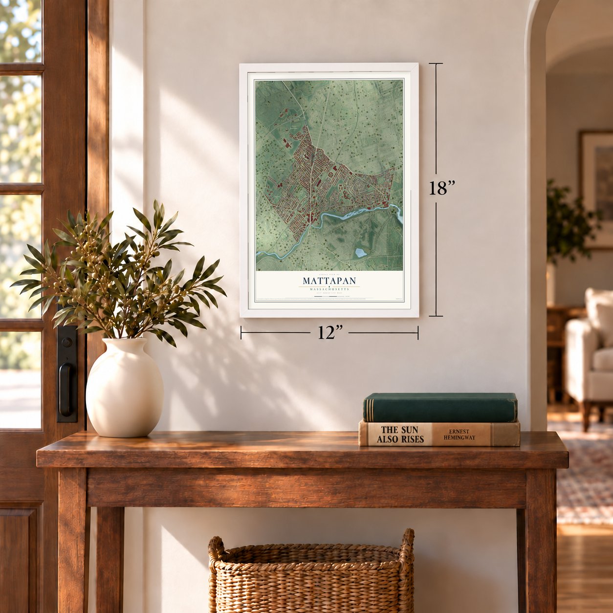
12" x 18" Archival Matte Print
A Map of Home. A Work of Art.
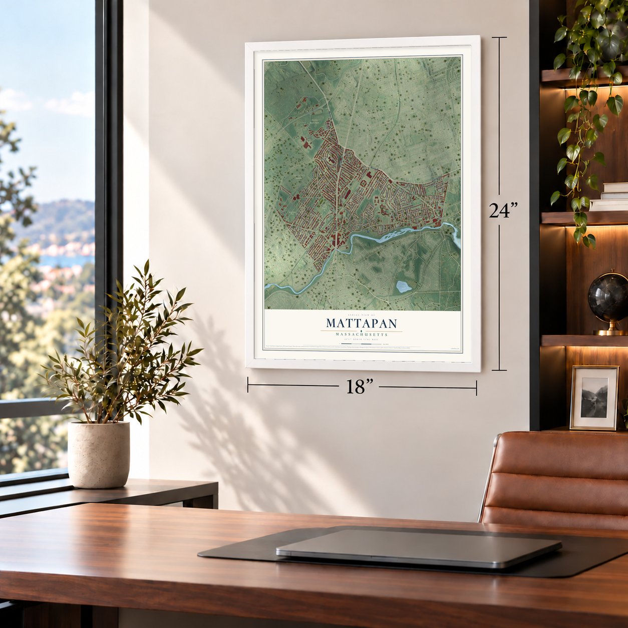
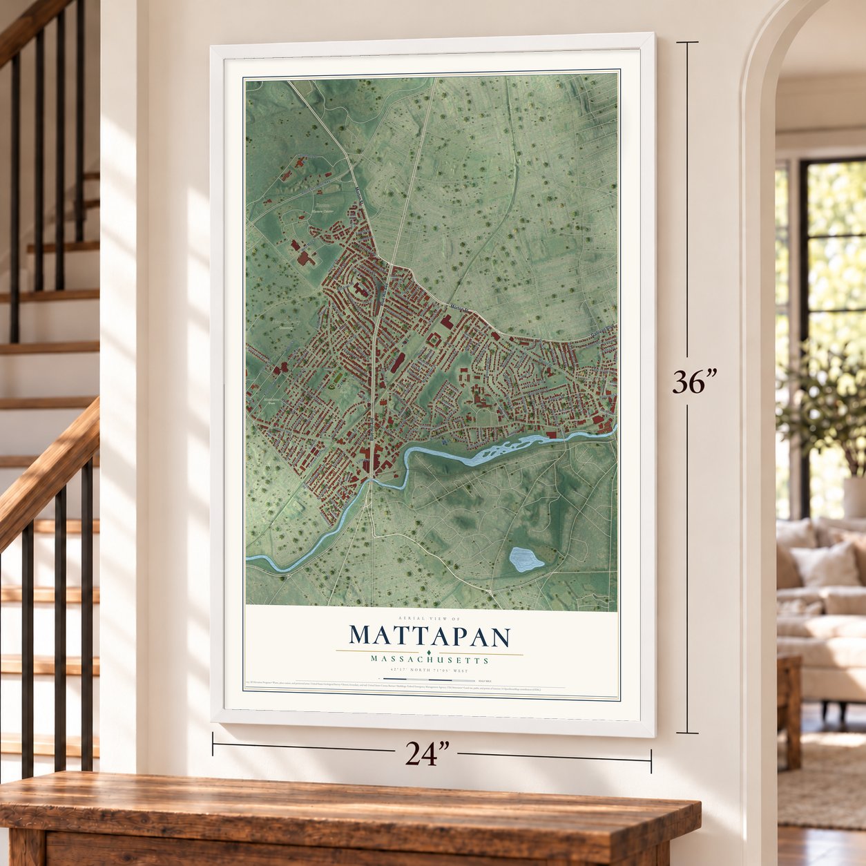
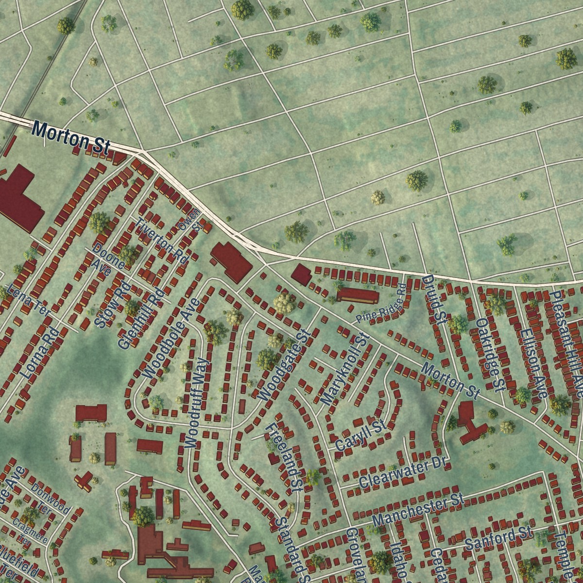
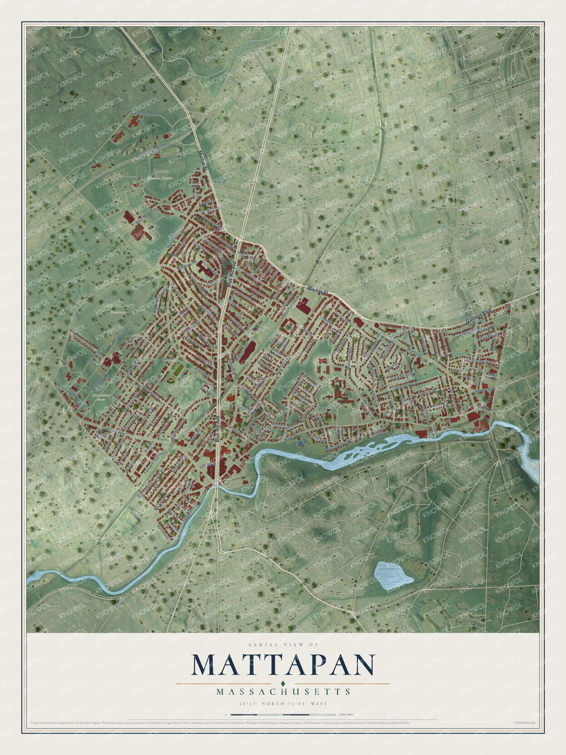
Explore Mattapan, Massachusetts from a whole new perspective. Created using aerial imagery and detailed geographic data, this map captures Mattapan building by building, with labeled streets, familiar landmarks, and shaded topographical relief that highlights the natural contours of the landscape.
Combining modern data with the timeless character of a vintage atlas, this map is just as interesting up close as it is beautiful on the wall. Whether you grew up in Mattapan, spent memorable years there, or call it home today, this unique map is a great way to celebrate a place that means something to you. Zoom in on the preview to look for your street, and then order a print to put your memories on the wall.
Three ways to hang it
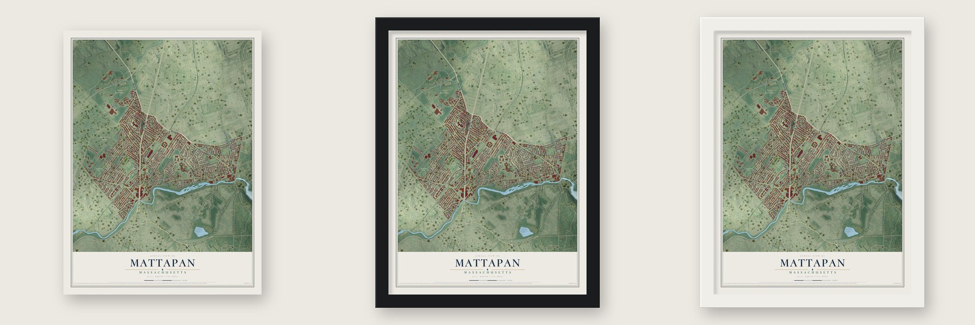
Unframed archival matte, a black wood frame or a white wood frame.
Up close
Geography Worth Displaying
This map was created using accurate cartographic data and authoritative geographic sources, including the U.S. Geological Survey and the Census Bureau. The map brings together terrain, waterways, roads, and building detail. The majority of the streets are labeled, houses are accurately depicted, and the topography is derived from government sources. Combining local data with carefully composed color and shading leads to this beautifully detailed Mattapan artwork for your wall.
Rather than simply showing street outlines, we’ve included as many of the street names as we could reasonably fit on the map while keeping their names legible. Zoom in on the high resolution preview to see exactly what’s on the map. We truly set out to create a statement piece for anyone who loves Mattapan. So whether it’s for you, or a gift for someone you love, we hope this map of Mattapan brings back fond memories.
Read the story behind this map: Detailed Map of Mattapan, Massachusetts.

Find your street
Names on the Mattapan map
Every name below is printed on this map. Look for your street, your school, the park where you played, or the pond down the road.
Places and landmarks6
- Almont Park
- Boston Nature Center
- New Calvary Cemetery
- Mattahunt Woods
- Lower Mills
- Merola Park
Streets and roads163
- Morton Street
- Gallivan Boulevard
- Blue Hill Avenue
- Wellington Hill Street
- Greendale Road
- Valley Road
- Fessenden Street
- River Street
- Temple Street
- Hiawatha Road
- Druid Street
- Crossman Street
- American Legion Highway
- Harvard Street
- Cummins Highway
- Walk Hill Street
- Alabama Street
- Itasca Street
- West Selden Street
- Canterbury Street
- Messinger Street
- West Main Street
- Almont Street
- Babson Street
- Colorado Street
- Norfolk Street
- Hebron Street
- Woodbole Avenue
- Standard Street
- Hazelton Street
Show all 163 streets
- Kennebec Street
- Savannah Avenue
- Lorna Road
- Mattapan Street
- Ormond Street
- Gladeside Avenue
- Delhi Street
- Manchester Street
- Woodhaven Street
- Edgewater Drive
- Stonecrest Road
- Woodruff Way
- Livermore Street
- Rosewood Street
- Rockdale Street
- Hollingsworth Street
- Deering Road
- Sanford Street
- Maryknoll Street
- Tennis Road
- Saint Gregory Street
- Woolson Street
- Westmore Road
- Favre Street
- Regis Road
- Clearwater Drive
- Currier Street
- Fremont Street
- Hosmer Street
- Pleasant Hill Avenue
- Old Morton Street
- Faunce Road
- Clarkwood Street
- Brockton Street
- Goodale Road
- Richmere Road
- Rexford Street
- Fairlawn Apartment
- Mildred Avenue
- Meadowbank Avenue
- Hallowell Street
- Cedar Street
- Hillsboro Road
- Woodgate Street
- Astoria Street
- Ellison Avenue
- Evelyn Street
- Mamelon Circle
- Rugdale Road
- Violet Street
- Idaho Street
- Harmon Street
- Caryll Street
- Clancy Road
- Oakridge Street
- Sturbridge Street
- Corman Road
- Groveland Street
- Dania Street
- Fottler Road
- Leston Street
- Outlook Road
- Freeland Street
- Glenhill Road
- Stow Road
- Richmond Street
- Croydon Street
- Rugby Road
- Wilmore Street
- Halborn Street
- Rich Street
- Sutton Street
- Estella Street
- Malta Street
- Verrill Street
- Prairie Street
- Fairway Street
- Culbert Street
- Courtland Road
- Washington Street
- Ridgeview Avenue
- Orlando Street
- Rockingham Road
- Newcroft Circle
- Oconnell Road
- Duke Street
- Canaan Street
- Doone Avenue
- Blue Jay Court
- Wildwood Street
- Mary Moore Beatty Circle
- Bluefield Terrace
- Southmere Road
- Mattakeeset Street
- Lena Terrace
- Rector Road
- Woodale Avenue
- Monson Street
- Wabash Street
- Briarcliff Terrace
- Linvale Terrace
- Tiverton Road
- Leahaven Road
- Banfield Avenue
- Riverdale Road
- Duxbury Road
- Flint Street
- Tesla Street
- Ruxton Road
- Bismarck Street
- Mother Julia Road
- Landor Road
- Central Avenue
- Burmah Street
- Marcy Road
- Falcon Lane
- Mulvey Street
- Avondale Street
- Pine Ridge Road
- Catbird Court
- Arborcrest Terrace
- Topalian Street
- Donwood Terrace
- French Street
- Owen Street
- Wichita Terrace
- Cookson Terrace
- Violante Street
- Cragmere Terrace
- Monterey Avenue
- Grant Place
- Taylor Terrace
- Lark Drive
Names are listed as they appear on the printed map. Zoom into the product photos to find them.
About Mattapan, Massachusetts
The Massachusett people named Mattapan and lived here first. Mattapan and Lower Mills were their main crossings of the Neponset River. Later settlers turned the native footpaths into roads. Adams Street and River Street began as trails linking Mattapan to fishing weirs at Lower Mills.
Keep exploring Massachusetts
Mattapan is one of 470 Massachusetts towns we've mapped. Every dot on the map is a print of its own.
The search covers every state, Massachusetts first.
Near Mattapan
Order 2 or more town maps and save 10%. Shown in the size and finish you picked above, so they hang as a set.
- Roslindale 12" x 18" / Archival Matte Print $39.99
- Dorchester 12" x 18" / Archival Matte Print $39.99
- Hyde Park 12" x 18" / Archival Matte Print $39.99


More maps nearby: Milton, Jamaica Plain, Roxbury, West Roxbury and Mission Hill.
The art of mapping a place
How This Map Was Made
Real places. Remarkable detail. Discover the layers that turn geographic data into a map of home.

The view from above
Aerial imagery reveals the character of the land: woodland, open fields, and the patterns of a place.

The shape of the land
Elevation data brings hills, valleys, and subtle changes in the landscape into view.

The details of home
Roads, waterways, and building footprints come together to make the map feel unmistakably local.

Geography becomes art
Considered color, shading, and typography bring the layers together in a map made for your wall.


Process illustrated with Mendon, Massachusetts. Aerial imagery: USDA NAIP. Terrain: USGS 3D Elevation Program. Map details and finished artwork: KNOWOL.
The Details
About This Print
Choose an archival matte print, or a black or white Ayous wood frame. The archival matte print is unframed.
Select your size and finish above to see the matching product image and price.
Materials & Craftsmanship
A contemporary map with the character of a classic atlas, printed on archival matte paper. Optional frames are made from Ayous wood.
Your printed map does not include the watermark shown in the full-map preview.
Shipping & Delivery
Free shipping within the United States. Every print is made to order in the USA.
Buying a gift? Add a note in your cart and we'll include it. We never put prices in the package.
Prints ship within 2 to 3 business days. Allow 7 to 10 days total from ordering for delivery. Timing may vary during holidays or periods of high order volume.
Read our shipping policy.
Returns and damaged prints
Each print is made to order. Change-of-mind refunds are not available after production.
If your print arrives damaged, misprinted or incorrect, contact support@knowol.com within 30 days of receiving it. Include your order number, photos and a description of the issue.
Read our full refund and replacement policy. For questions about your order, email support@knowol.com.