
Search for another town


Free U.S. delivery 7 to 10 days after you order
Milton, Massachusetts Map Art
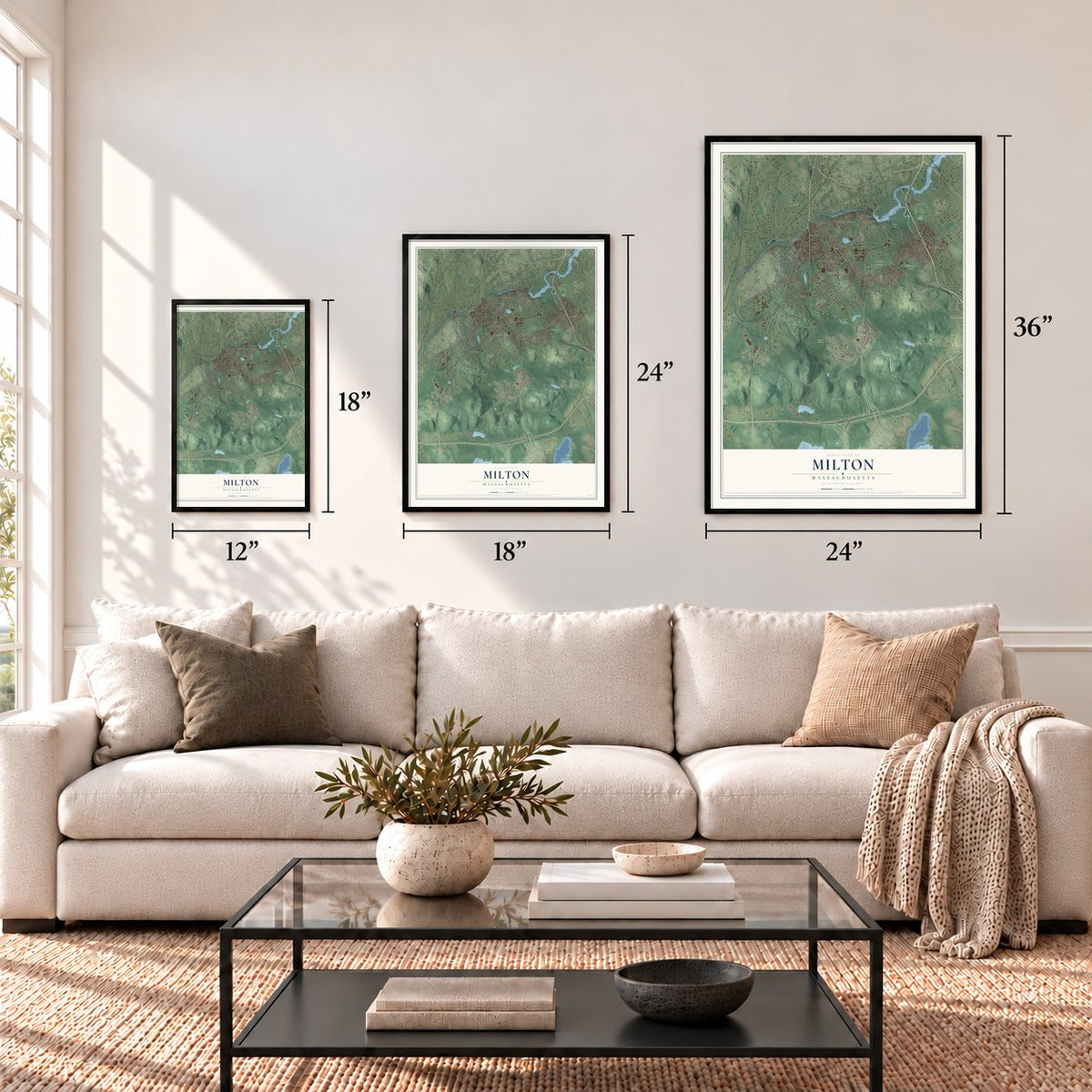
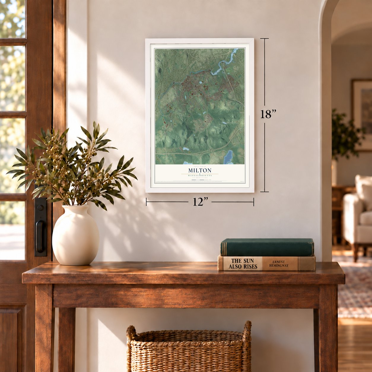
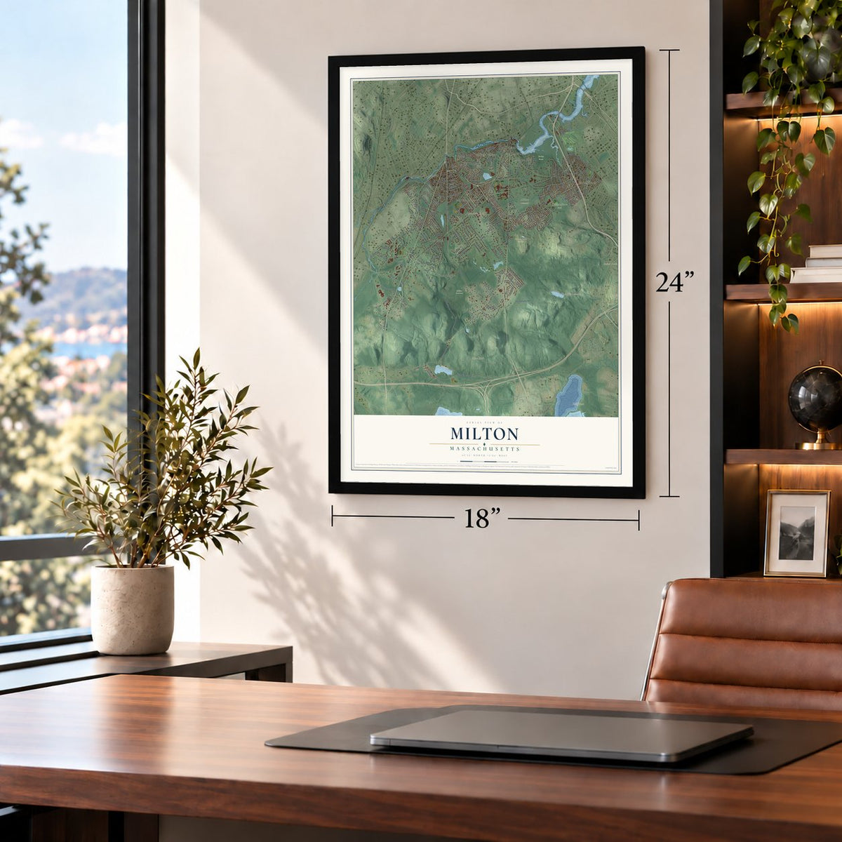
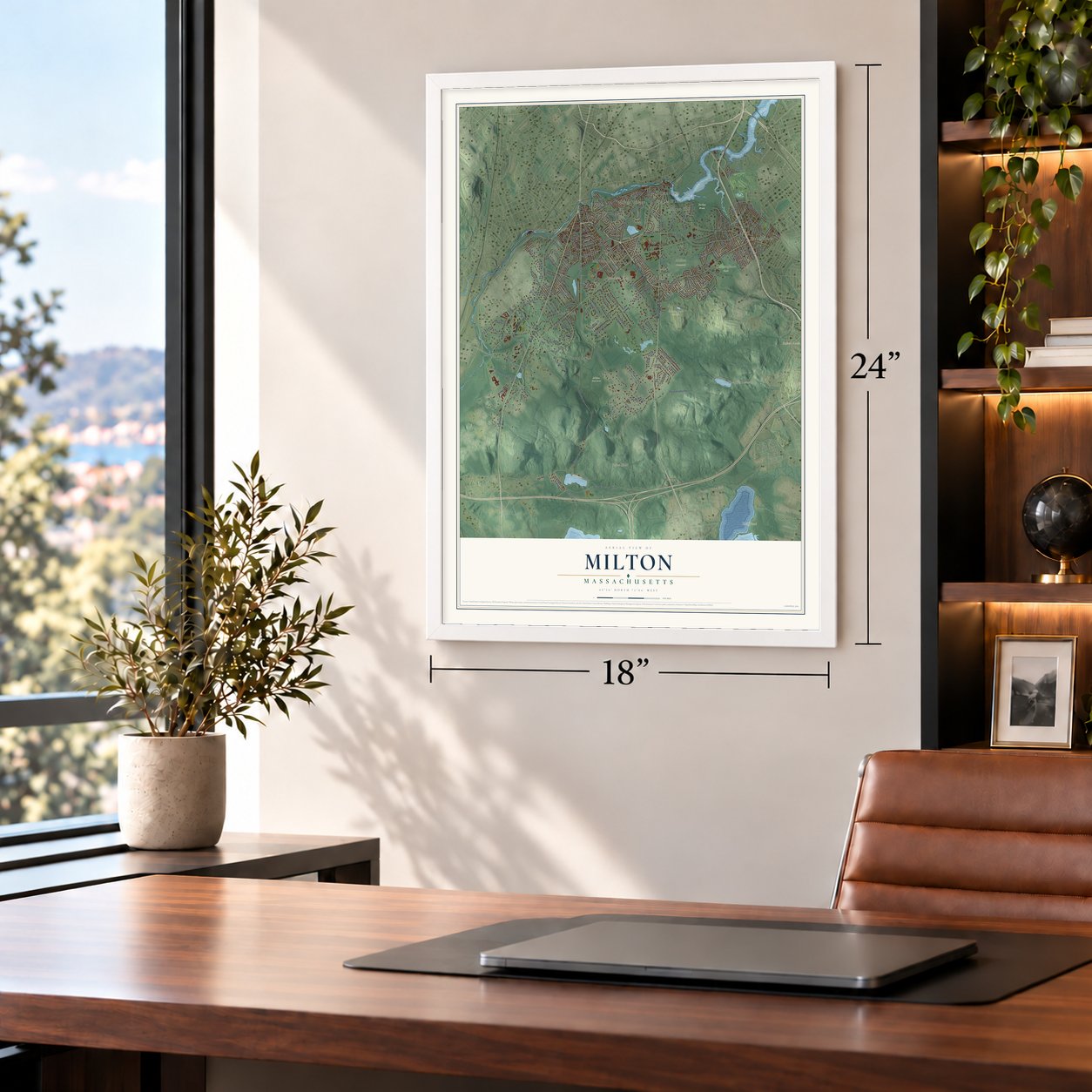
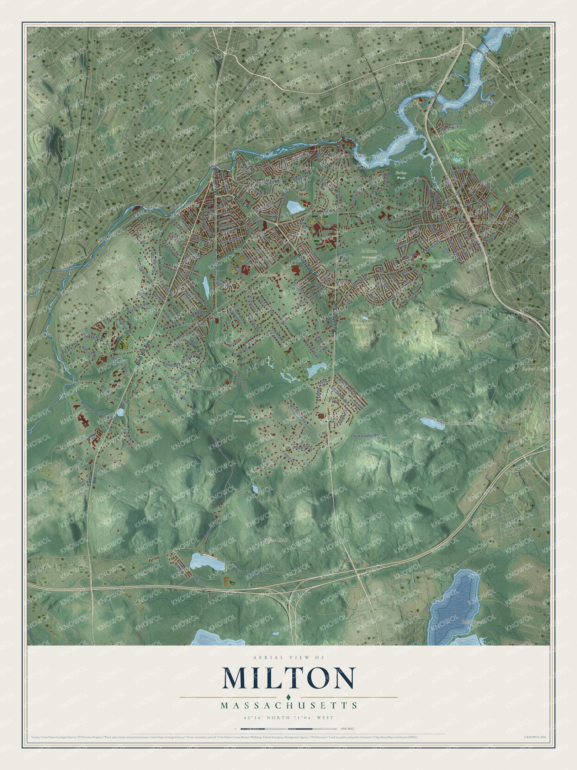
Building by building, with labeled streets and shaded relief.
12" x 18" Archival Matte Print
A Map of Home. A Work of Art.
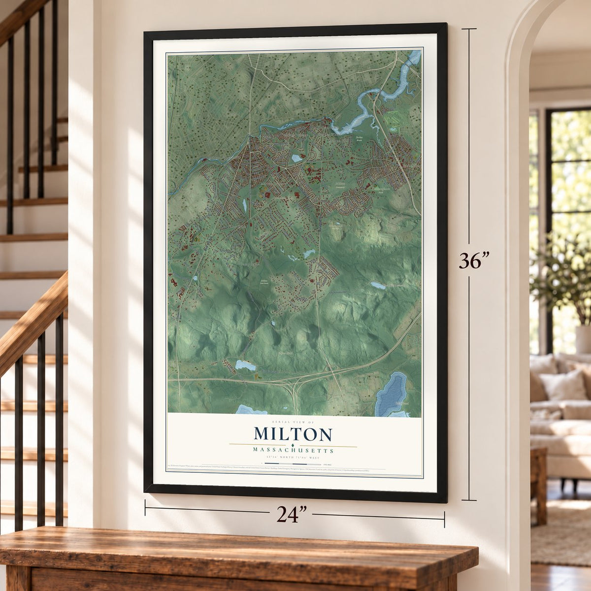
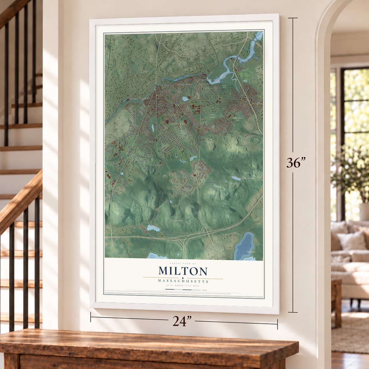
Explore Milton, Massachusetts from a whole new perspective. Created using aerial imagery and detailed geographic data, this map captures Milton building by building, with labeled streets, familiar landmarks, and shaded topographical relief that highlights the natural contours of the landscape.
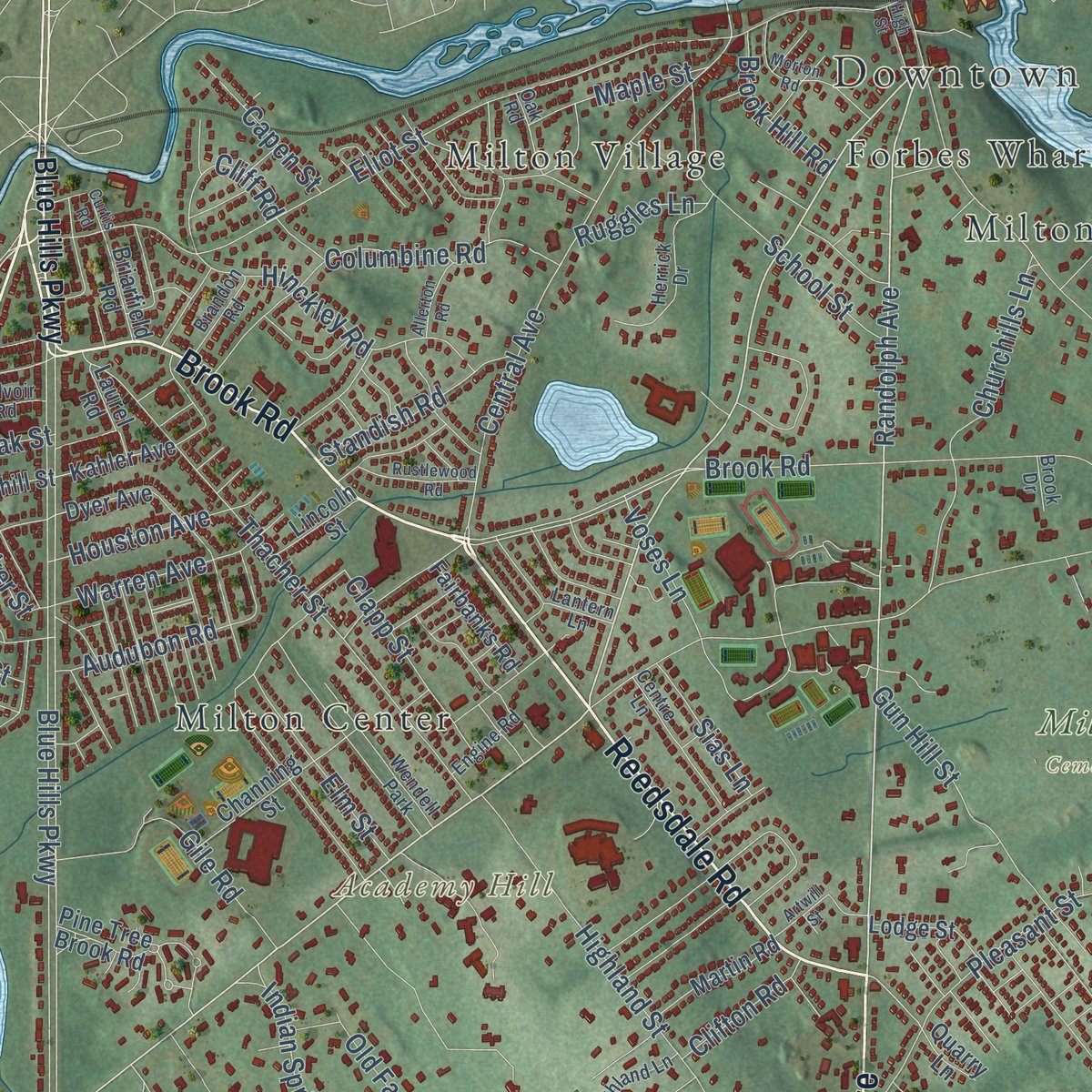
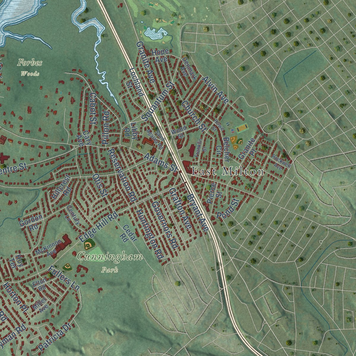
Combining modern data with the timeless character of a vintage atlas, this map is just as interesting up close as it is beautiful on the wall. Whether you grew up in Milton, spent memorable years there, or call it home today, this unique map is a great way to celebrate a place that means something to you. Zoom in on the preview to look for your street, and then order a print to put your memories on the wall.
Three ways to hang it
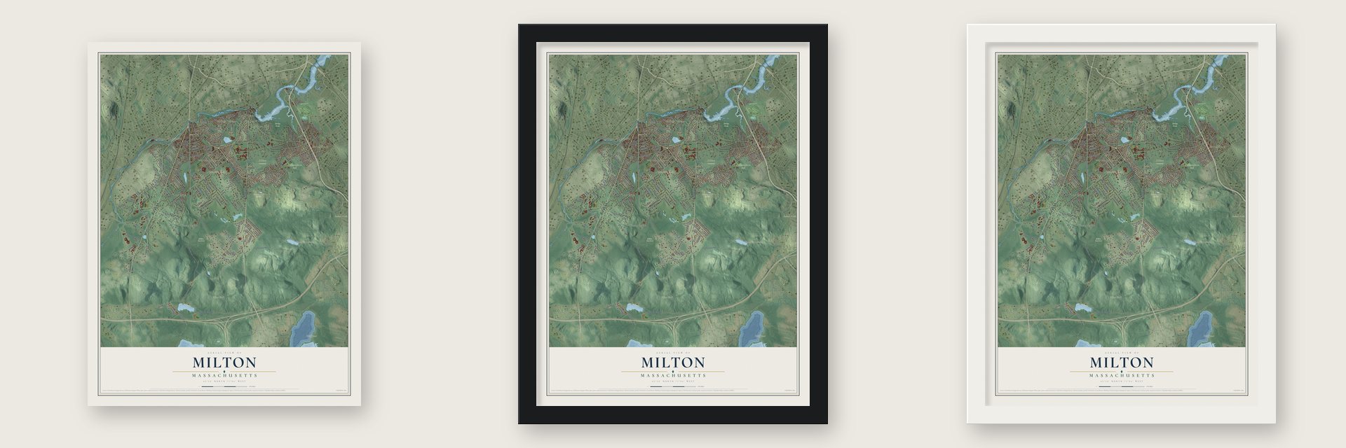
Unframed archival matte, a black wood frame or a white wood frame.
Up close
Geography Worth Displaying
This map was created using accurate cartographic data and authoritative geographic sources, including the U.S. Geological Survey (USGS) and FEMA. The map brings together terrain, waterways, roads, and building detail. The majority of the streets are labeled, houses are accurately depicted, and the topography is derived from government sources. Combining local data with carefully composed color and shading leads to this beautifully detailed Milton artwork for your wall.
Rather than simply showing street outlines, we’ve included as many of the street names as we could reasonably fit on the map while keeping their names legible. Zoom in on the high resolution preview to see exactly what’s on the map. We truly set out to create a statement piece for anyone who loves Milton. So whether it’s for you, or a gift for someone you love, we hope this map of Milton brings back fond memories.
Explore the full map of Milton, Massachusetts and read about the local places it shows.

Find your street
Names on the Milton map
Every name below is printed on this map. Look for your street, your school, the park where you played, or the pond down the road.
Places and landmarks20
- Downtown
- East Milton
- Academy Hill
- Babel Rock
- Boyce Hill
- Blue Hills Reservoir
- Great Pond
- Cunningham Park
- Forbes Woods
- Granite Links Golf Club
- Milton Cemetery
- Milton Town Forest
Show all 20 places
- Blue Hills
- Milton Upper Mills
- Camp Sayre
- Milton Center
- Forbes Wharf
- Milton Hill
- Milton Village
- Wendell Park
Streets and roads188
- Blue Hill Avenue
- Reedsdale Road
- Brook Road
- Randolph Avenue
- Canton Avenue
- Brush Hill Road
- Granite Avenue
- Bryant Avenue
- Central Avenue
- Blue Hills Parkway
- Ridgewood Road
- Milton Street
- Hillside Street
- Unquity Road
- Adams Street
- Harland Street
- Pleasant Street
- Chickataubut Road
- Atherton Street
- Eliot Street
- Centre Street
- Blue Hill River Road
- Edge Hill Road
- Highland Street
- Thacher Street
- Lyman Road
- Squantum Street
- Robbins Street
- Old Farm Road
- Woodland Road
Show all 188 streets
- Hinckley Road
- Churchills Lane
- Governors Road
- Neponset Valley Parkway
- Church Street
- School Street
- Whittier Road
- Loew Circle
- Columbine Road
- Dudley Lane
- Gerald Road
- Gile Road
- Sassamon Avenue
- Bradlee Road
- Indian Spring Road
- Gun Hill Street
- Woodside Drive
- Sumner Street
- Craig Street
- Ferncroft Road
- Truro Lane
- Audubon Road
- Cabot Street
- Warren Avenue
- Fullers Lane
- Cliff Road
- Countryside Lane
- Blue Jay Way
- Alfred Road
- Otis Street
- Elm Street
- Clapp Street
- Woodlot Drive
- Houston Avenue
- Valentine Road
- Huntington Road
- Alvin Avenue
- Wolcott Road
- Ford Ranch Road
- Smith Road
- Reservation Road
- Parkwood Drive
- Maple Street
- Decker Street
- Standish Road
- Amor Road
- Capen Street
- Hallen Avenue
- Forest Street
- Brook Hill Road
- Oak Street
- Patricia Drive
- Grafton Avenue
- Sias Lane
- Crestview Road
- Cushing Road
- Voses Lane
- Mark Lane
- Clifton Road
- Hudson Street
- Cheever Street
- Big Blue Drive
- Ruggles Lane
- Pillon Road
- Sears Road
- Horton Place
- Cheryl Drive
- Pond Street
- Rose Street
- Truman Parkway
- Kahler Avenue
- Caroline Drive
- Governor Stoughton Lane
- Forbes Road
- Cedar Road
- Stone Bridge Lane
- Cary Avenue
- Dyer Avenue
- Granite Place
- Channing Street
- Metropolitan Avenue
- Carberry Lane
- Ponkapoag Trail
- Martin Road
- Heather Drive
- Dean Road
- Longmeadow Road
- Fairbanks Road
- Silver Brook Road
- Belcher Circle
- Lodge Street
- Trout Brook Avenue
- Churchill Street
- Riverside Avenue
- Barbara Lane
- Vose Hill Road
- Briarfield Road
- Pierce Street
- Lochland Street
- Mingo Street
- Hope Avenue
- Hillcrest Road
- Hoy Terrace
- Dexter Street
- Lincoln Street
- Laurel Road
- Pope Hill Road
- Pine Tree Brook Road
- Brush Hill Lane
- Thistle Avenue
- Libby Road
- Quarry Lane
- Gordon Road
- Fox Hill Lane
- Dana Avenue
- Elias Lane
- Nahanton Avenue
- Hilltop Street
- Hollingsworth Road
- Wood Street
- Herrick Drive
- Centre Lane
- Margaret Road
- Meadowview Road
- Aberdeen Road
- Highland Lane
- Century Lane
- Brandon Road
- McKinnon Avenue
- Elton Road
- Engine Road
- Oak Road
- Belvoir Road
- Denmark Avenue
- Miller Avenue
- Lantern Lane
- Surrey Lane
- Eager Road
- Corey Lane
- Brook Drive
- Dollar Lane
- Susi Lane
- Franklin Street
- Allerton Road
- Morton Road
- Saint Agatha Road
- Howe Street
- Badger Circle
- Rustlewood Road
- Artwill Street
- Meeting House Lane
- Green Street
- Adanac Road
- Stonehill Lane
- Curtis Road
- Preacher Road
- High Street
- Rockwell Avenue
Names are listed as they appear on the printed map. Zoom into the product photos to find them.
About Milton, Massachusetts
Milton is a town of 28,630 people in Norfolk County, on hilly land that stretches from the Neponset River to the Blue Hills. The Neponset people of the Massachusett called it Unquatiquisset, or Lower Falls, for the rapids where the river reaches Massachusetts Bay. In 1636 the land was granted to Dorchester, which also paid its Native owners twenty-eight fathoms of wampum for it. In 1662 the Dorchester land south of the Neponset became a separate town, named for Milton Abbey in Dorset, England.
The falls turned Milton into a mill town. A powder mill opened on the river in 1674 and ran until it blew up in 1744, and in 1729 Daniel Henchman started New England's first paper mill on the Neponset. Paper-makers were so scarce during the Revolution that in 1775 the Provincial Congress let four soldiers work at the Milton mill. In 1801 Josiah Bent began baking water crackers in a single oven at his Highland Street house. The business went on to supply hardtack to soldiers in the Civil War, and the wooden factory built by his grandson George H. Bent joined the National Register in 2000.
“In the autumn of 1634 the waters of the Neponset turned the first wheel ever set up on its shores, and ground the first corn ever ground by water power in New England.”
- The governor's hillGovernor Thomas Hutchinson's country house stood on Milton Hill. On December 16, 1773, Boston sent the tea ship Dartmouth's owner, Francis Rotch, out to the governor to ask for a pass. Rotch came back refused at about six o'clock, and the tea party took place that evening. Hutchinson left for England on June 1, 1774, after walking down to the Lower Mills.
- The Suffolk Resolves, 1774That September the Suffolk Resolves were passed in Milton, and the men who drafted the Declaration of Independence later took them as a model. Captain Daniel Vose's house has long been called the place where it happened, though townspeople still argue the point, and tree rings date the house's oldest section to about 1763. The house faced demolition in 1950, so it was carried from Adams Street to Canton Avenue. It is now the Milton Historical Society's headquarters.
- Vaccinated in one summerMilton decided in the summer of 1809 to protect every resident from smallpox. Dr. Amos Holbrook offered cowpox to anyone for twenty-five cents, and from July 20 people lined up at the Milton Hill school house, in the Scotch Woods and on Brush Hill. Within days 337 had been vaccinated, over a quarter of the town. In October twelve children were exposed to true smallpox, and on October 25 all went home well.
- Bass-viols and pianosIn 1798 Benjamin Crehore was building stage machinery for Boston's Federal Street Theatre when he repaired the orchestra's broken bass-viol. He then started building bass-viols himself, which the 1887 town history calls the first made in the country. By that same account, he made the nation's first piano in his Milton shop in 1800. Years later a Milton deacon in Thomaston, Maine, found a church bass-viol with a paper inside: Ben. Crehore, Maker, Milton.
- The Granite Railway, 1826On October 7, 1826, the first train ran over the Granite Railway. It hauled Quincy granite to a wharf on the Neponset, where boats took the stone on toward Charlestown for the Bunker Hill Monument. East Milton Square grew up as the Railway Village, where workers dressed the granite in four sheds. A switch frog and a piece of track from the line, shown at the Chicago World's Fair in 1893, now sit in the gardens above the Southeast Expressway.
Keep exploring Massachusetts
Milton is one of 461 Massachusetts towns we've mapped. Every dot on the map is a print of its own.
The search covers every state, Massachusetts first.
Near Milton
Order 2 or more town maps and save 10%. Shown in the size and finish you picked above, so they hang as a set.
- Hyde Park 12" x 18" / Archival Matte Print $39.99
- Mattapan 12" x 18" / Archival Matte Print $39.99
- Roslindale 12" x 18" / Archival Matte Print $39.99


More maps nearby: Quincy, Dorchester, West Roxbury, Braintree and Jamaica Plain.
The art of mapping a place
How This Map Was Made
Real places. Remarkable detail. Discover the layers that turn geographic data into a map of home.

The view from above
Aerial imagery reveals the character of the land: woodland, open fields, and the patterns of a place.

The shape of the land
Elevation data brings hills, valleys, and subtle changes in the landscape into view.

The details of home
Roads, waterways, and building footprints come together to make the map feel unmistakably local.

Geography becomes art
Considered color, shading, and typography bring the layers together in a map made for your wall.


Process illustrated with Mendon, Massachusetts. Aerial imagery: USDA NAIP. Terrain: USGS 3D Elevation Program. Map details and finished artwork: KNOWOL.
The Details
About This Print
Choose an archival matte print, or a black or white Ayous wood frame. The archival matte print is unframed.
Select your size and finish above to see the matching product image and price.
Materials & Craftsmanship
A contemporary map with the character of a classic atlas, printed on archival matte paper. Optional frames are made from Ayous wood.
Your printed map does not include the watermark shown in the full-map preview.
Shipping & Delivery
Free shipping within the United States. Every print is made to order in the USA.
Buying a gift? Add a note in your cart and we'll include it. We never put prices in the package.
Prints ship within 2 to 3 business days. Allow 7 to 10 days total from ordering for delivery. Timing may vary during holidays or periods of high order volume.
Read our shipping policy.
Returns and damaged prints
Each print is made to order. Change-of-mind refunds are not available after production.
If your print arrives damaged, misprinted or incorrect, contact support@knowol.com within 30 days of receiving it. Include your order number, photos and a description of the issue.
Read our full refund and replacement policy. For questions about your order, email support@knowol.com.