


Search for another town





Free U.S. delivery 7 to 10 days after you order
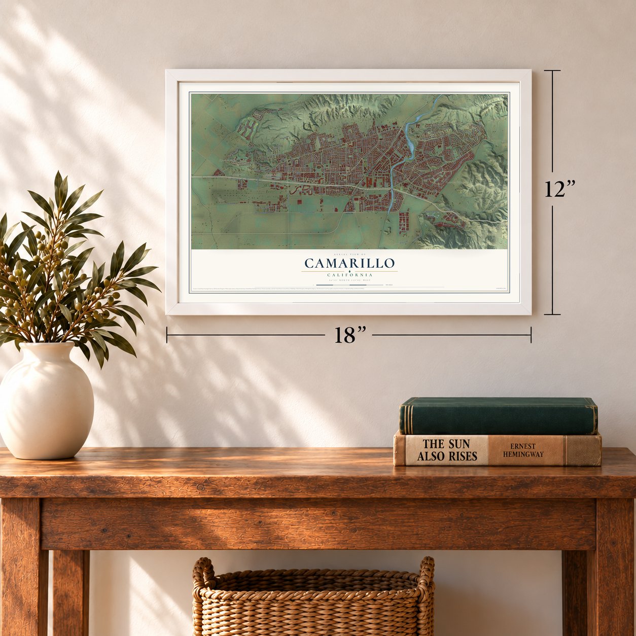
Camarillo, California Map Art
Building by building, with labeled streets and shaded relief.
12" x 18" Archival Matte Print
A Map of Home. A Work of Art.
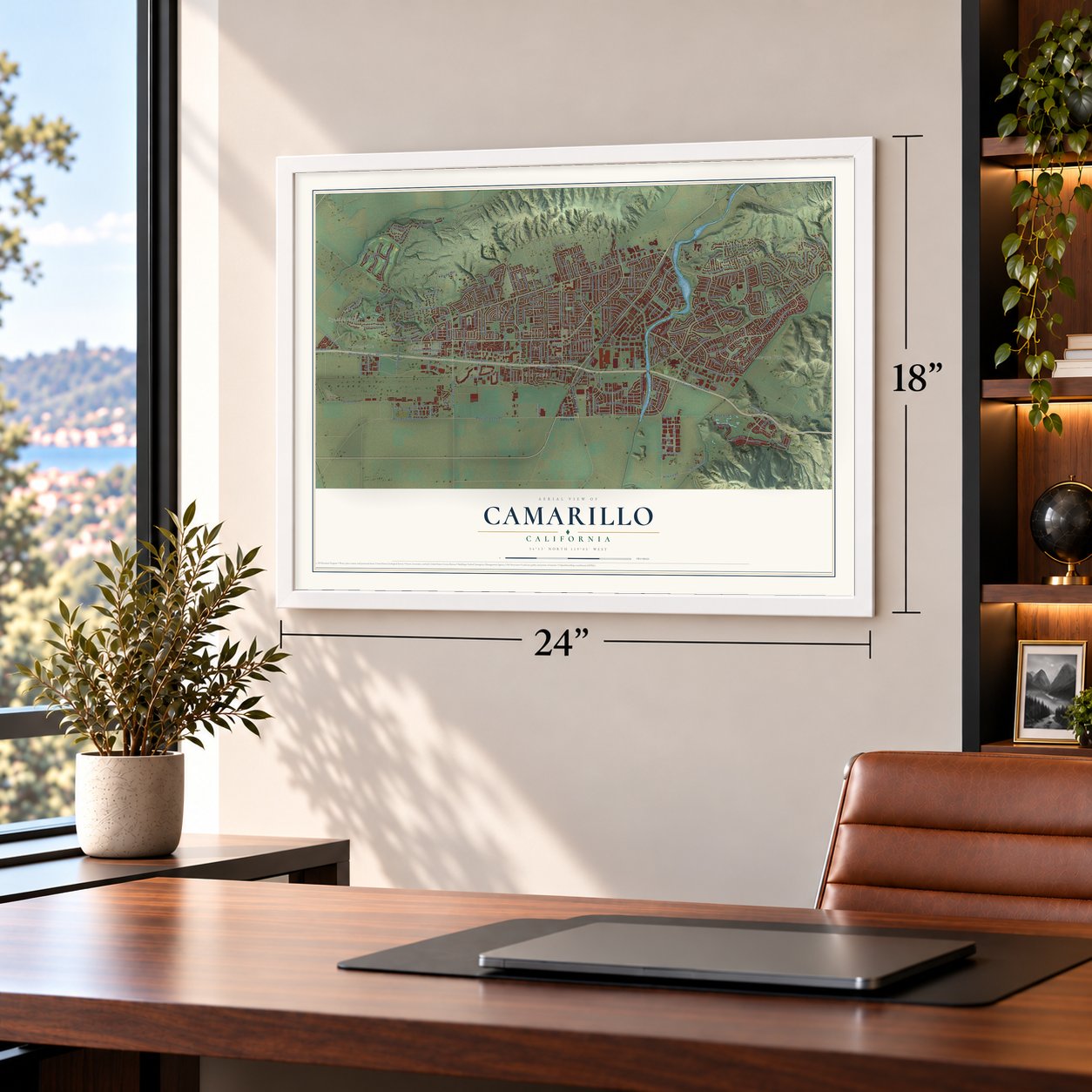
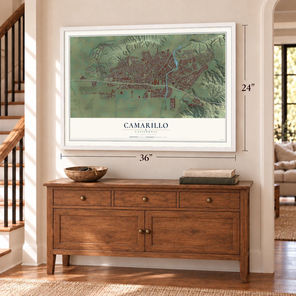
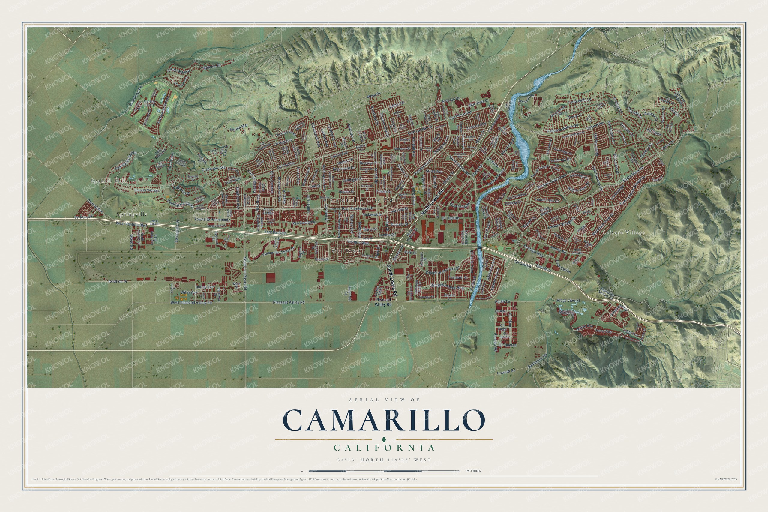
Explore Camarillo, California from a whole new perspective. Created using aerial imagery and detailed geographic data, this map captures Camarillo building by building, with labeled streets, familiar landmarks, and shaded topographical relief that highlights the natural contours of the landscape.
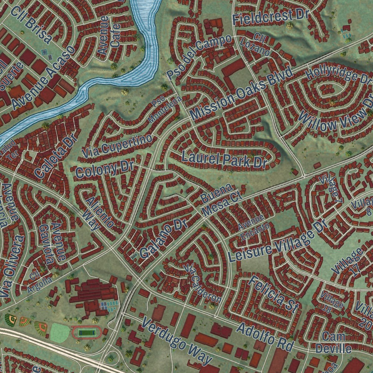
Combining modern data with the timeless character of a vintage atlas, this map is just as interesting up close as it is beautiful on the wall. Whether you grew up in Camarillo, spent memorable years there, or call it home today, this unique map is a great way to celebrate a place that means something to you. Zoom in on the preview to look for your street, and then order a print to put your memories on the wall.
Three ways to hang it
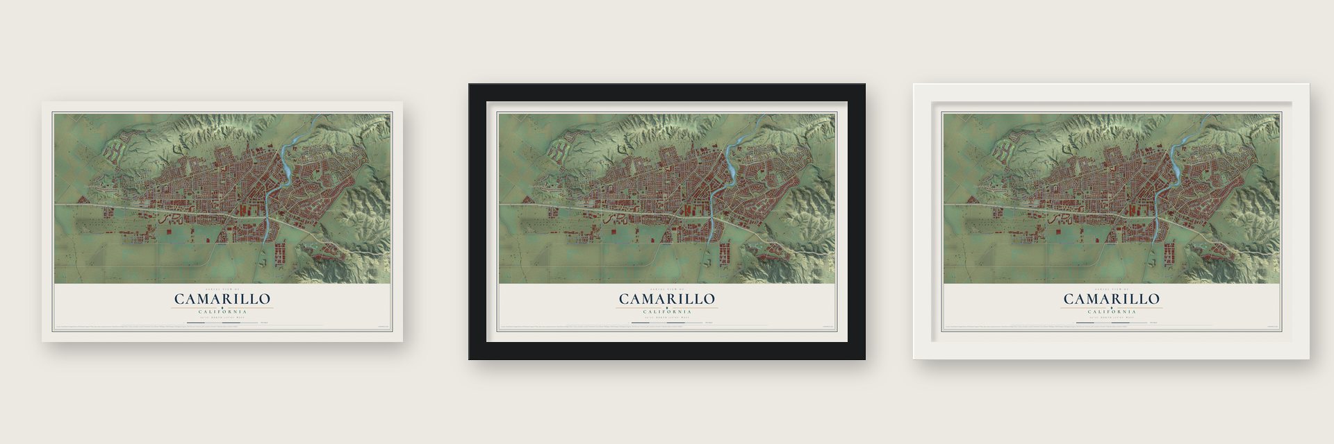
Unframed archival matte, a black wood frame or a white wood frame.
Up close
Geography Worth Displaying
This map was created using accurate cartographic data and authoritative geographic sources, including the U.S. Geological Survey and the Census Bureau. The map brings together terrain, waterways, roads, and building detail. The majority of the streets are labeled, houses are accurately depicted, and the topography is derived from government sources. Combining local data with carefully composed color and shading leads to this beautifully detailed Camarillo artwork for your wall.
Rather than simply showing street outlines, we’ve included as many of the street names as we could reasonably fit on the map while keeping their names legible. Zoom in on the high resolution preview to see exactly what’s on the map. We truly set out to create a statement piece for anyone who loves Camarillo. So whether it’s for you, or a gift for someone you love, we hope this map of Camarillo brings back fond memories.
Read the story behind this map of Camarillo, California from 2026.

Find your street
Names on the Camarillo map
Every name below is printed on this map. Look for your street, your school, the park where you played, or the pond down the road.
Places and landmarks5
- Camarillo City Hall
- Leisure Village
- Springville
- Spanish Hills
- Old Town
Streets and roads309
- South Lewis Road
- North Lewis Road
- Pleasant Valley Road
- Cll la Cumbre
- Anacapa Drive
- Cam la Madera
- Carmen Drive
- Ponderosa Drive
- Cll Higuera
- East Ponderosa Drive
- Aviation Drive
- West Ventura Boulevard
- Upland Road
- Leisure Village Drive
- Cam Tierra Santa
- Euclid Avenue
- Las Posas Road
- Ventura Boulevard
- Ridge View Street
- West Pleasant Valley Road
- Santa Rosa Road
- Mission Oaks Boulevard
- Adolfo Road
- Temple Avenue
- Arneill Road
- East Daily Drive
- East Leisure Village Drive
- Crestview Avenue
- Mountain View Drive
- Flynn Road
Show all 309 streets
- South Las Posas Road
- Irena Avenue
- Avenue Acaso
- Avenue de Aprisa
- Pancho Road
- Mobil Avenue
- Adohr Lane
- Antonio Drive
- Beardsley Road
- Village at the Park Drive
- Dunnigan Street
- Rosewood Avenue
- Cam Ruiz
- Lantana Street
- Old Ranch Road
- Pso Camarillo
- Dawson Drive
- Camarillo Center Drive
- Avenue de Autlan
- Armitos Drive
- Bridgehampton Way
- Verdugo Way
- Cll Brisa
- Terra Bella Lane
- Oak Cannon Road
- Fieldcrest Drive
- Cervato Drive
- North Adolfo Road
- East Landen Street
- Quito Court
- Loma Drive
- San Onofre Drive
- Via Montanez
- Willis Avenue
- Cll Portilla
- Barry Street
- Cll de Debesa
- Margarita
- Dara Street
- Via Latina Drive
- Mar Vista Drive
- Gracia Street
- Calarosa Ranch Road
- Lyndhurst Avenue
- Marco Drive
- Rocklyn Street
- Appletree Avenue
- Colony Drive
- Bradford Avenue
- Via Rosal
- Durley Avenue
- Townsite Promenade
- Skeel Drive
- Pso Noche
- Glenbrook Avenue
- Eston Street
- Cll Dia
- Willow View Drive
- Kendall Avenue
- Springville Drive
- Coe Street
- Dewayne Avenue
- Sanitation Road
- Edgemont Drive
- Jose Avenue
- Cll Plano
- Charter Oak Drive
- Via Pescador
- Cll de la Rosa
- Central Avenue
- Howard Road
- Hobart Drive
- Stacy Lane
- Cam Carillo
- Ramona Drive
- Cll Tecate
- Fulton Street
- Laurel Park Drive
- Cll Cuesta
- Aviano Drive
- Caleta Drive
- Hartnell Street
- Pickwick Drive
- Stiles Avenue
- La Marina Drive
- Galano Drive
- Murray Avenue
- Alta Vista Place
- Cll la Roda
- Wood Road
- Japonica Avenue
- Brookhill Drive
- Vis del Mar
- Fortuna Avenue
- Solano Drive
- Dumetz Street
- Fiesta Drive
- Pueblo Vis
- Cll Quetzal
- Cll Bodega
- Fountain Street
- Lathan Avenue
- Lada Avenue
- Via Olivera
- Lomita Street
- Isabel Avenue
- Harris Avenue
- Petit Street
- Felicia Street
- Amber Drive
- Saturn Street
- Cll Tania
- Mesa Drive
- Palm Drive
- Green Lawn Avenue
- Sevilla Street
- Euclid Circle
- West Loop Drive
- Cam Deville
- Seminary Road
- Village 17
- Westpark Court
- Woodcreek Road
- Camarillo Springs Road
- Summerfield Street
- Calle Tierra Vis
- North Brently Avenue
- Village 20
- Diamond Drive
- Via Alondra
- Mission Drive
- Valley Vista Drive
- Via Aracena
- Santo Domingo
- Cam Las Ramblas
- Via Cupertino
- North Agusta Avenue
- Durkin Street
- Sterling Hills Drive
- Hillridge Drive
- Vis Alcedo
- Munson Street
- Los Coyotes Place
- Avenue Magdalena
- Commons Park Drive
- Avenue Valencia
- Del Norte Road
- Camarillo Ranch Road
- Ciprian Avenue
- Corte la Cienega
- Cll Converse
- Hollyridge Drive
- Cerro Vista Way
- Vis Coto Verde
- Avocado Place
- Quailridge Drive
- San Ysidro Street
- Pso del Campo
- Cll Alto
- Stearman Street
- Overland Road
- North Dawson Drive
- Cam Esplendido
- Cam Avellana
- Hughes Drive
- Baywood Avenue
- Fallen Leaf Avenue
- North Aviador Street
- Avenue Cafe
- Calaveras Drive
- Cll Larios
- Bajo Aqua Avenue
- Cll Suerte
- Aliento Way
- Waverly Avenue
- Lucero Street
- Granada Street
- Flora Vista Avenue
- Cll San Pablo
- Arroyo del Mar
- East Loop Drive
- Southfield Road
- Canopy Drive
- Hayden Street
- Beverly Drive
- Via Secoya
- Corte Corrida
- Kelley Avenue
- Via la Silva
- Cll Carga
- Cll Bolero
- Gazebo Lane
- Cll la Palmera
- Gorman Street
- Itamo Street
- Aloha Street
- Avenue Gaviota
- Abbott Avenue
- Cll el Halcon
- Sereno Place
- Roman Avenue
- Buena Mesa Court
- Frazier Street
- Via Dulce
- Main Street
- Village 7
- Village 42
- West Daily Drive
- Walker Avenue
- Corby Avenue
- Cll de Marejada
- Corte Estrella
- La Ramada Drive
- Stage Trail Road
- Factory Stores Drive
- Via Calderon
- Burnley Street
- Daily Drive
- Cll Lozano
- San Rafael Way
- Almendro Way
- North Modesto Avenue
- Bordeaux Avenue
- Sweetwater Avenue
- Constitution Avenue
- Cam Alvarez
- Cll Escalon
- Golf Villa Way
- Belden Avenue
- Balboa Circle
- Stone Meadow Drive
- Cabrillo Mesa Court
- Via Terrado
- Cam Toluca
- Farnworth Street
- Via Corza
- Cielo Vista Court
- Jeffrey Road
- Old Somis Road
- Benito Drive
- Patina Court
- Francis Avenue
- Corte Regalo
- Valle Lindo Drive
- Convair Street
- Village 8
- Berwick Street
- Pso del Valle
- Palmer Avenue
- North Ponderosa Drive
- Village 44
- Town Center East
- Germain Street
- Avenue del Manzano
- Grandview Drive
- Brookhaven Avenue
- Pso Montelena
- San Como Lane
- Nordman Drive
- Village 11
- Cam Vera Cruz
- Village 18
- Avenue Encanto
- Encino Avenue
- Deerhurst Avenue
- Cll Argolla
- Shoreline Street
- Harvest Lane
- Spring Oak Road
- Mike Loza Drive
- Houck Street
- Paquita Street
- Rivermore Street
- Cmt Luisa
- Sierra Madre Drive
- Via Alba
- Baja Court
- Shasta Place
- Talud Terrace
Names are listed as they appear on the printed map. Zoom into the product photos to find them.
About Camarillo, California
Camarillo is a city of 70,741 people in Ventura County. It lies in Pleasant Valley, where the Oxnard Plain ends on the east. The Chumash lived here for thousands of years before Europeans came. Adolfo and Juan, his sons, built the land into a ranch, and the town now carries their name.
The first town site was laid out around 1910, with St. Mary Magdalen Church, Adolfo's family chapel, at its center. Growth stayed slow, and in the late 1940s a lot on Ventura Boulevard sold for $450, with few takers. City leaders convinced Caltrans to build the Ventura Freeway beside Ventura Boulevard instead of along Potrero Road, and it opened in the mid-1950s. The trip to Los Angeles now took about an hour, and the town boomed. By 1962 it had 7,500 people, and 3M began building a plant that would employ 900. Camarillo became a city in 1964 so it could control that growth.
- St. John's SeminaryIn 1927 Juan Camarillo gave 100 acres for a Catholic seminary honoring Saint John the Evangelist. St. John's Seminary opened there in 1939.
- Relaxin' at CamarilloCamarillo State Mental Hospital opened near the city in the 1930s. Patients came to recover from mental illness or tuberculosis in the mild climate. Charlie Parker wrote "Relaxin' at Camarillo" while he was recovering there from heroin addiction. The hospital closed in the 1990s, and in August 2002 California State University Channel Islands opened on the site. The university kept the hospital's Mission Revival bell tower.
- From air base to airportOxnard Army Air Field was built west of town during World War II and closed when the war ended. During the Korean War it reopened in 1951 as Oxnard Air Force Base, a fighter-interceptor base. It closed again in 1970 and became Camarillo Airport.
- A Christmas parade since 1962The Pleasant Valley Recreation and Park District has run the Camarillo Christmas Parade every December since 1962. Hundreds of groups march in it, and past grand marshals include the actor Walter Brennan and the softball star Jessica Mendoza.
Keep exploring California
Camarillo is one of 1,990 California towns we've mapped. Every dot on the map is a print of its own.
The search covers every state, California first.
Near Camarillo
Order 2 or more town maps and save 10%. Shown in the size and finish you picked above, so they hang as a set.
- Somis 12" x 18" / Archival Matte Print $39.99
- Casa Conejo 12" x 18" / Archival Matte Print $39.99
- El Rio 12" x 18" / Archival Matte Print $39.99


More maps nearby: Saticoy, Santa Rosa Valley, Thousand Oaks, Santa Paula and Moorpark.
The art of mapping a place
How This Map Was Made
Real places. Remarkable detail. Discover the layers that turn geographic data into a map of home.

The view from above
Aerial imagery reveals the character of the land: woodland, open fields, and the patterns of a place.

The shape of the land
Elevation data brings hills, valleys, and subtle changes in the landscape into view.

The details of home
Roads, waterways, and building footprints come together to make the map feel unmistakably local.

Geography becomes art
Considered color, shading, and typography bring the layers together in a map made for your wall.


Process illustrated with Mendon, Massachusetts. Aerial imagery: USDA NAIP. Terrain: USGS 3D Elevation Program. Map details and finished artwork: KNOWOL.
The Details
About This Print
Choose an archival matte print, or a black or white Ayous wood frame. The archival matte print is unframed.
Select your size and finish above to see the matching product image and price.
Materials & Craftsmanship
A contemporary map with the character of a classic atlas, printed on archival matte paper. Optional frames are made from Ayous wood.
Your printed map does not include the watermark shown in the full-map preview.
Shipping & Delivery
Free shipping within the United States. Every print is made to order in the USA.
Buying a gift? Add a note in your cart and we'll include it. We never put prices in the package.
Prints ship within 2 to 3 business days. Allow 7 to 10 days total from ordering for delivery. Timing may vary during holidays or periods of high order volume.
Read our shipping policy.
Returns and damaged prints
Each print is made to order. Change-of-mind refunds are not available after production.
If your print arrives damaged, misprinted or incorrect, contact support@knowol.com within 30 days of receiving it. Include your order number, photos and a description of the issue.
Read our full refund and replacement policy. For questions about your order, email support@knowol.com.