
Search for another town


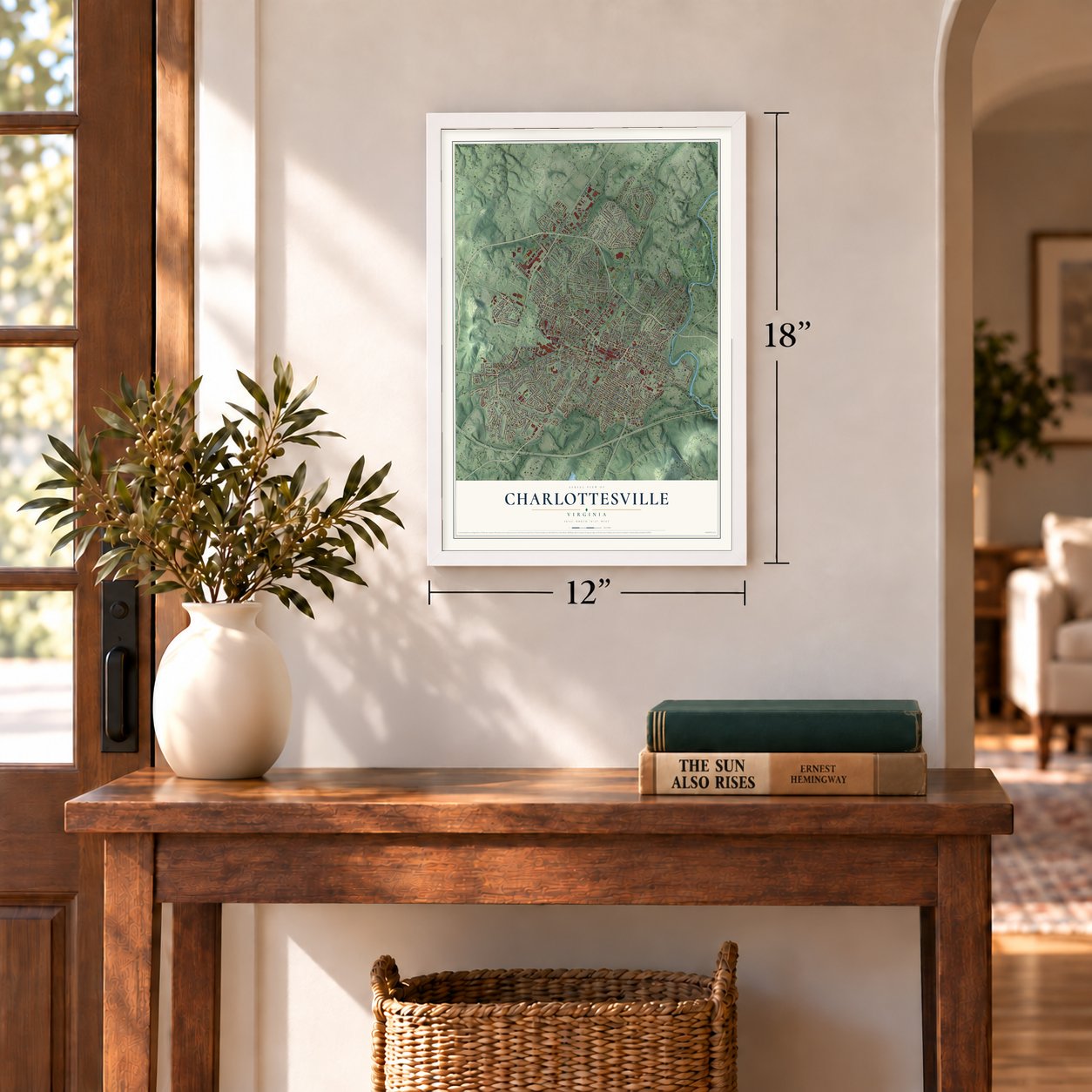

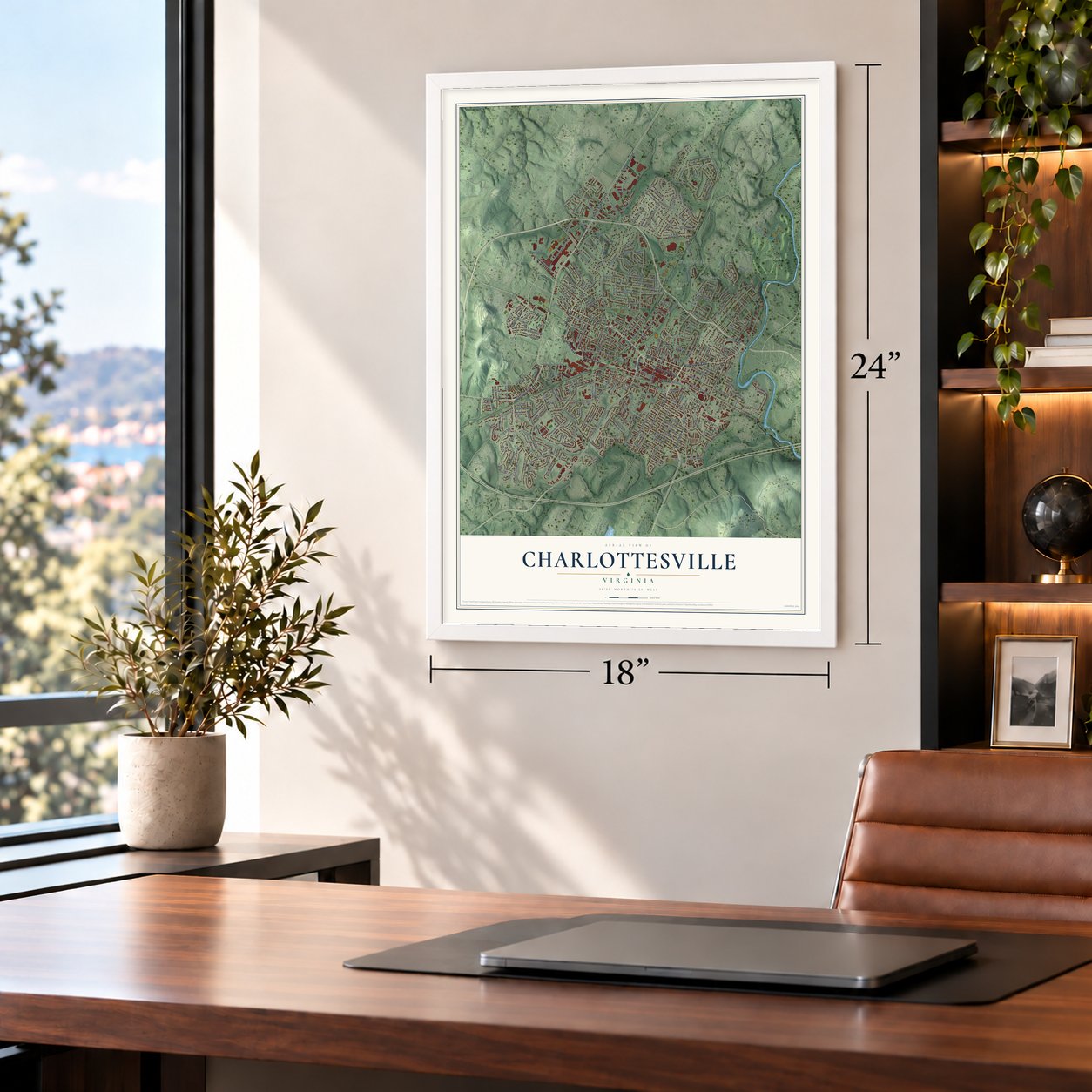

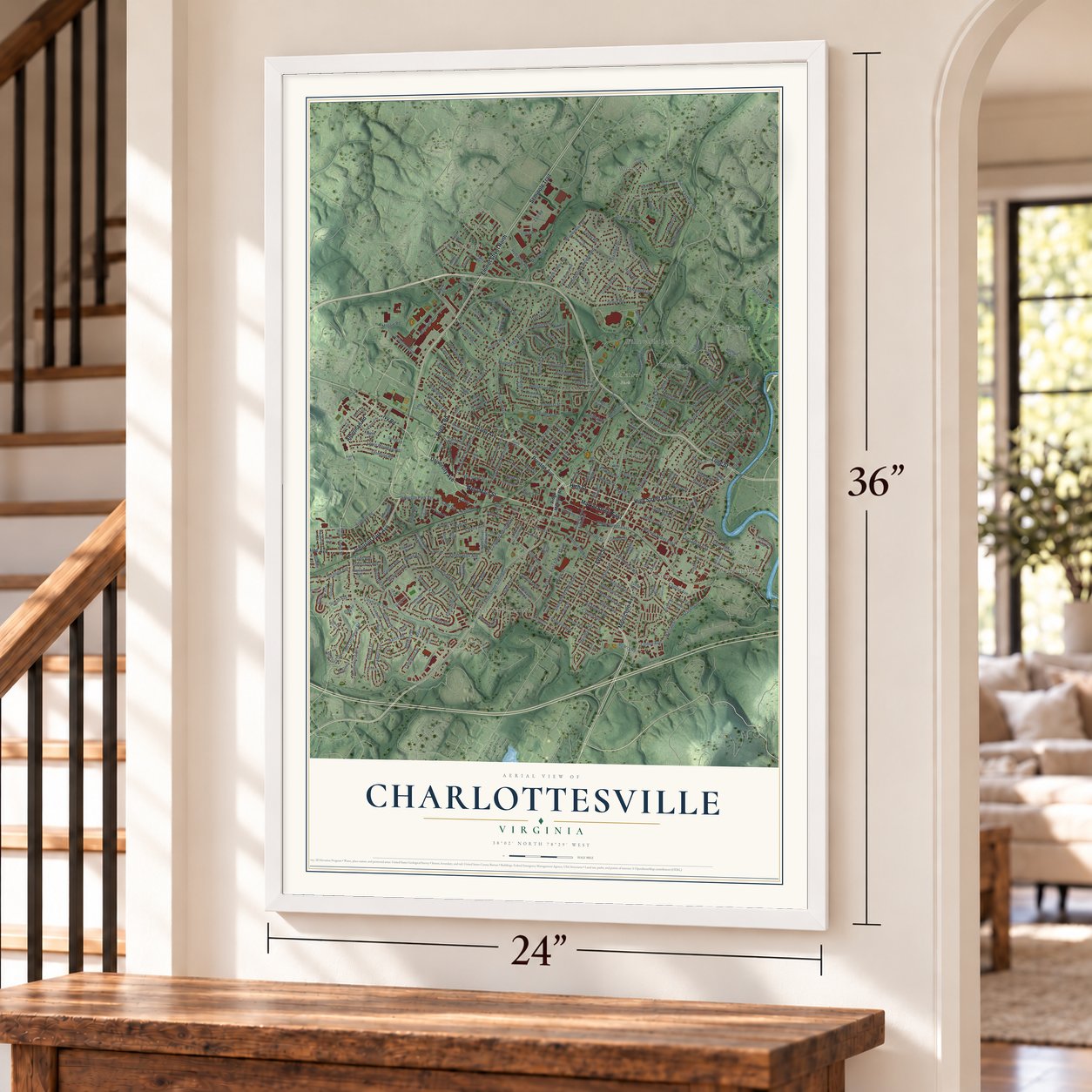

Free U.S. delivery 7 to 10 days after you order
Charlottesville, Virginia Map Art
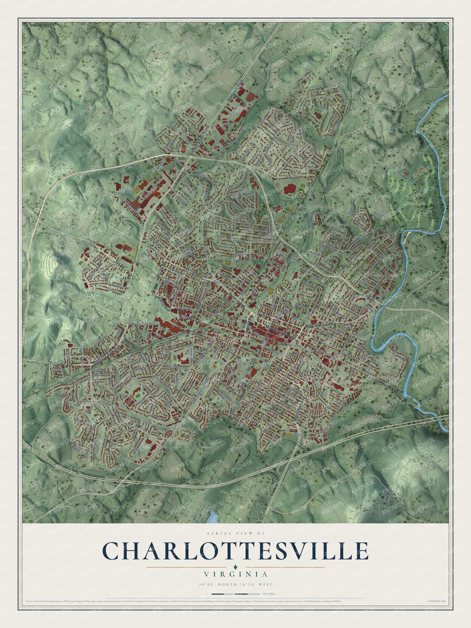
A new map of Charlottesville, Virginia, made in 2026 and printed to order on thick archival matte paper.
12" x 18" Archival Matte Print
A Map of Home. A Work of Art.
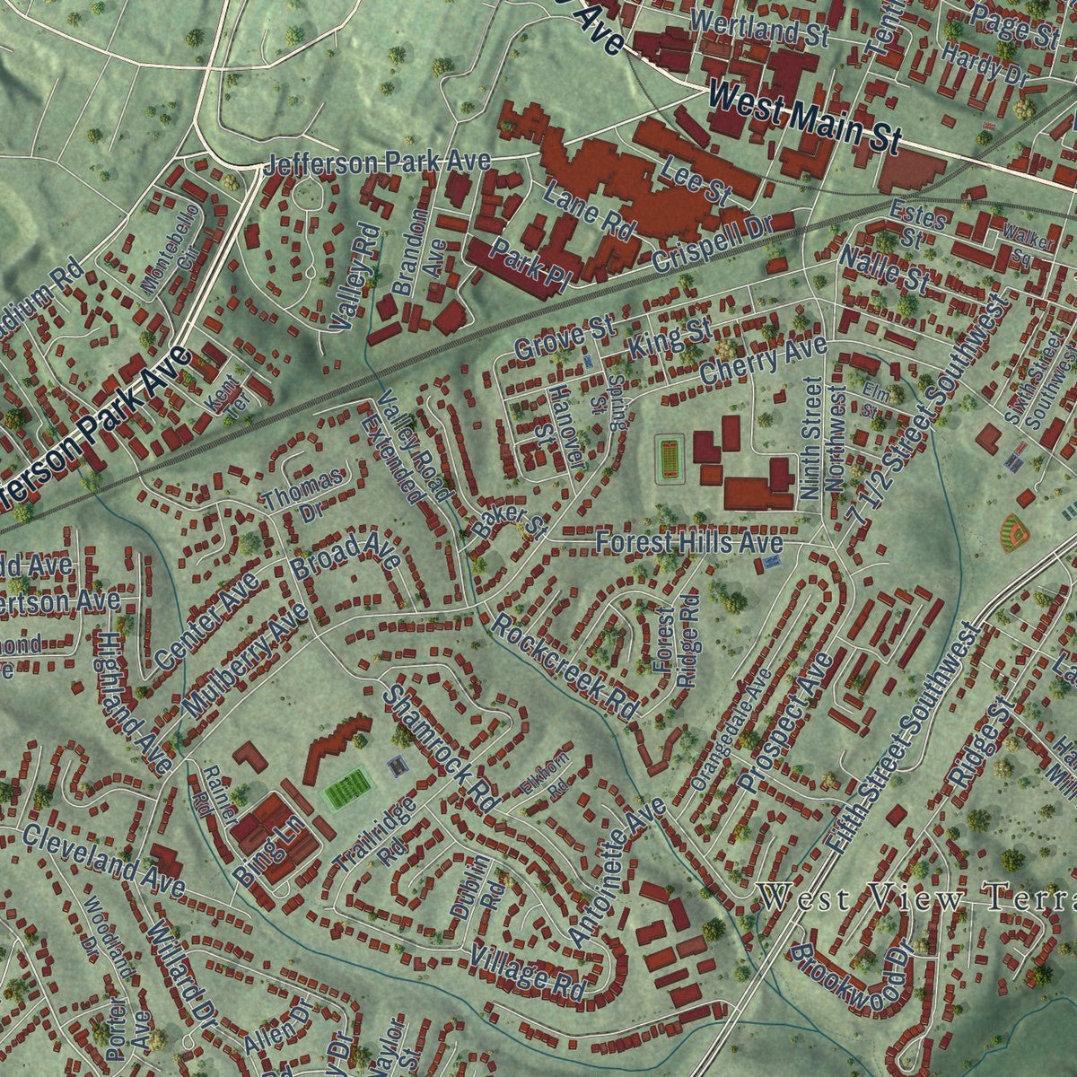
Explore Charlottesville, Virginia from a whole new perspective. Created using aerial imagery and detailed geographic data, this map captures Charlottesville building by building, with labeled streets, familiar landmarks, and shaded topographical relief that highlights the natural contours of the landscape.
Combining modern data with the timeless character of a vintage atlas, this map is just as interesting up close as it is beautiful on the wall. Whether you grew up in Charlottesville, spent memorable years there, or call it home today, this unique map is a great way to celebrate a place that means something to you. Zoom in on the preview to look for your street, and then order a print to put your memories on the wall.
Three ways to hang it
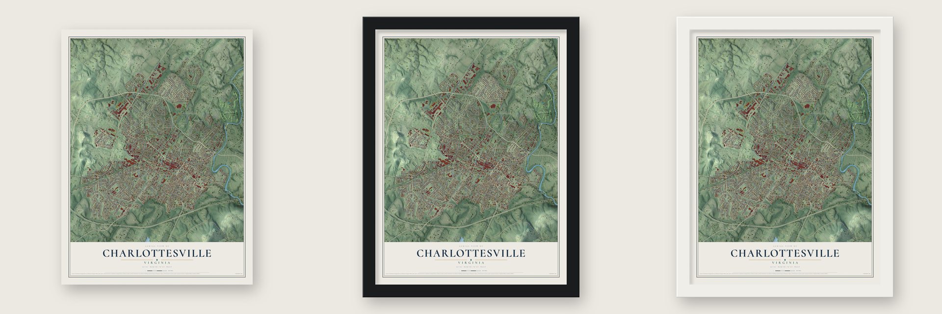
Unframed archival matte, a black wood frame or a white wood frame.
Up close
Geography Worth Displaying
This map was created using accurate cartographic data and authoritative geographic sources, including the U.S. Geological Survey and the Census Bureau. The map brings together terrain, waterways, roads, and building detail. The majority of the streets are labeled, houses are accurately depicted, and the topography is derived from government sources. Combining local data with carefully composed color and shading leads to this beautifully detailed Charlottesville artwork for your wall.
Rather than simply showing street outlines, we’ve included as many of the street names as we could reasonably fit on the map while keeping their names legible. Zoom in on the high resolution preview to see exactly what’s on the map. We truly set out to create a statement piece for anyone who loves Charlottesville. So whether it’s for you, or a gift for someone you love, we hope this map of Charlottesville brings back fond memories.
Read the story behind this map of Charlottesville, Virginia from 2026.

About Charlottesville, Virginia
Charlottesville is an independent city of 46,553 people in central Virginia, set on rolling hills between the University of Virginia and the Rivanna River. It is also the seat of Albemarle County, which surrounds it. An act of the Assembly created the town in 1762 on Three Notched Road, the trade route from Richmond west to the Shenandoah Valley. It was named for the British queen, Charlotte of Mecklenburg-Strelitz, and Thomas Walker was its first trustee.
During the Revolution, Congress held the prisoners of the Convention Army at the Albemarle Barracks here from 1779 to 1781. On June 4, 1781, Jack Jouett rode to warn the Virginia legislature, then meeting at Monticello, that Colonel Banastre Tarleton was planning a raid. The lawmakers got away just in time. Thomas Jefferson later founded the University of Virginia at Charlottesville in 1819.
- Home of two presidentsThomas Jefferson and James Monroe both made their homes in Charlottesville. While each served as governor of Virginia, he lived in Albemarle County and traveled the 71-mile Three Notch'd Road to Richmond and back. Monticello, Jefferson's home and plantation, stands 3 miles southeast of the city.
- Spared from burning in 1865Charlottesville saw little of the Civil War. Its only fight was a short skirmish at Rio Hill, where George Armstrong Custer met local Confederate Home Guards and pulled back. In 1865 the mayor surrendered the town to Custer and Philip Sheridan so it would not be burned.
- The mill that outlasted the warThe Charlottesville Factory had made woolen clothing for Confederate soldiers. After the surrender it caught fire by accident, when Union troops carrying coals to burn the railroad bridge dropped some on its floor. The factory was rebuilt right away and ran as the Woolen Mills until 1962. The Woolen Mills Village Historic District and the Woolen Mills Chapel are now on the National Register.
- Churches and a synagogueChrist Episcopal Church, the town's first church, was started in 1820 by builders Thomas Jefferson lent to the project. The First Baptist Church, the first black church in Charlottesville, followed in 1864. Until then the law had not allowed African Americans to have churches of their own. Congregation Beth Israel put up its building in 1882, and no older synagogue building still stands in Virginia.
- Vinegar Hill, razed in 1965Vinegar Hill was the downtown neighborhood that served Charlottesville's black community during segregation. In 1965 the city tore it down for urban renewal. A church, five Black-owned businesses and one hundred thirty homes were destroyed on about 20 acres next to West Main Street. Many families moved to the Westhaven public housing project, and the land was not rebuilt until the late 1970s.
Find your street
Names on the Charlottesville map
Every name below is printed on this map. Look for your street, your school, the park where you played, or the pond down the road.
Places and landmarks17
- North Downtown
- McIntire Park
- Pen Park
- Belmont
- Greenbriar Heights
- Greenfields
- Locust Grove
- Northerly
- Oak Terrace
- Rio Heights
- The Meadows
- Vinegar Hill
Show all 17 places
- Wakefield
- West View Terrace
- Wildwood
- Willow Heights
- Woolen Mills
Streets and roads320
- Emmet Street North
- Jefferson Park Avenue
- West Main Street
- University Avenue
- Rugby Road
- Alderman Road
- Avon Street
- Grady Avenue
- Fontaine Avenue
- High Street East
- High Street
- Monticello Avenue
- Ivy Road
- Market Street East
- Preston Avenue
- Seminole Trail
- Long Street
- Ridge Street
- Stadium Road
- Elliot Avenue
- First Street
- First Street South
- Park Street
- East Rio Road
- Harris Road
- Fifth Street Southwest
- Hydraulic Road
- 14th Street Northwest
- Melbourne Road
- Water Street East
Show all 320 streets
- Cherry Avenue
- Jefferson Street
- Mason Lane
- Quarry Road
- Forest Hills Avenue
- Brandywine Drive
- Barracks Road
- Rugby Avenue
- Locust Avenue
- Rose Hill Drive
- Monticello Road
- Shamrock Road
- Meridian Street
- Kenwood Lane
- Sixth Street Southeast
- Yorktown Drive
- Saint Clair Avenue
- Tenth Street Northwest
- Elliott Avenue
- Greenbrier Drive
- Carlton Avenue
- Rialto Street
- River Road
- Druid Avenue
- McIntire Road
- Grove Road
- Cleveland Avenue
- Chesapeake Street
- Meadowbrook Heights Road
- Moseley Drive
- Oxford Road
- Harris Street
- Old Lynchburg Road
- Meade Avenue
- Altavista Avenue
- Tarleton Drive
- Meadowbrook Road
- Dairy Road
- Westwood Road
- Holmes Avenue
- Montrose Avenue
- King Street
- Franklin Street
- Rives Street
- Blenheim Avenue
- Madison Avenue
- Saint Charles Avenue
- Hilltop Road
- Bolling Avenue
- Stribling Avenue
- Village Road
- Banbury Street
- Albemarle Street
- Camellia Drive
- Pen Park Road
- Millmont Street
- Watson Avenue
- Lexington Avenue
- Monte Vista Avenue
- Rockcreek Road
- Garrett Street
- Huntley Avenue
- Massie Road
- Gentry Lane
- Westview Road
- Grove Street
- Dice Street
- Nassau Street
- Lewis Mountain Road
- Prospect Avenue
- Keith Valley Road
- Arlington Boulevard
- West Street
- Crispell Drive
- University Circle
- Highland Avenue
- Thomson Road
- McElroy Drive
- Page Street
- Concord Drive
- Center Avenue
- Palatine Avenue
- Hazel Street
- Poplar Street
- Winston Road
- Azalea Drive
- Little High Street
- Sunset Avenue
- Oak Street
- Cabell Avenue
- Lester Drive
- Wellford Street
- Linden Avenue
- North Avenue
- Amherst Street
- Fendall Avenue
- Forrest Street
- Wertland Street
- Brookwood Drive
- Valley Road
- Short 18th Street
- Willard Drive
- Greenleaf Lane
- Wayside Place
- Agnese Street
- Michie Drive
- Rutledge Avenue
- Longwood Drive
- Locust Lane
- Field Road
- Lankford Avenue
- Mulberry Avenue
- Ware Street
- Park Place
- Lyons Avenue
- Bruce Avenue
- Robertson Avenue
- Antoinette Avenue
- Zan Road
- India Road
- Lane Road
- Lee Street
- Rosser Lane
- Broad Avenue
- Hedge Street
- Wilder Drive
- Grace Street
- Essex Road
- Nalle Street
- Davis Avenue
- Early Street
- Brook Road
- Holly Road
- Maple Street
- Todd Avenue
- Parkway Street
- Farish Street
- Lewis Street
- Brown Street
- Graves Street
- Bing Lane
- Park Road
- Allied Lane
- Ridge McIntire Road
- Maury Avenue
- Second Street Southeast
- First Street North
- Rio Road
- Denice Lane
- Baker Street
- Blue Ridge Road
- Carlton Road
- Trailridge Road
- Cedar Hill Road
- Fairway Avenue
- Riverside Avenue
- Ninth Street Northwest
- Saint Annes Road
- 15th Street Northwest
- Gordon Avenue
- Henry Avenue
- Angus Road
- Kerry Lane
- Wayne Avenue
- Hartmans Mill Road
- Charlton Avenue
- Hessian Road
- Lambeth Cmns
- Anderson Street
- Valley Road Extended
- Coleman Street
- Minor Road
- John West Warner Parkway
- Cottonwood Road
- Calhoun Street
- Forest Ridge Road
- Grove Avenue
- Cargil Lane
- Jamestown Drive
- Caroline Avenue
- Spottswood Road
- Smith Street
- Sheridan Avenue
- Virginia Avenue
- Hardy Drive
- Douglas Avenue
- Sherwood Road
- Vine Street
- Almere Avenue
- Madison Lane
- John Street
- Kensington Avenue
- Stewart Street
- Brandon Avenue
- Appletree Road
- Meriwether Street
- Lochlyn Hill Drive
- River Vista Avenue
- Summit Street
- Raymond Avenue
- Burgess Lane
- Earheart Street
- Willow Drive
- Hanover Street
- Price Avenue
- Carter Lane
- Mobile Lane
- Thomas Drive
- Spruce Street
- Sprigg Lane
- Porter Avenue
- Edge Hill Road
- Macaa Drive
- Dublin Road
- Cottage Lane
- Allen Drive
- Estes Street
- Cedars Court
- Oakleaf Lane
- Tufton Avenue
- Naylor Street
- Park Hill
- River Court
- Rugby Place
- Linda Court
- Lili Lane
- Rio Road East
- Pratt Drive
- Rainier Road
- Rockland Avenue
- Montebello Circle
- Orangedale Avenue
- Hillwood Place
- Rougemont Avenue
- Third Street Northeast
- Preston Place
- Edgewood Lane
- Sunset Road
- Woodland Drive
- Morgan Court
- Elizabeth Avenue
- Cynthianna Avenue
- Ricky Drive
- Oxford Circle
- Kent Road
- Sixth Street Southwest
- Wine Street
- Altamont Street
- Mowbray Place
- Morris Road
- Kent Terrace
- Spring Street
- Hardwood Avenue
- Welk Place
- Burnet Way
- Pine Top Road
- Chestnut Street
- Tunlaw Place
- Plateau Road
- Garden Street
- Old Ivy Road
- Rosa Terrace
- Lide Place
- Water Street West
- Jefferson Park Circle
- King Mountain Road
- Dale Avenue
- Bollingwood Road
- Castalia Street
- Chapel Hill Road
- Rosser Avenue
- Midland Street
- Walker Square
- Hillcrest Road
- Pen Park Lane
- Perry Drive
- Elm Street
- 18th Street Northeast
- Junction Lane
- Morton Drive
- Saint Charles Court
- Old Farm Road
- Warren Lane
- Elkhorn Road
- Garden Drive
- Lyman Street
- Hilton Drive
- Line Drive
- Herndon Road
- Bland Circle
Names are listed as they appear on the printed map. Zoom into the product photos to find them.
The art of mapping a place
How This Map Was Made
Real places. Remarkable detail. Discover the layers that turn geographic data into a map of home.

The view from above
Aerial imagery reveals the character of the land: woodland, open fields, and the patterns of a place.

The shape of the land
Elevation data brings hills, valleys, and subtle changes in the landscape into view.

The details of home
Roads, waterways, and building footprints come together to make the map feel unmistakably local.

Geography becomes art
Considered color, shading, and typography bring the layers together in a map made for your wall.


Process illustrated with Mendon, Massachusetts. Aerial imagery: USDA NAIP. Terrain: USGS 3D Elevation Program. Map details and finished artwork: KNOWOL.
The Details
About This Print
Choose an archival matte print, or a black or white Ayous wood frame. The archival matte print is unframed.
Select your size and finish above to see the matching product image and price.
Materials & Craftsmanship
A contemporary map with the character of a classic atlas, printed on archival matte paper. Optional frames are made from Ayous wood.
Your printed map does not include the watermark shown in the full-map preview.
Shipping & Delivery
Free shipping within the United States. Every print is made to order in the USA.
Buying a gift? Add a note in your cart and we'll include it. We never put prices in the package.
Prints ship within 2 to 3 business days. Allow 7 to 10 days total from ordering for delivery. Timing may vary during holidays or periods of high order volume.
Read our shipping policy.
Returns and damaged prints
Each print is made to order. Change-of-mind refunds are not available after production.
If your print arrives damaged, misprinted or incorrect, contact support@knowol.com within 30 days of receiving it. Include your order number, photos and a description of the issue.
Read our full refund and replacement policy. For questions about your order, email support@knowol.com.
Find your town
Looking for another city?
Find a map of home in our Virginia collection, or any town in the country.
Nearby
Maps of towns near Charlottesville
Know someone from one of these towns? Their map makes a great gift.
 University of Virginia
, Virginia
From $39.99See the map
 Pantops
, Virginia
From $39.99See the map
 Rio
Rio, Virginia
From $39.99See the map
More maps nearby: Ivy, Rivanna, Hollymead, Keswick and Earlysville.