
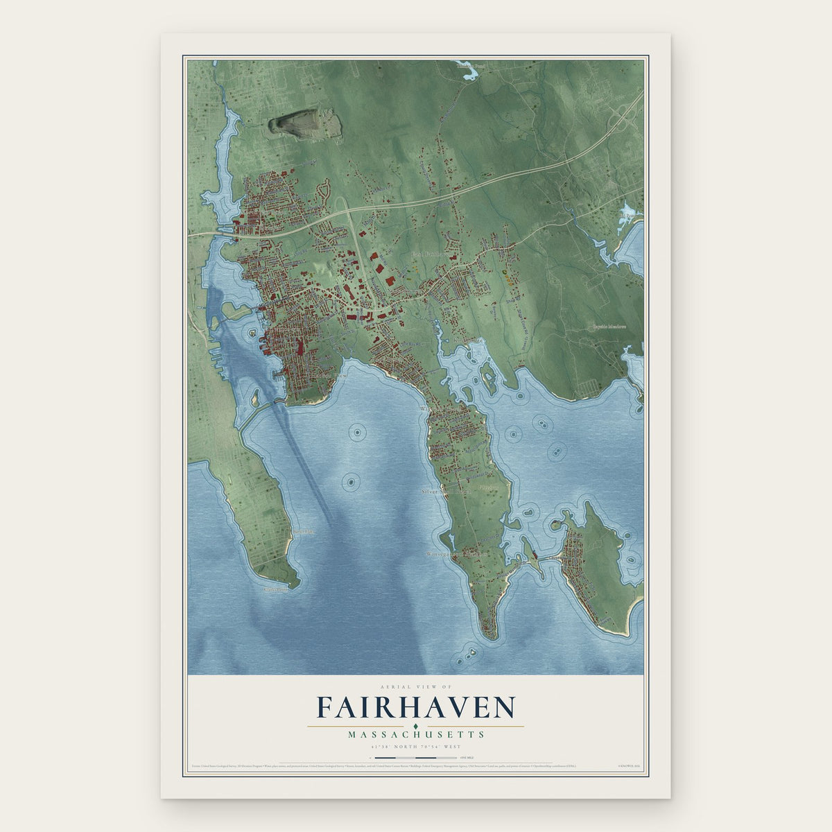


Search for another town





Free U.S. delivery 7 to 10 days after you order
Columbia, Connecticut Map Art
Building by building, with labeled streets and shaded relief.
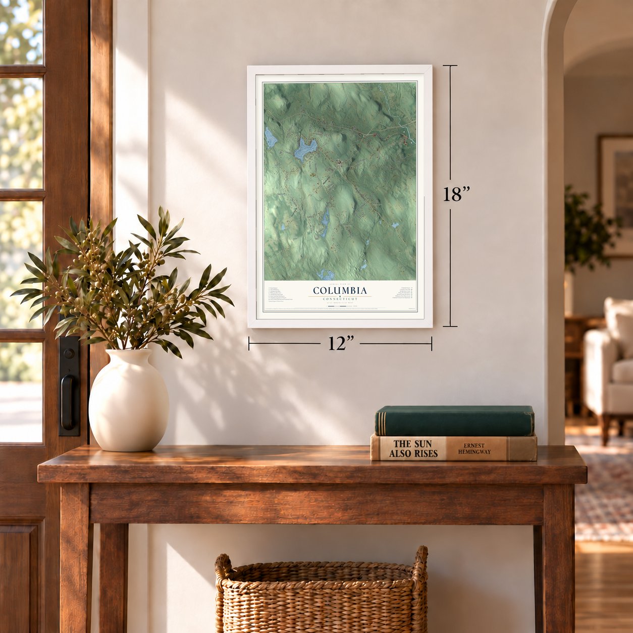
12" x 18" Archival Matte Print
A Map of Home. A Work of Art.
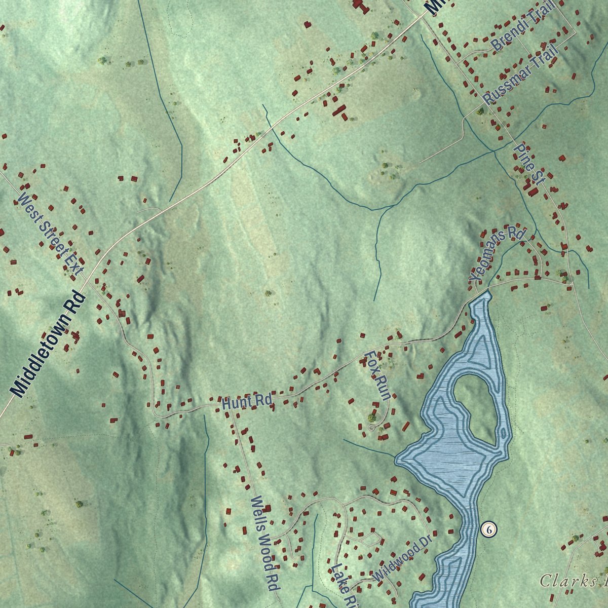
Explore Columbia, Connecticut from a whole new perspective. Created using aerial imagery and detailed geographic data, this map captures Columbia building by building, with labeled streets, familiar landmarks, and shaded topographical relief that highlights the natural contours of the landscape.
Combining modern data with the timeless character of a vintage atlas, this map is just as interesting up close as it is beautiful on the wall. Whether you grew up in Columbia, spent memorable years there, or call it home today, this unique map is a great way to celebrate a place that means something to you. Zoom in on the preview to look for your street, and then order a print to put your memories on the wall.

Three ways to hang it
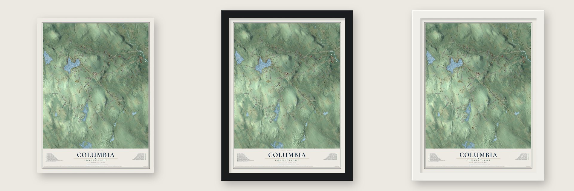
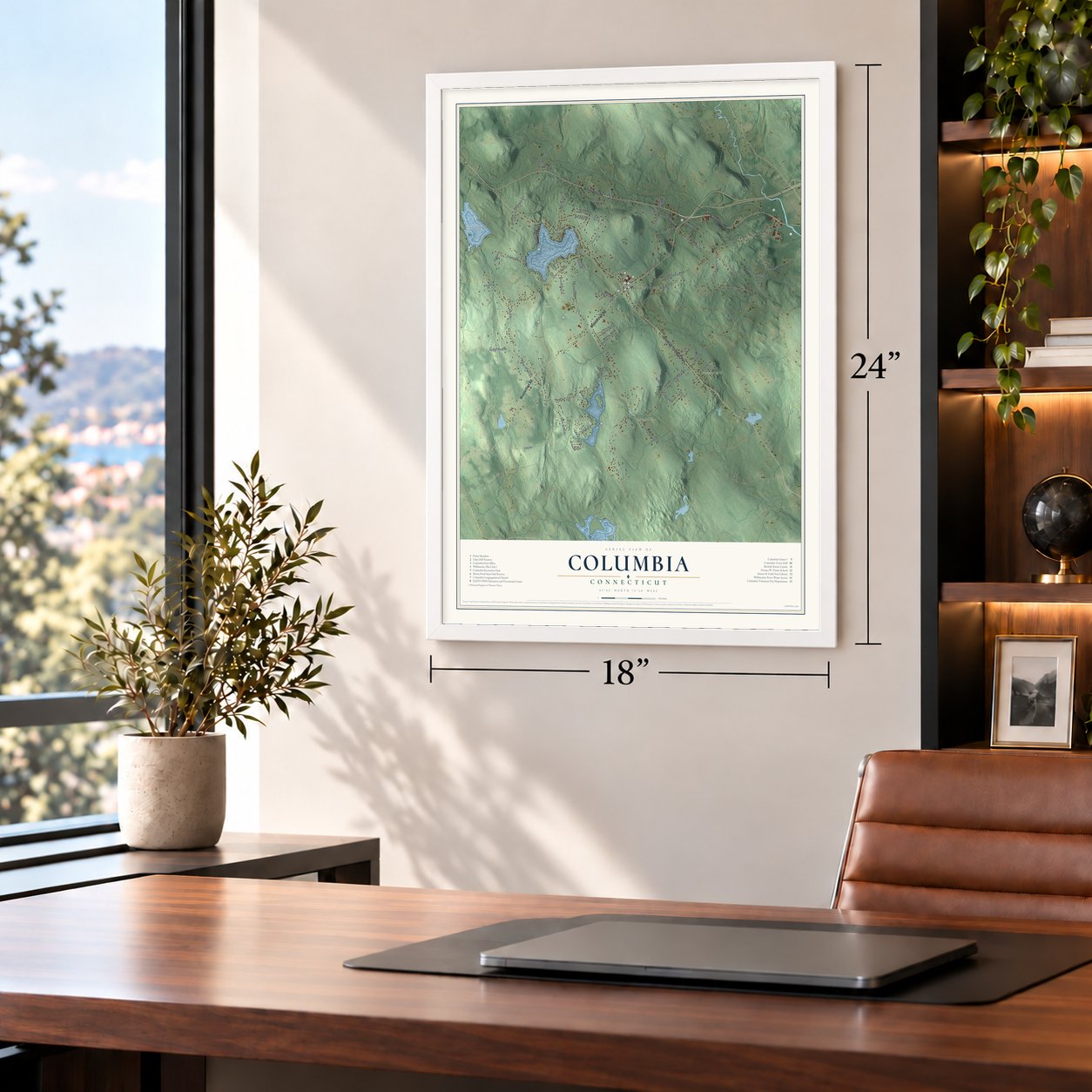
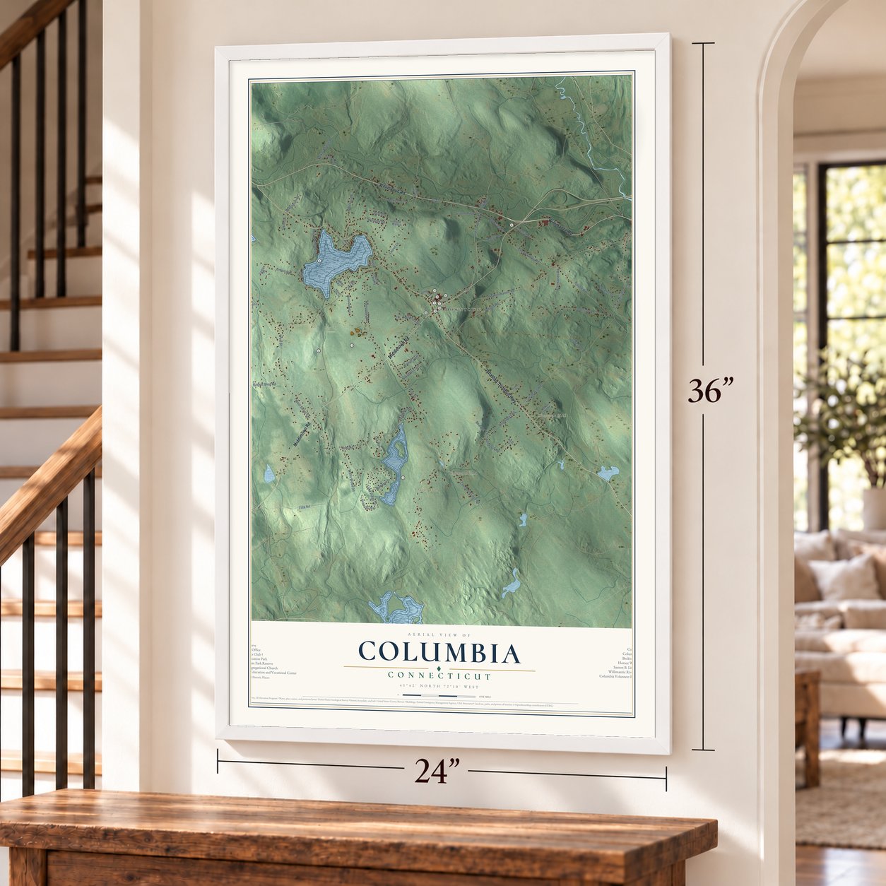
Unframed archival matte, a black wood frame or a white wood frame.
Up close
Geography Worth Displaying
This map was created using accurate cartographic data and authoritative geographic sources, including the U.S. Geological Survey (USGS) and FEMA. The map brings together terrain, waterways, roads, and building detail. The majority of the streets are labeled, houses are accurately depicted, and the topography is derived from government sources. Combining local data with carefully composed color and shading leads to this beautifully detailed Columbia artwork for your wall.
Rather than simply showing street outlines, we’ve included as many of the street names as we could reasonably fit on the map while keeping their names legible. Zoom in on the high resolution preview to see exactly what’s on the map. We truly set out to create a statement piece for anyone who loves Columbia. So whether it’s for you, or a gift for someone you love, we hope this map of Columbia brings back fond memories.
Explore the full map of Columbia, Connecticut and read about the local places it shows.

Find your street
Names on the Columbia map
Every name below is printed on this map. Look for your street, your school, the park where you played, or the pond down the road.
Places and landmarks9
- Downtown
- Bunker Hill
- Chestnut Hill
- Clarks Hill
- Cooks Hill
- Andover Lake
- Brousseous Pond
- Utley Hill Preserve
- Lakeview Park
Streets and roads70
- Willimantic Road
- Middletown Road
- Jonathan Trumbull Highway
- West Street
- Macht Road
- West Street Extension
- Cards Mill Road
- Latham Hill Road
- Old Coventry Road
- Russmar Trail
- Pine Street
- Old Willimantic Road
- Hunt Road
- Lake Road
- Johnson Road
- Doubleday Road
- Henniquin Road
- Szegda Road
- Erdoni Road
- Gaulin Road
- Whitney Road
- Cherry Valley Road
- Lake Ridge Drive
- Oakwood Lane
- Dilaj Drive
- Chesbro Bridge Road
- Wells Wood Road
- Edgarton Road
- Beaudet Terrace
- Zola Road
Show all 70 streets
- Chowanec Road
- Heritage Road
- Laurel Lane
- Parker Bridge Road
- Randazzo Road
- Basket Shop Road
- Yeomans Road
- Scalise Drive
- Colonial Drive
- Brendi Trail
- Wickford Road
- Fox Run
- Sharington Drive
- Jones Road
- Gavin Drive
- Westgate Road
- Columbia Landing
- Wildwood Drive
- Upper Woodland Terrace
- Homestead Lane
- Hop River Road
- Bears Den Way
- Hunters Ridge
- Baker Hill Road
- Stone Wall Lane
- Roses Bridge Road
- Wheelock
- Collins Road
- Sadlon Road
- Nuhfer Drive
- Samuel Hill Road
- Woodward Road
- Commerce Drive
- Sunrise Drive
- Robert Drive
- Hilltop Lane
- Sleepy Hollow Road
- Strickland Road
- Tunxis Drive
- Sunny Slopes
Names are listed as they appear on the printed map. Zoom into the product photos to find them.
About Columbia, Connecticut
Columbia is a town of 5,272 people in Tolland County, Connecticut. It began in 1716 as a second church society inside Lebanon, called the North Parish or Lebanon Crank, and in 1720 its Congregational church was organized, with Samuel Smith ordained as pastor that same day. In May 1804 the parish was set off from Lebanon as a town of its own and took the patriotic name Columbia, after the national symbol.
Columbia stayed mostly a farming town, but its streams powered a few small trades. It once turned out cheap woolen hats and some fur hats, and a cotton mill at Hop River ran for more than forty years; by 1883, as the Hop River Warp Manufacturing Company, it was the town's chief industry, and about 800 people lived here. In 1865 Willimantic's American Linen Company flooded meadowland to hold water for its mills, creating what is now Columbia Lake. By 1907 the population was 655, a paper mill ran at Hop River, and mail arrived by wagon twice a day at three post offices.
“Mr. Brockway, the pastor of the church, started off with his long gun and deacons and parishioners to assist in doing battle with the enemy.”
- The school that became DartmouthEleazar Wheelock became Lebanon Crank's pastor in 1735, and in December 1743 he took the Mohegan scholar Samson Occom into his home school. Occom did so well that Wheelock opened a school on land given by Joshua Moor of Mansfield, and its first pupils, two Lenape boys, came in 1754. By 1764 about 30 students, half Native and half English, played on the green. The school later followed Wheelock to Hanover, New Hampshire, and became Dartmouth College.
- A meetinghouse painted sky blueIn 1748 the parish chose cedar clapboards for the south side and ends of its meetinghouse and chestnut for the back, and those boards lasted until the building came down in 1832. With only 170 taxpayers, the parish voted in December 1753 to paint it "sky collour" and lay stone around it.
- A bell rung for 36 yearsSubscribers paid $150 for a steeple and bell in 1792. David Huntington rang that bell at noon and again at nine in the evening, and he kept the job for 36 years, ending only with his death in 1828.
- The parish in the RevolutionAt least 64 men of the parish served in the Revolution, and 14 of them died. During the war, General Rochambeau's officers stayed at the Landmark Inn on the green as they mapped out the French army's march from Newport, Rhode Island, to Yorktown, Virginia.
- Two white houses in 1816A man who remembered Columbia in 1816 told the church's 150th anniversary gathering in 1866 that most houses then were unpainted and only two were white. No house or church in town had a stove, so the meetinghouse went unheated, and families came to services on horseback.
Keep exploring Connecticut
Columbia is one of 382 Connecticut towns we've mapped. Every dot on the map is a print of its own.
The search covers every state, Connecticut first.
Near Columbia
Order 2 or more town maps and save 10%. Shown in the size and finish you picked above, so they hang as a set.
- South Coventry 12" x 18" / Archival Matte Print $39.99
- Andover 12" x 18" / Archival Matte Print $39.99
- Willimantic 12" x 18" / Archival Matte Print $39.99

More maps nearby: Hebron, Lebanon, Gilead, Coventry Lake and Coventry.
The art of mapping a place
How This Map Was Made
Real places. Remarkable detail. Discover the layers that turn geographic data into a map of home.

The view from above
Aerial imagery reveals the character of the land: woodland, open fields, and the patterns of a place.

The shape of the land
Elevation data brings hills, valleys, and subtle changes in the landscape into view.

The details of home
Roads, waterways, and building footprints come together to make the map feel unmistakably local.

Geography becomes art
Considered color, shading, and typography bring the layers together in a map made for your wall.


Process illustrated with Mendon, Massachusetts. Aerial imagery: USDA NAIP. Terrain: USGS 3D Elevation Program. Map details and finished artwork: KNOWOL.
The Details
About This Print
Choose an archival matte print, or a black or white Ayous wood frame. The archival matte print is unframed.
Select your size and finish above to see the matching product image and price.
Materials & Craftsmanship
A contemporary map with the character of a classic atlas, printed on archival matte paper. Optional frames are made from Ayous wood.
Your printed map does not include the watermark shown in the full-map preview.
Shipping & Delivery
Free shipping within the United States. Every print is made to order in the USA.
Buying a gift? Add a note in your cart and we'll include it. We never put prices in the package.
Prints ship within 2 to 3 business days. Allow 7 to 10 days total from ordering for delivery. Timing may vary during holidays or periods of high order volume.
Read our shipping policy.
Returns and damaged prints
Each print is made to order. Change-of-mind refunds are not available after production.
If your print arrives damaged, misprinted or incorrect, contact support@knowol.com within 30 days of receiving it. Include your order number, photos and a description of the issue.
Read our full refund and replacement policy. For questions about your order, email support@knowol.com.