
Search for another town



Free U.S. delivery 7 to 10 days after you order
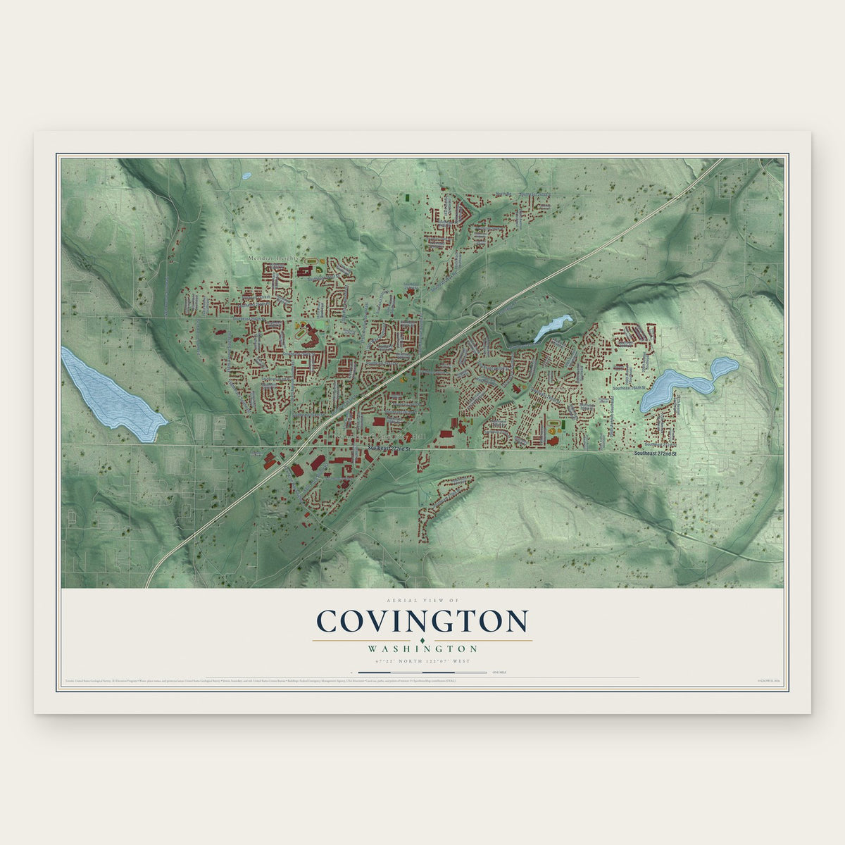
Covington, Washington Map Art
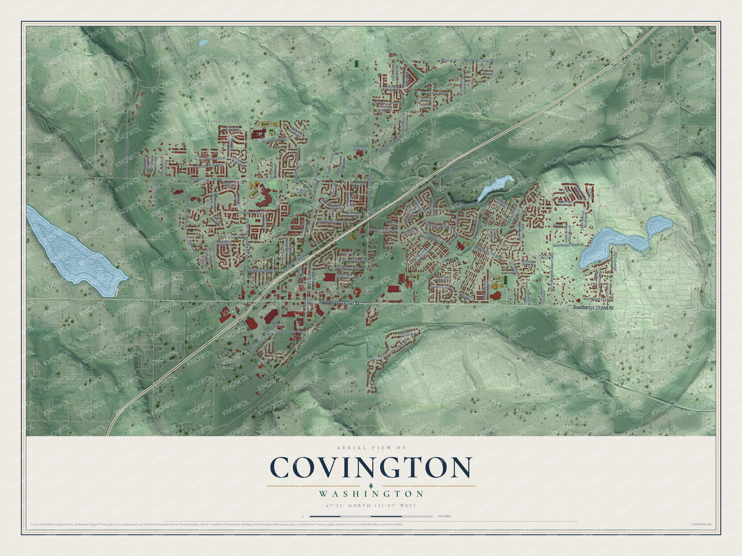
A new map of Covington, Washington, made in 2026 and printed to order on thick archival matte paper.
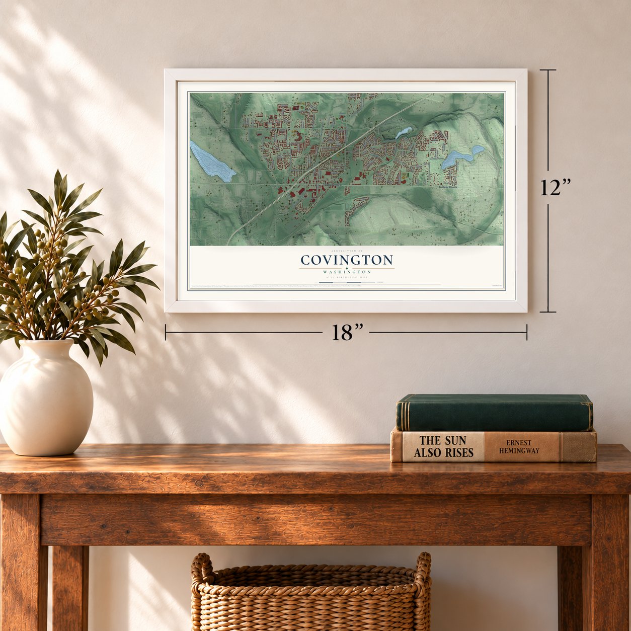
12" x 18" Archival Matte Print
A Map of Home. A Work of Art.
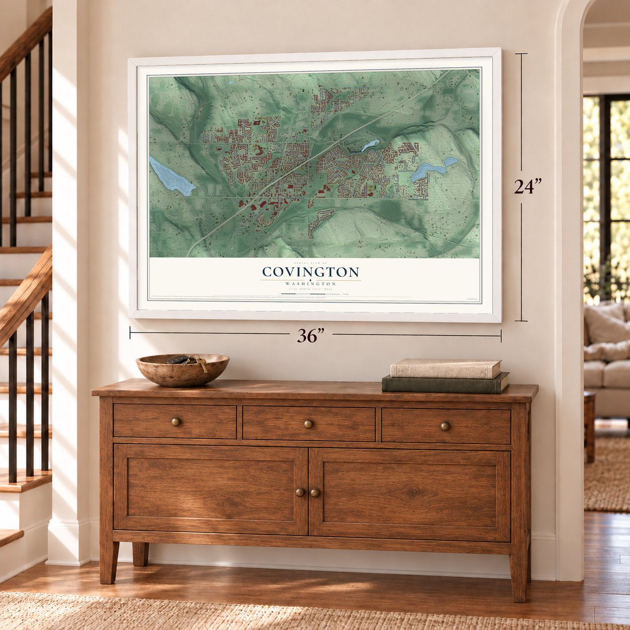
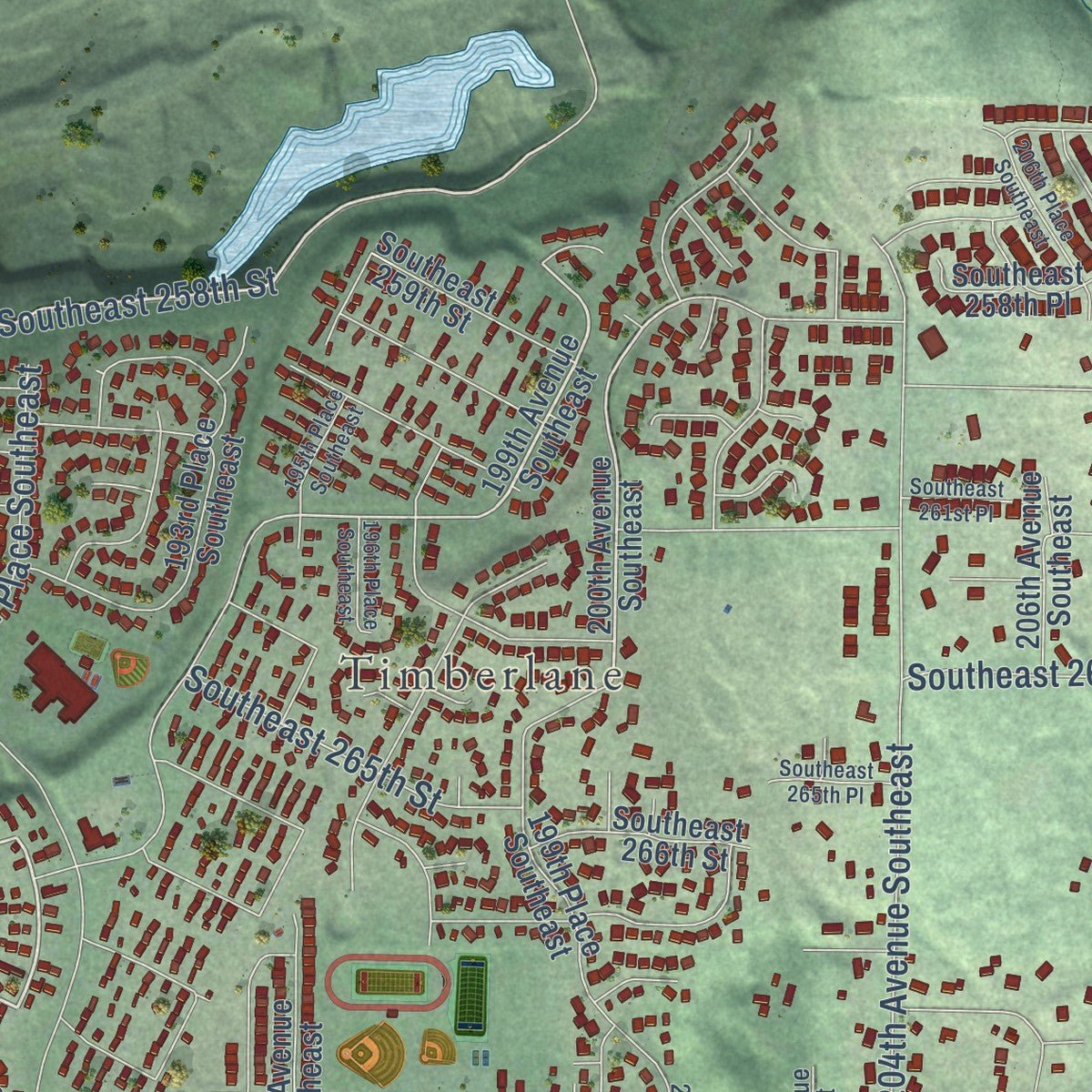
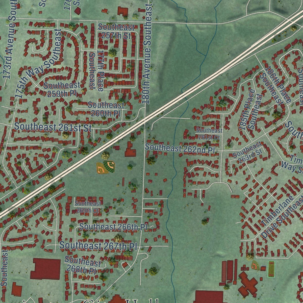
Explore Covington, Washington from a whole new perspective. Created using aerial imagery and detailed geographic data, this map captures Covington building by building, with labeled streets, familiar landmarks, and shaded topographical relief that highlights the natural contours of the landscape.
Combining modern data with the timeless character of a vintage atlas, this map is just as interesting up close as it is beautiful on the wall. Whether you grew up in Covington, spent memorable years there, or call it home today, this unique map is a great way to celebrate a place that means something to you. Zoom in on the preview to look for your street, and then order a print to put your memories on the wall.
Three ways to hang it
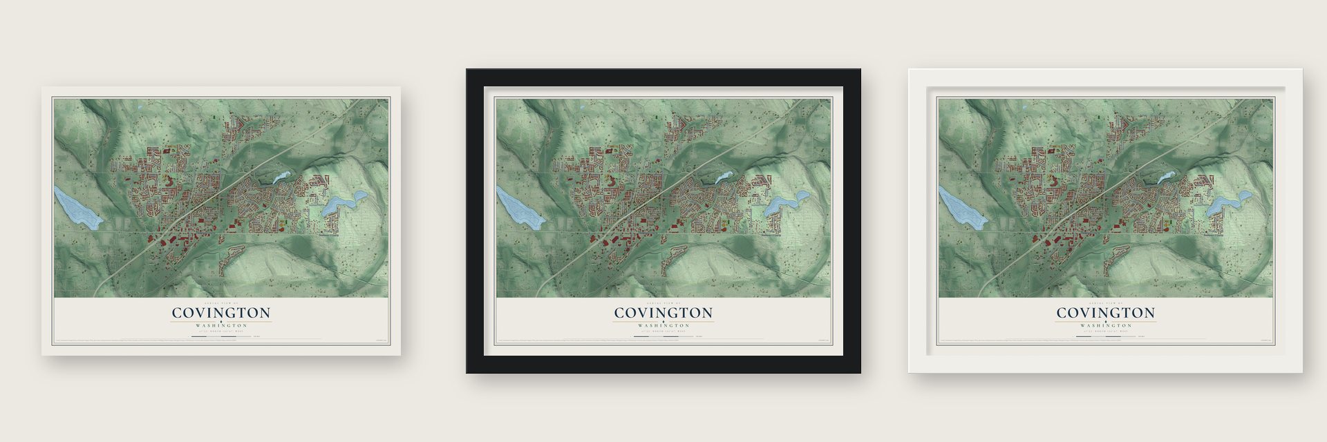
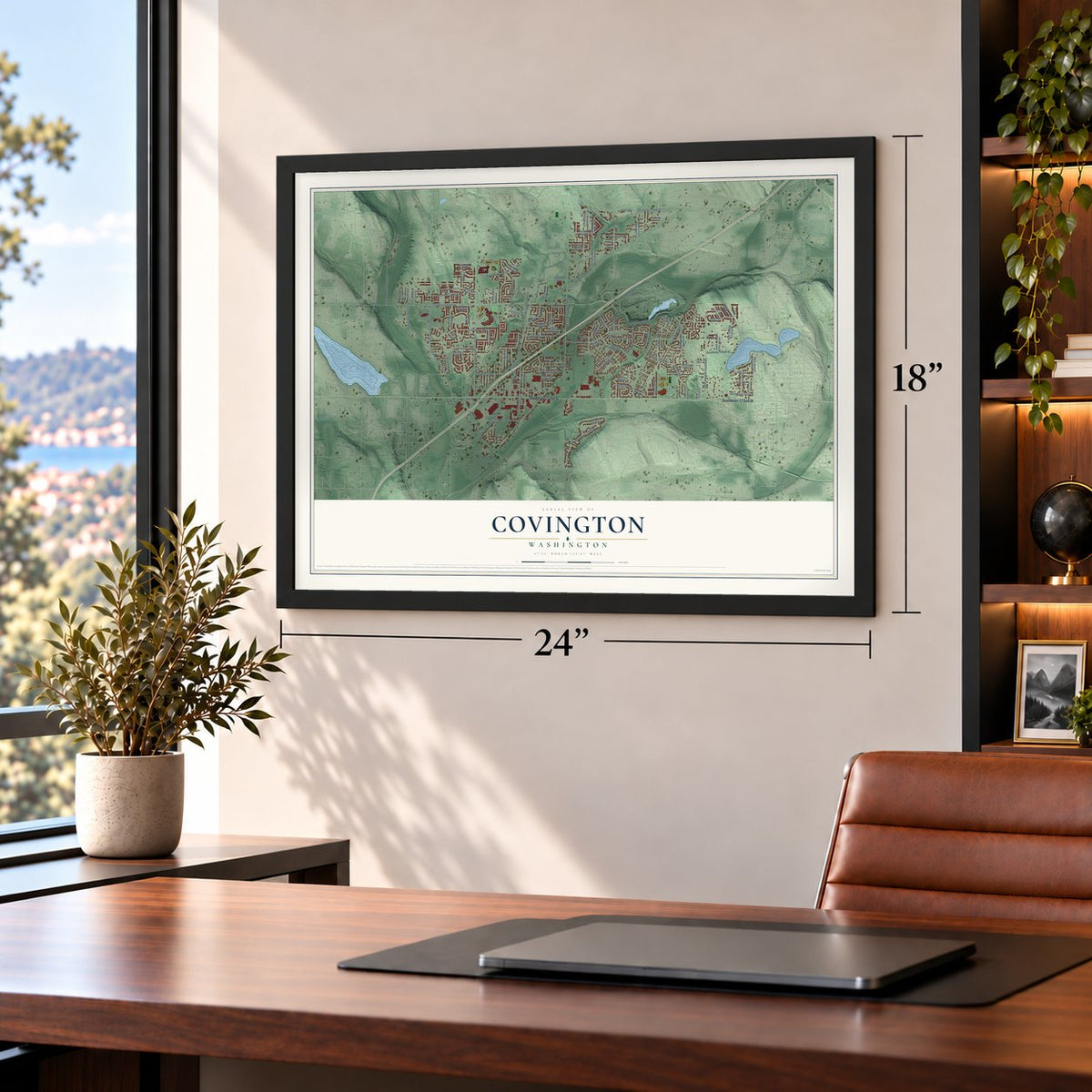
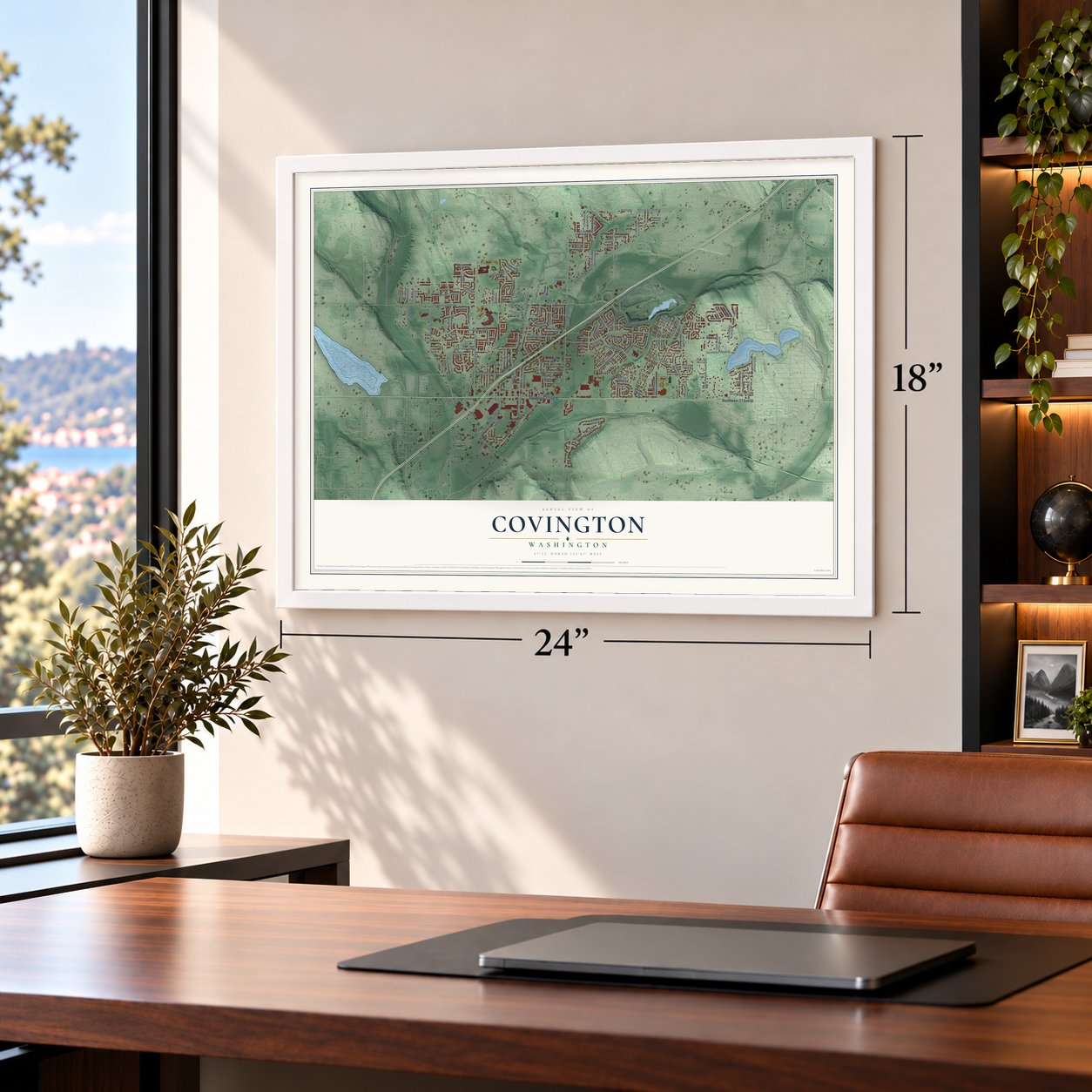
Unframed archival matte, a black wood frame or a white wood frame.
Up close
Geography Worth Displaying
This map was created using accurate cartographic data and authoritative geographic sources, including the U.S. Geological Survey and the Census Bureau. The map brings together terrain, waterways, roads, and building detail. The majority of the streets are labeled, houses are accurately depicted, and the topography is derived from government sources. Combining local data with carefully composed color and shading leads to this beautifully detailed Covington artwork for your wall.
Rather than simply showing street outlines, we’ve included as many of the street names as we could reasonably fit on the map while keeping their names legible. Zoom in on the high resolution preview to see exactly what’s on the map. We truly set out to create a statement piece for anyone who loves Covington. So whether it’s for you, or a gift for someone you love, we hope this map of Covington brings back fond memories.
Read the story behind this map of Covington, Washington from 2026.
About Covington, Washington
Covington is a King County city of 20,777 people, lying about 20 miles to the southeast of Seattle. The land was first called Jenkins Prairie. When the Northern Pacific needed a short link between Kanasket and Auburn, it sent a surveyor named Richard Covington to plan the route, now known as the Palmer Cutoff. Railroad telegrams used the code name "Rodent Frugality" for the line. A stop was named for the surveyor, and the settlement soon took the stop's name. The cutoff was done in 1900, with a 2,850-foot passing track and a bunkhouse for 24 men at Covington.
By the early 1990s Covington was turning into a suburb, and in 1992 King County named it an "urban activity center" for future growth. Residents wanted to plan that growth themselves, so in 1994 they started a signature drive to form a city. They lost a fight with Kent over Lake Meridian, which joined Kent instead. Voters approved the new city on November 6, 1996, the same day Maple Valley was created, and Covington became a city on August 31, 1997, with about 12,200 residents.
“J. A. Bunce is madder than a wet hen. First, because he did not kill Tracy when he had him so close by, and, second, because [Sheriff] Cudihee did not send reinforcements last night.”
- The Bereiter Mill of 1901Emil Bereiter and John W. Sandstrom built the area's first mill in 1901 where Soos and Jenkins creeks meet; it became the Covington Lumber Company. A 30-foot dam made a log pond, with a salmon ladder the Game Department required. The mill cut 6,000 board feet an hour, plus shingles. More than one hundred workers lived in more than thirty small houses, a bunkhouse and a cookhouse, and Japanese workers lived across Soos Creek.
- An outlaw passes throughHarry Tracy escaped from the Oregon State Penitentiary and headed east through the area in 1902. After raiding a home near Kent for supplies, he reportedly traded shots with a few men near the Covington Mill Company. A posse rode out the next day with a Seattle Daily Times reporter, but it arrived too late. Tracy got as far as Lincoln County, where he died in a shootout that August.
- Strawberries after a dry springAs the timber ran out, dairy farmers known as Soos Creek stump ranchers grazed cattle on the cleared land, and a cheese factory followed after World War I. In the dry spring of 1922, canals from Jenkins Creek were tested on 1,250 acres near Covington. The Seattle Daily Times reported that irrigated strawberries kept bearing two weeks after unirrigated fields were done, and berry farming grew more popular with irrigation.
- A schoolhouse with two roomsMill carpenters built Covington's first school, a small room with one teacher for every grade. Around 1912 a larger school went up, with a little room for grades one through four and another for grades five through seven. After the schools joined the Meridian and then Kent districts, the building became the Covington Community Center, which burned down in 1976.
Find your street
Names on the Covington map
Every name below is printed on this map. Look for your street, your school, the park where you played, or the pond down the road.
Places and landmarks3
- City of Covington City Hall
- Timberlane
- Meridian Heights
Streets and roads112
- Southeast 272nd Street
- 191st Place Southeast
- Southeast 258th Street
- Southeast 262nd Street
- Southeast Wax Road
- Southeast 256th Street
- 180th Avenue Southeast
- Southeast 260th Street
- 168th Place Southeast
- 164th Avenue Southeast
- Southeast 264th Street
- North Road
- Southeast 240th Street
- Southeast 268th Street
- Southeast 261st Street
- Southeast 251st Street
- Southeast 265th Street
- 204th Avenue Southeast
- Southeast 267th Place
- 148th Avenue Southeast
- 156th Avenue Southeast
- Covington Way Southeast
- Southeast 254th Place
- Southeast 267th Street
- 156th Place Southeast
- 173rd Avenue Southeast
- Southeast 279th Place
- 170th Place Southeast
- Southeast 271st Street
- Frontage Road
Show all 112 streets
- 175th Way Southeast
- Southeast 269th Street
- 185th Place Southeast
- 199th Avenue Southeast
- Southeast 266th Street
- 200th Avenue Southeast
- 184th Avenue Southeast
- 172nd Avenue Southeast
- 152nd Avenue Southeast
- Southeast 270th Place
- Southeast 244th Street
- Southeast 254th Street
- Southeast 244th Place
- Southeast 247th Street
- 160th Avenue Southeast
- Southeast 263rd Place
- Southeast 264th Place
- 192nd Avenue Southeast
- Southeast 252nd Place
- Southeast 262nd Place
- 188th Avenue Southeast
- Southeast 259th Street
- 196th Avenue Southeast
- Timberlane Way Southeast
- Southeast 258th Place
- 171st Avenue Southeast
- Southeast 270th Street
- Southeast 260th Place
- Southeast 259th Place
- 167th Place Southeast
- Southeast 257th Street
- Southeast 266th Place
- 183rd Avenue Southeast
- 193rd Place Southeast
- 184th Place Southeast
- 199th Place Southeast
- Southeast 253rd Place
- 161st Place Southeast
- 176th Avenue Southeast
- 186th Place Southeast
- Timberlane Drive Southeast
- 171st Place Southeast
- Southeast 276th Street
- 206th Avenue Southeast
- Southeast 277th Place
- Southeast 252nd Street
- 177th Place Southeast
- 210th Avenue Southeast
- 170th Avenue Southeast
- 208th Avenue Southeast
- 172nd Place Southeast
- 170th Way Southeast
- 151st Place Southeast
- 212th Avenue Southeast
- 153rd Avenue Southeast
- Southeast 249th Place
- Southeast 268th Place
- 207th Place Southeast
- Southeast 256th Place
- 163rd Avenue Southeast
- Southeast 263rd Street
- 201st Avenue Southeast
- 166th Place Southeast
- 159th Avenue Southeast
- 203rd Avenue Southeast
- Southeast 257th Place
- Southeast 246th Street
- 150th Place Southeast
- 159th Place Southeast
- Southeast 273rd Place
- Southeast 245th Place
- 195th Place Southeast
- Southeast 261st Place
- Southeast 261st Court
- 211th Avenue Southeast
- 206th Place Southeast
- Southeast 265th Place
- Southeast 265th Court
- 209th Loop Southeast
- Southeast 241st Place
- 196th Place Southeast
- Southeast 246th Place
Names are listed as they appear on the printed map. Zoom into the product photos to find them.
The art of mapping a place
How This Map Was Made
Real places. Remarkable detail. Discover the layers that turn geographic data into a map of home.

The view from above
Aerial imagery reveals the character of the land: woodland, open fields, and the patterns of a place.

The shape of the land
Elevation data brings hills, valleys, and subtle changes in the landscape into view.

The details of home
Roads, waterways, and building footprints come together to make the map feel unmistakably local.

Geography becomes art
Considered color, shading, and typography bring the layers together in a map made for your wall.


Process illustrated with Mendon, Massachusetts. Aerial imagery: USDA NAIP. Terrain: USGS 3D Elevation Program. Map details and finished artwork: KNOWOL.
The Details
About This Print
Choose an archival matte print, or a black or white Ayous wood frame. The archival matte print is unframed.
Select your size and finish above to see the matching product image and price.
Materials & Craftsmanship
A contemporary map with the character of a classic atlas, printed on archival matte paper. Optional frames are made from Ayous wood.
Your printed map does not include the watermark shown in the full-map preview.
Shipping & Delivery
Free shipping within the United States. Every print is made to order in the USA.
Buying a gift? Add a note in your cart and we'll include it. We never put prices in the package.
Prints ship within 2 to 3 business days. Allow 7 to 10 days total from ordering for delivery. Timing may vary during holidays or periods of high order volume.
Read our shipping policy.
Returns and damaged prints
Each print is made to order. Change-of-mind refunds are not available after production.
If your print arrives damaged, misprinted or incorrect, contact support@knowol.com within 30 days of receiving it. Include your order number, photos and a description of the issue.
Read our full refund and replacement policy. For questions about your order, email support@knowol.com.
Find your town
Looking for another city?
Find a map of home in our Washington collection, or any town in the country.
Nearby
Maps of towns near Covington
Know someone from one of these towns? Their map makes a great gift.
 Lake Morton-Berrydale
, Washington
From $39.99See the map
 Shadow Lake
, Washington
From $39.99See the map
 Maple Valley
, Washington
From $39.99See the map
More maps nearby: Lake Holm, Maple Heights-Lake Desire, Black Diamond, Kent and Hobart.