
Search for another town



Free U.S. delivery 7 to 10 days after you order
Davie, Florida Map Art
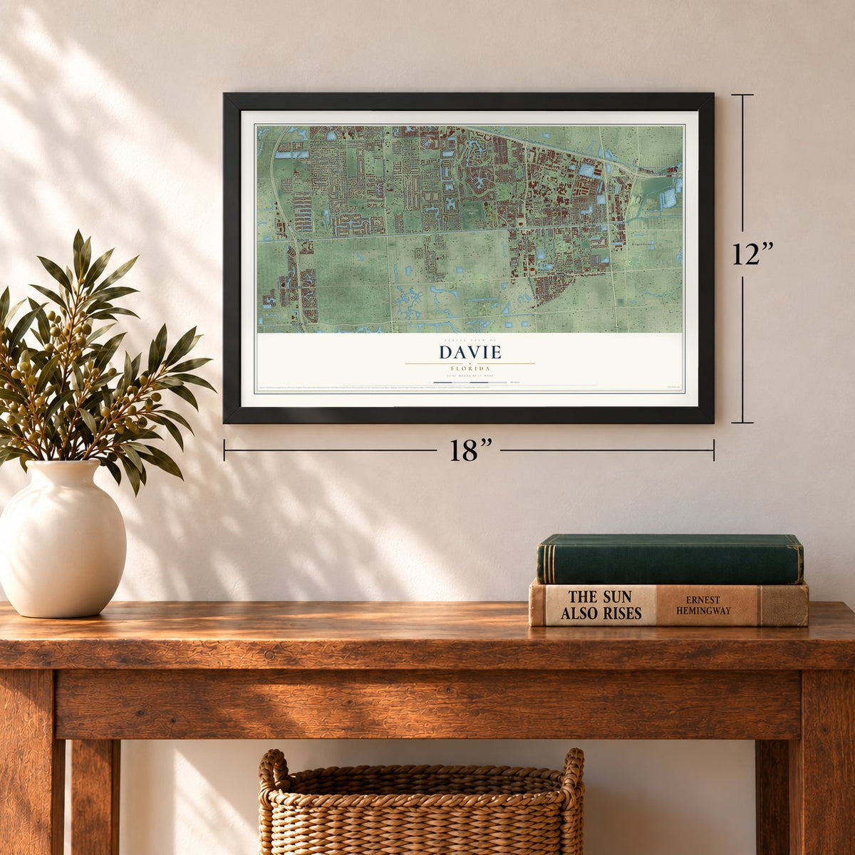
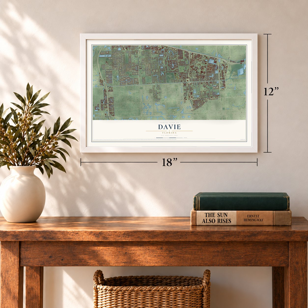
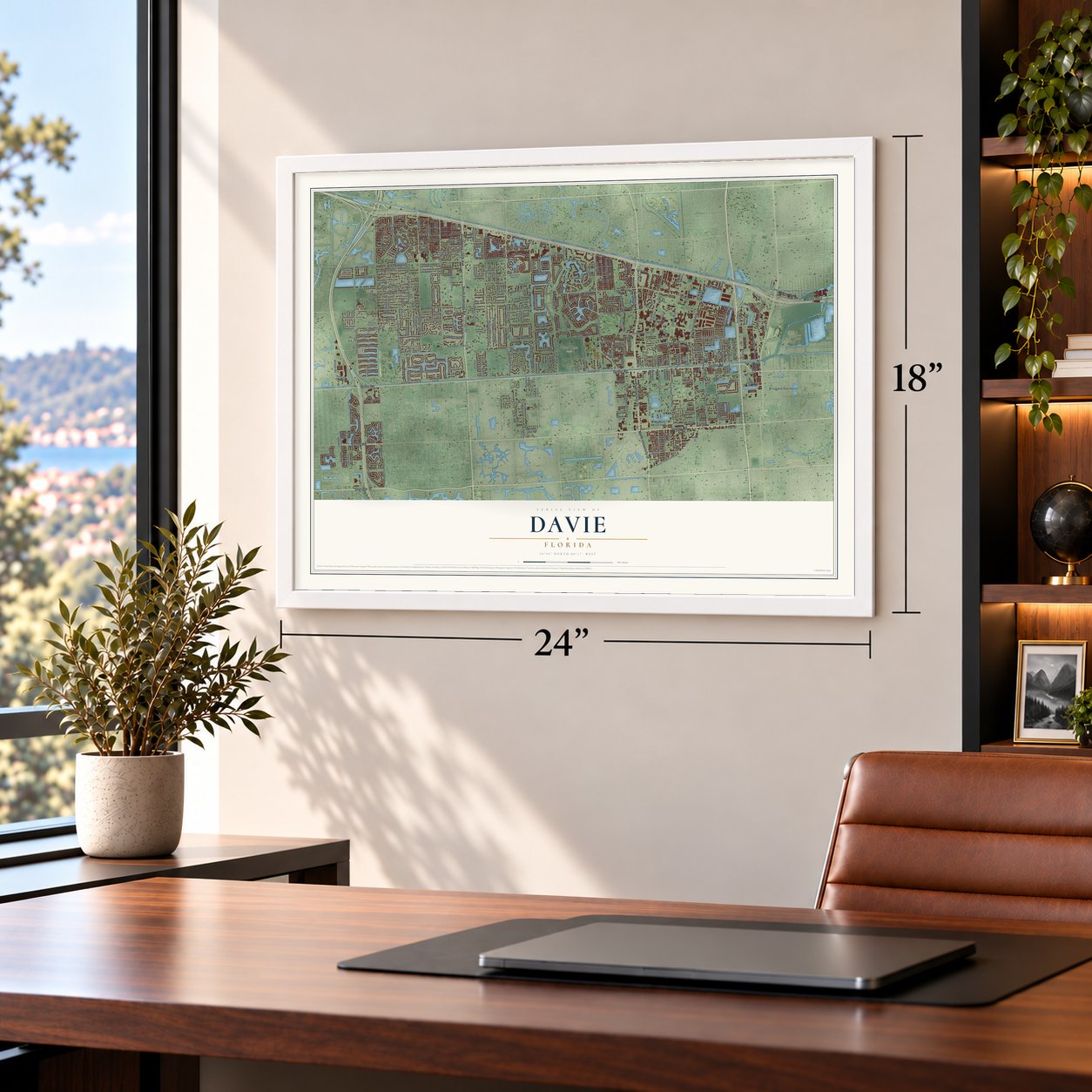
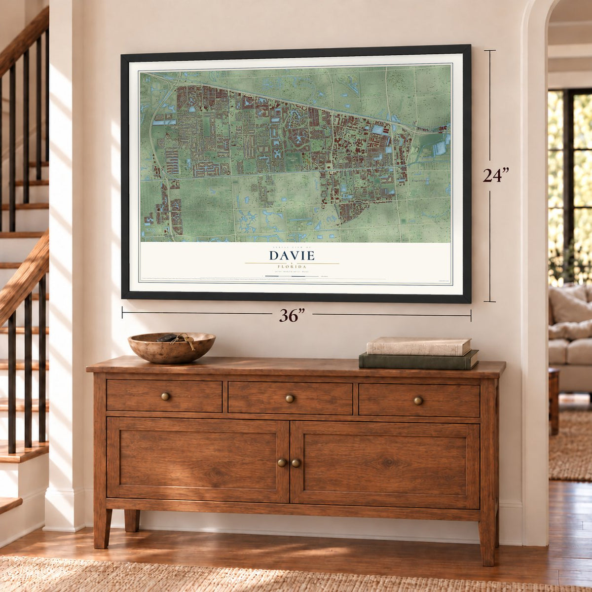
A new map of Davie, Florida, made in 2026 and printed to order on thick archival matte paper.
12" x 18" Archival Matte Print
A Map of Home. A Work of Art.
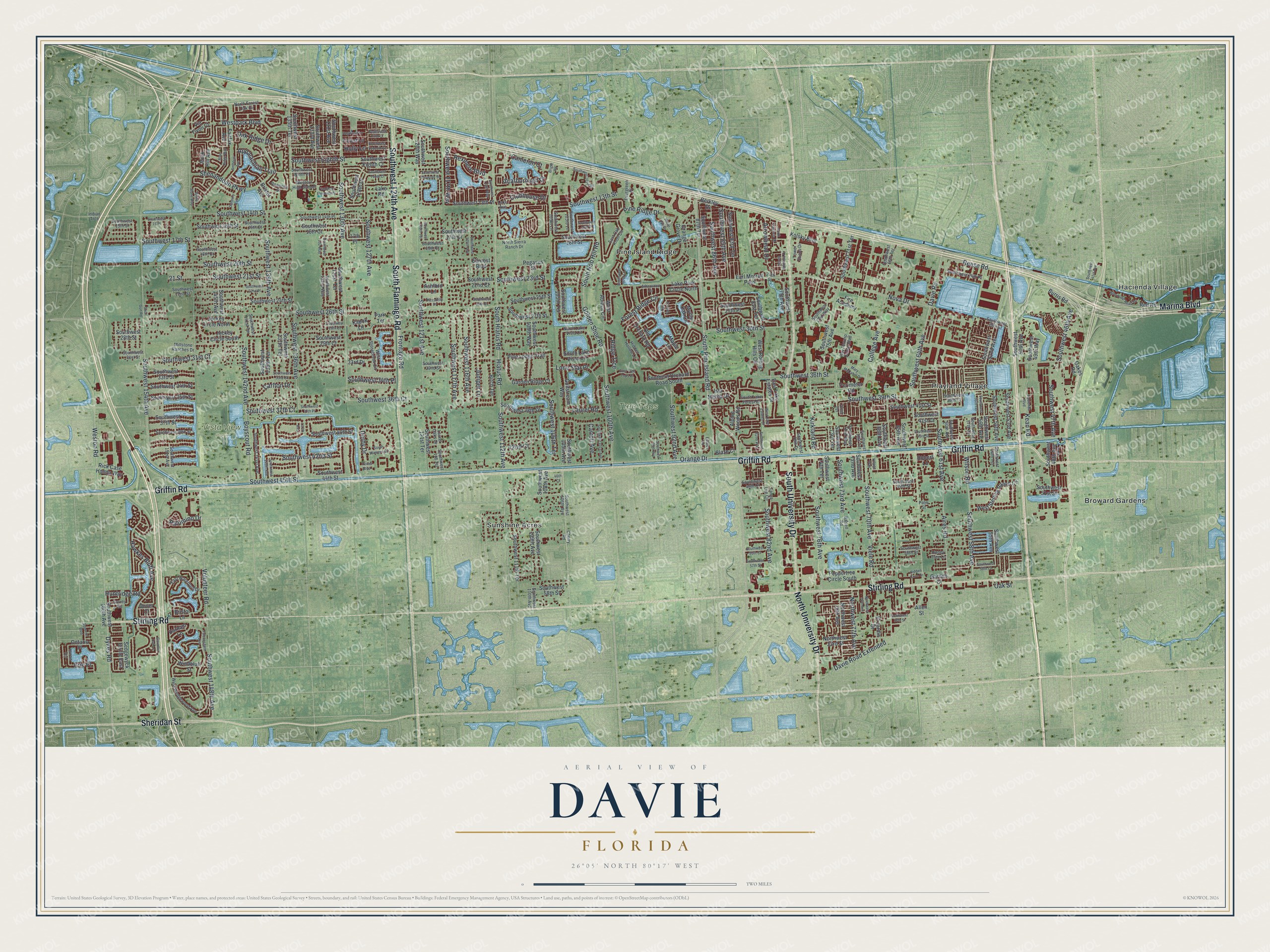
Explore Davie, Florida from a whole new perspective. Created using aerial imagery and detailed geographic data, this map captures Davie building by building, with labeled streets, familiar landmarks, and shaded topographical relief that highlights the natural contours of the landscape.
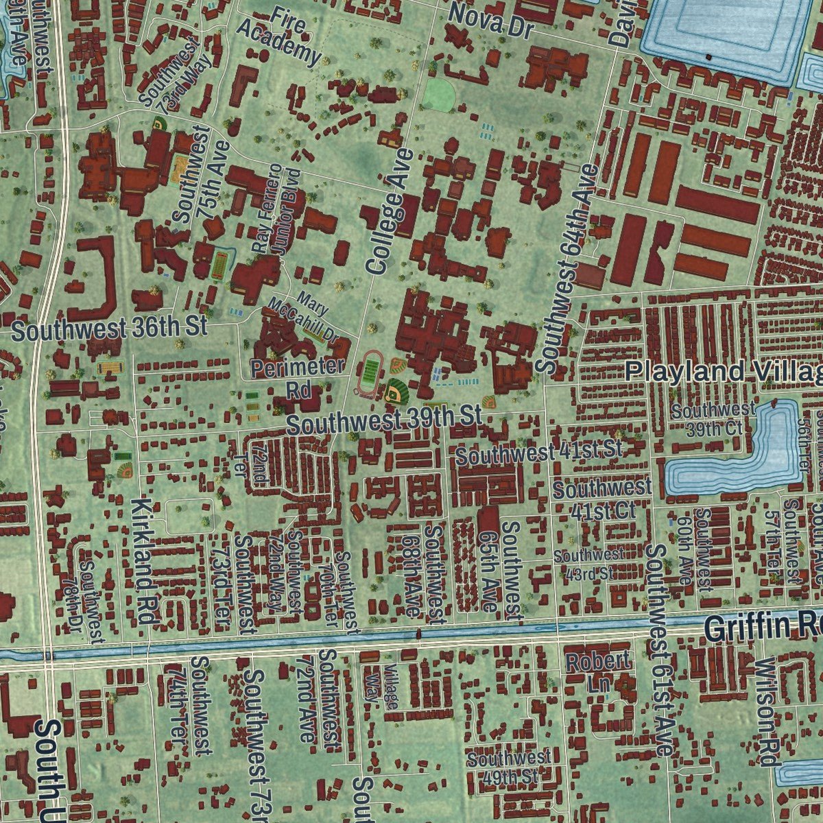
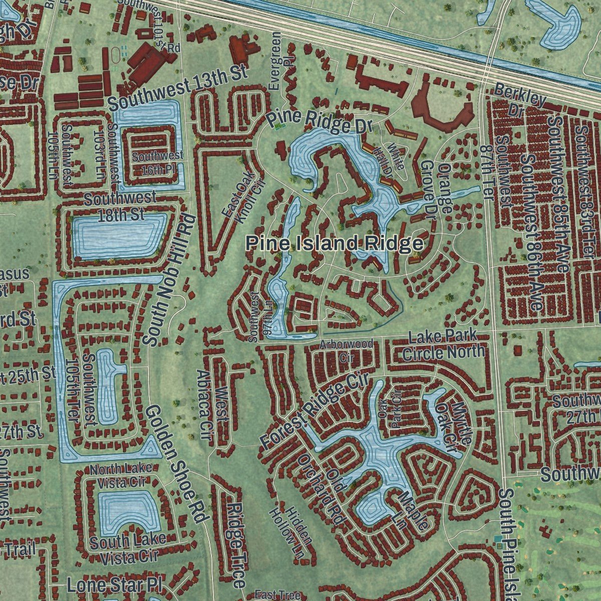
Combining modern data with the timeless character of a vintage atlas, this map is just as interesting up close as it is beautiful on the wall. Whether you grew up in Davie, spent memorable years there, or call it home today, this unique map is a great way to celebrate a place that means something to you. Zoom in on the preview to look for your street, and then order a print to put your memories on the wall.
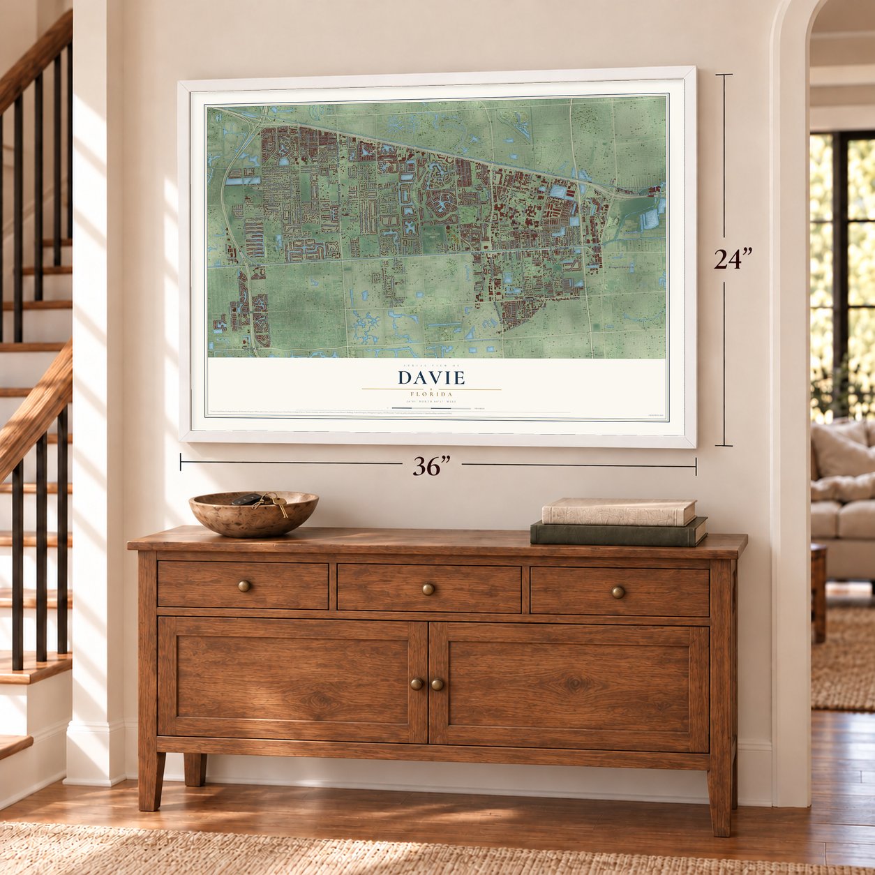
Three ways to hang it
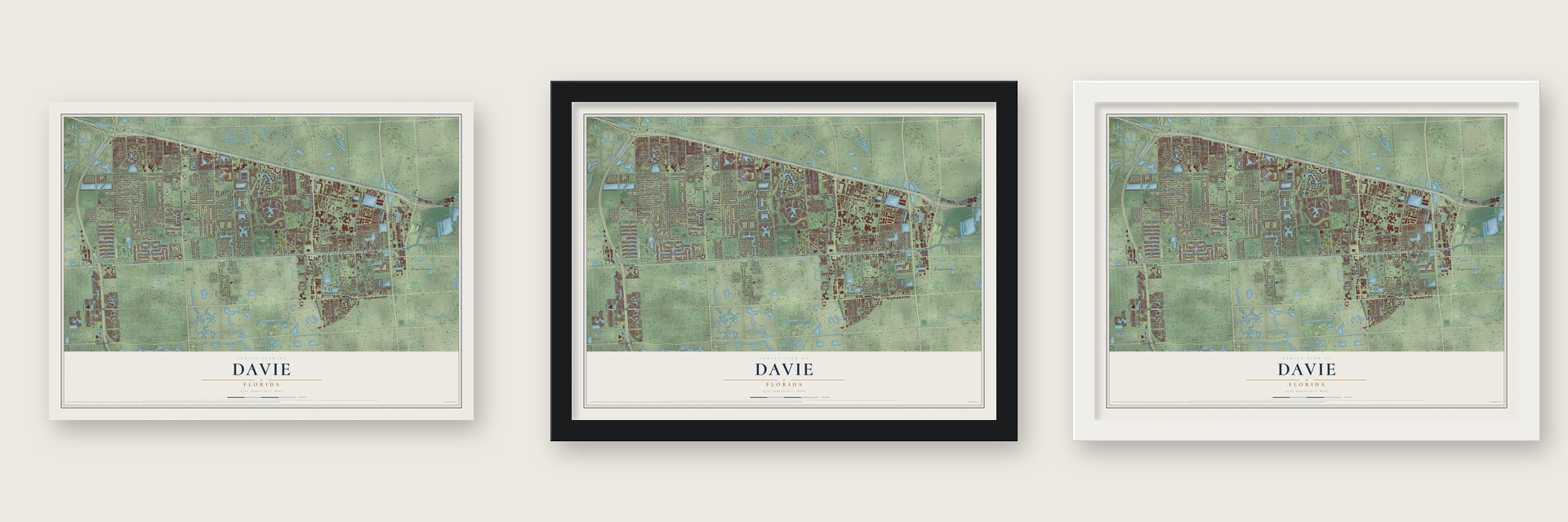
Unframed archival matte, a black wood frame or a white wood frame.
Up close
Geography Worth Displaying
This map was created using accurate cartographic data and authoritative geographic sources, including the U.S. Geological Survey (USGS) and FEMA. The map brings together terrain, waterways, roads, and building detail. The majority of the streets are labeled, houses are accurately depicted, and the topography is derived from government sources. Combining local data with carefully composed color and shading leads to this beautifully detailed Davie artwork for your wall.
Rather than simply showing street outlines, we’ve included as many of the street names as we could reasonably fit on the map while keeping their names legible. Zoom in on the high resolution preview to see exactly what’s on the map. We truly set out to create a statement piece for anyone who loves Davie. So whether it’s for you, or a gift for someone you love, we hope this map of Davie brings back fond memories.
Explore the full map of Davie, Florida and read about the local places it shows.
About Davie, Florida
Davie is a town of 110,320 people in Broward County, 24 miles north of Miami, and the 2020 census made it the largest town in Florida. Long before Europeans arrived, the Tequesta camped and buried their dead here. The oldest of those sites, on Pine Island Ridge, are 5,000 to 7,000 years old.
Around the start of the 20th century, Florida reclaimed 156 square miles of swamp. Robert Parsell Davie, a businessman from out of state, bought 44 square miles of that land to start farms and a town named Zona. Within a few years the settlers renamed the town Davie to honor him.
- The rodeo that horses savedWhen the town drew up plans in 1978 to put youth ball fields on that site, about 200 residents rode to a council meeting on horseback in protest, and the arena was spared. Its rodeo is considered Florida's oldest.
- Bergeron Rodeo GroundsPercy Bergeron, who ran a tiny country grocery, was among the arena's early leaders. In 1995 and 1996 his son Ron paid for land for parking and a paved entrance, and the grounds took the name Bergeron Rodeo Grounds.
- Refuge on Pine Island RidgeDuring the Second Seminole War, Seminoles took shelter on this ridge. It rises 29 feet above sea level, the highest natural ground in Broward County. The county bought the ridge in 1989 with money from its Environmentally Sensitive Lands bond issue, and on September 15, 2006, it became part of Davie.
- A grove at the Everglades' edgeFloyd L. and Jane Wray came in 1927, putting up a weekend house and planting a citrus grove on land that was then the edge of the Everglades. The Wray Home is now a museum showing a country home of the early 1930s.
- From airfield to campusNova Southeastern University left downtown Fort Lauderdale for a main campus in Davie, and part of that ground had been a naval training airfield during World War II. In 1993 the Miami Dolphins opened their training center on the campus.
Find your street
Names on the Davie map
Every name below is printed on this map. Look for your street, your school, the park where you played, or the pond down the road.
Places and landmarks7
- Tree Tops Park
- Vista View Park
- Broward Gardens
- Hacienda Village
- Pine Island Ridge
- Playland Village
- Sunshine Acres
Streets and roads332
- South University Drive
- Griffin Road
- Stirling Road
- South Flamingo Road
- Southwest 124th Avenue
- North University Drive
- Marina Boulevard
- Sheridan Street
- South Pine Island Road
- Southwest 36th Street
- Hiatus Road
- Southwest 82nd Avenue
- Southwest 112th Avenue
- Southwest 106th Terrace
- Orange Drive
- Southwest 45th Street
- Southwest 148th Avenue
- Southwest 136th Avenue
- Southwest 20th Street
- Davie Road
- Southwest 64th Avenue
- Southwest 26th Street
- Southwest 130th Avenue
- Southwest 14th Street
- Nova Drive
- Southwest 39th Street
- Southwest 30th Street
- Southwest 154th Avenue
- Southwest 61st Avenue
- Southwest 36th Court
Show all 332 streets
- Southwest 76th Avenue
- Hawkes Bluff Avenue
- Southwest 121st Avenue
- Southwest 23rd Street
- Kirkland Road
- Volunteer Road
- Southwest 70th Avenue
- Southwest 100th Avenue
- Golden Shoe Road
- Southwest 139th Avenue
- Southwest 17th Street
- College Avenue
- Southwest 142nd Avenue
- Boyscout Road
- South Hiatus Road
- Pine Ridge Drive
- Southwest 58th Avenue
- Shenandoah Parkway
- Frontage Road
- Davie Road Extended
- South Nob Hill Road
- Southwest 117th Avenue
- Southwest 116th Avenue
- Aires Road
- Forest Ridge Circle
- Southwest 37th Court
- Southwest 46th Avenue
- Wilson Road
- Southwest 21st Street
- Southwest 42nd Street
- Reese Road
- Southwest 85th Avenue
- Southwest Eighth Street
- Cameron Court
- Southwest 86th Avenue
- Southwest 127th Avenue
- Weston Road
- Southwest 73rd Avenue
- Southwest 13th Street
- Juniper Lane
- Viele Road
- Dykes Road
- Southwest 92nd Avenue
- Southwest 47th Avenue
- Northwest 77th Avenue
- Southwest 31st Court
- Scarborough Drive
- Southwest 34th Place
- Clubhouse Drive
- Southwest 117th Way
- Kean Road
- Appalachian Trail
- Palomino Drive
- Arrowhead Drive
- Ridge Trce
- Oak Ridge Drive
- Westpark Boulevard
- Rexmere Boulevard
- Derby Drive
- Huntridge Road
- Lone Star Place
- Carlton Drive
- Carroll Avenue
- 42nd Court
- Laurel Road
- Erie Place
- Holly Lane
- Oak Street
- 21 Street
- Southwest 52nd Avenue
- Southwest 79th Avenue
- Southwest 54th Avenue
- Southwest 58th Street
- Southwest 41st Street
- Southwest 40th Street
- Southwest 16th Street
- Southwest 24th Street
- Southwest 111th Terrace
- Southwest 51st Street
- Southwest 22nd Court
- Southwest 71st Terrace
- Southwest 55th Avenue
- Southwest 16th Court
- Southwest 87th Terrace
- Southwest 131st Terrace
- Southwest 44th Street
- Southwest 41st Court
- Southwest 145th Avenue
- Southwest 83rd Terrace
- Southwest 28th Street
- Southwest 27th Street
- Birch Terrace
- Southwest 17th Court
- Orange Grove Drive
- Southwest 25th Street
- Burris Road
- Southwest 133rd Avenue
- Southwest 37th Street
- Southwest 160th Avenue
- Southwest 53rd Avenue
- Old Orchard Road
- Northwest 78th Avenue
- Southwest 18th Street
- Southwest 29th Court
- Southwest 34th Street
- Southwest 56th Avenue
- Southwest 65th Avenue
- Southwest 35th Street
- Southwest 109th Avenue
- Southwest 75th Avenue
- West Sterling Ranch Circle
- Southwest 131st Avenue
- Southwest 33rd Street
- Northwest 33rd Street
- Southwest 120th Way
- Southwest 72nd Avenue
- Southwest 81st Terrace
- Southern Orchard Road South
- Southwest 38th Drive
- Southwest 121st Terrace
- Southwest 50th Avenue
- Southwest 27th Place
- West Rolling Hills Circle
- Peppertree Circle South
- Southwest 105th Avenue
- Southwest 13th Place
- Southwest 137th Terrace
- Southwest 105th Terrace
- Southwest 74th Terrace
- Southwest 108th Way
- East Lake Estates Drive
- Pine Lodge Trail
- Southwest 135th Terrace
- Garden Ridge Court
- Rock Hill Avenue
- Gulfstream Way
- Kolsky Boulevard
- Myrtle Oak Circle
- Oakes Road
- Southwest Eighth Court
- Berkley Drive
- Alpine Woods Road
- Southwest 128th Drive
- Southwest 139th Terrace
- Earl Morrall Pass
- Fire Academy
- Rick Case Honda Way
- Southwest 48th Avenue
- South Lake Vista Circle
- Jockey Circle North
- Southwest 73rd Terrace
- Sedgewyck Circle East
- Lake Park Circle North
- Jockey Circle South
- Isla Merita Drive
- Southwest 49th Way
- West Abiaca Circle
- Perimeter Road
- Lake Road
- Windbluff Street
- Earnest Boulevard
- Southwest 108th Avenue
- Red Road
- Southwest 68th Avenue
- Bristol Avenue
- Bristol Lane
- Pegasus Street
- Via Tivoli Court
- Fairfax Avenue
- Ontario Place
- Forest Lane
- El Jardin Drive
- Maple Lane
- Durham Lane
- 17th Place
- Blaze Court
- Ashford Lane
- 33rd Drive
- Garden Court
- Park Terrace
- Robert Lane
- Kapok Lane
- Dover Court
- Allen Street
- Southwest 14th Place
- Southwest Ninth Place
- Southwest 39th Court
- Southwest 18th Court
- Southwest 29th Street
- Bartell Road
- Southwest 31st Street
- Southwest 49th Street
- Southwest 66th Terrace
- Southwest 38th Street
- Southwest 70th Terrace
- Southwest 132nd Way
- Southwest 24th Place
- Southwest 60th Avenue
- West Wedgewood Avenue
- Southwest 72nd Way
- Southwest 15th Court
- Southwest 48th Court
- Southwest 106th Avenue
- Southwest 32nd Street
- Southwest 56th Street
- Southwest 57th Terrace
- Southwest 15th Street
- Laurel Oaks Drive
- Southwest 118 Terrace
- Southwest 19th Court
- Southwest 141st Avenue
- Southwest 141st Terrace
- Cherry Road
- Hidden Hollow Lane
- East Oak Knoll Circle
- Evergreen Place
- East Waterford Drive
- Southwest 54th Terrace
- Southwest 22nd Street
- West Stonebrook Circle
- Southwest 110th Avenue
- Southwest 151st Avenue
- Tanya Lee Circle
- Lake Avenue
- Southwest 73rd Way
- North Forest Oak Circle
- Ray Ferrero Junior Boulevard
- North Sierra Ranch Drive
- Tower Shops Drive
- Southwest 103rd Lane
- Western High School
- North Lake Vista Circle
- South Lake Forest Drive
- Southwest 78th Drive
- 24th Street
- Southwest 105th Lane
- Millstone Ranches Drive
- Roanoke Street
- Huron Terrace
- Surrey Circle
- Honey Tree Lane
- Indian Trce
- 72nd Terrace
- Palm Street
- North Valencia Drive
- South Valencia Drive
- Gauntlet Hall Lane
- Oak Park Circle
- Southwest 57th Street
- Southwest 43rd Street
- Falconsgate Avenue
- Southwest 58th Court
- White Hall Drive
- Southwest Fifth Court
- Southwest Tenth Court
- Southwest 101st Avenue
- Southwest 115th Avenue
- Hacienda Boulevard
- Arborwood Circle
- Southwest 33rd Court
- Southwest 16th Place
- Southwest 22nd Place
- Southwest Seventh Street
- Southwest 28th Court
- Southwest 112th Way
- West Lake Estates Drive
- Southwest 140th Avenue
- West State Road 84
- Amherst Avenue
- Southwest 97th Lane
- Northwest 37th Street
- Southwest Eleventh Street
- Southwest 55th Court
- Southwest 101st Road
- Northwest 76th Avenue
- Hidden Cove Drive
- Southwest 37th Place
- Blue Ridge Way
- Southwest 82nd Way
- Southwest 25th Court
- South Winners Circle
- Southwest 120th Terrace
- East Tree Tops Court
- Bright Road
- Mary McCahill Drive
- Flamingo Elementary
- Dogwood Lane
- Superior Boulevard
- Danbury Avenue
- Southwest 56th Terrace
- Southwest 15 Place
- Southwest 41st Avenue
- Southwest 95th Avenue
- Piccadilly Place
- Southwest 132 Way
- White Stone Way
- Estates Road
- Trotter Boulevard
- Shot Gun Road
- Village Way
- 137th Avenue
- 46th Court
Names are listed as they appear on the printed map. Zoom into the product photos to find them.
The art of mapping a place
How This Map Was Made
Real places. Remarkable detail. Discover the layers that turn geographic data into a map of home.

The view from above
Aerial imagery reveals the character of the land: woodland, open fields, and the patterns of a place.

The shape of the land
Elevation data brings hills, valleys, and subtle changes in the landscape into view.

The details of home
Roads, waterways, and building footprints come together to make the map feel unmistakably local.

Geography becomes art
Considered color, shading, and typography bring the layers together in a map made for your wall.


Process illustrated with Mendon, Massachusetts. Aerial imagery: USDA NAIP. Terrain: USGS 3D Elevation Program. Map details and finished artwork: KNOWOL.
The Details
About This Print
Choose an archival matte print, or a black or white Ayous wood frame. The archival matte print is unframed.
Select your size and finish above to see the matching product image and price.
Materials & Craftsmanship
A contemporary map with the character of a classic atlas, printed on archival matte paper. Optional frames are made from Ayous wood.
Your printed map does not include the watermark shown in the full-map preview.
Shipping & Delivery
Free shipping within the United States. Every print is made to order in the USA.
Buying a gift? Add a note in your cart and we'll include it. We never put prices in the package.
Prints ship within 2 to 3 business days. Allow 7 to 10 days total from ordering for delivery. Timing may vary during holidays or periods of high order volume.
Read our shipping policy.
Returns and damaged prints
Each print is made to order. Change-of-mind refunds are not available after production.
If your print arrives damaged, misprinted or incorrect, contact support@knowol.com within 30 days of receiving it. Include your order number, photos and a description of the issue.
Read our full refund and replacement policy. For questions about your order, email support@knowol.com.
Find your town
Looking for another city?
Find a map of home in our Florida collection, or any town in the country.
Nearby
Maps of towns near Davie
Know someone from one of these towns? Their map makes a great gift.
 Cooper City
, Florida
From $39.99See the map
 Plantation
, Florida
From $39.99See the map
 Broadview Park
, Florida
From $39.99See the map
More maps nearby: Pembroke Pines, Southwest Ranches, Sunrise, Lauderhill and Boulevard Gardens.