
Search for another town

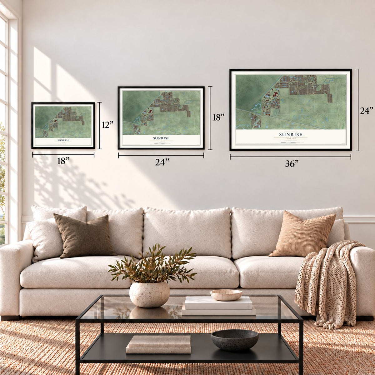

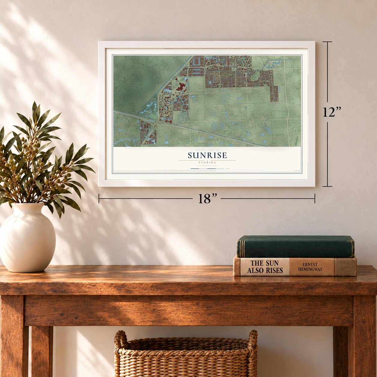
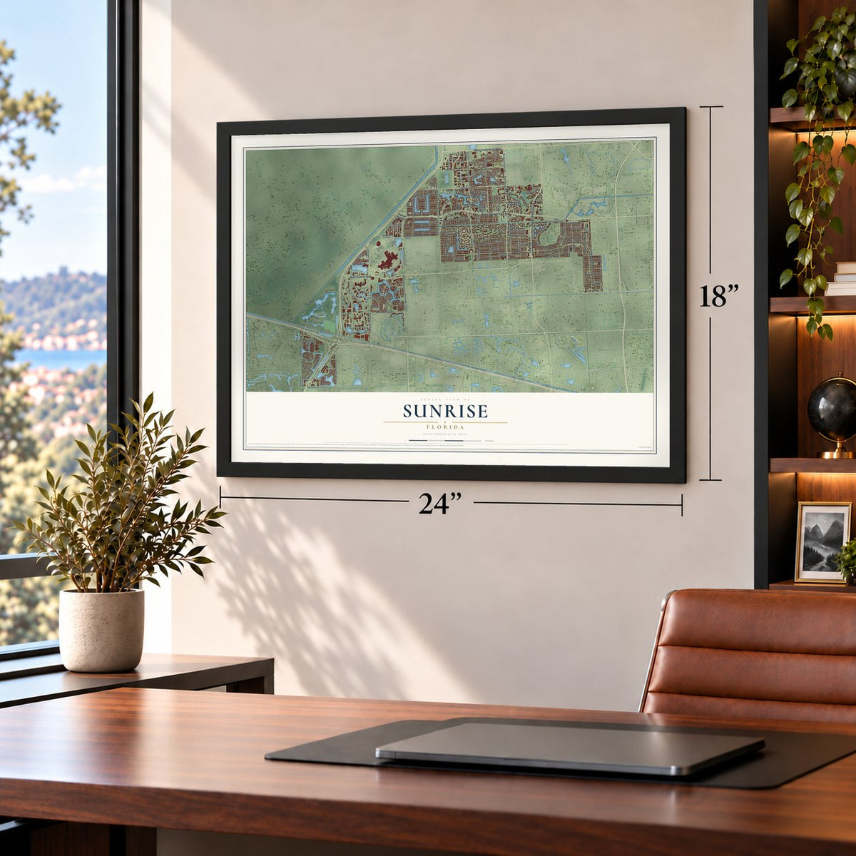
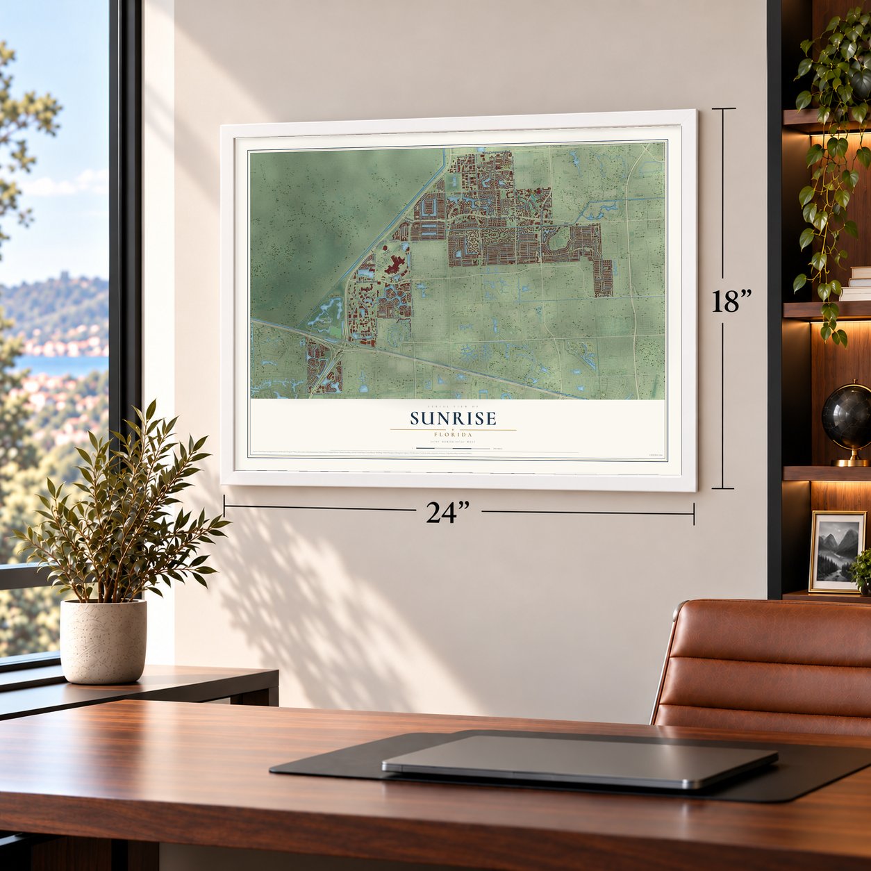


Free U.S. delivery 7 to 10 days after you order
Sunrise, Florida Map Art
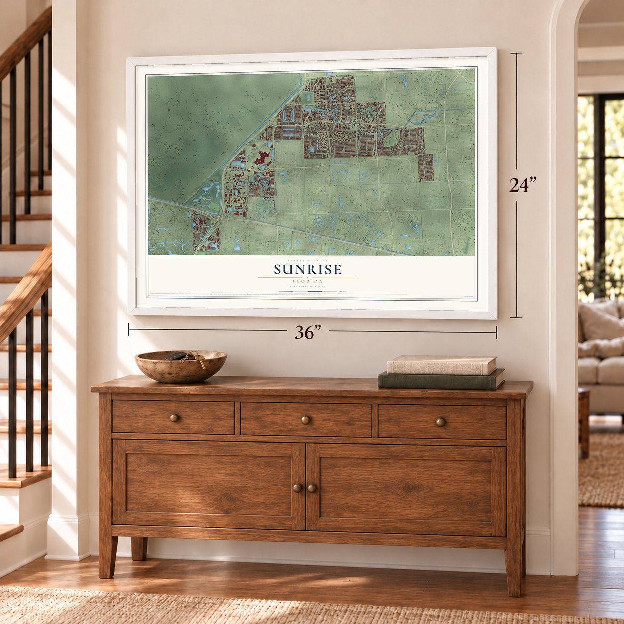
A new map of Sunrise, Florida, made in 2026 and printed to order on thick archival matte paper.
12" x 18" Archival Matte Print
A Map of Home. A Work of Art.
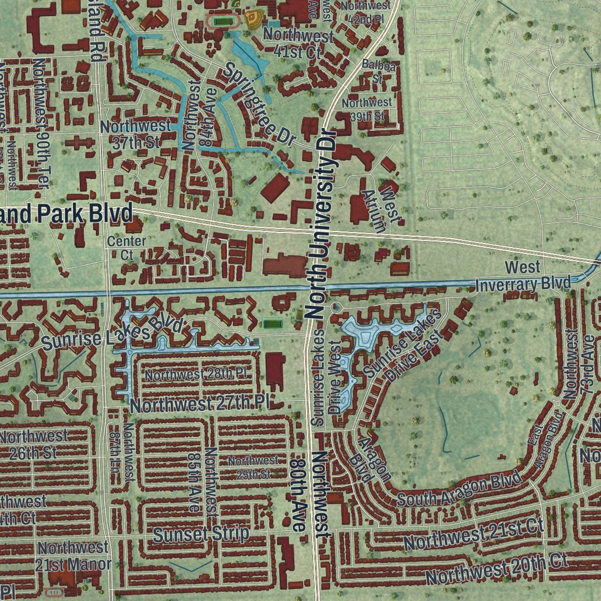
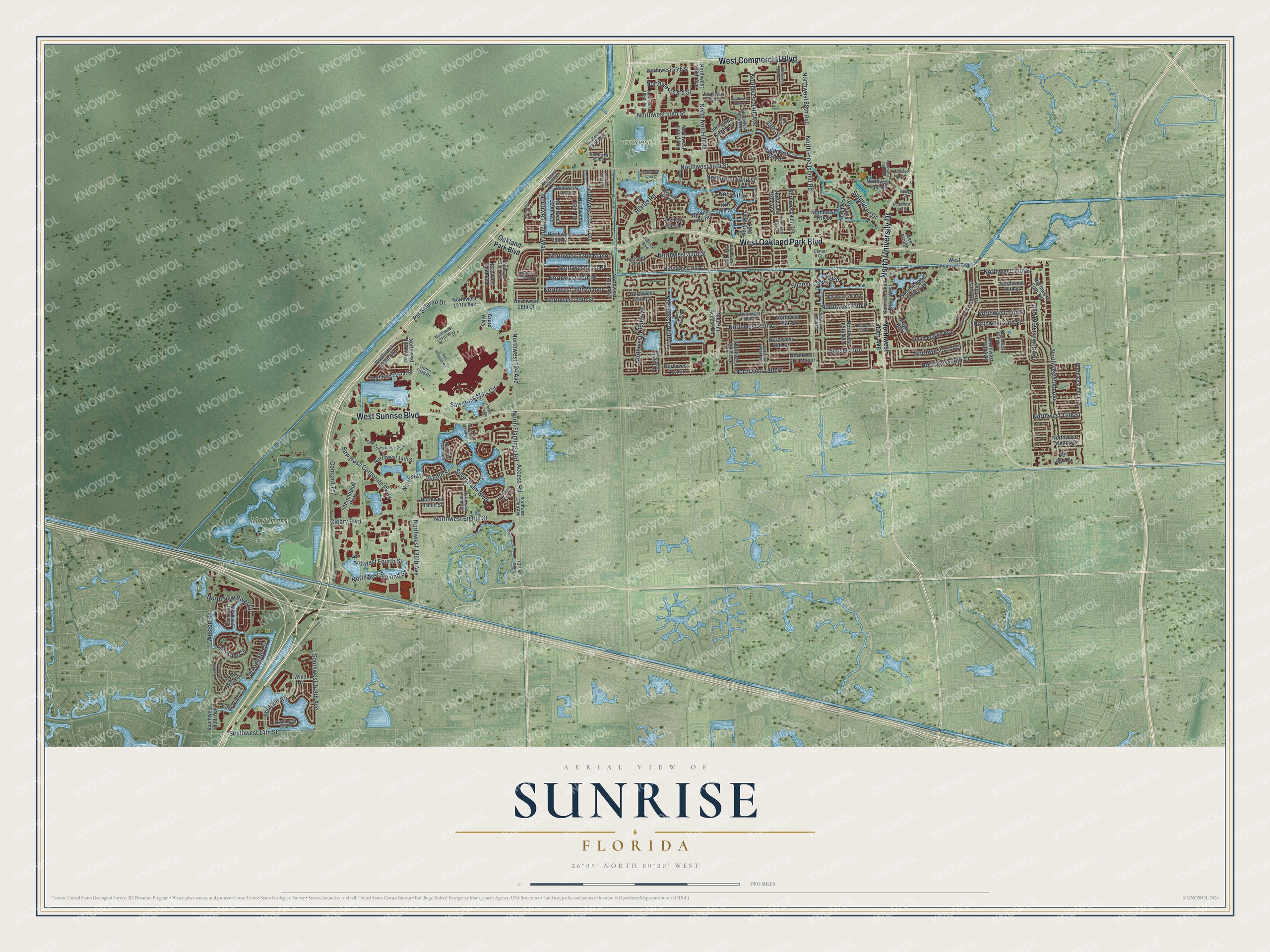
Explore Sunrise, Florida from a whole new perspective. Created using aerial imagery and detailed geographic data, this map captures Sunrise building by building, with labeled streets, familiar landmarks, and shaded topographical relief that highlights the natural contours of the landscape.
Combining modern data with the timeless character of a vintage atlas, this map is just as interesting up close as it is beautiful on the wall. Whether you grew up in Sunrise, spent memorable years there, or call it home today, this unique map is a great way to celebrate a place that means something to you. Zoom in on the preview to look for your street, and then order a print to put your memories on the wall.
Three ways to hang it
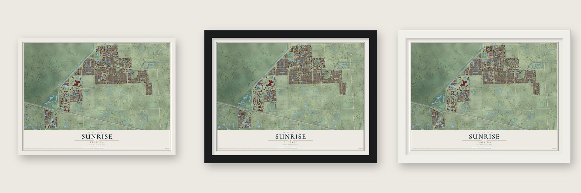
Unframed archival matte, a black wood frame or a white wood frame.
Up close
Geography Worth Displaying
This map was created using accurate cartographic data and authoritative geographic sources, including the U.S. Geological Survey (USGS) and FEMA. The map brings together terrain, waterways, roads, and building detail. The majority of the streets are labeled, houses are accurately depicted, and the topography is derived from government sources. Combining local data with carefully composed color and shading leads to this beautifully detailed Sunrise artwork for your wall.
Rather than simply showing street outlines, we’ve included as many of the street names as we could reasonably fit on the map while keeping their names legible. Zoom in on the high resolution preview to see exactly what’s on the map. We truly set out to create a statement piece for anyone who loves Sunrise. So whether it’s for you, or a gift for someone you love, we hope this map of Sunrise brings back fond memories.
Explore the full map of Sunrise, Florida and read about the local places it shows.

About Sunrise, Florida
Sunrise is a city of 97,335 people in Broward County, reaching west to the edge of the Everglades. In 1960 Norman Johnson, a developer from Iowa, bought 2,650 acres of southwestern Broward County for $9 million, and by 1961 fewer than 350 people lived on the land. The new community was reportedly meant to be called Sunset Village, but residents thought "sunset" sounded too final, so they chose Sunrise instead.
Governor C. Farris Bryant named Johnson the first mayor of Sunrise Golf Village in 1961. By 1967 the village had 4,300 people on just 1.75 square miles, and its residents took over their own government that year. When Broward County spread west in the 1970s, the city grew for the first time. Voters renamed it the City of Sunrise in 1971, and annexations carried it past 18 square miles, so that about 50,000 people lived here by October 1984.
“Sunrise Golf Village emerged from a developer's operation into a free city under complete control of its residents.”
- The upside-down houseTo bring in buyers, Johnson and F. E. Dykstra built a house turned on its head and furnished every room. Newspaper stories and a feature in Life magazine made it a national attraction, and thousands of visitors came to the village to see it. One of them, John Lomelo Jr., had once owned a nightclub in Miami. He settled here and became the first mayor the residents elected.
- Sawgrass Mills, 1990Sawgrass Mills opened its first phase in October 1990. Its plan was drawn in the shape of an alligator, and its name comes from saw grass, a common plant of the Everglades less than a mile away. The center has since grown to almost 2.3 million square feet, with 350 outlet and value retailers.
- Stanley Cup on home iceThe arena opened in 1998 as the National Car Rental Center and is now Amerant Bank Arena, the largest indoor arena in Florida and home of the Florida Panthers. On June 24, 2024, the Panthers beat the Edmonton Oilers 2-1 in the seventh game of the finals to win their first Stanley Cup in front of their own fans. They beat the Oilers again in 2025, 4 games to 2.
- Its own gas companySunrise runs its own water, wastewater and natural gas service, along with its own police and fire-rescue departments. Its gas system ranks sixth in size among city-owned systems in Florida and reaches nearly 10,000 homes and businesses, while its water and sewer lines serve more than 200,000 customers.
Find your street
Names on the Sunrise map
Every name below is printed on this map. Look for your street, your school, the park where you played, or the pond down the road.
Places and landmarks3
- Markham Park
- Trailhead
- Saw Technology Park
Streets and roads163
- North University Drive
- West Oakland Park Boulevard
- West Sunrise Boulevard
- West Commercial Boulevard
- North Nob Hill Road
- North Pine Island Road
- Northwest 88th Avenue
- Shotgun Road
- Northwest 31st Place
- Northwest 15th Street
- Access Road
- Northwest 24th Place
- Northwest 32nd Manor
- Northwest 50th Street
- Northwest 94th Avenue
- Northwest 124 Avenue
- North Flamingo Road
- Silver Palm Boulevard
- Northwest 109th Avenue
- Northwest 20th Court
- Northwest 30th Place
- Pat Salerno Drive
- Sunset Strip
- Northwest 136th Avenue
- Sunrise Lakes Boulevard
- Northwest 44th Street
- Hiatus Road
- Sawgrass Mills Circle
- Northwest 25th Court
- Northwest 24th Street
Show all 163 streets
- Sawgrass Corporate Parkway
- Northwest Eighth Street
- Springtree Drive
- Northwest 21st Court
- Northwest 33rd Street
- Northwest 29th Manor
- Northwest 29th Street
- Northwest 42nd Street
- Northwest 60th Avenue
- Northwest 115th Terrace
- North New River Circle
- Northwest 120th Way
- Northwest 63rd Avenue
- Northwest Twelfth Street
- Weston Road
- Cleary Boulevard
- Northwest 53rd Street
- Southwest 14th Street
- Northwest 27th Place
- Northwest 30th Street
- Southwest 148th Avenue
- Northwest Fourth Street
- Concord Terrace
- Northwest 105th Lane
- Northwest Second Street
- Lakeside Circle
- Northwest 19th Place
- Woodgate Circle
- 49th Street
- Nob Hill Lane
- Oakland Park Boulevard
- Northwest 80th Avenue
- Northwest 84th Avenue
- Northwest 100th Avenue
- Northwest 22nd Street
- Northwest 45th Street
- Northwest 126th Avenue
- Northwest 31st Court
- Nob Hill Access Road
- Northwest 24th Court
- Northwest 113th Avenue
- Northwest 85th Avenue
- Northwest 137th Avenue
- Northwest 26th Street
- Northwest 21st Street
- International Parkway
- Northwest 28th Street
- Sunrise Lakes Drive East
- Northwest 55th Street
- Northwest 103rd Avenue
- Northwest 28th Court
- Northwest 90th Terrace
- Springtree Lakes Drive
- Northwest 58th Terrace
- Northwest 14th Street
- Northwest 37th Street
- Northwest 35th Street
- Northwest 29th Court
- Northwest 73rd Avenue
- Northwest 60th Terrace
- Northwest 92nd Avenue
- Northwest 21st Manor
- Winding Lake Road
- Northwest Twelfth Court
- Northwest 95th Terrace
- Northwest 98th Avenue
- Nob Hill Court
- Northwest 139th Avenue
- Azure Alley
- South Aragon Boulevard
- Northwest Tenth Street
- Northwest 41st Court
- West Atrium
- Sunrise Lakes Drive West
- Northwest 116th Terrace
- West Inverrary Boulevard
- Southwest 160th Avenue
- Northwest 119th Avenue
- East Wind Circle
- Northwest 127th Avenue
- South Wind Circle
- Northwest 70th Avenue
- Del Lago Circle
- Aragon Boulevard
- Welleby Isles Lane
- Wind Drive
- Northwest 95th Avenue
- Northwest 97th Avenue
- Northwest 45th Place
- Northwest 125th Avenue
- Northwest 124th Avenue
- Center Court
- Northwest 26th Place
- Northwest 41st Street
- Northwest 32nd Place
- Northwest 68th Avenue
- Northwest 94th Way
- Northwest 108th Avenue
- Vista Isles Drive
- Northwest 52nd Street
- Joshlee Boulevard
- Northwest 107th Terrace
- Northwest 87th Lane
- Northwest 28th Place
- Northwest 130th Terrace
- Green Toad Road
- Northwest 137th Way
- Southwest 159th Avenue
- Southwest 13th Place
- Northwest 115th Way
- Northwest 120th Lane
- Northwest 104th Avenue
- Northwest 39th Street
- Northwest 25th Street
- Northwest 90th Avenue
- East Aragon Boulevard
- Northwest 113th Terrace
- Northwest 42nd Court
- Northwest 40th Street
- Northwest 122nd Terrace
- Northwest 91st Lane
- Northwest 129th Way
- Southwest 158th Lane
- Northwest 128th Drive
- Northwest 79th Avenue
- Red Snapper Road
- Purple Parrot Place
- Northwest Tenth Place
- Northwest 52nd Court
- Northwest 42nd Place
- Northwest 30th Manor
- Balboa Street
- 49th Court
Names are listed as they appear on the printed map. Zoom into the product photos to find them.
The art of mapping a place
How This Map Was Made
Real places. Remarkable detail. Discover the layers that turn geographic data into a map of home.

The view from above
Aerial imagery reveals the character of the land: woodland, open fields, and the patterns of a place.

The shape of the land
Elevation data brings hills, valleys, and subtle changes in the landscape into view.

The details of home
Roads, waterways, and building footprints come together to make the map feel unmistakably local.

Geography becomes art
Considered color, shading, and typography bring the layers together in a map made for your wall.


Process illustrated with Mendon, Massachusetts. Aerial imagery: USDA NAIP. Terrain: USGS 3D Elevation Program. Map details and finished artwork: KNOWOL.
The Details
About This Print
Choose an archival matte print, or a black or white Ayous wood frame. The archival matte print is unframed.
Select your size and finish above to see the matching product image and price.
Materials & Craftsmanship
A contemporary map with the character of a classic atlas, printed on archival matte paper. Optional frames are made from Ayous wood.
Your printed map does not include the watermark shown in the full-map preview.
Shipping & Delivery
Free shipping within the United States. Every print is made to order in the USA.
Buying a gift? Add a note in your cart and we'll include it. We never put prices in the package.
Prints ship within 2 to 3 business days. Allow 7 to 10 days total from ordering for delivery. Timing may vary during holidays or periods of high order volume.
Read our shipping policy.
Returns and damaged prints
Each print is made to order. Change-of-mind refunds are not available after production.
If your print arrives damaged, misprinted or incorrect, contact support@knowol.com within 30 days of receiving it. Include your order number, photos and a description of the issue.
Read our full refund and replacement policy. For questions about your order, email support@knowol.com.
Find your town
Looking for another city?
Find a map of home in our Florida collection, or any town in the country.
Nearby
Maps of towns near Sunrise
Know someone from one of these towns? Their map makes a great gift.
 Tamarac
, Florida
From $39.99See the map
 Lauderhill
, Florida
From $39.99See the map
 Plantation
, Florida
From $39.99See the map
More maps nearby: North Lauderdale, Lauderdale Lakes, Roosevelt Gardens, Washington Park and Boulevard Gardens.