


Search for another town





Free U.S. delivery 7 to 10 days after you order
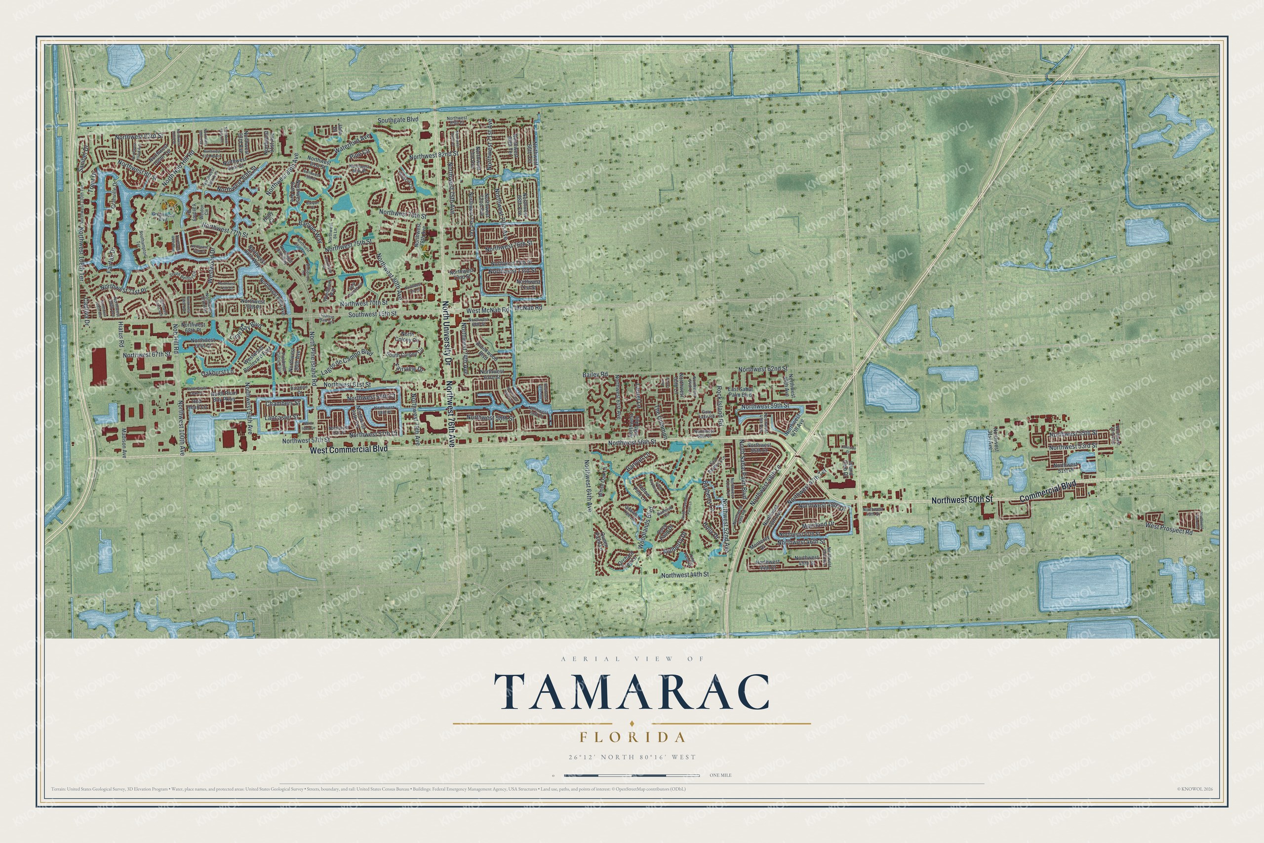
Tamarac, Florida Map Art
Building by building, with labeled streets and shaded relief.
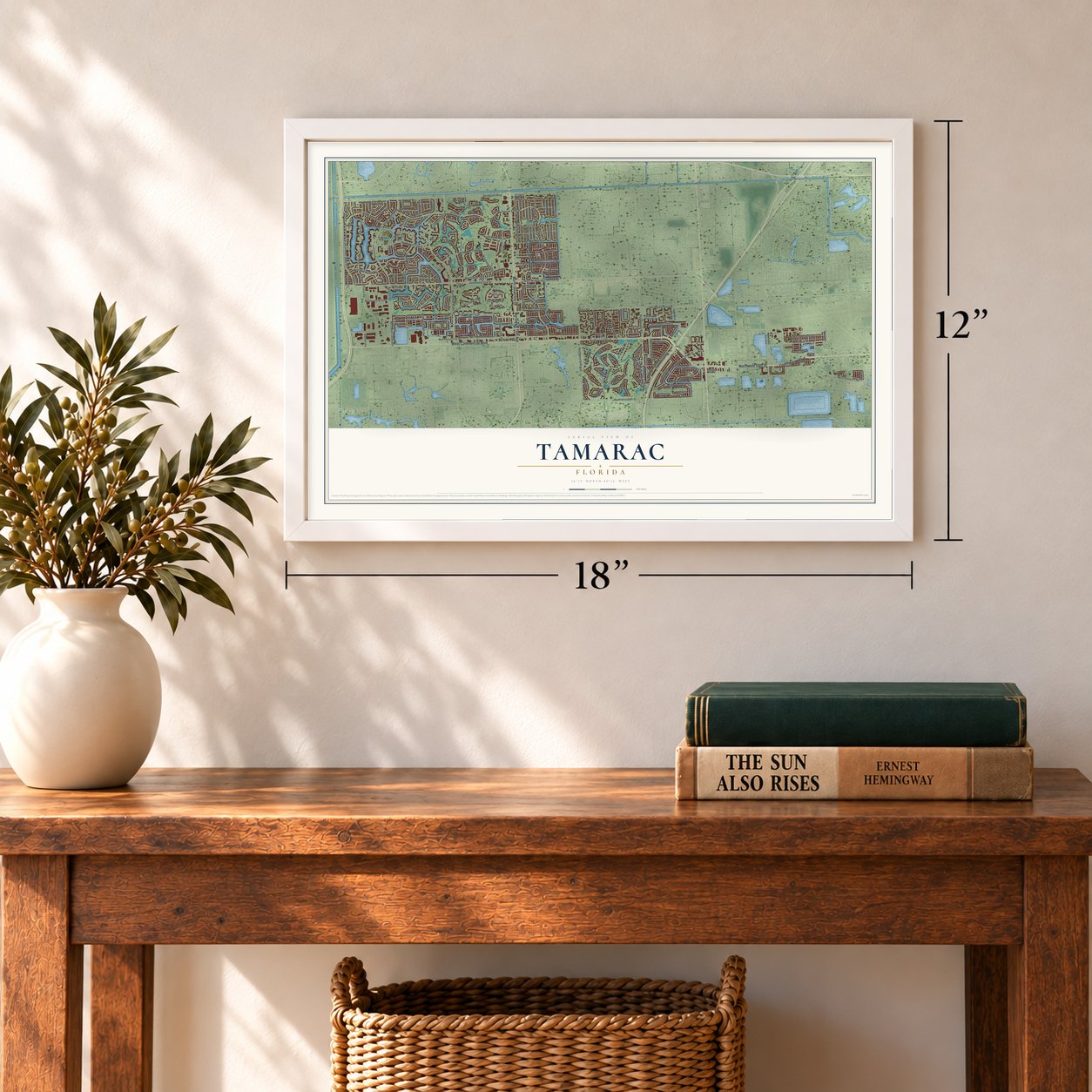
12" x 18" Archival Matte Print
A Map of Home. A Work of Art.
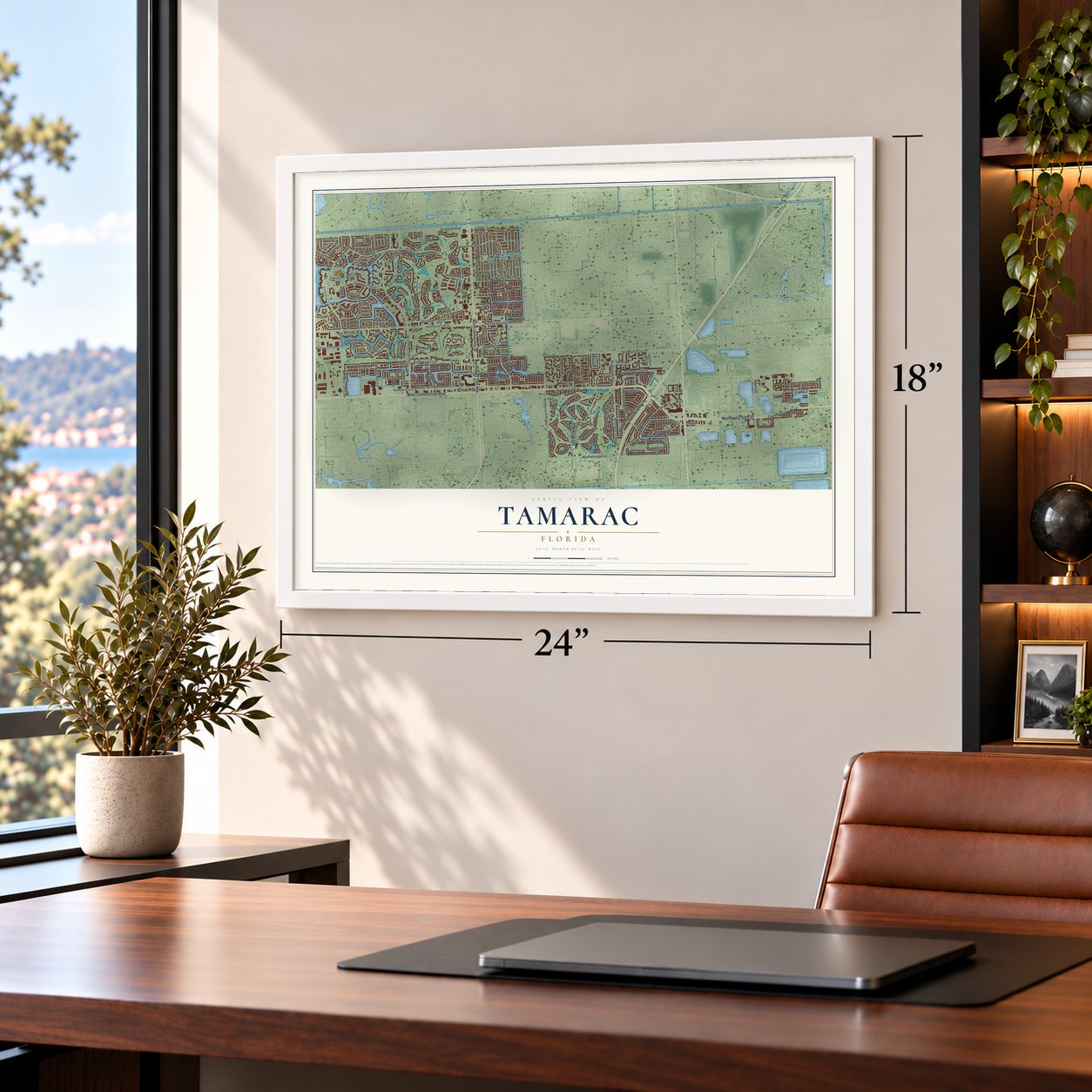
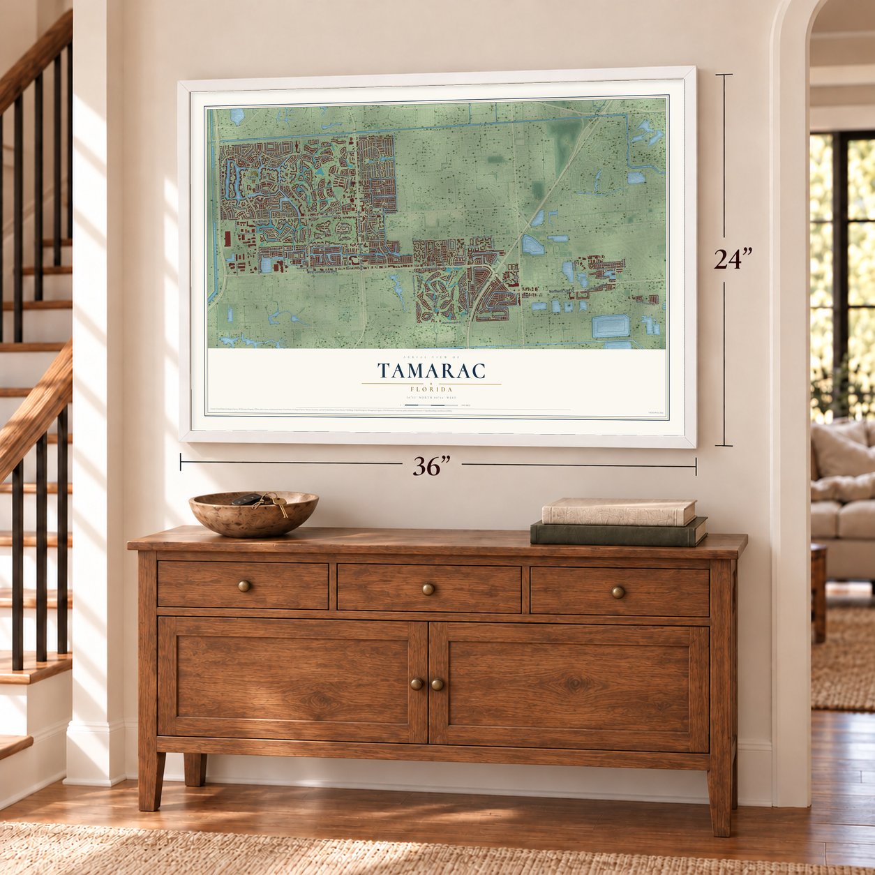
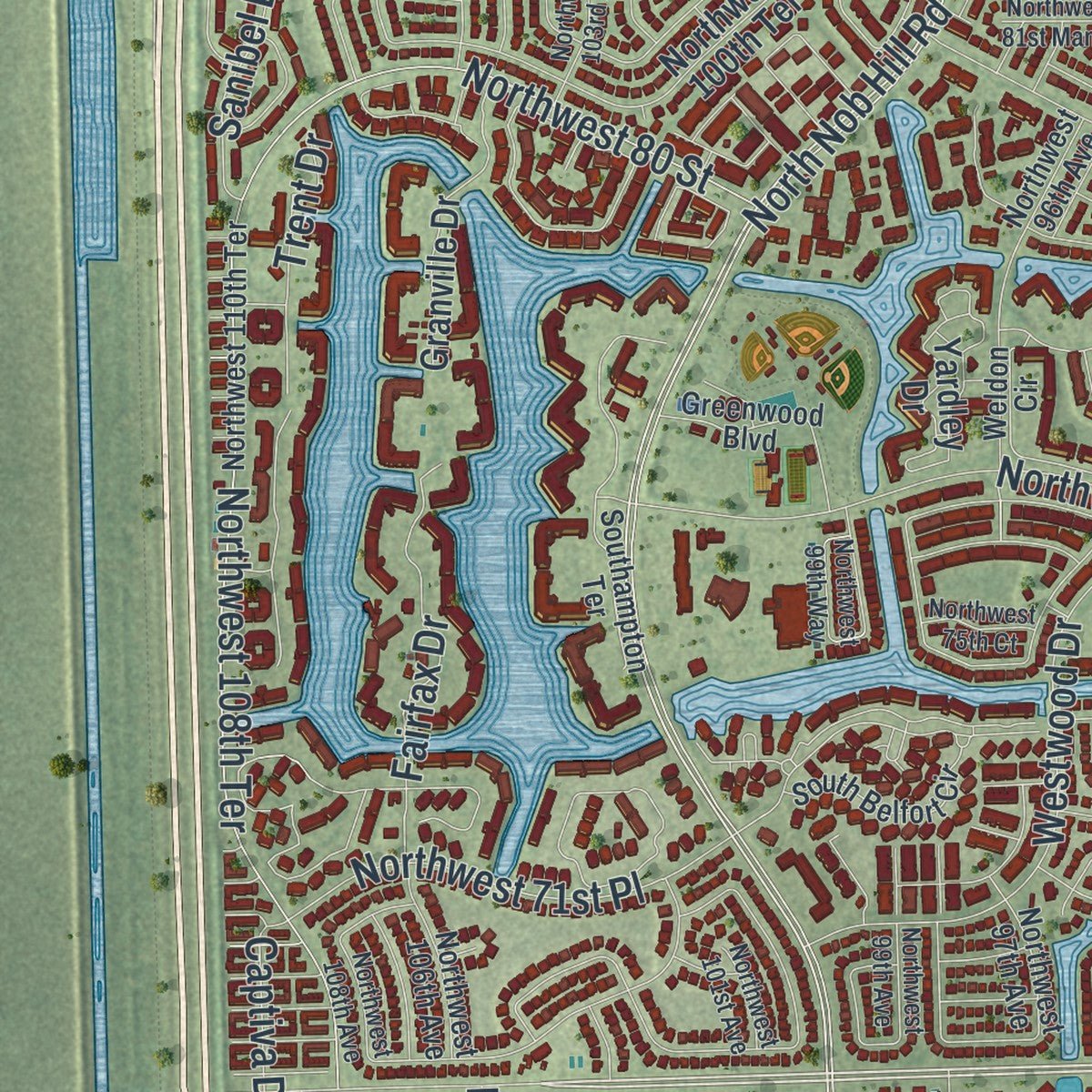
Explore Tamarac, Florida from a whole new perspective. Created using aerial imagery and detailed geographic data, this map captures Tamarac building by building, with labeled streets, familiar landmarks, and shaded topographical relief that highlights the natural contours of the landscape.
Combining modern data with the timeless character of a vintage atlas, this map is just as interesting up close as it is beautiful on the wall. Whether you grew up in Tamarac, spent memorable years there, or call it home today, this unique map is a great way to celebrate a place that means something to you. Zoom in on the preview to look for your street, and then order a print to put your memories on the wall.
Three ways to hang it
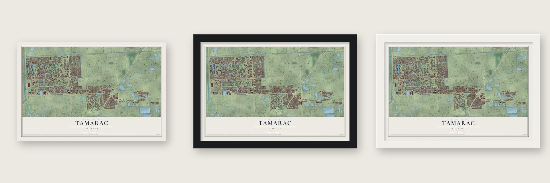
Unframed archival matte, a black wood frame or a white wood frame.
Up close
Geography Worth Displaying
This map was created using accurate cartographic data and authoritative geographic sources, including the U.S. Geological Survey (USGS) and FEMA. The map brings together terrain, waterways, roads, and building detail. The majority of the streets are labeled, houses are accurately depicted, and the topography is derived from government sources. Combining local data with carefully composed color and shading leads to this beautifully detailed Tamarac artwork for your wall.
Rather than simply showing street outlines, we’ve included as many of the street names as we could reasonably fit on the map while keeping their names legible. Zoom in on the high resolution preview to see exactly what’s on the map. We truly set out to create a statement piece for anyone who loves Tamarac. So whether it’s for you, or a gift for someone you love, we hope this map of Tamarac brings back fond memories.
Explore the full map of Tamarac, Florida and read about the local places it shows.

Find your street
Names on the Tamarac map
Every name below is printed on this map. Look for your street, your school, the park where you played, or the pond down the road.
Streets and roads195
- West Commercial Boulevard
- North University Drive
- Northwest 50th Street
- Commercial Boulevard
- Northwest 76th Avenue
- West McNab Road
- West Prospect Road
- Northwest 44th Street
- Nob Hill Road
- Northwest 80th Street
- North Nob Hill Road
- Northwest 57th Court
- Waterford Avenue
- North Pine Island Road
- Northwest 71st Avenue
- Northwest 46th Street
- Northwest 52nd Avenue
- Holly Drive
- Northwest 88th Avenue
- Northwest 100th Avenue
- Southgate Boulevard
- Northwest 57th Street
- Southwest 15th Street
- Northwest 70th Avenue
- Northwest 70th Street
- Northwest 62nd Street
- Northwest 61st Street
- Northwest 58th Street
- Northwest 83rd Street
- Northwest 77th Street
Show all 195 streets
- Northwest 82nd Street
- Woodlands Boulevard
- Northwest 94th Avenue
- Bailey Road
- Rock Island Road
- Northwest 59th Street
- Bayberry Lane
- Northwest 80th Avenue
- Northwest 74th Avenue
- Northwest 78th Street
- Northwest 108th Terrace
- Northwest 75th Street
- Northwest 53rd Street
- Banyan Lane
- Northwest 76th Street
- Hiatus Road
- Northwest 64th Avenue
- Lagos de Campo Boulevard
- Westwood Drive
- Northwest 67th Street
- Northwest 75th Avenue
- Northwest 47th Terrace
- Northwest 48th Lane
- Northwest 55th Street
- Northwest 73rd Street
- Northwest 79th Avenue
- Northwest 71st Place
- North Sabal Palm Boulevard
- Northwest 59th Court
- Mainland Drive
- Northwest 80 Street
- Northwest 49th Drive
- The Common
- Fairfax Drive
- Mulberry Drive
- Lime Bay Boulevard
- Northwest 56th Street
- Trent Drive
- Sanibel Drive
- Oakburst Lane
- Banyan Way
- Pine Circle
- Laurel Lane
- Captiva Drive
- Lancaster Street
- Chambers Street
- Fairview Drive
- McNab Road
- Northwest 73rd Terrace
- North Plum Bay Parkway
- Northwest 81st Street
- Northwest 72nd Street
- Northwest 66th Terrace
- Northwest 68th Avenue
- Northwest 73rd Avenue
- Northwest 72nd Avenue
- Brookwood Boulevard
- Northwest 84th Terrace
- Northwest 68th Terrace
- Northwest 89th Avenue
- Northwest 93rd Avenue
- Northwest 71st Street
- Northwest 48th Avenue
- Yardley Drive
- Northwest 47th Street
- White Oak Lane
- Northwest 81st Court
- Northwest 63rd Street
- Island Club Drive
- Northwest 78th Avenue
- Northwest 31st Avenue
- Northwest 91st Avenue
- Northwest 87th Avenue
- Northwest 74th Place
- Northwest 47th Avenue
- Northwest 67th Court
- East Sabal Palm Boulevard
- Northwest 100th Terrace
- Northwest 70th Place
- Northwest 90th Avenue
- Queen Palm Lane
- Granville Drive
- South Colony Circle
- Northwest 55th Court
- Northwest 61st Avenue
- Northwest 55th Lane
- Yellow Pine Lane
- Northwest 45th Street
- Westwood Boulevard East
- Northwest 88th Way
- Madison Avenue
- Northwest 44th Court
- Northwest 51st Place
- Orchard Tree Lane
- Northwest 46th Avenue
- Northwest 68th Place
- Coco Palm Drive
- Northwest 59th Avenue
- North Colony Circle
- Monterey Drive
- Red Heart Lane
- Holly Court
- Jade Drive
- Northwest 56th Court
- Northwest 58th Court
- Northwest 110th Terrace
- Weldon Circle
- East Bayberry Lane
- Northwest 96th Avenue
- Northwest 57th Place
- Northwest 49th Street
- Southampton Terrace
- Hibiscus Circle
- Golf Pointe Circle
- Northwest 51st Terrace
- Northwest 49th Avenue
- Northwest 106th Avenue
- Gate Lake Road
- Northwest 80th Place
- Northwest 49th Road
- Northwest 58th Place
- Northwest 68th Street
- Umbrella Tree Lane
- Northwest 43rd Avenue
- King Palm Drive
- South Belfort Circle
- Greenwood Boulevard
- Northwest 54th Lane
- Northwest 97th Avenue
- Northwest 87th Way
- Northwest 84 Lane
- Paradise Drive
- Woodmont Way
- Northwest 85th Court
- Northwest 22nd Avenue
- Pinehurst Circle East
- Bamboo Circle
- Woodmont Terrace
- Northwest 69th Avenue
- Ann Lee Lane
- Northwest 67th Avenue
- Northwest 79th Street
- Northwest 71st Court
- Northwest 74th Terrace
- Northwest 75th Court
- Northwest 86th Terrace
- Northwest 103rd Avenue
- Northwest 101st Avenue
- Northwest 95th Avenue
- Northwest 72nd Court
- Northwest 99th Avenue
- North Grand Duke Circle
- Northwest 98th Avenue
- Northwest 99th Way
- Lakeside Drive
- Northwest 81st Manor
- Northwest 108th Avenue
- North Travelers Palm Lane
- Northwest 100th Drive
- Corkwood Terrace
- South Bayberry Lane
- Banyan Court
- Cypress Walk Terrace
- Northwest 16th Avenue
- North Isles Circle
Names are listed as they appear on the printed map. Zoom into the product photos to find them.
About Tamarac, Florida
Tamarac is a city of 71,897 people in Broward County. In 1956 Ken Behring moved from Wisconsin to Florida and started a building firm in Fort Lauderdale. In the early 1960s he began buying whatever parcels he could on old wetlands, pastures and fields. He planned a community for active adults, made up of two-bedroom homes that needed no upkeep, and borrowed its name from the Tamarac Country Club nearby in Oakland Park.
In 1963 the first homes, Tamarac Lakes Section One and Section Two, rose east of State Road 7. Behring built them and Jesse Pilch sold them. The young community incorporated as a city on July 25, 1963, and in later years it opened to residents of every age.
- Built neighborhood by neighborhoodAfter the first sections came Tamarac Lakes North, planted on what had been an orange grove. Tamarac Lakes South followed, and after it came the Mainlands of Tamarac Lakes, on the west side of State Road 7, and last of all the Woodlands. Behring's company grew to be Florida's biggest builder of single-family houses, and he even gave the Tamarac name to a subdivision near Pinellas Park, the Mainlands of Tamarac By-the-Gulf.
- Borders drawn by a builderTamarac's limits went wherever Behring put up houses. Its early leaders wanted a bedroom community, so they let Fort Lauderdale take pockets of commercial land, giving up tax money the city might have used. In the late 1970s the city also de-annexed a long strip of businesses from State Road 7 to Northwest 31 Avenue. That is why the eastern edge pinches to a sliver between Northwest 31st and 37th Avenues before it widens again to the south.
- Founder of the Wheelchair FoundationThe builder who created Tamarac went on to own the Seattle Seahawks. Behring also started the Wheelchair Foundation, and by 2013 it had handed out more than 940,000 wheelchairs.
Keep exploring Florida
Tamarac is one of 1,067 Florida towns we've mapped. Every dot on the map is a print of its own.
The search covers every state, Florida first.
Near Tamarac
Order 2 or more town maps and save 10%. Shown in the size and finish you picked above, so they hang as a set.
- Sunrise 12" x 18" / Archival Matte Print $39.99
- North Lauderdale 12" x 18" / Archival Matte Print $39.99
- Lauderhill 12" x 18" / Archival Matte Print $39.99


More maps nearby: Margate, Lauderdale Lakes, Coral Springs, Plantation and Roosevelt Gardens.
The art of mapping a place
How This Map Was Made
Real places. Remarkable detail. Discover the layers that turn geographic data into a map of home.

The view from above
Aerial imagery reveals the character of the land: woodland, open fields, and the patterns of a place.

The shape of the land
Elevation data brings hills, valleys, and subtle changes in the landscape into view.

The details of home
Roads, waterways, and building footprints come together to make the map feel unmistakably local.

Geography becomes art
Considered color, shading, and typography bring the layers together in a map made for your wall.


Process illustrated with Mendon, Massachusetts. Aerial imagery: USDA NAIP. Terrain: USGS 3D Elevation Program. Map details and finished artwork: KNOWOL.
The Details
About This Print
Choose an archival matte print, or a black or white Ayous wood frame. The archival matte print is unframed.
Select your size and finish above to see the matching product image and price.
Materials & Craftsmanship
A contemporary map with the character of a classic atlas, printed on archival matte paper. Optional frames are made from Ayous wood.
Your printed map does not include the watermark shown in the full-map preview.
Shipping & Delivery
Free shipping within the United States. Every print is made to order in the USA.
Buying a gift? Add a note in your cart and we'll include it. We never put prices in the package.
Prints ship within 2 to 3 business days. Allow 7 to 10 days total from ordering for delivery. Timing may vary during holidays or periods of high order volume.
Read our shipping policy.
Returns and damaged prints
Each print is made to order. Change-of-mind refunds are not available after production.
If your print arrives damaged, misprinted or incorrect, contact support@knowol.com within 30 days of receiving it. Include your order number, photos and a description of the issue.
Read our full refund and replacement policy. For questions about your order, email support@knowol.com.