


Search for another town






Free U.S. delivery 7 to 10 days after you order
Deep River, Connecticut Map Art
Building by building, with labeled streets and shaded relief.
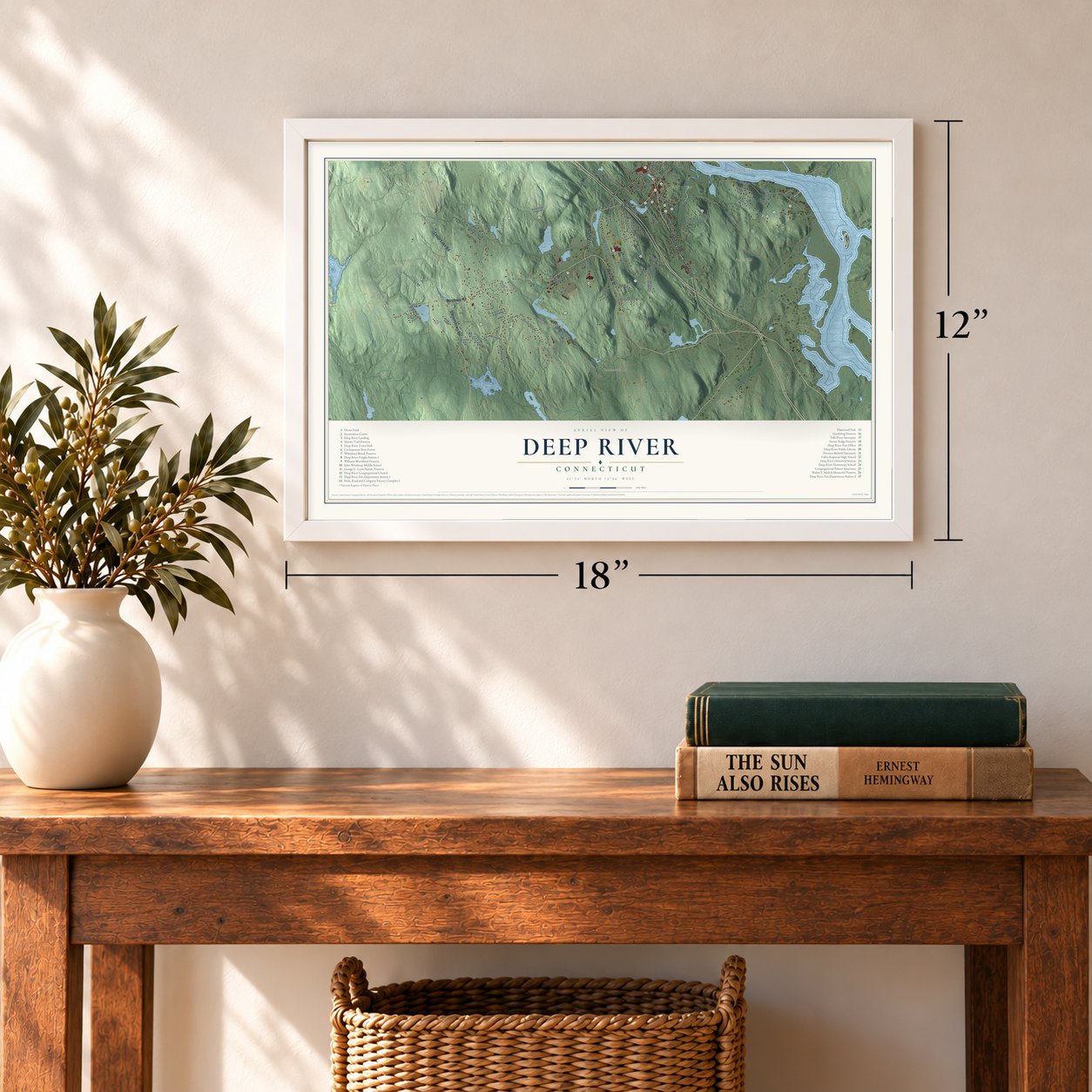
12" x 18" Archival Matte Print
A Map of Home. A Work of Art.
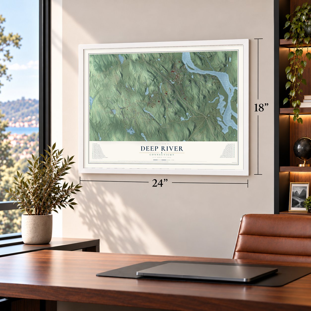
Explore Deep River, Connecticut from a whole new perspective. Created using aerial imagery and detailed geographic data, this map captures Deep River building by building, with labeled streets, familiar landmarks, and shaded topographical relief that highlights the natural contours of the landscape.
Combining modern data with the timeless character of a vintage atlas, this map is just as interesting up close as it is beautiful on the wall. Whether you grew up in Deep River, spent memorable years there, or call it home today, this unique map is a great way to celebrate a place that means something to you. Zoom in on the preview to look for your street, and then order a print to put your memories on the wall.

Three ways to hang it
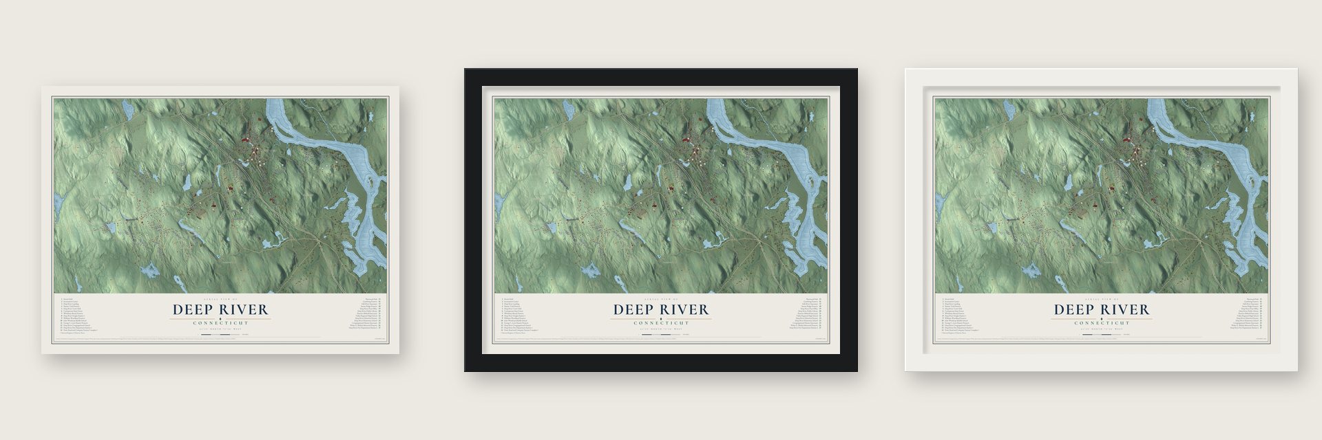
Unframed archival matte, a black wood frame or a white wood frame.
Up close
Geography Worth Displaying
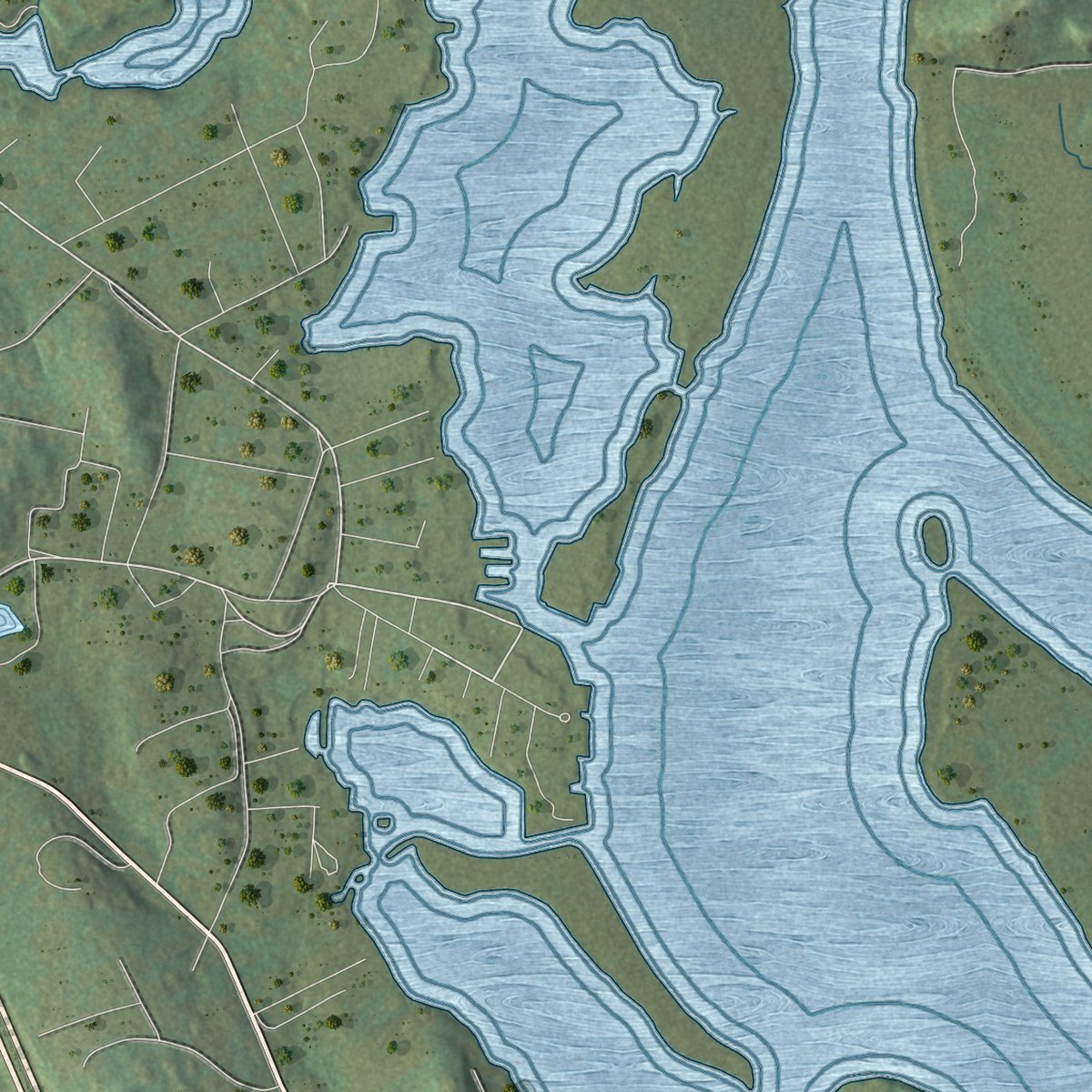
This map was created using accurate cartographic data and authoritative geographic sources, including the U.S. Geological Survey (USGS) and FEMA. The map brings together terrain, waterways, roads, and building detail. The majority of the streets are labeled, houses are accurately depicted, and the topography is derived from government sources. Combining local data with carefully composed color and shading leads to this beautifully detailed Deep River artwork for your wall.
Rather than simply showing street outlines, we’ve included as many of the street names as we could reasonably fit on the map while keeping their names legible. Zoom in on the high resolution preview to see exactly what’s on the map. We truly set out to create a statement piece for anyone who loves Deep River. So whether it’s for you, or a gift for someone you love, we hope this map of Deep River brings back fond memories.
Explore the full map of Deep River, Connecticut and read about the local places it shows.

Find your street
Names on the Deep River map
Every name below is printed on this map. Look for your street, your school, the park where you played, or the pond down the road.
Places and landmarks10
- Downtown
- Book Hill
- Bushy Hill
- Chester Rock
- Bushy Hill Pond
- Comstock Pond
- Cockaponset State Forest
- Incarnation Center
- Lake View
- Winthrop
Streets and roads69
- Middlesex Turnpike
- Elm Street
- West Elm Street
- Main Street
- Winthrop Road
- Warsaw Street
- Cedar Lake Road
- Stevenstown Road
- River Road
- Essex Street
- Rattling Valley Road
- Union Street
- Westbrook Road
- Spruce Ledge Road
- Kelsey Hill Road
- Cedar Swamp Road
- Bushy Hill Road
- Falls Landing Road
- Hoopole Hill Road
- River Street
- Plains Road
- Hemlock Drive
- Kirtland Street
- Book Hill Road
- West Bridge Street
- Bahr Road
- Witch Hazel Drive
- Scenic View Drive
- Lords Lane
- Winter Avenue
Show all 69 streets
- Bochim Road
- Long Hill Road
- Spring Street
- Bridge Street
- Acorn Road
- River Lane
- Barn Road
- South Main Street
- North Pine Ledge Road
- Meadow Woods Road
- Bokum Road
- Shailer Pond Road
- Tower Hill Road
- Whittlesey Brook Road
- Riverview Avenue
- Stanwoll Hill Road
- Prospect Street
- Village Street
- Everett Lane
- Castle Heights
- Laurel Wood Drive
- Hillside Terrace
- Doane Road
- Lobb Road
- Maple Avenue
- Ellen Lane
- South Incarnation Road
- Woodland Road
- Sunset Ridge
- Industrial Park Road
- Nature Trail
- Rosemont Drive
- Oak Ridge Drive
- John Winthrop Road
- Pinewood Trail
- Fairview Avenue
- Brockway Ferry Road
- Pine Ledge Road
- Phelps Lane
Names are listed as they appear on the printed map. Zoom into the product photos to find them.
About Deep River, Connecticut
Deep River is a town of 4,415 people on the Connecticut River's west bank, in Middlesex County. It began as part of old Saybrook, where settlers landed in 1635. In the 1800s new towns split off from Saybrook, beginning with Chester in 1836 and ending with Old Saybrook in 1854. The part that remained kept the Saybrook name until 1947, when it renamed itself for its main village. The village was named for a small stream, the Deep River, which once ran its mills and factories.
Ivory made the town. Phineas Pratt was cutting ivory combs by hand by 1809, and Ezra Williams & Co. opened a small comb shop on North Main Street in 1816. By 1819 more than twenty men turned out 50,000 combs each year, and George Read & Co. had shifted to piano keys before 1839. Three firms merged in 1863 to form Pratt, Read & Co. From 1840 to about 1940 the United States bought more ivory than any other nation, and most of it was shipped to Deep River. That wealth gave the town its nickname, the queen of the valley.
“When arrayed in its summer dress, one of the most beautiful villages on the west side of Connecticut River, as it is without doubt the busiest place south of Middletown.”
- The fire of 1881Fire swept the Pratt, Read factory on Main Street on Sunday morning, July 31, 1881, burning the building and its contents; little but the safe and records survived. The superintendent sent many workers to temporary jobs in Ivoryton's factories while the town wondered whether the firm would stay. On August 6 voters agreed unanimously to cut its taxes for five years if it rebuilt here. The new brick factory shipped its first goods on May 8, 1882.
- Winthrop's jailed BaptistsWinthrop, at the west end of town, took up Baptist beliefs as early as 1729. In February 1744, fourteen of its Baptists were arrested for meeting on the Sabbath and made to walk all the way to the New London jail. People believed their congregation was the state's second oldest Baptist church. A post office opened about 1837 under the name Sayville, for Lord Say and Seal, and within a few years the place took the name Winthrop.
- A station brought backThe New Haven Railroad built the Deep River Freight Station at the landing about 1915, on the old Connecticut Valley line. Passenger service ended in 1933 and freight in 1961. The new Valley Railroad ran its first train between Essex and Deep River on July 29, 1971, 100 years to the day after the first train on the line. The station joined the National Register in 1994.
- Town Hall of 1893After fire took the old town hall in 1891, the town finished a three story brick hall in 1893 at the junction of Routes 80 and 154. Town offices filled the ground floor, with an auditorium above. Its city look is rare in a quiet country town, and it joined the National Register in 1976.
- The Ancient MusterOn the third Saturday of every July, Deep River hosts the Ancient Muster, the largest single-day meeting of fife and drum corps anywhere in the nation.
Keep exploring Connecticut
Deep River is one of 382 Connecticut towns we've mapped. Every dot on the map is a print of its own.
The search covers every state, Connecticut first.
Near Deep River
Order 2 or more town maps and save 10%. Shown in the size and finish you picked above, so they hang as a set.
- Winthrop 12" x 18" / Archival Matte Print $39.99
- Deep River Center 12" x 18" / Archival Matte Print $39.99
- Chester Center 12" x 18" / Archival Matte Print $39.99


More maps nearby: Chester, Essex, Essex Village, Westbrook and Killingworth.
The art of mapping a place
How This Map Was Made
Real places. Remarkable detail. Discover the layers that turn geographic data into a map of home.

The view from above
Aerial imagery reveals the character of the land: woodland, open fields, and the patterns of a place.

The shape of the land
Elevation data brings hills, valleys, and subtle changes in the landscape into view.

The details of home
Roads, waterways, and building footprints come together to make the map feel unmistakably local.

Geography becomes art
Considered color, shading, and typography bring the layers together in a map made for your wall.


Process illustrated with Mendon, Massachusetts. Aerial imagery: USDA NAIP. Terrain: USGS 3D Elevation Program. Map details and finished artwork: KNOWOL.
The Details
About This Print
Choose an archival matte print, or a black or white Ayous wood frame. The archival matte print is unframed.
Select your size and finish above to see the matching product image and price.
Materials & Craftsmanship
A contemporary map with the character of a classic atlas, printed on archival matte paper. Optional frames are made from Ayous wood.
Your printed map does not include the watermark shown in the full-map preview.
Shipping & Delivery
Free shipping within the United States. Every print is made to order in the USA.
Buying a gift? Add a note in your cart and we'll include it. We never put prices in the package.
Prints ship within 2 to 3 business days. Allow 7 to 10 days total from ordering for delivery. Timing may vary during holidays or periods of high order volume.
Read our shipping policy.
Returns and damaged prints
Each print is made to order. Change-of-mind refunds are not available after production.
If your print arrives damaged, misprinted or incorrect, contact support@knowol.com within 30 days of receiving it. Include your order number, photos and a description of the issue.
Read our full refund and replacement policy. For questions about your order, email support@knowol.com.