
Search for another town




Free U.S. delivery 7 to 10 days after you order
Easton, Connecticut Map Art
Building by building, with labeled streets and shaded relief.
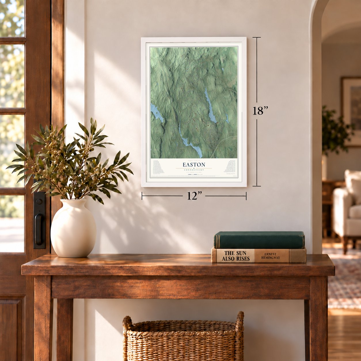
12" x 18" Archival Matte Print
A Map of Home. A Work of Art.
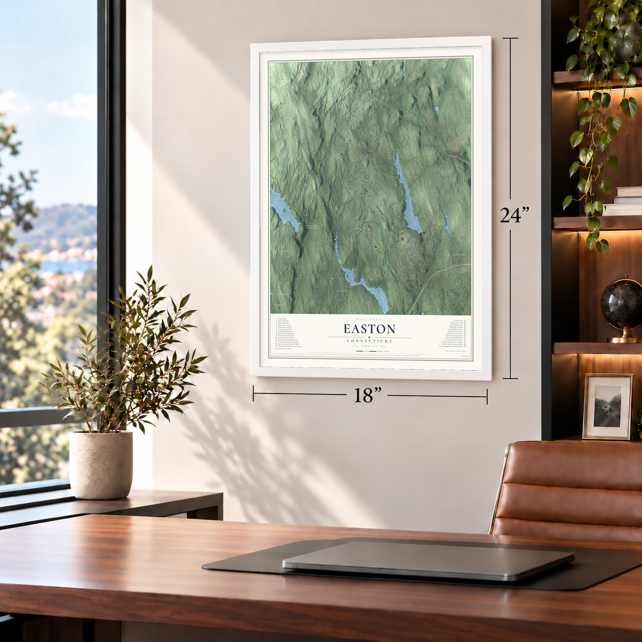
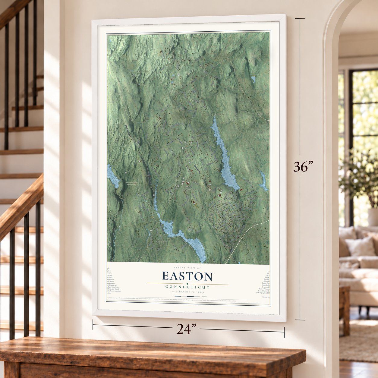
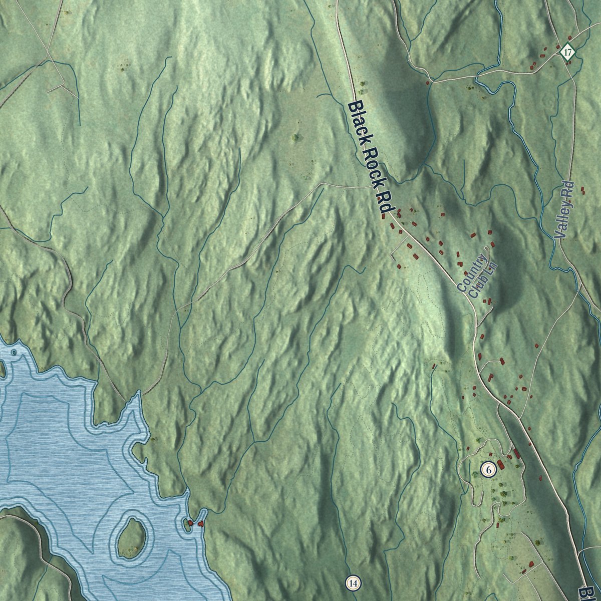
Explore Easton, Connecticut from a whole new perspective. Created using aerial imagery and detailed geographic data, this map captures Easton building by building, with labeled streets, familiar landmarks, and shaded topographical relief that highlights the natural contours of the landscape.
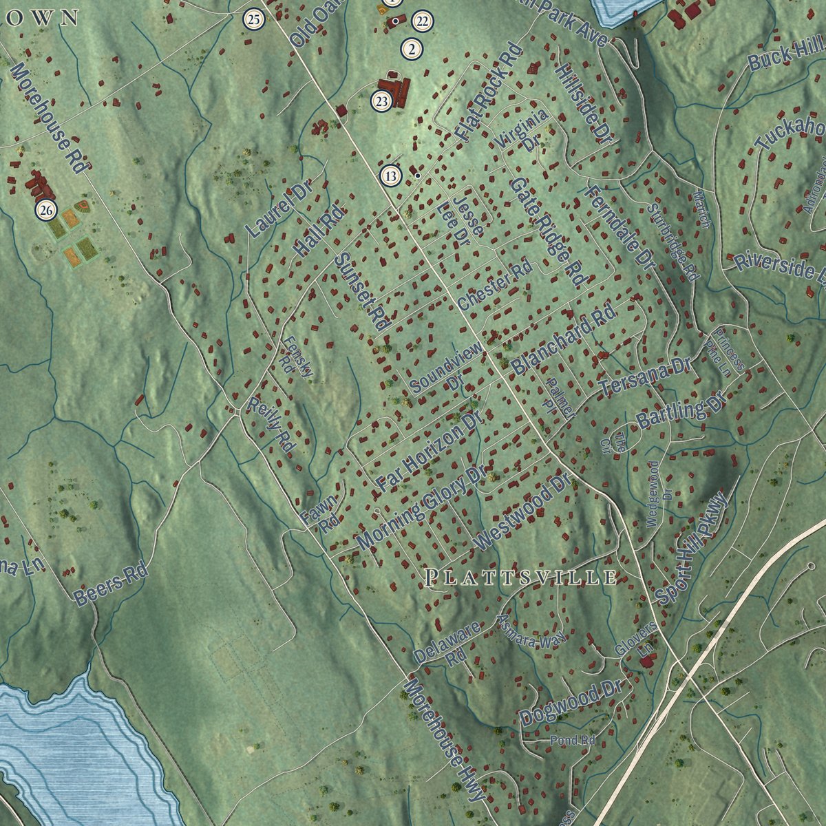
Combining modern data with the timeless character of a vintage atlas, this map is just as interesting up close as it is beautiful on the wall. Whether you grew up in Easton, spent memorable years there, or call it home today, this unique map is a great way to celebrate a place that means something to you. Zoom in on the preview to look for your street, and then order a print to put your memories on the wall.

Three ways to hang it
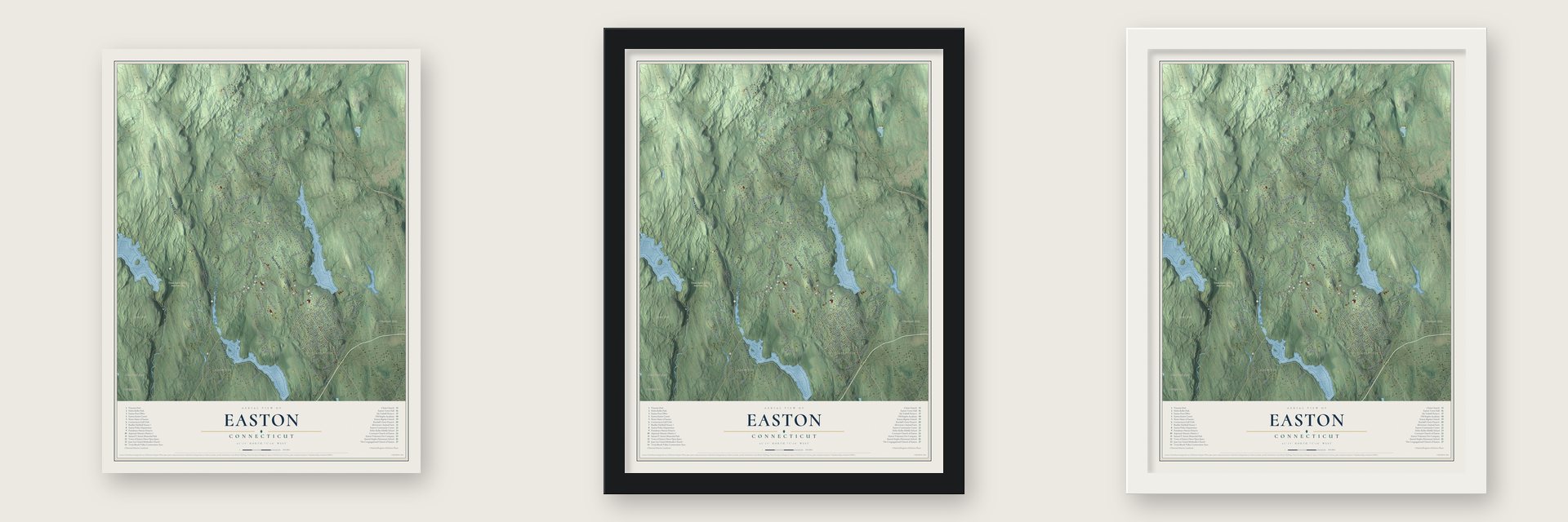
Unframed archival matte, a black wood frame or a white wood frame.
Up close
Geography Worth Displaying
This map was created using accurate cartographic data and authoritative geographic sources, including the U.S. Geological Survey (USGS) and FEMA. The map brings together terrain, waterways, roads, and building detail. The majority of the streets are labeled, houses are accurately depicted, and the topography is derived from government sources. Combining local data with carefully composed color and shading leads to this beautifully detailed Easton artwork for your wall.
Rather than simply showing street outlines, we’ve included as many of the street names as we could reasonably fit on the map while keeping their names legible. Zoom in on the high resolution preview to see exactly what’s on the map. We truly set out to create a statement piece for anyone who loves Easton. So whether it’s for you, or a gift for someone you love, we hope this map of Easton brings back fond memories.
Explore the full map of Easton, Connecticut and read about the local places it shows.

Find your street
Names on the Easton map
Every name below is printed on this map. Look for your street, your school, the park where you played, or the pond down the road.
Places and landmarks11
- Downtown
- Plattsville
- Aspetuck
- Camfield Hill
- Chestnut Hill
- Davis Hill
- Eden Hill
- Big Lake
- Davidge Pond
- Trout Brook Valley Conservation Area
- Rock Raymond
Streets and roads127
- Black Rock Road
- Westport Road
- Sport Hill Road
- Stepney Road
- Morehouse Road
- Beers Road
- Rock House Road
- North Park Avenue
- Judd Road
- Center Road
- Morehouse Highway
- South Park Avenue
- Staples Road
- North Street
- Silver Hill Road
- Wilson Road
- Valley Road
- Maple Road
- Everett Road
- Redding Road
- Banks Road
- Norton Road
- Adams Road
- Bibbins Road
- Mile Cmn
- Tuckahoe Road
- Wells Hill Road
- Far Horizon Drive
- Eden Hill Road
- Bayberry Lane
Show all 127 streets
- Buck Hill Road
- Flat Rock Road
- Tranquility Drive
- Morning Glory Drive
- Tersana Drive
- Prdr
- Laurel Drive
- Sunny Ridge Road
- Ferndale Drive
- Burr Street
- Vista Drive
- Cedar Hill Road
- Gate Ridge Road
- Northwood Drive
- Andrews Road
- Knapp Street
- Wyldewood Road
- Deerfield Drive
- Westwood Drive
- Orchard Lane
- Honeysuckle Hill Lane
- Kellers Farm Road
- Hayes Street
- Burroughs Road
- Sherwood Drive
- Dogwood Drive
- Sunset Road
- Division Street
- Blanchard Road
- Kachele Street
- Bartling Drive
- Riverside Lane
- Sport Hill Parkway
- Abbey Road
- Todds Way
- West Road
- Old Oak Road
- Mills Lane
- Barrows Road
- Hillside Drive
- April Drive
- Brianna Lane
- Hall Road
- Elm Drive
- Sherwood Road
- Delaware Road
- Deepwood Road
- High Meadow Road
- Stones Throw Road
- Wood End Drive
- Old Stonewall Road
- Hunting Ridge Road
- Chester Road
- Sweetbrier Trail
- Soundview Drive
- Rocky Ridge Road
- Harvester Road
- Jesse Lee Drive
- Old Sow Road
- Grace View Drive
- Sanford Drive
- Country Club Lane
- Canterbury Lane
- Reilly Road
- Fawn Road
- Virginia Drive
- Laskay Drive
- Lilac Lane
- Dairy Lane
- Mile Common Road
- Freeborn Road
- East Common Road
- Sturbridge Road
- Fieldstone Drive
- Crossbow Lane
- Asmara Way
- Magellan Lane
- Glovers Lane
- Palmer Place
- Congress Street
- Bohus Lane
- Stanczyk Drive
- Fox Run Drive
- Fensky Road
- Sky Line Drive
- Wedgewood Drive
- Hickory Knoll Drive
- Pond Road
- Woodland Drive
- Tatetuck Trail
- The Circle
- Adirondack Trail
- Ridgeline Road
- Meadow Ridge Drive
- Sunny Ridge Lane
- Princess Pine Lane
- Marich
Names are listed as they appear on the printed map. Zoom into the product photos to find them.
About Easton, Connecticut
Easton is a town of 7,605 people in Fairfield County, in the hills along the Aspetuck River. Families from Fairfield began settling here in 1757, and in 1762 they formed the North Fairfield Society, the parish that slowly grew into Easton. When Weston became a town in 1787, this land went with it. The rough hills kept the area slow to grow, so Easton did not break away from Weston until May 1845, and it held its first town meeting on the green that August.
By 1890 Easton had 1,001 people, and most made their living farming. Mail came through three post offices, at Easton, Aspetuck and Plattsville. Later the quiet hills drew two famous women. In 1906 the journalist Ida Tarbell bought a farmhouse she called Twin Oaks, paying for it with money earned from her book on the history of the Standard Oil Company, and she retired there in 1924. Helen Keller spent her last years in a house built in 1946 on Redding Road in Aspetuck, and the middle school now carries her name.
“This is, we believe, the first instance in the United States in which the substance of this species of meteor has been found on the earth”
- A stone from the sky, 1807Just after dawn on December 14, 1807, a fireball streaked over western Connecticut and burst with a huge boom, scattering stones across Fairfield County. One piece, about 30 pounds, landed on ground then in Weston and now in Easton, and people passed it around at town meeting that same day. At Yale, Professor Silliman held a magnet to a sample and found that it was iron.
- Staples' free school, 1798Samuel Staples, buried in Easton after his death in 1787, left his fortune to charity, above all to a school where poor children could learn without paying. It opened in 1798, offering English grammar, Latin, Greek, geography and mathematics for a dollar a quarter, and poor children paid nothing. Isaac Toucey, later governor of Connecticut and a U.S. senator, had his first lessons there.
- The British march of 1777British troops marching to Danbury in 1777 came up what is now the Black Rock Turnpike. They drove off Samuel Wakeman's oxen and took the farmer Samuel Wheeler two miles before releasing him. Years later, when the house came down, the balls were still in the wood.
- A farm under the reservoirThe Bradley-Hubbell House on the Black Rock Turnpike went up in 1816 for Aljah and Elizabeth Bradley. Their descendants sold the farm in 1912 to the Bridgeport Hydraulic Company, which put much of it under a reservoir and leased the house to its worker Franklin Hubbell. Restored by the Easton Historical Society, its owner since 1998, the house joined the National Register in 2003. The Aquarion Water Company now owns about half the property in town.
Keep exploring Connecticut
Easton is one of 382 Connecticut towns we've mapped. Every dot on the map is a print of its own.
The search covers every state, Connecticut first.
Near Easton
Order 2 or more town maps and save 10%. Shown in the size and finish you picked above, so they hang as a set.
- Tashua 12" x 18" / Archival Matte Print $39.99
- Plattsville 12" x 18" / Archival Matte Print $39.99
- Long Hill 12" x 18" / Archival Matte Print $39.99
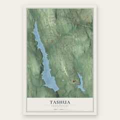
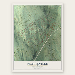

More maps nearby: Sacred Heart University, Weston, Stepney, Trumbull and Daniels Farm.
The art of mapping a place
How This Map Was Made
Real places. Remarkable detail. Discover the layers that turn geographic data into a map of home.

The view from above
Aerial imagery reveals the character of the land: woodland, open fields, and the patterns of a place.

The shape of the land
Elevation data brings hills, valleys, and subtle changes in the landscape into view.

The details of home
Roads, waterways, and building footprints come together to make the map feel unmistakably local.

Geography becomes art
Considered color, shading, and typography bring the layers together in a map made for your wall.


Process illustrated with Mendon, Massachusetts. Aerial imagery: USDA NAIP. Terrain: USGS 3D Elevation Program. Map details and finished artwork: KNOWOL.
The Details
About This Print
Choose an archival matte print, or a black or white Ayous wood frame. The archival matte print is unframed.
Select your size and finish above to see the matching product image and price.
Materials & Craftsmanship
A contemporary map with the character of a classic atlas, printed on archival matte paper. Optional frames are made from Ayous wood.
Your printed map does not include the watermark shown in the full-map preview.
Shipping & Delivery
Free shipping within the United States. Every print is made to order in the USA.
Buying a gift? Add a note in your cart and we'll include it. We never put prices in the package.
Prints ship within 2 to 3 business days. Allow 7 to 10 days total from ordering for delivery. Timing may vary during holidays or periods of high order volume.
Read our shipping policy.
Returns and damaged prints
Each print is made to order. Change-of-mind refunds are not available after production.
If your print arrives damaged, misprinted or incorrect, contact support@knowol.com within 30 days of receiving it. Include your order number, photos and a description of the issue.
Read our full refund and replacement policy. For questions about your order, email support@knowol.com.