


Search for another town





Free U.S. delivery 7 to 10 days after you order
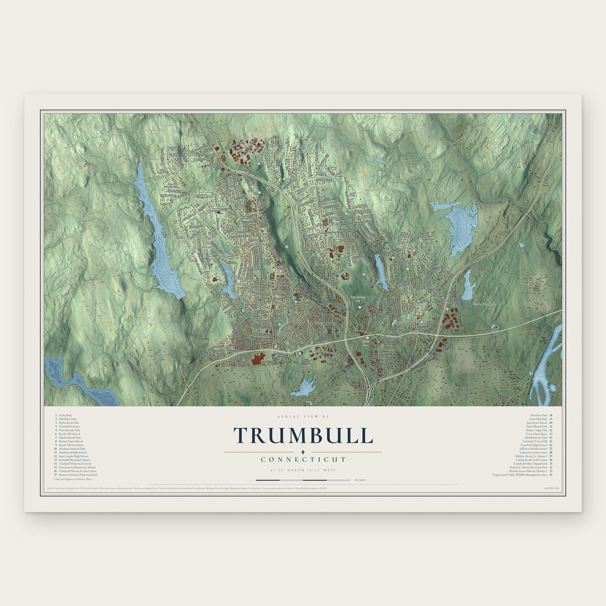
Trumbull, Connecticut Map Art
Building by building, with labeled streets and shaded relief.
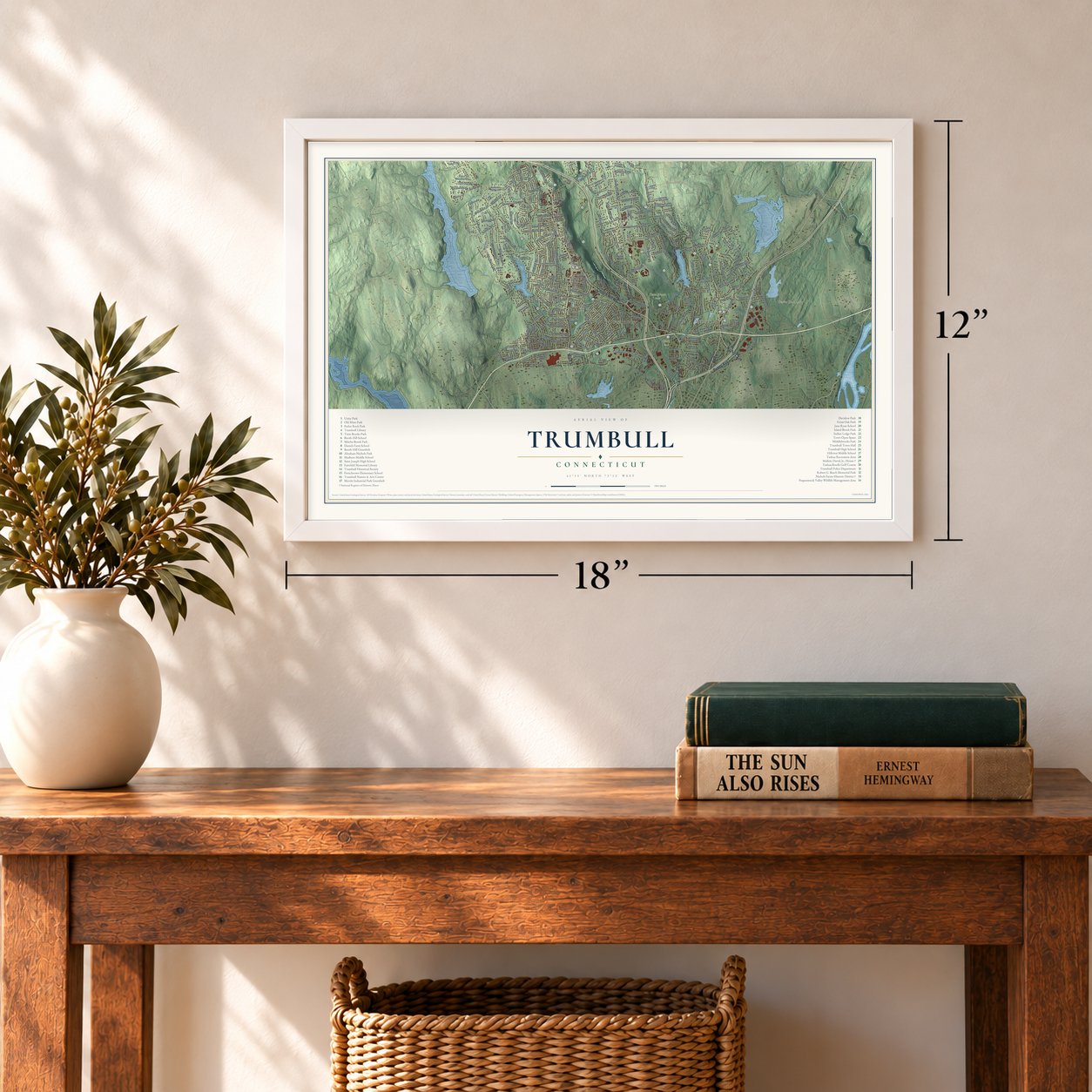
12" x 18" Archival Matte Print
A Map of Home. A Work of Art.
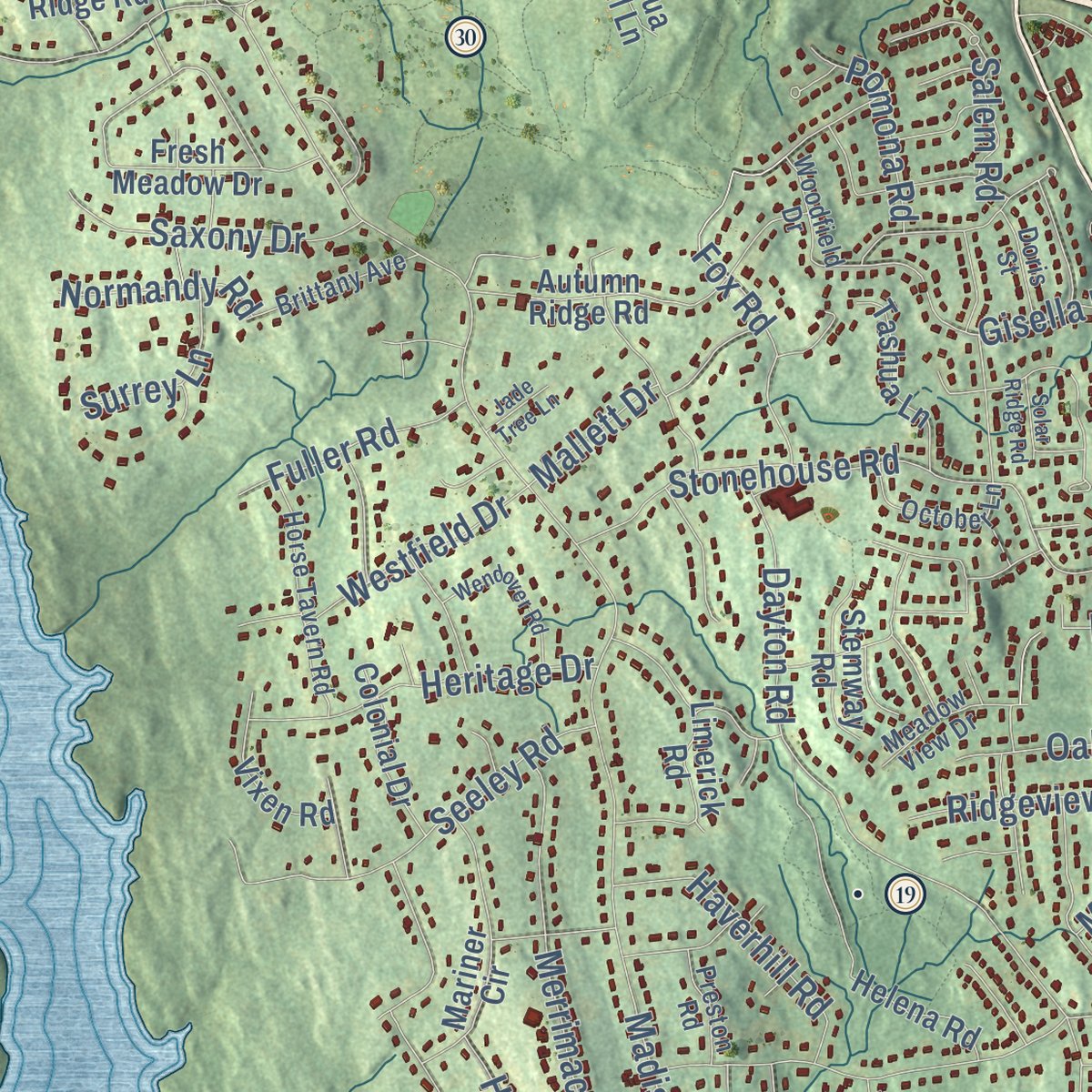
Explore Trumbull, Connecticut from a whole new perspective. Created using aerial imagery and detailed geographic data, this map captures Trumbull building by building, with labeled streets, familiar landmarks, and shaded topographical relief that highlights the natural contours of the landscape.
Combining modern data with the timeless character of a vintage atlas, this map is just as interesting up close as it is beautiful on the wall. Whether you grew up in Trumbull, spent memorable years there, or call it home today, this unique map is a great way to celebrate a place that means something to you. Zoom in on the preview to look for your street, and then order a print to put your memories on the wall.

Three ways to hang it
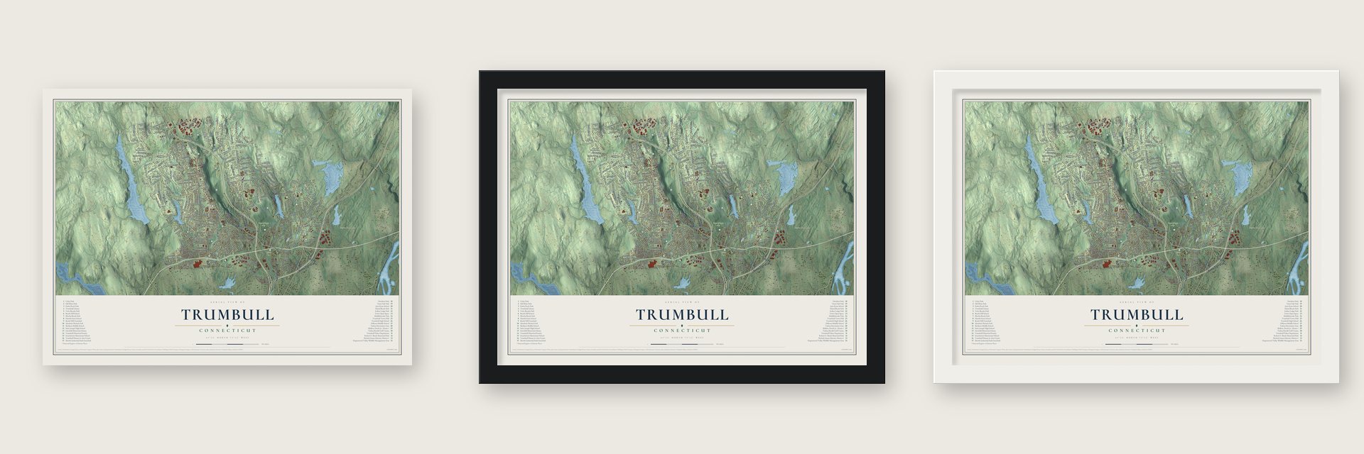
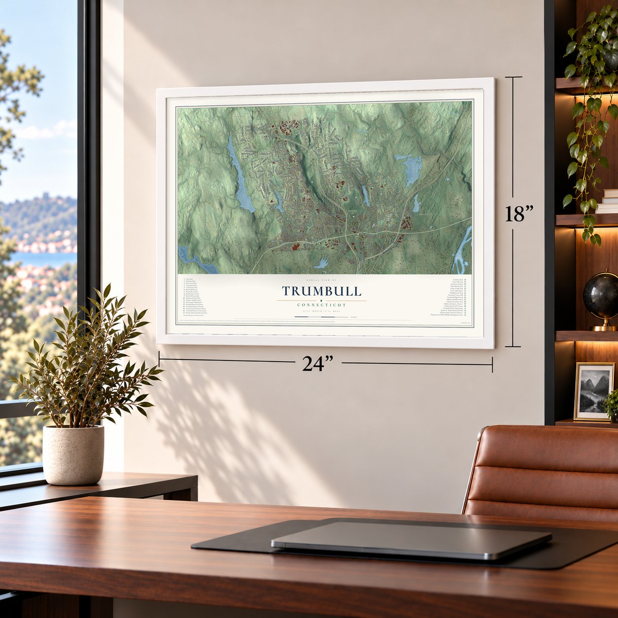
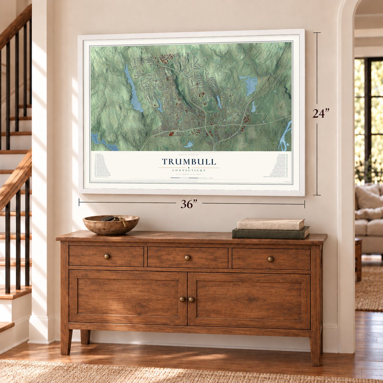
Unframed archival matte, a black wood frame or a white wood frame.
Up close
Geography Worth Displaying
This map was created using accurate cartographic data and authoritative geographic sources, including the U.S. Geological Survey (USGS) and FEMA. The map brings together terrain, waterways, roads, and building detail. The majority of the streets are labeled, houses are accurately depicted, and the topography is derived from government sources. Combining local data with carefully composed color and shading leads to this beautifully detailed Trumbull artwork for your wall.
Rather than simply showing street outlines, we’ve included as many of the street names as we could reasonably fit on the map while keeping their names legible. Zoom in on the high resolution preview to see exactly what’s on the map. We truly set out to create a statement piece for anyone who loves Trumbull. So whether it’s for you, or a gift for someone you love, we hope this map of Trumbull brings back fond memories.
Explore the full map of Trumbull, Connecticut and read about the local places it shows.

Find your street
Names on the Trumbull map
Every name below is printed on this map. Look for your street, your school, the park where you played, or the pond down the road.
Places and landmarks12
- Downtown
- Rock Raymond
- Nichols
- Ox Hill
- Booth Hill
- Chestnut Hill
- Hirams Hill
- Bantam Pond
- Beaver Dam Lake
- Twin Brooks Park
- Unity Park
- Long Hill
Streets and roads285
- Main Street
- Nichols Avenue
- Penny Avenue
- White Plains Road
- Church Hill Road
- Monroe Turnpike
- Park Street
- Daniels Farm Road
- McGuire Road
- Moose Hill Road
- Madison Avenue
- Booth Hill Road
- Old Town Road
- Tashua Road
- Whitney Avenue
- Strobel Road
- Stonehouse Road
- Shelton Road
- Edison Road
- Lake Avenue
- Putting Green Road
- Teller Road
- Reservoir Avenue
- Dayton Road
- Merritt Boulevard
- Twin Brooks Drive
- Unity Road
- Porters Hill Road
- Driftwood Lane
- Canoe Brook Road
Show all 285 streets
- Huntington Road
- Broadway Road
- Park Lane
- Merrimac Drive
- Old Field Road
- Beach Memorial Road
- Plattsville Road
- Roosevelt Drive
- Ridgeview Avenue
- Saint John's Drive
- Williams Road
- Greenbrier Road
- Aspen Lane
- Columbine Drive
- Fox Road
- Sterling Road
- Oakridge Road
- Spring Hill Road
- Cottage Street
- Blackhouse Road
- Red Barn Road
- Elliott Road
- Middlebrooks Avenue
- North Street
- Velvet Street
- Golden Hill
- Seeley Road
- Oakland Drive
- Hurd Road
- Teeter Rock Road
- Leonard Place
- Chestnut Hill Road
- Quarry Road
- Coventry Lane
- Stoneleigh Road
- Haverhill Road
- Hawley Lane
- Gray Rock Road
- Old Hollow Road
- Garwood Road
- Park Avenue
- Saxony Drive
- Midland Road
- Barnswallow Drive
- Jog Hill Road
- North Stowe Place
- Fairview Avenue
- Sturbridge Lane
- Kent Lane
- Rangely Drive
- Colony Avenue
- Salem Road
- Garden Street
- Great Neck Road
- Meadow Road
- Lafayette Drive
- Plum Tree Lane
- Westfield Drive
- Skyview Drive
- Hills Point Road
- Wilson Avenue
- Topaz Lane
- Hedgehog Road
- Fuller Road
- Towerview Drive
- Firehouse Road
- Shawnee Road
- Friar Lane
- Calhoun Avenue
- Beech Street
- Magnolia Road
- Lindeman Drive
- Pomona Road
- Lillian Drive
- Heritage Drive
- Old Mine Road
- Plymouth Avenue
- Bassick Road
- Normandy Road
- Wisteria Drive
- Ceil Road
- Surrey Lane
- Poplar Street
- Marathon Road
- Oxen Hill Road
- Erwin Street
- Pine Street
- Gisella Road
- Flint Street
- Inca Drive
- Mallett Drive
- Pert Street
- Manor Drive
- Stag Lane
- Huntington Turnpike
- Old Dike Road
- Fresh Meadow Drive
- Woolsley Avenue
- Arden Road
- Ironwood Road
- Helena Road
- Lawrence Road
- Beacon Hill Road
- Shelter Rock Road
- Scenic Hill Road
- Mariner Circle
- Corporate Drive
- Carmel Ridge
- Rocky Hill Road
- Cranbury Drive
- Ascolese Road
- Autumn Ridge Road
- Tait Road
- Lewis Road
- Evelyn Street
- Lorma Avenue
- High Ridge Road
- Hilltop Drive
- Bunker Hill Drive
- Limerick Road
- Bonnie View Drive
- Killian Avenue
- Country Club Road
- Skating Pond Road
- Fern Circle
- Tashua Knoll Lane
- Trefoil Drive
- Oriole Lane
- West Lake Road
- Rolling Wood Drive
- Tashua Lane
- Wendy Road
- Laurie Road
- Hillston Road
- Colonial Drive
- Springwood Drive
- Valley View Road
- Vixen Road
- Under Cliff Road
- Wildwood Drive
- Craig Lane
- Hemlock Trail
- Clover Hill Road
- Stemway Road
- Vintage Road
- Old Green Road
- Red Fox Lane
- Old Dairy Road
- Chalon Road
- Wood Avenue
- Hilltop Circle
- Mischa Hill Road
- Alden Avenue
- Elberta Avenue
- Elaine Street
- Jackson Drive
- Raynor Avenue
- Grove Street
- Walker Road
- Haviland Drive
- Lincoln Street
- Dale Road
- Dalecot Drive
- Harvester Road
- Coral Drive
- Partridge Lane
- Merrill Road
- Nutmeg Drive
- Kitcher Court
- Newton Lane
- Wesley Drive
- Anita Avenue
- George Street
- Clarion Place
- Harned Place
- Walnut Avenue
- Stones Throw
- Skytop Drive
- Alpine Road
- Abric Drive
- Cedar Hill Drive
- Drew Circle
- Vail Court
- Beardsley Parkway
- Johnson Street
- Woodcrest Avenue
- Riverside Drive
- Horse Tavern Road
- Spinning Wheel Road
- Woodridge Circle
- Suzanne Circle
- Dogwood Lane
- October Lane
- Cherry Gate Lane
- Catherine Street
- Brittany Avenue
- Woodfield Drive
- Berkshire Avenue
- White Birch Drive
- Green Ridge Road
- Frost Hill Road
- Apple Gate Lane
- Blue Ridge Drive
- Placid Street
- Bayberry Lane
- Sarenee Circle
- Rutlee Drive
- Larkspur Drive
- Brewster Place
- Gilbert Drive
- Preston Road
- Meadow View Drive
- Doris Street
- Ruth Street
- Pilgrim Lane
- Reiner Drive
- Frelma Drive
- Marshall Avenue
- Nuthatch Hill Road
- Taits Mill Road
- Unity Drive
- Ann Street
- Cardinal Circle
- Primrose Drive
- Turkey Meadow Road
- Wendover Road
- Rocky Hill Terrace
- Robinwood Road
- Avalon Gates
- Pondview Avenue
- Tudor Lane
- Finchwood Drive
- Macdonald Road
- Jerusalem Hl
- Beach Hill Road
- Mohawk Drive
- Hillcrest Road
- Mulberry Street
- Owl Hill Trail
- Horseshoe Drive
- Cobblers Hill Road
- Lindberg Drive
- Glenarden Road
- Mayflower Drive
- Rose Terrace
- Quail Trail
- Hidden Pond Lane
- Solar Ridge Road
- Winslow Road
- Beverly Road
- Cider Mill Lane
- Louis Street
- Wordins Lane
- Jade Tree Lane
- Green Street
Names are listed as they appear on the printed map. Zoom into the product photos to find them.
About Trumbull, Connecticut
Trumbull is a Connecticut community in Fairfield County, with 36,827 residents recorded in the 2020 census.
- 36,827 residentsRecorded by the 2020 census.
- Incorporated in 1797Trumbull became an incorporated Connecticut municipality that year.
- 23.5 square milesThe Census Bureau reports this as the community's total area.
- Fairfield CountyTrumbull is part of this Connecticut county.
Keep exploring Connecticut
Trumbull is one of 382 Connecticut towns we've mapped. Every dot on the map is a print of its own.
The search covers every state, Connecticut first.
Near Trumbull
Order 2 or more town maps and save 10%. Shown in the size and finish you picked above, so they hang as a set.
- Daniels Farm 12" x 18" / Archival Matte Print $39.99
- Long Hill 12" x 18" / Archival Matte Print $39.99
- Tashua 12" x 18" / Archival Matte Print $39.99
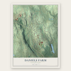


More maps nearby: Trumbull Center, Nichols, Sacred Heart University, Plattsville and Shelton.
The art of mapping a place
How This Map Was Made
Real places. Remarkable detail. Discover the layers that turn geographic data into a map of home.

The view from above
Aerial imagery reveals the character of the land: woodland, open fields, and the patterns of a place.

The shape of the land
Elevation data brings hills, valleys, and subtle changes in the landscape into view.

The details of home
Roads, waterways, and building footprints come together to make the map feel unmistakably local.

Geography becomes art
Considered color, shading, and typography bring the layers together in a map made for your wall.


Process illustrated with Mendon, Massachusetts. Aerial imagery: USDA NAIP. Terrain: USGS 3D Elevation Program. Map details and finished artwork: KNOWOL.
The Details
About This Print
Choose an archival matte print, or a black or white Ayous wood frame. The archival matte print is unframed.
Select your size and finish above to see the matching product image and price.
Materials & Craftsmanship
A contemporary map with the character of a classic atlas, printed on archival matte paper. Optional frames are made from Ayous wood.
Your printed map does not include the watermark shown in the full-map preview.
Shipping & Delivery
Free shipping within the United States. Every print is made to order in the USA.
Buying a gift? Add a note in your cart and we'll include it. We never put prices in the package.
Prints ship within 2 to 3 business days. Allow 7 to 10 days total from ordering for delivery. Timing may vary during holidays or periods of high order volume.
Read our shipping policy.
Returns and damaged prints
Each print is made to order. Change-of-mind refunds are not available after production.
If your print arrives damaged, misprinted or incorrect, contact support@knowol.com within 30 days of receiving it. Include your order number, photos and a description of the issue.
Read our full refund and replacement policy. For questions about your order, email support@knowol.com.