
Search for another town

Free U.S. delivery 7 to 10 days after you order
Shelton, Connecticut Map Art
Building by building, with labeled streets and shaded relief.
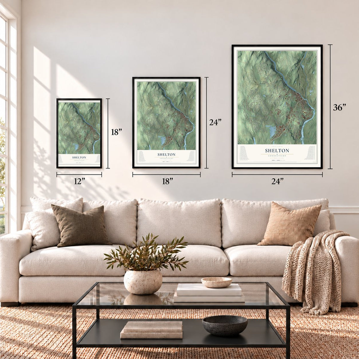
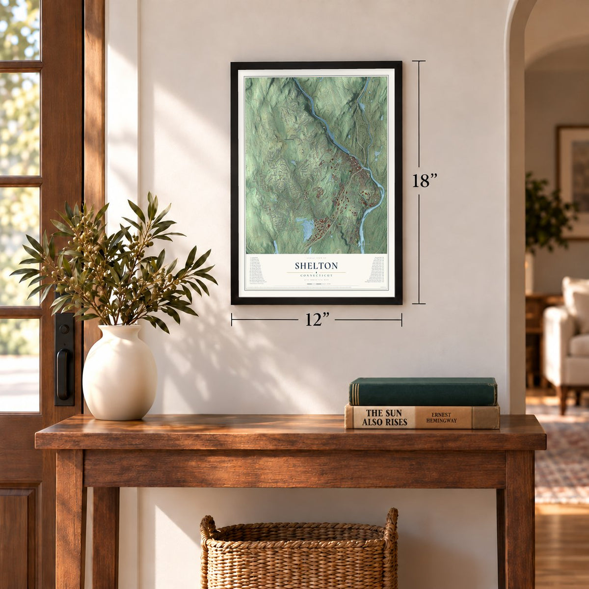
12" x 18" Archival Matte Print
A Map of Home. A Work of Art.
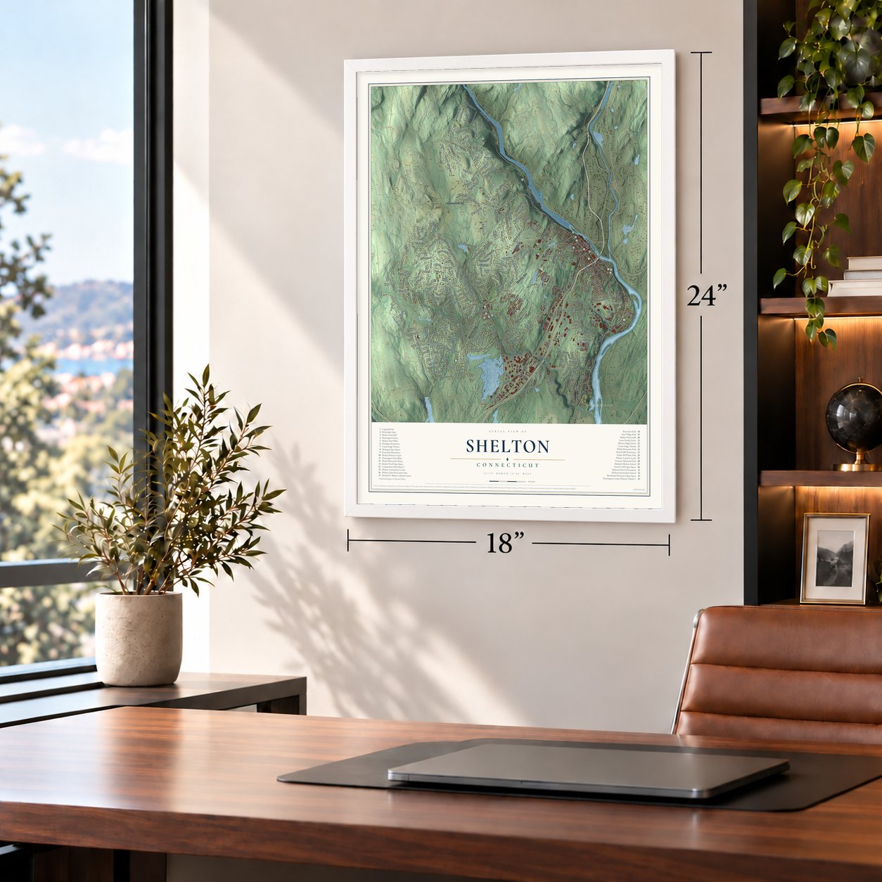
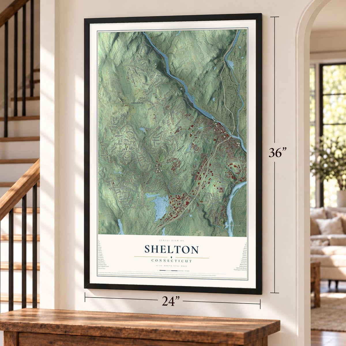
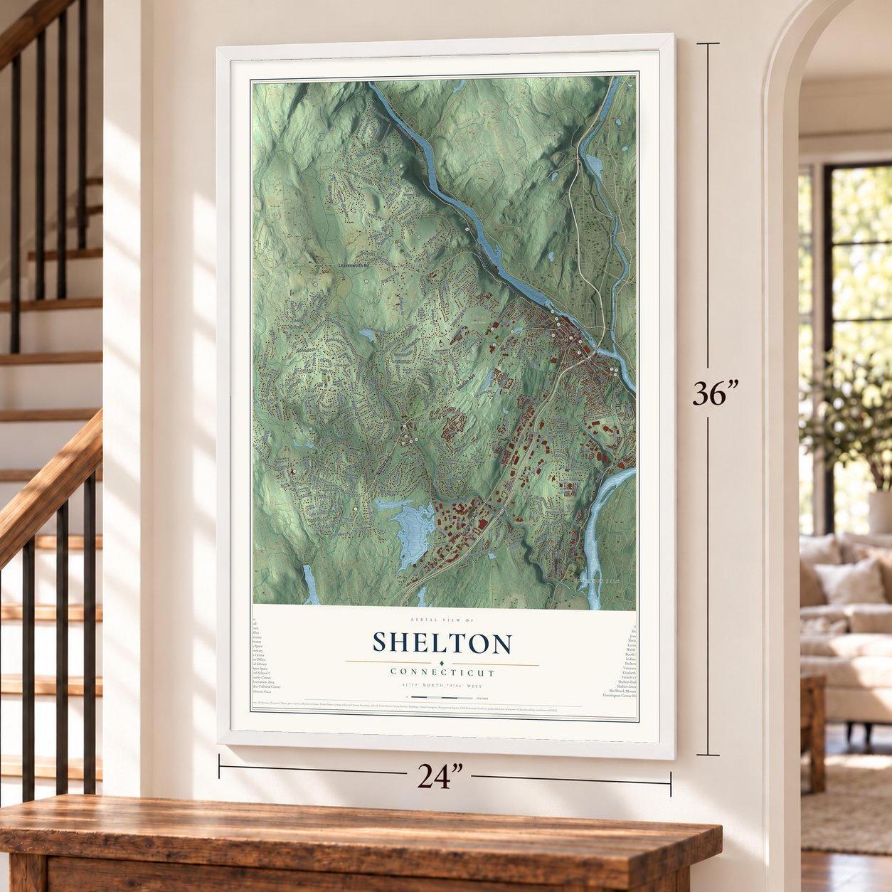
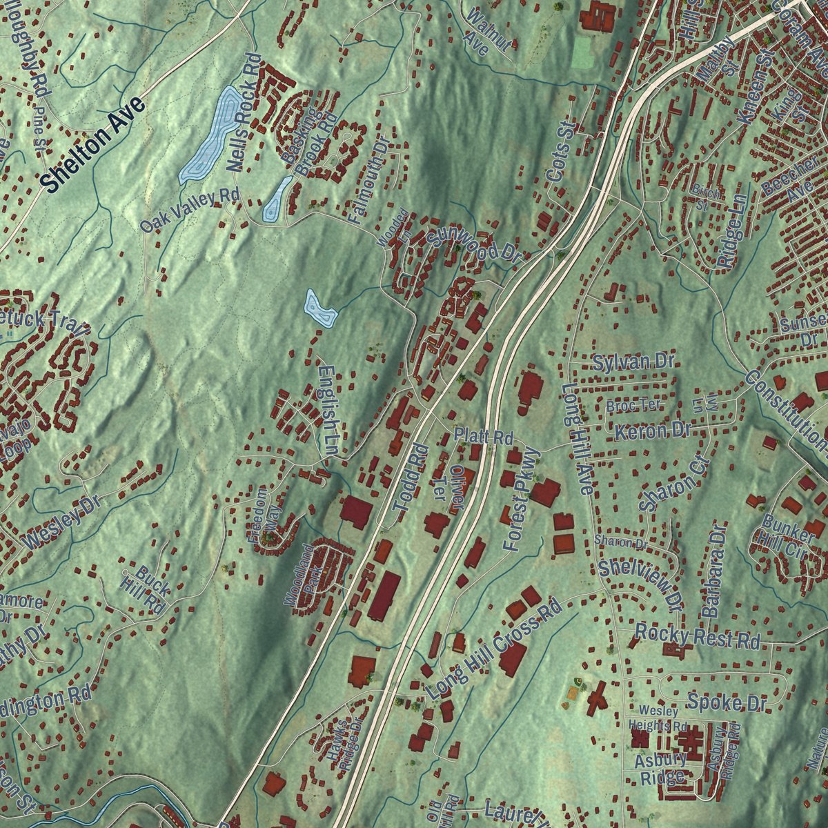
Explore Shelton, Connecticut from a whole new perspective. Created using aerial imagery and detailed geographic data, this map captures Shelton building by building, with labeled streets, familiar landmarks, and shaded topographical relief that highlights the natural contours of the landscape.
Combining modern data with the timeless character of a vintage atlas, this map is just as interesting up close as it is beautiful on the wall. Whether you grew up in Shelton, spent memorable years there, or call it home today, this unique map is a great way to celebrate a place that means something to you. Zoom in on the preview to look for your street, and then order a print to put your memories on the wall.

Three ways to hang it
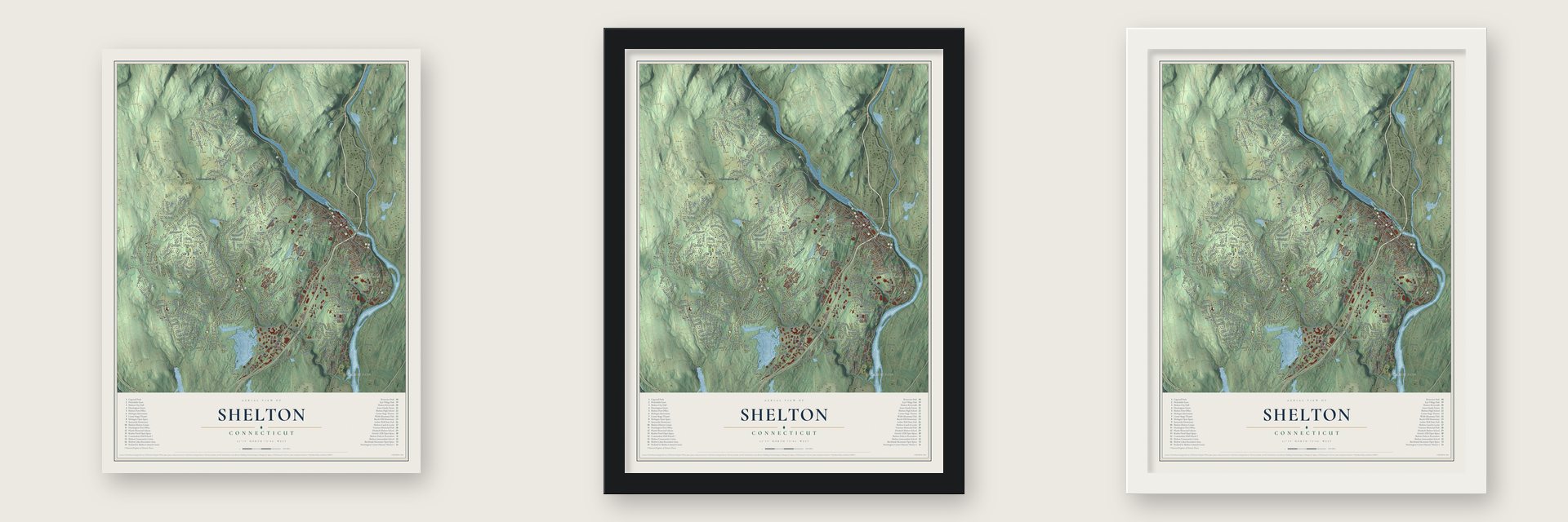
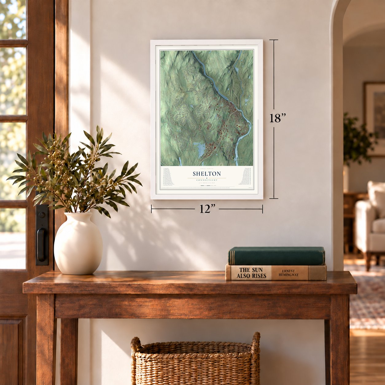
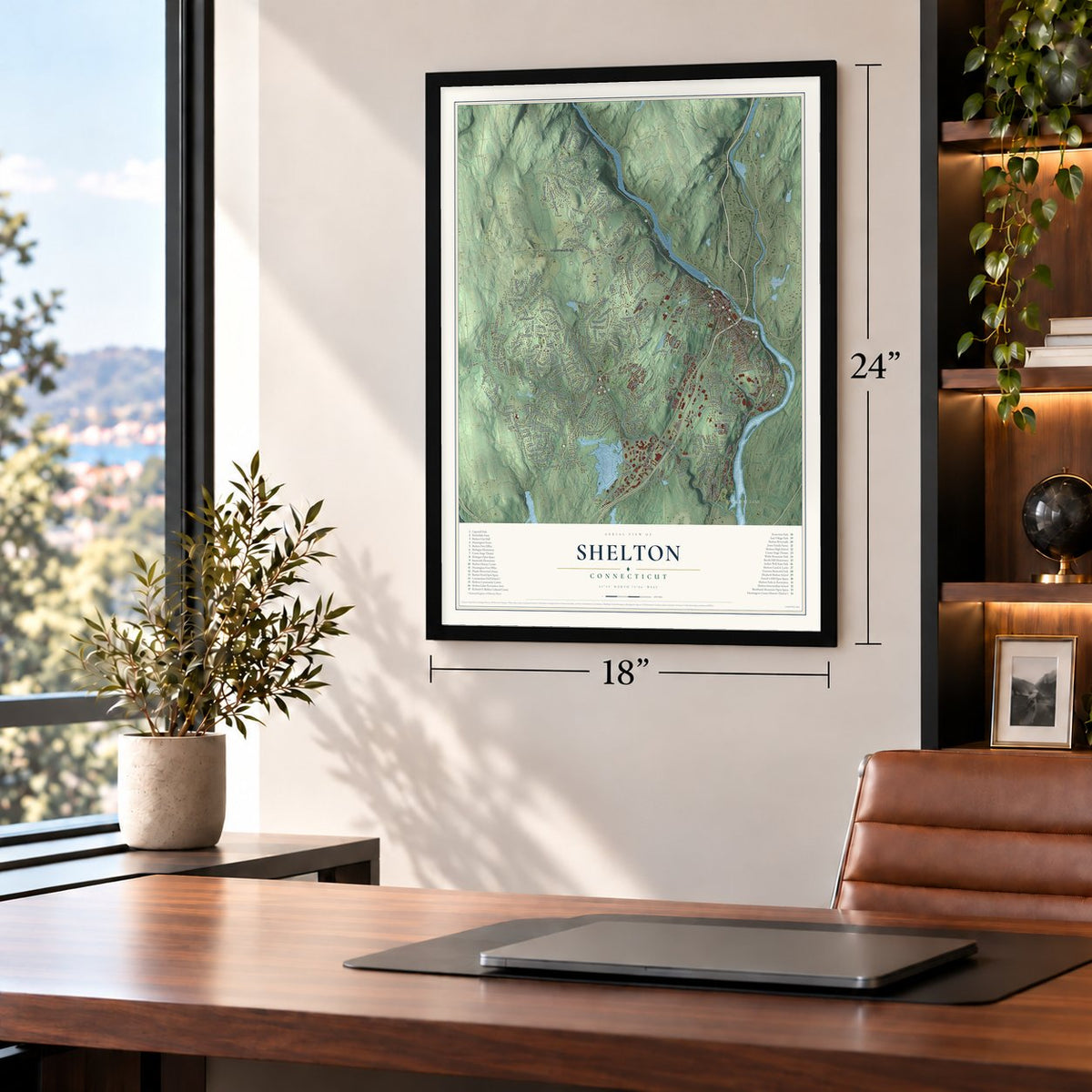
Unframed archival matte, a black wood frame or a white wood frame.
Up close
Geography Worth Displaying
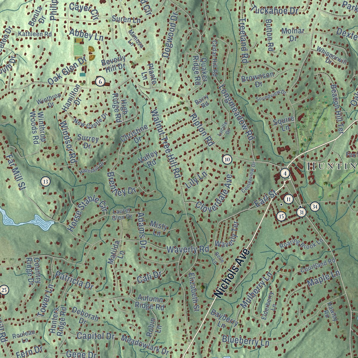
This map was created using accurate cartographic data and authoritative geographic sources, including the U.S. Geological Survey (USGS) and FEMA. The map brings together terrain, waterways, roads, and building detail. The majority of the streets are labeled, houses are accurately depicted, and the topography is derived from government sources. Combining local data with carefully composed color and shading leads to this beautifully detailed Shelton artwork for your wall.
Rather than simply showing street outlines, we’ve included as many of the street names as we could reasonably fit on the map while keeping their names legible. Zoom in on the high resolution preview to see exactly what’s on the map. We truly set out to create a statement piece for anyone who loves Shelton. So whether it’s for you, or a gift for someone you love, we hope this map of Shelton brings back fond memories.
Explore the full map of Shelton, Connecticut and read about the local places it shows.
Find your street
Names on the Shelton map
Every name below is printed on this map. Look for your street, your school, the park where you played, or the pond down the road.
Places and landmarks13
- Downtown
- Pine Rock Park
- Bagburn Hill
- Barn Hill
- Booth Hill
- Ansonia Reservoir
- Baird Millpond
- Jones Family Farms
- Wiacek Open Space
- Huntington
- Sunnyside
- White Hills
Show all 13 places
- Woodland Park
Streets and roads322
- Bridgeport Avenue
- Shelton Avenue
- Nichols Avenue
- Indian Well Road
- Howe Avenue
- Leavenworth Road
- River Road
- Booth Hill Road
- Huntington Street
- Coram Road
- Ripton Road
- Coram Avenue
- Birchbank Road
- Longmeadow Road
- Buddington Road
- Mill Street
- Old Stratford Road
- Maler Avenue
- Walnut Tree Hill Road
- Long Hill Avenue
- Soundview Avenue
- East Village Road
- Isinglass Road
- Mohegan Road
- Waverly Road
- Meadow Street
- Beardsley Road
- Nells Rock Road
- Constitution Boulevard South
- Birdseye Road
Show all 322 streets
- Saw Mill City Road
- Village Drive
- Far Mill Street
- Thompson Street
- Maple Avenue
- Longfellow Road
- Long Hill Cross Road
- North Street
- Tuckahoe Drive
- Blueberry Lane
- Commerce Drive
- Poplar Drive
- Big Horn Road
- Armstrong Road
- Spoke Drive
- Willoughby Road
- Rocky Rest Road
- Grove Street
- Cali Drive
- Chamberlain Drive
- Dickinson Drive
- Thoreau Drive
- Pearmain Road
- Capitol Drive
- Aspetuck Trail
- Kings Highway
- Wesley Drive
- Kneen Street
- Park Avenue
- Forest Parkway
- Rugby Road
- Independence Drive
- Perry Hill Road
- Fairlane Drive
- Timberlane Drive
- Yutaka Trail
- Lane Street
- Laurel Wood Drive
- Dexter Drive
- Vista Drive
- Adams Drive
- Cayer Circle
- Wheeler Street
- Plaskon Drive
- Mulberry Lane
- Stendahl Drive
- Cloverdale Avenue
- Beech Tree Hill Road
- Martinka Drive
- Ojibwa Road
- Fawn Hill Road
- Dogwood Drive
- Okenuck Way
- Wabuda Place
- Gray Street
- Soundridge Road
- Research Drive
- Sunwood Drive
- Old Dairy Lane
- Lady Slipper Drive
- Ballaro Drive
- Treeland Road
- Beard Sawmill Road
- Sachem Drive
- Dimon Road
- Progress Drive
- Redwood Circle
- Brookwood Lane
- Ridge Lane
- Keron Drive
- Eagle Drive
- Greenfield Drive
- Windsor Road
- Brentley Drive
- Maple Lane
- Hill Street
- Rodia Ridge Road
- Patricia Drive
- Cedarwood Lane
- New Street
- Horse Stable Circle
- Toas Street
- Sharon Court
- Lake Road
- Clinton Drive
- Woodfield Drive
- Tower Lane
- Philip Drive
- Hurd Road
- Wigwam Drive
- Woodsend Avenue
- Ten Coat Lane
- September Lane
- Federal Road
- Oak Hill Lane
- Brook Pine Drive
- Todd Road
- Cots Street
- Canfield Drive
- Short Street
- Mustang Drive
- Cathy Drive
- Kazo Drive
- Webster Drive
- Shelview Drive
- West Street
- Judson Street
- Hubbell Lane
- Oak Glen Drive
- Abbey Lane
- Barbara Drive
- English Lane
- Sylvan Drive
- Rayo Drive
- Astor Drive
- Perch Road
- Gene Drive
- Earl Street
- Dome Drive
- Fern Drive
- Lily Lane
- Wooster Street
- Moose Hill Road
- Riverdale Avenue
- Summerfield Gardens
- Waterview Drive
- Brownson Drive
- Canal Street East
- Navajo Loop
- Applewood Drive
- Lynne Terrace
- Winthrop Woods Road
- Ojibwa Trail
- Rock Ridge Road
- Great Oak Road
- Woods Grove Road
- Sunset Drive
- Kyles Way
- Richard Boulevard
- Bunker Hill Circle
- Walnut Avenue
- Rolling Brook Lane
- Beacon Hill Terrace
- Valley Road
- Maltby Street
- Platt Road
- William Street
- Hillside Avenue
- Country Ridge Drive
- Quaker Ridge Road
- Suren Lane
- Spruce Hill Road
- Dartmouth Drive
- Hunters Ridge Road
- Nutmeg Lane
- Trap Falls Road
- Oak Avenue
- Meadowlark Drive
- Wopowog Trail
- Hilltop Drive
- Oak Valley Road
- Trap Falls Road Extension
- Twin Brook Drive
- White Oak Road
- Hidden Pond Lane
- Christine Drive
- Autumn Ridge Road
- Matilda Lane
- Hearthstone Drive
- Hiawatha Trail
- Sycamore Drive
- Soundcrest Drive
- Princeton Drive
- Robin Lane
- Button Road
- Parrott Drive
- Bonita Drive
- Waverly Terrace
- Margaret Drive
- Commodore Avenue
- Falmouth Drive
- Basking Brook Road
- Elizabeth Street
- Warwick Lane
- Stowe Drive
- Cameo Drive
- Beecher Avenue
- Cliff Street
- Hamilton Drive
- Oliver Terrace
- Surrey Drive
- Asbury Ridge
- Ridgefield Terrace
- Summit Ridge Road
- Jordan Avenue
- High Ridge Road
- Old Coram Road
- Misty Lane
- Reiner Drive
- Deborah Drive
- Bayberry Lane
- Buck Hill Road
- Molnar Drive
- Coral Drive
- Emerald Ridge Court
- Plum Tree Lane
- Sorel Drive
- Coppel Lane
- Sterling Ridge
- Park Street
- Elliott Drive
- Beverly Hill Drive
- Plante Lane
- Ann Avenue
- Cisco Drive
- Hull Street
- Elaine Drive
- Squire Lane
- Henry Drive
- Ladas Place
- King Street
- Asbury Ridge Road
- Sunrise Circle
- New Castle Drive
- Daybreak Lane
- Princess Wenonah Drive
- Laurel Glen Drive
- Freedom Way
- Elderberry Lane
- Roaring Brook Lane
- Cedar Hill Road
- High Street
- Greenacre Drive
- Courtland Road
- Broc Terrace
- Kathleen Road
- Heather Hill Road
- Pine Street
- Winthrop Drive
- Roberts Street
- Whipporwill Drive
- High Meadow Road
- Mimosa Lane
- Rouleau Lane
- Golden Hill Lane
- Hawks Ridge Drive
- Partridge Lane
- Cribbins Avenue
- Nature Lane
- Maria Alicia Drive
- Fox Run
- Hawley Road
- Foxhunt Road
- Barry Road
- Jenyfer Court
- April Lane
- Main Street
- Olin Court
- Old Mill Road
- Reed Lane
- Ivy Lane
- Tory Lane
- Oak Street
- Avalon Drive
- School Street
- Fairoaks Drive
- Hickory Lane
- Rolling Ridge Road
- Cold Spring Circle
- Lucille Drive
- Sharon Drive
- Shinnacock Trail
- Wesley Heights Road
- Driftwood Lane
- Buttercup Lane
- Centerview Drive
- Soundview Drive
- Haverhill Drive
- Cynthia Lane
- Tahmore Place
- Greenwood Lane
- Lagana Lane
- Saranor Drive
- Perry Avenue
- Cree Trail
- Timothy Lane
- Spruce Drive
- Meghan Court
- Wooded Lane
- Belle Lane
- Quail Court
- Birch Street
Names are listed as they appear on the printed map. Zoom into the product photos to find them.
About Shelton, Connecticut
Shelton is a city of 40,869 people in Fairfield County, where the Naugatuck River flows into the Housatonic. English settlers arrived in 1639, when the land belonged to Stratford, and in 1717 the farm families of Stratford's northern reaches won a parish of their own called Ripton. In 1789 Ripton and New Stratford split off to form a new town, Huntington, which took its name from Samuel Huntington.
Later, a company sought a charter to dam the Housatonic, and towns up the river fought it, warning that a dam would ruin the shad runs. Nelson H. Downs put up the first factory on farmland across from Birmingham in 1871, and by 1880 Shelton's village counted 175 houses and twelve factories. It became a borough in 1882 and a city in 1915, and in 1919 it merged with the town of Huntington.
“Why Doctor, the boy isn't born who will live long enough to see the Ousatonic dammed.”
- Ripton parish in 1717In 1717 the farmers of northern Stratford, living up to ten miles from the meetinghouse, asked for their own parish, and Daniel Shelton signed first. They named it Ripton, reportedly for Ripon in Yorkshire, his old home. The church formed in 1724 with 92 members and ordained Rev. Jedediah Mills the same day. He served about fifty years, and in 1743 he took in young David Brainerd, expelled from Yale, and taught him theology.
- A dove and a church fireSt. Paul's Episcopal church at Ripton, built around 1740, burned in June 1811. By one story, a young man fired at a dove perched on the church and set the blaze. The congregation finished a new building before Easter of 1812, and that St. Paul's still stands in Huntington Center.
- The Indian WellWriters in the 1880s gave the fall as twenty-five feet, said tradition found no bottom at a hundred feet, and counted thousands of visitors each summer. An 1886 history called it the last visible trace of the Pootatuck people who lived along this river.
- A fireproof school in 1907Shelton was still part of Huntington when the Commodore Hull School went up on Oak Avenue in 1907. Its walls combined terra cotta block, brick and reinforced concrete, and it is thought to be Connecticut's first school built with fireproof terra cotta and concrete together. Its name honors Isaac Hull, captain of USS Constitution during the War of 1812. Classes ended in 1978, the building became apartments, and it joined the National Register in 1983.
- A library on Wooster StreetThe Plumb Memorial Library was built on Wooster Street in 1895, a Richardsonian Romanesque design by Charles T. Beardsley Jr. of Bridgeport. It is named for David Wells Plumb, who did business in town, and his widow gave the land for it. A modern addition followed in 1975, and the library joined the National Register in 1978.
Keep exploring Connecticut
Shelton is one of 382 Connecticut towns we've mapped. Every dot on the map is a print of its own.
The search covers every state, Connecticut first.
Near Shelton
Order 2 or more town maps and save 10%. Shown in the size and finish you picked above, so they hang as a set.
- Derby 12" x 18" / Archival Matte Print $39.99
- Oronoque 12" x 18" / Archival Matte Print $39.99
- Daniels Farm 12" x 18" / Archival Matte Print $39.99


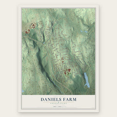
More maps nearby: Trumbull, Ansonia, Nichols, East Village and Trumbull Center.
The art of mapping a place
How This Map Was Made
Real places. Remarkable detail. Discover the layers that turn geographic data into a map of home.

The view from above
Aerial imagery reveals the character of the land: woodland, open fields, and the patterns of a place.

The shape of the land
Elevation data brings hills, valleys, and subtle changes in the landscape into view.

The details of home
Roads, waterways, and building footprints come together to make the map feel unmistakably local.

Geography becomes art
Considered color, shading, and typography bring the layers together in a map made for your wall.


Process illustrated with Mendon, Massachusetts. Aerial imagery: USDA NAIP. Terrain: USGS 3D Elevation Program. Map details and finished artwork: KNOWOL.
The Details
About This Print
Choose an archival matte print, or a black or white Ayous wood frame. The archival matte print is unframed.
Select your size and finish above to see the matching product image and price.
Materials & Craftsmanship
A contemporary map with the character of a classic atlas, printed on archival matte paper. Optional frames are made from Ayous wood.
Your printed map does not include the watermark shown in the full-map preview.
Shipping & Delivery
Free shipping within the United States. Every print is made to order in the USA.
Buying a gift? Add a note in your cart and we'll include it. We never put prices in the package.
Prints ship within 2 to 3 business days. Allow 7 to 10 days total from ordering for delivery. Timing may vary during holidays or periods of high order volume.
Read our shipping policy.
Returns and damaged prints
Each print is made to order. Change-of-mind refunds are not available after production.
If your print arrives damaged, misprinted or incorrect, contact support@knowol.com within 30 days of receiving it. Include your order number, photos and a description of the issue.
Read our full refund and replacement policy. For questions about your order, email support@knowol.com.