


Search for another town

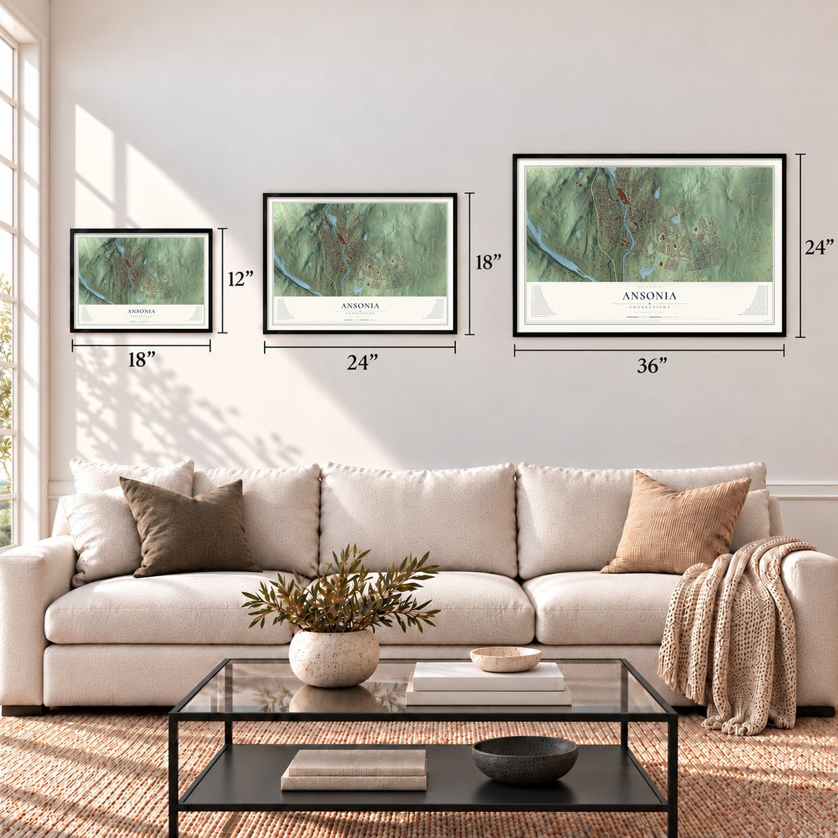
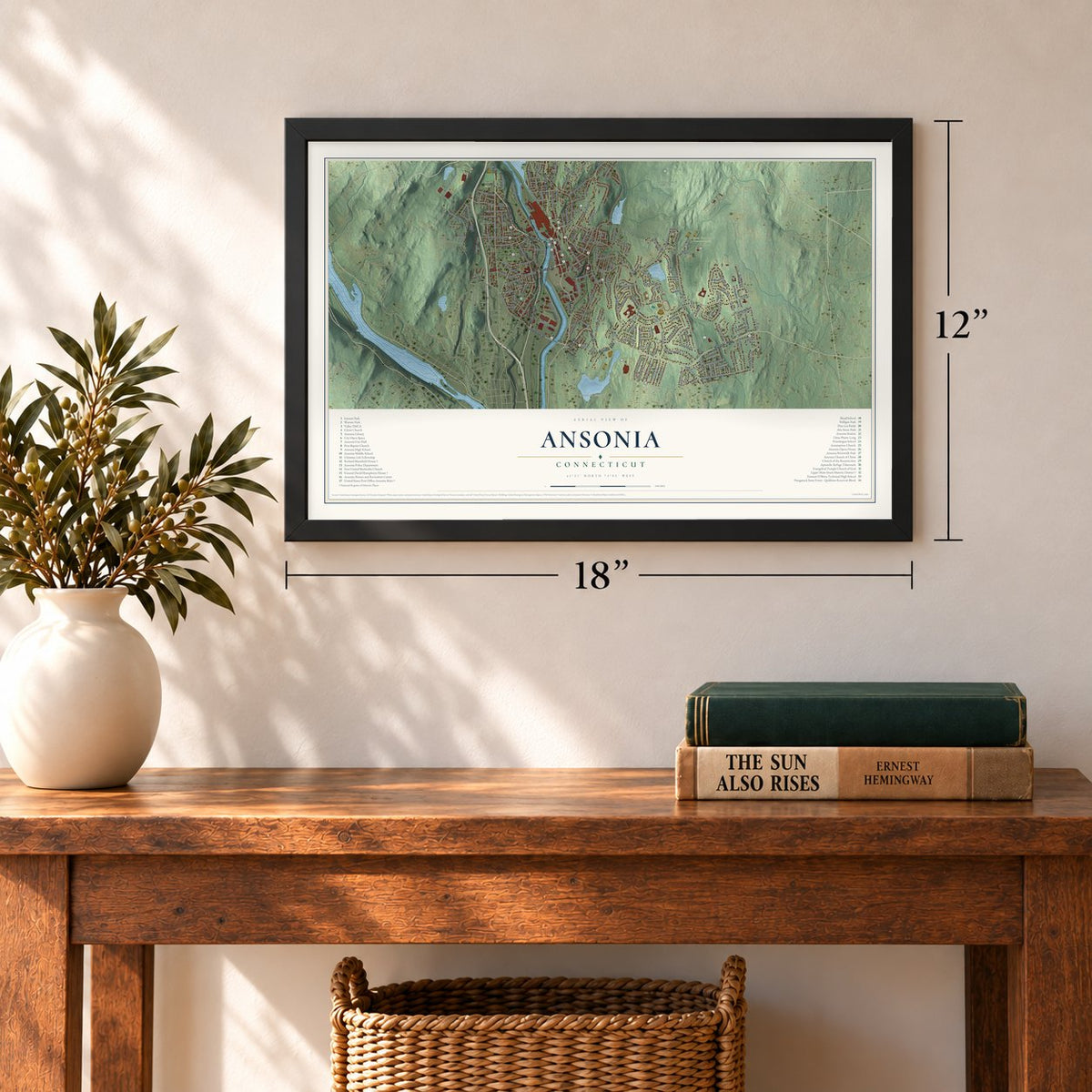
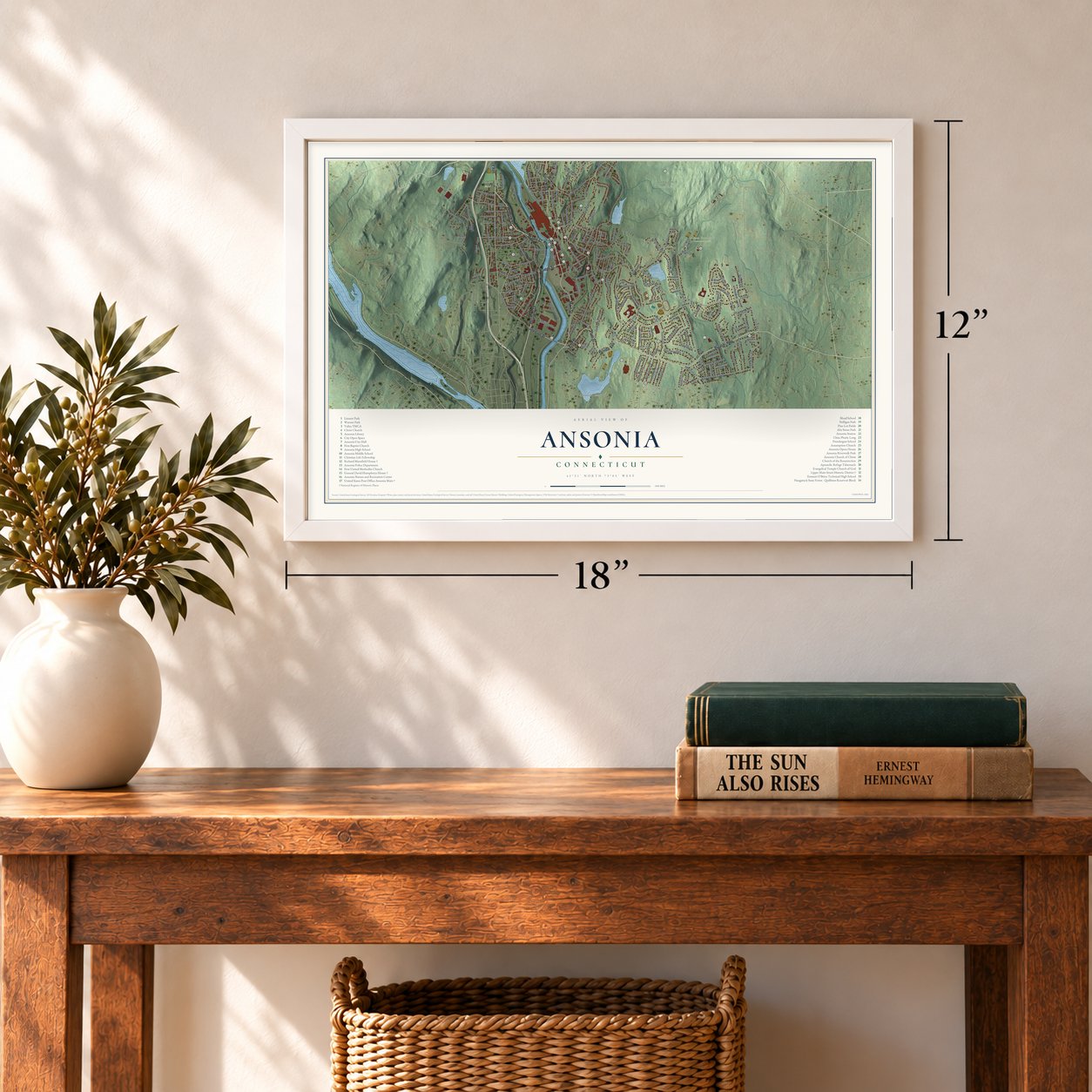
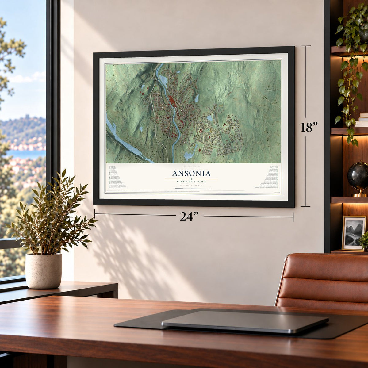
Free U.S. delivery 7 to 10 days after you order
Ansonia, Connecticut Map Art
Building by building, with labeled streets and shaded relief.
12" x 18" Archival Matte Print
A Map of Home. A Work of Art.
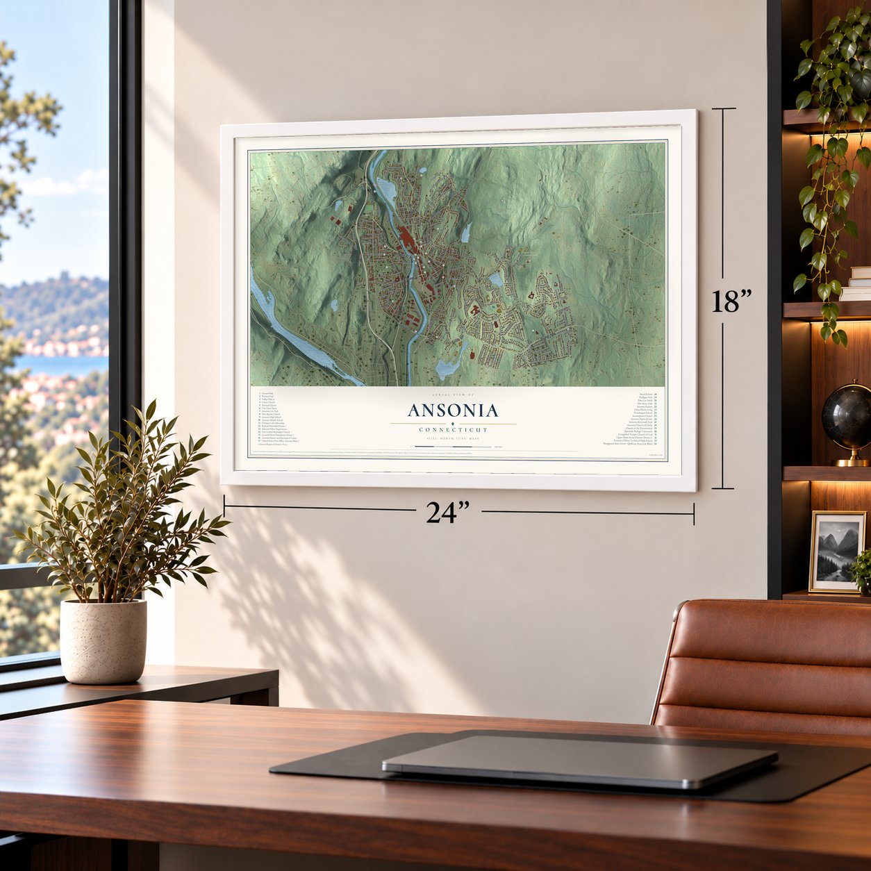
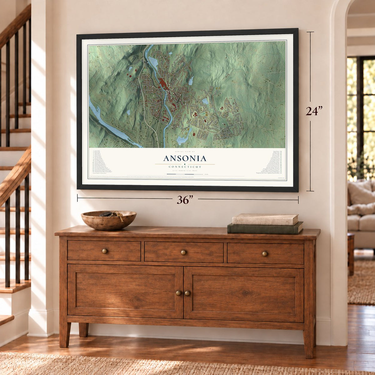
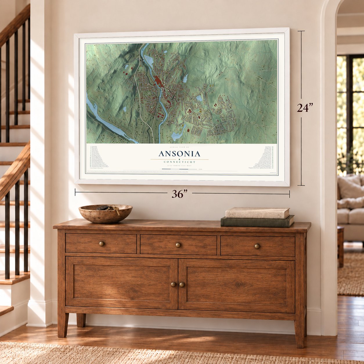
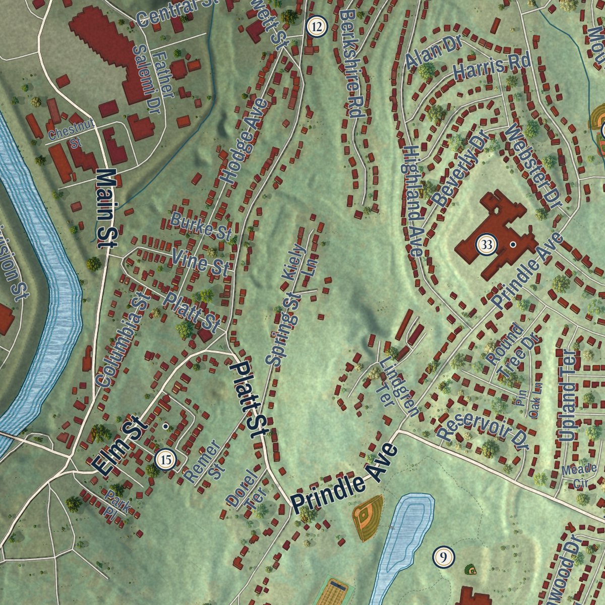
Explore Ansonia, Connecticut from a whole new perspective. Created using aerial imagery and detailed geographic data, this map captures Ansonia building by building, with labeled streets, familiar landmarks, and shaded topographical relief that highlights the natural contours of the landscape.
Combining modern data with the timeless character of a vintage atlas, this map is just as interesting up close as it is beautiful on the wall. Whether you grew up in Ansonia, spent memorable years there, or call it home today, this unique map is a great way to celebrate a place that means something to you. Zoom in on the preview to look for your street, and then order a print to put your memories on the wall.

Three ways to hang it
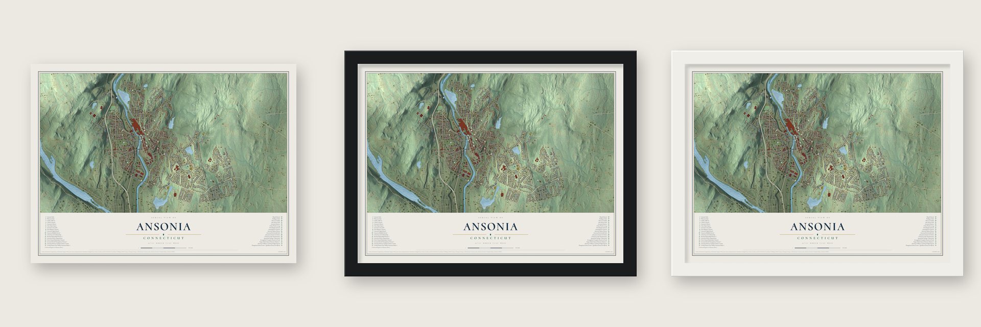
Unframed archival matte, a black wood frame or a white wood frame.
Up close
Geography Worth Displaying
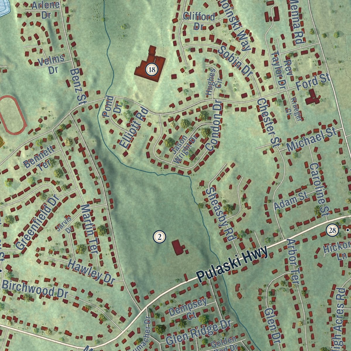
This map was created using accurate cartographic data and authoritative geographic sources, including the U.S. Geological Survey (USGS) and FEMA. The map brings together terrain, waterways, roads, and building detail. The majority of the streets are labeled, houses are accurately depicted, and the topography is derived from government sources. Combining local data with carefully composed color and shading leads to this beautifully detailed Ansonia artwork for your wall.
Rather than simply showing street outlines, we’ve included as many of the street names as we could reasonably fit on the map while keeping their names legible. Zoom in on the high resolution preview to see exactly what’s on the map. We truly set out to create a statement piece for anyone who loves Ansonia. So whether it’s for you, or a gift for someone you love, we hope this map of Ansonia brings back fond memories.
Explore the full map of Ansonia, Connecticut and read about the local places it shows.

Find your street
Names on the Ansonia map
Every name below is printed on this map. Look for your street, your school, the park where you played, or the pond down the road.
Places and landmarks7
- Downtown
- Derby Hill
- Ansonia Reservoir
- Coe Pond
- Ansonia Nature and Recreation Center
- Naugatuck State Forest
- Nolan Field
Streets and roads202
- Pulaski Highway
- Pershing Drive
- Wakelee Avenue
- Franklin Street
- Great Hill Road
- Prindle Avenue
- Platt Street
- Division Street
- Bridge Street
- Main Street
- North Main Street
- Elm Street
- Maple Street
- Ford Road
- Olson Drive
- Silver Hill Road
- Riverside Drive
- Garden Street
- Benz Street
- Beaver Street
- Bartholomew Avenue
- Star Street
- Finney Street
- Ford Street
- Coe Lane
- Howard Avenue
- Prospect Street
- North State Street
- Jewett Street
- Hull Street
Show all 202 streets
- Highland Avenue
- Westfield Avenue
- Woodbridge Avenue
- Rockwood Avenue
- Hoinski Way
- Grove Street
- North Division Street
- Hill Street
- Jackson Street
- Glen Drive
- South Cliff Street
- Clifton Avenue
- Hodge Avenue
- Condon Drive
- Greenfield Drive
- Martin Terrace
- Chester Street
- Webb Terrace
- High Acres Road
- Mountain View Road
- North Cliff Street
- Berkshire Road
- Liberty Street
- Birchwood Drive
- North Fourth Street
- Sheasby Road
- Sunset Drive
- Arbor Terrace
- Colony Road
- Beechwood Drive
- Bassett Street
- Holbrook Street
- Birmingham Boulevard
- North Coe Lane
- Sobin Drive
- Farrell Drive
- Upland Terrace
- Webster Drive
- Castle Lane
- Marshall Lane
- High Street
- Glen Ridge Drive
- Menna Road
- Spring Street
- Orchard Street
- Catalina Drive
- White Oak Road
- Beverly Drive
- Harris Road
- Reservoir Drive
- Church Street
- Shortell Drive
- Fitzpatrick Drive
- Caroline Street
- Byron Avenue
- Ells Street
- Hawley Drive
- Granite Terrace
- Crescent Street
- Clark Street
- Francis Street
- Woodlawn Avenue
- Doyle Drive
- Meadow Street
- Columbia Street
- South Street
- Pleasant Street
- Hershey Drive
- Scotland Street
- Hubbell Avenue
- Vine Street
- Toro Lane
- Michael Street
- Mott Street
- Central Street
- Cascio Road
- Milan Street
- Hunters Lane
- John Street
- Alan Drive
- Mary Street
- East Street
- Murray Street
- Buswell Street
- Winter Street
- Kathy Lane
- Smith Street
- Elliott Road
- Clover Street
- Hall Street
- Avon Street
- North Prospect Street
- East Main Street
- North Prospect Street Extended
- West Main Street
- Father Salemi Drive
- Crestwood Road
- Finney Street Extended
- Bruns Road
- Lester Street
- Clarkson Street
- Fairview Street
- Elaine Drive
- Deerfield Road
- Hodio Drive
- Morningside Drive
- Lindgren Terrace
- Rufus Street
- Elizabeth Street
- Remer Street
- Roosevelt Drive
- Round Tree Drive
- Pinecrest Avenue
- Dwight Street
- James Street
- Locke Street
- Johnson Street
- Kimberly Lane
- Lopresti Court
- Rev Taylor Drive
- Wesley Street
- Adam Street
- Clifford Drive
- Hale Drive
- Dempsey Court
- Pond Drive
- Adanti Avenue
- Riggs Street
- Friars Drive
- Arch Street
- Underhill Road
- Judson Place
- Eagle Street
- May Street
- Davies Court
- Kiely Lane
- Bennett Terrace
- Velms Drive
- Burke Street
- Arlene Drive
- Hickory Lane
- Page Street
- Dorel Terrace
- Beech Street
- West Road
- Tremont Street
- North Westwood Road
- Schumacher Drive
- Jason Wright Drive
- Kimberly Avenue
- Hemlock Drive
- Golden Rod Drive
- Hughes Circle
- Park Place
- Willow Street
- Reichelt Terrace
- Forest Avenue
- Rose Hill Avenue
- Edgehill Road
- Cottage Avenue
- Fifth Street
- Nancy Road
- Jarvis Drive
- Pin Oak Lane
- Meade Circle
- Davis Court
- Nichols Street
- Krueger Court
- Crowley Street
- Sharyl Drive
- Chestnut Street
- Hallihan Lane
Names are listed as they appear on the printed map. Zoom into the product photos to find them.
About Ansonia, Connecticut
Ansonia is a city of 18,918 people in New Haven County, on the Naugatuck River just north of Derby. English colonists farmed this valley from 1652, when it belonged to Derby. In 1844 the merchant Anson Green Phelps set out to build a factory village next to his mill at Birmingham, but a farmer there raised his price from $5,000 to $30,000. Phelps would not pay, so he bought land two miles upriver on the east bank instead.
In 1845 Irish laborers with picks, shovels, carts and horses started digging a canal to carry river power to the new mills, and an embankment a mile and a half long was raised to hold the reservoir. The first contractors gave up after spending $10,000, and Almon Farrel and Abraham Hubbell completed the job. Phelps had hoped to call the place Phelpsville, but another village already used that name, so on a friend's advice he built the name from his own first name. Ansonia became a borough of Derby in 1864. In 1889 the state made it a separate town, Connecticut's 168th, and it was incorporated as a city in 1893.
“Ansonia has steadily grown in wealth, population and enterprise until she now vies with any manufacturing village in the state.”
- Hard years, 1852 to 1854An 1852 fire wrecked several factories, a $75,000 loss. On a Sunday in November 1853 the Naugatuck climbed more than seventeen feet at Derby, and the copper mill stood under four feet of water. That night the river took the Ansonia bridge while a young couple was crossing, and people downstream heard their cries, but in the dark no one could reach them.
- New England's first electric roadElectric cars began running between Ansonia and Derby in April 1888, the first electric line working anywhere in New England. Its builders expected freight to cover the costs, hauling cargo to the Derby docks to meet the New York steamboat. After two years they gave up on freight and carried passengers only.
- Birthplace of Washington's aideDerby decided in 1690 to put up a house for its minister, and the work was done in 1698 on today's Elm Street. David Humphreys was born in it in 1752. The General David Humphreys House was listed on the National Register in 1972, and the Derby Historical Society runs it as a museum.
- A library from Phelps's granddaughterCaroline Phelps Stokes funded the Ansonia Library to honor her parents and her grandfather, Anson Phelps. The architect George Keller gave the brownstone building a clock tower, and it was completed in 1892. Four years later, in 1896, the city took charge of it, and it has run the library ever since. It was added to the National Register in 1985.
- The Flood of 1955On August 19, 1955, rain from Hurricane Diane pushed the Naugatuck out of its banks. The water wrecked homes and businesses and swept away the Maple Street Bridge. A flood wall was later built on the east bank to protect Main Street and the factories. Across the river, federal public housing took the place of the ruined blocks on Broad Street, now called Olson Drive.
Keep exploring Connecticut
Ansonia is one of 382 Connecticut towns we've mapped. Every dot on the map is a print of its own.
The search covers every state, Connecticut first.
Near Ansonia
Order 2 or more town maps and save 10%. Shown in the size and finish you picked above, so they hang as a set.
- Derby 12" x 18" / Archival Matte Print $39.99
- Seymour 12" x 18" / Archival Matte Print $39.99
- Woodbridge 12" x 18" / Archival Matte Print $39.99


More maps nearby: Shelton, Orange, Amity, Westville and East Village.
The art of mapping a place
How This Map Was Made
Real places. Remarkable detail. Discover the layers that turn geographic data into a map of home.

The view from above
Aerial imagery reveals the character of the land: woodland, open fields, and the patterns of a place.

The shape of the land
Elevation data brings hills, valleys, and subtle changes in the landscape into view.

The details of home
Roads, waterways, and building footprints come together to make the map feel unmistakably local.

Geography becomes art
Considered color, shading, and typography bring the layers together in a map made for your wall.


Process illustrated with Mendon, Massachusetts. Aerial imagery: USDA NAIP. Terrain: USGS 3D Elevation Program. Map details and finished artwork: KNOWOL.
The Details
About This Print
Choose an archival matte print, or a black or white Ayous wood frame. The archival matte print is unframed.
Select your size and finish above to see the matching product image and price.
Materials & Craftsmanship
A contemporary map with the character of a classic atlas, printed on archival matte paper. Optional frames are made from Ayous wood.
Your printed map does not include the watermark shown in the full-map preview.
Shipping & Delivery
Free shipping within the United States. Every print is made to order in the USA.
Buying a gift? Add a note in your cart and we'll include it. We never put prices in the package.
Prints ship within 2 to 3 business days. Allow 7 to 10 days total from ordering for delivery. Timing may vary during holidays or periods of high order volume.
Read our shipping policy.
Returns and damaged prints
Each print is made to order. Change-of-mind refunds are not available after production.
If your print arrives damaged, misprinted or incorrect, contact support@knowol.com within 30 days of receiving it. Include your order number, photos and a description of the issue.
Read our full refund and replacement policy. For questions about your order, email support@knowol.com.