
Search for another town





Free U.S. delivery 7 to 10 days after you order
Fairfield, Connecticut Map Art
Building by building, with labeled streets and shaded relief.
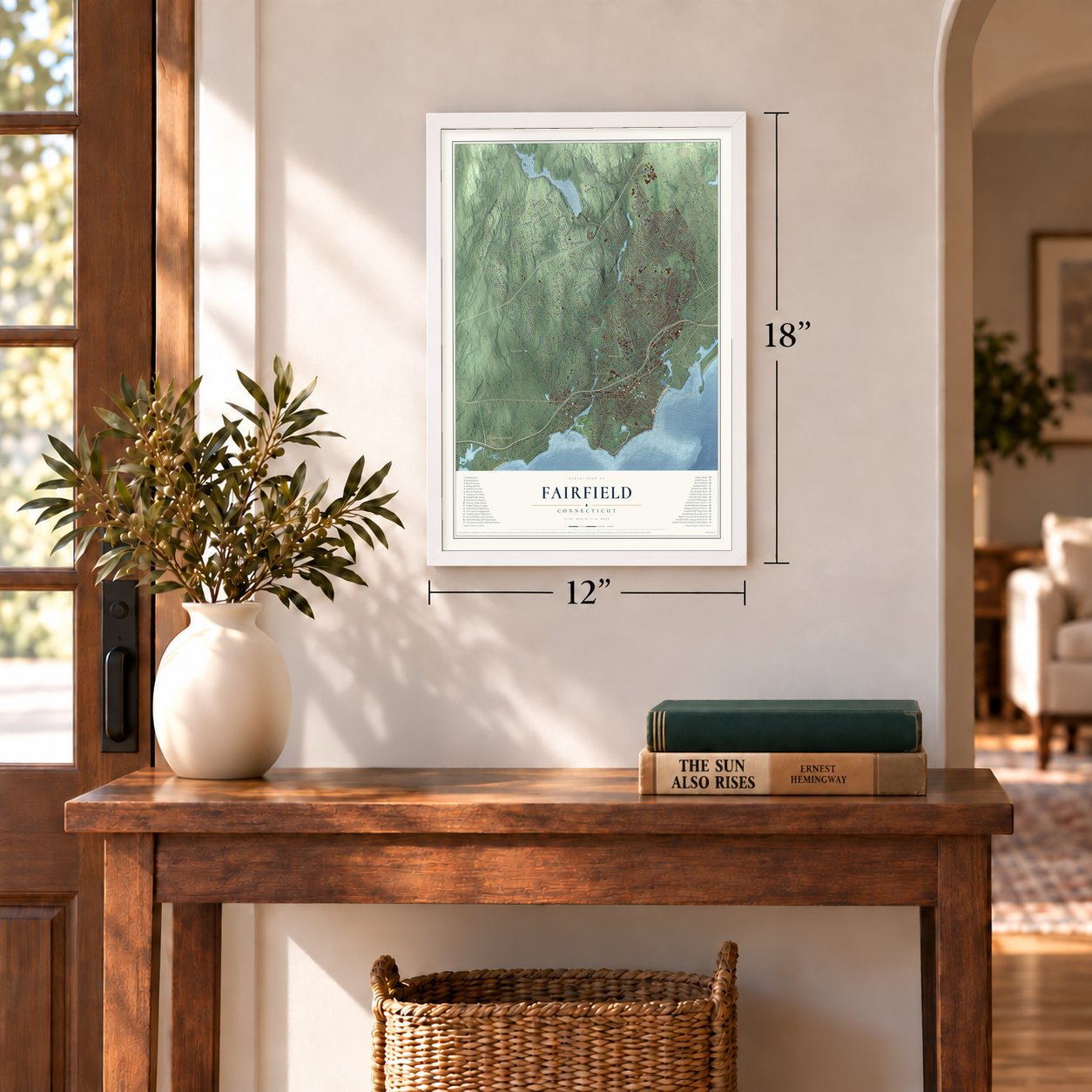
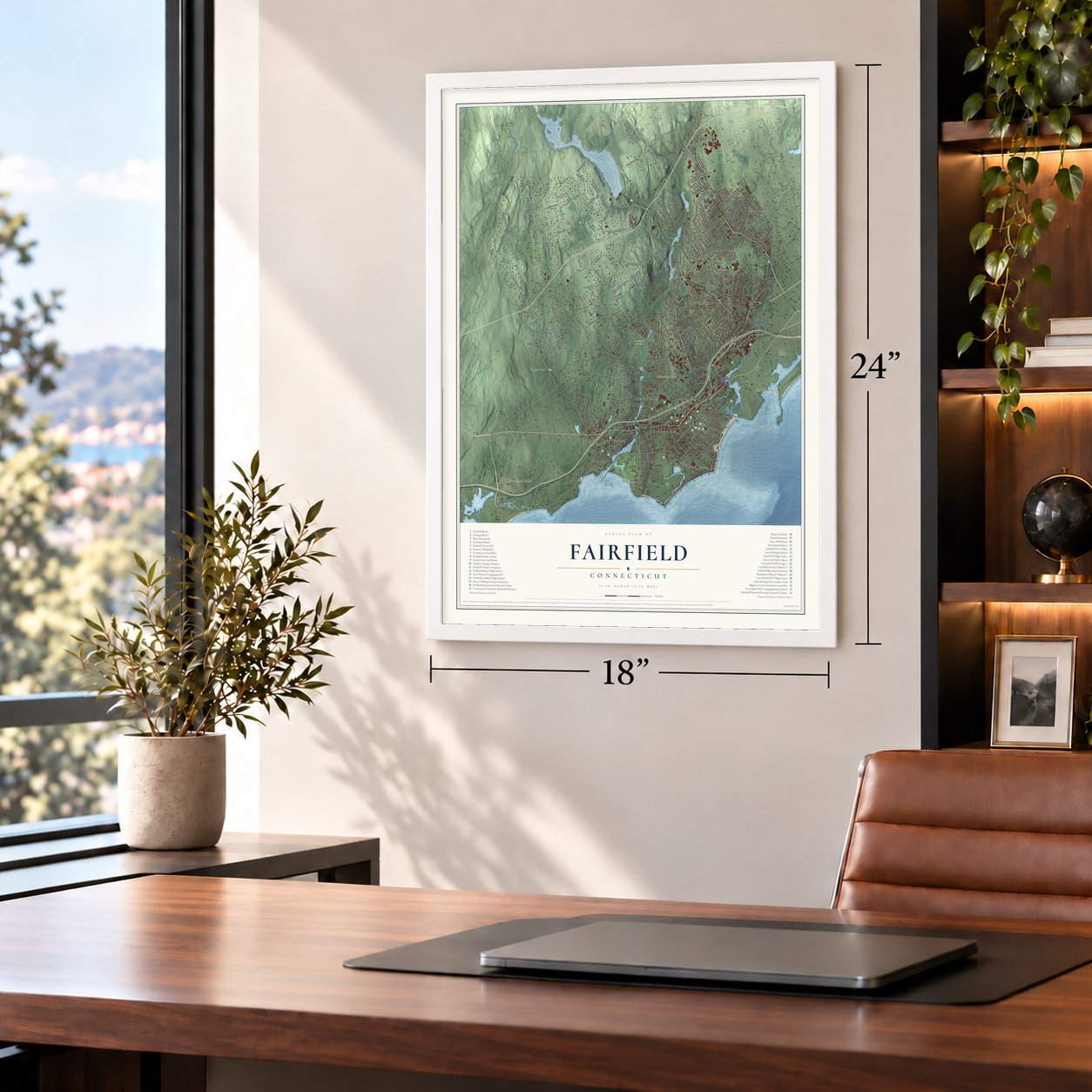
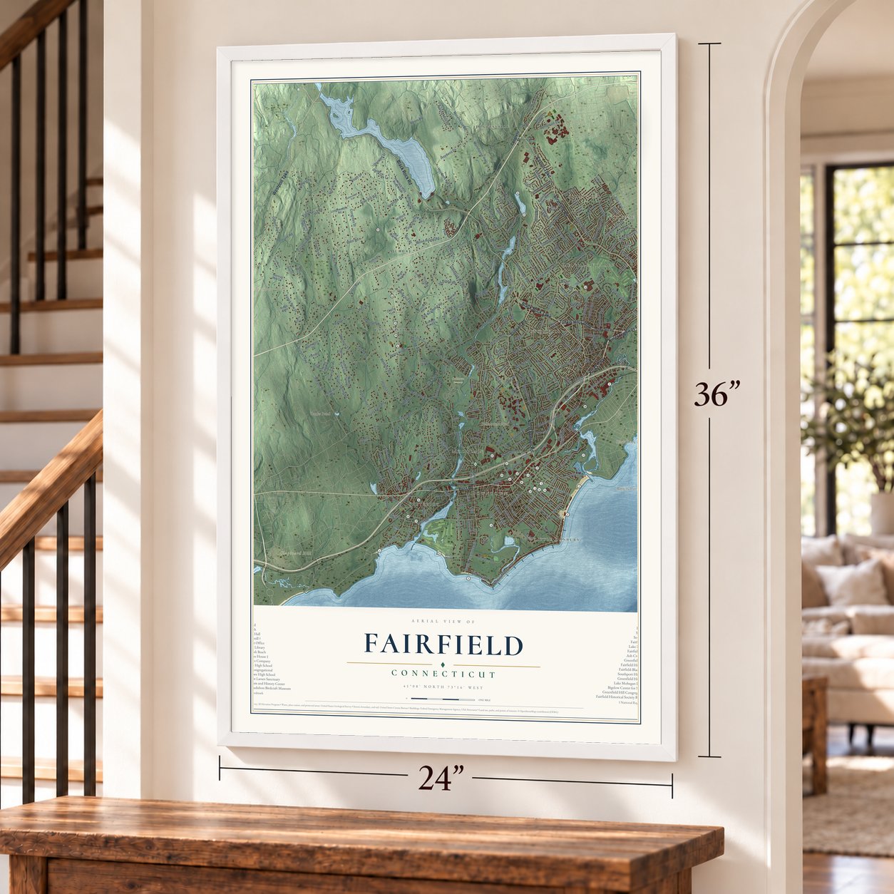
12" x 18" Archival Matte Print
A Map of Home. A Work of Art.
Explore Fairfield, Connecticut from a whole new perspective. Created using aerial imagery and detailed geographic data, this map captures Fairfield building by building, with labeled streets, familiar landmarks, and shaded topographical relief that highlights the natural contours of the landscape.
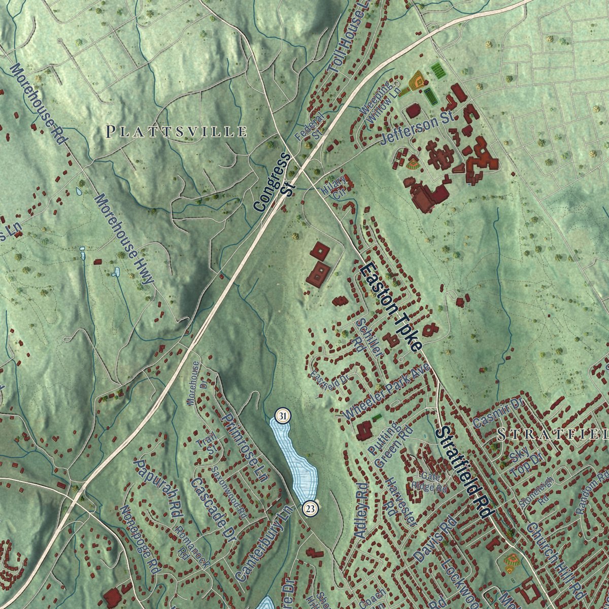
Combining modern data with the timeless character of a vintage atlas, this map is just as interesting up close as it is beautiful on the wall. Whether you grew up in Fairfield, spent memorable years there, or call it home today, this unique map is a great way to celebrate a place that means something to you. Zoom in on the preview to look for your street, and then order a print to put your memories on the wall.

Three ways to hang it
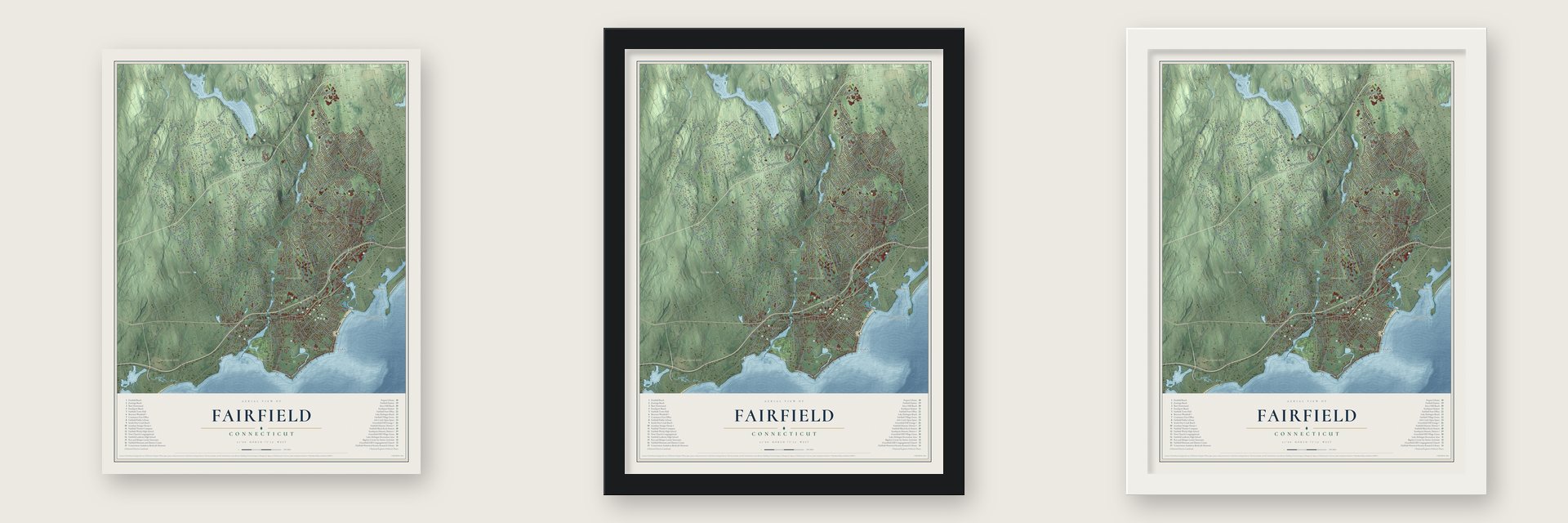
Unframed archival matte, a black wood frame or a white wood frame.
Up close
Geography Worth Displaying
This map was created using accurate cartographic data and authoritative geographic sources, including the U.S. Geological Survey (USGS) and FEMA. The map brings together terrain, waterways, roads, and building detail. The majority of the streets are labeled, houses are accurately depicted, and the topography is derived from government sources. Combining local data with carefully composed color and shading leads to this beautifully detailed Fairfield artwork for your wall.
Rather than simply showing street outlines, we’ve included as many of the street names as we could reasonably fit on the map while keeping their names legible. Zoom in on the high resolution preview to see exactly what’s on the map. We truly set out to create a statement piece for anyone who loves Fairfield. So whether it’s for you, or a gift for someone you love, we hope this map of Fairfield brings back fond memories.
Explore the full map of Fairfield, Connecticut and read about the local places it shows.
Find your street
Names on the Fairfield map
Every name below is printed on this map. Look for your street, your school, the park where you played, or the pond down the road.
Places and landmarks18
- Downtown
- Little Danbury
- Battery Point
- Black Rock Neck
- Catamount Hill
- Clapboard Hill
- Banks Pond
- Bellarmine Pond
- Oaklawn Cemetery
- Plattsville
- Murray
- Melville Village
Show all 18 places
- Tunxis Hill
- Toilsome Hill
- Southport
- Greenfield Hill
- Stratfield
- Mill Plain
Streets and roads349
- Post Road
- Black Rock Turnpike
- Kings Highway East
- Kings Highway
- Stillson Road
- Stratfield Road
- Tunxis Hill Cutoff
- North Benson Road
- Westport Turnpike
- Easton Turnpike
- Black Rock Road
- Sturges Highway
- Hulls Farm Road
- Park Avenue
- Fairfield Woods Road
- Church Hill Road
- Gilbert Highway
- Verna Hill Road
- Pansy Road
- Congress Street
- Redding Road
- Morehouse Highway
- Bronson Road
- Burr Street
- Hillside Road
- Mill Plain Road
- Merwins Lane
- Cross Highway
- Fairfield Beach Road
- North Street
Show all 349 streets
- Jennings Road
- Melville Avenue
- Round Hill Road
- Pequot Avenue
- Fence Row Drive
- Brookside Drive
- Catamount Road
- Mill Hill Road
- Old Post Road
- Mill Hill Terrace
- Galloping Hill Road
- Morehouse Road
- Sasco Hill Road
- Cedar Road
- South Pine Creek Road
- Old Academy Road
- Mine Hill Road
- Hulls Highway
- Valley Road
- Oldfield Road
- Reef Road
- Harbor Road
- High Street
- Knapps Highway
- Banks North Road
- Riverside Drive
- Hoydens Hill Road
- Towne House Road
- Duck Farm Road
- Old Dam Road
- Beach Road
- Silver Spring Road
- Hill Farm Road
- Flintlock Road
- Holland Hill Road
- Sturges Road
- Rowland Road
- Villa Avenue
- Tahmore Drive
- Beers Road
- Morehouse Lane
- Commerce Drive
- Hoydens Lane
- Winnepoge Drive
- Reid Street
- Hollydale Road
- Penfield Road
- Center Street
- Rolling Hills Drive
- Warner Hill Road
- Barlow Road
- Toilsome Hill Road
- Jessica Lane
- Shrub Oak Lane
- Surrey Lane
- Division Street
- Brooklawn Avenue
- Davis Road
- Jefferson Street
- Springer Road
- Algonquin Road
- Jackman Avenue
- Lakeview Drive
- Hemlock Road
- Joan Drive
- Wood House Road
- Woodridge Avenue
- Pemburn Drive
- Cornell Road
- Toll House Lane
- Treasure Road
- Aran Hill Road
- Leeber Road
- Dunham Road
- Crestwood Road
- Cascade Drive
- Lockwood Road
- Marlborough Terrace
- Carroll Road
- Riders Lane
- Szost Drive
- Meadowbrook Road
- Meadow Street
- McInnes Road
- Half Mile Road
- Jeniford Road
- Sturges Street
- Papurah Road
- Pvrd
- Primrose Lane
- Governors Lane
- Brookbend Road
- North Cedar Road
- Buena Vista Road
- Bellarmine Road
- Lucille Street
- Wormwood Road
- Warde Terrace
- Fairland Drive
- Nutmeg Lane
- Fallow Field Road
- Shetland Road
- Canterbury Lane
- Eliot Street
- South Street
- Godfrey Road
- Veres Street
- Adley Road
- Brett Road
- Lenox Road
- Coventry Lane
- Winton Road
- Willow Street
- Old Farm Road
- Euclid Avenue
- School Road
- Papermill Lane
- James Street
- Village Lane
- York Road
- Miro Street
- Henry Street
- Sterling Street
- Lovers Lane
- Kings Drive
- May Street
- Stephens Lane
- Burroughs Road
- Mountain Laurel Road
- South Benson Road
- Rock Ridge Road
- Wellington Drive
- Westway Road
- Edward Street
- Hemlock Hills Road North
- Samp Mortar Drive
- Grasmere Avenue
- Nonopoge Road
- Old Hickory Road
- Ruane Street
- Sky Top Drive
- Melville Drive
- Hill Brook Lane
- Pine Creek Avenue
- Wheeler Park Avenue
- Longmeadow Road
- Orchard Hill Lane
- Jennie Lane
- Barberry Road
- Queens Grant Road
- North Pine Creek Road
- Old Farm Lane
- Putting Green Road
- Alma Drive
- Old Black Rock Turnpike
- Old Spring Road
- Mistywood Lane
- Rakoczy Avenue
- Harvester Road
- Inwood Road
- Ferncliff Road
- Queens Grant Drive
- Lakeside Drive
- Beacon View Drive
- Partridge Lane
- Lynch Road
- Arbor Drive
- Palamar Drive
- Foggwood Road
- Shady Hill Road
- Spring Hill Road
- Whites Hill Lane
- Carter Henry Drive
- Midlock Road
- Rennell Drive
- Mulberry Hill Road
- Pratt Street
- Somerset Avenue
- Daybreak Lane
- Fern Street
- Ingleside Road
- Millard Street
- Hurd Street
- Pease Avenue
- Fleming Lane
- Sunset Avenue
- Morning Dew Circle
- Oxford Road
- Farmstead Hill
- Glenarden Drive
- Main Street
- Lancelot Road
- Ridge Cmn
- Fair Oak Drive
- Flax Road
- Judson Road
- Windsor Road
- Deepwood Road
- Wilton Road
- Casmir Drive
- Hanford Drive
- Meadow Ridge Road
- Lawrence Road
- Hickory Lane
- Red Oak Road
- Schiller Road
- High Point Lane
- Dudley Drive
- Audubon Lane
- Mill Hill Lane
- Golden Pond Lane
- Oldfield Drive
- Moritz Place
- Melin Drive
- Sasco River Lane
- Forest Avenue
- Summit Lane
- River Street
- Hunter Road
- Sasco Point
- Acorn Lane
- Banks Place
- Perry Street
- Taylor Place
- Cherry Lane
- Rena Place
- Finn Street
- Tunxis Hill Road
- Walls Drive
- Katona Drive
- Greenfield Hill Road
- Romanock Road
- One Rod Highway
- Ronald Drive
- Collingwood Avenue
- Random Road
- Farist Road
- Short Hill Lane
- Fairmount Terrace
- Hunyadi Avenue
- Campfield Drive
- Knollwood Drive
- Weeping Willow Lane
- Valley View Road
- Paulding Street
- Robin Lane
- Linley Drive
- Brion Drive
- Doreen Drive
- Edgewood Road
- Homestead Lane
- Elm Street
- Fairfield Place
- Rolling Ridge Road
- Bittersweet Road
- Wildflower Lane
- Brookview Avenue
- Blueridge Road
- College Park Drive
- Coach Lane
- Flower House Drive
- Federal Street
- Dill Road
- Ermine Street
- Cobblers Hill Road
- Rhoda Avenue
- Frog Pond Lane
- Trillium Road
- Lee Drive
- Marian Road
- Senate Lane
- Valley Circle
- Trail Street
- Hilary Circle
- Lewis Drive
- Third Street
- Jay Circle
- Unquowa Road
- Lalley Boulevard
- Eastfield Drive
- Taintor Drive
- Greenfield Street
- Brambly Hedge Circle
- Bennington Road
- Fulling Mill Lane North
- Andrassy Avenue
- Gate Ridge Road
- Morehouse Drive
- Linwood Avenue
- Hemlock Hills Road South
- Mill River Road
- Wakeman Lane
- Saxonwood Road
- School Street
- Sturbridge Lane
- Paddock Hill Lane
- Ross Road
- Sherwood Drive
- Sherwood Farm Road
- Field Point Drive
- Ironside Road
- Mariners Way
- Riverview Circle
- Beagling Circle
- Stoneleigh Road
- Gould Avenue
- Florence Lane
- Prince Street
- Boroskey Drive
- Milbank Road
- Rutland Avenue
- Barlow Place
- Stella Lane
- Sasco Hill Terrace
- Open Gate Lane
- Rita Avenue
- Wagon Hill Road
- Grist Mill Lane
- Cider Mill Lane
Names are listed as they appear on the printed map. Zoom into the product photos to find them.
About Fairfield, Connecticut
Fairfield is a town of 61,512 people in Fairfield County, on Long Island Sound. Roger Ludlowe, author of Connecticut's Fundamental Orders, purchased the land known as Unquowa in 1639 and gave the settlement its name. Its founders laid out the center in Four Squares. When Fairfield County was formed in 1666, the village became its county seat, and it held that role until the courts left for Bridgeport in 1853.
Fairfield backed independence early, so the British meant to make an example of it. On July 7, 1779, some 2,000 soldiers led by General Tryon landed at Fairfield Beach, and ten-year-old Samuel Rowland watched them from the spire of Trinity Church until a neighbor sent him running. That evening and into the next morning the soldiers set fire to the meetinghouse and the jail, and by the end more than two hundred buildings were lost. Residents rebuilt over the next twenty years and put up a new town hall on the Green in 1794. Rowland later served as town clerk for more than forty years.
“For more than two hundred years Fairfield was the queen of the county”
- Penfield's mills fed the armyIn 1750 the town gave Peter Penfield permission to put up a grist mill on Ash Creek, close to where the Unquowa River empties out. During the Revolution guards watched the Penfield mills day and night, because James Penfield was grinding flour for the army, several barrels of it each day. By 1819 Fairfield had nine grain mills, four of them run by the tide, grinding wheat brought in from other states.
- The Southport Globe onionThe harbor village of Mill River carried the largest trade in town, its coasting vessels running to New York and the southern ports, and an 1819 gazetteer named it Fairfield's wealthiest village. It was chartered as the borough of Southport in 1831. While the Civil War went on, nearby farms raised an onion named for the borough, the Southport Globe, and a barrel of them brought ten dollars.
- Dwight's academy on the hillA 1909 guide says Major Benjamin Tallmadge, Washington's secret agent, often watched British ships from the Greenfield Hill meeting house spire during the Revolution. Timothy Dwight, later Yale's president, became parish minister in 1783 and opened an academy teaching classics to young women and men alike. His long poem of 1794 took the village's name. Frederic Bronson built the octagonal Bronson Windmill in 1893 and 1894 to pump water into an underground cistern; it joined the National Register in 1971.
- A farmhouse the fire missedDavid Ogden built his saltbox farmhouse on Bronson Road around 1750, about the time he married Jane Sturges, and his family lived there for 125 years. The house survived the 1779 burning, was listed on the National Register in 1979, and now serves as a museum run by the Fairfield Museum and History Center.
- First hoist rescue, 1945A gale drove a barge with two crewmen aboard onto Penfield Reef. A helicopter flew over from the Sikorsky Aircraft plant in nearby Bridgeport and lifted the men to safety on November 29, 1945, the first civilian helicopter hoist rescue ever made.
Keep exploring Connecticut
Fairfield is one of 375 Connecticut towns we've mapped. Every dot on the map is a print of its own.
The search covers every state, Connecticut first.
Near Fairfield
Order 2 or more town maps and save 10%. Shown in the size and finish you picked above, so they hang as a set.
- Fairfield University 12" x 18" / Archival Matte Print $39.99
- Mill Plain 12" x 18" / Archival Matte Print $39.99
- Murray 12" x 18" / Archival Matte Print $39.99


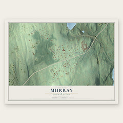
More maps nearby: Black Rock, Stratfield, Southport, Staples and Sacred Heart University.
The art of mapping a place
How This Map Was Made
Real places. Remarkable detail. Discover the layers that turn geographic data into a map of home.

The view from above
Aerial imagery reveals the character of the land: woodland, open fields, and the patterns of a place.

The shape of the land
Elevation data brings hills, valleys, and subtle changes in the landscape into view.

The details of home
Roads, waterways, and building footprints come together to make the map feel unmistakably local.

Geography becomes art
Considered color, shading, and typography bring the layers together in a map made for your wall.


Process illustrated with Mendon, Massachusetts. Aerial imagery: USDA NAIP. Terrain: USGS 3D Elevation Program. Map details and finished artwork: KNOWOL.
The Details
About This Print
Choose an archival matte print, or a black or white Ayous wood frame. The archival matte print is unframed.
Select your size and finish above to see the matching product image and price.
Materials & Craftsmanship
A contemporary map with the character of a classic atlas, printed on archival matte paper. Optional frames are made from Ayous wood.
Your printed map does not include the watermark shown in the full-map preview.
Shipping & Delivery
Free shipping within the United States. Every print is made to order in the USA.
Buying a gift? Add a note in your cart and we'll include it. We never put prices in the package.
Prints ship within 2 to 3 business days. Allow 7 to 10 days total from ordering for delivery. Timing may vary during holidays or periods of high order volume.
Read our shipping policy.
Returns and damaged prints
Each print is made to order. Change-of-mind refunds are not available after production.
If your print arrives damaged, misprinted or incorrect, contact support@knowol.com within 30 days of receiving it. Include your order number, photos and a description of the issue.
Read our full refund and replacement policy. For questions about your order, email support@knowol.com.