
Search for another town


Free U.S. delivery 7 to 10 days after you order
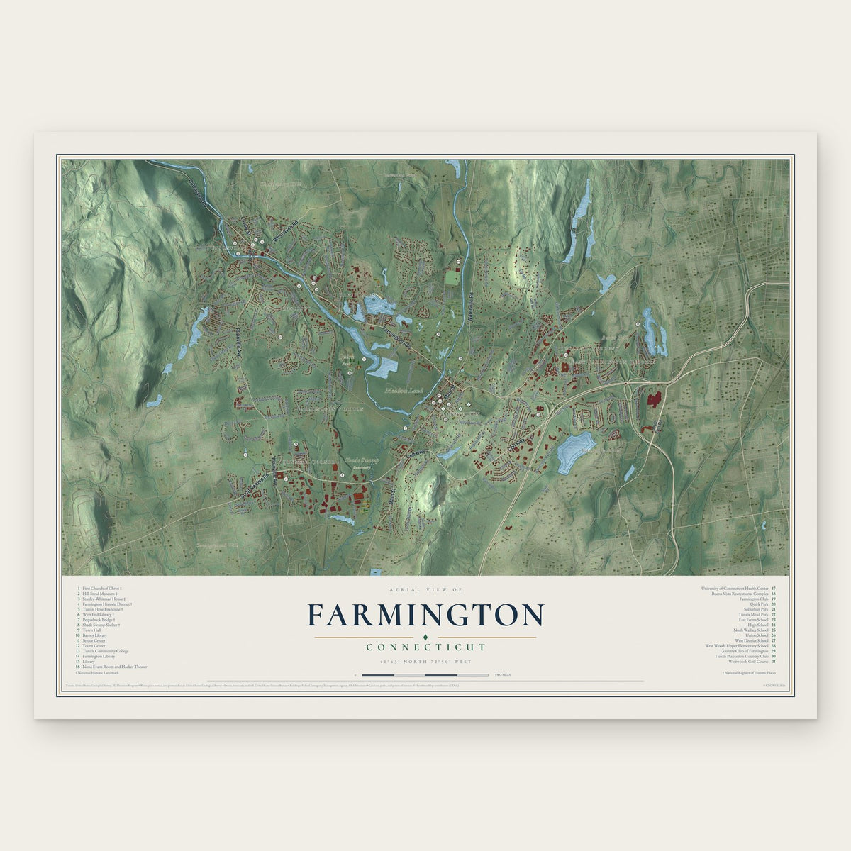
Farmington, Connecticut Map Art
Building by building, with labeled streets and shaded relief.
12" x 18" Archival Matte Print
A Map of Home. A Work of Art.
Explore Farmington, Connecticut from a whole new perspective. Created using aerial imagery and detailed geographic data, this map captures Farmington building by building, with labeled streets, familiar landmarks, and shaded topographical relief that highlights the natural contours of the landscape.
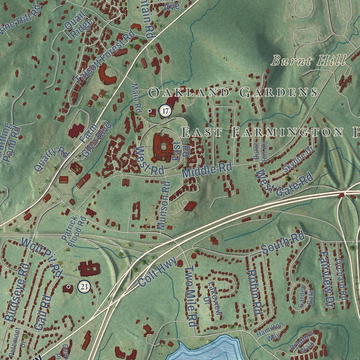
Combining modern data with the timeless character of a vintage atlas, this map is just as interesting up close as it is beautiful on the wall. Whether you grew up in Farmington, spent memorable years there, or call it home today, this unique map is a great way to celebrate a place that means something to you. Zoom in on the preview to look for your street, and then order a print to put your memories on the wall.

Three ways to hang it
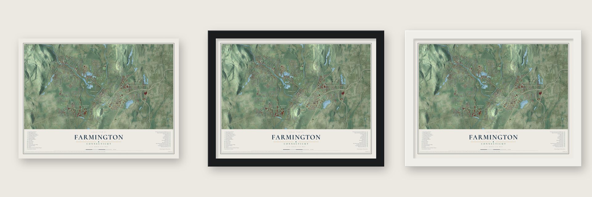
Unframed archival matte, a black wood frame or a white wood frame.
Up close
Geography Worth Displaying
This map was created using accurate cartographic data and authoritative geographic sources, including the U.S. Geological Survey (USGS) and FEMA. The map brings together terrain, waterways, roads, and building detail. The majority of the streets are labeled, houses are accurately depicted, and the topography is derived from government sources. Combining local data with carefully composed color and shading leads to this beautifully detailed Farmington artwork for your wall.
Rather than simply showing street outlines, we’ve included as many of the street names as we could reasonably fit on the map while keeping their names legible. Zoom in on the high resolution preview to see exactly what’s on the map. We truly set out to create a statement piece for anyone who loves Farmington. So whether it’s for you, or a gift for someone you love, we hope this map of Farmington brings back fond memories.
Explore the full map of Farmington, Connecticut and read about the local places it shows.

Find your street
Names on the Farmington map
Every name below is printed on this map. Look for your street, your school, the park where you played, or the pond down the road.
Places and landmarks16
- Downtown
- East Farmington Heights
- Oakland Gardens
- Burnt Hill
- Campground Hill
- Huckleberry Hill
- Batterson Park Pond
- Beaverdam Pond
- Meadow Land
- Quirk Park
- Shade Swamp Sanctuary
- Bensted Corner
Show all 16 places
- Unionville
- West District
- River Glen
- Farmington Station
Streets and roads184
- Colt Highway
- Scott Swamp Road
- Farmington Avenue
- Lovely Street
- Plainville Avenue
- Main Street
- Collinsville Road
- Waterville Road
- West Avon Road
- Batterson Park Road
- Two Mile Road
- Birch Street
- Pine Drive
- Perry Street
- New Britain Avenue
- Meadow Road
- South Road
- Copper Mine Road
- Talcott Notch Road
- Old Mountain Road
- Town Farm Road
- Mountain Spring Road
- Brickyard Road
- River Road
- Red Oak Hill Road
- Devonwood Drive
- Mountain Road
- Middle Road
- Forest Hills Drive
- Knollwood Road
Show all 184 streets
- Round Hill Road
- Birdseye Road
- Pinnacle Road
- Hyde Road
- Woodruff Road
- Garden Street
- Spring Lane
- Cope Farms Road
- Burlington Road
- Ely Road
- Morea Road
- Reservoir Road
- Portage Crossing
- Wolf Pit Road
- Crosswood Road
- Judson Lane
- Harold Road
- Songbird Lane
- Carriage Drive
- Basswood Road
- Bonnie Drive
- Webster Street
- Poplar Hill Drive
- West Gate Road
- High Street
- Cooke Street
- Wells Drive
- Colton Street
- Tunxis Street
- Robin Road
- West Road
- Fairview Drive
- Redcoat Lane
- Gail Road
- Hatters Lane
- Ellen Drive
- Roma Drive
- South East Road
- Camp Street
- Cambridge Crossing
- Prattling Pond Road
- Fienemann Road
- West District Road
- Tunxis Village
- Tunxis Meade Drive
- Somersby Way
- Winding Trail
- Oakridge Drive
- Melrose Drive
- Farm Glen Boulevard
- Highwood Road
- Farmington Ridge Drive
- Snowberry Lane
- South Ridge Road
- Tanglewood Road
- Mallard Drive
- Talcott Forest Road
- Wood Pond Road
- Lido Road
- Waterside Drive
- Walnut Farms Drive
- Maple Avenue
- Executive Drive
- Quail Ridge
- Vine Hill Road
- Maple Ridge Drive
- Chimney Hill Drive
- White Oak Road
- Mountain Lane
- Peggy Lane
- Munson Road
- Northeast Road
- Briar Hill
- Thatcher Terrace
- Baldwin Drive
- Dunne Wood Court
- Forest Street
- Wakefield Lane
- Junior Road
- Quarry Road
- East Road
- Penfield Place
- Lake Street
- Depot Place
- Walton Way
- Slater Road
- Keyes Street
- Pilgrim Path
- Bella Lane
- Serra Drive
- Ash Court
- South Main Street
- Westview Terrace
- Main Road
- Mohawk Drive
- Bridgehampton Crossing
- Woodside Drive
- Salisbury Way
- Pinewood Drive
- Orchard Road
- Skyline Drive
- Patrick Flood Road
- Lakeview Drive
- Fenwick Drive
- Sanford Avenue
- Kent Lane
- Trotters Gln
- Girard Avenue
- Canterbury Lane
- Inwood Lane
- Autumn Way
- Fox Run Road
- Johnson Avenue
- Sylvan Avenue
- Virginia Lane
- Doris Street
- Parish Road
- Maiden Lane
- Nauset Lane
- Beech Street
- Muls Hill Drive
- Bradford Walk
- Field Stone Run
- Garden Gate
- Farmington Chase Crescent
- Pembroke Hill
- Wyndwood Road
- Burnt Hill Road
- Taine Mountain Road
- Tall Timbers Drive
- Lakeshore Drive
- Bridgewater Road
- Fairlawn Street
- Sunset Drive
- Meadow Lane
- Briarwood Road
- Hunters Ridge
- Butternut Drive
- Colt Highway Cutoff
- Hampton Court
- Trumbull Lane
- Petemont Drive
- Glen Hollow Drive
- Goodrich Road
- Tanbark Trail
- Sunset Terrace
- Pheasant Hill Road
- Hamilton Way
- Bari Lane
- Lincoln Street
- Carrier Place
- Bailey Court
- Elm Street
- Fir Drive
Names are listed as they appear on the printed map. Zoom into the product photos to find them.
About Farmington, Connecticut
Farmington is a town of 26,712 people in Hartford County, on the Farmington River. The Tunxis people lived here first, and in 1640 families from Hartford began a settlement on their land, the first inland settlement west of the Connecticut River. The town and the river both took the name Farmington in 1645, because the place sat in a farming district. Over time its huge territory was carved up to create Southington in 1779, Bristol in 1785, Avon in 1830 and Plainville in 1869, which is why people call it the "mother of towns."
After the Revolution the village turned to trade. The Deming and Cowles merchants supplied the new settlements to the west and north, Farmington owners held three West India ships, and one of them sailed to China and brought back silks, tea and china marked with its owners' initials. In 1802 Governor John Treadwell judged that no inland town in the state had more money in trade. The boom faded after about 1825, because the turnpikes the merchants had backed over Talcott Mountain let their customers shop in Hartford instead. The railroad later passed the village by, so its old Main Street houses were never torn down.
“These were the days of prosperity and pride for this always beautiful village.”
- The Boston Port Act on trialParliament's Boston Port Act angered the town, so on May 19, 1774, Farmington's people gathered and put the law itself on trial. They found it guilty of "being instigated by the devil," hanged a copy of it and then burned it.
- The Amistad captives in 1841After the Amistad trial, the U.S. government refused to pay for the freed Mende Africans to go home. Farmington took in 38 of them and their leader Cinque in 1841, teaching them English and Christianity while residents raised money for the voyage back to Africa. They worshiped at the First Church of Christ, the meetinghouse Judah Woodruff built in 1771. Because it gave them shelter, the church earned National Historic Landmark status in 1975.
- Ladders on every roofMany early chimneys here were made of wood lined with clay, so in 1656 the town ordered every householder to keep a ladder tall enough to reach the roof beside his chimney. Hard money was scarce and wheat served as cash, and Deacon Thomas Bull once gave up four acres to get three pairs of shoes.
- Unionville's water powerBells, cannon and music greeted the first canal boat launched at Farmington in 1828. A dam built at Unionville soon powered a wood screw factory, opened in 1832. That screw business held on for only about three years, yet the same building later produced clocks, spoons, mouse traps, oyster tongs and gunstocks. From 1844 Lambert Hitchcock made furniture there, the Union Nut Company began in 1861, and by the 1880s the river also ran five paper mills.
- Hill-Stead and its ImpressionistsThe industrialist Alfred Atmore Pope had Hill-Stead built on the hill above the village between 1898 and 1901. His daughter, Theodate Pope Riddle, among the earliest women architects in America, designed the house with McKim, Mead & White. She left it as a museum for the public, with the family's paintings by Monet, Manet, Degas and Mary Cassatt, and it became a National Historic Landmark in 1991. It also hosts the Sunken Garden Poetry Festival.
Keep exploring Connecticut
Farmington is one of 382 Connecticut towns we've mapped. Every dot on the map is a print of its own.
The search covers every state, Connecticut first.
Near Farmington
Order 2 or more town maps and save 10%. Shown in the size and finish you picked above, so they hang as a set.
- West District 12" x 18" / Archival Matte Print $39.99
- Plainville 12" x 18" / Archival Matte Print $39.99
- Avon 12" x 18" / Archival Matte Print $39.99


More maps nearby: New Britain, West Hartford, Burlington, Bristol and Newington.
The art of mapping a place
How This Map Was Made
Real places. Remarkable detail. Discover the layers that turn geographic data into a map of home.

The view from above
Aerial imagery reveals the character of the land: woodland, open fields, and the patterns of a place.

The shape of the land
Elevation data brings hills, valleys, and subtle changes in the landscape into view.

The details of home
Roads, waterways, and building footprints come together to make the map feel unmistakably local.

Geography becomes art
Considered color, shading, and typography bring the layers together in a map made for your wall.


Process illustrated with Mendon, Massachusetts. Aerial imagery: USDA NAIP. Terrain: USGS 3D Elevation Program. Map details and finished artwork: KNOWOL.
The Details
About This Print
Choose an archival matte print, or a black or white Ayous wood frame. The archival matte print is unframed.
Select your size and finish above to see the matching product image and price.
Materials & Craftsmanship
A contemporary map with the character of a classic atlas, printed on archival matte paper. Optional frames are made from Ayous wood.
Your printed map does not include the watermark shown in the full-map preview.
Shipping & Delivery
Free shipping within the United States. Every print is made to order in the USA.
Buying a gift? Add a note in your cart and we'll include it. We never put prices in the package.
Prints ship within 2 to 3 business days. Allow 7 to 10 days total from ordering for delivery. Timing may vary during holidays or periods of high order volume.
Read our shipping policy.
Returns and damaged prints
Each print is made to order. Change-of-mind refunds are not available after production.
If your print arrives damaged, misprinted or incorrect, contact support@knowol.com within 30 days of receiving it. Include your order number, photos and a description of the issue.
Read our full refund and replacement policy. For questions about your order, email support@knowol.com.