
Search for another town





Free U.S. delivery 7 to 10 days after you order
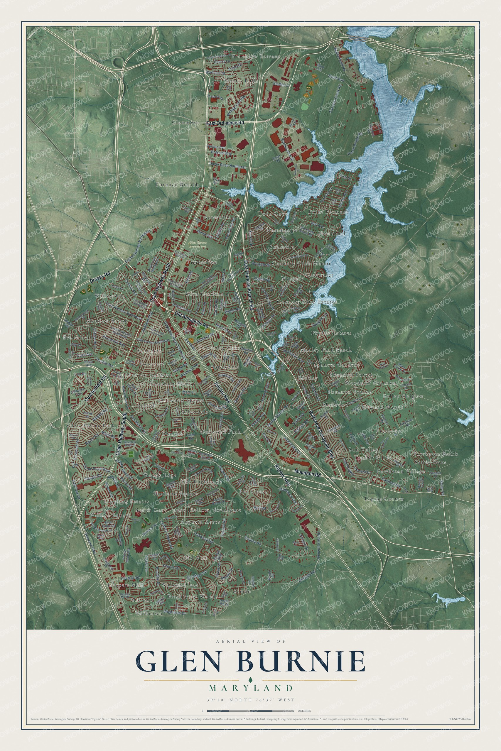
Glen Burnie, Maryland Map Art
Building by building, with labeled streets and shaded relief.
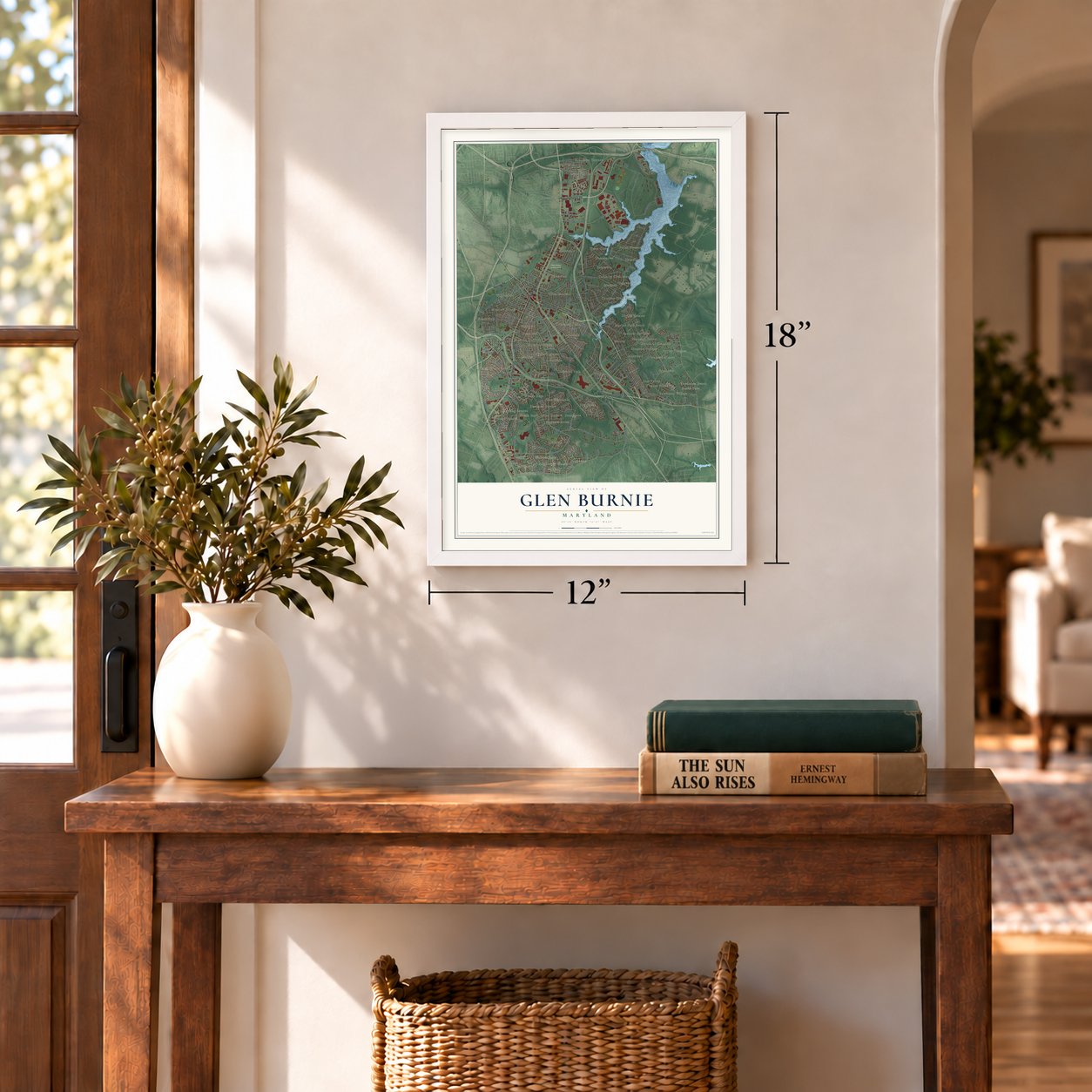
12" x 18" Archival Matte Print
A Map of Home. A Work of Art.
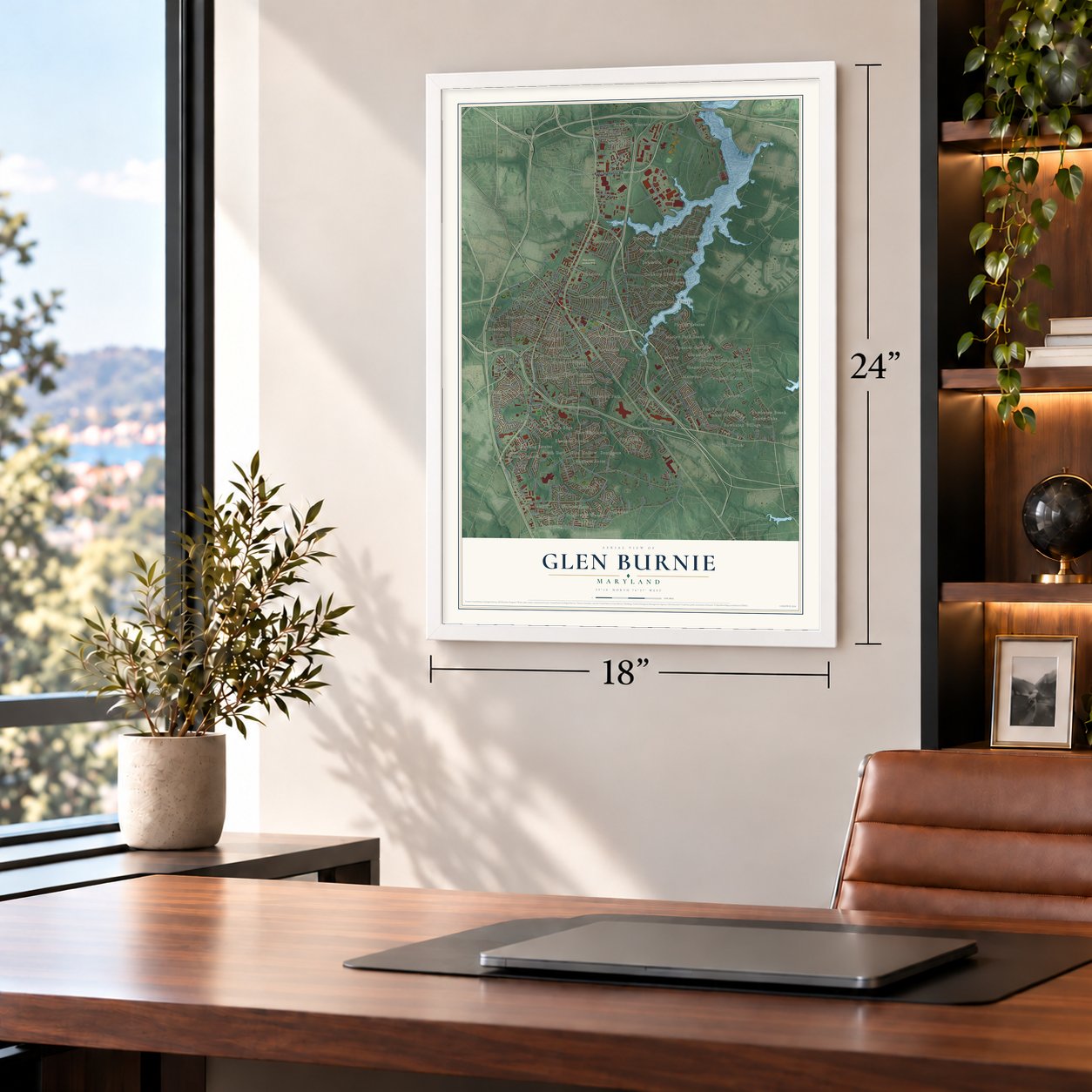
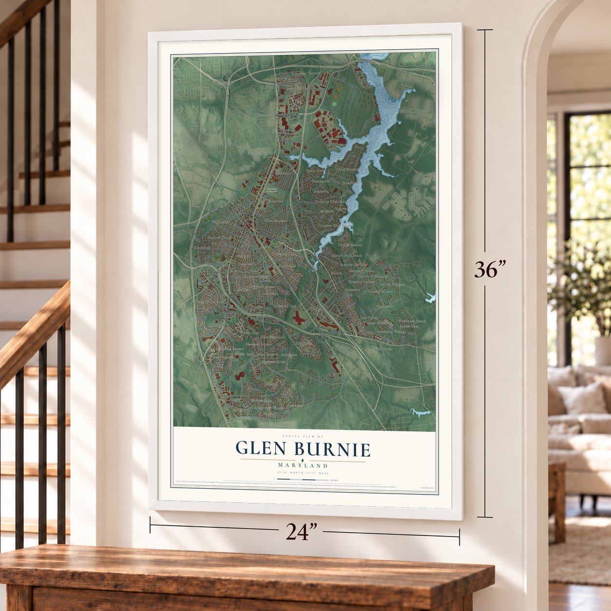
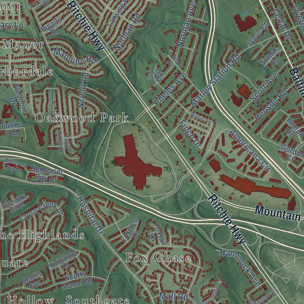
Explore Glen Burnie, Maryland from a whole new perspective. Created using aerial imagery and detailed geographic data, this map captures Glen Burnie building by building, with labeled streets, familiar landmarks, and shaded topographical relief that highlights the natural contours of the landscape.
Combining modern data with the timeless character of a vintage atlas, this map is just as interesting up close as it is beautiful on the wall. Whether you grew up in Glen Burnie, spent memorable years there, or call it home today, this unique map is a great way to celebrate a place that means something to you. Zoom in on the preview to look for your street, and then order a print to put your memories on the wall.
Three ways to hang it
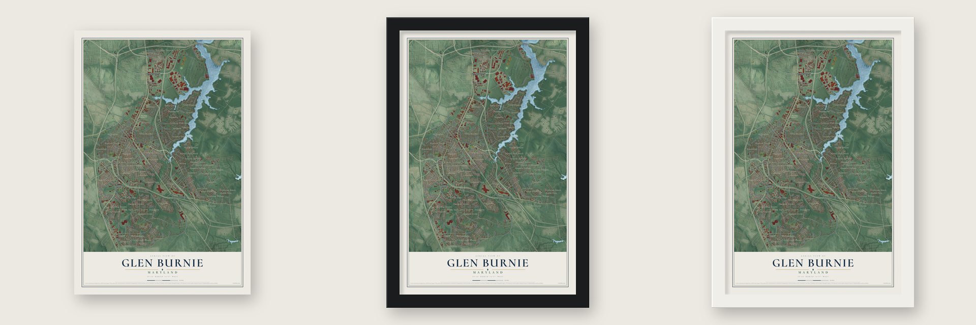
Unframed archival matte, a black wood frame or a white wood frame.
Up close
Geography Worth Displaying
This map was created using accurate cartographic data and authoritative geographic sources, including the U.S. Geological Survey and the Census Bureau. The map brings together terrain, waterways, roads, and building detail. The majority of the streets are labeled, houses are accurately depicted, and the topography is derived from government sources. Combining local data with carefully composed color and shading leads to this beautifully detailed Glen Burnie artwork for your wall.
Rather than simply showing street outlines, we’ve included as many of the street names as we could reasonably fit on the map while keeping their names legible. Zoom in on the high resolution preview to see exactly what’s on the map. We truly set out to create a statement piece for anyone who loves Glen Burnie. So whether it’s for you, or a gift for someone you love, we hope this map of Glen Burnie brings back fond memories.
Read the story behind this map of Glen Burnie, Maryland from 2026.

Find your street
Names on the Glen Burnie map
Every name below is printed on this map. Look for your street, your school, the park where you played, or the pond down the road.
Places and landmarks66
- Glen Haven Memorial Park
- Yorktown
- Brooklyn Terrace
- Powhatan Village
- Point Pleasant
- Augusta Acres
- Willowdale
- Spencer Gardens
- Oakwood Park
- Gatewater
- Glenmore
- Watson Place
Show all 66 places
- Monroe Gardens
- Furnace Branch
- Powhatan Beach
- Fox Chase
- Country Club Estates
- Marwood
- Glen Gardens
- Dundee
- Zeman
- Brookfield
- Twin Cove
- Woods Edge
- Solley Heights
- Harundale
- Glen Burnie Park
- Lipins Corner
- The Highlands
- Sun Valley
- Phyllis Estates
- Old Mill
- South Gate
- Shannon Square
- Harpers Mill
- Marley Park Beach
- Oakwood Manor
- Hammarlee
- Lehigh
- Freetown
- Margate
- Marley
- Timber Glade
- Village Square
- Shoreland
- Southgate
- Shetland Square
- Aquahart Manor
- Woods of Shannon
- Meadow Brook
- Timberline
- Rippling Estates
- Suburbia
- Somerset
- Saunders
- Millrace
- Sandy Oaks
- Morris Hills
- Country Club Manor
- Howard Manor
- Brightview Woods
- Arbordale
- Glen Hollow
- Shannon Forest
- Acresville
- Towering Oaks
Streets and roads277
- Baltimore Annapolis Boulevard
- Crain Highway North
- Old Annapolis Road
- East Ordnance Road
- Crain Highway South
- Dorsey Road
- Ritchie Highway
- East Furnace Branch Road
- Mountain Road
- Quarterfield Road
- Jumpers Hole Road
- Central Avenue
- Finch Drive
- Nolpark Court
- Phelps Avenue
- Rose Anne Road
- Howard Road
- Oakwood Road
- Hospital Drive
- Elvaton Road
- Veterans Highway
- Solley Road
- Americana Circle
- Obrecht Road
- Old Mill Road
- South Avenue
- Brightview Drive
- Baylor Road
- Eastway
- Marley Station Road
Show all 277 streets
- Baymeadow Drive
- Eighth Avenue Northwest
- Aquahart Road
- Furnace Creek Road
- Thomas Road
- Phirne Road
- Chalet Drive
- Margate Drive
- Kenora Drive
- Marley Avenue
- Oak Manor Drive
- Overhill Road
- Glen Road
- Greenway Road Southeast
- Thelma Avenue
- Patrol Bridge Road
- Country Club Drive
- Dover Road Northeast
- Stahls Point Road
- Third Avenue Southwest
- Carroll Road
- Norman Avenue
- Mayo Road
- Foxwell Road
- Bell Avenue
- Cherry Lane
- Hidden Brook Drive
- Cedarcliff Drive
- Patriot Lane
- Ridgely Road
- Arundel Corp Road
- Furnace Drive
- Phirne Road West
- Brandon Drive
- Kent Road
- Roosevelt Avenue
- Elizabeth Road
- Saltgrass Drive
- East Park Drive
- Old Mayo Road
- Marie Avenue
- Warfield Road
- Elizabeth Lane
- Ahearn Drive
- Leonard Drive
- Cedar Drive
- Langley Road
- Century Towne Road
- Caldwell Road
- Padfield Boulevard
- Holsum Way
- Scott Avenue
- Biddle Road
- Amberly Road
- Mall Road
- Henson Road
- McGowan Avenue
- Gaylor Road
- Norman Road
- Hammock Avenue
- Fleagle Road
- Edgerly Road
- Sunset Drive
- Villagio Drive
- Evans Street
- Lori Drive
- Bunch Avenue
- Manning Road
- Rose Avenue
- Vernon Avenue
- Jaki Terrace
- Mary Lane
- Blades Lane
- First Street
- Range Road
- Anon Lane
- Jay Court
- Freetown Road
- Spencer Road
- Phirne Road East
- Furnace Avenue
- Cross Creek Drive
- Delaware Avenue
- Stewart Avenue
- Lincoln Avenue Southwest
- Lincoln Drive
- Fifth Avenue Southeast
- Shoreham Beach Road
- Green Branch Lane
- Scotts Manor Drive
- Norfolk Road
- Maple Lane Northwest
- Saint James Drive
- Stiemly Avenue
- Dover Road
- Benmere Road
- Madison Park Drive
- Old Mill Boulevard
- Phyllis Drive
- Louise Terrace
- Dublin Drive
- Cloverleaf Drive
- Stevens Road
- Crawford Drive
- Nolpark Road
- Maryland Avenue
- Woods Road
- Valiant Circle
- Eleanore Drive
- Addisson Drive
- Phillip Drive
- Lansing Road
- Wende Way
- Nolberry Drive
- Kempton Road
- Bonnie View Road
- Truck Farm Drive
- Gordon Court
- Orchard Road
- Sonny Drive
- Glenlea Drive
- Cohansey Trail
- Madeline Avenue
- Martha Road
- Powers Drive
- Funke Road
- Cody Drive
- Ingalls Road
- Ridge Road
- Sangria Court
- Somerset Bay Drive
- Foxtree Drive
- Niedert Drive
- Pine Terrace
- Shore Forest Drive
- James Road
- Solomon Road
- Marigold Road
- Jeffrey Road
- Harford Road
- Short Curve Road
- Davis Court
- Joyce Drive
- Bruton Drive
- Clover Court
- Sumac Road
- Broad Avenue
- Foxtail Lane
- Shady Hill Lane
- Ivy Lane
- Scotts Gln
- Renfro Court
- Hook Road
- Lanny Court
- Lisa Lane
- Ertel Road
- West Avenue
- Lea Road
- School Road
- Sunnybrook Drive
- New Jersey Avenue Northeast
- Genine Drive
- Shoreland Drive
- South Meadow Drive
- Leymar Road
- Twin Ridge Drive
- First Avenue Southwest
- Glenview Avenue
- North Thompson Avenue
- Millhouse Drive
- Whitaker Road
- First Avenue
- Mountain Ridge Court
- Highland Drive
- Kippis Road
- Garrett Road
- Weyburn Road
- Mountain View Circle
- Bliss Lane
- Meadowbrook Road
- Sprite Way
- Linden Lane
- Joy Circle
- Kess Circle
- Fifth Street
- Hartwell Road
- Harpers Mill Road
- Third Street
- Marley Creek Drive
- Highlander Drive
- Belmawr Place
- Farmington Road
- Beach Road
- Glengary Garth
- Nolview Court
- Galiot Drive
- Holloway Road
- Roesler Avenue
- McLean Way
- Hall Avenue
- Sunrise Lane
- Jackson Avenue
- Tall Pines Court
- Burton Road
- Cory Drive
- Ray Lane
- Fourth Avenue Southeast
- Virginia Lane
- Greenway Street Northwest
- Robin Road
- Old Stage Road
- Arundel Corporation Road
- Shetlands Lane
- Sixth Avenue Northeast
- New Freetown Road
- Cheverly Lane
- Holly Ridge Drive
- Chester Circle
- Kellington Drive
- Third Avenue
- Dorchester Road
- Monaghan Road
- North Langley Road
- Warehouse Creek Road
- Allan Avenue
- Georgia Avenue Northeast
- Wilkes Lane
- Roesler Road
- Crown Road
- Sharon Drive
- Pillsbury Place
- Merry Chase Court
- Oakwood Village Road
- Johnson Farm Lane
- Westport Bay Drive
- Majesty Gln
- Shana Road
- Old Hospital Drive
- Forest Road
- Nolfield Drive
- Merlot Street
- Sunnyview Drive
- Heather Stone Way
- Waterview Court
- Castle Road
- Paul Marr Drive
- Miriam Road
Names are listed as they appear on the printed map. Zoom into the product photos to find them.
About Glen Burnie, Maryland
Glen Burnie is an unincorporated community of 72,891 people in Anne Arundel County, just south of Baltimore. In 1812 Elias Glenn, a district attorney, built a country estate here and called it Glennsburne. As the land passed down through his family, the name changed to Glennsbourne Farm and then to Glenburnie. In 1854 his grandson, William Wilkins Glenn, brought the Curtis Creek Mining, Furnace and Manufacturing Company onto the family land. The business did well and added several thousand acres in northern Anne Arundel County.
After William Wilkins Glenn died, his son, brother and nephew took over. Two cousins, John Glenn Jr. and John M. Glenn, planned a suburb on 3,000 acres of family land along the new rail line linking Baltimore and Annapolis. The family brought in George T. Melvin and Henry S. Mancha, who drew up the town's plan and advertised it, and in 1888 the state recognized Glenburnie as an official subdivision. The post office, once called Tracey's Station and then Myrtle, took the Glenburnie name. In 1930 postmaster Louis J. DeAlba split it into two words, Glen Burnie.
- A carnival since 1908Albert Hamlen and other residents founded the Glen Burnie Improvement Association in 1908. For more than a century, money from its summer carnival has paid for the volunteer fire company, playgrounds, a water supply and street lights.
- Harundale Mall in 1958James W. Rouse of the Rouse Company and local developer Charles Steffey first offered to build their mall on Crain Highway to revive the struggling town center. Town leaders said no, because the corner of Crain Highway and Quarterfield Road flooded in ordinary rains and fixing the storm drains would cost too much. Harundale Mall opened on Ritchie Highway in 1958 as the first enclosed mall east of the Mississippi, and Glen Burnie Mall followed in 1962.
- Crain Highway in 1927Crain Highway, named for Robert Crain, opened in 1927. In 1939 a second road opened, Ritchie Highway, which honors Albert C. Ritchie, a former governor of Maryland. Until Interstate 97 opened as a bypass in the 1980s, nearly every driver headed from the Baltimore area to Annapolis or the Chesapeake Bay Bridge used Ritchie Highway.
- The last trainsThe Baltimore and Annapolis Railroad ran passenger trains through Glen Burnie until February 1950, when buses and private cars took away its riders. Freight trains kept running until Hurricane Agnes damaged the railroad's trestle over the Severn River in Annapolis, and the Army Corps of Engineers condemned it for train use.
- A school from 1899First Avenue Elementary, built in 1899, was one of Glen Burnie's earliest schools. St. Alban's Episcopal, from 1904, is the oldest church in the area, and many of its bricks came from Marley Chapel, a Maryland parish of the 1730s.
Keep exploring Maryland
Glen Burnie is one of 874 Maryland towns we've mapped. Every dot on the map is a print of its own.
The search covers every state, Maryland first.
Near Glen Burnie
Order 2 or more town maps and save 10%. Shown in the size and finish you picked above, so they hang as a set.
- Pasadena 12" x 18" / Archival Matte Print $39.99
- Ferndale 12" x 18" / Archival Matte Print $39.99
- Arundel Gardens 12" x 18" / Archival Matte Print $39.99

More maps nearby: Riviera Beach, Hawkins Point, Brooklyn Park, Curtis Bay and Linthicum.
The art of mapping a place
How This Map Was Made
Real places. Remarkable detail. Discover the layers that turn geographic data into a map of home.

The view from above
Aerial imagery reveals the character of the land: woodland, open fields, and the patterns of a place.

The shape of the land
Elevation data brings hills, valleys, and subtle changes in the landscape into view.

The details of home
Roads, waterways, and building footprints come together to make the map feel unmistakably local.

Geography becomes art
Considered color, shading, and typography bring the layers together in a map made for your wall.


Process illustrated with Mendon, Massachusetts. Aerial imagery: USDA NAIP. Terrain: USGS 3D Elevation Program. Map details and finished artwork: KNOWOL.
The Details
About This Print
Choose an archival matte print, or a black or white Ayous wood frame. The archival matte print is unframed.
Select your size and finish above to see the matching product image and price.
Materials & Craftsmanship
A contemporary map with the character of a classic atlas, printed on archival matte paper. Optional frames are made from Ayous wood.
Your printed map does not include the watermark shown in the full-map preview.
Shipping & Delivery
Free shipping within the United States. Every print is made to order in the USA.
Buying a gift? Add a note in your cart and we'll include it. We never put prices in the package.
Prints ship within 2 to 3 business days. Allow 7 to 10 days total from ordering for delivery. Timing may vary during holidays or periods of high order volume.
Read our shipping policy.
Returns and damaged prints
Each print is made to order. Change-of-mind refunds are not available after production.
If your print arrives damaged, misprinted or incorrect, contact support@knowol.com within 30 days of receiving it. Include your order number, photos and a description of the issue.
Read our full refund and replacement policy. For questions about your order, email support@knowol.com.