
Search for another town





Free U.S. delivery 7 to 10 days after you order
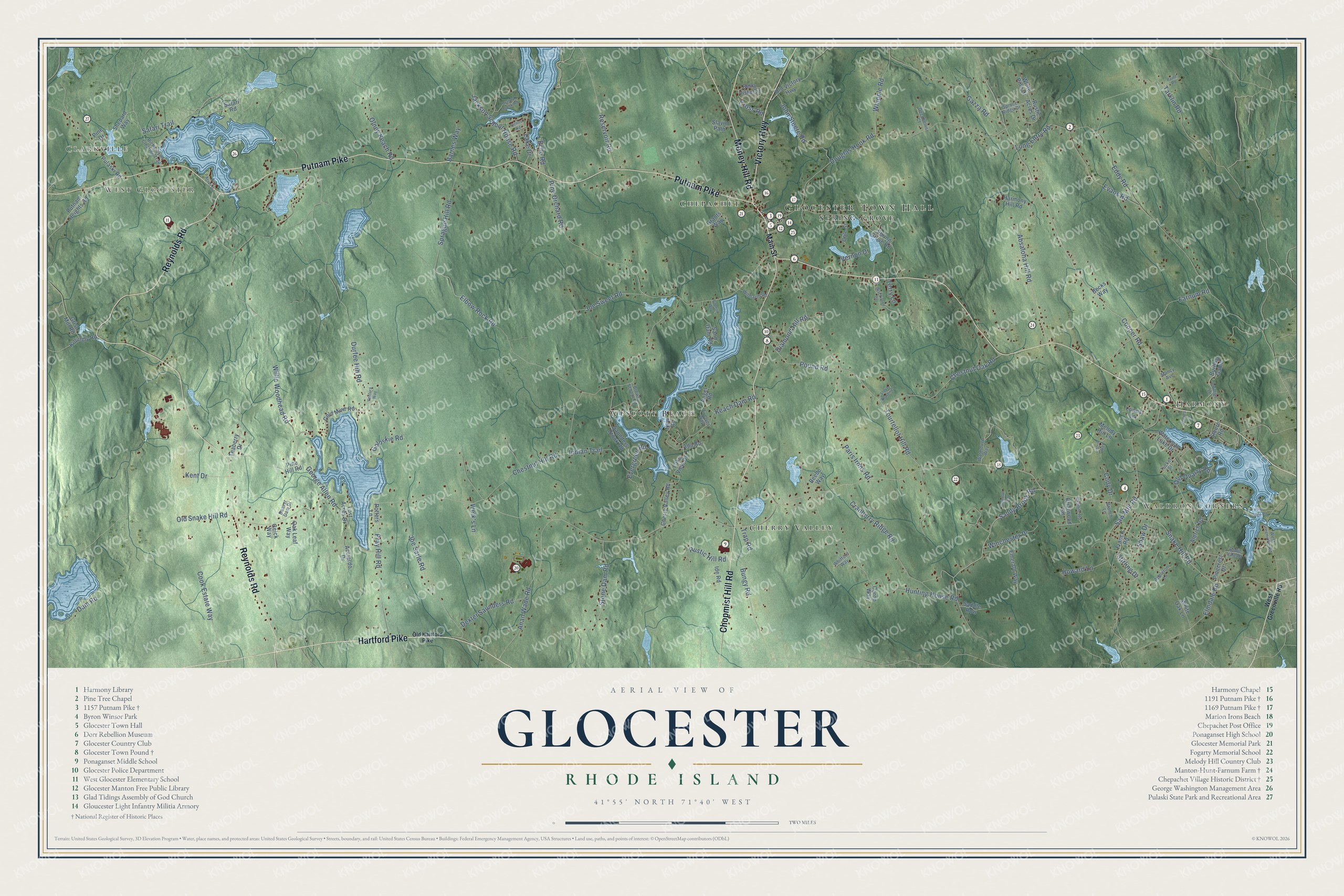
Glocester, Rhode Island Map Art
Building by building, with labeled streets and shaded relief.
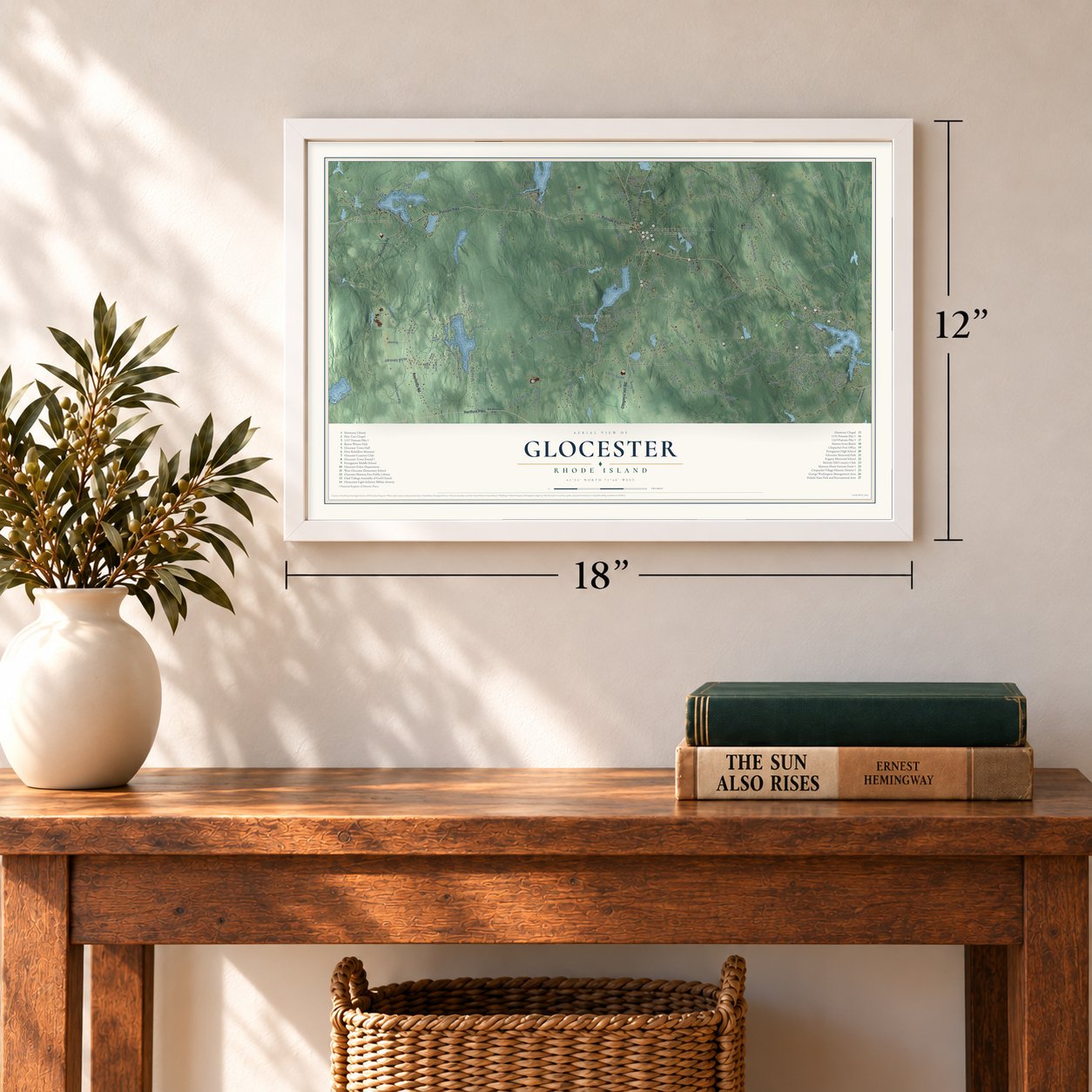
12" x 18" Archival Matte Print
A Map of Home. A Work of Art.
Explore Glocester, Rhode Island from a whole new perspective. Created using aerial imagery and detailed geographic data, this map captures Glocester building by building, with labeled streets, familiar landmarks, and shaded topographical relief that highlights the natural contours of the landscape.
Combining modern data with the timeless character of a vintage atlas, this map is just as interesting up close as it is beautiful on the wall. Whether you grew up in Glocester, spent memorable years there, or call it home today, this unique map is a great way to celebrate a place that means something to you. Zoom in on the preview to look for your street, and then order a print to put your memories on the wall.
Three ways to hang it
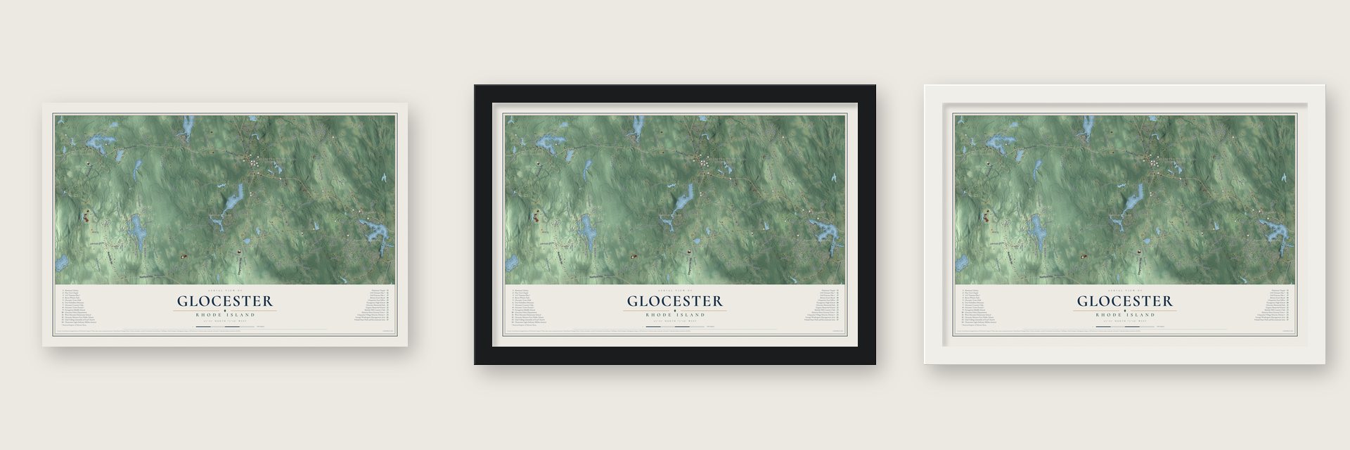
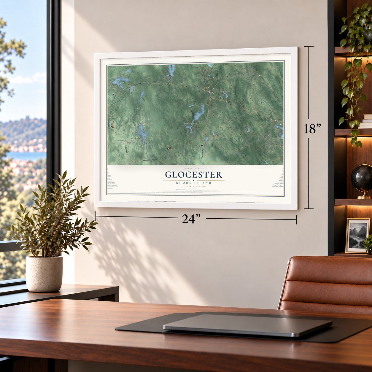
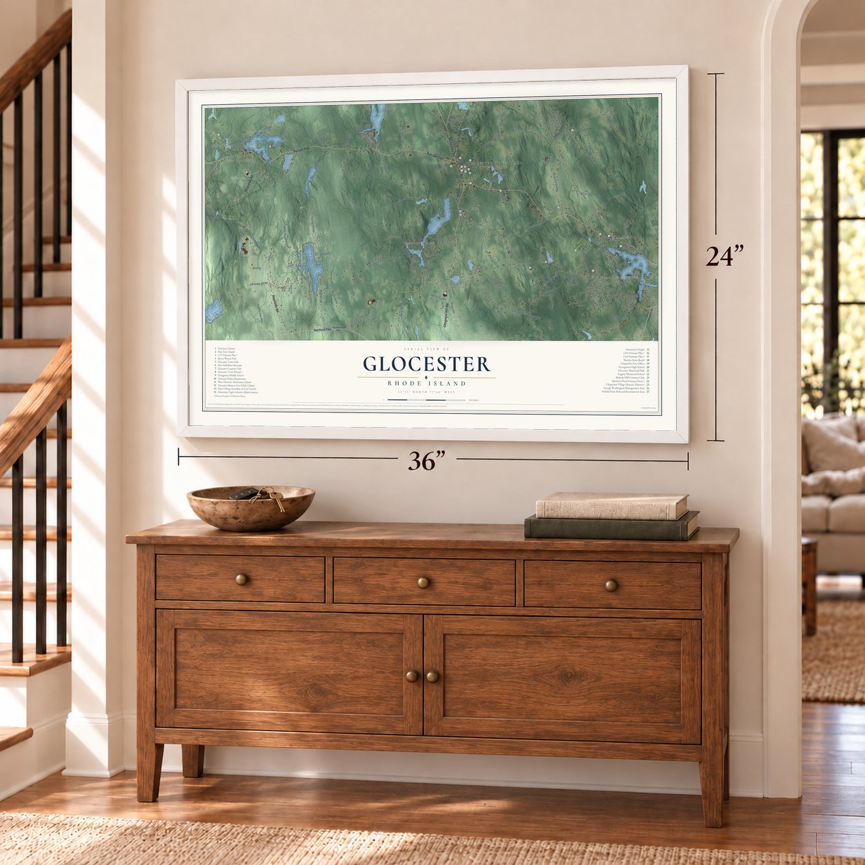
Unframed archival matte, a black wood frame or a white wood frame.
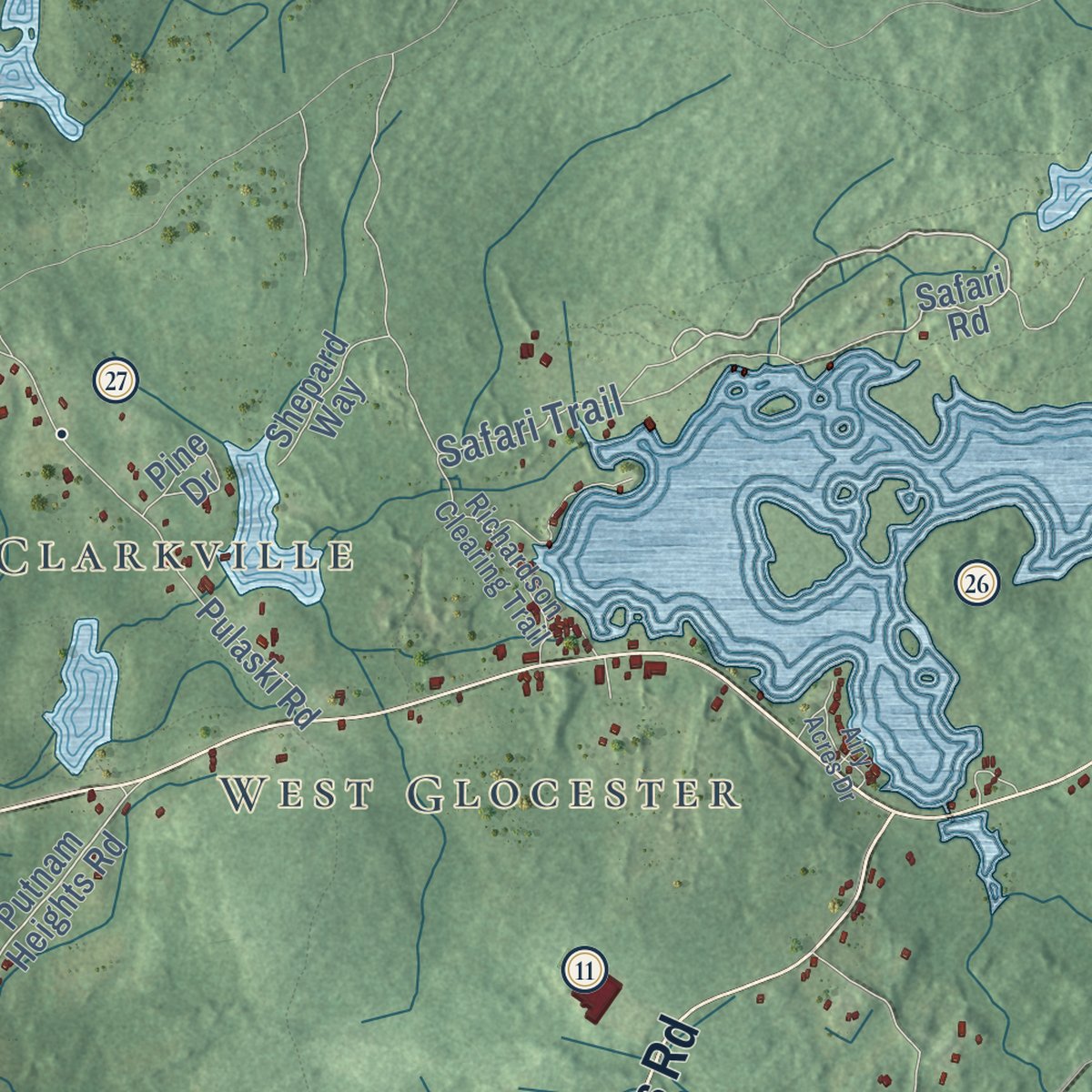
Up close
Geography Worth Displaying
This map was created using accurate cartographic data and authoritative geographic sources, including the U.S. Geological Survey (USGS) and FEMA. The map brings together terrain, waterways, roads, and building detail. The majority of the streets are labeled, houses are accurately depicted, and the topography is derived from government sources. Combining local data with carefully composed color and shading leads to this beautifully detailed Glocester artwork for your wall.
Rather than simply showing street outlines, we’ve included as many of the street names as we could reasonably fit on the map while keeping their names legible. Zoom in on the high resolution preview to see exactly what’s on the map. We truly set out to create a statement piece for anyone who loves Glocester. So whether it’s for you, or a gift for someone you love, we hope this map of Glocester brings back fond memories.
Explore the full map of Glocester, Rhode Island and read about the local places it shows.

Find your street
Names on the Glocester map
Every name below is printed on this map. Look for your street, your school, the park where you played, or the pond down the road.
Places and landmarks9
- Glocester Town Hall
- Clarkville
- West Glocester
- Harmony
- Waldron Corners
- Cherry Valley
- Wescott Beach
- Spring Grove
- Chepachet
Streets and roads147
- Victory Highway
- Putnam Pike
- Reynolds Road
- Chopmist Hill Road
- Money Hill Road
- Hartford Pike
- Elbow Rock Road
- Sandy Brook Road
- Cooper Road
- Snake Hill Road
- Chestnut Hill Road
- Durfee Hill Road
- Tourtellot Hill Road
- Douglas Hook Road
- Willie Woodhead Road
- Evans Road
- Old Snake Hill Road
- Saw Mill Road
- Pine Orchard Road
- Hunting House Road
- Long Entry Road
- Absalona Hill Road
- Joe Sarle Road
- Cranberry Ridge Road
- Cook Estate Way
- Farnum Road
- Chestnut Oak Road
- Pray Hill Road
- Tarklin Road
- Anan Wade Road
Show all 147 streets
- George Allen Road
- Paris Irons Road
- Joe Sweet Road
- Sprague Hill Road
- Keach Dam Road
- Indian Trail
- Stone Dam Road
- Kent Drive
- Winchester Drive
- Gazza Road
- John Steere Road
- Eddy Road
- Old Quarry Road
- Jackson School House Road
- Reservoir Road
- Pound Road
- Safari Trail
- Bungy Road
- Lake Drive
- Dexter Saunders Road
- Olney Keach Road
- Shaw Drive
- Rustic Hill Road
- Welk's Lane
- Whipple Road
- Howard Lane
- Stirling Drive
- Diamond Hill Road
- Cross Road
- Trap Road
- Vernon Drive
- Evergreen Road
- Elmdale Road
- Goloskie Road
- Barnes Way
- Cody Drive
- Echo Road
- Dam Road
- Terry Lane
- Main Street
- Safari Road
- Putnam Heights Road
- Pine Hill Road
- Burling Game
- Old Victory Highway
- Spring Grove Road
- Acciardo Drive
- Gold Mine Road
- Pulaski Road
- Lake View Drive
- Aldrich Road
- Saunders Brook Road
- Bella Vista Circle
- Pinecrest Drive
- Emerald Way
- Rustic Acres Drive
- Sand Dam Road
- Waterman Lake Drive
- Oak Leaf Way
- Cherry Valley Road
- Melody Hill Lane
- Francis Road
- Angel Road
- Lost Acres Drive
- Killingly Road
- Pine Drive
- White Oak Lane
- Harmony Hill Road
- Beebe Way
- Shepard Way
- Cole Street
- Steere Road
- Briarwood Road
- Grist Mill Road
- Saddle Row
- Ide Road
- Teaberry Drive
- Caron Way
- Grants Way
- Potters Lane
- Geick Way
- White Pine Drive
- Slavin Path
- New Road
- Lowes Lane
- Ada Road
- Becks Way
- West Greenville Road
- Watmough Way
- Phillips Lane
- Appleton Lane
- Richardson Clearing Trail
- Brown School Road
- Evelyns Way
- Spruce Ridge Drive
- Wilmarth Road
- Ramble Road
- Tucker Street
- Decubellis Court
- Robin Vale Drive
- Beaver Dam Drive
- Branch Lane
- Whitford Way
- Vories Lane
- Muncy Avenue
- Old Hartford Pike
- Pine Ledge Road
- Blackinton Drive
- Ventura Way
- Brandy Brook Road
- Harris Way
- Camelot Way
- Lloyd Bowen Court
- Airy Acres Drive
- Paine Road
- Centre Road
- Capron Way
Names are listed as they appear on the printed map. Zoom into the product photos to find them.
About Glocester, Rhode Island
Glocester is a town of 9,974 people in Providence County, and its two villages are Chepachet and Harmony. The land belonged to Providence until 1731, when it broke off as a separate town and took the name Gloucester to honor Henry Stuart, Duke of Gloucester. Its northern section split off in 1806 to form Burrillville, and the voters left behind dropped a letter from the name so their town would not be confused with Gloucester, Massachusetts.
Pequot and Nipmuc people lived here before the English arrived, and Chepachet's name means "where rivers meet." Patriot feeling ran strong in the years before the Revolution, and the Gloucester Light Infantry was organized in Chepachet in 1774. Loyalists exiled from Newport were sent to Stephen Keach's farm in town, where one of them, Thomas Vernon, kept a record of his neighbors in 1776.
“inclined much to talk of liberty...It is amazing what false and erroneous opinions and ideas these people have entertained”
- The Dorr RebellionIn the 1840s Rhode Island still ran under its colonial charter of 1663, so only men who owned land could vote. Thomas Wilson Dorr led the push for change, and the rebellion began in Glocester in 1841 and reached its end at Chepachet in 1842. Dorr lost, but the state was forced to write a new constitution, and the vote opened to men without land. The Dorr Rebellion Museum tells the story.
- A town pound from 1748Glocester built a stone pen in 1748, where Pound Road meets Chopmist Hill Road, to hold livestock that wandered loose. The town calls it the oldest pound still standing in America, and the Glocester Town Pound joined the National Register in 1970.
- The Ancient and HorriblesEach Fourth of July a parade of veterans, fire trucks and floats mocking the politics of the day comes down Putnam Pike in Chepachet. The parade got its start during the presidency of Calvin Coolidge, who belonged to Boston's Ancient and Honorable Artillery Company. As the parade's 2008 chair explained, Rhode Islanders made a joke out of that company's name.
- A toll road through HarmonyIn the early 1800s the Glocester Turnpike kept a toll booth in Harmony, and the tolls paid for the road's upkeep until they ended in the 1850s. The Harmony Chapel and Cemetery, dating from 1816, stand at the center of the village.
- Lovecraft's Dark SwampSearching for a rumored "Dark Swamp," C. M. Eddy Jr. and H. P. Lovecraft visited the Chepachet area in 1923. The swamp eluded them, but what they saw of the countryside went into at least the opening of Lovecraft's story "The Colour Out of Space."
Keep exploring Rhode Island
Glocester is one of 85 Rhode Island towns we've mapped. Every dot on the map is a print of its own.
The search covers every state, Rhode Island first.
Near Glocester
Order 2 or more town maps and save 10%. Shown in the size and finish you picked above, so they hang as a set.
- Chepachet 12" x 18" / Archival Matte Print $39.99
- West Glocester 12" x 18" / Archival Matte Print $39.99
- Harmony 12" x 18" / Archival Matte Print $39.99


More maps nearby: Pascoag, Harrisville, Burrillville, North Scituate and Scituate.
The art of mapping a place
How This Map Was Made
Real places. Remarkable detail. Discover the layers that turn geographic data into a map of home.

The view from above
Aerial imagery reveals the character of the land: woodland, open fields, and the patterns of a place.

The shape of the land
Elevation data brings hills, valleys, and subtle changes in the landscape into view.

The details of home
Roads, waterways, and building footprints come together to make the map feel unmistakably local.

Geography becomes art
Considered color, shading, and typography bring the layers together in a map made for your wall.


Process illustrated with Mendon, Massachusetts. Aerial imagery: USDA NAIP. Terrain: USGS 3D Elevation Program. Map details and finished artwork: KNOWOL.
The Details
About This Print
Choose an archival matte print, or a black or white Ayous wood frame. The archival matte print is unframed.
Select your size and finish above to see the matching product image and price.
Materials & Craftsmanship
A contemporary map with the character of a classic atlas, printed on archival matte paper. Optional frames are made from Ayous wood.
Your printed map does not include the watermark shown in the full-map preview.
Shipping & Delivery
Free shipping within the United States. Every print is made to order in the USA.
Buying a gift? Add a note in your cart and we'll include it. We never put prices in the package.
Prints ship within 2 to 3 business days. Allow 7 to 10 days total from ordering for delivery. Timing may vary during holidays or periods of high order volume.
Read our shipping policy.
Returns and damaged prints
Each print is made to order. Change-of-mind refunds are not available after production.
If your print arrives damaged, misprinted or incorrect, contact support@knowol.com within 30 days of receiving it. Include your order number, photos and a description of the issue.
Read our full refund and replacement policy. For questions about your order, email support@knowol.com.