
Search for another town





Free U.S. delivery 7 to 10 days after you order
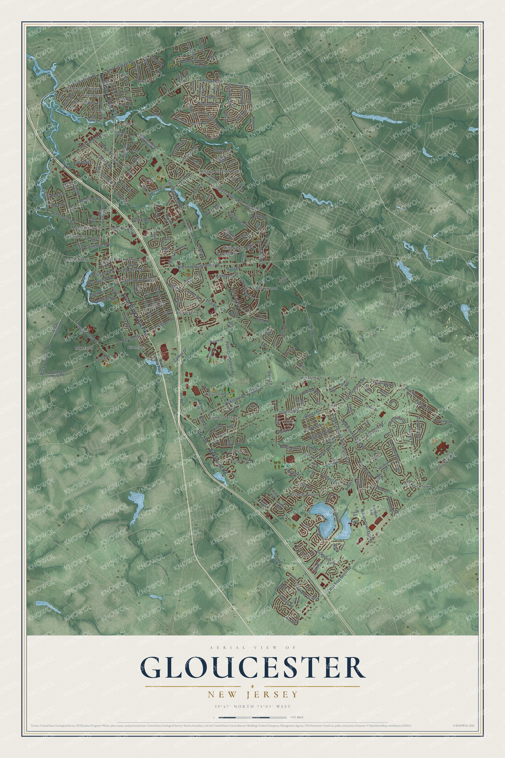
Gloucester, New Jersey Map Art
Building by building, with labeled streets and shaded relief.
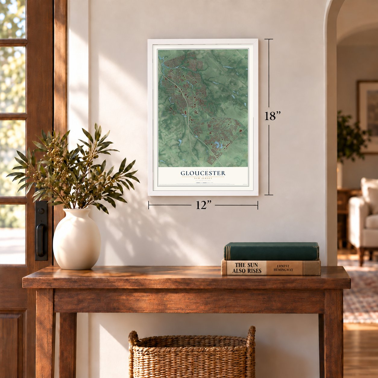
12" x 18" Archival Matte Print
A Map of Home. A Work of Art.
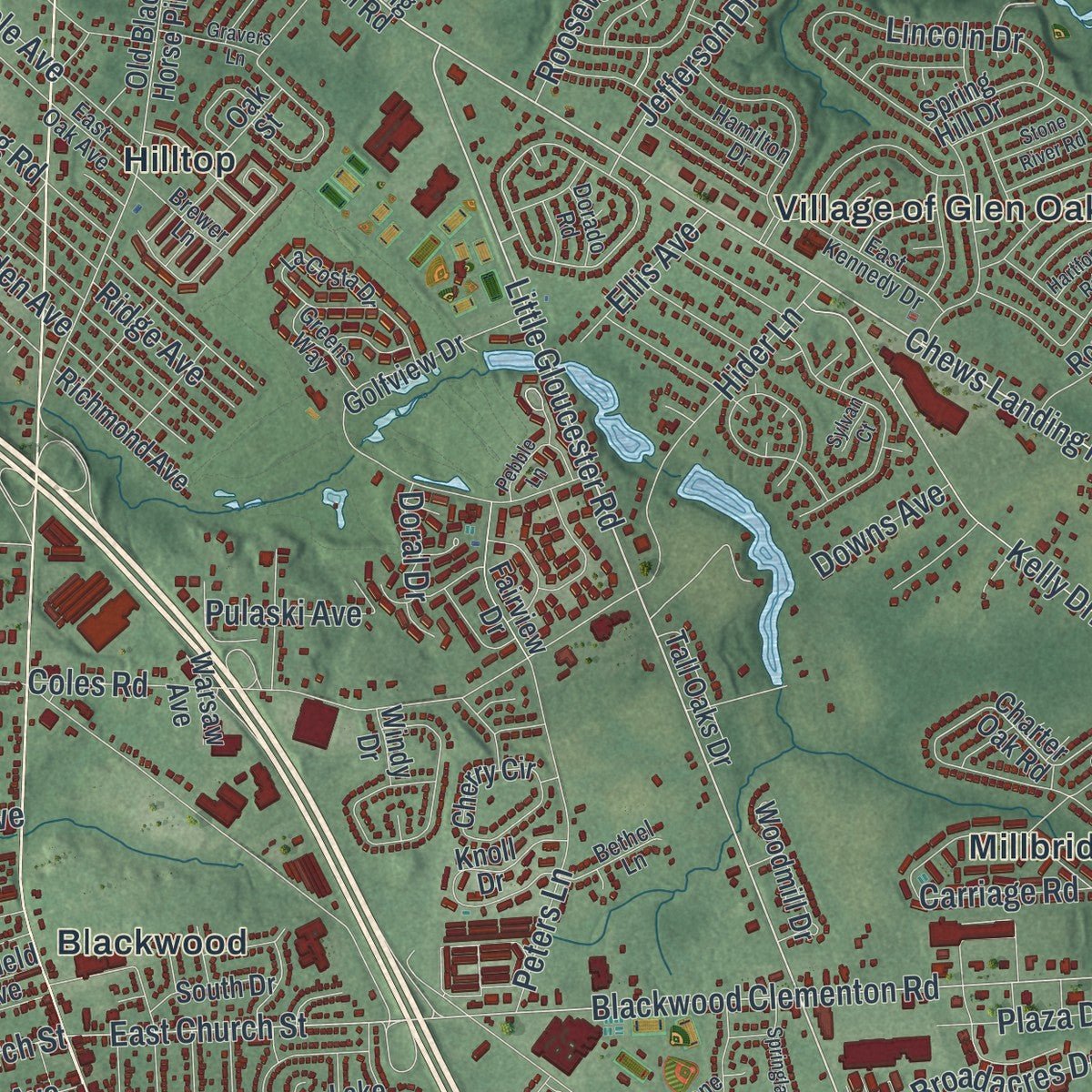
Explore Gloucester, New Jersey from a whole new perspective. Created using aerial imagery and detailed geographic data, this map captures Gloucester building by building, with labeled streets, familiar landmarks, and shaded topographical relief that highlights the natural contours of the landscape.
Combining modern data with the timeless character of a vintage atlas, this map is just as interesting up close as it is beautiful on the wall. Whether you grew up in Gloucester, spent memorable years there, or call it home today, this unique map is a great way to celebrate a place that means something to you. Zoom in on the preview to look for your street, and then order a print to put your memories on the wall.
Three ways to hang it
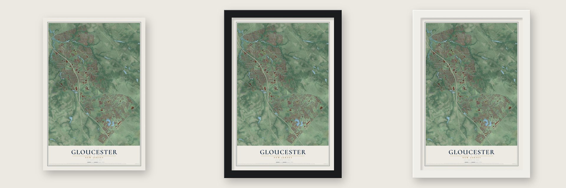
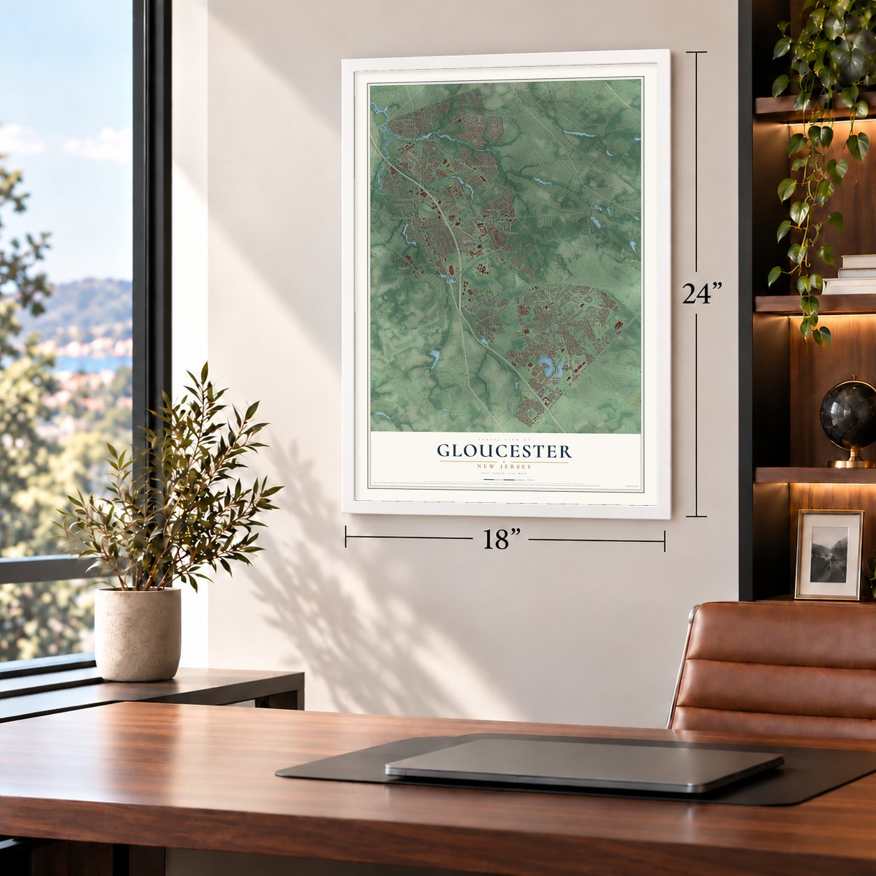
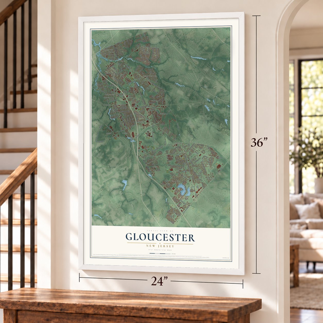
Unframed archival matte, a black wood frame or a white wood frame.
Up close
Geography Worth Displaying
This map was created using accurate cartographic data and authoritative geographic sources, including the U.S. Geological Survey (USGS) and FEMA. The map brings together terrain, waterways, roads, and building detail. The majority of the streets are labeled, houses are accurately depicted, and the topography is derived from government sources. Combining local data with carefully composed color and shading leads to this beautifully detailed Gloucester artwork for your wall.
Rather than simply showing street outlines, we’ve included as many of the street names as we could reasonably fit on the map while keeping their names legible. Zoom in on the high resolution preview to see exactly what’s on the map. We truly set out to create a statement piece for anyone who loves Gloucester. So whether it’s for you, or a gift for someone you love, we hope this map of Gloucester brings back fond memories.
Explore the full map of Gloucester, New Jersey and read about the local places it shows.

Find your street
Names on the Gloucester map
Every name below is printed on this map. Look for your street, your school, the park where you played, or the pond down the road.
Places and landmarks21
- Bishop Wood
- Blackwood
- Blenheim
- Cherrywood
- Chews
- Clements Bridge
- Davisville
- Dicktown
- Erial
- Glendora
- Good Intent
- Grenloch
Show all 21 places
- Hickstown
- Hilltop
- Lakeland
- Lambs Terrace
- Mechanicsville
- Millbridge
- Revere Run
- Terrestria
- Village of Glen Oaks
Streets and roads276
- South Black Horse Pike
- Route 705
- Sicklerville Road
- North Black Horse Pike
- Little Gloucester Road
- College Drive
- Little Mill Road
- Chews Landing Road
- Peter Cheeseman Road
- Somerdale Road
- Station Avenue
- West Church Street
- Fifth Avenue
- Alberta Avenue
- Blackwoodtown Road
- Williamstown Erial Road
- County House Road
- Erial Clementon Road
- East Church Street
- Salina Road
- Pine Run Drive
- Blackwood Clementon Road
- East Evesham Road
- Tilford Road
- Woodland Avenue
- Lakeland Road
- Erial Road
- Cross Keys Berlin Road
- Cross Keys Road
- Hickstown Road
Show all 276 streets
- New Brooklyn Erial Road
- Jarvis Road
- Chews Landing Williamstown Road
- Lower Landing Road
- Garwood Road
- Mullen Drive
- Kearsley Road
- Kelly Driver Road
- Kelly Drivers Lane
- Breckenridge Drive
- Coles Road
- Lincoln Drive
- Broadacres Drive
- Hidden Drive
- Almonesson Road
- Cedar Grove Drive
- Annapolis Drive
- Saint Moritz Drive
- Roberts Drive
- Davistown Road
- Orr Road
- Sturbridge Drive
- High Street
- Aberdeen Drive
- Orchard Avenue
- Main Street
- Highland Avenue
- Prospect Avenue
- Landing Road
- Larkspur Circle
- Hobart Drive
- Monticello Drive
- Marshall Avenue
- State Street
- Argyle Avenue
- Beverly Drive
- Easton Drive
- Winding Way
- Jefferson Drive
- Skyline Drive
- Dixon Lane
- Peters Lane
- Bryce's Court
- Maple Avenue
- Sherbrook Boulevard
- Winfield Road
- Cherrywood Drive
- Plymouth Road
- East Lake Avenue
- Shelly Street
- Johnson Road
- Ridge Avenue
- Lehigh Avenue
- Roosevelt Drive
- Hider Lane
- Wyngate Road
- Pine Street
- Hemlock Drive
- West Central Avenue
- Carriage Road
- Essex Avenue
- Estelle Avenue
- Clementon Avenue
- Plaza Drive
- Malibu Drive
- Stephen Drive
- Arline Avenue
- Fresno Drive
- Pulaski Avenue
- Doral Drive
- Glenn Avenue
- Bee Lane
- Ellis Avenue
- Linda Avenue
- Downs Avenue
- Garden Avenue
- Albert Road
- King Street
- Beech Drive
- Walnut Street
- Chews Landing Clementon Road
- Mount Pleasant Road
- West Evesham Road
- Sewell County House Road
- San Jose Drive
- Old Black Horse Pike
- East Front Street
- Charter Oak Road
- Hazel Avenue
- Golfview Drive
- Vance Avenue
- Shenandoah Drive
- Hollyoke Road
- Central Avenue
- Clement Drive
- Cedar Lane
- West Blenheim Avenue
- Spring Hill Drive
- Village Green Lane
- Oak Avenue
- Deer Park Circle
- Jonquil Way
- Hazeltop Drive
- Tall Oaks Drive
- Huckleberry Avenue
- Upton Way
- Lake Avenue
- Indiana Avenue
- Red Bank Drive
- Glen Burnie Drive
- Lincoln Avenue
- Knoll Drive
- Freedom Way
- Cummings Avenue
- Royalty Lane
- Cherry Circle
- Sunset Drive
- Santalina Drive
- Circle Drive
- Dunlin Way
- Warsaw Avenue
- Whitall Drive
- McKinley Avenue
- Blackwell Court
- Cedar Avenue
- Innsbruck Drive
- Southwick Road
- Richmond Avenue
- Woodmill Drive
- Fernwood Drive
- Fairview Drive
- Glamis Road
- Waterview Drive
- Millgate Road
- Mardale Drive
- Wilson Drive
- Sawood Drive
- Blue Grass Road
- San Diego Drive
- South Drive
- Garfield Avenue
- Dittess Lane
- Britt Lea Drive
- Thorny Lane
- Porter Avenue
- Olympus Avenue
- Maynard Drive
- Noble Road
- Mill Court
- York Terrace
- Aster Drive
- Laguna Drive
- Erik Court
- Oak Street
- Wye Mill Drive
- Briar Lane
- Holly Lane
- Windy Drive
- Heath Court
- Lisa Drive
- Black Horse Pike
- West Somerdale Road
- Good Intent Road
- Downing Road
- Turnerville Hickstown Road
- Chews Landing Clem Road
- Wilson Avenue
- Raintree Drive
- Fox Chase Drive
- Edinburgh Road
- La Costa Drive
- Drexel Avenue
- Crestview Avenue
- Roosevelt Avenue
- Conestoga Road
- Sofia Drive
- Blue Stone Circle
- Seventh Avenue
- East Kennedy Drive
- Woodlane Drive
- Railroad Avenue
- Eaton Circle
- West Annapolis Drive
- Carol Avenue
- Liberty Place
- Mercer Drive
- Stewart Avenue
- Morningstar Court
- Cattell Drive
- Hamilton Drive
- Arlington Road
- Hampton Lane
- Chrissy Way
- Bromley Drive
- Poplar Avenue
- Greens Way
- East Oak Avenue
- Brewer Lane
- Bethel Lane
- Firethorn Lane
- Dresden Court
- Spring Ridge Court
- Sherri Lane
- Dorado Road
- Kristian Drive
- Eden Lane
- Zane Avenue
- Stowe Court
- Kay Lane
- La Cascata
- Price Avenue
- Millbridge Road
- Dearborne Avenue
- Lakeview Drive
- Springlane Drive
- Red Gravel Circle
- Gravers Lane
- Maryellen Lane
- Lane of Acres
- Woodshire Drive
- Cole Landing Road
- Lee Ann Drive
- Brantley Way
- Roosevelt Drive East
- Cayuga Way
- Country Garden Lane
- Third Avenue
- Heritage Hill Drive
- Murray Way
- Patriot Court
- Terrestria Lane
- Danbury Drive
- Sayre Drive
- Pebble Lane
- Aspen Road
- Stone River Road
- Hybrid Place
- Harbor Lane
- Stonegate Court
- Elizabeth Place
- Jerrys Court
- Hartford Road
- Autumn Court
- Glen Drive
- Furman Drive
- Sylvan Court
Names are listed as they appear on the printed map. Zoom into the product photos to find them.
About Gloucester, New Jersey
Gloucester is a township of 66,034 people in Camden County, covering 23.30 square miles. It was formed in 1695 as part of Gloucester County and took its name from the English city of Gloucester. It was incorporated under New Jersey's township law in 1798, and when Camden County was created in 1844 the township became part of the new county. It is a separate municipality from Gloucester City, and its communities include Blackwood, Blenheim, Chews and Glendora.
- A tavern turned hospitalThe Gabreil Daveis Tavern House went up in 1756 in what is now Glendora, near Big Timber Creek, which runs across the township to the Delaware River. Boatmen moving goods toward Philadelphia stayed there as an inn. In the Revolution, George Washington made the building a hospital, and it came to be called the Hillman Hospital House. It joined the National Register in 1977.
- Four National Register placesBesides the Hillman Hospital House, the township holds the Chew-Powell House, Solomon Wesley United Methodist Church, and St. John's Episcopal Church and Burying Ground, all on the National Register of Historic Places.
- Four EuroLeague titlesKyle Hines transferred from Camden Catholic to Timber Creek Regional High School, where he started on the varsity team. After playing college basketball at UNC Greensboro, he went to Europe and won the EuroLeague four times: in 2012 and 2013 with Olympiacos, and in 2016 and 2019 with CSKA Moscow. The league also named him its Best Defender in 2016, 2018 and 2022.
Keep exploring New Jersey
Gloucester is one of 990 New Jersey towns we've mapped. Every dot on the map is a print of its own.
The search covers every state, New Jersey first.
Near Gloucester
Order 2 or more town maps and save 10%. Shown in the size and finish you picked above, so they hang as a set.
- Grenloch 12" x 18" / Archival Matte Print $39.99
- Blackwood 12" x 18" / Archival Matte Print $39.99
- Turnersville 12" x 18" / Archival Matte Print $39.99


More maps nearby: Good Intent, Laurel Springs, Stratford, Clementon and Pine Hill.
The art of mapping a place
How This Map Was Made
Real places. Remarkable detail. Discover the layers that turn geographic data into a map of home.

The view from above
Aerial imagery reveals the character of the land: woodland, open fields, and the patterns of a place.

The shape of the land
Elevation data brings hills, valleys, and subtle changes in the landscape into view.

The details of home
Roads, waterways, and building footprints come together to make the map feel unmistakably local.

Geography becomes art
Considered color, shading, and typography bring the layers together in a map made for your wall.


Process illustrated with Mendon, Massachusetts. Aerial imagery: USDA NAIP. Terrain: USGS 3D Elevation Program. Map details and finished artwork: KNOWOL.
The Details
About This Print
Choose an archival matte print, or a black or white Ayous wood frame. The archival matte print is unframed.
Select your size and finish above to see the matching product image and price.
Materials & Craftsmanship
A contemporary map with the character of a classic atlas, printed on archival matte paper. Optional frames are made from Ayous wood.
Your printed map does not include the watermark shown in the full-map preview.
Shipping & Delivery
Free shipping within the United States. Every print is made to order in the USA.
Buying a gift? Add a note in your cart and we'll include it. We never put prices in the package.
Prints ship within 2 to 3 business days. Allow 7 to 10 days total from ordering for delivery. Timing may vary during holidays or periods of high order volume.
Read our shipping policy.
Returns and damaged prints
Each print is made to order. Change-of-mind refunds are not available after production.
If your print arrives damaged, misprinted or incorrect, contact support@knowol.com within 30 days of receiving it. Include your order number, photos and a description of the issue.
Read our full refund and replacement policy. For questions about your order, email support@knowol.com.