
Search for another town



Free U.S. delivery 7 to 10 days after you order
Granger, Indiana Map Art
A new map of Granger, Indiana, made in 2026 and printed to order on thick archival matte paper.
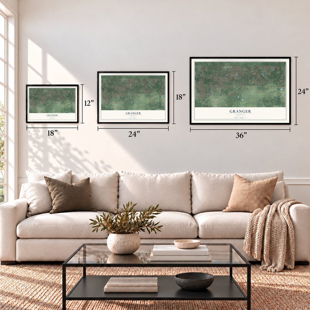
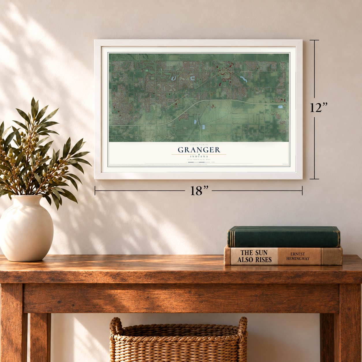
12" x 18" Archival Matte Print
A Map of Home. A Work of Art.
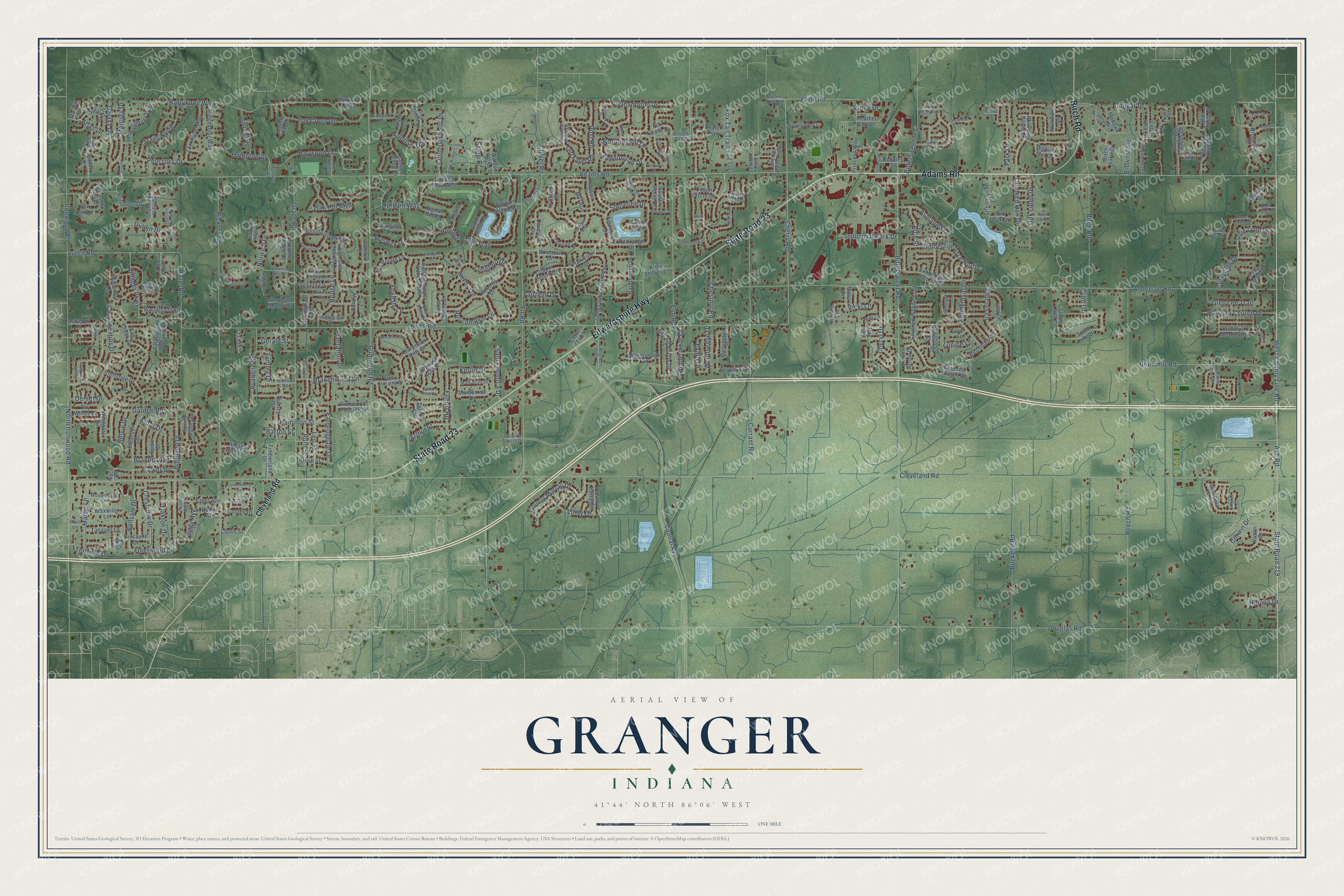
Explore Granger, Indiana from a whole new perspective. Created using aerial imagery and detailed geographic data, this map captures Granger building by building, with labeled streets, familiar landmarks, and shaded topographical relief that highlights the natural contours of the landscape.
Combining modern data with the timeless character of a vintage atlas, this map is just as interesting up close as it is beautiful on the wall. Whether you grew up in Granger, spent memorable years there, or call it home today, this unique map is a great way to celebrate a place that means something to you. Zoom in on the preview to look for your street, and then order a print to put your memories on the wall.
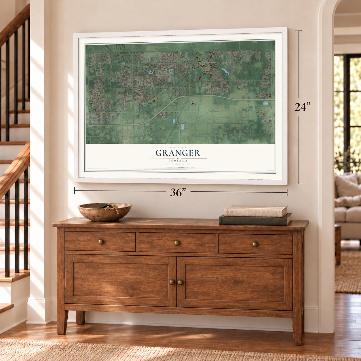
Three ways to hang it
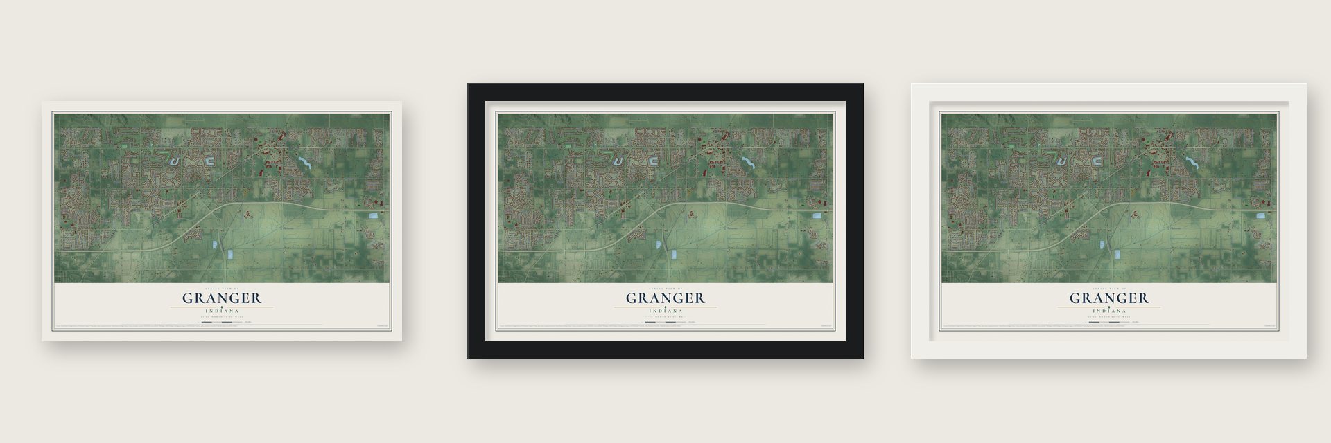
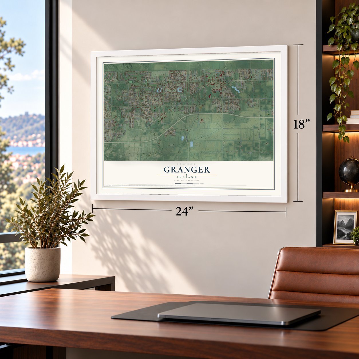
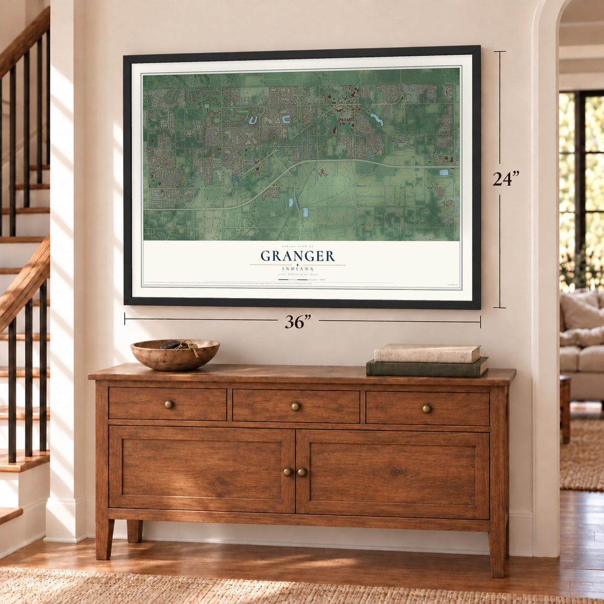
Unframed archival matte, a black wood frame or a white wood frame.
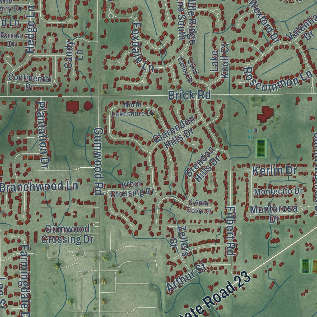
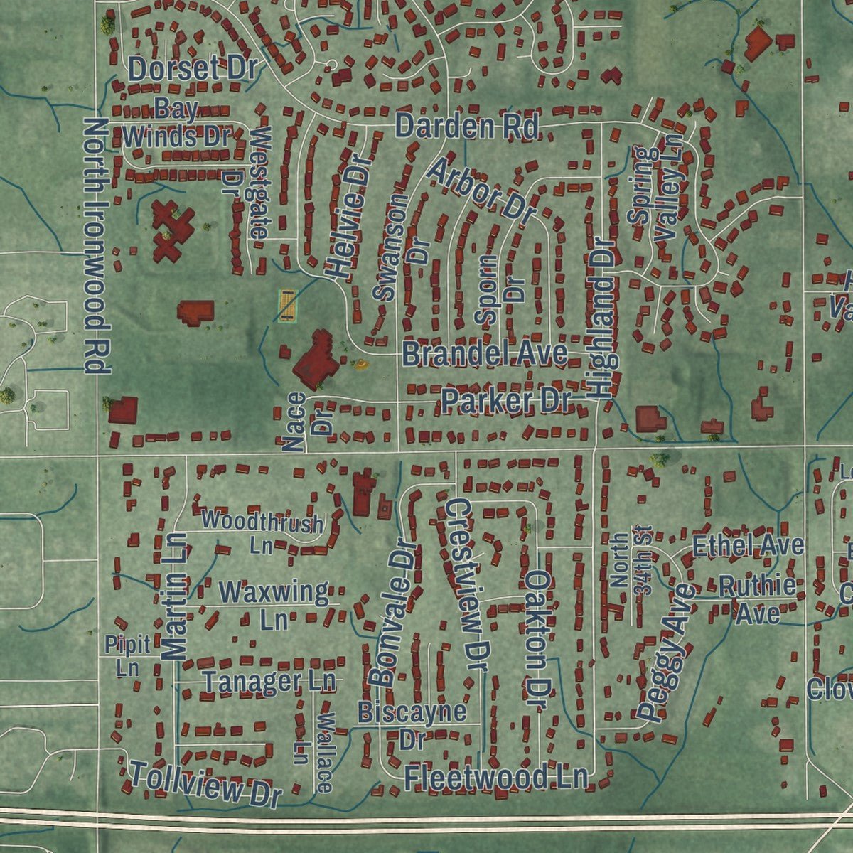
Up close
Geography Worth Displaying
This map was created using accurate cartographic data and authoritative geographic sources, including the U.S. Geological Survey and the Census Bureau. The map brings together terrain, waterways, roads, and building detail. The majority of the streets are labeled, houses are accurately depicted, and the topography is derived from government sources. Combining local data with carefully composed color and shading leads to this beautifully detailed Granger artwork for your wall.
Rather than simply showing street outlines, we’ve included as many of the street names as we could reasonably fit on the map while keeping their names legible. Zoom in on the high resolution preview to see exactly what’s on the map. We truly set out to create a statement piece for anyone who loves Granger. So whether it’s for you, or a gift for someone you love, we hope this map of Granger brings back fond memories.
Read the story behind this map of Granger, Indiana from 2026.
About Granger, Indiana
From the History of St. Joseph County: "The great farmer's movement organized during the latter part of the nineteenth century, and known as the Grange was commemorated by the founding of the town of Granger, in Harris township, by Thomas J. Foster, April 3, 1883."
Find your street
Names on the Granger map
Every name below is printed on this map. Look for your street, your school, the park where you played, or the pond down the road.
Streets and roads319
- Adams Road
- State Road 23
- Edwardsburg Highway
- Birch Road
- Ash Road
- State Road 219
- Baywood Lane
- Worthington Drive
- Northampton Drive
- Taddington Drive
- Jodie Lynn Drive
- Durham Way
- Cherry Road
- Fleetwood Lane
- Tammy Drive
- Chestnut Road
- Bonvale Drive
- Cleveland Road
- Douglas Road
- Brick Road
- Anderson Road
- West County Line Road
- Fir Road
- Bittersweet Road
- Hickory Road
- Beech Road
- Capital Avenue
- Gumwood Road
- Grape Road
- Currant Road
Show all 319 streets
- Darden Road
- Barryknoll Way
- Ironwood Road
- North Ironwood Road
- Elm Road
- Hunting Ridge Trail
- Buckeye Road
- Brummitt Road
- Auten Road
- Brandel Avenue
- Hazel Road
- Hamilton Street
- Santa Monica Drive
- Cheryl Drive
- Kline Road
- Fox Tail Trail
- Arthur Street
- Carriage Hills Drive
- Timberline Trce North
- Crooked Oak Drive
- Pennyroyal Lane
- Filbert Road
- Mercury Drive
- Fox Cross Drive
- Bittersweet Trail
- Branchwood Lane
- Trails North
- Clover Road
- Avanelle Street
- Patricia Church Drive
- Glen Lee Trail
- County Murray Drive
- Ashland Street
- Crestview Drive
- Villager Parkway
- Martin Lane
- Highland Drive
- Country Knolls Drive
- Hampton Drive
- Ruth Street
- Leo Street
- Galaxy Drive
- Park Lane
- Hedge Lane
- Farmingdale Drive
- Peggy Avenue
- Oakton Drive
- Evard Drive
- Industrial Park Drive
- Parker Drive
- Windermere Court
- Foxdale Lane
- Arbor Drive
- Lindy Drive
- Cougar Drive
- Pencross Drive
- Kerlin Drive
- Norwich Drive
- Oak Lined Drive
- Sunrise Trail
- Dublin Drive
- Lincroft Lane
- Woodsedge Drive
- Roscommon Lane
- Chicory Lane
- Tollview Drive
- Plantation Drive
- Oak Hill Boulevard
- Longford Drive
- Helena Drive
- Arch Street
- Creekside Drive
- Old Farm Road
- Gerald Street
- Shoreline Drive
- Brownstone
- Fairfield Drive
- Atlas Lane
- Safari Drive
- Helvie Drive
- Sandy Drive
- Elk Trail
- Post Road
- Barton Street
- Lupine Lane
- Dorset Drive
- Vicki Lane
- Corwin Drive
- Cybil Drive
- Wellington Parkway
- Erin Glen Drive
- Harvester Drive
- Durham Way West
- South Lake Drive
- Brookside Drive
- Brush Trail
- James Lawrence Parkway
- Fox Den Drive
- Wheaton Drive
- Farmington Square Road
- Swanson Drive
- Shamrock Hills Drive
- Fall Creek Drive
- Fox Trail
- Covered Wagon Trail
- Birch Lake Drive
- Brendon Hills Drive
- Princess Way
- Timberline Trce South
- Durham Way East
- Clarendon Hills Drive
- Ashley Drive
- Mallard Pointe Drive
- Covered Bridge Drive
- Woodbury Way
- Tarrington Way
- Copper Penny Drive
- Quincy Street
- Saddle Ridge Lane South
- Streamwood Drive
- Partridge Woods Drive
- Ridgemoor Way
- Pheasant Cove Drive
- Barrington Place
- South Lake Court
- Monterosa Drive
- Sporn Drive
- Fox Pointe Lane
- Wexford Drive
- Waterford Lane
- Canyon Ridge Drive
- Woodhurst Road
- Autumn Ridge Drive
- Highland Shores Drive
- Wilkins Mill Drive
- Buttercup Circle
- Preswick Lane
- Harborough Drive
- Cherry Farm Trail
- Thrush Street
- Sherwood Drive
- Amesburry Drive
- Sussex Point Drive
- Fairfield Lane
- Fox Chase Drive
- County Kerry Drive
- Tanager Lane
- Parkridge Drive
- Covered Wagon Court
- Waxwing Lane
- Terri Brooke Drive
- Timberland Drive
- Heather Park Drive
- Candy Lane
- Gumwood Crossing Drive
- Ashleys Meadow Drive
- Fountain Court
- Ironstone Drive
- Waldon Park Lane
- Woods Trail
- Rockingham Drive
- Sorrel Drive
- Hidden Valley Drive
- Spring Valley Lane
- Bay Winds Drive
- Westgate Drive
- Coveside Drive
- Watersedge Drive
- Broken Arrow Drive
- Beckley Street
- Hinton Lane
- Yorkview Drive
- Conestoga Court
- Valentia Drive
- Kline Shores Drive
- Ashford Lane
- Ethel Avenue
- Coach Circle Drive
- Old Oak Drive
- Zellers Street
- Lake Knoll Court
- Marlowe Way
- Mohawk Drive
- Ashton Court
- Woodland Manor Court
- Signal Hill Court
- Avery Point
- Biscayne Drive
- Colony Drive
- Clover Trail
- Ashville Lane
- Ruthie Avenue
- Locks Lane
- Brush Lane
- Clovis Street
- Ashmont Place
- Pheasant Run Drive
- Shafer Trail
- Mill Run
- Deer Ridge Court
- Little John Lane
- Miller Drive
- Victor Drive
- Pat Lane
- Mallow Court
- Nace Drive
- Haven Hill Drive
- Ray Drive
- Summer Hill Drive
- Chestnut Ridge Drive
- State Line Road
- Wescott Drive
- Bellcrest Circle
- Stonebridge Drive
- Evergreen Road
- Glen Meadow Lane
- Arbor Crossing Drive
- Woodthrush Lane
- West Cedar Lake Drive
- Continental Drive
- Broken Wood Drive
- Hidden Pines Court
- Montecito Drive
- Park Ridge Court
- Wild Cherry Drive
- Old Colony Drive
- Edinburg Lane
- Yorktown Road
- Pebble Beach Court
- Golfview Court
- Heatherton Court
- Canyon Lane
- Carrigan Court
- Wallace Lane
- Stapleford Court
- North 34th Street
- Summer Ridge Drive
- Barna Drive
- Grande Vista Drive
- Sturdy Oak Lane
- Pipit Lane
- Cain Lane
- Lakeside Drive
- Carrigan Way
- Bellflower Lane
- Harrington Drive
- Woodland Hills Drive
- North Lakeshore Drive
- Tecumseh Drive
- Eaglewood Drive
- Covington Shores Drive
- Tallyho Drive North
- Avon Street
- Shannon Brook Court
- Quail Valley Drive
- Orchid Ridge Court
- Greenway Drive
- Red Pine Drive
- Northfield Drive
- Painted Ridge Trail
- Greenfield Manor Drive
- Londonberry Lane
- Pemburry Drive
- Gentian Lane
- Ellington Drive
- Colleen Court
- Pine Ridge Drive
- Homestead Trail
- Fieldcrest Court
- Cheyenne Court
- Copper Chase Drive
- Rocky Ridge Trail
- Herbert Street
- Billington Court
- North Pointe Drive
- Split Oak Drive
- Cricket Sound Court
- Redstone Drive
- Jesse Court
- Heather Cv
- Tebay Drive
- Tenbury Drive
- Balsam Circle
- Corydon Court
- Chatem Court
- Cedar Cove Court
- Tabor Hill Court
- Pacific Drive
- Juno Lane
Names are listed as they appear on the printed map. Zoom into the product photos to find them.
The art of mapping a place
How This Map Was Made
Real places. Remarkable detail. Discover the layers that turn geographic data into a map of home.

The view from above
Aerial imagery reveals the character of the land: woodland, open fields, and the patterns of a place.

The shape of the land
Elevation data brings hills, valleys, and subtle changes in the landscape into view.

The details of home
Roads, waterways, and building footprints come together to make the map feel unmistakably local.

Geography becomes art
Considered color, shading, and typography bring the layers together in a map made for your wall.


Process illustrated with Mendon, Massachusetts. Aerial imagery: USDA NAIP. Terrain: USGS 3D Elevation Program. Map details and finished artwork: KNOWOL.
The Details
About This Print
Choose an archival matte print, or a black or white Ayous wood frame. The archival matte print is unframed.
Select your size and finish above to see the matching product image and price.
Materials & Craftsmanship
A contemporary map with the character of a classic atlas, printed on archival matte paper. Optional frames are made from Ayous wood.
Your printed map does not include the watermark shown in the full-map preview.
Shipping & Delivery
Free shipping within the United States. Every print is made to order in the USA.
Buying a gift? Add a note in your cart and we'll include it. We never put prices in the package.
Prints ship within 2 to 3 business days. Allow 7 to 10 days total from ordering for delivery. Timing may vary during holidays or periods of high order volume.
Read our shipping policy.
Returns and damaged prints
Each print is made to order. Change-of-mind refunds are not available after production.
If your print arrives damaged, misprinted or incorrect, contact support@knowol.com within 30 days of receiving it. Include your order number, photos and a description of the issue.
Read our full refund and replacement policy. For questions about your order, email support@knowol.com.
Find your town
Looking for another city?
Find a map of home in our Indiana collection, or any town in the country.
Nearby
Maps of towns near Granger
Know someone from one of these towns? Their map makes a great gift.
 Mishawaka
, Indiana
From $39.99See the map
 Indian Village
, Indiana
From $39.99See the map
 Osceola
, Indiana
From $39.99See the map
More maps nearby: Notre Dame, Roseland, South Bend, Simonton Lake and Elkhart.