
Search for another town




Free U.S. delivery 7 to 10 days after you order
Great Falls, Virginia Map Art
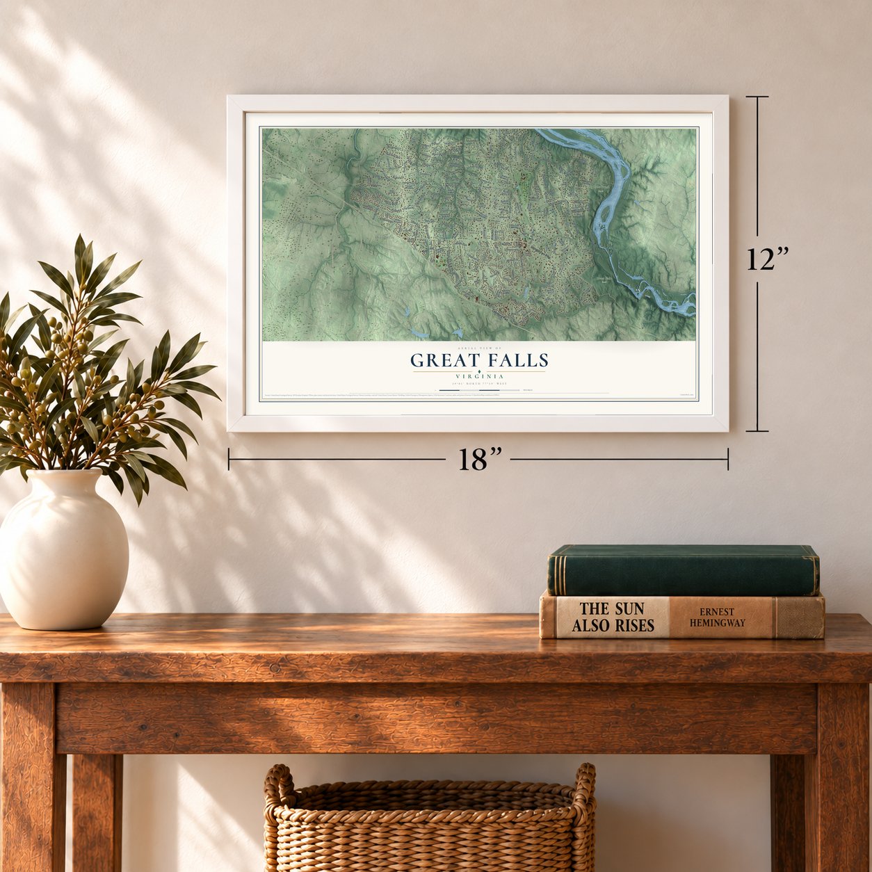
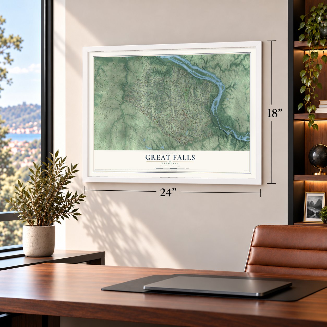
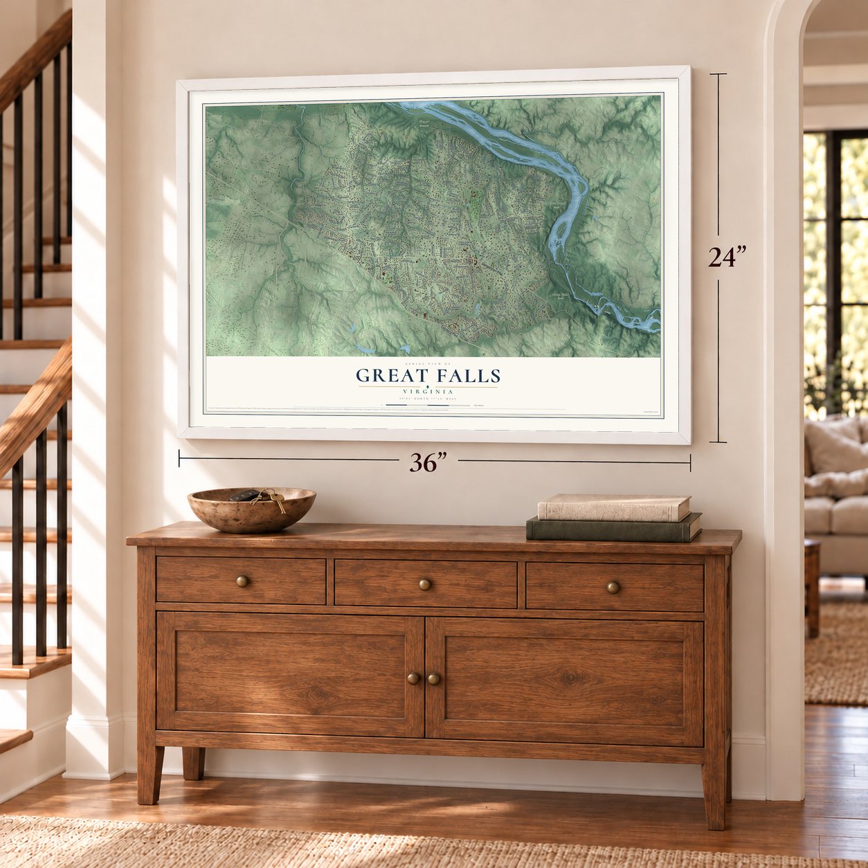
A new map of Great Falls, Virginia, made in 2026 and printed to order on thick archival matte paper.
12" x 18" Archival Matte Print
A Map of Home. A Work of Art.
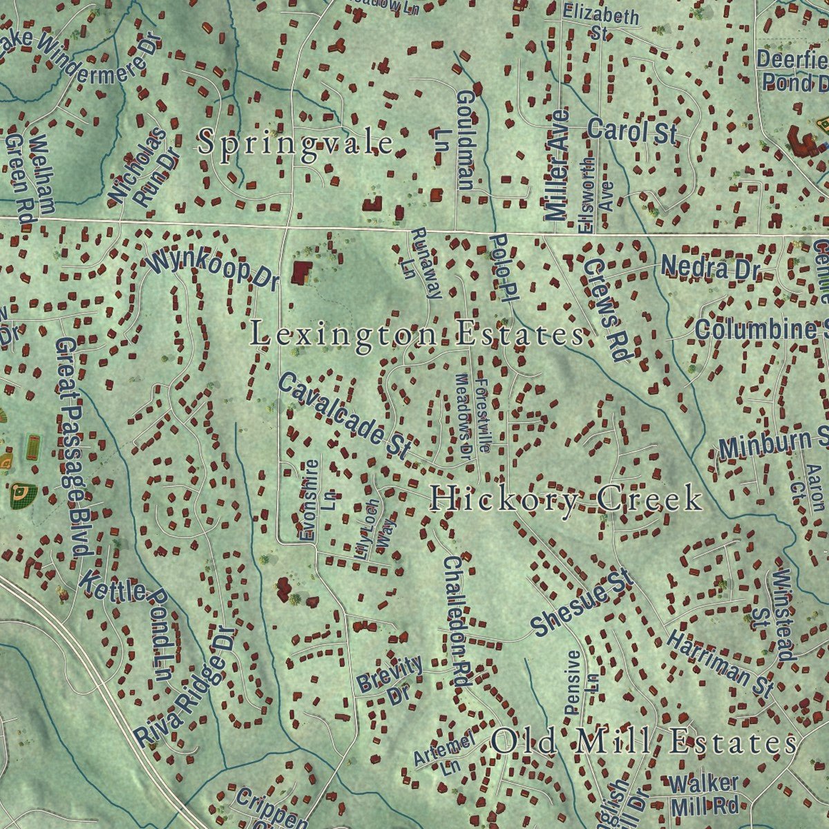
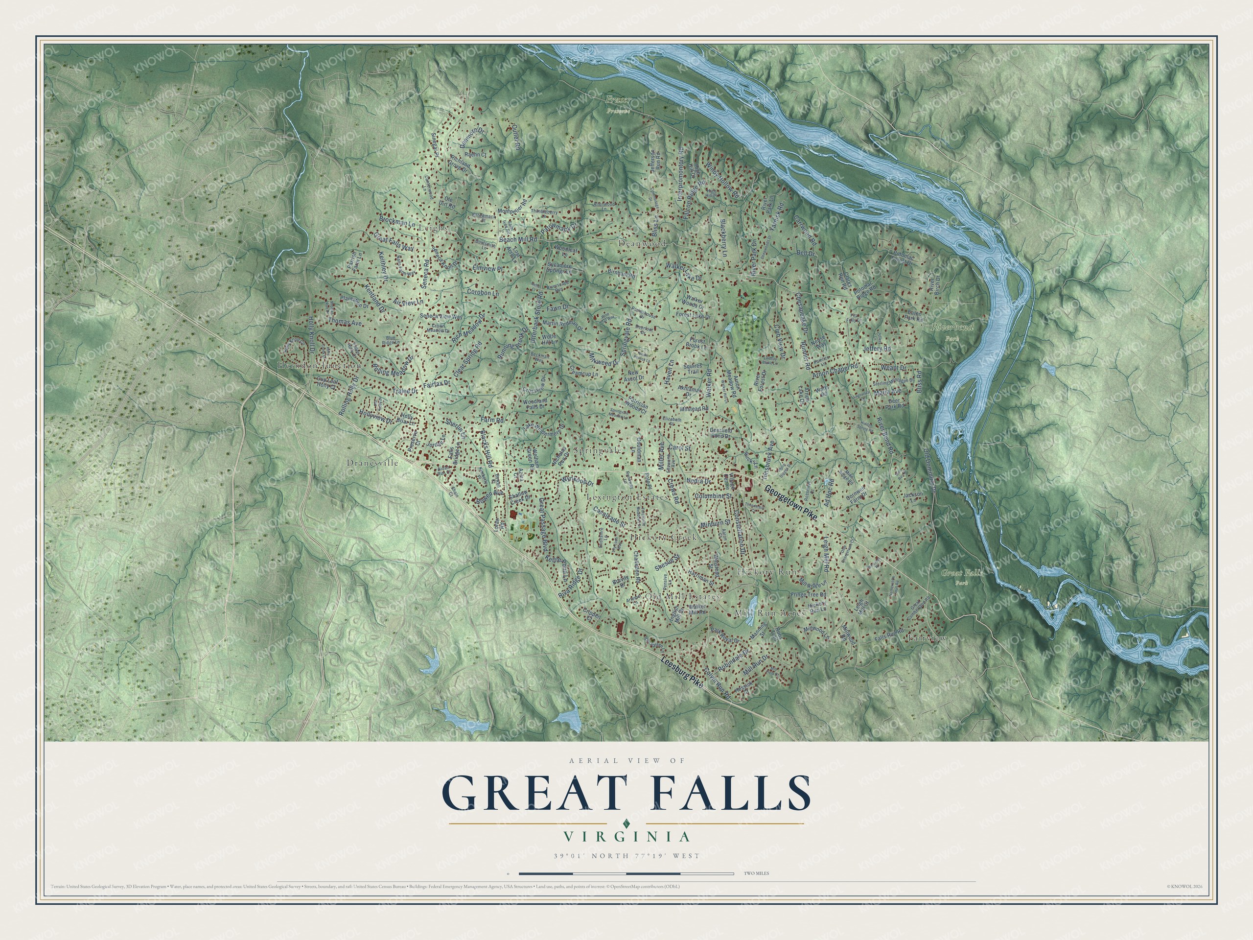
Explore Great Falls, Virginia from a whole new perspective. Created using aerial imagery and detailed geographic data, this map captures Great Falls building by building, with labeled streets, familiar landmarks, and shaded topographical relief that highlights the natural contours of the landscape.
Combining modern data with the timeless character of a vintage atlas, this map is just as interesting up close as it is beautiful on the wall. Whether you grew up in Great Falls, spent memorable years there, or call it home today, this unique map is a great way to celebrate a place that means something to you. Zoom in on the preview to look for your street, and then order a print to put your memories on the wall.
Three ways to hang it
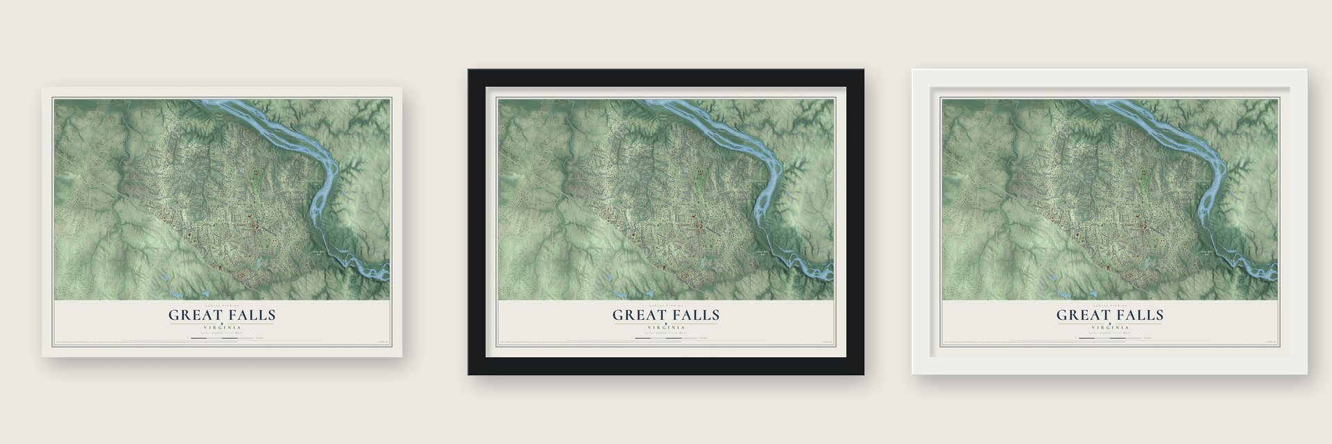
Unframed archival matte, a black wood frame or a white wood frame.
Up close
Geography Worth Displaying
This map was created using accurate cartographic data and authoritative geographic sources, including the U.S. Geological Survey and the Census Bureau. The map brings together terrain, waterways, roads, and building detail. The majority of the streets are labeled, houses are accurately depicted, and the topography is derived from government sources. Combining local data with carefully composed color and shading leads to this beautifully detailed Great Falls artwork for your wall.
Rather than simply showing street outlines, we’ve included as many of the street names as we could reasonably fit on the map while keeping their names legible. Zoom in on the high resolution preview to see exactly what’s on the map. We truly set out to create a statement piece for anyone who loves Great Falls. So whether it’s for you, or a gift for someone you love, we hope this map of Great Falls brings back fond memories.
Read the story behind this map of Great Falls, Virginia from 2026.
About Great Falls, Virginia
Great Falls is a community of 15,953 people in Fairfax County, on the right bank of the Potomac River. It takes its name from the Great Falls of the Potomac, which lie on its east side. Farm settlements began to form here by the late 1700s.
For years the village went by Forestville, though only informally, because another Forestville already had a post office. In 1955 the name was changed to Great Falls. The old name lives on at the Great Falls Grange Hall and Forestville School, which is on the National Register of Historic Places.
- Washington's canal at the fallsGeorge Washington helped build the Patowmack Canal to carry boats around the falls on the Virginia side, but it never made money as a business. Pieces of the canal, and of Matildaville, the village that grew up beside it, survive today in Great Falls Park. In 1906 the Great Falls and Old Dominion Railroad brought visitors to the park along Old Dominion Drive.
- A ring of Cold War defensesDuring the Cold War, a defense complex was built here to guard Washington against Soviet air attack. It was one of thirteen such sites around Washington and Baltimore, along with others at Fairfax and Lorton.
- Holidays on the Village GreenThe Village Green is where the community gathers. It hosts a Spring Festival with an egg hunt at Easter, celebrations for the Fourth of July, Halloween and Thanksgiving, a Christmas tree lighting and concerts in the summer.
Find your street
Names on the Great Falls map
Every name below is printed on this map. Look for your street, your school, the park where you played, or the pond down the road.
Places and landmarks14
- Fraser Preserve
- Great Falls Park
- Riverbend Park
- Deanwood
- Dranesville
- Fairview
- Herndon Junction
- Hickory Creek
- Hickory Run
- Leighs
- Lexington Estates
- Mill Run Acres
Show all 14 places
- Old Mill Estates
- Springvale
Streets and roads206
- Georgetown Pike
- Leesburg Pike
- River Bend Road
- Springvale Road
- Walker Road
- Beach Mill Road
- Seneca Road
- Utterback Store Road
- Old Dominion Drive
- Holly Knoll Drive
- Interpromontory Road
- River Park Drive
- Arnon Chapel Road
- Jeffery Road
- Leigh Mill Road
- Riva Ridge Drive
- Chesapeake Drive
- Weant Drive
- Rich Meadow Drive
- Kentland Drive
- Colvin Run Road
- Innsbruck Avenue
- Thomas Avenue
- Clear Spring Road
- Carrwood Road
- Mill Run Drive
- Falcon Ridge Road
- Corobon Lane
- Blacks Hill Road
- Club View Drive
Show all 206 streets
- Great Passage Boulevard
- Windy Hollow Road
- Walker Lake Drive
- Constellation Drive
- Rolling Holly Drive
- Keithley Drive
- Bliss Lane
- Great Falls Way
- Runner Road
- Tralee Drive
- Brockman Lane
- Blackberry Lane
- Miller Avenue
- Hollyview Drive
- Milkweed Drive
- Carol Street
- Running Brook Drive
- Cavalcade Street
- Rolling Meadow Drive
- Wynkoop Drive
- Donmore Drive
- Patowmack Drive
- Elmview Place
- Fawn Drive
- Shesue Street
- Columbine Street
- Maria Avenue
- Minburn Street
- Yarnick Road
- Kettle Pond Lane
- Ad Hoc Road
- Fairfax Drive
- Robindale Drive
- Nedra Drive
- Sherlin Lane
- Bell Drive
- Bowen Avenue
- Bliss Road
- Air View Lane
- Farm Road
- Haven Lane
- Crews Road
- Outlet Road
- Harriman Street
- Inglish Mill Drive
- Falls Run Road
- Potomac Ridge Road
- Manning Street
- Challedon Road
- Plantation Drive
- Gouldman Lane
- Millwood Lane
- Montpelier Road
- Cup Leaf Holly Court
- Millwood Road
- River Birch Drive
- Cornwell Farm Drive
- Lake Windermere Drive
- Seneca Knoll Drive
- Martin Redman Drive
- Akhtamar Drive
- River Park Lane
- Hickory Run Lane
- Seneca View Way
- Richland Grove Drive
- Creamcup Lane
- Shallow Creek Drive
- Falls Bridge Lane
- Park Royal Drive
- Arnon Meadow Road
- Welham Green Road
- Potomac Forest Drive
- Polo Place
- Walker Woods Drive
- Clarks Run Road
- Sycamore Springs Lane
- Woodland Falls Drive
- High Hill Court
- Jefferson Run Road
- Forest Lake Drive
- Mill Ridge Lane
- Squires Trail
- Patrician Woods Court
- Fringe Tree Road
- Crossview Drive
- Deer Park Road
- Village Centre
- Ole Dirt Road
- Nicholas Run Drive
- Bucks Lane
- Lost Acre Lane
- New Ascot Drive
- Walker Mill Road
- Sinegar Place
- Deerfield Pond Drive
- Birnham Road
- Milstead Road
- Winstead Street
- Arnon Lake Drive
- Eaton Park Road
- Roos Trail
- Holly Briar Lane
- Woodleaf Lane
- Jackson Lane
- Jordan Lane
- Brevity Drive
- River Forest Drive
- Wolfe Hill Lane
- Parrish Farm Lane
- Neuse Way
- Forest Brook Lane
- Raehn Court
- Loran Road
- Leigh Mill Court
- Crippen Court
- Preserve Court
- Hessick Court
- Watts Road
- Aziza Court
- Pensive Lane
- Holly Knoll Circle
- Nalls Farm Way
- Ellsworth Avenue
- Sterling Montague Drive
- Canterwood Lane
- Thimbleberry Lane
- Crown Meadow Drive
- Rossmore Court
- Runaway Lane
- Goldsmith Lane
- Great Cumberland Road
- Mine Ridge Road
- Parkerhouse Drive
- Elizabeth Street
- Riverscape Run
- Van Patten Lane
- Potowmack Street
- Saint Ives Road
- Deerfoot Drive
- Fallen Holly Court
- Artemel Lane
- Allenwood Lane
- Evonshire Lane
- High Hill Place
- Beckman Way
- Blue Ridge Lane
- Kimberly Place
- Pamlico Lane
- Bowen Court
- Shain Court
- Aaron Court
- Fitz Folly Drive
- Aidan Run Court
- Commonage Drive
- Down Patrick Lane
- Hidden Spring Road
- Forestville Meadows Drive
- Deepwoods Drive
- Mill Field Court
- Walker Hill Lane
- Holly Creek Drive
- Old Holly Drive
- Wise Owl Way
- Thomas Run Drive
- Nethercliffe Hall Road
- Philip Digges Drive
- Olde Georgetown Court
- Springvale Meadow Lane
- Lagovista Court
- Lindsay Blake Lane
- Lily Loch Way
- Thunderhill Court
- Mine Run Drive
- Wincrest Place
- Jeffery Lane
- Neha Court
Names are listed as they appear on the printed map. Zoom into the product photos to find them.
The art of mapping a place
How This Map Was Made
Real places. Remarkable detail. Discover the layers that turn geographic data into a map of home.

The view from above
Aerial imagery reveals the character of the land: woodland, open fields, and the patterns of a place.

The shape of the land
Elevation data brings hills, valleys, and subtle changes in the landscape into view.

The details of home
Roads, waterways, and building footprints come together to make the map feel unmistakably local.

Geography becomes art
Considered color, shading, and typography bring the layers together in a map made for your wall.


Process illustrated with Mendon, Massachusetts. Aerial imagery: USDA NAIP. Terrain: USGS 3D Elevation Program. Map details and finished artwork: KNOWOL.
The Details
About This Print
Choose an archival matte print, or a black or white Ayous wood frame. The archival matte print is unframed.
Select your size and finish above to see the matching product image and price.
Materials & Craftsmanship
A contemporary map with the character of a classic atlas, printed on archival matte paper. Optional frames are made from Ayous wood.
Your printed map does not include the watermark shown in the full-map preview.
Shipping & Delivery
Free shipping within the United States. Every print is made to order in the USA.
Buying a gift? Add a note in your cart and we'll include it. We never put prices in the package.
Prints ship within 2 to 3 business days. Allow 7 to 10 days total from ordering for delivery. Timing may vary during holidays or periods of high order volume.
Read our shipping policy.
Returns and damaged prints
Each print is made to order. Change-of-mind refunds are not available after production.
If your print arrives damaged, misprinted or incorrect, contact support@knowol.com within 30 days of receiving it. Include your order number, photos and a description of the issue.
Read our full refund and replacement policy. For questions about your order, email support@knowol.com.
Find your town
Looking for another city?
Find a map of home in our Virginia collection, or any town in the country.
Nearby
Maps of towns near Great Falls
Know someone from one of these towns? Their map makes a great gift.
 Great Falls Crossing
, Virginia
From $39.99See the map
 Lowes Island
, Virginia
From $39.99See the map
 Dranesville
, Virginia
From $39.99See the map
More maps nearby: Sugarland Run, Reston, Cascades, Wolf Trap and Herndon.