
Search for another town





Free U.S. delivery 7 to 10 days after you order
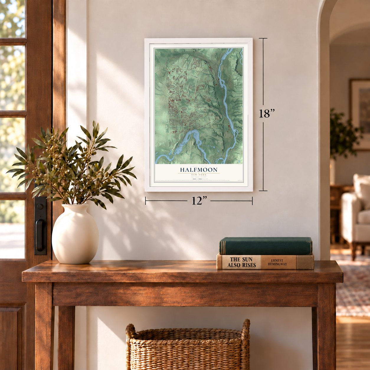
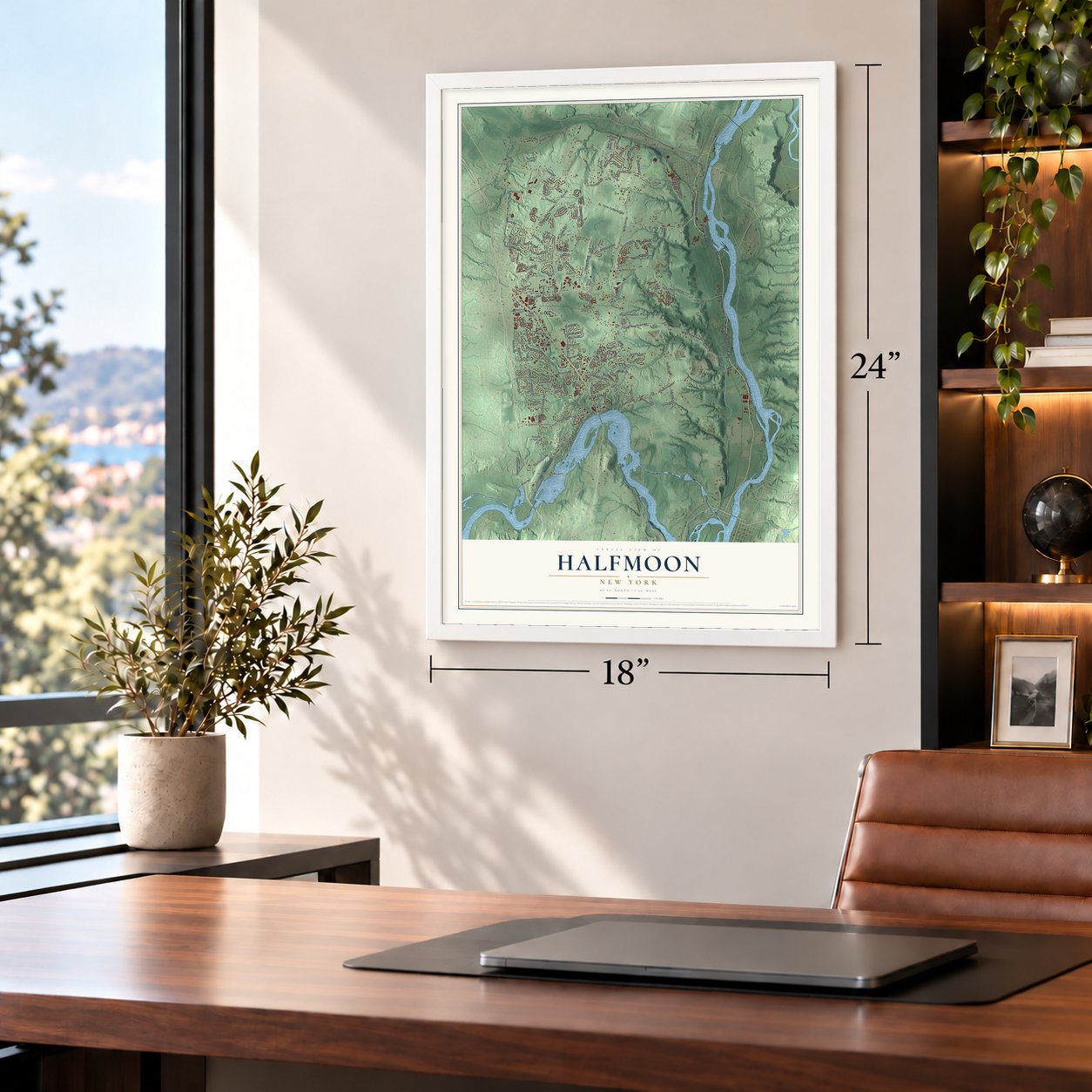
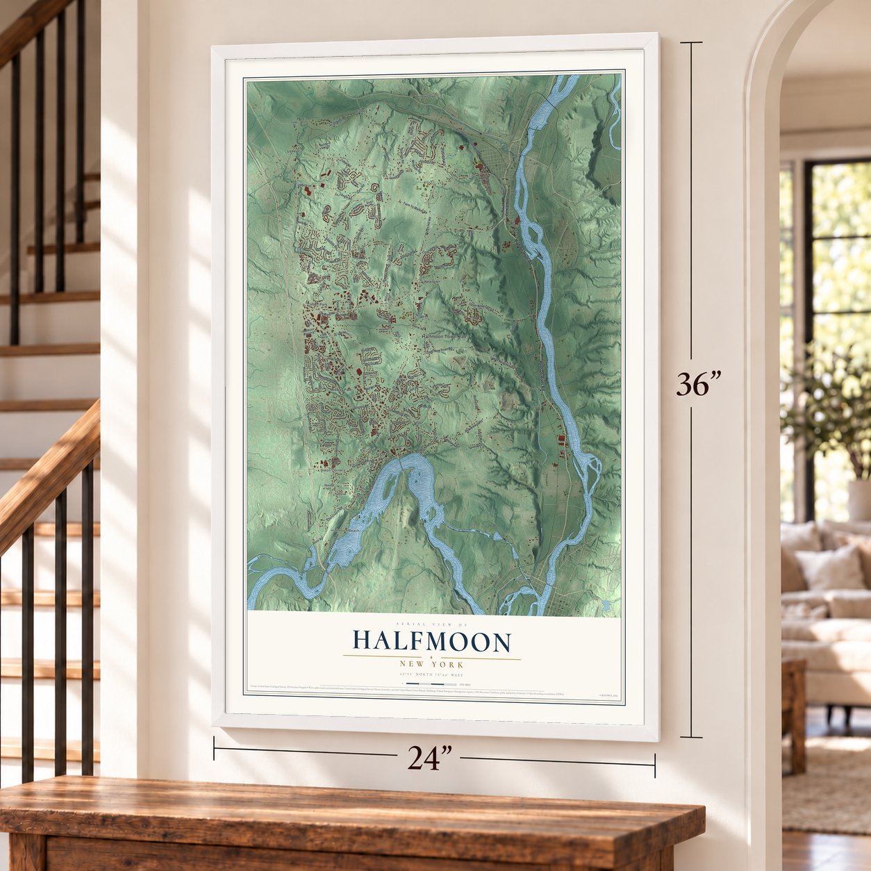
Halfmoon, New York Map Art
A new map of Halfmoon, New York, made in 2026 and printed to order on thick archival matte paper.
12" x 18" Archival Matte Print
A Map of Home. A Work of Art.
Bring a piece of Halfmoon home. Whether it’s where you grew up, your current home, or simply a moment in your life, this Halfmoon, New York map print brings those memories to your wall. Antique-inspired styling and modern geographic detail combine to create artwork that’s beautiful from across the room, with plenty to study and explore when you get up close.

Three ways to hang it
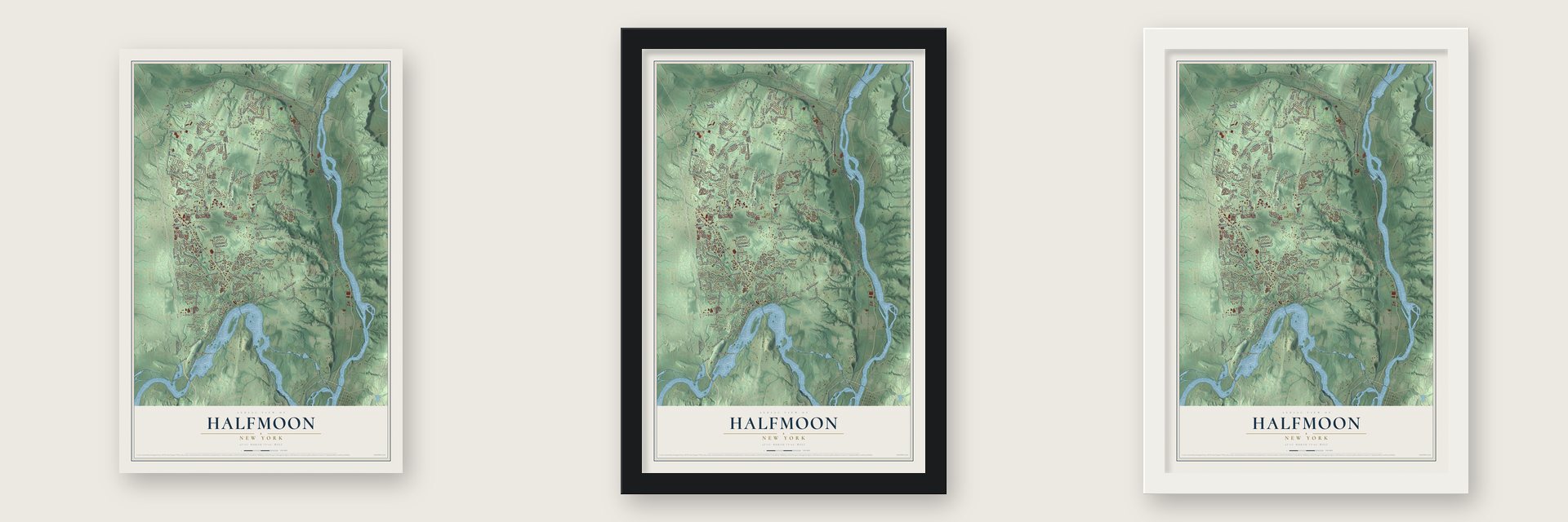
Unframed archival matte, a black wood frame or a white wood frame.
Up close
Real geography. Art worth displaying.
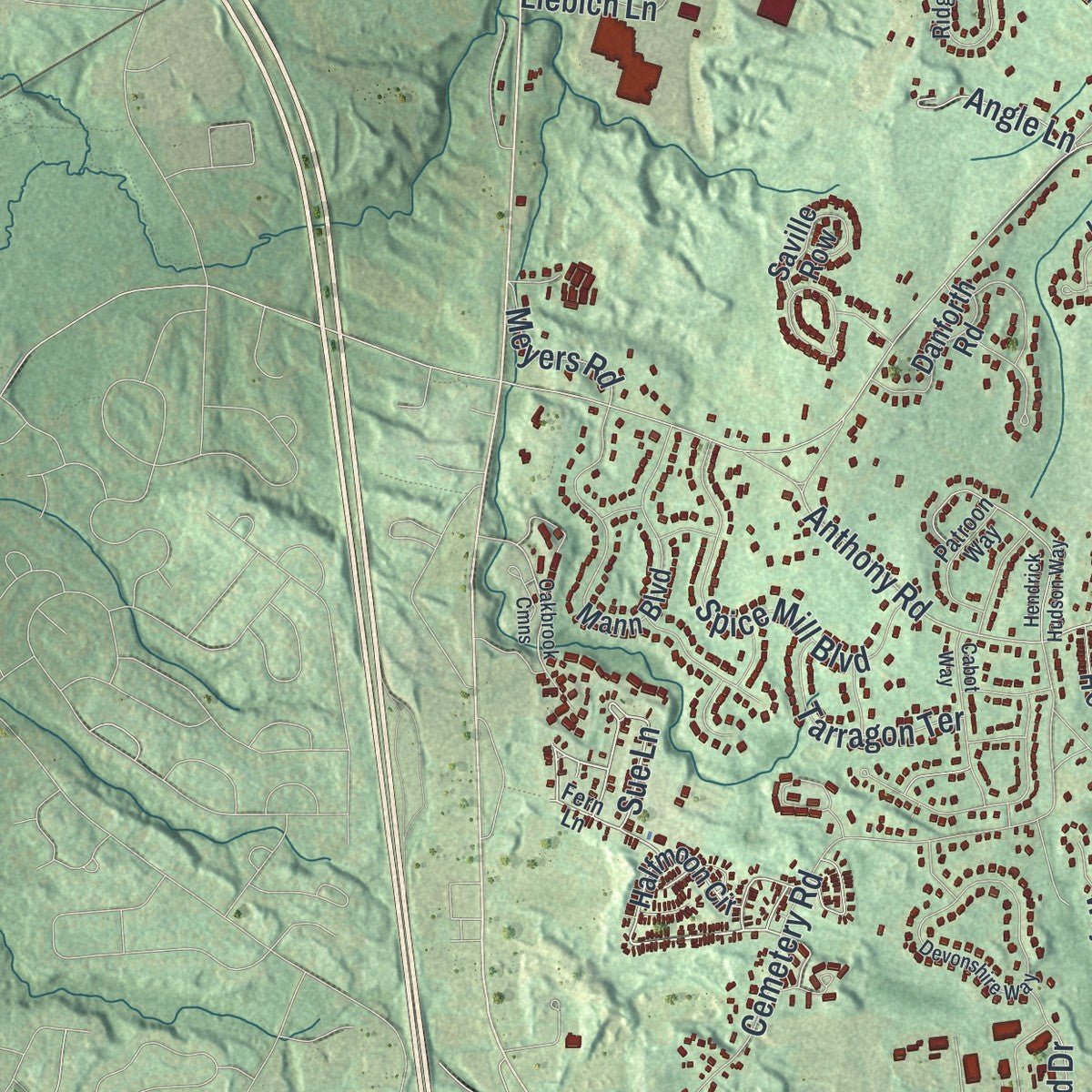
This map was created using accurate cartographic data and authoritative geographic sources, including the U.S. Geological Survey (USGS) and FEMA. The map brings together terrain, waterways, roads, and building detail. The majority of the streets are labeled, houses are accurately depicted, and the topography is derived from government sources. Combining local data with carefully composed color and shading leads to this beautifully detailed Halfmoon artwork for your wall.
Rather than simply showing street outlines, we’ve included as many of the street names as we could reasonably fit on the map while keeping their names legible. Zoom in on the high resolution preview to see exactly what’s on the map. We truly set out to create a statement piece for anyone who loves Halfmoon. So whether it’s for you, or a gift for someone you love, we hope this map of Halfmoon brings back fond memories.
Explore the full map of Halfmoon, New York and read about the local places it shows.

About Halfmoon, New York
Halfmoon is part of Saratoga County, New York, United States. The first dwellings were said to have been established by the 1680s in the area of the current boundary between the Town of Halfmoon and Town of Waterford on the Hudson River. The 2020 census counted 25,662 residents.
- 25,662 peopleCounted in the 2020 census.
- Local watersThe town is named for the shape of the lower elevation land north of the junction of the Hudson and Mohawk Rivers.
- Established in 1788Halfmoon was formed while still part of Albany County in 1788.
Find your street
Names on the Halfmoon map
Every name below is printed on this map. Look for your street, your school, the park where you played, or the pond down the road.
Places and landmarks10
- Halfmoon Town Hall
- Clifton Park
- Coons
- Crescent
- Grays Corners
- Halfmoon Beach
- Midway Park
- Newtown
- Ushers
- Willow Glen
Streets and roads170
- Hudson River Road
- Stone Quarry Road
- Crescent Road
- Beach Road
- Sue Lane
- Anthony Road
- Lower New Town Road
- Ushers Road
- Lower Newtown Road
- Plant Road
- Anchor Drive
- Meyers Road
- Farm To Market Road
- Upper Newtown Road
- Woodin Road
- Fellows Road
- Brookwood Road
- Pruyn Hill Road
- Canal Road
- Johnson Road
- Cary Road
- Harris Road
- Vosburgh Road
- Dunsbach Road
- Clamsteam Road
- Towpath Road
- Cemetery Road
- Tabor Road
- Button Road
- Guideboard Road
Show all 170 streets
- Old Canal Road
- Grooms Road
- Smith Road
- Werner Road
- Liebich Lane
- Staniak Road
- Raylinsky Lane
- Sheldon Drive
- Sitterly Road
- Spice Mill Boulevard
- Stone Crest Drive
- Elizabeth Street Extended
- Lape Road
- Deer Run Hollow
- McBride Road
- Fairway Drive
- Bayberry Drive
- Swatling Drive
- Ponderosa Drive
- Cindy Lane
- Devitt Road
- Cooks Court
- Chester Drive
- Plank Road
- Falcon Terrace
- Covington Drive
- Farmview Lane
- Bent Grass Drive
- Tarragon Terrace
- Marcel Road
- Dubois Lane
- Silo Drive
- Kelly Lane
- Dewey Avenue
- Crew Road
- Marina Drive
- Siena Drive
- Old Plant Road
- River Road
- Angle Lane
- Eagle Lane
- Gorsline Drive
- Whitney Drive
- Idared Lane
- Parkford Drive
- Stone Road
- South Central Avenue
- Halfmoon Circle
- South Main Street
- Lakeview Drive
- Mann Boulevard
- Church Hill Road
- Oregon Trail
- Outlook Drive South
- Linden Park Drive
- Hayner Road
- Middletown Road
- Corporate Park Drive
- Fairview Lane
- Cambridge Avenue
- Dormie Avenue
- Northern Sites Drive
- Stage Run
- Greenbrier Way
- Park 200
- Orchardview Drive
- Algonquin Road
- Henry Boulevard
- Saville Row
- Hidden Farm Lane
- Delta Way
- Pine Lane
- Knox Boulevard
- Pine Drive
- Halfmoon Crossing
- Sunset Boulevard
- Forest Lane
- Camber Court
- Cardin Drive
- Back Spin Drive
- Nadeau Road
- Robin Hill Drive
- Highview Way
- Milford Way
- Mari Nol Drive
- Krazewski Lane
- Fort Hill Drive
- Danforth Road
- Allen Drive
- Birch Lane
- Elena Court
- High Street
- Stuart Drive
- Clayton Drive
- Oak Hill Drive
- Adsit Lane
- Oak Avenue
- Ridgewood Drive
- Independence Boulevard
- Pointe West Drive
- Enterprise Avenue
- Mill Towne Drive
- Pine Ridge II
- Domenica Drive
- Wesley Court
- Fitzpatrick Lane
- Betts Lane
- Patroon Way
- Fern Lane
- Whites Lane
- Pohl Drive
- Kasper Drive
- Smith Road Spr
- Pruyn Avenue
- Valley View Drive
- Belleard Lane
- Ashton Drive
- Rolling Hills Drive
- Pine Street
- Irvs
- Oakbrook Cmns
- Timberwick Drive
- Devonshire Way
- Vischer Ferry Road
- Shelbourne Drive
- Hendrick Hudson Way
- Summit Trail
- Cabot Way
- Cemetery Avenue
- Bedford Circle
- Tourtise Drive
- Fieldstone Drive
- Gauthier Drive
- Princeton Avenue
- Alexandra Court
- Stewart Street
- Parkside Drive
- Merry Hill Lane
- English Road
- Myrtle Lane
Names are listed as they appear on the printed map. Zoom into the product photos to find them.
The art of mapping a place
How This Map Was Made
Real places. Remarkable detail. Discover the layers that turn geographic data into a map of home.

The view from above
Aerial imagery reveals the character of the land: woodland, open fields, and the patterns of a place.

The shape of the land
Elevation data brings hills, valleys, and subtle changes in the landscape into view.

The details of home
Roads, waterways, and building footprints come together to make the map feel unmistakably local.

Geography becomes art
Considered color, shading, and typography bring the layers together in a map made for your wall.


Process illustrated with Mendon, Massachusetts. Aerial imagery: USDA NAIP. Terrain: USGS 3D Elevation Program. Map details and finished artwork: KNOWOL.
The Details
About This Print
Choose an archival matte print, or a black or white Ayous wood frame. The archival matte print is unframed.
Select your size and finish above to see the matching product image and price.
Materials & Craftsmanship
A contemporary map with the character of a classic atlas, printed on archival matte paper. Optional frames are made from Ayous wood.
Your printed map does not include the watermark shown in the full-map preview.
Shipping & Delivery
Free shipping within the United States. Every print is made to order in the USA.
Buying a gift? Add a note in your cart and we'll include it. We never put prices in the package.
Prints ship within 2 to 3 business days. Allow 7 to 10 days total from ordering for delivery. Timing may vary during holidays or periods of high order volume.
Read our shipping policy.
Returns and damaged prints
Each print is made to order. Change-of-mind refunds are not available after production.
If your print arrives damaged, misprinted or incorrect, contact support@knowol.com within 30 days of receiving it. Include your order number, photos and a description of the issue.
Read our full refund and replacement policy. For questions about your order, email support@knowol.com.
Find your town
Looking for another city?
Find a map of home in our New York collection.
Nearby
Maps of towns near Halfmoon
Know someone from one of these towns? Their map makes a great gift.
 Clifton Gardens
, New York
From $39.99See the map
 Mechanicville
, New York
From $39.99See the map
 Clifton Knolls-Mill Creek
, New York
From $39.99See the map
More maps nearby: Town of Waterford, Clifton Park, Country Knolls, Village of Waterford and Cohoes.