
Search for another town





Free U.S. delivery 7 to 10 days after you order
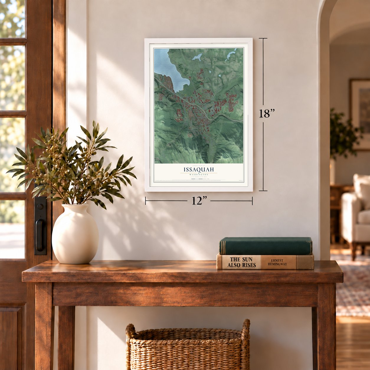
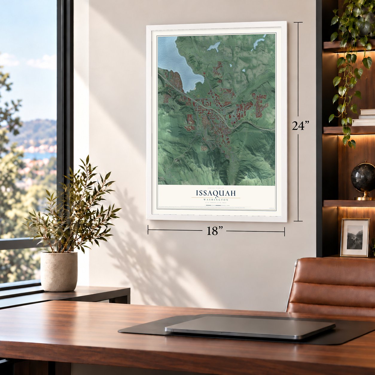
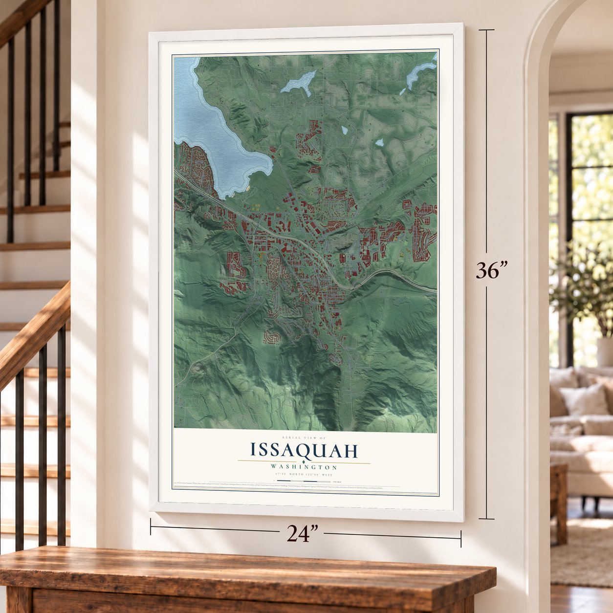
Issaquah, Washington Map Art
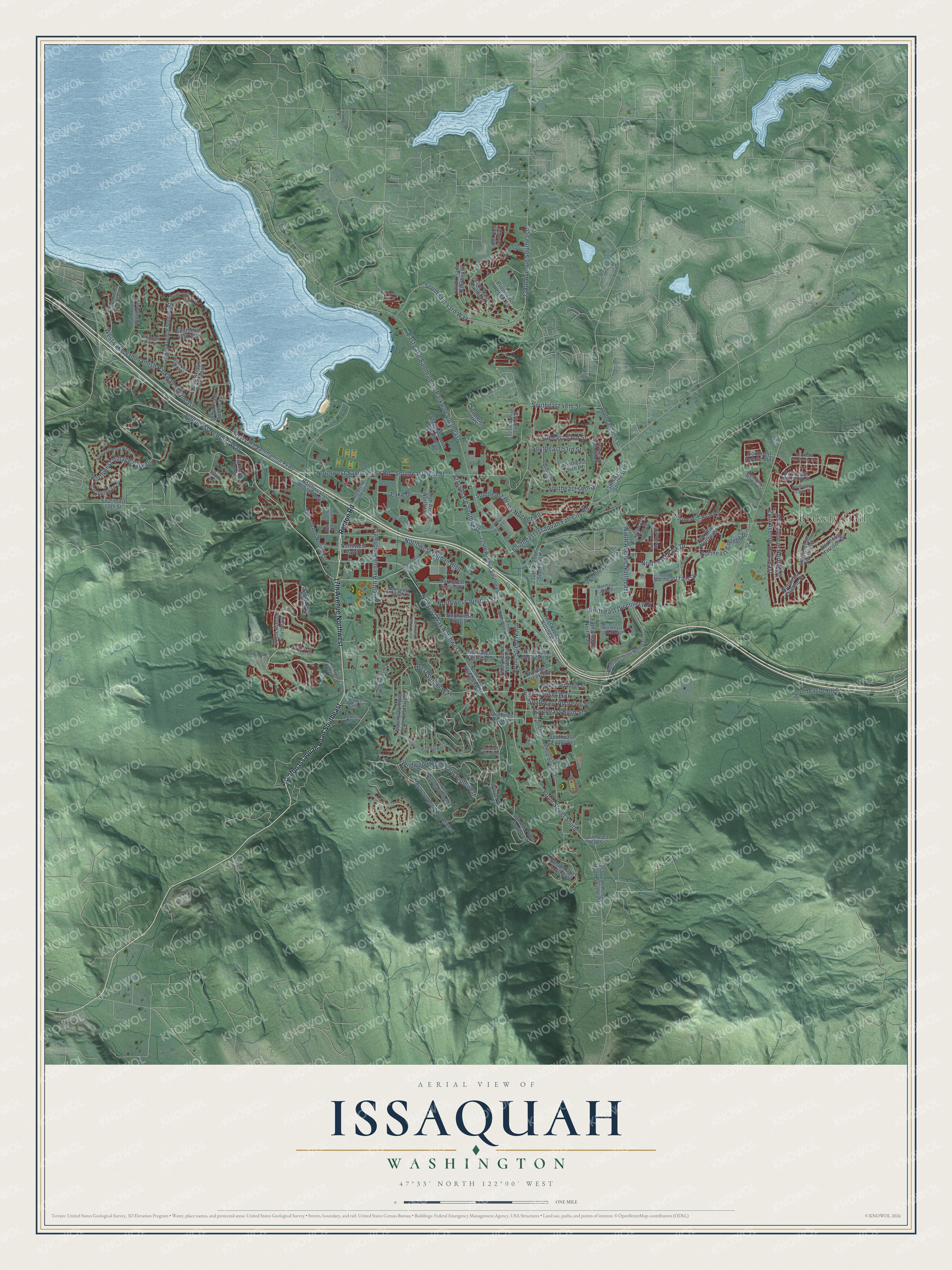
A new map of Issaquah, Washington, made in 2026 and printed to order on thick archival matte paper.
12" x 18" Archival Matte Print
A Map of Home. A Work of Art.
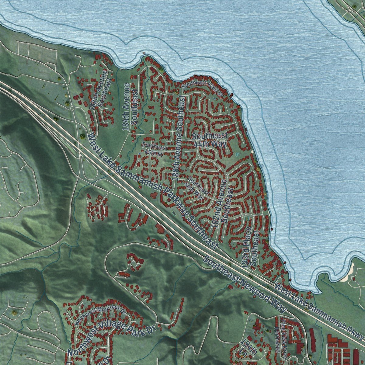
Explore Issaquah, Washington from a whole new perspective. Created using aerial imagery and detailed geographic data, this map captures Issaquah building by building, with labeled streets, familiar landmarks, and shaded topographical relief that highlights the natural contours of the landscape.
Combining modern data with the timeless character of a vintage atlas, this map is just as interesting up close as it is beautiful on the wall. Whether you grew up in Issaquah, spent memorable years there, or call it home today, this unique map is a great way to celebrate a place that means something to you. Zoom in on the preview to look for your street, and then order a print to put your memories on the wall.
Three ways to hang it
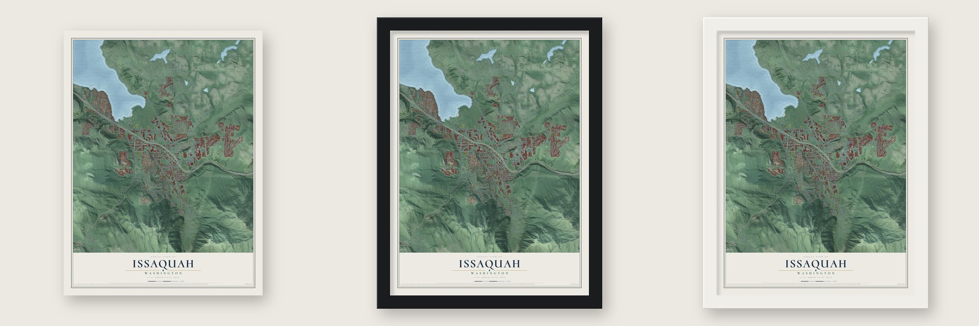
Unframed archival matte, a black wood frame or a white wood frame.
Up close
Geography Worth Displaying
This map was created using accurate cartographic data and authoritative geographic sources, including the U.S. Geological Survey and the Census Bureau. The map brings together terrain, waterways, roads, and building detail. The majority of the streets are labeled, houses are accurately depicted, and the topography is derived from government sources. Combining local data with carefully composed color and shading leads to this beautifully detailed Issaquah artwork for your wall.
Rather than simply showing street outlines, we’ve included as many of the street names as we could reasonably fit on the map while keeping their names legible. Zoom in on the high resolution preview to see exactly what’s on the map. We truly set out to create a statement piece for anyone who loves Issaquah. So whether it’s for you, or a gift for someone you love, we hope this map of Issaquah brings back fond memories.
Read the story behind this map of Issaquah, Washington from 2026.

About Issaquah, Washington
Issaquah is a city of 40,051 people in King County, at the south end of Lake Sammamish. Its name is an English form of a Southern Lushootseed place name. That name may mean "the sound of birds," "snake" or "little stream," and the old name Squak Valley comes from the same word. In September 1885, before the town was incorporated, attackers shot at Chinese workers who had come to pick hops in the valley. Three of the workers died. Seven men were indicted, but each was acquitted or had the charges dropped.
In 1888 the Seattle businessmen Daniel Hunt Gilman and Thomas Burke ran their Seattle, Lake Shore & Eastern Railroad out to the coal mines here. For a short time the town was called Gilman in his honor. The state legislature incorporated Issaquah on April 29, 1892. When the coal began to run out in the late 1890s, lumber companies moved in and shipped timber to Seattle and other growing towns. Farmers then turned the logged-off land into dairy country with creameries. Those booms had quieted by the Great Depression, and in June 1996 Costco moved its world headquarters here from Kirkland.
- Salmon since 1936The federal Works Project Administration built the salmon hatchery on Issaquah Creek in 1936. It raises Chinook and Coho salmon and draws an estimated 350,000 visitors a year, more than any other hatchery in Washington. Each October the town welcomes the returning salmon with Salmon Days, a two-day festival with a parade, crafts, music and sports. In 2005 more than 400,000 people came.
- The depot and the trolleyThe Issaquah Depot joined the National Register in 1990, and the Dr. Johan and Louise Wenberg House followed in 2024. The Issaquah Historical Society runs a heritage trolley on the old tracks from the depot to Gilman Village. That shopping center was made in 1972 from historic houses and shops that were moved and restored. The trolley stopped in 2020 for lack of money and came back in August 2026.
- Village Theatre since 1979The Village Theatre began staging plays downtown in 1979 in a former movie theater. In 1993 it built its main stage, the Francis J. Gaudette Theatre. It is now an Equity theater with a second stage in Everett.
- Mountains older than the CascadesCougar, Squak and Tiger mountains, known locally as the Issaquah Alps, surround the city on three sides. Unlike the Cascades, they did not form from volcanoes, and geologists think they are what is left of a much older range. Hang gliders and paragliders now launch from Poo Poo Point on Tiger Mountain.
Find your street
Names on the Issaquah map
Every name below is printed on this map. Look for your street, your school, the park where you played, or the pond down the road.
Places and landmarks1
- Blakely Hall
Streets and roads125
- West Sunset Way
- East Sunset Way
- Front Street South
- Southeast 52nd Street
- 24th Avenue Northeast
- Front Street North
- Southeast Newport Way
- Newport Way Northwest
- Northwest Gilman Boulevard
- East Lake Sammamish Parkway Southeast
- Southeast 56th Street
- Northwest Sammamish Road
- Southeast Black Nugget Road
- Northwest Village Park Drive
- West Lake Sammamish Parkway Southeast
- Wildwood Boulevard Southwest
- Twelfth Avenue Northwest
- Southeast Issaquah Fall City Road
- Southeast 43rd Way
- Northeast Park Drive
- 25th Avenue Northeast
- 228th Avenue Southeast
- Ninth Avenue Northeast
- Lake Drive
- 221st Place Southeast
- Southeast 48th Street
- Southeast Andrews Street
- Northwest Juniper Street
- Southeast Bush Street
- Northeast Discovery Drive
Show all 125 streets
- Northeast College Drive
- Southeast 79th Street
- Southeast 58th Street
- Southeast 53rd Street
- Renton Issaquah Road Southeast
- 17th Avenue Northwest
- Renton Road
- First Avenue Northeast
- 201st Avenue Southeast
- Providence Heights Lp
- Northeast Alder Street
- Northeast Mulberry Street
- Northeast Daphne Street
- Southeast 96th Street
- Northwest Newport Way
- Idylwood Drive Southwest
- Second Avenue Southeast
- 30th Avenue Northeast
- Northeast High Street
- Southeast 50th Street
- Northeast Katsura Street
- 220th Place Southeast
- Southeast 60th Street
- Park Drive Northeast
- Mount Olympus Drive Southwest
- 19th Avenue Northwest
- Northeast Harrison Drive
- West Lake Sammamish Parkway
- 184th Avenue Southeast
- Northwest Holly Street
- 193rd Place Southeast
- 224th Avenue Southeast
- 188th Avenue Southeast
- Issaquah Hobart Road Southeast
- Northeast Falls Drive
- Lac Lehman Drive
- Fifth Avenue Northeast
- 230th Avenue Southeast
- First Avenue Northwest
- 192nd Avenue Southeast
- 220th Avenue Southeast
- Northwest Dogwood Street
- Northwest Mall Street
- Northwest Poplar Way
- Sunrise Place Southeast
- Northeast Natalie Way
- Tenth Avenue Northwest
- Hillside Drive Southeast
- Southeast 30th Street
- 238th Avenue Southeast
- 223rd Place Southeast
- Southeast Evans Street
- Southeast 44th Way
- Southwest Clark Street
- Northeast Dogwood Street
- Northwest Locust Street
- Northeast Creek Way
- Southeast 54th Place
- 194th Lane
- Northeast Logan Street
- Highlands Drive Northeast
- Tenth Avenue Northeast
- Rainier Boulevard North
- Northeast Ellis Drive
- 227th Avenue Southeast
- 182nd Avenue Southeast
- 236th Place Southeast
- Northeast Lilac Street
- Northeast Morgan Lane
- Southeast 82nd Street
- Bobcat Lane Northwest
- Northwest Pickering Street
- 18th Avenue Northwest
- Northwest Boulder Place
- Northeast Blakley
- Northwest Talus Drive
- Northeast Marquette Way
- Providence Point Drive Southeast
- Mountain Park Boulevard Southwest
- Northwest Maple Street
- 231st Avenue Southeast
- Greenwood Boulevard Southwest
- Northwest Montreux Drive
- Southeast 45th Street
- Sunrise Place Southwest
- Southeast 42nd Place
- Mount Quay Drive Northwest
- Southeast 62nd Street
- Southeast 46th Way
- 224th Place Southeast
- Southeast 42nd Street
- Pine View Drive Northwest
- Southeast 83rd Place
- Northwest Everwood Drive
- Southwest Gibson Lane
Names are listed as they appear on the printed map. Zoom into the product photos to find them.
The art of mapping a place
How This Map Was Made
Real places. Remarkable detail. Discover the layers that turn geographic data into a map of home.

The view from above
Aerial imagery reveals the character of the land: woodland, open fields, and the patterns of a place.

The shape of the land
Elevation data brings hills, valleys, and subtle changes in the landscape into view.

The details of home
Roads, waterways, and building footprints come together to make the map feel unmistakably local.

Geography becomes art
Considered color, shading, and typography bring the layers together in a map made for your wall.


Process illustrated with Mendon, Massachusetts. Aerial imagery: USDA NAIP. Terrain: USGS 3D Elevation Program. Map details and finished artwork: KNOWOL.
The Details
About This Print
Choose an archival matte print, or a black or white Ayous wood frame. The archival matte print is unframed.
Select your size and finish above to see the matching product image and price.
Materials & Craftsmanship
A contemporary map with the character of a classic atlas, printed on archival matte paper. Optional frames are made from Ayous wood.
Your printed map does not include the watermark shown in the full-map preview.
Shipping & Delivery
Free shipping within the United States. Every print is made to order in the USA.
Buying a gift? Add a note in your cart and we'll include it. We never put prices in the package.
Prints ship within 2 to 3 business days. Allow 7 to 10 days total from ordering for delivery. Timing may vary during holidays or periods of high order volume.
Read our shipping policy.
Returns and damaged prints
Each print is made to order. Change-of-mind refunds are not available after production.
If your print arrives damaged, misprinted or incorrect, contact support@knowol.com within 30 days of receiving it. Include your order number, photos and a description of the issue.
Read our full refund and replacement policy. For questions about your order, email support@knowol.com.
Find your town
Looking for another city?
Find a map of home in our Washington collection, or any town in the country.
Nearby
Maps of towns near Issaquah
Know someone from one of these towns? Their map makes a great gift.
 Sammamish
, Washington
From $39.99See the map
 East Renton Highlands
, Washington
From $39.99See the map
 Newcastle
, Washington
From $39.99See the map
More maps nearby: Bellevue, Mirrormont, Fall City, Ames Lake and Maple Heights-Lake Desire.