
Search for another town

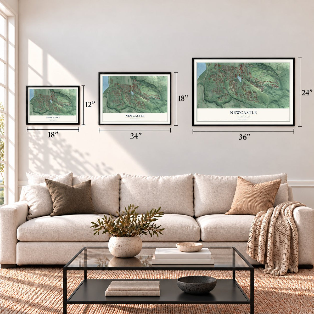

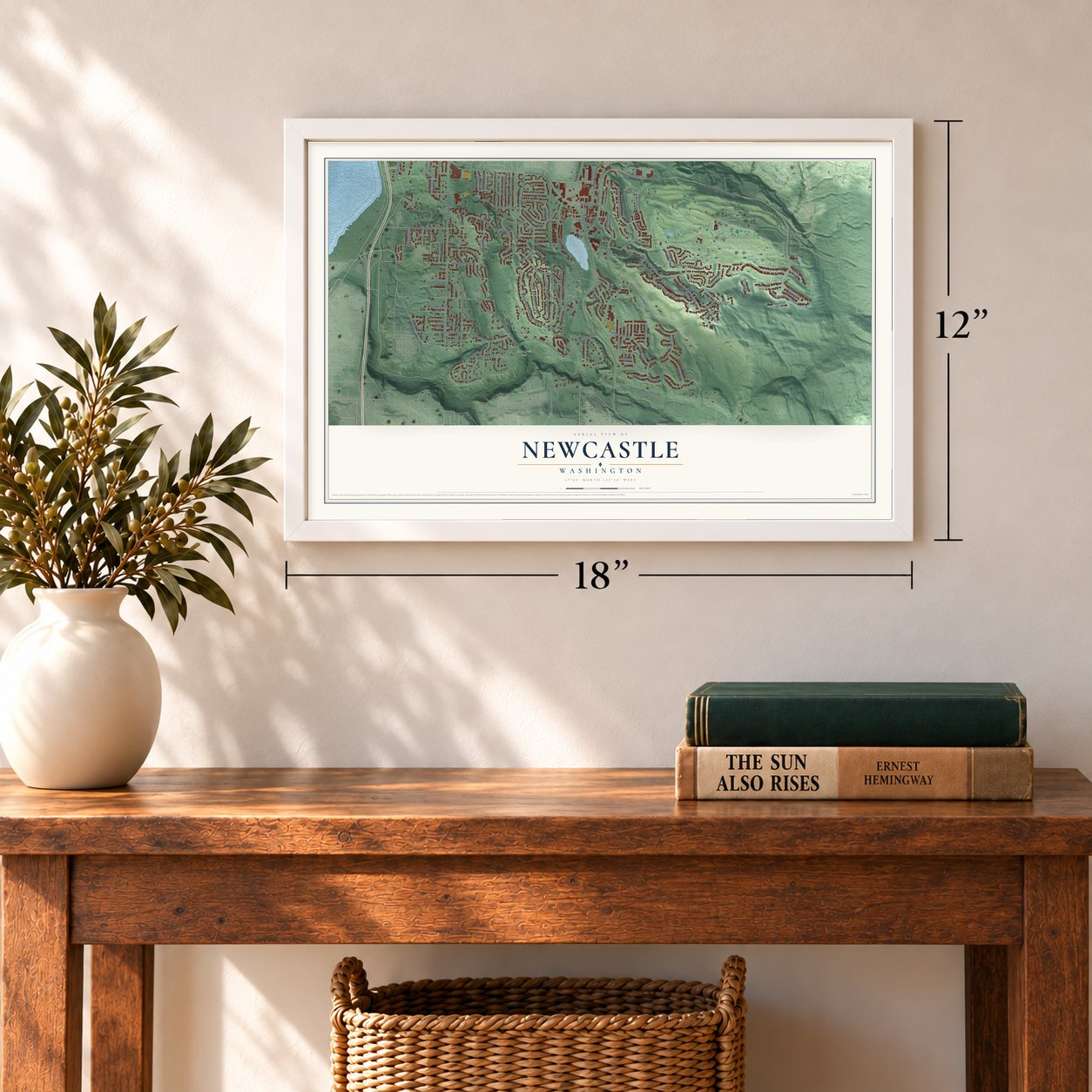

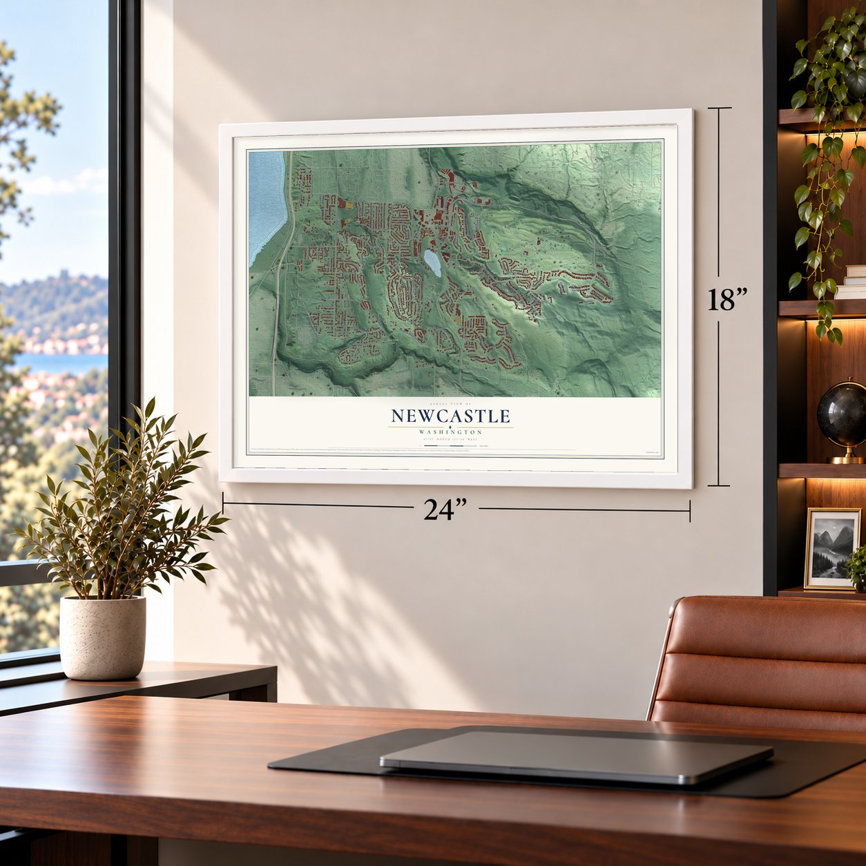
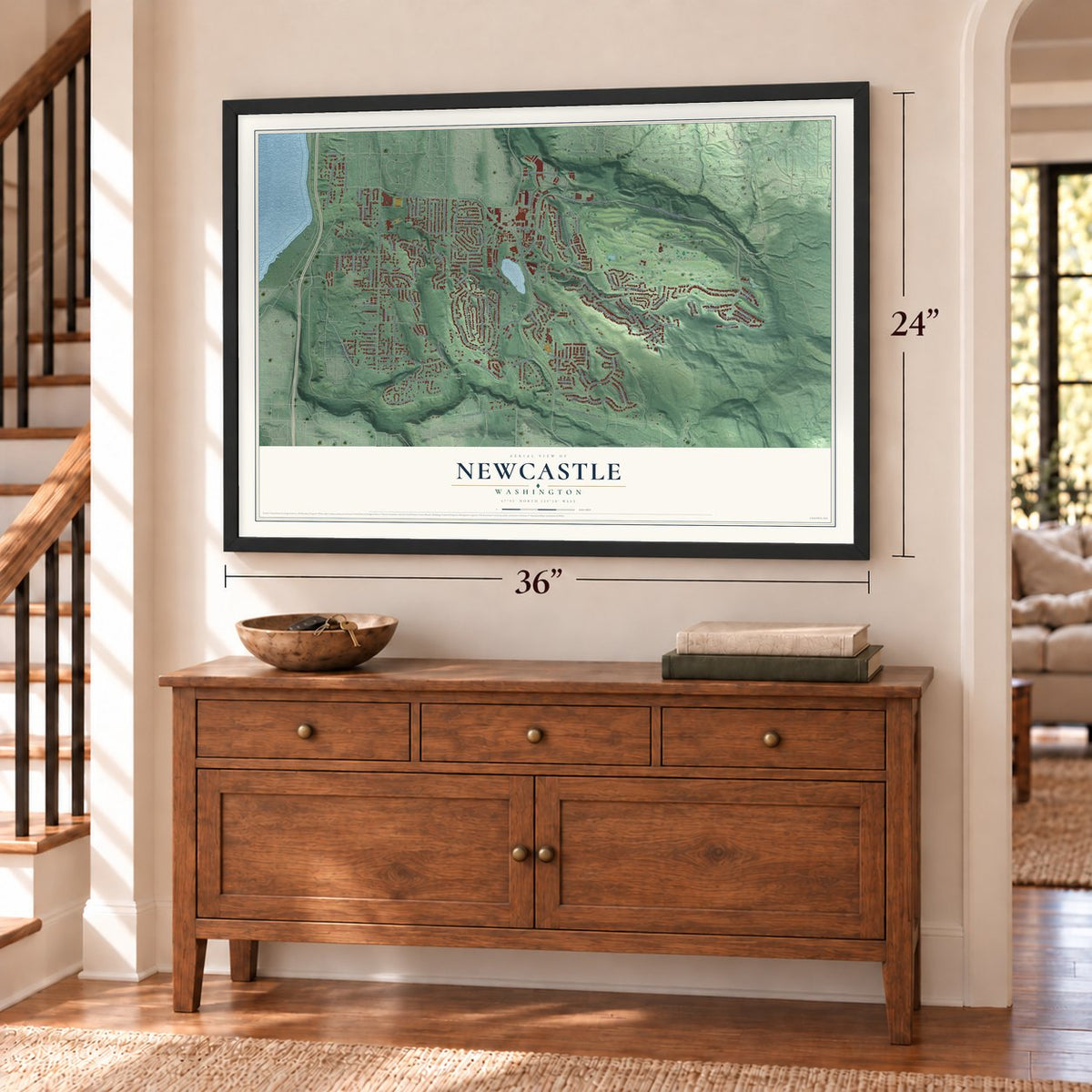
Free U.S. delivery 7 to 10 days after you order
Newcastle, Washington Map Art
A new map of Newcastle, Washington, made in 2026 and printed to order on thick archival matte paper.
12" x 18" Archival Matte Print
A Map of Home. A Work of Art.
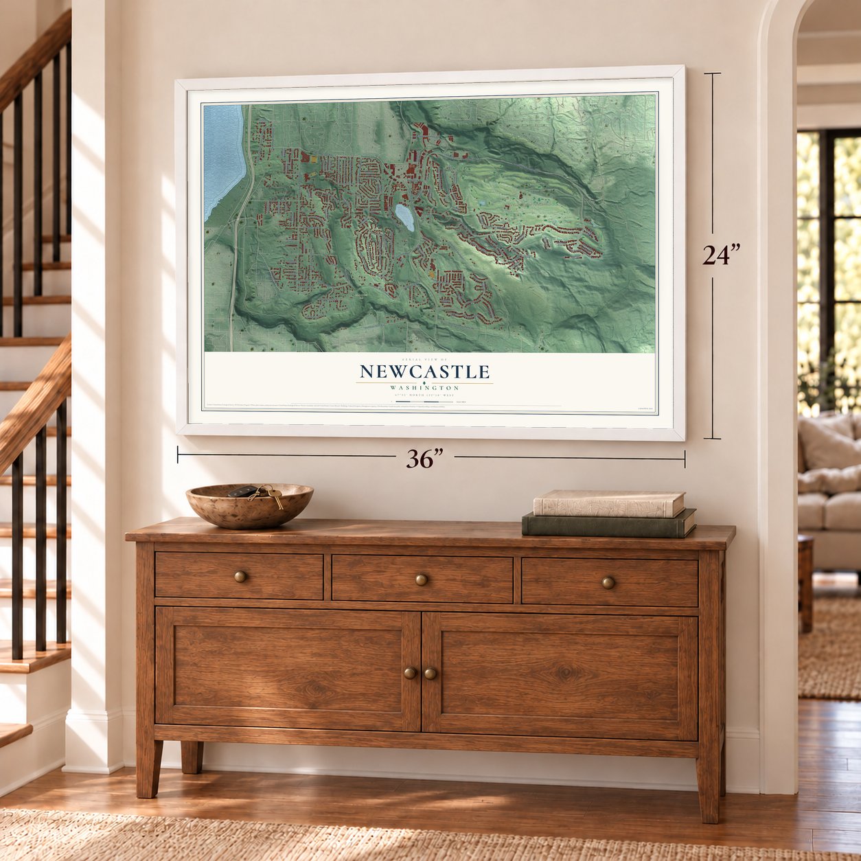
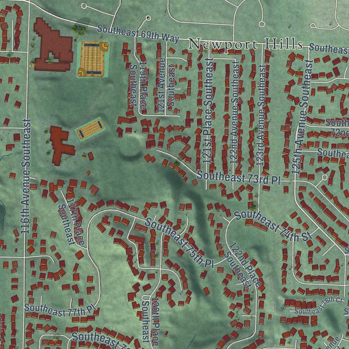
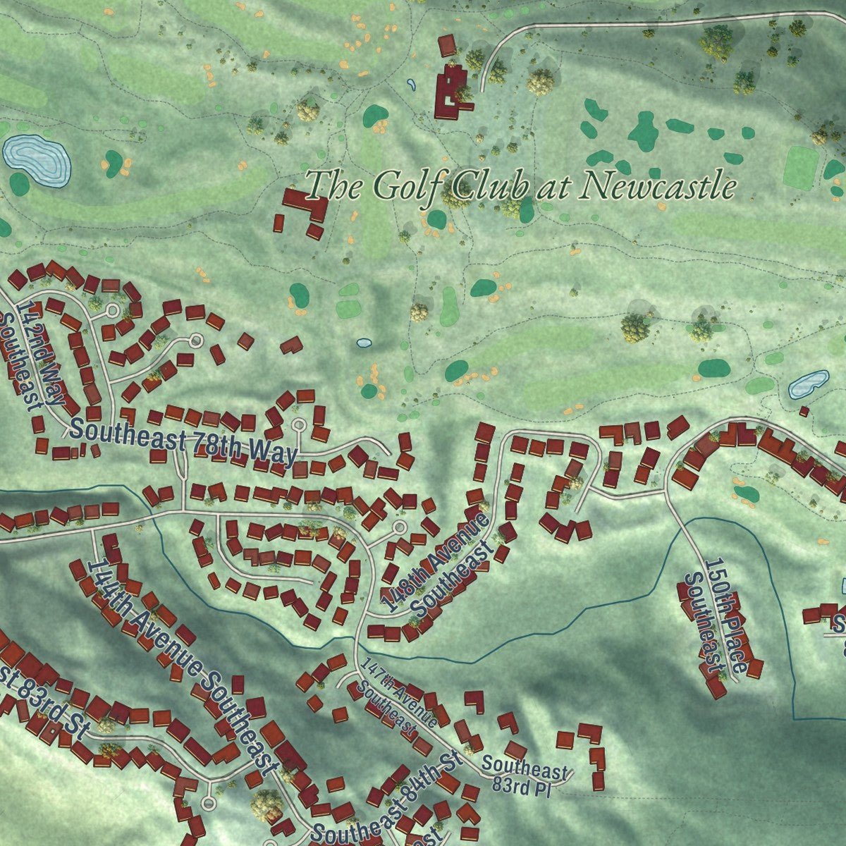
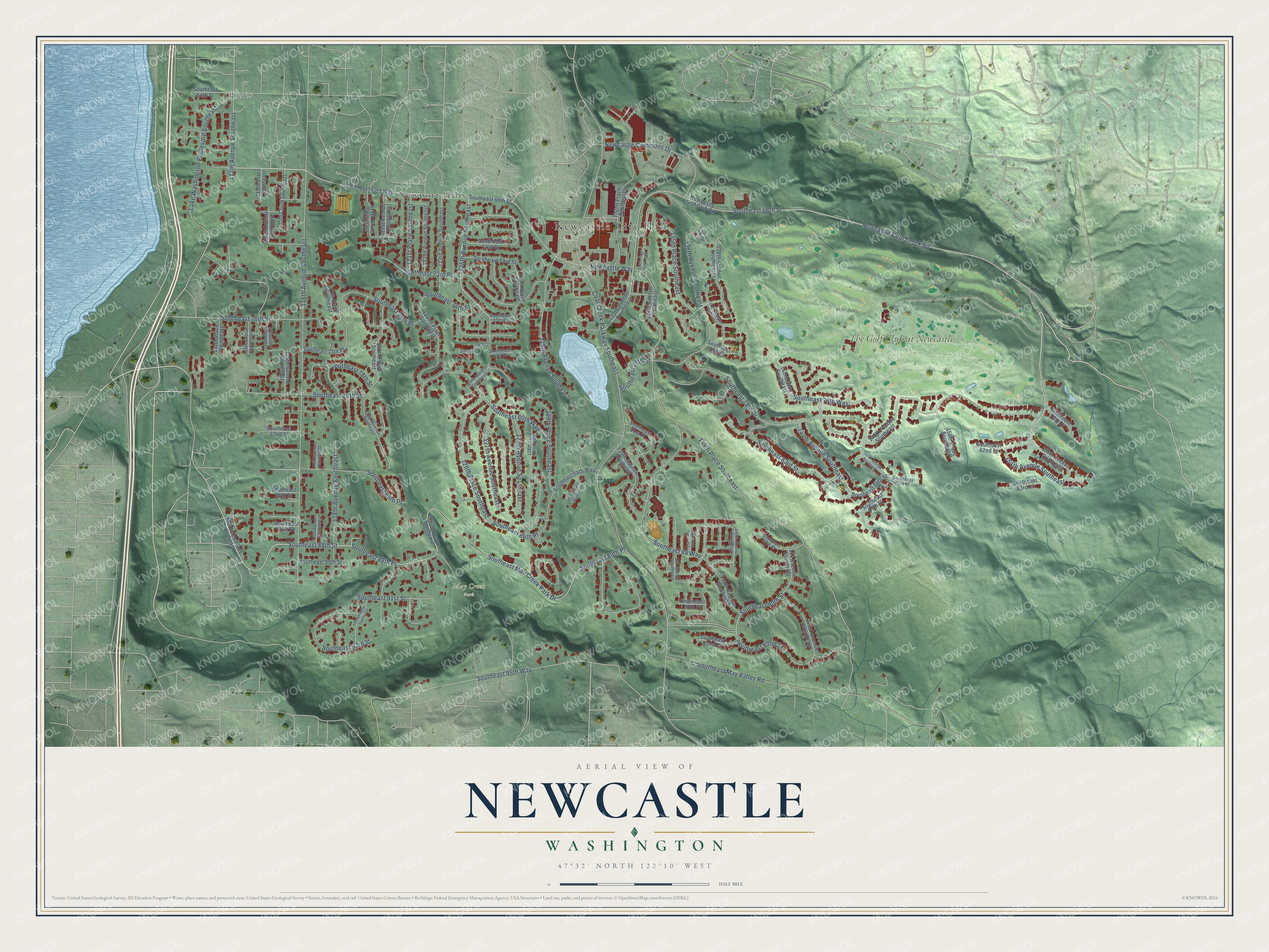
Explore Newcastle, Washington from a whole new perspective. Created using aerial imagery and detailed geographic data, this map captures Newcastle building by building, with labeled streets, familiar landmarks, and shaded topographical relief that highlights the natural contours of the landscape.
Combining modern data with the timeless character of a vintage atlas, this map is just as interesting up close as it is beautiful on the wall. Whether you grew up in Newcastle, spent memorable years there, or call it home today, this unique map is a great way to celebrate a place that means something to you. Zoom in on the preview to look for your street, and then order a print to put your memories on the wall.
Three ways to hang it
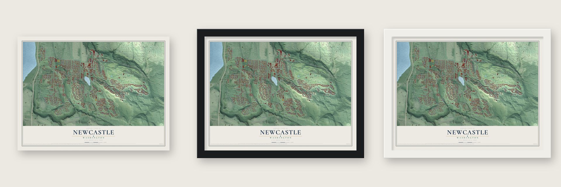
Unframed archival matte, a black wood frame or a white wood frame.
Up close
Geography Worth Displaying
This map was created using accurate cartographic data and authoritative geographic sources, including the U.S. Geological Survey and the Census Bureau. The map brings together terrain, waterways, roads, and building detail. The majority of the streets are labeled, houses are accurately depicted, and the topography is derived from government sources. Combining local data with carefully composed color and shading leads to this beautifully detailed Newcastle artwork for your wall.
Rather than simply showing street outlines, we’ve included as many of the street names as we could reasonably fit on the map while keeping their names legible. Zoom in on the high resolution preview to see exactly what’s on the map. We truly set out to create a statement piece for anyone who loves Newcastle. So whether it’s for you, or a gift for someone you love, we hope this map of Newcastle brings back fond memories.
Read the story behind this map of Newcastle, Washington from 2026.
About Newcastle, Washington
Newcastle is a city of 13,017 people in King County, set in the hills between Lake Washington and Cougar Mountain. King County Surveyor Edwin Richardson and his crew found coal along Coal Creek on January 9, 1864. The next month Richardson, Philip Lewis and Josiah Settle filed claims, and by 1867 almost every piece of ground on the upper creek had an owner.
Getting the coal to market was the hard part. A three-mile wagon road to Lake Washington opened in late 1866. Later, mules pulled cars along a wooden tramway to the lake, where the coal started a journey to Seattle that moved it between boats and trams 11 times. The Seattle and Walla Walla Railroad finally reached the mines on February 5, 1878, and within two months five trains a day were carrying 500 tons of coal to Seattle.
- Named for an English coal townThe name comes from the old saying about carrying coals to Newcastle, the English coal city. According to F. H. Whitworth, a member of a party of coal surveyors in 1869, one of the men proposed "New Castle," and everyone involved took it up. The city seal still gives 1869 as the founding year, and a post office opened on August 22, 1878.
- A president's visit in 1880Newcastle grew into one of the leading towns of the central Puget Sound, and on October 11, 1880, President Rutherford B. Hayes came to see it with General William T. Sherman. The Newcastle Historical Society counts 750 residents by 1883 and 140 houses by the end of that decade. The Odd Fellows Hall, which could seat at least 200, served as the town's gathering place.
- 218,742 tons in 1883The Coal Creek Mine had its best year in 1883, when miners brought up 218,742 tons, reportedly more than half of all the coal dug in Washington Territory. A fire in December 1894 wrecked that mine for good. The Bagley Mine opened to the southeast in 1899, and the new town of Coal Creek grew up beside it. Large-scale mining ended in 1929, and both towns faded away during the 1930s.
- From Newport Hills to NewcastleWhen suburbs spread over the old mining ground in the 1960s, the area took the name Newport Hills. In 1993 five parcels, holding nearly half the community's people, voted to join Bellevue. The rest incorporated as a city on September 30, 1994, and to avoid confusion with Bellevue's new Newport Hills neighborhood, residents chose between Cougar Mountain and Newcastle. They picked Newcastle, bringing back the old coal town's name.
Find your street
Names on the Newcastle map
Every name below is printed on this map. Look for your street, your school, the park where you played, or the pond down the road.
Places and landmarks5
- Newcastle City Hall
- May Creek Park
- Newport Hills
- Pines
- The Golf Club at Newcastle
Streets and roads114
- 154th Avenue Southeast
- 125th Avenue Southeast
- Southeast 68th Street
- Southeast 88th Street
- 112th Avenue Southeast
- Southeast 92nd Street
- Southeast 90th Street
- Southeast 91st Street
- 118th Avenue Southeast
- Coal Creek Parkway Southeast
- Southeast May Creek Park Drive
- Newcastle Way
- 136th Avenue Southeast
- Newcastle Coal Creek Road
- 116th Avenue Southeast
- 144th Place Southeast
- Southeast 89th Place
- Southeast 95th Way
- Southeast 80th Street
- 129th Avenue Southeast
- Southeast May Valley Road
- Southeast 79th Drive
- Lake Washington Boulevard Southeast
- 129th Place Southeast
- Southeast 76th Street
- 126th Place Southeast
- 127th Avenue Southeast
- Southeast 83rd Street
- Southeast 73rd Place
- Southeast 80th Way
Show all 114 streets
- Southeast 75th Place
- Southeast 74th Street
- 135th Place Southeast
- Newcastle Commons Drive
- Southeast 88th Place
- 121st Place Southeast
- 128th Avenue Southeast
- Southeast 93rd Street
- 144th Avenue Southeast
- Southeast 84th Place
- Southeast 88 Way
- Southeast 78th Way
- Southeast 86th Place
- Southeast 79th Street
- Southeast 78th Street
- 155th Avenue Southeast
- Southeast 69th Place
- 114th Avenue Southeast
- Southeast 92nd Place
- 138th Avenue Southeast
- 133rd Avenue Southeast
- 134th Avenue Southeast
- Southeast 69th Way
- Newcastle Golf Club Road
- 132nd Place Southeast
- Southeast 84th Street
- 121st Avenue Southeast
- 127th Place Southeast
- Southeast 85th Street
- 139th Avenue Southeast
- 123rd Avenue Southeast
- 122nd Place Southeast
- 120th Place Southeast
- Southeast 77th Place
- 143rd Avenue Southeast
- 135th Avenue Southeast
- Southeast 78th Place
- Southeast 87th Street
- 124th Avenue Southeast
- 122nd Avenue Southeast
- Southeast 73rd Street
- Southeast 86th Street
- Southeast 72nd Street
- 119th Place Southeast
- Southeast 79th Place
- Southeast 89th Street
- 150th Place Southeast
- Southeast 82nd Street
- Southeast 81st Place
- 115th Court Southeast
- 115th Avenue Southeast
- 148th Avenue Southeast
- 117th Place Southeast
- Monterey Place Northeast
- Southeast 84th Way
- Southeast 64th Street
- Southeast 83rd Lane
- 142nd Way Southeast
- Southeast 82nd Court
- 111th Place Southeast
- 113th Place Southeast
- 144 Avenue Southeast
- Southeast 90th Place
- Southeast 75th Street
- 140th Avenue Southeast
- Southeast 77th Court
- 113th Avenue Southeast
- 137 Avenue Southeast
- 126th Avenue Southeast
- 128th Lane Southeast
- 119th Avenue Southeast
- Southeast 87th Place
- 114th Place Southeast
- 117 Avenue Southeast
- Southeast 83rd Place
- 137th Avenue Southeast
- 117th Avenue Southeast
- Southeast 71st Street
- 134th Court Southeast
- 147th Avenue Southeast
- 120th Avenue Southeast
- Southeast 76th Court
- 130th Place Southeast
- 138 Place Southeast
Names are listed as they appear on the printed map. Zoom into the product photos to find them.
The art of mapping a place
How This Map Was Made
Real places. Remarkable detail. Discover the layers that turn geographic data into a map of home.

The view from above
Aerial imagery reveals the character of the land: woodland, open fields, and the patterns of a place.

The shape of the land
Elevation data brings hills, valleys, and subtle changes in the landscape into view.

The details of home
Roads, waterways, and building footprints come together to make the map feel unmistakably local.

Geography becomes art
Considered color, shading, and typography bring the layers together in a map made for your wall.


Process illustrated with Mendon, Massachusetts. Aerial imagery: USDA NAIP. Terrain: USGS 3D Elevation Program. Map details and finished artwork: KNOWOL.
The Details
About This Print
Choose an archival matte print, or a black or white Ayous wood frame. The archival matte print is unframed.
Select your size and finish above to see the matching product image and price.
Materials & Craftsmanship
A contemporary map with the character of a classic atlas, printed on archival matte paper. Optional frames are made from Ayous wood.
Your printed map does not include the watermark shown in the full-map preview.
Shipping & Delivery
Free shipping within the United States. Every print is made to order in the USA.
Buying a gift? Add a note in your cart and we'll include it. We never put prices in the package.
Prints ship within 2 to 3 business days. Allow 7 to 10 days total from ordering for delivery. Timing may vary during holidays or periods of high order volume.
Read our shipping policy.
Returns and damaged prints
Each print is made to order. Change-of-mind refunds are not available after production.
If your print arrives damaged, misprinted or incorrect, contact support@knowol.com within 30 days of receiving it. Include your order number, photos and a description of the issue.
Read our full refund and replacement policy. For questions about your order, email support@knowol.com.
Find your town
Looking for another city?
Find a map of home in our Washington collection, or any town in the country.
Nearby
Maps of towns near Newcastle
Know someone from one of these towns? Their map makes a great gift.
 Mercer Island
, Washington
From $39.99See the map
 Renton
, Washington
From $39.99See the map
 Beaux Arts Village
, Washington
From $39.99See the map
More maps nearby: Bryn Mawr-Skyway, Bellevue, East Renton Highlands, Issaquah and Fairwood.