
Search for another town





Free U.S. delivery 7 to 10 days after you order
Renton, Washington Map Art
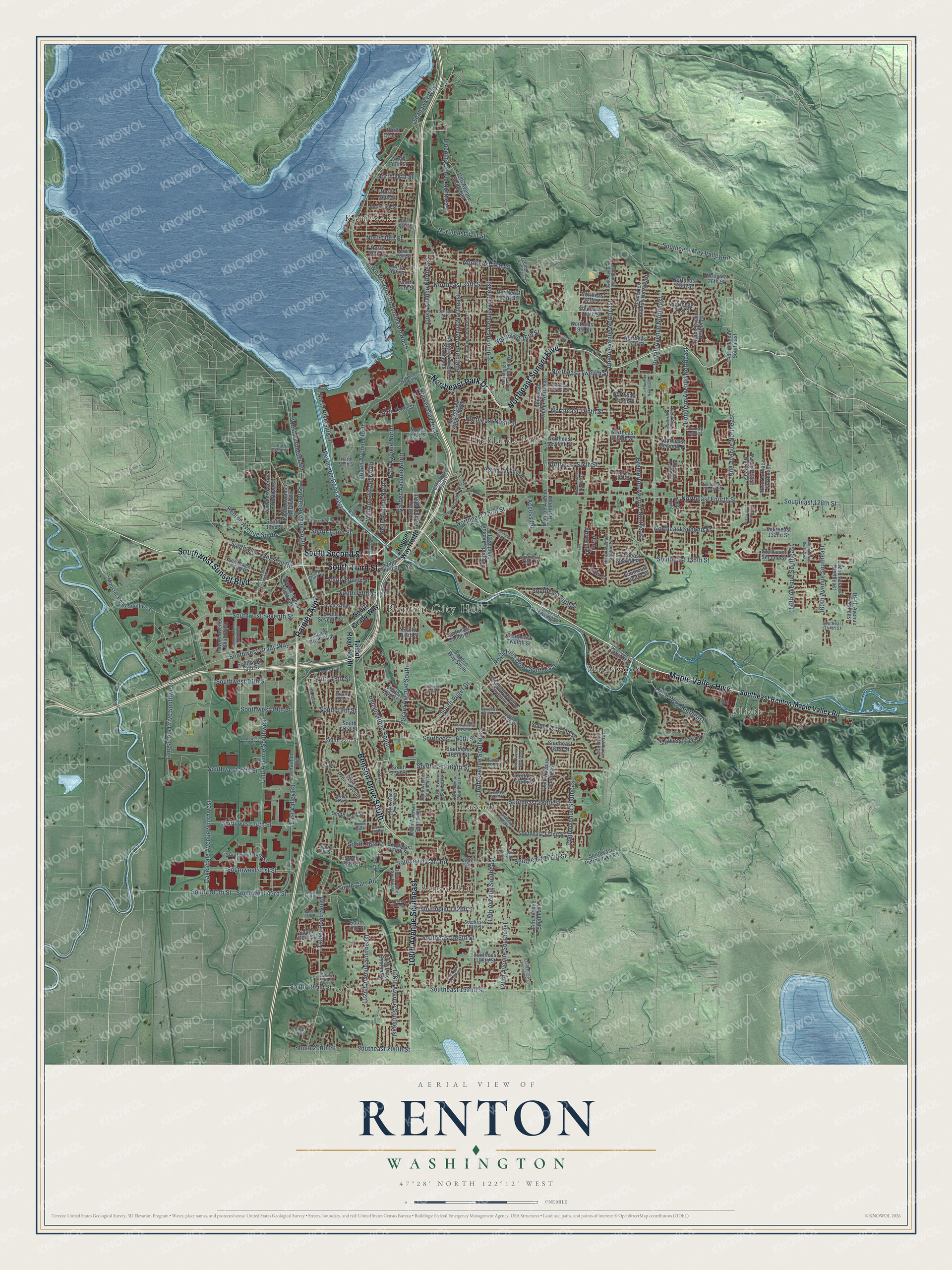
A new map of Renton, Washington, made in 2026 and printed to order on thick archival matte paper.
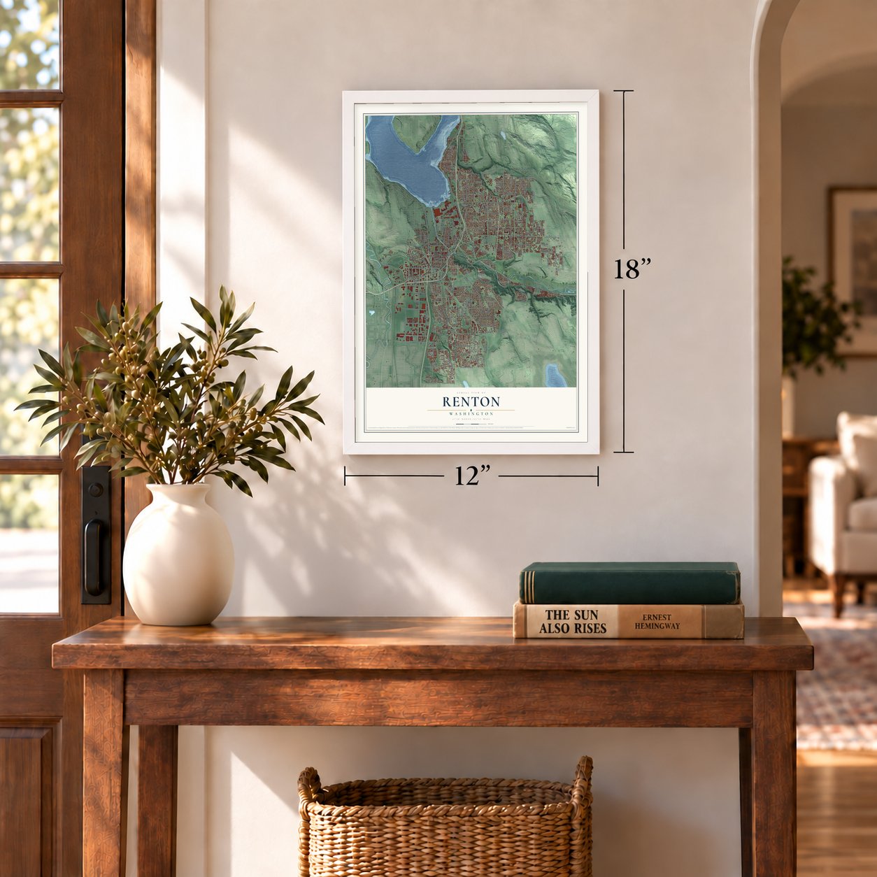
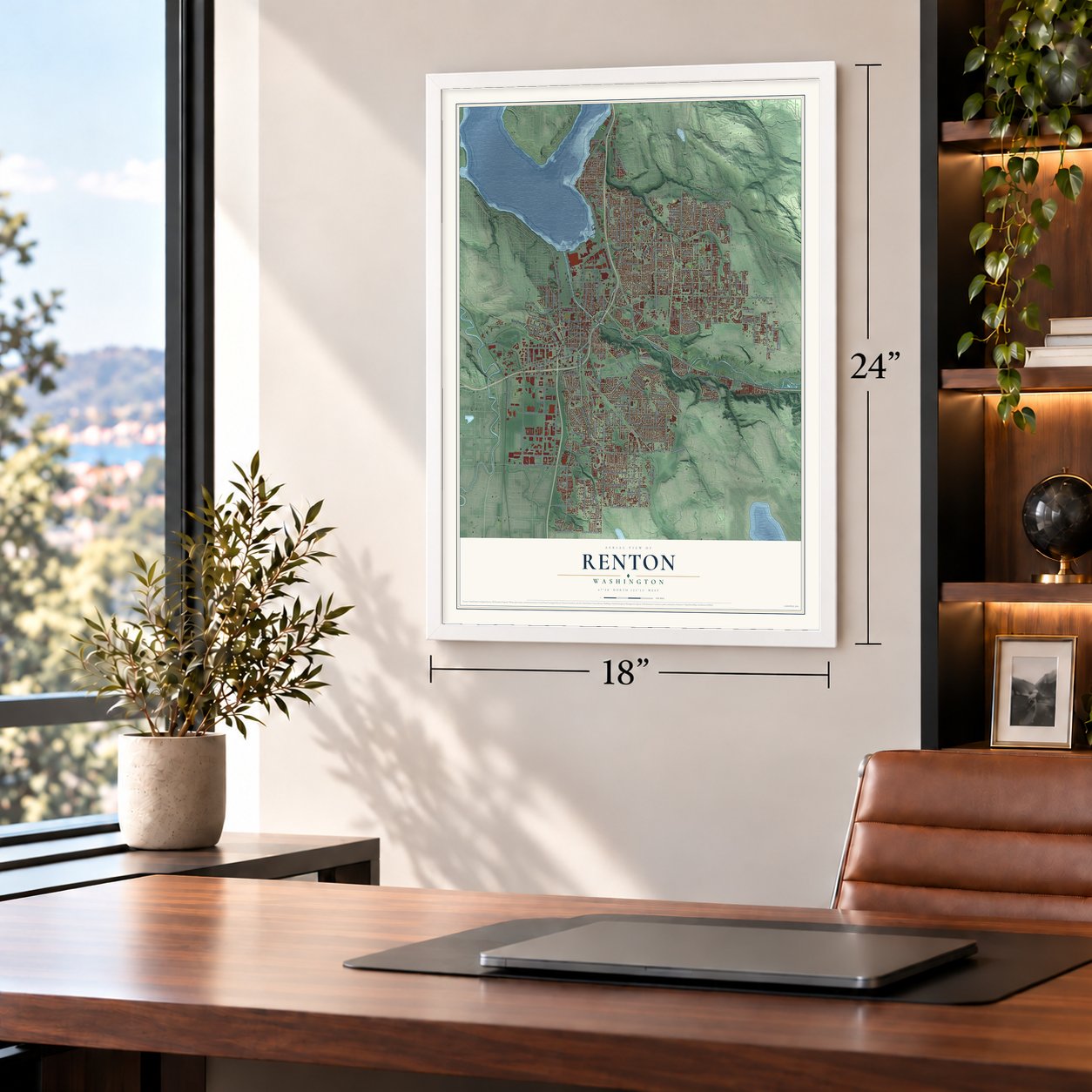
12" x 18" Archival Matte Print
A Map of Home. A Work of Art.
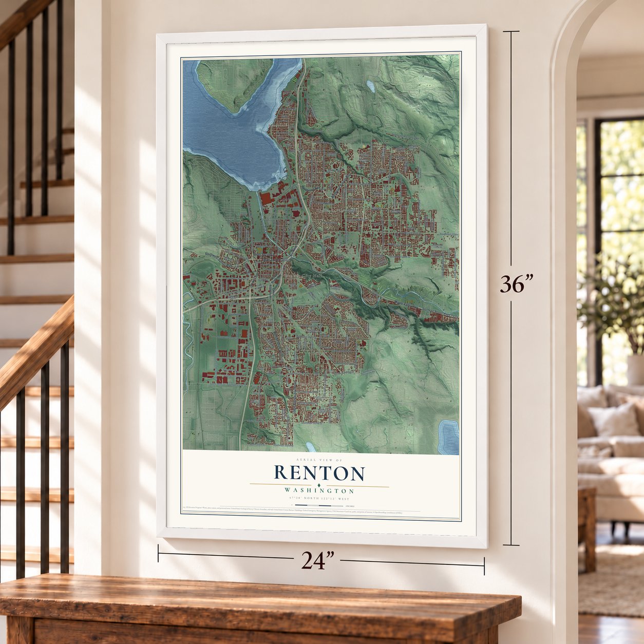
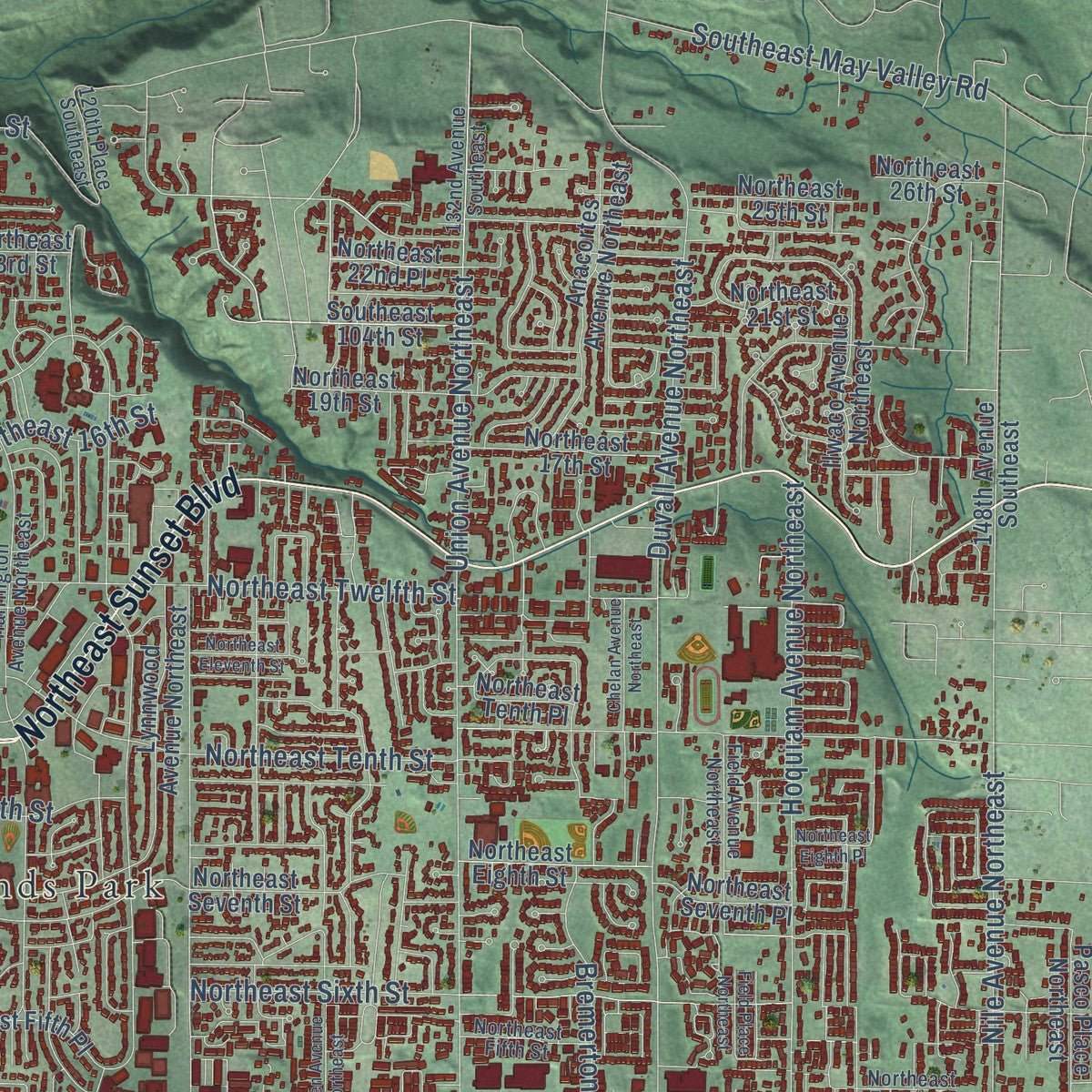
Explore Renton, Washington from a whole new perspective. Created using aerial imagery and detailed geographic data, this map captures Renton building by building, with labeled streets, familiar landmarks, and shaded topographical relief that highlights the natural contours of the landscape.
Combining modern data with the timeless character of a vintage atlas, this map is just as interesting up close as it is beautiful on the wall. Whether you grew up in Renton, spent memorable years there, or call it home today, this unique map is a great way to celebrate a place that means something to you. Zoom in on the preview to look for your street, and then order a print to put your memories on the wall.
Three ways to hang it
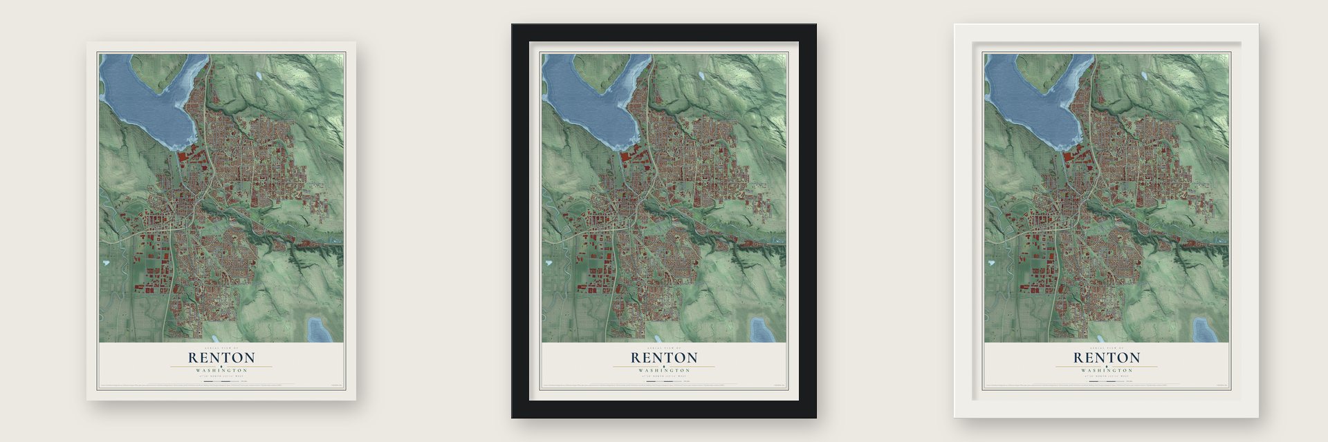
Unframed archival matte, a black wood frame or a white wood frame.
Up close
Geography Worth Displaying
This map was created using accurate cartographic data and authoritative geographic sources, including the U.S. Geological Survey and the Census Bureau. The map brings together terrain, waterways, roads, and building detail. The majority of the streets are labeled, houses are accurately depicted, and the topography is derived from government sources. Combining local data with carefully composed color and shading leads to this beautifully detailed Renton artwork for your wall.
Rather than simply showing street outlines, we’ve included as many of the street names as we could reasonably fit on the map while keeping their names legible. Zoom in on the high resolution preview to see exactly what’s on the map. We truly set out to create a statement piece for anyone who loves Renton. So whether it’s for you, or a gift for someone you love, we hope this map of Renton brings back fond memories.
Read the story behind this map of Renton, Washington from 2026.

About Renton, Washington
Renton is a city of 106,785 people in King County, at the south end of Lake Washington where the Cedar River flows in. The Duwamish had a village here where the Black and Cedar rivers met, and they called the place Mox La Push. Henry Tobin paddled up the Duwamish in 1853, claimed land where the rivers joined and built a mill. Fighting in 1855 burned the mill, and Tobin died soon after. In 1857 Erasmus Smithers married his widow, Diana, who still held the claim.
Smithers and his partners found coal here again in 1873. Captain William Renton, a wealthy investor, paid to develop it, so the mine and the planned town both took his name. Smithers filed the plat on September 5, 1875, with 28 blocks and room for a railroad, and in 1877 the tracks of the Seattle and Walla Walla Railroad reached the town. Renton became a city on September 6, 1901, with just over 1,000 people.
“Henry Moses, last of the Duwamish, who died in January said he took his dugout canoe which his grandfather had made for him and hid it in the brush one day and never paddled it again. He couldn’t bear the thoughts of using it in any stream but the Black”
- The Black River vanishesIn the fall of 1911 the dam at Landsburg failed, and the flooded Cedar tore out bridges and filled Renton's streets and homes. Engineers then dug a new channel that sent the Cedar straight into Lake Washington. When Seattle's ship canal opened in 1916, the lake dropped about 9 feet, and the Black River dried up, taking a whole salmon run with it. The Cedar has been the lake's only outlet at its south end ever since.
- Nine saloons, no churchesCoal made Renton a rough town, and in 1885 it had nine saloons and not one church. By 1910 the town could count churches, schools, newspapers and a bank of its own. The Renton Mine shut for good in 1920, but brick, tile, glass, twine, cigar and pasta plants and lumber mills kept people working, and the Chamber of Commerce called Renton the "Town of Payrolls."
- Bombers and tanks in wartimeBoeing set up a plant near the lakeshore in 1941, and during World War II it built B-29 Superfortress bombers at up to six a day. Pacific Car and Foundry, in Renton since 1908, made 30 Sherman tanks a month and 1,500 by 1945. Renton grew from 4,488 people in 1940 to 16,039 in 1950, and the same Boeing plant now assembles the 737.
- A library over the riverThe Renton Public Library opened in 1966, built right on top of the Cedar River beside Liberty Park. The building spans 80 feet from bank to bank.
Find your street
Names on the Renton map
Every name below is printed on this map. Look for your street, your school, the park where you played, or the pond down the road.
Places and landmarks7
- Renton City Hall
- Benson Hill
- Cascade
- Elliott
- Highlands Park
- Kennydale
- Maplewood
Streets and roads248
- Maple Valley Highway
- Benson Drive South
- Rainier Avenue
- South Third Street
- South Second Street
- Southwest Sunset Boulevard
- Northeast Sunset Boulevard
- 108th Avenue Southeast
- Northeast Park Drive
- Lake Washington Boulevard North
- Benson Road South
- South Puget Drive
- Seahawks Way
- South 15th Street
- 116th Avenue Southeast
- 140th Way Southeast
- Rainier Avenue South
- Southwest Grady Way
- Northeast Third Street
- Jones Avenue Northeast
- Talbot Road South
- Access Road
- Northeast 24th Street
- Southeast 168th Street
- Southwest Seventh Street
- Northeast Fourth Street
- Oakesdale Avenue Southwest
- Lind Avenue Southwest
- Duvall Avenue Northeast
- Union Avenue Northeast
Show all 248 streets
- Edmonds Avenue Northeast
- Park Avenue North
- Northeast Twelfth Street
- Northeast Tenth Street
- Northeast Second Street
- Southeast 176th Street
- East Valley Road
- Northeast Sixth Street
- 120th Avenue Southeast
- Aberdeen Avenue Northeast
- Southeast 192nd Street
- Southeast 164th Street
- Southeast 128th Street
- Hoquiam Avenue Northeast
- Southeast 160th Street
- Garden Avenue North
- Northeast Ninth Street
- Renton Avenue South
- Houser Way North
- West Perimeter Road
- Nile Avenue Northeast
- Bremerton Avenue Northeast
- Southeast Carr Road
- South 180th Street
- 106th Avenue Southeast
- 128th Avenue Southeast
- Southwest 43rd Street
- Northeast 16th Street
- Logan Avenue North
- Southwest 16th Street
- Southeast 186th Street
- Grant Avenue South
- 118th Avenue Southeast
- 160th Avenue Southeast
- Southeast 182nd Street
- Pelly Avenue North
- Longacres Drive Southwest
- North Riverside Drive
- 156th Avenue Southeast
- Royal Hills Drive Southeast
- Southeast 136th Street
- Lincoln Avenue Northeast
- Northeast 27th Street
- Perimeter Road West
- Southwest 27th Street
- Southeast May Valley Road
- Southwest Langston Road
- Southwest 34th Street
- Southwest 41st Street
- 102nd Avenue Southeast
- South 192nd Street
- Southeast Fifth Street
- South Carr Road
- Williams Street North
- Northeast 31st Street
- North 30th Street
- South Tobin Street
- Southwest 19th Street
- Southeast 200th Street
- South 200th Street
- South Fourth Street
- South Fifth Street
- South 19th Street
- Spruce Drive
- South 36th Place
- North 38th Street
- Fir Drive
- Southeast Renton Maple Valley Road
- South Grady Way
- Edmonds Avenue Southeast
- Southeast Second Street
- South 23rd Street
- Factory Avenue North
- Beacon Way South
- Stevens Avenue Northwest
- Southeast 104th Street
- Southeast Second Place
- North 42nd Place
- Southeast Fourth Street
- Northeast 25th Street
- Northeast Seventh Street
- Morris Avenue South
- Monroe Avenue Northeast
- Northeast Eighth Street
- Northeast Seventh Place
- Southeast Petrovitsky Road
- Anacortes Avenue Northeast
- 112th Avenue Southeast
- Monster Road Southwest
- Southeast 172nd Street
- 124th Avenue Southeast
- Southeast 162nd Street
- Northeast Fifth Place
- Northeast 19th Street
- Northeast 23rd Street
- Southeast 132nd Street
- Hardie Avenue Southwest
- Northeast 21st Street
- Ilwaco Avenue Northeast
- Northeast 17th Street
- North Eighth Street
- Northeast Tenth Place
- Powell Avenue Southwest
- Southeast 165th Street
- Southeast 158th Street
- Southeast 188th Street
- Monterey Avenue Northeast
- South Seventh Street
- Lynnwood Avenue Northeast
- Ferndale Avenue Southeast
- 126th Avenue Southeast
- 148th Avenue Southeast
- Southeast 161st Street
- South 132nd Street
- Southeast 159th Place
- 104th Place Southeast
- 162nd Avenue Southeast
- Rosario Place Northeast
- South 18th Street
- North Tenth Street
- Southwest 39th Street
- Northeast 22nd Place
- 164th Avenue Southeast
- Taylor Avenue Northwest
- North 36th Street
- Southwest Third Place
- Pasco Place Northeast
- South 27th Street
- South 38th Court
- Southwest 13th Street
- South 47th Street
- South 48th Street
- South 32nd Street
- Southeast Eighth Drive
- Northeast 26th Street
- Southeast Twelfth Street
- North 28th Place
- Southeast 174th Street
- North 40th Street
- North 26th Street
- South 21st Street
- South Ninth Street
- Alder Place
- 176th Street
- North 24th Street
- Field Avenue
- Southeast Third Street
- Union Avenue Southeast
- Harrington Avenue Northeast
- Blaine Avenue Northeast
- Northeast Fifth Street
- Field Avenue Northeast
- Southeast 184th Street
- 109th Avenue Southeast
- 113th Avenue Southeast
- North Sixth Street
- 111th Avenue Southeast
- 105th Avenue Southeast
- Houser Way Bypass
- South Sixth Street
- North 32nd Street
- Northeast Fourth Court
- 132nd Avenue Southeast
- Airport Way South
- North 34th Street
- Southeast 144th Street
- Southeast Seventh Street
- South 31st Street
- Pine Drive
- 105th Place Southeast
- 131st Place Southeast
- 120th Place Southeast
- Southeast 148th Street
- South 37th Street
- Southeast 21st Street
- South Third Place
- South 122nd Street
- South 17th Street
- North 28th Street
- South 53rd Place
- Lake Avenue South
- South 14th Street
- Northeast First Street
- Pasco Drive Northeast
- South 35th Street
- Cedar Avenue South
- Queen Avenue Northeast
- Mill Avenue South
- Northeast 20th Street
- Wells Avenue South
- Northeast Eleventh Street
- 121st Avenue Southeast
- North Third Street
- Bronson Way Northeast
- Southeast 181st Street
- Chelan Avenue Northeast
- Thomas Avenue Southwest
- Southeast 167th Street
- Northeast Eighth Place
- Southeast 170th Place
- Stevens Avenue Southwest
- 158th Avenue Southeast
- Rhody Drive
- Field Place Northeast
- 123rd Place Southeast
- 103rd Avenue Southeast
- Southeast 163rd Street
- Southeast 157th Street
- Southeast 175th Street
- 113th Way Southeast
- Southeast 157th Place
- South 26th Street
- Southeast 16th Place
- South 45th Place
- South 43rd Street
- Southwest 23rd Street
- South 198th Street
- South 34th Place
Names are listed as they appear on the printed map. Zoom into the product photos to find them.
The art of mapping a place
How This Map Was Made
Real places. Remarkable detail. Discover the layers that turn geographic data into a map of home.

The view from above
Aerial imagery reveals the character of the land: woodland, open fields, and the patterns of a place.

The shape of the land
Elevation data brings hills, valleys, and subtle changes in the landscape into view.

The details of home
Roads, waterways, and building footprints come together to make the map feel unmistakably local.

Geography becomes art
Considered color, shading, and typography bring the layers together in a map made for your wall.


Process illustrated with Mendon, Massachusetts. Aerial imagery: USDA NAIP. Terrain: USGS 3D Elevation Program. Map details and finished artwork: KNOWOL.
The Details
About This Print
Choose an archival matte print, or a black or white Ayous wood frame. The archival matte print is unframed.
Select your size and finish above to see the matching product image and price.
Materials & Craftsmanship
A contemporary map with the character of a classic atlas, printed on archival matte paper. Optional frames are made from Ayous wood.
Your printed map does not include the watermark shown in the full-map preview.
Shipping & Delivery
Free shipping within the United States. Every print is made to order in the USA.
Buying a gift? Add a note in your cart and we'll include it. We never put prices in the package.
Prints ship within 2 to 3 business days. Allow 7 to 10 days total from ordering for delivery. Timing may vary during holidays or periods of high order volume.
Read our shipping policy.
Returns and damaged prints
Each print is made to order. Change-of-mind refunds are not available after production.
If your print arrives damaged, misprinted or incorrect, contact support@knowol.com within 30 days of receiving it. Include your order number, photos and a description of the issue.
Read our full refund and replacement policy. For questions about your order, email support@knowol.com.
Find your town
Looking for another city?
Find a map of home in our Washington collection, or any town in the country.
Nearby
Maps of towns near Renton
Know someone from one of these towns? Their map makes a great gift.
 Bryn Mawr-Skyway
, Washington
From $39.99See the map
 Fairwood
, Washington
From $39.99See the map
 Tukwila
, Washington
From $39.99See the map
More maps nearby: Newcastle, East Renton Highlands, SeaTac, Maple Heights-Lake Desire and Boulevard Park.