


Search for another town





Free U.S. delivery 7 to 10 days after you order
Lincoln, Rhode Island Map Art
Building by building, with labeled streets and shaded relief.
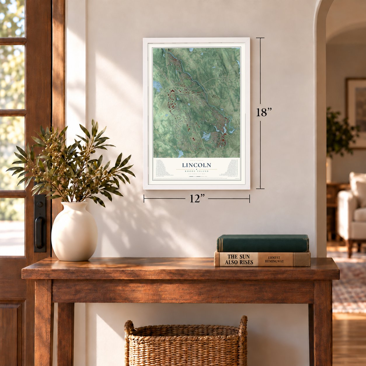
12" x 18" Archival Matte Print
A Map of Home. A Work of Art.
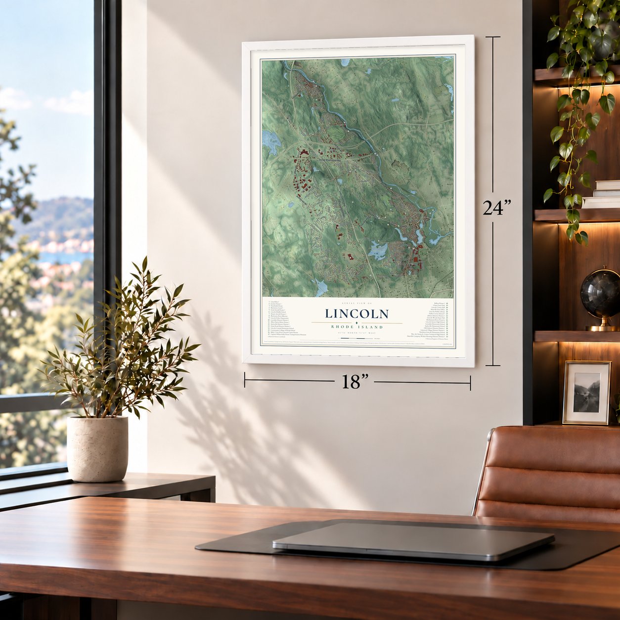
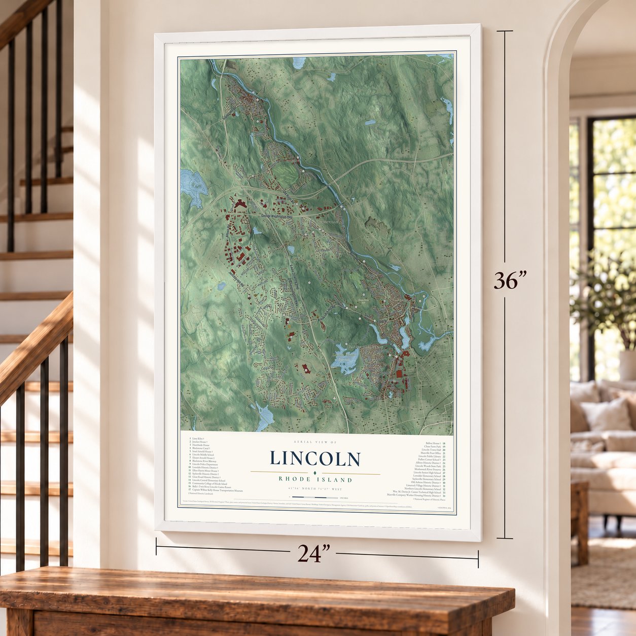
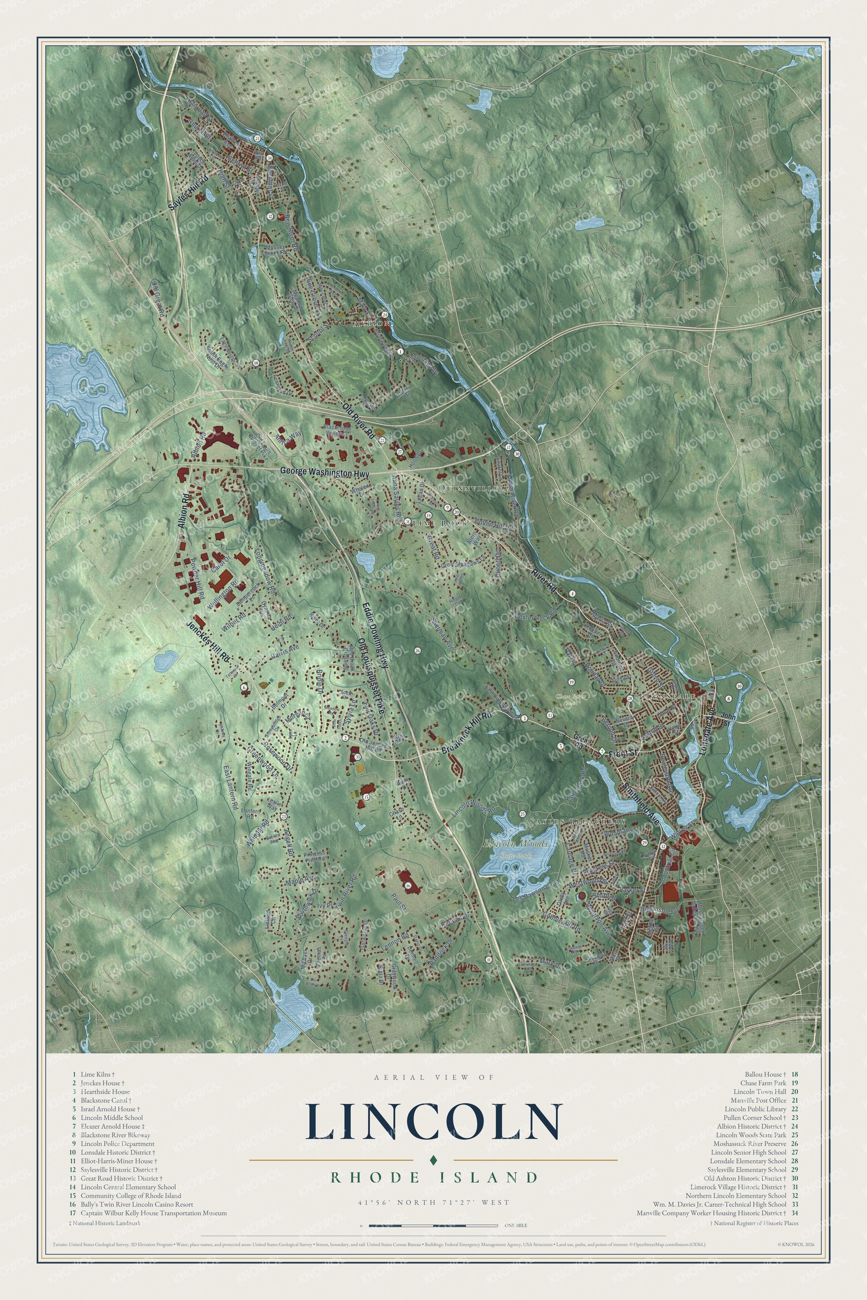
Explore Lincoln, Rhode Island from a whole new perspective. Created using aerial imagery and detailed geographic data, this map captures Lincoln building by building, with labeled streets, familiar landmarks, and shaded topographical relief that highlights the natural contours of the landscape.
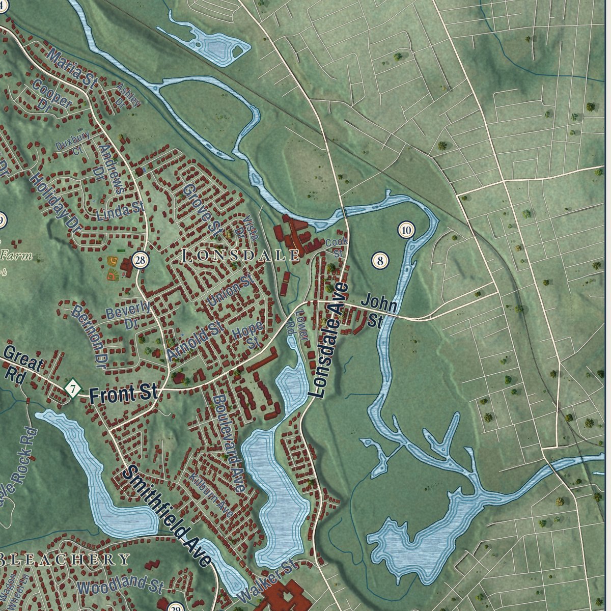
Combining modern data with the timeless character of a vintage atlas, this map is just as interesting up close as it is beautiful on the wall. Whether you grew up in Lincoln, spent memorable years there, or call it home today, this unique map is a great way to celebrate a place that means something to you. Zoom in on the preview to look for your street, and then order a print to put your memories on the wall.
Three ways to hang it
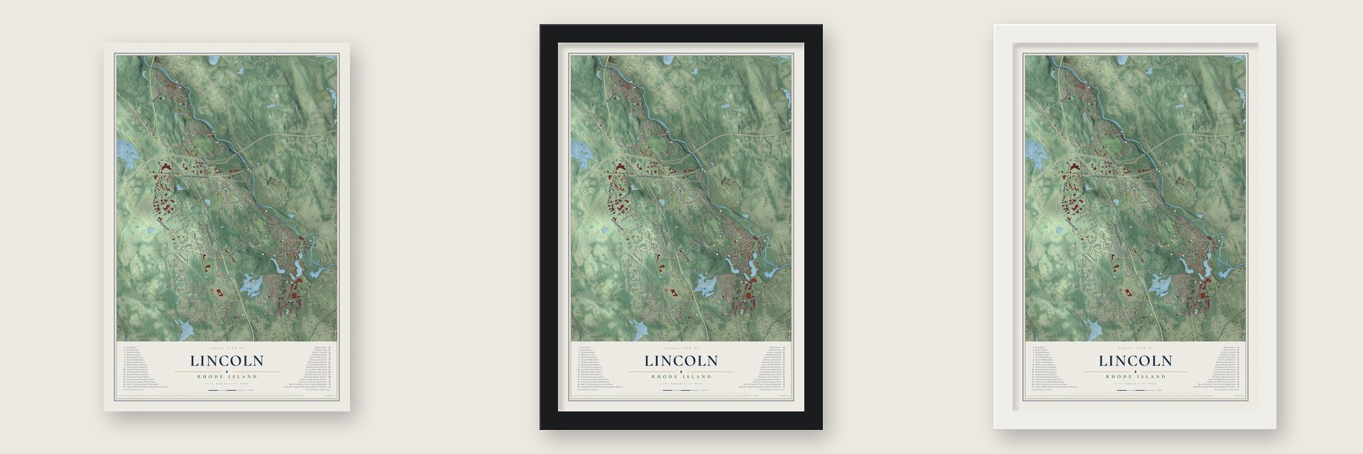
Unframed archival matte, a black wood frame or a white wood frame.
Up close
Geography Worth Displaying
This map was created using accurate cartographic data and authoritative geographic sources, including the U.S. Geological Survey (USGS) and FEMA. The map brings together terrain, waterways, roads, and building detail. The majority of the streets are labeled, houses are accurately depicted, and the topography is derived from government sources. Combining local data with carefully composed color and shading leads to this beautifully detailed Lincoln artwork for your wall.
Rather than simply showing street outlines, we’ve included as many of the street names as we could reasonably fit on the map while keeping their names legible. Zoom in on the high resolution preview to see exactly what’s on the map. We truly set out to create a statement piece for anyone who loves Lincoln. So whether it’s for you, or a gift for someone you love, we hope this map of Lincoln brings back fond memories.
Explore the full map of Lincoln, Rhode Island and read about the local places it shows.

Find your street
Names on the Lincoln map
Every name below is printed on this map. Look for your street, your school, the park where you played, or the pond down the road.
Places and landmarks7
- Chase Farm Park
- Lincoln Woods State Park
- Albion
- Lonsdale
- Sayles Bleachery
- Quinnville
- Lime Rock
Streets and roads168
- Old River Road
- Jenckes Hill Road
- River Road
- Breakneck Hill Road
- Front Street
- Smithfield Avenue
- Albion Road
- Eddie Dowling Highway
- George Washington Highway
- Old Louisquisset Pike
- Lonsdale Avenue
- Sayles Hill Road
- Great Road
- Lower River Road
- Anna Sayles Road
- Sherman Avenue
- Westwood Road
- Twin River Road
- School Street
- Maple Avenue
- Lincoln Woods Road
- Angell Road
- Wilbur Road
- Les Pawson Loop
- Cobble Hill Road
- New River Road
- Railroad Street
- Carriage Drive
- Paul Street
- Harris Avenue
Show all 168 streets
- Wellington Road
- Dexter Rock Road
- Powder Hill Road
- Reservoir Avenue
- Greenwood Lane
- Timberland Drive
- Southwick Drive
- Sylvia Lane
- Lennon Road
- Main Street
- Central Street
- Grove Street
- Progress Street
- Bridle Drive
- Holiday Drive
- Parker Street
- Amica Way
- Higginson Avenue
- Woodland Street
- Smith Street
- Industrial Circle
- Church Street
- Kendall Drive
- Paddock Drive
- Mark Drive
- High Street
- Whipple Road
- East Lantern Road
- Table Rock Road
- Walker Street
- Cullen Hill Road
- Longmeadow Road
- Pine Grove Avenue
- Rosewood Drive
- Boulevard Avenue
- Arnold Street
- Fair Oaks Drive
- Chestnut Street
- Ducarl Drive
- Maria Street
- Morgan Court
- Carol Drive
- Old Great Road
- Bernon Drive
- Heidi Road
- Ivy Place
- Pat Drive
- Earl Street
- John Street
- Old Jenckes Hill Road
- Blackstone Valley Place
- Briarwood Drive
- Red Brook Crossing
- Dennell Drive
- Great Meadows Lane
- East Butterfly Way
- Lampercock Lane
- Bouvier Avenue
- Moshassuck Valley Ind Highway
- South Eagle Nest Drive
- Wingate Road
- Joyce Anne Drive
- Musket Road
- Middle Street
- Graywood Drive
- Old Louis Quisset Pike
- Meadow Glen Drive
- Belmont Drive
- Mussey Brook Road
- Whalen Drive
- Garwaine Drive
- Lantern Road
- Princess Pine Road
- Olney Avenue
- Linfield Circle
- Foxwood Drive
- Old Main Street
- Cynthia Road
- Hood Drive
- Beverly Drive
- Andrews Drive
- Logan Drive
- Laurel Lane
- Thomas Drive
- Cooper Drive
- Linda Street
- Union Street
- Leslie Way
- Riata Drive
- Ledge Road
- Skyview Drive
- Rivet Drive
- Michael Drive
- Henry Drive
- Alern Way
- Elder Street
- Anne Drive
- Hope Street
- Chase Lane
- Almy Street
- Kirkbrae Drive
- Steeple Lane
- Mitris Boulevard
- Eagle Nest Drive
- Sables Way
- Vista Drive
- Stonybridge Drive
- Dario Drive
- Kilburn Avenue
- Cross Street
- Lower Road
- View Street
- Lladner Road
- Ballou Avenue
- Scott Drive
- Realm Court
- Park Way
- Lynn Lane
- Rockridge Road
- Prospect Street
- Pine Tree Lane
- Lori Ellen Drive
- Heritage Drive
- Wagon Wheel Lane
- Meader Pond Road
- Maple Street
- Edelweiss Avenue
- Elizabeth Drive
- Duxbury Court
- Cider Mill Lane
- Foxx Drive
- Whitman Way
- Tattersall Drive
- Meadow Road
- Ashley Drive
- Cliffside Drive
- Whitney Drive
- Cook Street
Names are listed as they appear on the printed map. Zoom into the product photos to find them.
About Lincoln, Rhode Island
Lincoln is a town of 22,529 people in Providence County, set along the western side of the Blackstone River just north of Providence. Settlers came in the 17th century under the Louisquisset grant, and the land belonged to Smithfield for generations. In 1871 it broke away as a separate town and took the name of Abraham Lincoln, and in 1895 Central Falls left Lincoln to become a city of its own.
Textile factories rose along the Blackstone, and by the late 19th century Lincoln had become an important mill town. The villages that grew up around those mills still give the town its neighborhoods: Saylesville, Lonsdale, Manville, Albion, Lime Rock, Fairlawn and Quinnville.
- Great Road, laid out in 1683In colonial days Great Road was the chief route tying Providence to Hartford and Worcester. Along the Moshassuck River it passes the Moffett Mill of 1812, the Israel Arnold House and Hearthside, a house built in 1810 for Stephen Smith, who opened that mill beside it a year later. One large stone-ender on the road, a house type with fieldstone end walls brought over from western England, has been dated to 1693 by its tree rings.
- A Quaker meetinghouse from 1703Quakers raised the Saylesville Meetinghouse on Great Road in 1703 and 1704, and it ranks among the oldest Friends meeting houses still standing in New England. Stephen Hopkins, who later signed the Declaration of Independence, wed Anna Smith there in 1755, and the abolitionist Elizabeth Buffum Chace was a member from 1836 to 1841. Friends still gather there to worship on Sunday mornings.
- Limestone at Lime RockQuarrying at Lime Rock began in the 17th century and has never stopped. Three colonial kilns survive from what was among the oldest lime processing works in North America, and the biggest, nearly 20 feet wide, stands near the Flanagan campus of the Community College of Rhode Island.
- The Sayles bleachery villageWilliam F. Sayles started the Sayles Bleacheries across from Bleachery Pond, and his son Frank built much of Saylesville to house the workers and managers. The company mixed up where matching houses stood, so the village escaped the identical rows of other mill towns. By the 1920s Frank Sayles had built the firm into one of the world's biggest textile finishing companies, and William Sayles paid for Memorial Hospital of Rhode Island in Pawtucket.
- A park for Lincoln's 100thIn 1908 Rhode Island purchased Quinsnicket Pond along with another 71 acres around it. The park opened to the public on February 12, 1909, exactly 100 years after Abraham Lincoln was born. Most people kept calling it Quinsnicket until the 1940s. Lincoln Woods State Park now covers 627 acres around Olney Pond, known for its giant glacial boulders, and H. P. Lovecraft spent summer days walking there.
Keep exploring Rhode Island
Lincoln is one of 86 Rhode Island towns we've mapped. Every dot on the map is a print of its own.
The search covers every state, Rhode Island first.
Near Lincoln
Order 2 or more town maps and save 10%. Shown in the size and finish you picked above, so they hang as a set.
- Ashton 12" x 18" / Archival Matte Print $39.99
- Saylesville 12" x 18" / Archival Matte Print $39.99
- Lonsdale 12" x 18" / Archival Matte Print $39.99


More maps nearby: Valley Falls, Central Falls, North Providence, Cumberland and Cumberland Hill.
The art of mapping a place
How This Map Was Made
Real places. Remarkable detail. Discover the layers that turn geographic data into a map of home.

The view from above
Aerial imagery reveals the character of the land: woodland, open fields, and the patterns of a place.

The shape of the land
Elevation data brings hills, valleys, and subtle changes in the landscape into view.

The details of home
Roads, waterways, and building footprints come together to make the map feel unmistakably local.

Geography becomes art
Considered color, shading, and typography bring the layers together in a map made for your wall.


Process illustrated with Mendon, Massachusetts. Aerial imagery: USDA NAIP. Terrain: USGS 3D Elevation Program. Map details and finished artwork: KNOWOL.
The Details
About This Print
Choose an archival matte print, or a black or white Ayous wood frame. The archival matte print is unframed.
Select your size and finish above to see the matching product image and price.
Materials & Craftsmanship
A contemporary map with the character of a classic atlas, printed on archival matte paper. Optional frames are made from Ayous wood.
Your printed map does not include the watermark shown in the full-map preview.
Shipping & Delivery
Free shipping within the United States. Every print is made to order in the USA.
Buying a gift? Add a note in your cart and we'll include it. We never put prices in the package.
Prints ship within 2 to 3 business days. Allow 7 to 10 days total from ordering for delivery. Timing may vary during holidays or periods of high order volume.
Read our shipping policy.
Returns and damaged prints
Each print is made to order. Change-of-mind refunds are not available after production.
If your print arrives damaged, misprinted or incorrect, contact support@knowol.com within 30 days of receiving it. Include your order number, photos and a description of the issue.
Read our full refund and replacement policy. For questions about your order, email support@knowol.com.