
Search for another town





Free U.S. delivery 7 to 10 days after you order
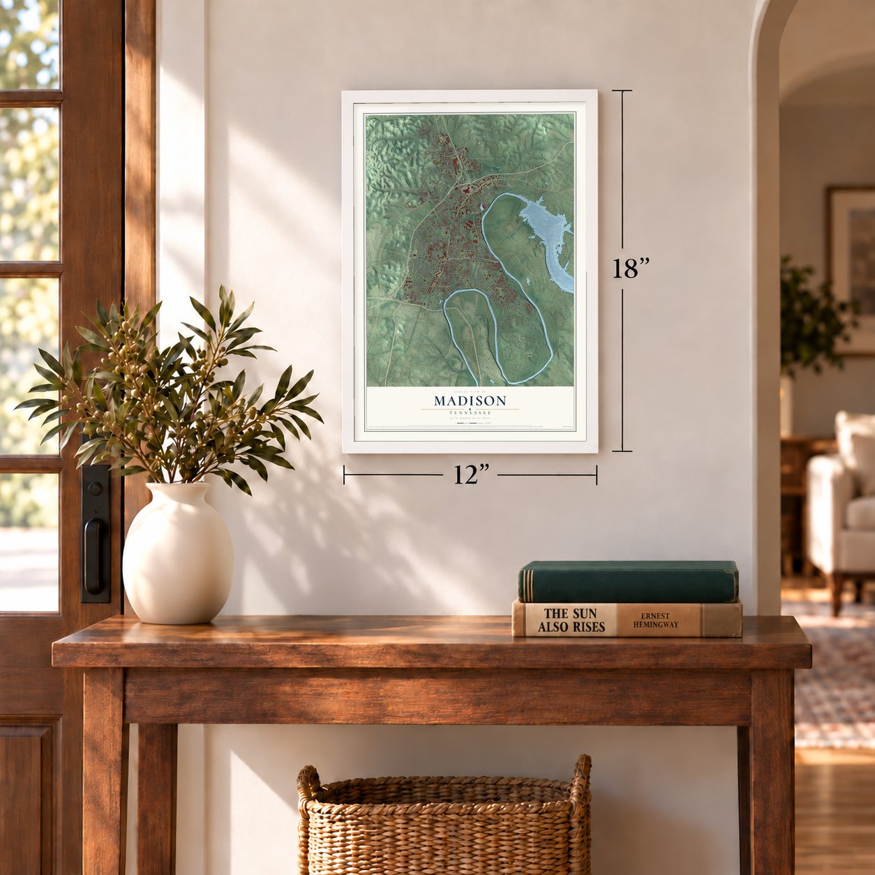
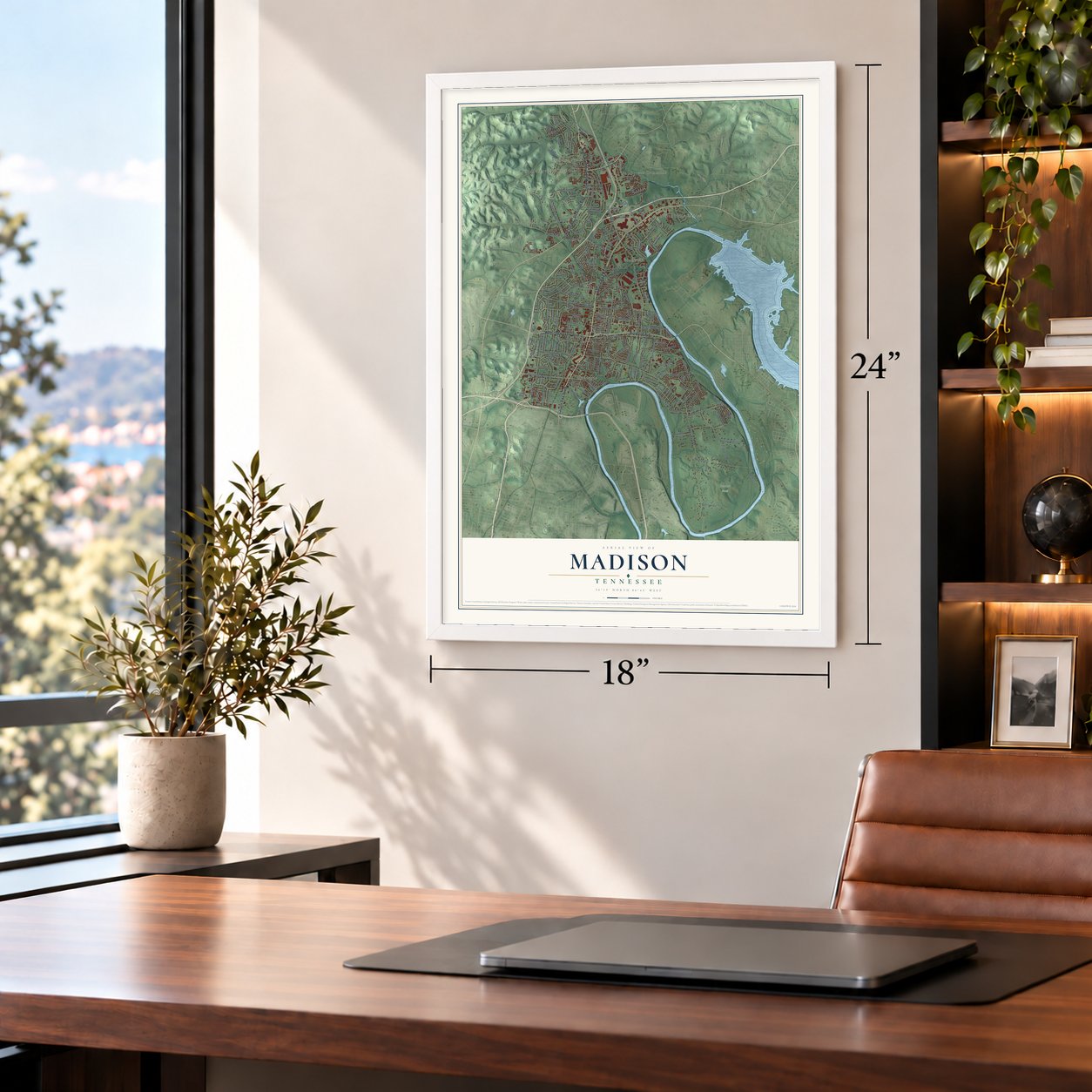
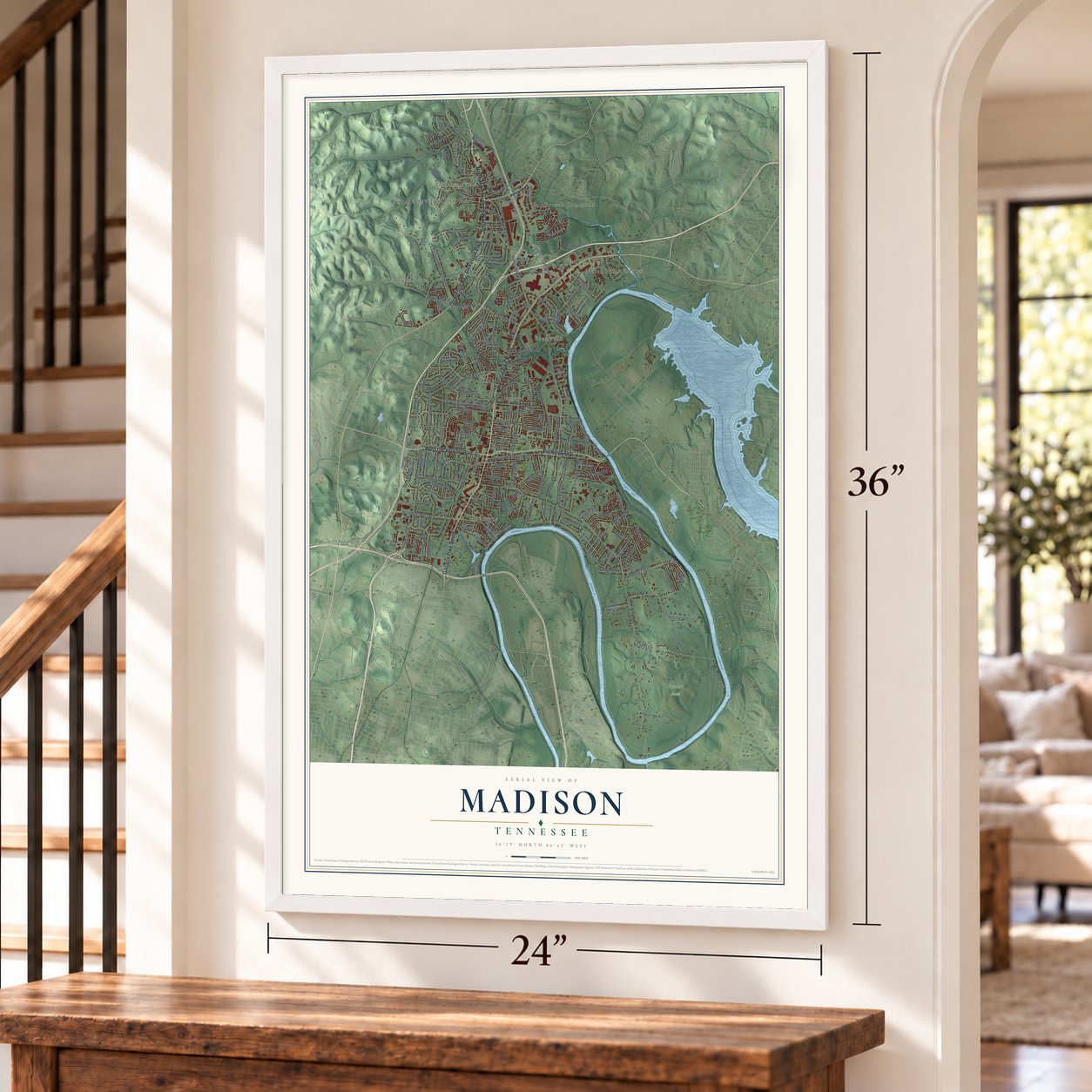
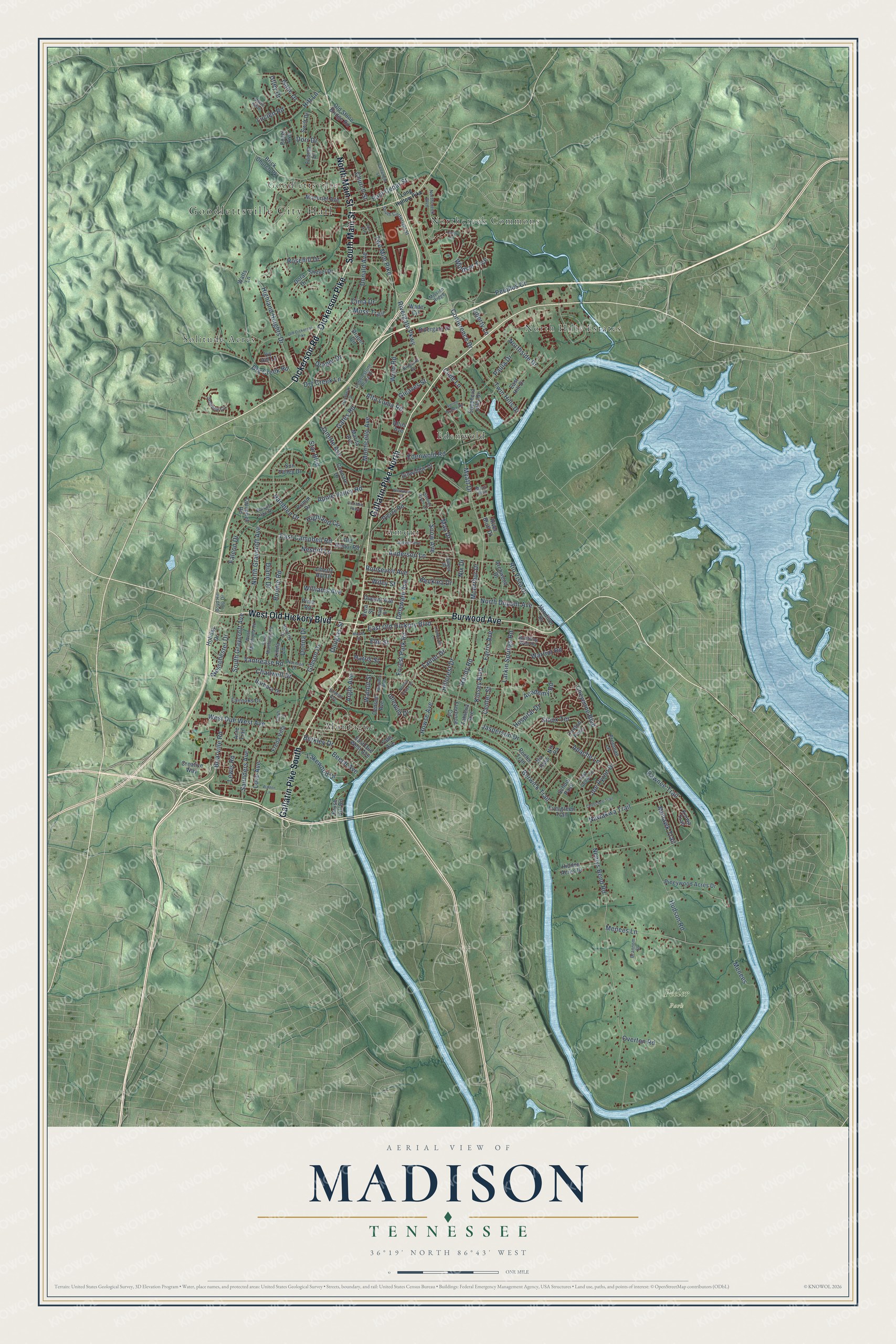
Madison, Tennessee Map Art
Building by building, with labeled streets and shaded relief.
12" x 18" Archival Matte Print
A Map of Home. A Work of Art.
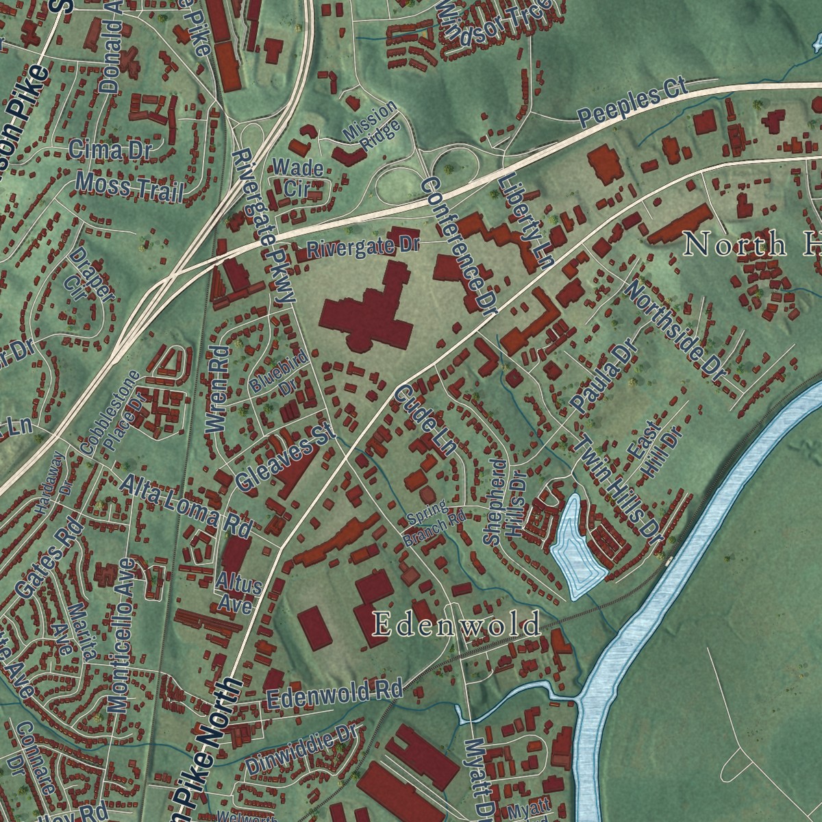
Explore Madison, Tennessee from a whole new perspective. Created using aerial imagery and detailed geographic data, this map captures Madison building by building, with labeled streets, familiar landmarks, and shaded topographical relief that highlights the natural contours of the landscape.
Combining modern data with the timeless character of a vintage atlas, this map is just as interesting up close as it is beautiful on the wall. Whether you grew up in Madison, spent memorable years there, or call it home today, this unique map is a great way to celebrate a place that means something to you. Zoom in on the preview to look for your street, and then order a print to put your memories on the wall.
Three ways to hang it
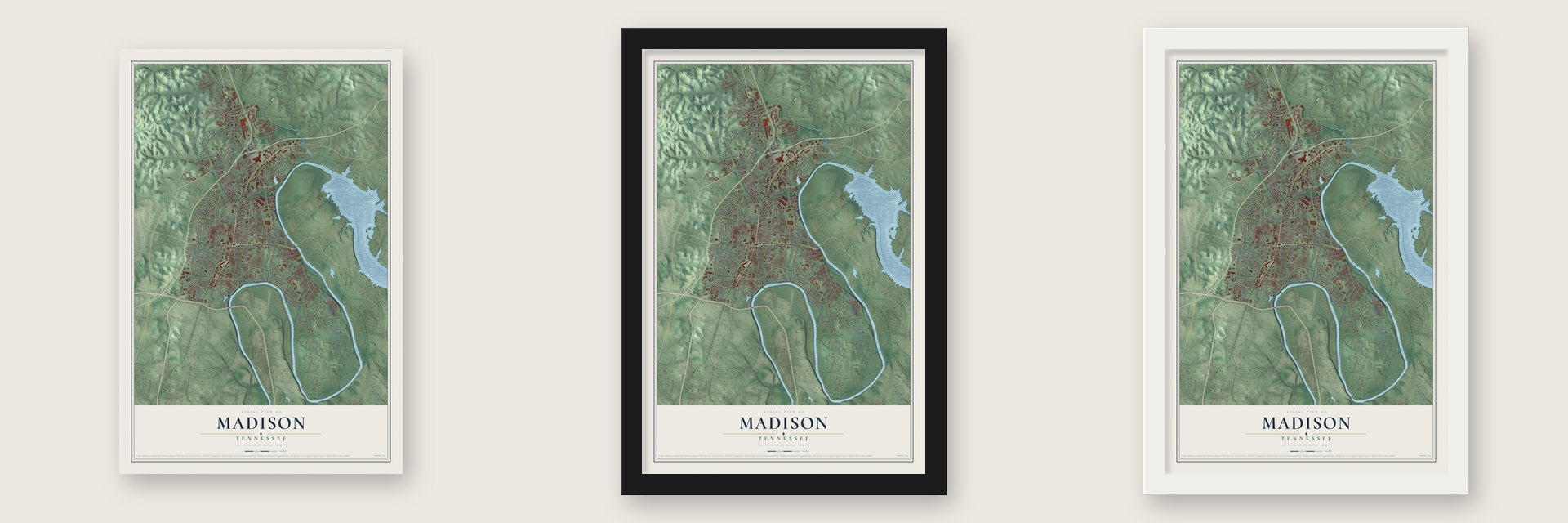
Unframed archival matte, a black wood frame or a white wood frame.
Up close
Geography Worth Displaying
This map was created using accurate cartographic data and authoritative geographic sources, including the U.S. Geological Survey and the Census Bureau. The map brings together terrain, waterways, roads, and building detail. The majority of the streets are labeled, houses are accurately depicted, and the topography is derived from government sources. Combining local data with carefully composed color and shading leads to this beautifully detailed Madison artwork for your wall.
Rather than simply showing street outlines, we’ve included as many of the street names as we could reasonably fit on the map while keeping their names legible. Zoom in on the high resolution preview to see exactly what’s on the map. We truly set out to create a statement piece for anyone who loves Madison. So whether it’s for you, or a gift for someone you love, we hope this map of Madison brings back fond memories.
Read the story behind this map: Detailed Map of Madison, Tennessee.

Find your street
Names on the Madison map
Every name below is printed on this map. Look for your street, your school, the park where you played, or the pond down the road.
Places and landmarks9
- Goodlettsville City Hall
- Peeler Park
- Amqui
- Montague
- Edenwold
- Solitude Acres
- North Hills Estates
- Northcreek Commons
- Goodlettsville
Streets and roads202
- Gallatin Pike North
- Gallatin Pike South
- West Old Hickory Boulevard
- North Main Street
- South Main Street
- Dickerson Pike
- Burwood Avenue
- Dickerson Road
- Rivergate Parkway
- Myatt Drive
- Moss Trail
- Janette Avenue
- Neelys Bend Road
- North Graycroft Avenue
- Cheyenne Boulevard
- East Old Hickory Boulevard
- Conference Drive
- East Campbell Road
- Pawnee Trail
- Berwick Trail
- Roosevelt Avenue
- Hudson Road
- Nesbitt Lane
- Saunders Avenue
- Anderson Lane
- Alta Loma Road
- Menees Lane
- North Dupont Avenue
- South Graycroft Avenue
- Apple Valley Road
Show all 202 streets
- West Due West Avenue
- Gibson Drive
- Hitt Lane
- Monticello Avenue
- Hamblen Drive
- Edenwold Road
- Chadwell Drive
- Larkin Springs Road
- Idlewild Drive
- Sioux Terrace
- Williams Avenue
- May Drive
- Ronnie Road
- Hospital Drive
- Nawakwa Trail
- Two Mile Pike
- Windsor Trce
- Argle Avenue
- Liberty Lane
- Twin Hills Drive
- Vantrease Road
- Randy Road
- East Cedar Street
- Lanier Drive
- Donald Avenue
- Utley Drive
- Star Boulevard
- Highland Heights Drive
- Hillcrest Drive
- Delaware Avenue
- Rosehill Drive
- Rio Vista Drive
- Warrior Road
- Wren Road
- Highland Circle
- Northside Drive
- Snow Avenue
- McArthur Drive
- Menees
- Gates Road
- Lakewood Drive
- Paula Drive
- Westchester Drive
- Briarville Road
- Dorr Drive
- Isaac Drive
- Joe Pyron Drive
- Becklea Drive
- Harris Street
- Peeples Court
- Howse Avenue
- Forest Park Road
- Cima Drive
- Dry Creek Road
- Dry Creek Lane
- Donna Drive
- Academy Road
- Jasperson Drive
- Mohawk Trail
- Center Street
- Kinsey Boulevard
- Church Street
- Apache Lane
- Overton Road
- Lewis Road
- Lucien Road
- Falcon Drive
- Diane Drive
- Gleaves Street
- Cude Lane
- Elm Street
- Nix Drive
- Farris Avenue
- Walnut Street
- Draper Drive
- Douglas Street
- Wiley Street
- Beech Avenue
- Berkley Drive
- Love Avenue
- Moncrief Avenue
- Campbell Road
- Pierce Road
- Canton Pass
- Shepherd Hills Drive
- Freda Villa
- Linda Lane
- East Due West Avenue
- Shevel Drive
- Archwood Drive
- Barbara Drive
- Peeler Trail
- Pineywood Acres Drive
- Ivy Hill Lane
- Rivergate Drive
- Fannin Drive
- Swift Drive
- Marita Avenue
- East Hill Drive
- Dupont Avenue
- Wade Circle
- Connare Drive
- Brick Church Pk
- Draper Circle
- Hidden Acres Drive
- Dinwiddie Drive
- Evergreen Trail
- Holiday Drive
- Creative Way
- Vandiver Drive
- School Pass
- Florence Circle
- Old Amqui Road
- Brush Hill Road
- Fairoaks Drive
- Freeman Lane
- Sun Valley Drive
- Old Stone Bridge Road
- Nix Pass
- Engel Avenue
- Tahlena Avenue
- Altus Avenue
- Denson Avenue
- Primm Drive
- Acre Trail
- Dora Drive
- Nix Pa
- River Bluff Drive
- Pima Road
- Liberty Hill Drive
- Falls Avenue
- Kiowa Trail
- Watts Lane
- Vera Street
- South Cartwright Street
- Woods Lake Drive
- Northcreek Boulevard
- Cobblestone Place Drive
- Emmitt Avenue
- Beverly Drive
- Sarver Avenue
- Solitude Circle
- West Marthona Road
- East Marthona Road
- Singer Drive
- East Cedar Lane
- Brannom Street
- Norman Drive
- Bluebird Drive
- Mission Ridge
- Boyd Hill Top Drive
- Bubbling Well Road
- Myatt Boulevard
- Stoney River Lane
- Cash Lane
- Kate Street
- Long Hollow Pike
- Old Dickerson Pike
- Walton Lane
- Lenox Place
- Madison Boulevard
- East Avenue
- Hardaway Drive
- Maple Street
- Cartwright Street
- Welworth Street
- Cheechee Trail
- One Mile Parkway
- Mystic Hill Drive
- Lombardia Lane
- Neelys Chase Drive
- Spring Branch Road
Names are listed as they appear on the printed map. Zoom into the product photos to find them.
About Madison, Tennessee
The Louisville and Nashville Railroad built the Amqui train station and used it until 1979. Country singer Johnny Cash then bought the station. He moved it to his home in nearby Sumner County. After the singer and his wife, June Carter Cash, both died, the depot came back to Madison. By 2016 it held a museum and visitor center.
A Civil War skirmish broke out at Madison. Col. George Dibrell's Confederate regiment fought a squad of Federal soldiers near the spot where his men had camped for the night. Dibrell then pulled his troops back toward Neely's Lick. One Confederate, a man named Goosetree, was killed.
Keep exploring Tennessee
Madison is one of 640 Tennessee towns we've mapped. Every dot on the map is a print of its own.
The search covers every state, Tennessee first.
Near Madison
Order 2 or more town maps and save 10%. Shown in the size and finish you picked above, so they hang as a set.
- Goodlettsville 12" x 18" / Archival Matte Print $39.99
- East Nashville 12" x 18" / Archival Matte Print $39.99
- Hendersonville 12" x 18" / Archival Matte Print $39.99


More maps nearby: Green Hill, Nashville, Shackle Island, Millersville and Ridgetop.
The art of mapping a place
How This Map Was Made
Real places. Remarkable detail. Discover the layers that turn geographic data into a map of home.

The view from above
Aerial imagery reveals the character of the land: woodland, open fields, and the patterns of a place.

The shape of the land
Elevation data brings hills, valleys, and subtle changes in the landscape into view.

The details of home
Roads, waterways, and building footprints come together to make the map feel unmistakably local.

Geography becomes art
Considered color, shading, and typography bring the layers together in a map made for your wall.


Process illustrated with Mendon, Massachusetts. Aerial imagery: USDA NAIP. Terrain: USGS 3D Elevation Program. Map details and finished artwork: KNOWOL.
The Details
About This Print
Choose an archival matte print, or a black or white Ayous wood frame. The archival matte print is unframed.
Select your size and finish above to see the matching product image and price.
Materials & Craftsmanship
A contemporary map with the character of a classic atlas, printed on archival matte paper. Optional frames are made from Ayous wood.
Your printed map does not include the watermark shown in the full-map preview.
Shipping & Delivery
Free shipping within the United States. Every print is made to order in the USA.
Buying a gift? Add a note in your cart and we'll include it. We never put prices in the package.
Prints ship within 2 to 3 business days. Allow 7 to 10 days total from ordering for delivery. Timing may vary during holidays or periods of high order volume.
Read our shipping policy.
Returns and damaged prints
Each print is made to order. Change-of-mind refunds are not available after production.
If your print arrives damaged, misprinted or incorrect, contact support@knowol.com within 30 days of receiving it. Include your order number, photos and a description of the issue.
Read our full refund and replacement policy. For questions about your order, email support@knowol.com.