
Search for another town





Free U.S. delivery 7 to 10 days after you order
East Nashville, Tennessee Map Art
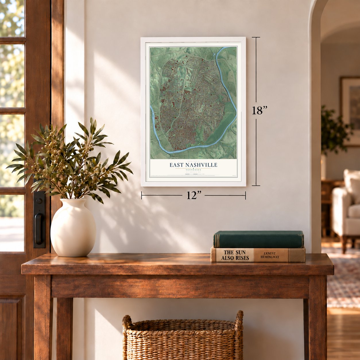
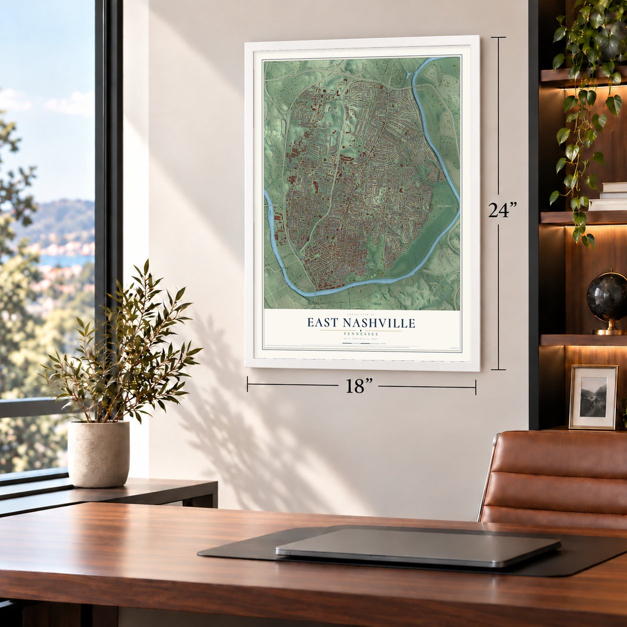
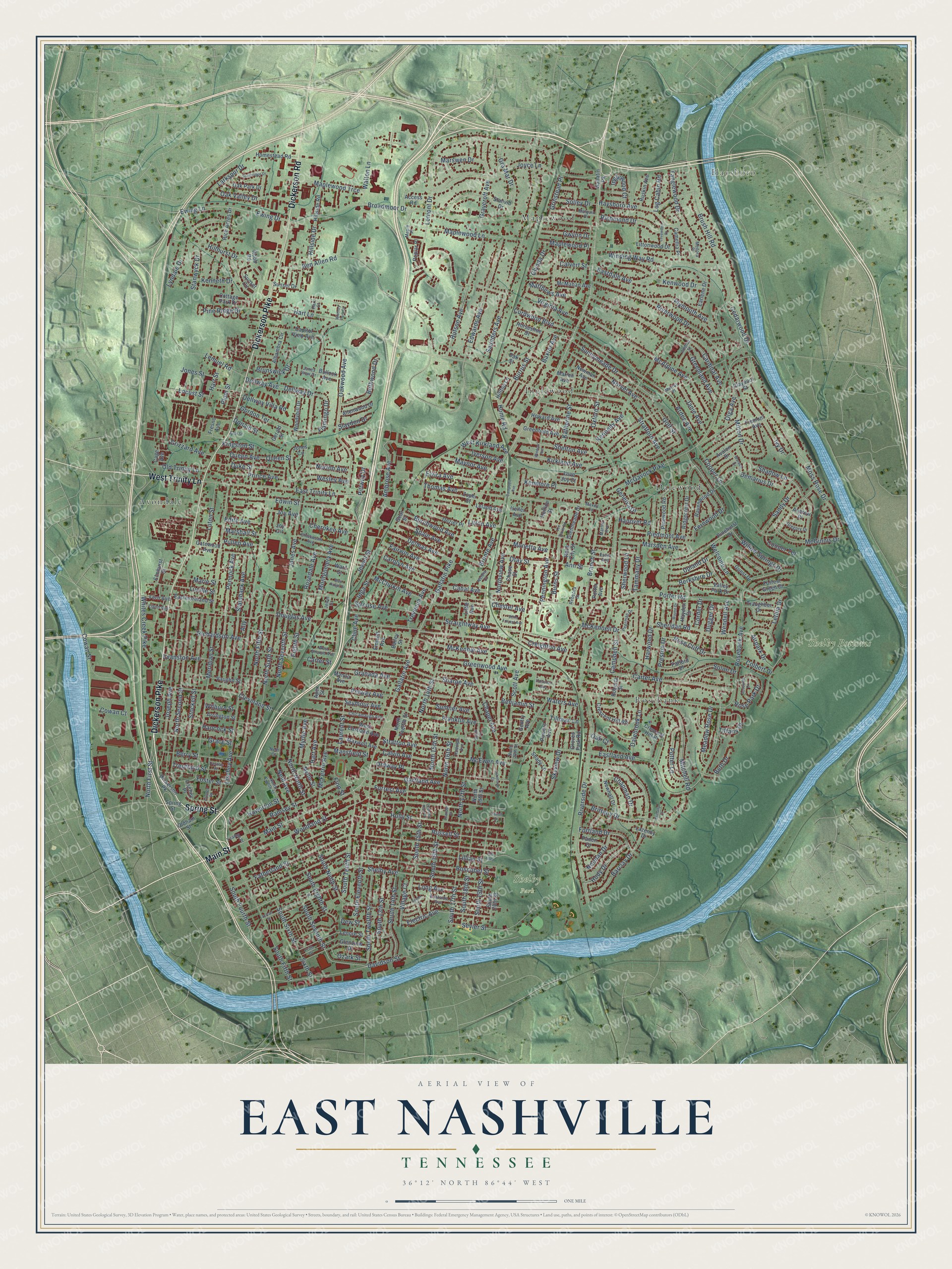
A new map of East Nashville, Tennessee, made in 2026 and printed to order on thick archival matte paper.
12" x 18" Archival Matte Print
A Map of Home. A Work of Art.
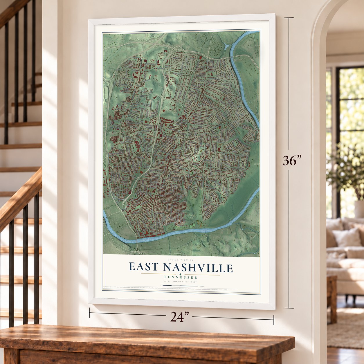
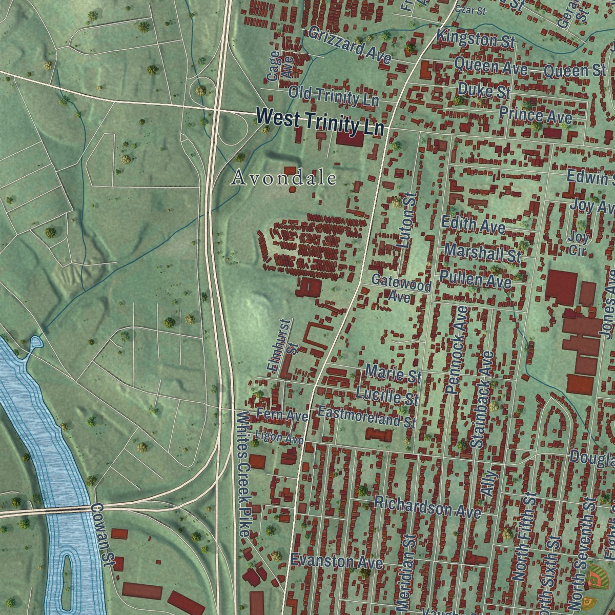
Explore East Nashville, Tennessee from a whole new perspective. Created using aerial imagery and detailed geographic data, this map captures East Nashville building by building, with labeled streets, familiar landmarks, and shaded topographical relief that highlights the natural contours of the landscape.
Combining modern data with the timeless character of a vintage atlas, this map is just as interesting up close as it is beautiful on the wall. Whether you grew up in East Nashville, spent memorable years there, or call it home today, this unique map is a great way to celebrate a place that means something to you. Zoom in on the preview to look for your street, and then order a print to put your memories on the wall.
Three ways to hang it
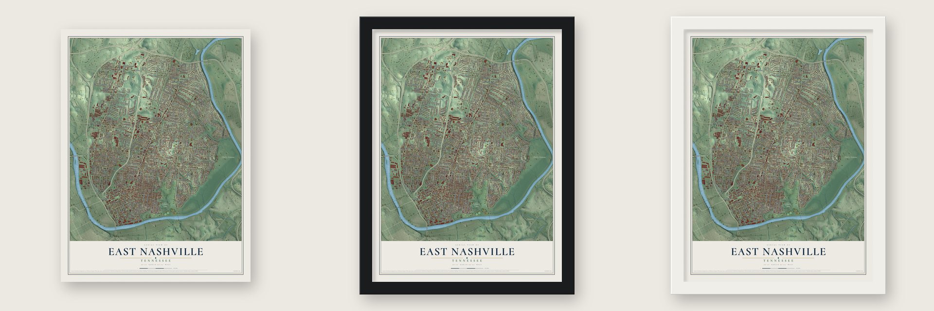
Unframed archival matte, a black wood frame or a white wood frame.
Up close
Geography Worth Displaying
This map was created using accurate cartographic data and authoritative geographic sources, including the U.S. Geological Survey and the Census Bureau. The map brings together terrain, waterways, roads, and building detail. The majority of the streets are labeled, houses are accurately depicted, and the topography is derived from government sources. Combining local data with carefully composed color and shading leads to this beautifully detailed East Nashville artwork for your wall.
Rather than simply showing street outlines, we’ve included as many of the street names as we could reasonably fit on the map while keeping their names legible. Zoom in on the high resolution preview to see exactly what’s on the map. We truly set out to create a statement piece for anyone who loves East Nashville. So whether it’s for you, or a gift for someone you love, we hope this map of East Nashville brings back fond memories.
Read the story behind this map: Detailed Map of East Nashville, Tennessee.

Find your street
Names on the East Nashville map
Every name below is printed on this map. Look for your street, your school, the park where you played, or the pond down the road.
Places and landmarks8
- Haysboro
- Shelby Park
- Shelby Bottoms
- Avondale
- Inglewood
- Rosebank
- Maplewood
- Dalewood
Streets and roads426
- Dickerson Pike
- Spring Street
- Main Street
- West Trinity Lane
- Dickerson Road
- Gallatin Pike
- Gallatin Avenue
- Cahal Avenue
- North First Street
- South Tenth Street
- Walton Lane
- Maplewood Lane
- Shelby Avenue
- Davidson Street
- Ben Allen Road
- Joyce Lane
- Maplewood Trce
- Lemont Drive
- Chester Avenue
- Myrtle Avenue
- South Fourth Street
- Riverside Drive
- Eastland Avenue
- Douglas Avenue
- Rosebank Avenue
- McGavock Pike
- Meridian Street
- Broadmoor Drive
- Woodland Street
- Porter Road
Show all 426 streets
- Jones Avenue
- Lischey Avenue
- Hart Lane
- Stratford Avenue
- Fatherland Street
- East Trinity Lane
- Riverwood Drive
- Russell Street
- Greenwood Avenue
- Saunders Avenue
- Scott Avenue
- Joseph Avenue
- Boscobel Street
- Moss Rose Drive
- Brush Hill Road
- Shadow Lane
- Barclay Drive
- Cowan Street
- Cooper Lane
- North 14th Street
- McFerrin Avenue
- Lillian Street
- Cleveland Street
- Sharpe Avenue
- Carter Avenue
- Greenland Avenue
- Burrus Street
- North Second Street
- Litton Avenue
- McAlpine Avenue
- Preston Drive
- North 16th Street
- Ardee Avenue
- North Fifth Street
- Shelton Avenue
- South 14th Street
- North Sixth Street
- Oakwood Avenue
- Chapel Avenue
- Straightway Avenue
- Kennedy Avenue
- South Fifth Street
- Richardson Avenue
- South Eleventh Street
- Stockell Street
- Ordway Place
- Holly Street
- Seymour Avenue
- Evanston Avenue
- Skyview Drive
- South Seventh Street
- Forrest Avenue
- Edwards Avenue
- Hutson Avenue
- Brittany Drive
- Pennock Avenue
- Stainback Avenue
- Winding Way Road
- Norvel Avenue
- Sevier Street
- Edwin Street
- South Twelfth Street
- Granada Avenue
- Kenwood Drive
- Hillhurst Drive
- South 15th Street
- McKennell Drive
- Virginia Avenue
- Lemuel Road
- Kirkland Avenue
- Pennington Avenue
- North Seventh Street
- South 19th Street
- Fernwood Drive
- Ewing Drive
- Ewing Lane
- South 13th Street
- South 16th Street
- Branch Street
- Benjamin Street
- Mitchell Road
- Franklin Avenue
- South Sixth Street
- Sunnymeade Drive
- North Ninth Street
- Log Cabin Road
- Katherine Street
- Cherokee Avenue
- Lyndale Drive
- South 18th Street
- Golf Street
- Laurent Street
- Haysboro Avenue
- South 17th Street
- Tammany Drive
- Delmas Avenue
- Mansfield Street
- Electric Avenue
- Stanwyck Drive
- Montgomery Avenue
- Welcome Lane
- Graycroft Avenue
- Neill Avenue
- South Eighth Street
- Gartland Avenue
- Upland Drive
- South Ninth Street
- Ivy Drive
- Petway Avenue
- Sheridan Road
- Hancock Street
- Baxter Avenue
- Long Avenue
- Oxford Street
- McKennie Avenue
- Milton Drive
- Marsden Avenue
- North 17th Street
- Eastdale Avenue
- Hillside Drive
- Oak Valley Drive
- Cardinal Avenue
- Whites Creek Pike
- Brunswick Drive
- Kenmore Place
- Grace Street
- Marie Street
- Piedmont Avenue
- Gra Mar Drive
- Plymouth Avenue
- Queen Avenue
- Duke Street
- Matthews Avenue
- Ambrose Avenue
- Bronte Avenue
- Strouse Avenue
- Bethwood Drive
- Fortland Drive
- Harwood Drive
- Dellway Avenue
- Dellway Drive
- Stratton Avenue
- Fairwin Avenue
- Pine Ridge Drive
- Richmond Drive
- Maplewood Place
- Creighton Avenue
- Inga Street
- Northview Avenue
- Potter Lane
- Rosedale Avenue
- Kenneth Drive
- Burns Street
- Lucille Street
- Willow Springs Drive
- Demarius Drive
- Rose Park Drive
- McGinnis Drive
- Luton Street
- Elvira Avenue
- Curdwood Boulevard
- McEwen Avenue
- Carolyn Avenue
- Gordon Terrace
- Meadow Rose Drive
- Spain Avenue
- Burchwood Avenue
- Tanglewood Drive
- Berry Street
- Larkspur Drive
- Rose Cliff Drive
- Ramsey Street
- Dalebrook Lane
- Hody Drive
- Colbert Drive
- Sandy Drive
- Thomas Avenue
- Solon Drive
- Flamingo Drive
- Prince Avenue
- Calvin Avenue
- Donald Street
- Jewell Street
- Maynor Avenue
- Chapman Drive
- Janie Avenue
- Old Trinity Lane
- West Kirkland Avenue
- Gwynn Drive
- McClurkin Avenue
- Dugger Drive
- Locust Street
- North 15th Street
- Airpark Drive
- Cedarwood Drive
- Howerton Street
- Dew Street
- Sumner Avenue
- Marswen Drive
- Slaydon Drive
- Cowan Court
- Inglewood Court
- Grizzard Avenue
- Berkshire Drive
- Noonan Drive
- Corder Drive
- Grinstead Place
- Waters Avenue
- Dellway Villa Road
- Wesley Avenue
- Monetta Avenue
- Sherwood Lane
- Norton Avenue
- Village Court
- Hart Avenue
- Otay Street
- Ann Street
- Iverson Avenue
- Tillman Lane
- Solley Drive
- Hart Street
- Campbell Street
- Trevecca Avenue
- Lethia Drive
- Home Road
- Ozark Street
- Eighth Street
- Edith Avenue
- Marshall Street
- Pullen Avenue
- Plum Street
- Foster Street
- Geneiva Drive
- Pittway Drive
- Queen Street
- Cooper Terrace
- Calvert Street
- Hanover Road
- Beth Drive
- Olga Avenue
- Treutland Street
- Glynda Drive
- Jones Street
- Wendell Avenue
- Cline Avenue
- Ally
- Kingston Street
- Wilburn Street
- Joy Avenue
- Carter Street
- Tiffany Drive
- Sixth Street
- Finn Street
- Oak Court
- Gallatin Pk
- South 20th Street
- Newman Avenue
- North Twelfth Street
- Lenore Street
- Greenfield Avenue
- West Eastland Avenue
- Hillside Road
- Pinehurst Drive
- Howard Avenue
- Crescent Hill Road
- Sunset Circle
- Rich Acres Drive
- Stanvid Drive
- Ridgecrest Drive
- Alhambra Circle
- Newhall Drive
- Gatewood Avenue
- Emmett Avenue
- Bailey Street
- Lischey Place
- Dickerson Pk
- Avalon Drive
- Oak Street
- Horseshoe Drive
- McMahan Avenue
- Vaughn Street
- Jones Circle
- Arrington Street
- Woodyhill Drive
- Ravenwood Drive
- Ruskin Avenue
- Maxwell Avenue
- Dozier Place
- Earlene Drive
- Gentry Avenue
- Sunset Drive
- Valley Park Drive
- Homestead Road
- Powers Avenue
- Hayden Drive
- Shady Lane
- Glenview Drive
- Eastmoreland Street
- Ward Street
- Pinewood Road
- Capitol View Avenue
- Elmhurst Street
- Joy Circle
- Oak Park Drive
- Zophi Street
- Forrest Green Drive
- Cottage Park Drive
- Fremont Avenue
- Guest Drive
- Allenwood Drive
- Glenmeade Drive
- Traughber Drive
- Fern Avenue
- Littonwood Drive
- Huffine Street
- Andrew Place
- Pafford Drive
- Paden Drive
- Groves Park Road
- Poplar Place
- Camellia Place
- North 18th Street
- Leland Avenue
- Love Joy Court
- Bullock Avenue
- Chase Street
- Access Road
- Rock City Street
- Myrtle Street
- Roberta Street
- Hilltop Lane
- Crescent Hill Place
- Porter Avenue
- Claypool Street
- Apex Street
- Lazenby Drive
- Little Avenue
- Oldham Street
- Marion Avenue
- Keller Avenue
- Fresno Avenue
- Gear Street
- Manila Avenue
- Gerald Street
- Cage Avenue
- Robb Road
- Eastside Avenue
- Chickasaw Avenue
- Murray Place
- Chicamauga Avenue
- North Eighth Street
- Malquin Drive
- Martha Avenue
- Frith Drive
- Rudolph Avenue
- Addine Street
- North 20th Street
- Peerman Drive
- Maple Place
- Ligon Avenue
- Rebecca Street
- West Sharpe Avenue
- Gregory Drive
- Yeaman Place
- Neldia Court
- Essex Avenue
- Foster Place
- Jones View Drive
- Medora Place
- Maxey Lane
- Hart Court
- Jewel Street
- Neill Court
- Sylvan Street
- Lakehurst Drive
- Setliff Place
- Southridge Drive
- Blue Ridge Drive
- Lee Davis Road
- Sevier Court
- Belle Forrest Avenue
- Wayne Drive
- Warden Drive
- Lovewood Drive
- Roseview Drive
- Campbell Avenue
- Treutlan Place
- Pontotoc Avenue
- Lindsley Park Drive
- Whitney Park Drive
- Evander Street
- Brittany Court
- Windsor Avenue
- Czar Street
- Oakhill Drive
- 735 Alley
Names are listed as they appear on the printed map. Zoom into the product photos to find them.
The art of mapping a place
How This Map Was Made
Real places. Remarkable detail. Discover the layers that turn geographic data into a map of home.

The view from above
Aerial imagery reveals the character of the land: woodland, open fields, and the patterns of a place.

The shape of the land
Elevation data brings hills, valleys, and subtle changes in the landscape into view.

The details of home
Roads, waterways, and building footprints come together to make the map feel unmistakably local.

Geography becomes art
Considered color, shading, and typography bring the layers together in a map made for your wall.


Process illustrated with Mendon, Massachusetts. Aerial imagery: USDA NAIP. Terrain: USGS 3D Elevation Program. Map details and finished artwork: KNOWOL.
The Details
About This Print
Choose an archival matte print, or a black or white Ayous wood frame. The archival matte print is unframed.
Select your size and finish above to see the matching product image and price.
Materials & Craftsmanship
A contemporary map with the character of a classic atlas, printed on archival matte paper. Optional frames are made from Ayous wood.
Your printed map does not include the watermark shown in the full-map preview.
Shipping & Delivery
Free shipping within the United States. Every print is made to order in the USA.
Buying a gift? Add a note in your cart and we'll include it. We never put prices in the package.
Prints ship within 2 to 3 business days. Allow 7 to 10 days total from ordering for delivery. Timing may vary during holidays or periods of high order volume.
Read our shipping policy.
Returns and damaged prints
Each print is made to order. Change-of-mind refunds are not available after production.
If your print arrives damaged, misprinted or incorrect, contact support@knowol.com within 30 days of receiving it. Include your order number, photos and a description of the issue.
Read our full refund and replacement policy. For questions about your order, email support@knowol.com.
Find your town
Looking for another city?
Find a map of home in our Tennessee collection, or any town in the country.
Nearby
Maps of towns near East Nashville
Know someone from one of these towns? Their map makes a great gift.
 Nashville
, Tennessee
From $39.99See the map
 Madison
, Tennessee
From $39.99See the map
 Berry Hill
, Tennessee
From $39.99See the map
More maps nearby: Goodlettsville, Oak Hill, Belle Meade, Green Hill and Hendersonville.