
Search for another town


Free U.S. delivery 7 to 10 days after you order
Nashville, Tennessee Map Art
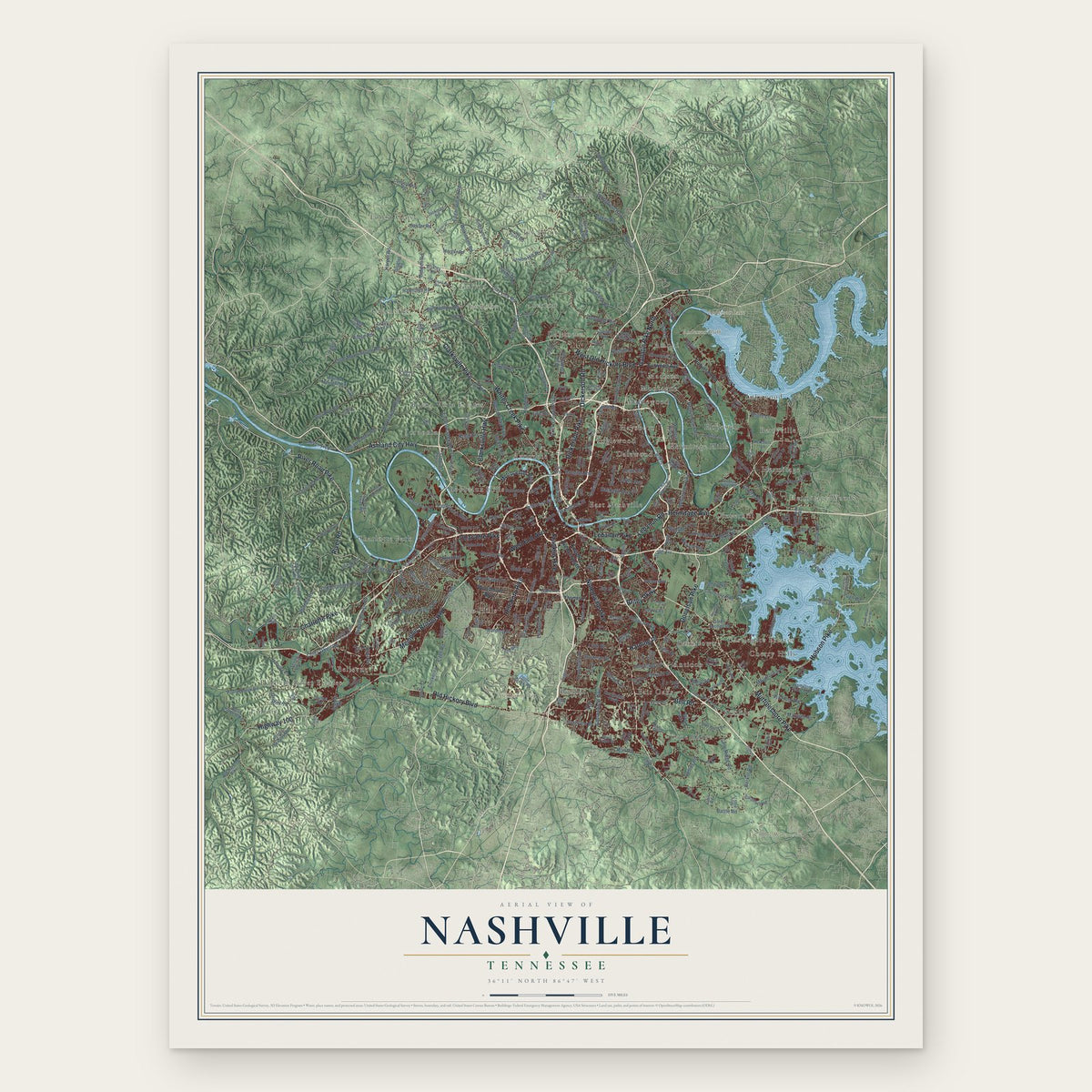
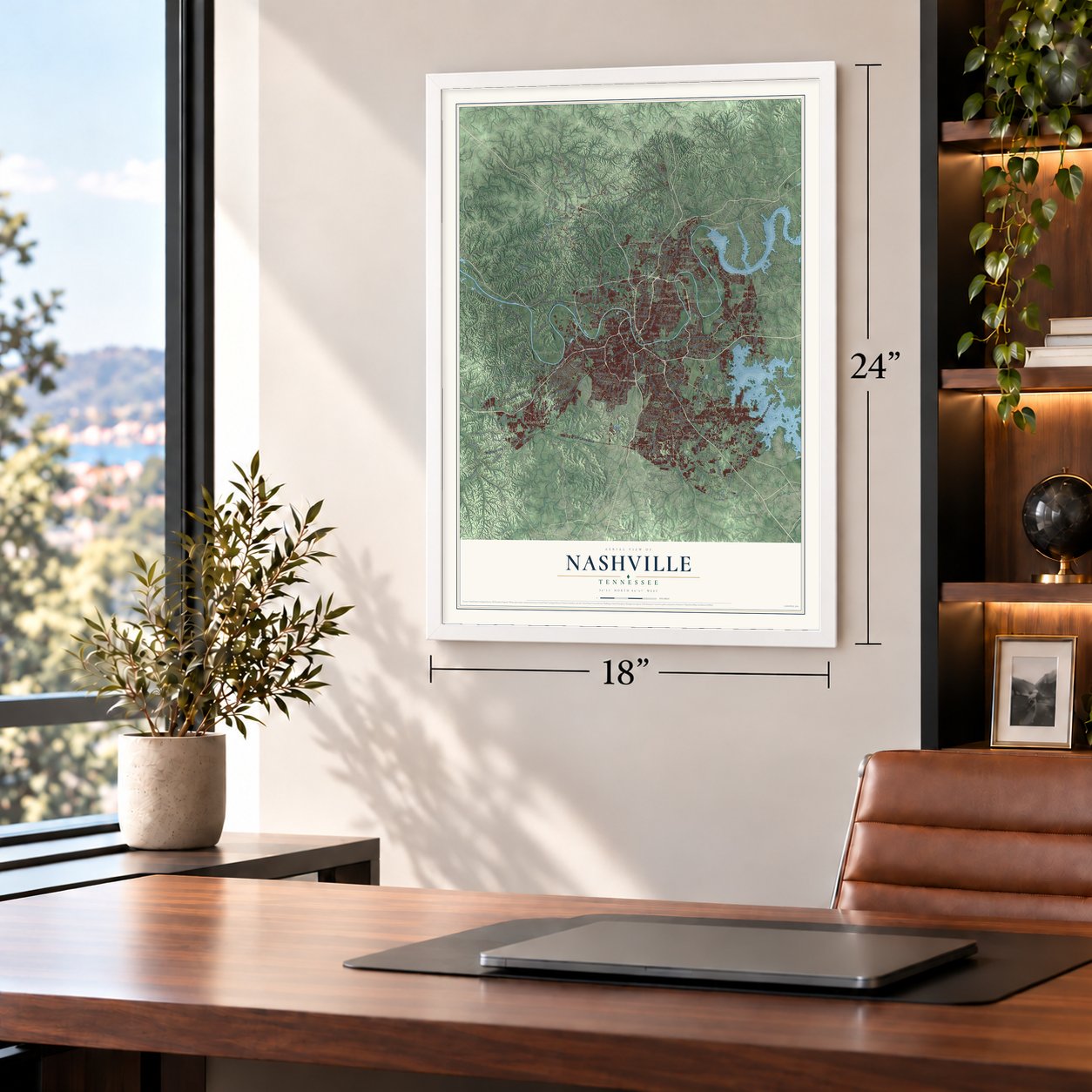
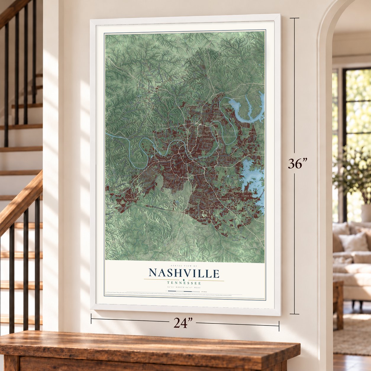
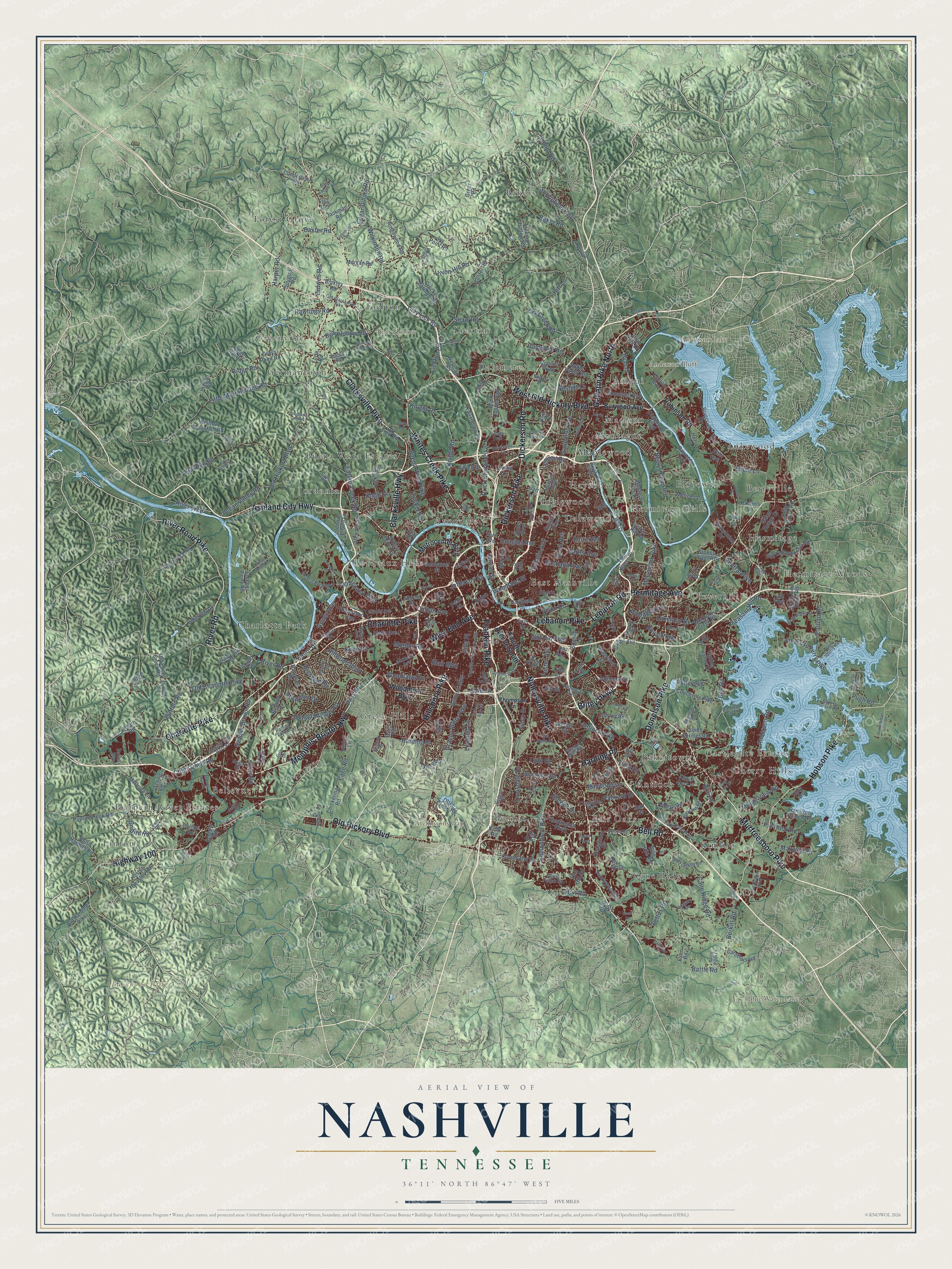
A new map of Nashville, Tennessee, made in 2026 and printed to order on thick archival matte paper.
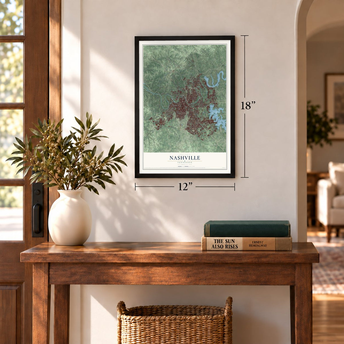
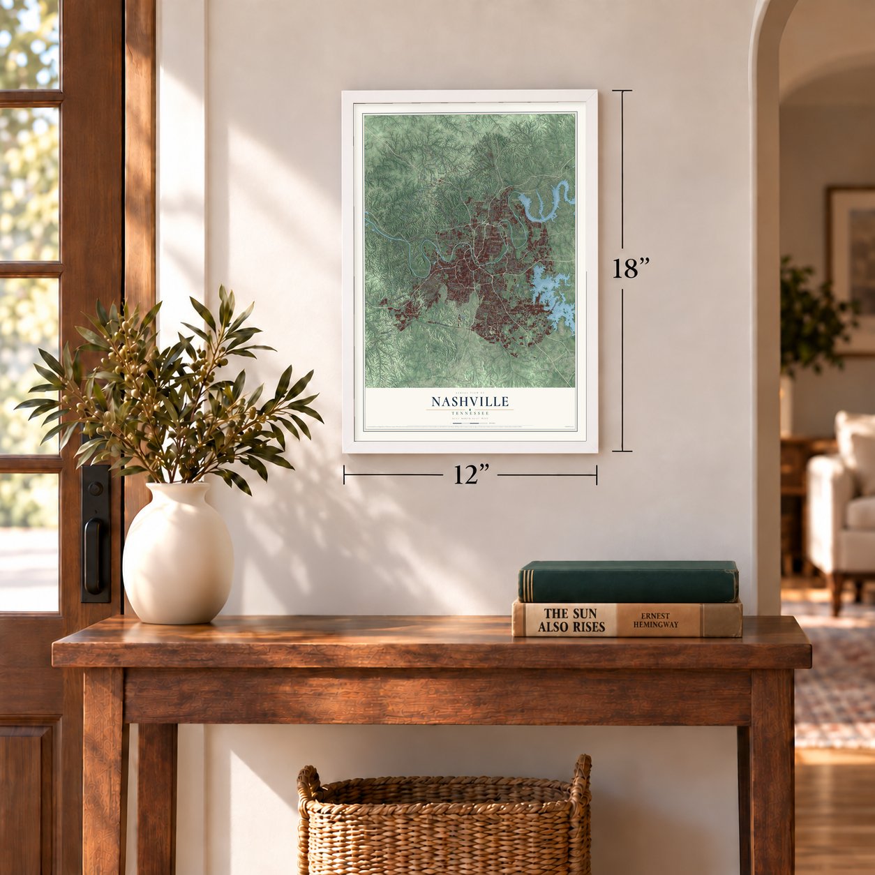
12" x 18" Archival Matte Print
A Map of Home. A Work of Art.
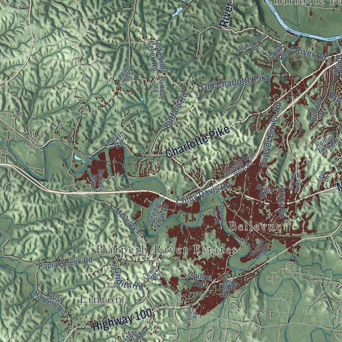
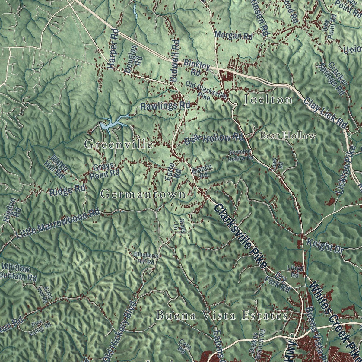
Explore Nashville, Tennessee from a whole new perspective. Created using aerial imagery and detailed geographic data, this map captures Nashville building by building, with labeled streets, familiar landmarks, and shaded topographical relief that highlights the natural contours of the landscape.
Combining modern data with the timeless character of a vintage atlas, this map is just as interesting up close as it is beautiful on the wall. Whether you grew up in Nashville, spent memorable years there, or call it home today, this unique map is a great way to celebrate a place that means something to you. Zoom in on the preview to look for your street, and then order a print to put your memories on the wall.
Three ways to hang it
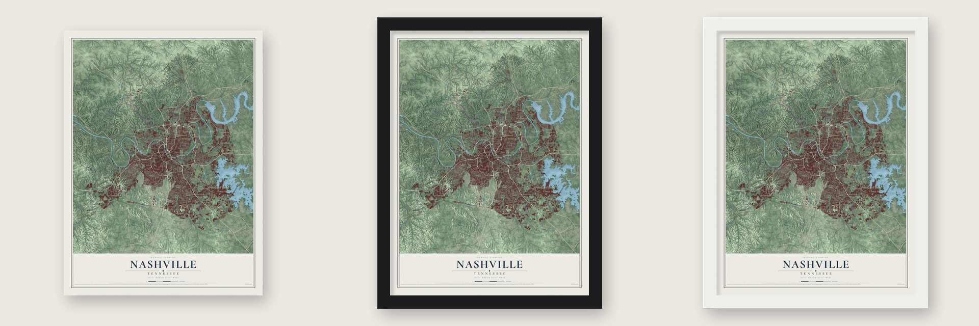
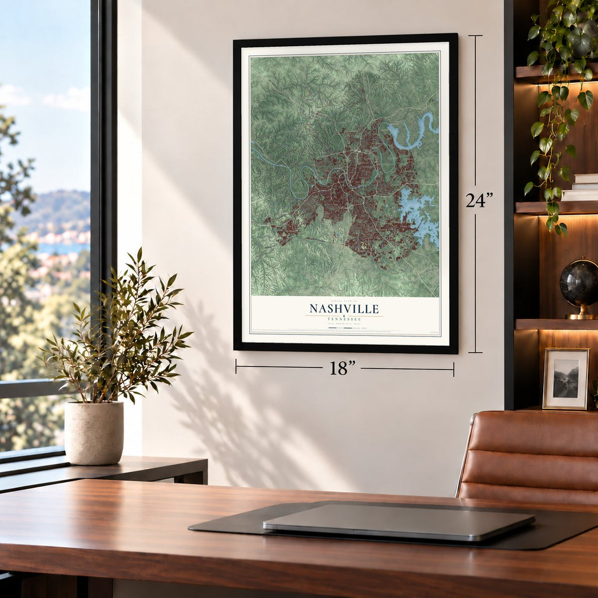
Unframed archival matte, a black wood frame or a white wood frame.
Up close
Geography Worth Displaying
This map was created using accurate cartographic data and authoritative geographic sources, including the U.S. Geological Survey and the Census Bureau. The map brings together terrain, waterways, roads, and building detail. The majority of the streets are labeled, houses are accurately depicted, and the topography is derived from government sources. Combining local data with carefully composed color and shading leads to this beautifully detailed Nashville artwork for your wall.
Rather than simply showing street outlines, we’ve included as many of the street names as we could reasonably fit on the map while keeping their names legible. Zoom in on the high resolution preview to see exactly what’s on the map. We truly set out to create a statement piece for anyone who loves Nashville. So whether it’s for you, or a gift for someone you love, we hope this map of Nashville brings back fond memories.
Read the story behind this map of Nashville, Tennessee from 2026.

About Nashville, Tennessee
Nashville is the capital of Tennessee and the seat of Davidson County, a city of 689,447 people on the Cumberland River. French traders came first. In 1714 Charles Charleville set up a trading post where downtown stands today, and the spot became known as French Lick. The traders bought furs from Native Americans, but by the 1740s most of them had left.
In 1779 a party sent by Judge Richard Henderson and led by James Robertson and John Donelson reached French Lick and built Fort Nashborough. The North Carolina General Assembly, meeting in Hillsborough, chartered the town on April 19, 1784, and named it for Francis Nash, a Revolutionary War hero. By 1800 it had 345 residents, 136 of them enslaved. Nashville became a city in 1806, and in 1843 it was made the permanent state capital after Knoxville, Kingston and Murfreesboro had each held that role.
- The first capital to fallThe river port and rail lines made Nashville a prize in the Civil War. After the Confederacy lost the Battle of Fort Donelson in February 1862, Nashville became the first Confederate state capital taken by U.S. troops. Confederate forces tried to win it back at the Battle of Nashville on December 15 and 16, 1864, and failed. It was one of the most decisive Union victories of the war.
- Jubilee Singers on tour, 1871After the war, the Fisk Jubilee Singers of Fisk University began touring the United States and Europe in 1871, singing Negro spirituals. Their concerts won praise overseas and raised money the university needed. Jubilee Hall at Fisk is now on the National Register.
- Music City since 1950The Grand Ole Opry began in 1925 and drew country musicians to town. By the late 1940s, recording studios were opening to record its performers. In 1950 WSM radio announcer David Cobb, speaking off the cuff, called the city Music City, and people still call it that. The Ryman Auditorium, RCA Studio B and the Grand Ole Opry House are all on the National Register.
- Jefferson StreetJefferson Street grew into the center of Black life in Nashville. The Tennessee Agricultural and Industrial and Normal School moved there in 1912. The first Prince's Hot Chicken Shack opened at Jefferson and 28th Avenue in 1945. The street drew jazz and blues musicians until the federal government built Interstate 40 through the area in the late 1960s and split it apart.
- A Parthenon in Centennial ParkNashville is sometimes called the Athens of the South because it has so many colleges, among them Vanderbilt, Fisk, Tennessee State and Belmont. In the prosperous years after the Civil War, the city built a copy of the Parthenon in Centennial Park, near downtown. The Parthenon is now on the National Register.
Find your street
Names on the Nashville map
Every name below is printed on this map. Look for your street, your school, the park where you played, or the pond down the road.
Places and landmarks47
- Anderson Bluff
- Atchinsons Gap
- Backbone Ridge
- Bear Hollow
- Anderson Lake
- Blue Water Lake
- Amqui
- Antioch
- Avondale
- Bakers
- Bakertown
- Bellevue
Show all 47 places
- Benbar
- Berryville
- Bordeaux Hills
- Buena Vista Estates
- Cane Ridge
- Castlegate Estates
- Charlotte Park
- Cherry Hills
- Cloverhill
- Dalemere
- Dalewood
- East Nashville
- Fair Oaks
- Forest Grove
- Germantown
- Green Hills
- Greenville
- Harpeth River Estates
- Haysboro
- Hermitage
- Hermitage Hills
- Hermitage Woods
- Hopewell
- Inglewood
- Ivy Point
- Joelton
- Jordonia
- Kimbro
- Lakewood
- Lickton
- Linton
- Madison
- Maplewood
- Montague
- Brick Church Park
Streets and roads364
- Clarksville Pike
- Murfreesboro Pike
- Charlotte Pike
- Ashland City Highway
- Nolensville Pike
- Dickerson Pike
- Memphis-Bristol Highway
- Dickerson Road
- Hillsboro Pike
- Gallatin Pike North
- Franklin Pike
- West End Avenue
- River Road Pike
- River Road
- Lebanon Pike
- Hermitage Avenue
- Whites Creek Pike
- Highway 100
- Clarksville Highway
- West Old Hickory Boulevard
- Old Hickory Boulevard
- Briley Parkway
- Hobson Pike
- Donelson Pike
- Harding Place
- Bell Road
- Lebanon Road
- Brick Church Pike
- Jefferson Street
- River Trce
Show all 364 streets
- Gallatin Avenue
- Lemont Drive
- Dry Creek Road
- Springfield Highway
- Anderson Road
- McGavock Pike
- Pleasant Hill Road
- Eatons Creek Road
- Lickton Pike
- Old Charlotte Pike
- Elm Hill Pike
- Sawyer Brown Road
- Union Hill Road
- Neelys Bend Road
- Mount View Road
- Antioch Pike
- Campbell Road
- Stewarts Ferry Pike
- Little Marrowbone Road
- Edmondson Pike
- Bull Run Road
- Buena Vista Pike
- Burkitt Road
- Granny White Pike
- Trousdale Drive
- Centennial Boulevard
- Pettus Road
- Cane Ridge Road
- Knight Road
- Knight Drive
- Tinnin Road
- Clay Lick Road
- Bresslyn Road
- Jocelyn Hollow Road
- Battle Road
- Baker Road
- Saunders Avenue
- Edgar Dillard Road
- Douglas Avenue
- Coley Davis Road
- Eastland Avenue
- Earhart Road
- Bidwell Road
- Brewer Drive
- Lealand Lane
- Woodland Street
- Buffalo Road
- Kings Lane
- Lakeland Drive
- Harper Road
- Shute Lane
- Wilkinson Road
- Woodlawn Drive
- Hitt Lane
- Baxter Road
- Annex Avenue
- Page Road
- Pecan Valley Road
- Nesbitt Lane
- Foster Avenue
- Pin Hook Road
- Sidco Drive
- Post Road
- Holt Road
- Haywood Lane
- Central Pike
- Hillwood Boulevard
- Porter Road
- Clifton Avenue
- Bear Hollow Road
- Rawlings Road
- Brownlee Drive
- Maxwell Road
- Woodberry Drive
- Pulley Road
- Lynn Drive
- Gale Lane
- Scott Avenue
- Packard Drive
- Knob Road
- Griffith Road
- Cowan Street
- Moss Road
- Ridge Road
- Cabot Drive
- Murphy Road
- Visco Drive
- Blair Boulevard
- Royal Parkway
- Tucker Road
- Carter Avenue
- Luna Drive
- Pugh Road
- Shaw Road
- Villa Place
- Jay Street
- Fourth Avenue South
- Metrocenter Boulevard
- Burwood Avenue
- Woodmont Boulevard
- Robinson Road
- Greer Road
- Rice Road
- Gallatin Pike
- Union Street
- Myatt Drive
- 21st Avenue
- Old Harding Pike
- Poplar Creek Road
- McCrory Lane
- Smith Springs Road
- McCrory Creek Road
- Hamilton Church Road
- Riverside Drive
- Hester Beasley Road
- Couchville Pike
- Tulip Grove Road
- Ivy Point Road
- Grays Point Road
- Dry Fork Road
- Old Lebanon Dirt Road
- Ewing Lane
- Hicks Road
- Massman Drive
- Ridgewood Road
- Belmont Boulevard
- Scenic View Drive
- Ewing Drive
- Crocker Springs Road
- Cloverland Drive
- Blue Hole Road
- Estes Road
- Dabbs Avenue
- Barnes Road
- Sunnywood Drive
- Davidson Street
- South Harpeth Road
- Hill Road
- Morgan Road
- Currey Road
- South New Hope Road
- Meridian Street
- Cheyenne Boulevard
- Jones Avenue
- Cub Creek Road
- Spence Lane
- Buchanan Street
- Hart Lane
- Rodney Drive
- Old Pond Creek Road
- Higdon Road
- Albion Street
- Freeman Hollow Road
- Robertson Avenue
- Stewarts Lane
- Lakeview Drive
- Pawnee Trail
- Whitlow Mountain Road
- Jacksonian Drive
- Roosevelt Avenue
- Jennie Brown Lane
- Blackman Road
- Trail Hollow Lane
- Otter Creek Road
- Jackman Road
- Ridge Hill Road
- Chickering Road
- Cabin Hill Road
- Stones River Road
- Menees Lane
- Hydes Ferry Road
- Polk Avenue
- Apple Valley Road
- Davidson Drive
- Coopertown Road
- McCall Street
- Huntington Parkway
- Rachels Lane
- Westcap Road
- Western Hills Drive
- Carothers Road
- Timber Valley Drive
- Bart Drive
- Cleeces Ferry Road
- Baton Rouge Drive
- Vultee Boulevard
- Keeton Avenue
- Cedarmont Drive
- Tyne Boulevard
- Gower Road
- Douglas Road
- Port Drive
- Pitts Avenue
- Idaho Avenue
- Cunniff Parkway
- Luster Road
- Call Hill Road
- Binkley Road
- Two Rivers Court
- Jenry Drive
- Twin Hills Drive
- Hutson Avenue
- Temple Road
- Hurst Drive
- Heath Road
- Pearl Street
- Fann Road
- Ellis Drive
- Vaulx Lane
- Nichol Lane
- Collins Road
- Ermac Drive
- Lyle Lane
- Cliff Drive
- Fern Avenue
- Ivy Drive
- Hill Avenue
- Fain Street
- Forte Road
- Dory Drive
- Bluff Road
- Kelly Road
- Hills Lane
- Thompson Lane
- Pebble Creek Drive
- Rural Hill Road
- Ivey Point Road
- Old Clarksville Pike
- Tusculum Road
- Drakes Branch Road
- Twelfth Avenue South
- Old Franklin Road
- Hickory Hollow Parkway
- Glenrose Avenue
- Cato Road
- Erin Lane
- John Hager Road
- Paragon Mills Road
- Ezell Pike
- Lewis Road
- Granny Wright Lane
- Brush Hill Road
- Mount Pisgah Road
- Nesbitt Drive
- Regent Drive
- Cockrill Bend Boulevard
- Doverside Drive
- Reynolds Road
- Bakers Grove Road
- George East Horn Road
- Alvin Sperry Road
- Heil Quaker Boulevard
- Greeley Drive
- Gibson Drive
- Opry Mills Drive
- Lone Oak Road
- Stringfellow Road
- Oakwood Avenue
- Rolling Fork Drive
- Illinois Avenue
- Margo Lane
- Settlers Way
- Edinburgh Drive
- Garfield Street
- Premier Drive
- Selma Drive
- Lloyd Road
- Whitland Avenue
- Lake Parkway
- Hamilton Creek
- Park Plaza
- Foothill Drive
- Duffield Road
- Mc Nally Drive
- Electric Avenue
- Neill Avenue
- Legacy Drive
- Beacon Drive
- Creek Trail Drive
- Bridle Drive
- Oceola Avenue
- Village Trail
- Bianco Road
- Acorn Drive
- Patio Drive
- Frist Boulevard
- Cave Road
- Old Springfield Pike
- Greenbrier Road
- Benzing Road
- Harpeth Bend Drive
- Music Valley Drive
- Morton Mill Road
- General Bate Drive
- Park Circle
- Craighead Street
- Scovel Street
- Brandau Road
- Kirby Hill Road
- Ingram Road
- Pine Valley Road
- Bush Road
- Old Due West Avenue
- Tidwell Hollow Road
- Frontier Lane
- Blueberry Hill Road
- Riley Adcock Road
- Allen Road
- South Mount Juliet Road
- Swiss Avenue
- Battle Ridge Lane
- Pond Creek Road
- Centennial Place
- Turley Drive
- School Lane
- Macauley Lane
- Seymour Hollow Road
- Barker Road
- Marchant Drive
- Peeples Court
- Pasquo Road
- Shire Drive
- Forest View Drive
- Hobson Drive
- Summit Oaks Drive
- Woods Street
- Rossi Road
- Potter Lane
- Harris Street
- Grady Lane
- Olivia Drive
- Laws Road
- Tony Road
- 30th Street
Names are listed as they appear on the printed map. Zoom into the product photos to find them.
The art of mapping a place
How This Map Was Made
Real places. Remarkable detail. Discover the layers that turn geographic data into a map of home.

The view from above
Aerial imagery reveals the character of the land: woodland, open fields, and the patterns of a place.

The shape of the land
Elevation data brings hills, valleys, and subtle changes in the landscape into view.

The details of home
Roads, waterways, and building footprints come together to make the map feel unmistakably local.

Geography becomes art
Considered color, shading, and typography bring the layers together in a map made for your wall.


Process illustrated with Mendon, Massachusetts. Aerial imagery: USDA NAIP. Terrain: USGS 3D Elevation Program. Map details and finished artwork: KNOWOL.
The Details
About This Print
Choose an archival matte print, or a black or white Ayous wood frame. The archival matte print is unframed.
Select your size and finish above to see the matching product image and price.
Materials & Craftsmanship
A contemporary map with the character of a classic atlas, printed on archival matte paper. Optional frames are made from Ayous wood.
Your printed map does not include the watermark shown in the full-map preview.
Shipping & Delivery
Free shipping within the United States. Every print is made to order in the USA.
Buying a gift? Add a note in your cart and we'll include it. We never put prices in the package.
Prints ship within 2 to 3 business days. Allow 7 to 10 days total from ordering for delivery. Timing may vary during holidays or periods of high order volume.
Read our shipping policy.
Returns and damaged prints
Each print is made to order. Change-of-mind refunds are not available after production.
If your print arrives damaged, misprinted or incorrect, contact support@knowol.com within 30 days of receiving it. Include your order number, photos and a description of the issue.
Read our full refund and replacement policy. For questions about your order, email support@knowol.com.
Find your town
Looking for another city?
Find a map of home in our Tennessee collection, or any town in the country.
Nearby
Maps of towns near Nashville
Know someone from one of these towns? Their map makes a great gift.
 Berry Hill
, Tennessee
From $39.99See the map
 Belle Meade
, Tennessee
From $39.99See the map
 Oak Hill
, Tennessee
From $39.99See the map
More maps nearby: Forest Hills, Goodlettsville, Brentwood, Green Hill and Hendersonville.