
Search for another town





Free U.S. delivery 7 to 10 days after you order
Martinez, California Map Art
Building by building, with labeled streets and shaded relief.
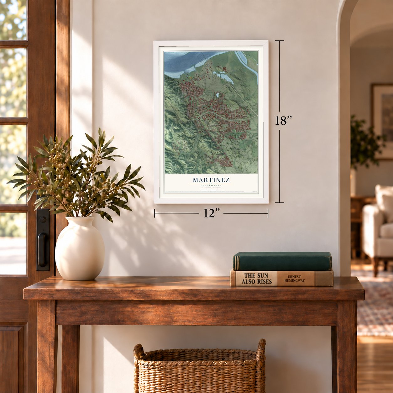
12" x 18" Archival Matte Print
A Map of Home. A Work of Art.
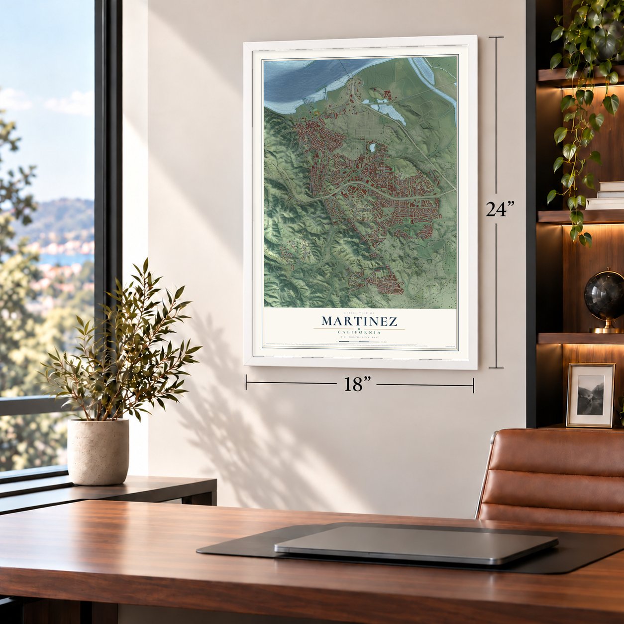
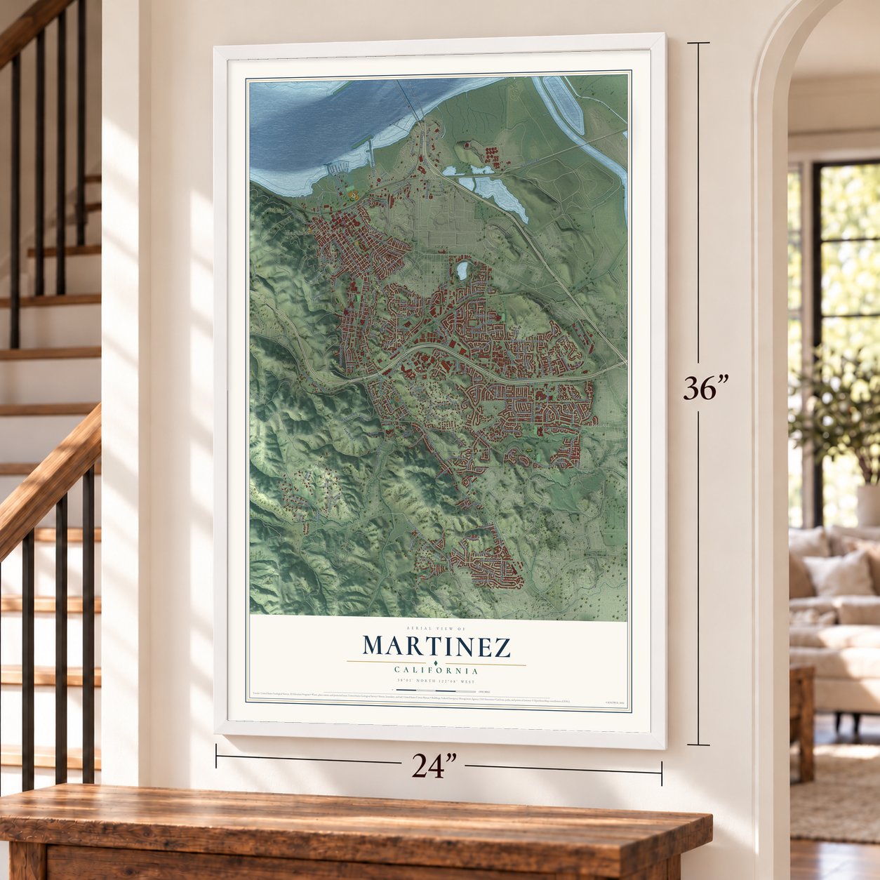
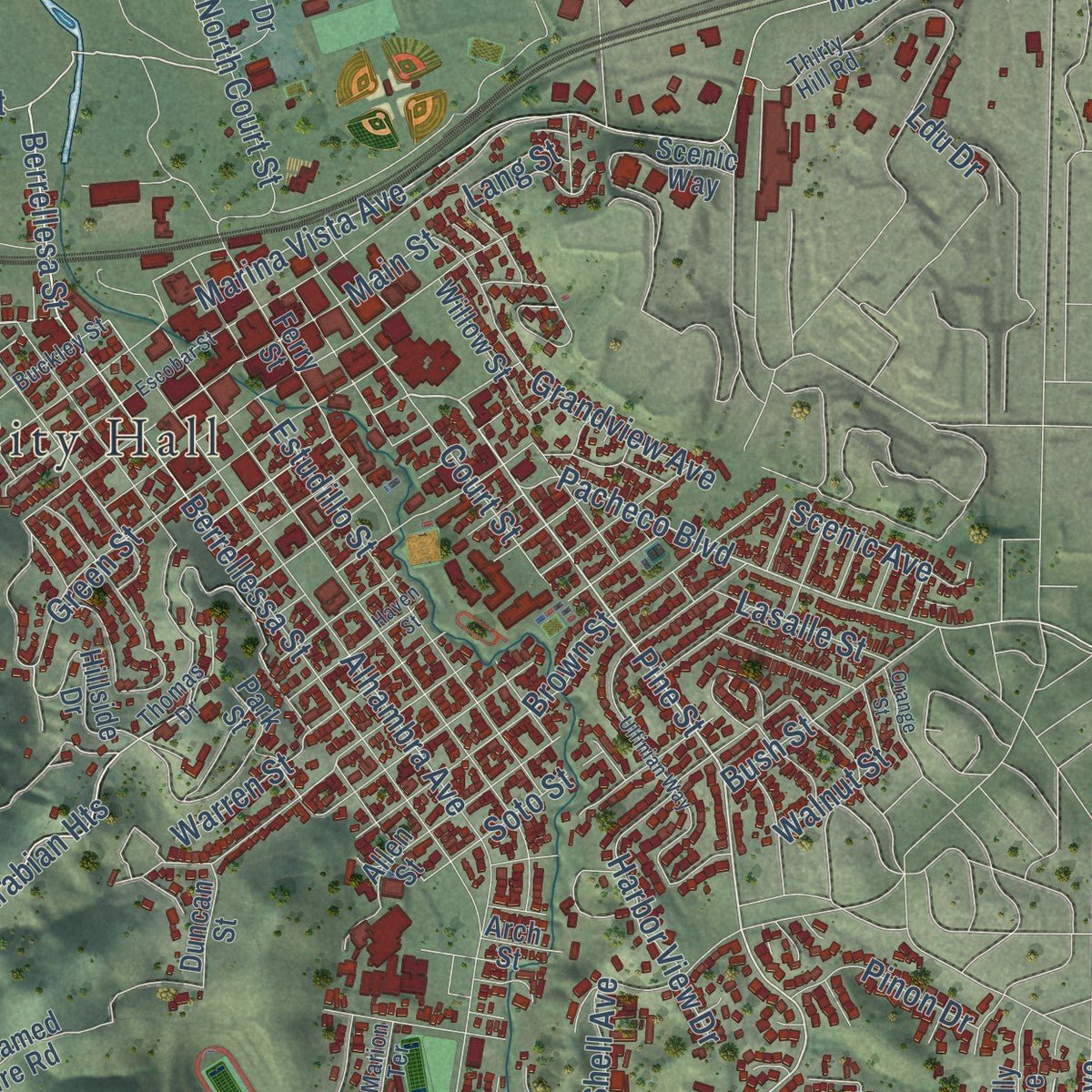
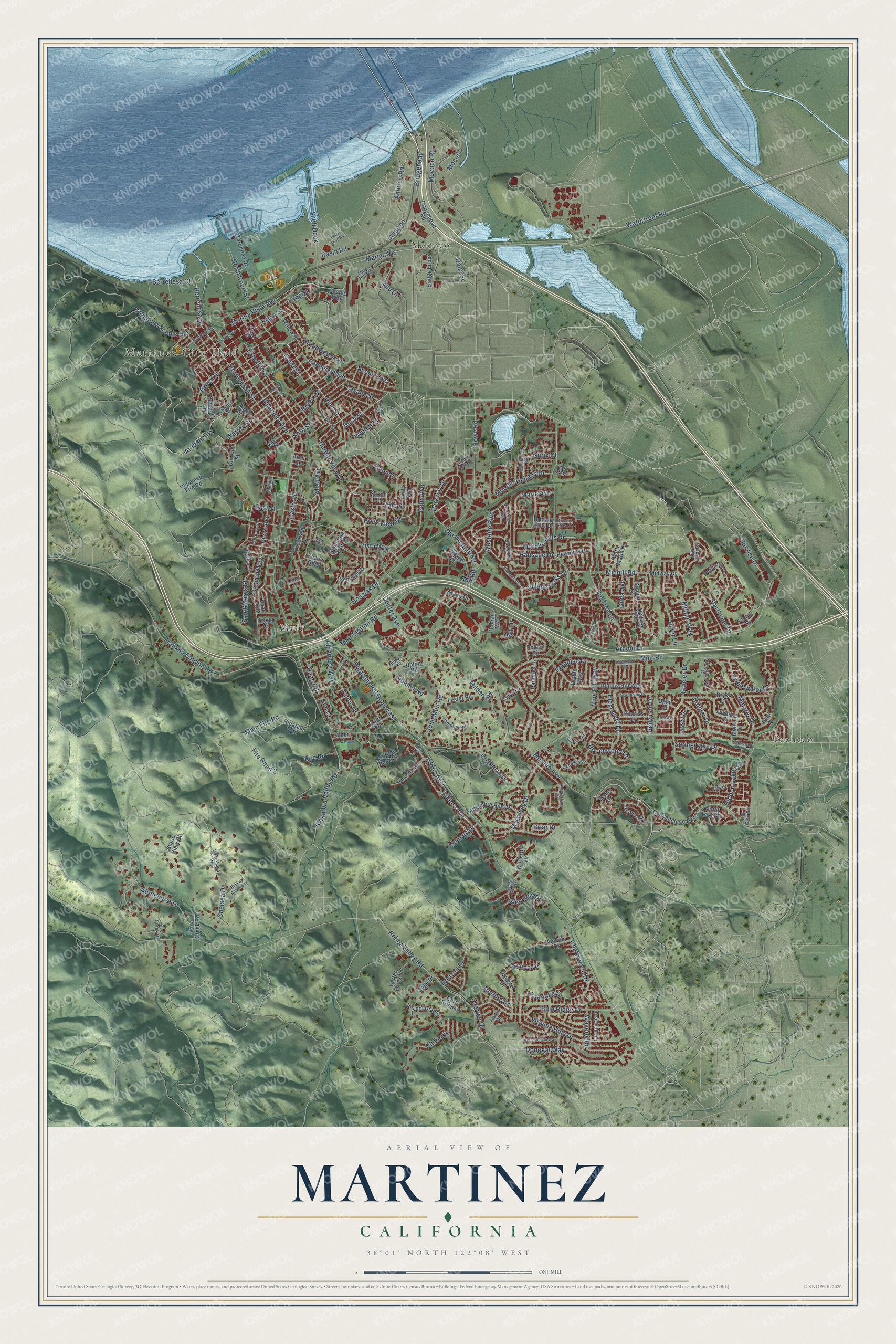
Explore Martinez, California from a whole new perspective. Created using aerial imagery and detailed geographic data, this map captures Martinez building by building, with labeled streets, familiar landmarks, and shaded topographical relief that highlights the natural contours of the landscape.
Combining modern data with the timeless character of a vintage atlas, this map is just as interesting up close as it is beautiful on the wall. Whether you grew up in Martinez, spent memorable years there, or call it home today, this unique map is a great way to celebrate a place that means something to you. Zoom in on the preview to look for your street, and then order a print to put your memories on the wall.
Three ways to hang it
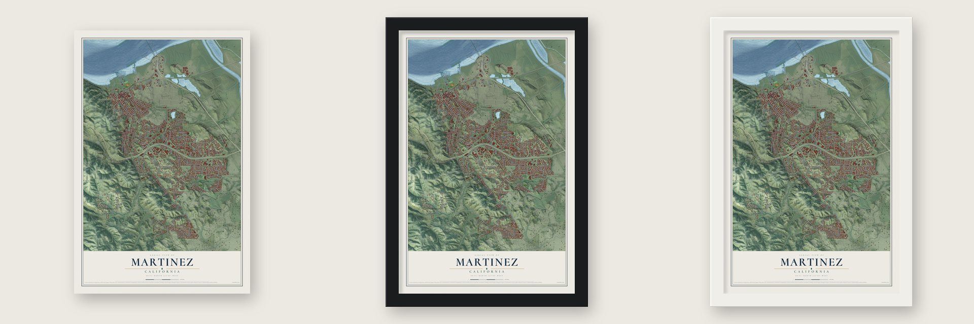
Unframed archival matte, a black wood frame or a white wood frame.
Up close
Geography Worth Displaying
This map was created using accurate cartographic data and authoritative geographic sources, including the U.S. Geological Survey and the Census Bureau. The map brings together terrain, waterways, roads, and building detail. The majority of the streets are labeled, houses are accurately depicted, and the topography is derived from government sources. Combining local data with carefully composed color and shading leads to this beautifully detailed Martinez artwork for your wall.
Rather than simply showing street outlines, we’ve included as many of the street names as we could reasonably fit on the map while keeping their names legible. Zoom in on the high resolution preview to see exactly what’s on the map. We truly set out to create a statement piece for anyone who loves Martinez. So whether it’s for you, or a gift for someone you love, we hope this map of Martinez brings back fond memories.
Read the story behind this map of Martinez, California from 2026.

Find your street
Names on the Martinez map
Every name below is printed on this map. Look for your street, your school, the park where you played, or the pond down the road.
Places and landmarks4
- Martinez City Hall
- Mococo
- Muir
- Pacheco
Streets and roads222
- Morello Avenue
- Pine Street
- Berrellesa Court
- Court Street
- Likens Avenue
- Likins Avenue
- Sunrise Drive
- Vista Way
- Berrellesa Street
- Canyon Way
- Pacheco Boulevard
- Arabian Heights
- Elderwood Drive
- Alhambra Avenue
- Center Avenue
- Arnold Drive
- Muir Road
- Marina Vista Avenue
- Vine Hill Way
- Howe Road
- Marina Vis
- Estudillo Street
- Alhambra Way
- Castro Street
- Shell Avenue
- Stonehurst Drive
- Alhambra Valley Road
- Franklin Canyon Road
- Berrellessa Street
- Starflower Drive
Show all 222 streets
- Reliez Valley Road
- Blue Ridge Drive
- Mococo Road
- Roanoke Drive
- Main Fire Road
- Pleasant Hill Road East
- Fire Road 2
- Brown Street
- Chelsea Drive
- Donegal Way
- Warren Street
- Green Street
- Parkway Drive
- Virginia Hills Drive
- Glacier Drive
- Main Street
- Shell Dock
- Macalvey Drive
- Harbor View Drive
- Sweetwater Drive
- Waterfront Road
- John Muir Road
- Palm Avenue
- Fig Tree Lane
- Grandview Avenue
- Milano Way
- Waverly Road
- Midhill Road
- Westaire Boulevard
- Spring Lake Drive
- Muir Station Road
- Venner Road
- Hidden Lakes Drive
- Old Orchard Road
- Beechwood Drive
- Morello Hills Drive
- Carquinez Scenic Drive
- Costanza Drive
- Amorco Road
- Morello Heights Drive
- Paradise Drive
- North Court Street
- Holly View Drive
- Saint Marys Street
- Amorco
- Lasalle Street
- Bush Street
- Yale Street
- Chattswood Drive
- East Street
- Marie Avenue
- Milden Road
- Douglas Drive
- Village Oaks Drive
- Minaret Drive
- Glenview Drive
- Ricks Avenue
- Hiller Lane
- Scenic Avenue
- Pinon Drive
- Walnut Street
- Horizon Drive
- Skyline Drive
- Tahoe Drive
- Palisade Drive
- Bridgehead
- Redwood Drive
- Soto Street
- Fire Road
- Lindsey Drive
- Cll Verde
- Rainier Drive
- Gilda Avenue
- Sterling Drive
- Gilrix Court
- Haag Road
- Briar Drive
- Sherree Drive
- Mill Road
- Basin Road
- Kim Court
- Lang Street
- Hull Lane
- Dana Street
- Ldu Drive
- Wildcroft Drive
- Rolling Hill Way
- Chilpancingo Parkway
- Ferry Street
- Holiday Hills Drive
- Riparian Trail
- Bridge Loop
- Unnamed Fire Road
- Olympic Drive
- Willow Street
- Bridgehead Road
- Raap Avenue
- Allen Street
- Hillside Drive
- Jeanne Circle
- Brookside Drive
- Alhambra Hills Drive
- Carter Acres Lane
- Christie Drive
- Webster Drive
- Stone View Court
- Tarantino Drive
- Scenic Way
- Lester Road
- Polson Circle
- Duncan Street
- Vis del Diablo
- Benham Drive
- Solitude Peak Drive
- Midway Drive
- Village Place
- Corte Briones
- Isabel Drive
- Heavenly Drive
- Arana Drive
- Kelly Avenue
- Shady Glen
- Saxon Street
- Mono Drive
- Endriss Drive
- Bryce Drive
- Roman Way
- Marti Marie Drive
- Foxhill Drive
- Rainbow Drive
- Snow Drive
- Lassen Drive
- Upton Road
- Sentinel Drive
- Sunhill Lane
- Mountain View Drive
- Truitt Avenue
- Vaca Creek Road
- Diablo Way
- Platt Drive
- Quiet Lake Place
- Brittany Hills Drive
- Silva Court
- Sage Drive
- Ophir Court
- Gilbert Court
- Arch Street
- Park Street
- Freda Court
- Fountainhead Court
- Thirty Hill Road
- Ashwood Drive
- Banbury Loop
- Augustine Drive
- Oakwood Circle
- Heatherleaf Lane
- Geneva Street
- Escondido Drive
- Crestview Avenue
- Hampton Road
- Oak Glen Circle
- Buckley Street
- Thomas Drive
- Las Animas Drive
- Linton Terrace
- Hilltop Road
- Serrano Street
- Whitehaven Way
- Deer Creek Drive
- Country Run Drive
- Smith Drive
- Marion Terrace
- Escobar Street
- Ulfinian Way
- Eastgate Lane
- Haven Street
- Shadowfalls Drive
- Deerwood Drive
- Martindale Drive
- Rolling Ridge Way
- Appalachian Way
- Valley Glen Lane
- Yellowstone Drive
- Lake Oaks Court
- Park Glen
- Orange Street
- Laurel Court
- Linden Lane
- Brittany Hills Court
- Francis Drive
- Pond Dive Road
- Glacier Court
Names are listed as they appear on the printed map. Zoom into the product photos to find them.
About Martinez, California
Martinez is a city of 37,287 people and the county seat of Contra Costa County, on the south shore of the Carquinez Strait. In 1824 the Alhambra Valley, on the city's west side, became part of Rancho El Pinole, a Mexican land grant to the Californio rancher Ygnacio Martínez. In 1847 Dr. Robert Semple agreed to run a ferry from here to Benicia, and for many years it was the only way across the strait.
By 1849 the spot had become a stop for people headed to the Gold Rush. That year Col. William M. Smith laid out a town and named it for Martínez. Martinez was made the county seat in 1850, but it had fewer than the 200 registered voters the law required to incorporate. It finally became a city in 1876.
- John Muir's homeThe naturalist John Muir lived in Martinez from 1880 until his death in 1914. His house is now the John Muir National Historic Site, which joined the National Register in 1966. Muir was buried about a mile to the south.
- Pony Express riders, 1860In 1860 Martinez had a part in the Pony Express. Riders crossed on the ferry from Benicia, mostly when they had missed the steamer in Sacramento.
- Refinery town since 1904The area's first oil refinery opened in 1904 at Bull's Head Point, two miles east of downtown. A copper smelter run by the Mountain Copper Company came in 1905, so the area became known as Mococo. The Golden Eagle refinery followed in 1913 at Avon, and a Shell refinery beside the city limits opened in January 1916. That Shell plant still runs today.
- The DiMaggio brothersJoe DiMaggio, who spent his whole 13-year Hall of Fame career as a center fielder for the New York Yankees, came from Martinez. So did his brother Vince DiMaggio, an all-star center fielder for the Pittsburgh Pirates.
Keep exploring California
Martinez is one of 1,990 California towns we've mapped. Every dot on the map is a print of its own.
The search covers every state, California first.
Near Martinez
Order 2 or more town maps and save 10%. Shown in the size and finish you picked above, so they hang as a set.
- Vine Hill 12" x 18" / Archival Matte Print $39.99
- Alhambra Valley 12" x 18" / Archival Matte Print $39.99
- Pacheco 12" x 18" / Archival Matte Print $39.99

More maps nearby: Pleasant Hill, Reliez Valley, Port Costa, Clyde and Benicia.
The art of mapping a place
How This Map Was Made
Real places. Remarkable detail. Discover the layers that turn geographic data into a map of home.

The view from above
Aerial imagery reveals the character of the land: woodland, open fields, and the patterns of a place.

The shape of the land
Elevation data brings hills, valleys, and subtle changes in the landscape into view.

The details of home
Roads, waterways, and building footprints come together to make the map feel unmistakably local.

Geography becomes art
Considered color, shading, and typography bring the layers together in a map made for your wall.


Process illustrated with Mendon, Massachusetts. Aerial imagery: USDA NAIP. Terrain: USGS 3D Elevation Program. Map details and finished artwork: KNOWOL.
The Details
About This Print
Choose an archival matte print, or a black or white Ayous wood frame. The archival matte print is unframed.
Select your size and finish above to see the matching product image and price.
Materials & Craftsmanship
A contemporary map with the character of a classic atlas, printed on archival matte paper. Optional frames are made from Ayous wood.
Your printed map does not include the watermark shown in the full-map preview.
Shipping & Delivery
Free shipping within the United States. Every print is made to order in the USA.
Buying a gift? Add a note in your cart and we'll include it. We never put prices in the package.
Prints ship within 2 to 3 business days. Allow 7 to 10 days total from ordering for delivery. Timing may vary during holidays or periods of high order volume.
Read our shipping policy.
Returns and damaged prints
Each print is made to order. Change-of-mind refunds are not available after production.
If your print arrives damaged, misprinted or incorrect, contact support@knowol.com within 30 days of receiving it. Include your order number, photos and a description of the issue.
Read our full refund and replacement policy. For questions about your order, email support@knowol.com.