
Search for another town





Free U.S. delivery 7 to 10 days after you order
Milford, Ohio Map Art
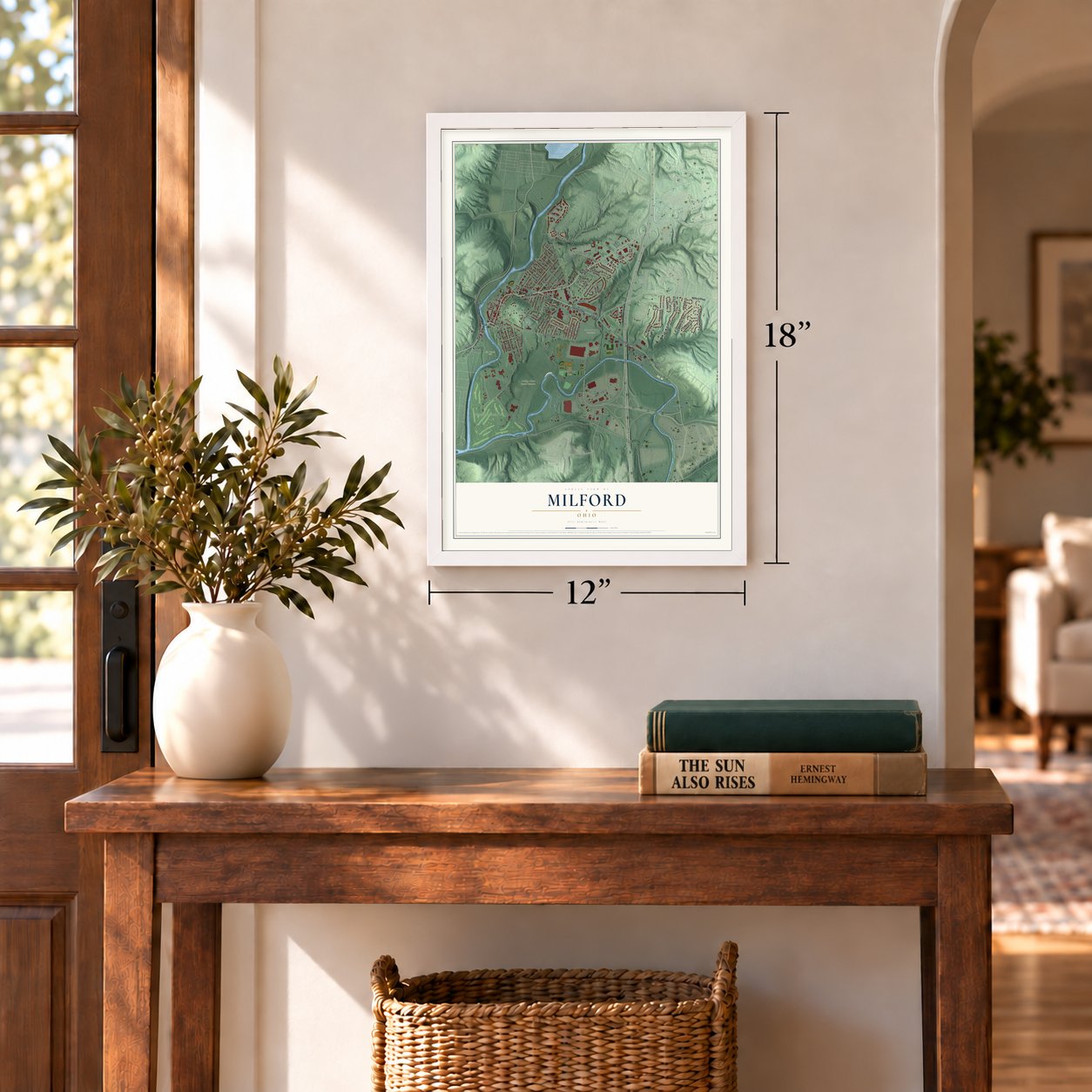
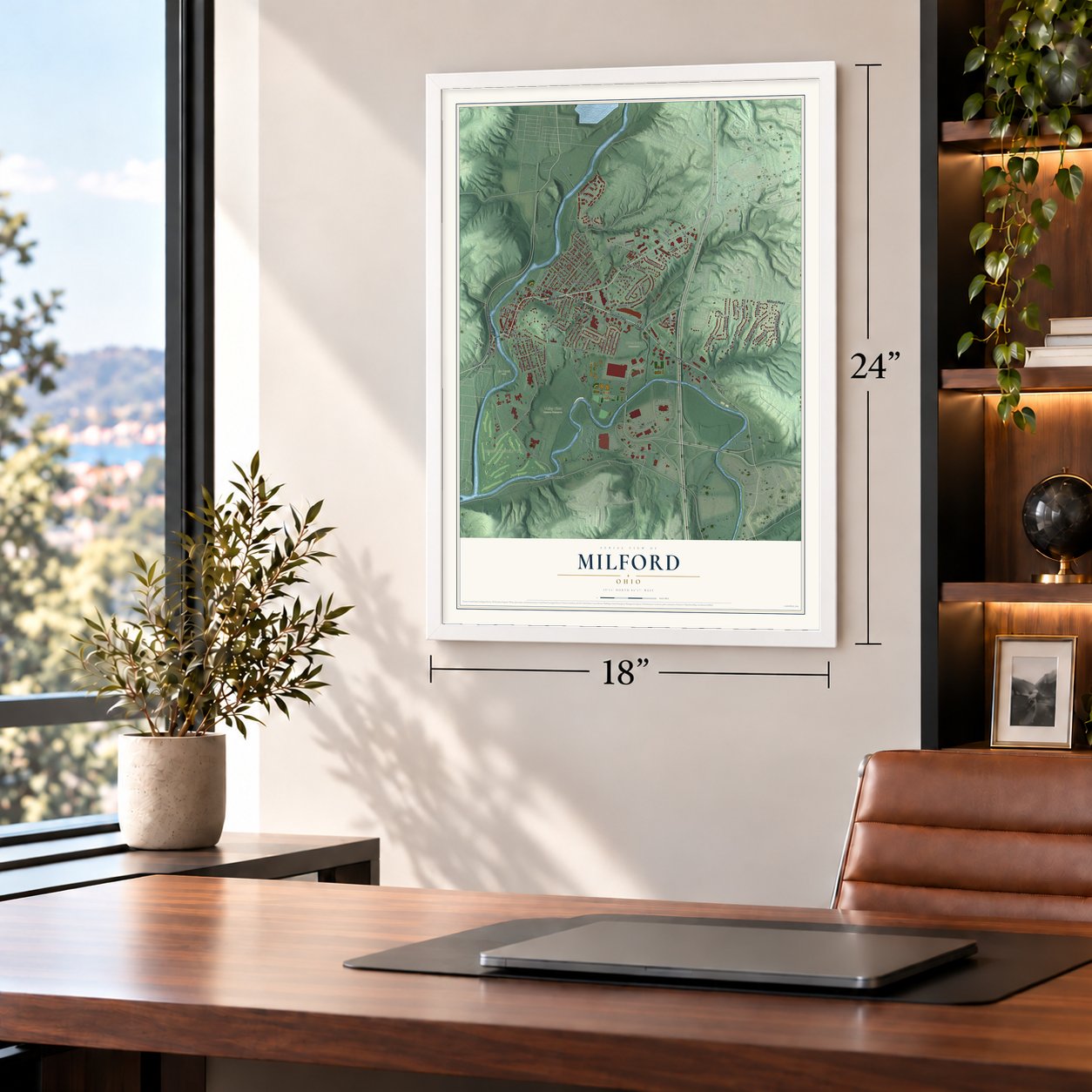
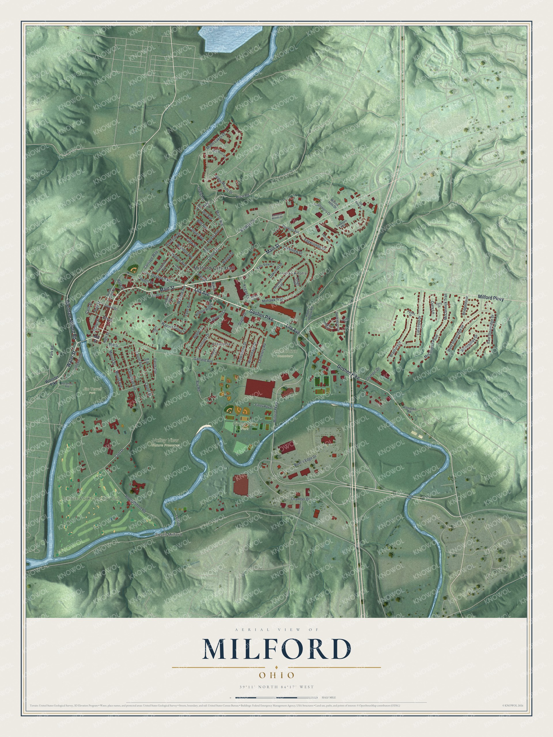
A new map of Milford, Ohio, made in 2026 and printed to order on thick archival matte paper.
12" x 18" Archival Matte Print
A Map of Home. A Work of Art.
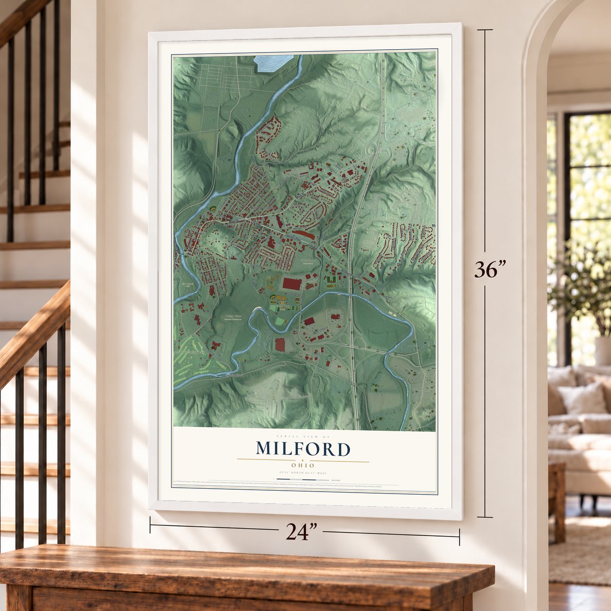
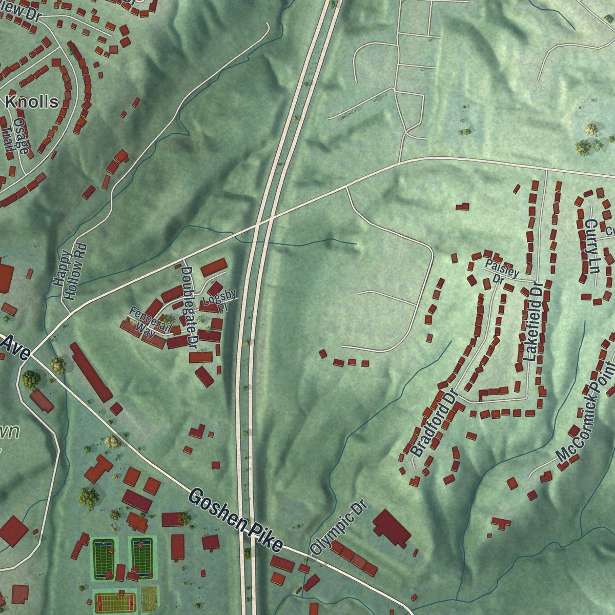
Explore Milford, Ohio from a whole new perspective. Created using aerial imagery and detailed geographic data, this map captures Milford building by building, with labeled streets, familiar landmarks, and shaded topographical relief that highlights the natural contours of the landscape.
Combining modern data with the timeless character of a vintage atlas, this map is just as interesting up close as it is beautiful on the wall. Whether you grew up in Milford, spent memorable years there, or call it home today, this unique map is a great way to celebrate a place that means something to you. Zoom in on the preview to look for your street, and then order a print to put your memories on the wall.
Three ways to hang it
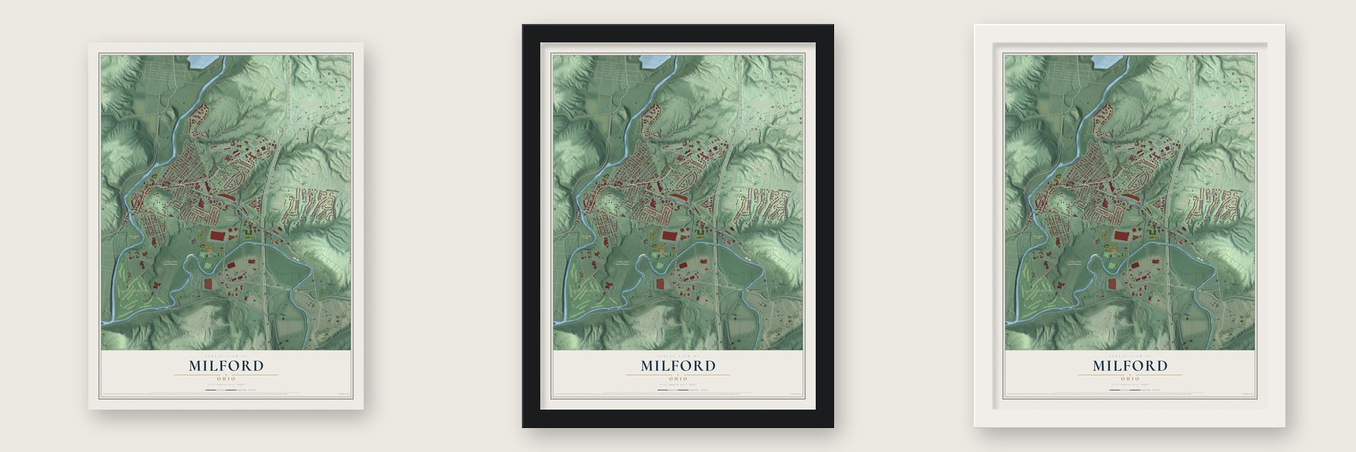
Unframed archival matte, a black wood frame or a white wood frame.
Up close
Geography Worth Displaying
This map was created using accurate cartographic data and authoritative geographic sources, including the U.S. Geological Survey and the Census Bureau. The map brings together terrain, waterways, roads, and building detail. The majority of the streets are labeled, houses are accurately depicted, and the topography is derived from government sources. Combining local data with carefully composed color and shading leads to this beautifully detailed Milford artwork for your wall.
Rather than simply showing street outlines, we’ve included as many of the street names as we could reasonably fit on the map while keeping their names legible. Zoom in on the high resolution preview to see exactly what’s on the map. We truly set out to create a statement piece for anyone who loves Milford. So whether it’s for you, or a gift for someone you love, we hope this map of Milford brings back fond memories.

About Milford, Ohio
Milford is a city of 6,582 people in Clermont County, where the Little Miami River meets its East Fork. The land was part of a single survey made in 1788 for John Nancarrow, a Revolutionary War veteran from Virginia. In 1796 the Reverend Francis McCormick, who had fought in the Revolution and held a grant of a thousand acres, arrived and built a log cabin on the hill. That start ties Milford with Williamsburg as the oldest settlement in the county.
On December 20, 1802, Nancarrow sold 230 acres to Philip Gatch for $920.00. Gatch later sold 125 acres to Ambrose Ranson, who passed 64 acres on to John Hageman. Hageman called the valley Hageman's Mills and laid out 46 lots, pricing the best one, lot #1 at Mill and Water Streets, at $35.00 and most others at $25.00. In February 1806 the newspaper began calling the place Milford, since it offered the first safe crossing of the Little Miami above the Ohio River. Hageman left for Indiana by 1811, but the name stuck. Milford was incorporated as a village on January 23, 1836, and with 5232 people it became a city in 1982.
“No wonder, then, that it struck with rapture the quaint and eccentric John Nancarrow, who had it surveyed for him on May 28, 1788 as Dutch burgomaster intended to found a city that should become the future metropolis of the West.”
- Methodists since 1797Milford's Methodists first gathered in 1797, in Francis McCormick's log cabin, and their congregation is counted as the oldest Methodist church in Ohio and the old Northwest Territory. Settlers hiked long distances through the forest to hear circuit preachers. The congregation dedicated its sanctuary on Christmas Day, 1835, and added a bell tower and Sunday School rooms in 1870. The church still stands at 541 Main Street.
- A library open since 1900The Milford Village Improvement Society founded the Milford Public Library in 1900, knocking on doors to gather both books and paying members. A year's membership cost adults 25 cents and children 10 cents. The library has never closed, which makes it the oldest in Clermont County, and it still works out of the stone building at 19 Water Street where it started.
- The Gatch SiteFor several generations a field along Gatch Avenue, once part of John Gatch's farm, has turned up large numbers of artifacts. Archaeologists believe a Native American village stood there during the Woodland period. The Valley View conservancy now manages the field beside the Gatch estate.
- Paydays below MilfordIn 1814 a newspaper told Ohio militia soldiers they would be paid at Chenemiah Covett's stone house below Milford. By then farm families from the surrounding township came down into town to sell crops, buy flour at the mill and visit shops before heading back up the hill.
Find your street
Names on the Milford map
Every name below is printed on this map. Look for your street, your school, the park where you played, or the pond down the road.
Places and landmarks9
- Milford City Hall
- Finley Ray Park
- Greenlawn Cemetery
- Jim Terrell Park
- Valley View Nature Preserve
- Clertoma
- Indian Knolls
- South Milford
- Terrace Park Country Club
Streets and roads108
- Goshen Pike
- Lila Avenue
- Main Street
- Water Street
- Glendale Milford Road
- Milford Parkway
- Brooklyn Drive
- Center Street
- Miami Avenue
- Carriage Way
- Mill Street
- Riverside Drive
- Craig Lane
- Garfield Avenue
- South Milford Road
- Miami Lakes Drive
- Chamber Drive
- Club Drive
- Wallace Avenue
- Mohawk Trail
- High Street
- Forest Avenue
- Miami Woods Drive
- Lakefield Drive
- Clertoma Drive
- Cleveland Avenue
- Laurel Avenue
- Laurel Street
- Bay Road
- Powhatton Drive
Show all 108 streets
- East Stoneridge Drive
- West Stoneridge Drive
- Cemetery Road
- Edgecombe Drive
- Park Road
- Bradford Drive
- River's Edge Drive
- Mound Avenue
- Mound Street
- McCormick Trail
- Crestview Drive
- Walnut Street
- Oakcrest Drive
- Price Road
- Apple Lane
- Winnebago Drive
- McCormick Point
- Kirgan Lane
- Slagle Drive
- Wallace Grove Lane
- Tyler Avenue
- Hudson Avenue
- Robbie Ridge
- Tabaleen Cv
- Brandon Avenue
- Bridgestone
- Polk Street
- Clark Street
- Gatch Avenue
- Elm Street
- Cooper Avenue
- Pike Street
- Belt Avenue
- Stonevalley Drive
- Dot Avenue
- Leaf Lane
- Curry Lane
- Race Street
- Olympic Drive
- Beech Street
- Cash Street
- Wooster Pike
- Brooklyn Avenue
- Seminole Trail
- Longworth Street
- Oak Street
- Pasadena Avenue
- Locust Street
- Vally View Circle
- Finley Ray Drive
- Castleberry Court
- Doublegate Drive
- Happy Hollow Road
- Osage Trail
- Victor Steir Drive
- Lewis Avenue
- Baker Drive
- Klondyke Road
- Milford Hills Drive
- May Street
- Concord Woods Drive
- Spring Avenue
- Cross Street
- Dot Street
- Theilmans Mhp
- Choctaw Lane
- Fencerail Way
- Sycamore Avenue
- Paisley Drive
- Curry Drive
- Old Bank Road
- Logsby Place
- Hogan Drive
- Edgecombe Road
- White Water Way
- Milford Vista Lane
- Beechwood Road
- George Street
Names are listed as they appear on the printed map. Zoom into the product photos to find them.
The art of mapping a place
How This Map Was Made
Real places. Remarkable detail. Discover the layers that turn geographic data into a map of home.

The view from above
Aerial imagery reveals the character of the land: woodland, open fields, and the patterns of a place.

The shape of the land
Elevation data brings hills, valleys, and subtle changes in the landscape into view.

The details of home
Roads, waterways, and building footprints come together to make the map feel unmistakably local.

Geography becomes art
Considered color, shading, and typography bring the layers together in a map made for your wall.


Process illustrated with Mendon, Massachusetts. Aerial imagery: USDA NAIP. Terrain: USGS 3D Elevation Program. Map details and finished artwork: KNOWOL.
The Details
About This Print
Choose an archival matte print, or a black or white Ayous wood frame. The archival matte print is unframed.
Select your size and finish above to see the matching product image and price.
Materials & Craftsmanship
A contemporary map with the character of a classic atlas, printed on archival matte paper. Optional frames are made from Ayous wood.
Your printed map does not include the watermark shown in the full-map preview.
Shipping & Delivery
Free shipping within the United States. Every print is made to order in the USA.
Buying a gift? Add a note in your cart and we'll include it. We never put prices in the package.
Prints ship within 2 to 3 business days. Allow 7 to 10 days total from ordering for delivery. Timing may vary during holidays or periods of high order volume.
Read our shipping policy.
Returns and damaged prints
Each print is made to order. Change-of-mind refunds are not available after production.
If your print arrives damaged, misprinted or incorrect, contact support@knowol.com within 30 days of receiving it. Include your order number, photos and a description of the issue.
Read our full refund and replacement policy. For questions about your order, email support@knowol.com.
Find your town
Looking for another city?
Find a map of home in our Ohio collection, or any town in the country.
Nearby
Maps of towns near Milford
Know someone from one of these towns? Their map makes a great gift.
 Terrace Park
, Ohio
From $39.99See the map
 Camp Dennison
, Ohio
From $39.99See the map
 Mulberry
, Ohio
From $39.99See the map
More maps nearby: Day Heights, The Village of Indian Hill, Summerside, Miamiville and Mount Repose.