


Search for another town





Free U.S. delivery 7 to 10 days after you order
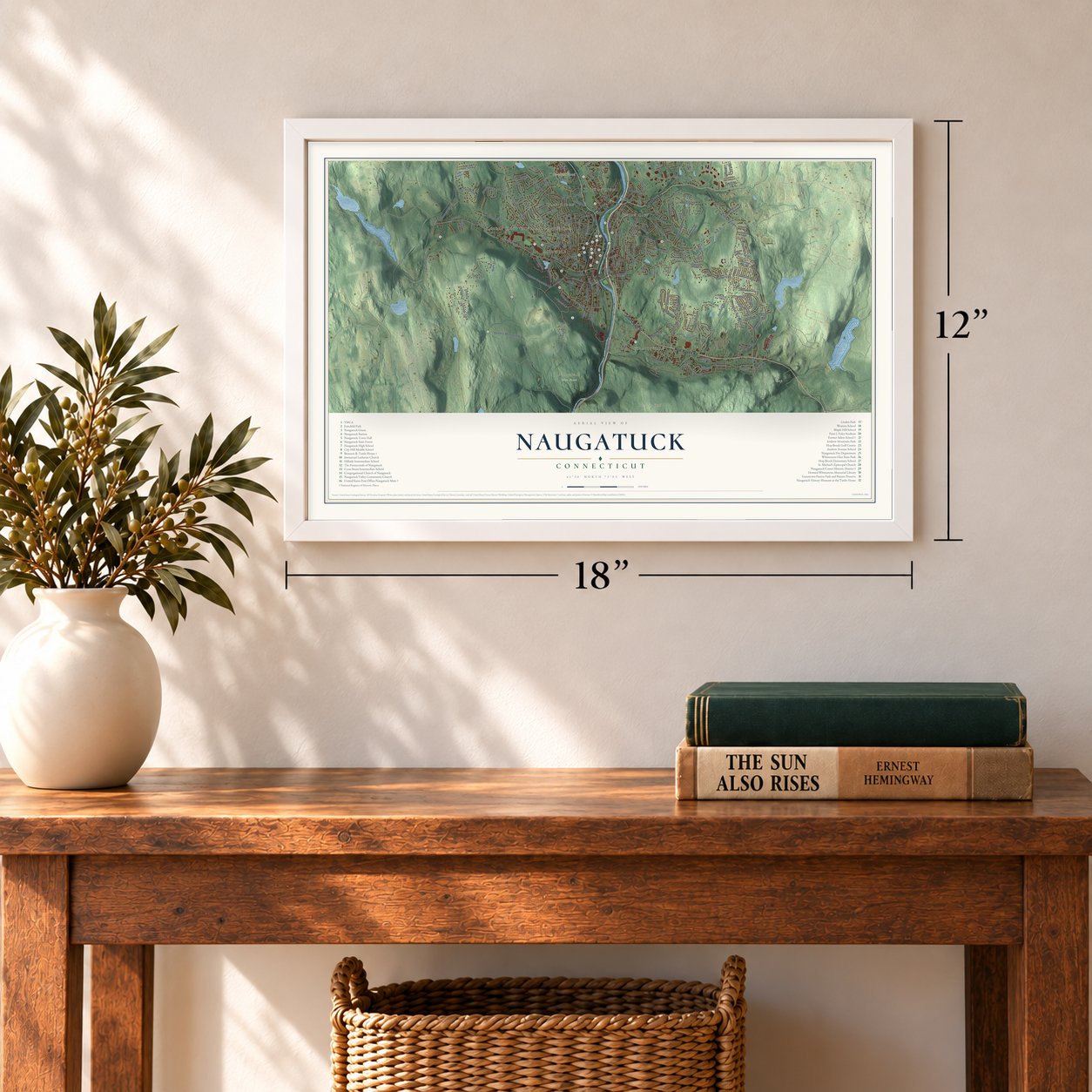
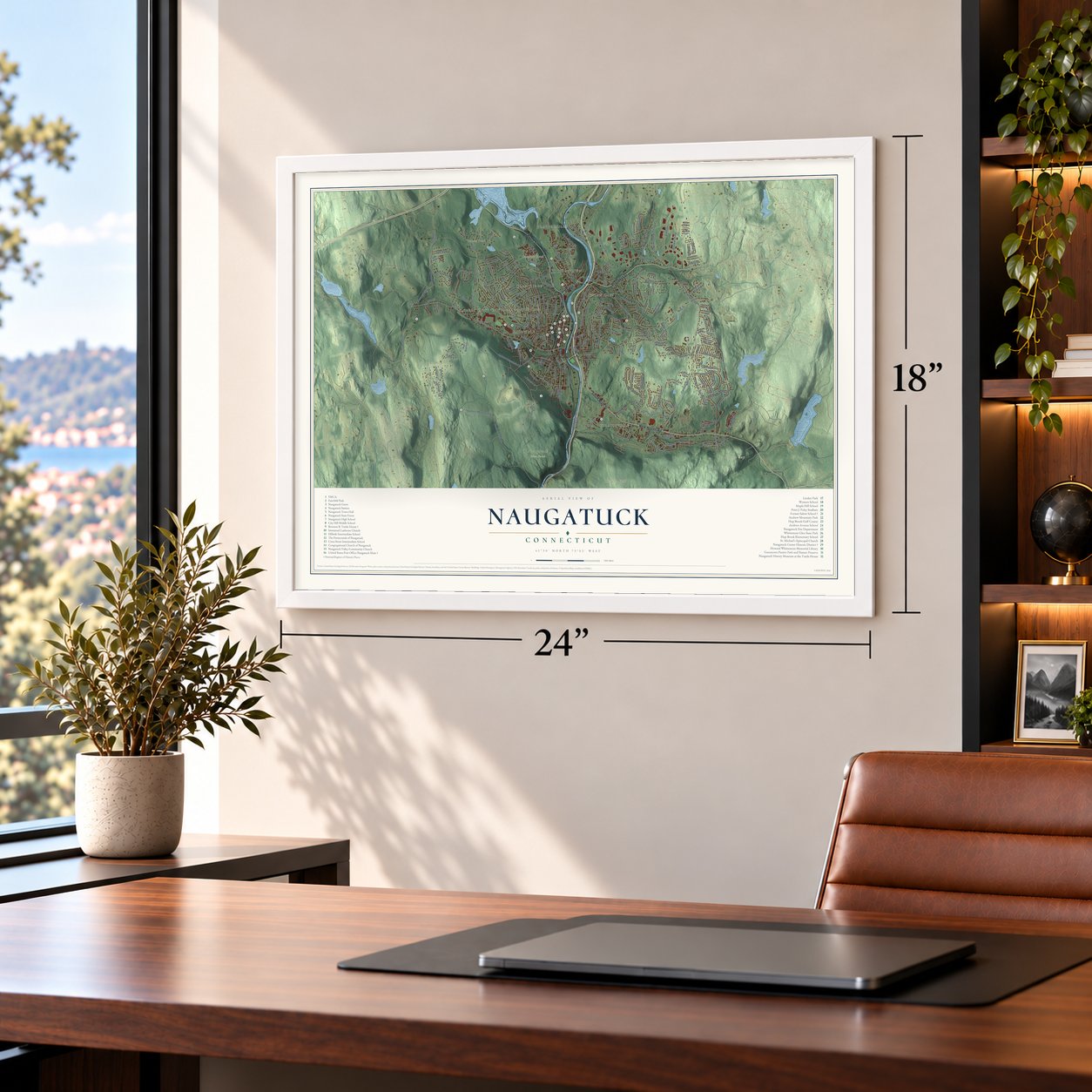
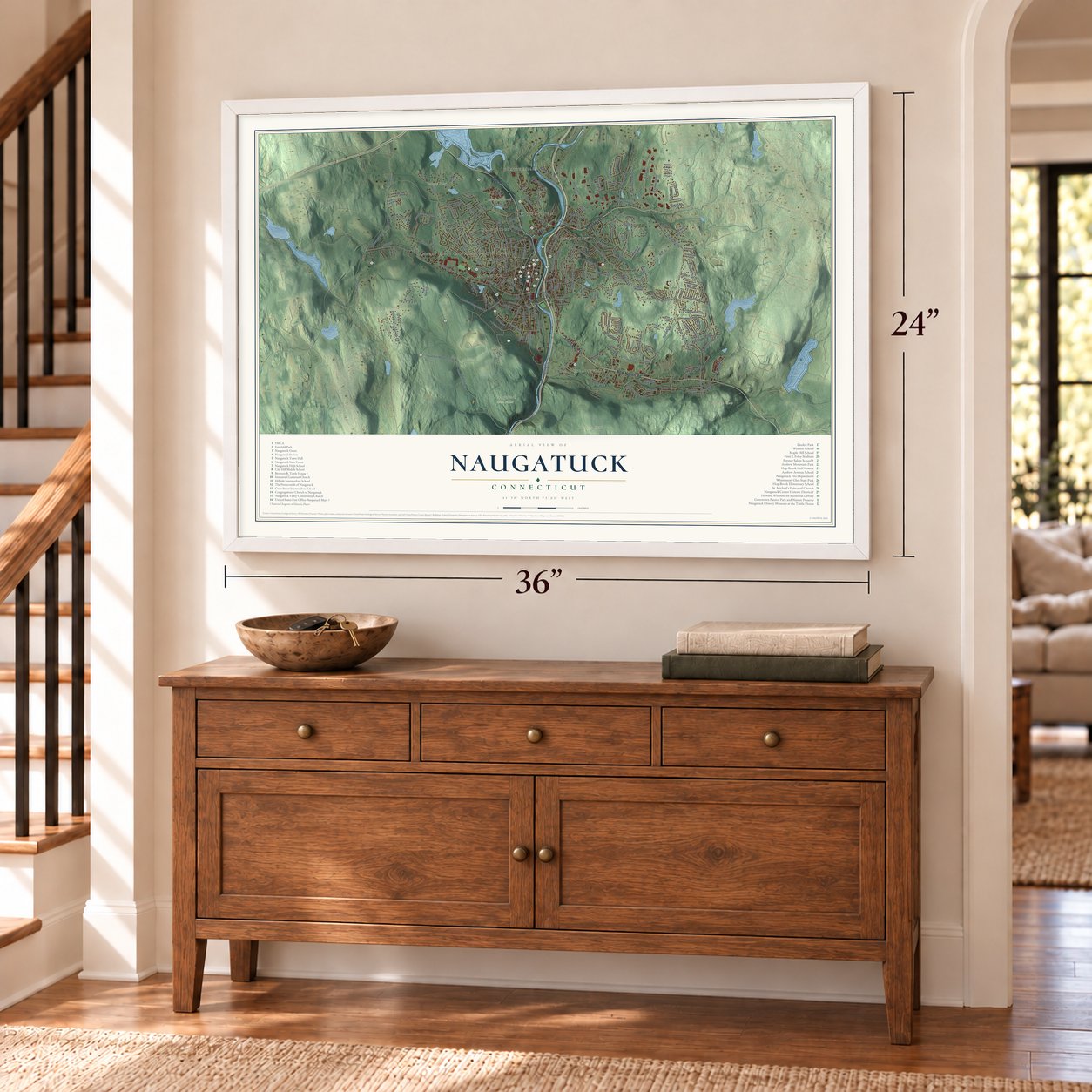
Naugatuck, Connecticut Map Art
Building by building, with labeled streets and shaded relief.
12" x 18" Archival Matte Print
A Map of Home. A Work of Art.
Explore Naugatuck, Connecticut from a whole new perspective. Created using aerial imagery and detailed geographic data, this map captures Naugatuck building by building, with labeled streets, familiar landmarks, and shaded topographical relief that highlights the natural contours of the landscape.
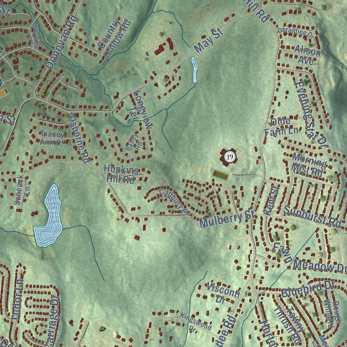
Combining modern data with the timeless character of a vintage atlas, this map is just as interesting up close as it is beautiful on the wall. Whether you grew up in Naugatuck, spent memorable years there, or call it home today, this unique map is a great way to celebrate a place that means something to you. Zoom in on the preview to look for your street, and then order a print to put your memories on the wall.

Three ways to hang it
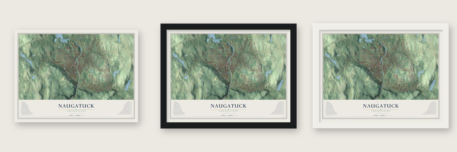
Unframed archival matte, a black wood frame or a white wood frame.
Up close
Geography Worth Displaying
This map was created using accurate cartographic data and authoritative geographic sources, including the U.S. Geological Survey (USGS) and FEMA. The map brings together terrain, waterways, roads, and building detail. The majority of the streets are labeled, houses are accurately depicted, and the topography is derived from government sources. Combining local data with carefully composed color and shading leads to this beautifully detailed Naugatuck artwork for your wall.
Rather than simply showing street outlines, we’ve included as many of the street names as we could reasonably fit on the map while keeping their names legible. Zoom in on the high resolution preview to see exactly what’s on the map. We truly set out to create a statement piece for anyone who loves Naugatuck. So whether it’s for you, or a gift for someone you love, we hope this map of Naugatuck brings back fond memories.
Explore the full map of Naugatuck, Connecticut and read about the local places it shows.

Find your street
Names on the Naugatuck map
Every name below is printed on this map. Look for your street, your school, the park where you played, or the pond down the road.
Places and landmarks13
- Downtown
- Platts Mills
- Straitsville
- Glen Ridge
- Union City
- Andrews Hill
- Beacon Cap
- Beacon Hill
- Barbers Pond
- Baummer Pond
- Naugatuck State Forest
- Millville
Show all 13 places
- Robert Hutt Congregate Housing
Streets and roads215
- Church Street
- Bridge Street
- Prospect Street
- New Haven Road
- Elm Street
- South Main Street
- Rubber Avenue
- Chesnut Hill Road
- Gunntown Road
- Krodel Road
- Bird Road
- Auburn Street
- Salem Street
- Spencer Street
- May Street
- Cherry Street
- Radnor Avenue
- Andrew Mountain Road
- Hunters Mountain Road
- Maple Hill Road
- Field Street
- Great Hill Road
- High Street
- Black Forest Road
- Millville Avenue
- Mulberry Street
- Wooster Street
- Allerton Farms Road
- Hillside Avenue
- Horton Hill Road
Show all 215 streets
- Candee Road
- City Hill Street
- Spring Street
- Quinn Street
- Osborn Road
- North Main Street
- Sheridan Drive
- Union City Road
- Conrad Street
- Celantano Drive
- Jones Road
- Jones Street
- Scott Street
- East Waterbury Road
- Webb Road
- Johnson Street
- Wisteria Drive
- Bluebird Drive
- Stonefence Road
- Applewood Lane
- Evening Star Drive
- Donovan Road
- Cross Street
- Graham Ridge Road
- Rado Drive
- Morning Dove Road
- Wedgewood Drive
- King Street
- Evelyn Drive
- Raytkwich Road
- Fieldstone Terrace
- Lincoln Street
- Beacon Manor Road
- Fawn Meadow Drive
- Walnut Street
- Darcangelo Drive
- Lewis Street
- Village Circle
- Carriage Drive
- Clark Road
- Aetna Street
- Morris Street
- Maple Street
- Gorman Street
- Ruela Drive
- Cliff Street
- Coen Street
- Birch Lane
- Mill Street
- Ward Street
- Red Robin Road
- Forest Street
- Woodbine Street
- Old Highway
- Linda Court
- Tudor Lane
- Timothy Road
- Brook Street
- Hill Street
- Irving Street
- Sunburst Road
- Debbie Lane
- Perock Lane
- John Street
- Dunn Avenue
- Bowman Drive
- Warren Avenue
- Gail Drive
- Adella Street
- Osborne Road
- Park Avenue
- Crestwood Drive
- Beacon Valley Road
- Andrew Avenue
- Margaret Circle
- Hoadley Street
- Melbourne Street
- Lorann Drive
- Tawny Thrush Road
- Morning Mist Road
- Heritage Drive
- Shadduck Road
- Cherry Street Extended
- Hilltop Road
- New Street
- Pine Street
- Manners Avenue
- General Patton Drive
- Marsh Hill Road
- May Avenue
- High Ridge Road
- Yorktown Lane
- Albion Street
- Kosko Lane
- Sunset Drive
- Donna Lane
- Barn Finch Circle
- Silver Beech Drive
- Trout Brook Drive
- Brookside Avenue
- Pondview Drive
- Riverside Drive South
- Carroll Street
- Crofut Road
- Hackett Street
- Amanda Lane
- Nichols Street
- Sherman Street
- Brighton Road
- Michael Lane
- Country Hollow Road
- Ash Road
- Red Maple Court
- Fairwood Road
- Arch Street
- Alison Avenue
- Tower Lane
- Longview Terrace
- Hopkins Hill Road
- Eagle Street
- Gabriel Drive
- Hickory Road
- Marc Street
- Trailer Park Road
- Nicole Drive
- Visconti Drive
- Olivia Lane
- Olde Farm Lane
- Kent Street
- Ridge Road
- Jolie Road
- East Drive
- Gus Street
- Hill Road
- North Hoadley Street
- Platts Mill Road
- Meadow Lark Road
- Hickory Lane
- Locust Street
- Rough Wing Road
- Dorman Drive
- Porter Avenue
- Longwood Drive
- Wintergreen Lane
- Buckingham Street
- Miller Drive
- Tracey Ann Court
- Alma Street
- Cadbury Place
- Pleasant Avenue
- Nettleton Avenue
- Adriatic Lane
- Anderson Street
- Davin Drive
- Schenck Lane
- Fox Hill Road
- Pearl Road
- Wilson Street
- Vidich Lane
- Seth Drive
- Patricia Lane
- Fairview Avenue
- Phoenix Avenue
- Kingswood Drive
- Wildwood Circle
- Round Hill Road
- Golden Hill Street
- Curtiss Street
- Waterbury Road
- Brittany Lane
- Geraldine Drive
- Oak Street
- Country Hill Road
- Skyview Drive
- Woodland Street
- Whitney Place
- Moore Avenue
- Sierra Ridge Road
- Laurel Avenue
- Florence Street
- Bridle Trail Drive
- Bailey Road
- Donovan Court
- Cedar Street
- Grickis Lane
Names are listed as they appear on the printed map. Zoom into the product photos to find them.
About Naugatuck, Connecticut
Naugatuck is a borough and town of 31,519 people in New Haven County, built on both banks of the Naugatuck River just below Waterbury. In 1686 Deacon Thomas Judd drew eight acres beside the river, and the meadow carried his name for decades. Samuel Hickox had a house here by 1702, and in 1709 he put up a fulling mill on a stream that was later named Fulling Mill Brook for it.
Judd's Meadow was renamed Salem Bridge in 1752, and in 1773 the colony set off the south end of Waterbury as a parish called Salem. The post office switched to the name Naugatuck on August 21, 1834, and in 1844 pieces of Waterbury, Bethany and Oxford were joined to form the new town. A borough followed in 1893, and when it grew to cover the whole town in 1895, Naugatuck became the one place in Connecticut that is both a town and a consolidated borough.
“These have changed it from a poor agricultural section to one of the richest, most active parts of the county.”
- Hoes hammered by nightProspect's Eben Tuttle invented the goose-neck hoe, but eight men by hand made just twenty-five daily. His first machine, a crude Union City trip-hammer, was free only at night, so blanks went down, got pounded till morning, then returned to Prospect. In 1846 he moved to Union City, then barely half a dozen houses. After an 1858 fire, son Bronson partnered with John H. Whittemore, and their malleable iron castings made Union City a factory village.
- Goodyear's rubber bootsAround 1812 Amasa Goodyear made forks, buttons and molasses gates on Fulling Mill Brook. Once his son Charles learned to vulcanize rubber, he returned with money from brother-in-law William DeForest, a local woolen manufacturer, and started in a small Union City building. By 1890 the Goodyear Metallic Rubber Shoe Company had space for 2,000 workers and could turn out 25,000 pairs of boots and shoes daily.
- Salem School, built in 1893John Howard Whittemore paid for Salem School, a brick Renaissance Revival building facing the green, and McKim, Mead & White designed it. Two schools had stood on that ground before it: a single-room schoolhouse from 1773 and an Italianate building from 1852. Salem School joined the National Register in 1983 and held its last classes in June 2025.
- The last industrialist's mansionDaniel Beecher kept a large inn on the west bank from 1797 until about 1834, and the Masons' Harmony Lodge got its start under his roof. Bronson Tuttle later lived on that land. Waterbury architect Robert W. Hill designed his red brick Queen Anne home, built from 1879 to 1881 with a three-story tower. In 1935 the Tuttles donated the house to the town, it joined the National Register in 1990, and it now holds the Naugatuck History Museum.
- Thanksgiving football since 1900Naugatuck High School, home of the garnet and gray Greyhounds, has played Ansonia on Thanksgiving morning every year since 1900, and Ansonia leads the series.
Keep exploring Connecticut
Naugatuck is one of 382 Connecticut towns we've mapped. Every dot on the map is a print of its own.
The search covers every state, Connecticut first.
Near Naugatuck
Order 2 or more town maps and save 10%. Shown in the size and finish you picked above, so they hang as a set.
- Beacon Falls 12" x 18" / Archival Matte Print $39.99
- Prospect 12" x 18" / Archival Matte Print $39.99
- Middlebury 12" x 18" / Archival Matte Print $39.99

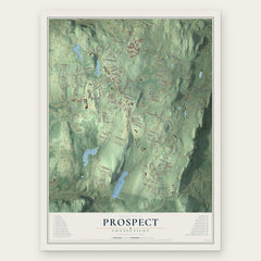

More maps nearby: Waterbury, Hillside, Bethany, Oxford and Quaker Farms.
The art of mapping a place
How This Map Was Made
Real places. Remarkable detail. Discover the layers that turn geographic data into a map of home.

The view from above
Aerial imagery reveals the character of the land: woodland, open fields, and the patterns of a place.

The shape of the land
Elevation data brings hills, valleys, and subtle changes in the landscape into view.

The details of home
Roads, waterways, and building footprints come together to make the map feel unmistakably local.

Geography becomes art
Considered color, shading, and typography bring the layers together in a map made for your wall.


Process illustrated with Mendon, Massachusetts. Aerial imagery: USDA NAIP. Terrain: USGS 3D Elevation Program. Map details and finished artwork: KNOWOL.
The Details
About This Print
Choose an archival matte print, or a black or white Ayous wood frame. The archival matte print is unframed.
Select your size and finish above to see the matching product image and price.
Materials & Craftsmanship
A contemporary map with the character of a classic atlas, printed on archival matte paper. Optional frames are made from Ayous wood.
Your printed map does not include the watermark shown in the full-map preview.
Shipping & Delivery
Free shipping within the United States. Every print is made to order in the USA.
Buying a gift? Add a note in your cart and we'll include it. We never put prices in the package.
Prints ship within 2 to 3 business days. Allow 7 to 10 days total from ordering for delivery. Timing may vary during holidays or periods of high order volume.
Read our shipping policy.
Returns and damaged prints
Each print is made to order. Change-of-mind refunds are not available after production.
If your print arrives damaged, misprinted or incorrect, contact support@knowol.com within 30 days of receiving it. Include your order number, photos and a description of the issue.
Read our full refund and replacement policy. For questions about your order, email support@knowol.com.