
Search for another town





Free U.S. delivery 7 to 10 days after you order
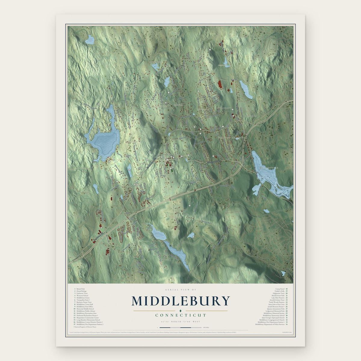
Middlebury, Connecticut Map Art
Building by building, with labeled streets and shaded relief.
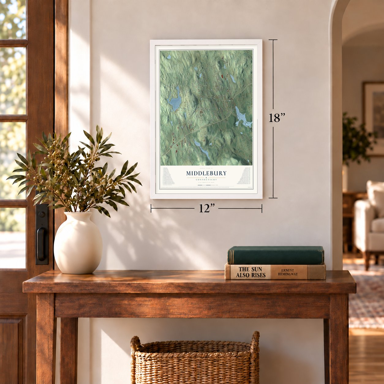
12" x 18" Archival Matte Print
A Map of Home. A Work of Art.
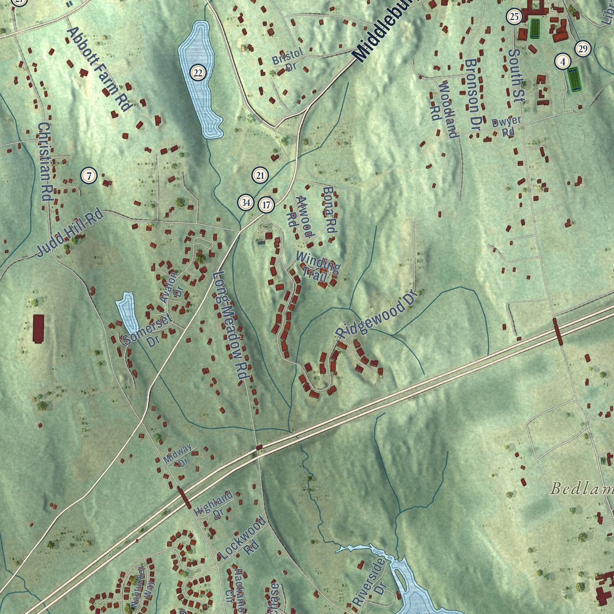
Explore Middlebury, Connecticut from a whole new perspective. Created using aerial imagery and detailed geographic data, this map captures Middlebury building by building, with labeled streets, familiar landmarks, and shaded topographical relief that highlights the natural contours of the landscape.
Combining modern data with the timeless character of a vintage atlas, this map is just as interesting up close as it is beautiful on the wall. Whether you grew up in Middlebury, spent memorable years there, or call it home today, this unique map is a great way to celebrate a place that means something to you. Zoom in on the preview to look for your street, and then order a print to put your memories on the wall.

Three ways to hang it
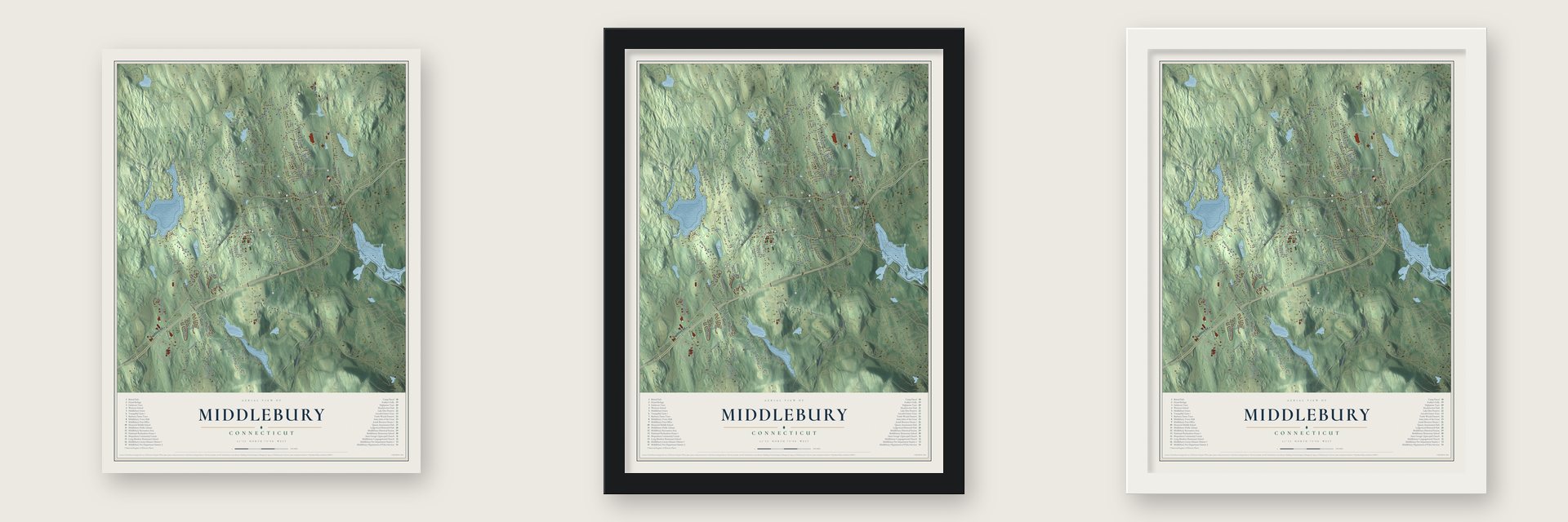
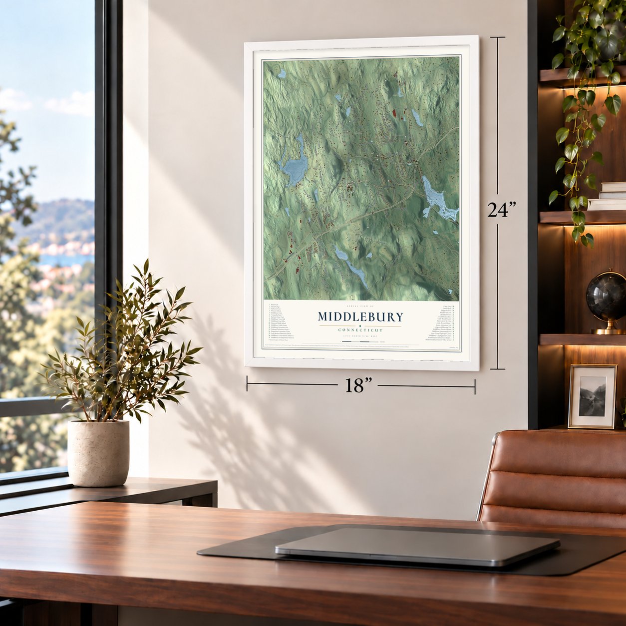
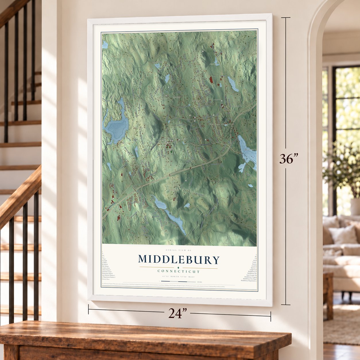
Unframed archival matte, a black wood frame or a white wood frame.
Up close
Geography Worth Displaying
This map was created using accurate cartographic data and authoritative geographic sources, including the U.S. Geological Survey (USGS) and FEMA. The map brings together terrain, waterways, roads, and building detail. The majority of the streets are labeled, houses are accurately depicted, and the topography is derived from government sources. Combining local data with carefully composed color and shading leads to this beautifully detailed Middlebury artwork for your wall.
Rather than simply showing street outlines, we’ve included as many of the street names as we could reasonably fit on the map while keeping their names legible. Zoom in on the high resolution preview to see exactly what’s on the map. We truly set out to create a statement piece for anyone who loves Middlebury. So whether it’s for you, or a gift for someone you love, we hope this map of Middlebury brings back fond memories.
Explore the full map of Middlebury, Connecticut and read about the local places it shows.

Find your street
Names on the Middlebury map
Every name below is printed on this map. Look for your street, your school, the park where you played, or the pond down the road.
Places and landmarks12
- Downtown
- Bradleyville
- Oronoke
- Hillcrest
- Westview Heights
- Bedlam Hill
- Breakneck Hill
- Buell Flats
- Great Hill
- Abbotts Pond
- Atwood Pond
- Juniper Hill
Streets and roads139
- Whittemore Road
- Middlebury Road
- Straits Turnpike
- Southford Road
- Glenwood Avenue
- Wheeler Road
- Kelly Road
- North Street
- Christian Road
- South Street
- White Deer Rock Road
- Long Meadow Road
- Breakneck Hill Road
- Charcoal Avenue
- Watertown Road
- Park Road
- Shadduck Road
- Three Mile Hill Road
- Sandy Beach Road
- Ridgewood Drive
- Benson Road
- Tranquility Road
- Burr Hall Road
- Old Watertown Road
- Upper Whittemore Road
- Judd Hill Road
- Regan Road
- Wooster Road
- Leonard Road
- Washington Drive
Show all 139 streets
- Yale Avenue
- Sandy Hill Road
- Mirey Dam Road
- Brookside Drive
- Tucker Hill Road
- Strathmore Road
- Bioski Road
- Artillery Road
- Lake Shore Drive
- North Benson Road
- Triangle Boulevard
- Steinmann Avenue
- Central Road
- White Avenue
- Porter Avenue
- Gunntown Road
- Munson Road
- Kissawaug Road
- West Lake Road
- Krodel Road
- Nota Town Road
- Chesnut Hill Road
- Crest Road
- Acme Drive
- Joy Road
- Falcon Crest Road
- Marney Drive
- Skyline Drive
- Chesham Drive
- Bronson Drive
- Northridge Drive
- Allerton Farms Road
- Curtis Road
- East Farms Road
- Green Hill Road
- Algin Drive
- Tower Road
- Fenn Road
- Ravenwood Drive
- Abbott Farm Road
- Richardson Drive
- Juliano Drive
- Hill Parkway
- Walnut Road
- Turnpike Drive
- Bristol Road
- King Street
- Hill Road
- Carriage Drive
- Porter Hill Road
- North Farms Road
- Steeplechase Drive
- Northwood Drive
- Country Club Road West
- Tyler Crossing
- Hunting Ridge Road
- Library Road
- Madison Court
- Spring Road
- Fairhaven Drive
- Memorial Drive
- Stony Brook Road
- Somerset Drive
- Senior Drive
- Bona Road
- Narcissus Road
- Maple Drive
- Tyler Road
- Deer Run Road
- Bayberry Road
- Foster Street
- Lockwood Road
- Atwood Road
- Middlebury Terrace
- Janet Drive
- Merideth Road
- Winding Trail
- Chase Road
- Riverside Drive
- Woodland Road
- Sycamore Road
- Stonewall Drive
- Cross Road
- Nichols Road
- Nick Road
- Park Drive
- Independence Circle
- Stevens Road
- Old Regan Road
- Dwyer Road
- Avalon Drive
- Hackamore Circle
- Pine Hollow Drive
- Highland Drive
- Upland Road
- Bristol Drive
- Rose Court
- Colonial Avenue
- Periwinkle Drive
- Gleneagle Road
- Kelly Road Extended
- East Ridge Drive
- Nantucket Way
- Winthrup Drive
- Clear View Knoll
- Store Road
- Midway Drive
- Aveline Avenue
- Service Road
Names are listed as they appear on the printed map. Zoom into the product photos to find them.
About Middlebury, Connecticut
Middlebury is a town of 7,574 people in New Haven County, just north of Waterbury. It began as West Farms, the western fringe of Waterbury, and in 1786 its families won the right to hear preaching at home for eight winter Sundays. In 1790 West Farms joined bordering corners of Woodbury and Southbury to form the society of Middlebury, named for its spot in the middle of those three older towns.
In 1793 the society built a meetinghouse in the center of town, and three years later, in 1796, twelve members gathered its church. Waterbury fought every petition for a separate town until the General Assembly gave in during October 1807. In April 1808 the new town voted 67 to none in favor of joining New Haven County, and that fall five townsmen wrote to President Jefferson about the hardships the embargo had brought.
“Its waters are clear, cool and in parts very deep. The lake abounds with fish, mostly bass and pickerel, and the locality has always been a favorite resort of sportsmen.”
- Rochambeau on Breakneck HillThe Comte de Rochambeau's French army marched through Middlebury on June 27, 28 and 29, 1781, bound from Newport for Yorktown. Hauling cannon and wagons up Breakneck Hill was among the toughest days of the march, and some troops camped on the hill. In October 1782 the French came back through, headed for Boston. In 2026 the historical society honored them with Tony Falcone's statue of a French foot soldier in Meadowview Park.
- The oldest house, about 1738The Bronsons were among the earliest families around Breakneck Hill, and Josiah Bronson most likely built the house on Breakneck Hill Road about 1738. No older house still stands in Middlebury. Much of the original woodwork remains, Federal touches came about 1800, and a pair of old barns sits behind the house. The Josiah Bronson House joined the National Register in 1982.
- A steam yacht on QuassapaugHiram J. Wallace purchased the old Uri Manville farm on the south end of Lake Quassapaug in 1874 and turned it into a pleasure resort. By 1888 he had a hotel, a score of rowboats and the White Deer, a steam yacht for 36 passengers. Across the lake, Eben E. Richardson opened Richardson's Grove in 1878, known for shore dinners.
- Cloth and knives at BradleyvilleSometime after 1795 Enos Bradley put up a sawmill and cloth works on Hop Brook. He was so skilled at dressing cloth that people hauled rough cloth to his mill from across the county. Later the mill made wagon wheels, then pocket knives. Samuel Root managed the cutlery works, staffed by skilled English workmen, until it shut down in 1887.
Keep exploring Connecticut
Middlebury is one of 382 Connecticut towns we've mapped. Every dot on the map is a print of its own.
The search covers every state, Connecticut first.
Near Middlebury
Order 2 or more town maps and save 10%. Shown in the size and finish you picked above, so they hang as a set.
- Woodbury Center 12" x 18" / Archival Matte Print $39.99
- Naugatuck 12" x 18" / Archival Matte Print $39.99
- Oakville 12" x 18" / Archival Matte Print $39.99


More maps nearby: Hillside, Woodbury, Waterbury, Oxford and Heritage Village.
The art of mapping a place
How This Map Was Made
Real places. Remarkable detail. Discover the layers that turn geographic data into a map of home.

The view from above
Aerial imagery reveals the character of the land: woodland, open fields, and the patterns of a place.

The shape of the land
Elevation data brings hills, valleys, and subtle changes in the landscape into view.

The details of home
Roads, waterways, and building footprints come together to make the map feel unmistakably local.

Geography becomes art
Considered color, shading, and typography bring the layers together in a map made for your wall.


Process illustrated with Mendon, Massachusetts. Aerial imagery: USDA NAIP. Terrain: USGS 3D Elevation Program. Map details and finished artwork: KNOWOL.
The Details
About This Print
Choose an archival matte print, or a black or white Ayous wood frame. The archival matte print is unframed.
Select your size and finish above to see the matching product image and price.
Materials & Craftsmanship
A contemporary map with the character of a classic atlas, printed on archival matte paper. Optional frames are made from Ayous wood.
Your printed map does not include the watermark shown in the full-map preview.
Shipping & Delivery
Free shipping within the United States. Every print is made to order in the USA.
Buying a gift? Add a note in your cart and we'll include it. We never put prices in the package.
Prints ship within 2 to 3 business days. Allow 7 to 10 days total from ordering for delivery. Timing may vary during holidays or periods of high order volume.
Read our shipping policy.
Returns and damaged prints
Each print is made to order. Change-of-mind refunds are not available after production.
If your print arrives damaged, misprinted or incorrect, contact support@knowol.com within 30 days of receiving it. Include your order number, photos and a description of the issue.
Read our full refund and replacement policy. For questions about your order, email support@knowol.com.