


Search for another town





Free U.S. delivery 7 to 10 days after you order
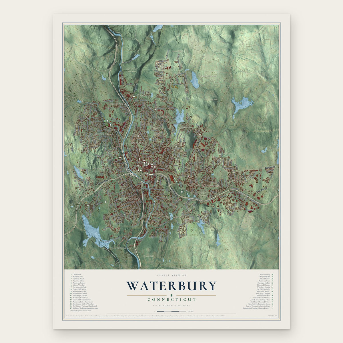
Waterbury, Connecticut Map Art
Building by building, with labeled streets and shaded relief.
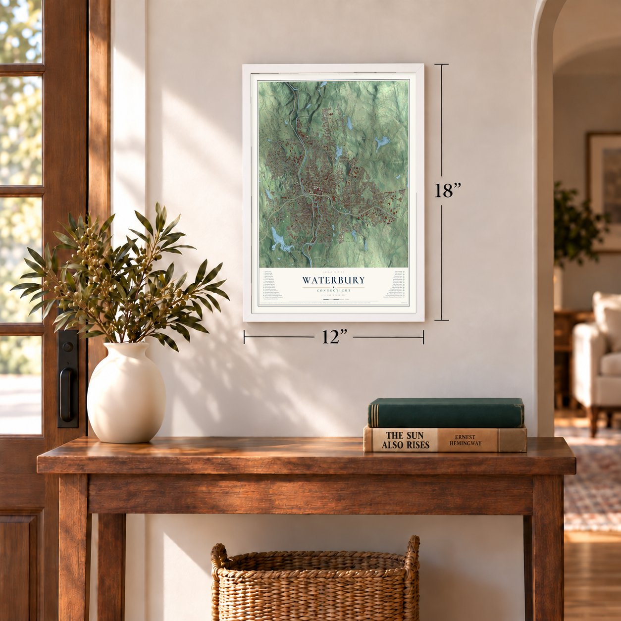
12" x 18" Archival Matte Print
A Map of Home. A Work of Art.
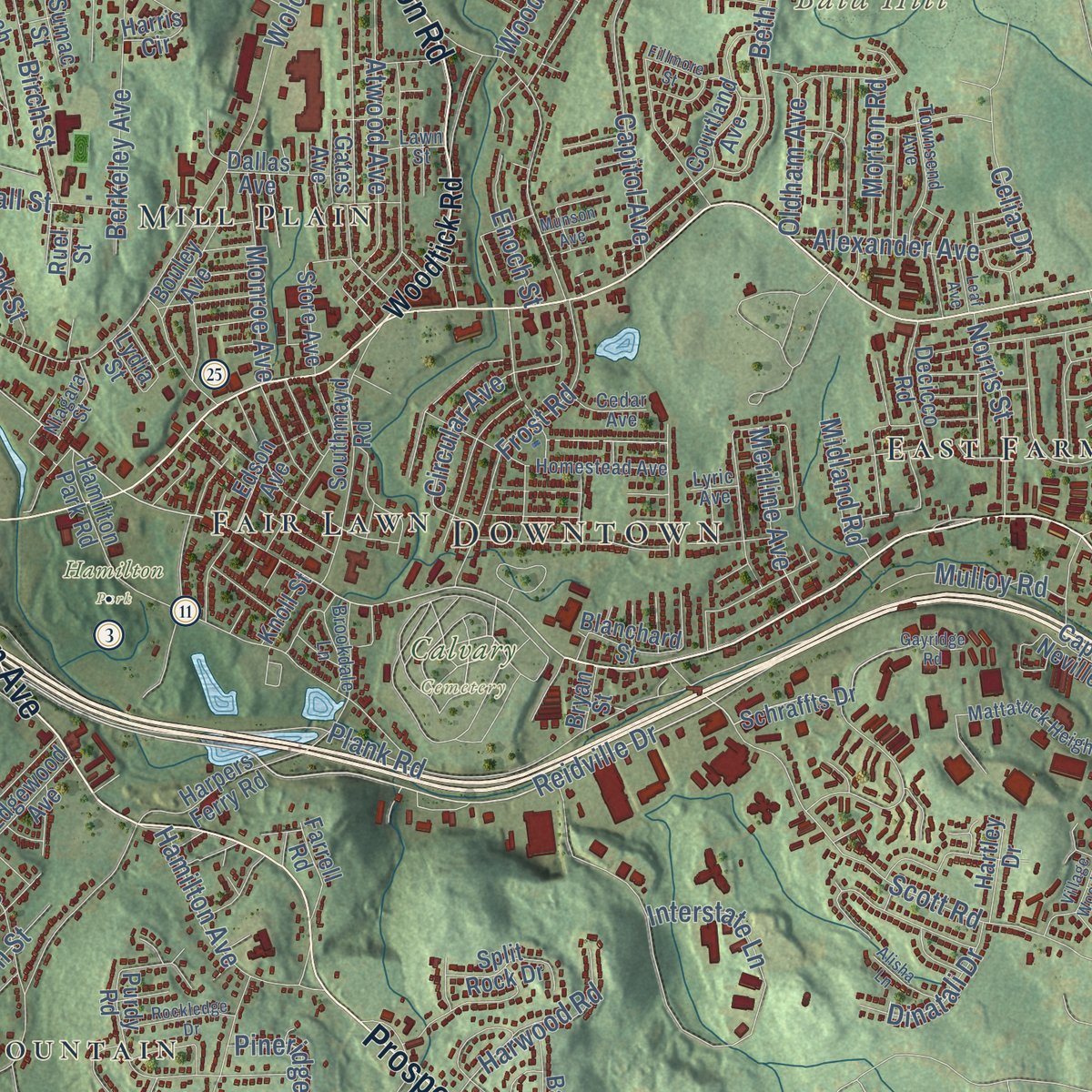
Explore Waterbury, Connecticut from a whole new perspective. Created using aerial imagery and detailed geographic data, this map captures Waterbury building by building, with labeled streets, familiar landmarks, and shaded topographical relief that highlights the natural contours of the landscape.
Combining modern data with the timeless character of a vintage atlas, this map is just as interesting up close as it is beautiful on the wall. Whether you grew up in Waterbury, spent memorable years there, or call it home today, this unique map is a great way to celebrate a place that means something to you. Zoom in on the preview to look for your street, and then order a print to put your memories on the wall.

Three ways to hang it
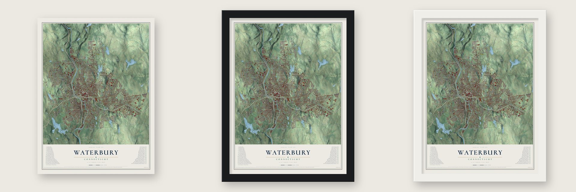
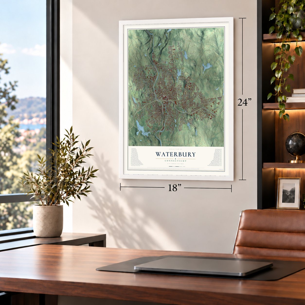
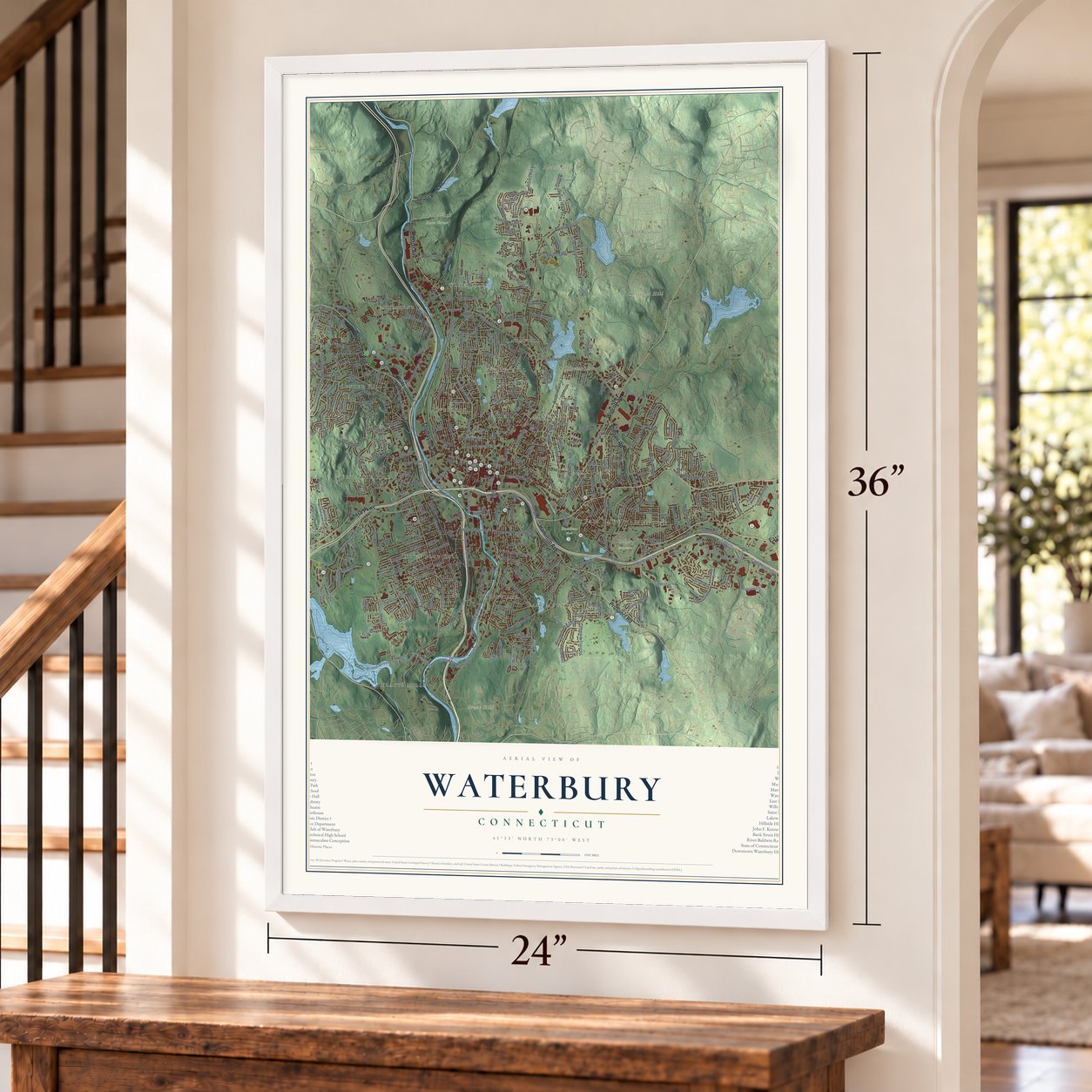
Unframed archival matte, a black wood frame or a white wood frame.
Up close
Geography Worth Displaying
This map was created using accurate cartographic data and authoritative geographic sources, including the U.S. Geological Survey (USGS) and FEMA. The map brings together terrain, waterways, roads, and building detail. The majority of the streets are labeled, houses are accurately depicted, and the topography is derived from government sources. Combining local data with carefully composed color and shading leads to this beautifully detailed Waterbury artwork for your wall.
Rather than simply showing street outlines, we’ve included as many of the street names as we could reasonably fit on the map while keeping their names legible. Zoom in on the high resolution preview to see exactly what’s on the map. We truly set out to create a statement piece for anyone who loves Waterbury. So whether it’s for you, or a gift for someone you love, we hope this map of Waterbury brings back fond memories.
Explore the full map of Waterbury, Connecticut and read about the local places it shows.

Find your street
Names on the Waterbury map
Every name below is printed on this map. Look for your street, your school, the park where you played, or the pond down the road.
Places and landmarks26
- Downtown
- Bald Hill
- Bucks Hill
- Chestnut Hill
- Great Hill
- Belleview Lake
- Chestnut Hill Reservoir
- Calvary Cemetery
- Hamilton Park
- Mattatuck State Forest
- Oronoke
- Bunker Hill
Show all 26 places
- Hopeville
- West Side Hill
- Fairmount
- East Mountain
- Mill Plain
- Long Hill
- Town Plot Hill
- Overlook
- Burnt Hill
- Waterville
- Platts Mills
- East Farms
- Fair Lawn
- Lakewood
Streets and roads367
- East Main Street
- Thomaston Avenue
- Meriden Road
- Chase Parkway
- Watertown Avenue
- Prospect Road
- Hamilton Avenue
- Wolcott Street
- Stillson Road
- West Main Street
- Bank Street
- Brookside Road
- Reidville Drive
- South Main Street
- Cherry Street
- North Main Street
- Baldwin Street
- Wilson Street
- Windy Drive
- Highland Avenue
- Waterville Street
- North Walnut Street
- Cooke Street
- Oronoke Road
- Riverside Street
- Pearl Lake Road
- Boyden Street
- Bucks Hill Road
- Park Road
- Country Club Road
Show all 367 streets
- Columbia Boulevard
- Huntingdon Avenue
- Willow Street
- Plank Road
- Frost Road
- Congress Avenue
- Hill Street
- Lakewood Road
- Sylvan Avenue
- Interstate Lane
- South Leonard Street
- Farmwood Road
- East Mountain Road
- Pierpont Road
- Scott Road
- Woodtick Road
- Washington Avenue
- Union Street
- Beth Lane
- Austin Road
- Pine Street
- Clough Road
- Chase Avenue
- Bradley Avenue
- Oakville Avenue
- Long Hill Road
- Tudor Street
- Chipman Street
- Rairoad Hill Street
- Lakeside Boulevard West
- Municipal Road
- Bristol Street Extended
- Piedmont Street
- Anna Avenue
- Spring Lake Road
- Progress Lane
- Oak Street
- Walnut Street
- Platts Mill Road
- Grassy Hill Road
- Yale Street
- Perkins Avenue
- East Aurora Street
- Chase River Road
- Mapleridge Drive
- Chestnut Hill Avenue
- Robbins Street
- Orange Street
- Washington Street
- Atwood Avenue
- Lincoln Street
- Fairfield Avenue
- Capitol Avenue
- Ardsley Road
- Wall Street
- Grove Street
- Dwight Street
- Berkeley Avenue
- Hillside Avenue
- Circular Avenue
- Gaylord Drive
- New Haven Avenue
- Sheffield Street
- Jersey Street
- Lounsbury Street
- Geddes Terrace
- Juniper Ridge Drive
- Capt Neville Drive
- Kendall Circle
- Raymond Street
- Blueridge Drive
- Montoe Road
- Eastern Avenue
- Heritage Drive
- Mill Street
- Wesley Street
- Alexander Avenue
- Bishop Street
- Harwood Road
- Platt Street
- Birch Street
- Moran Street
- Alder Street
- Freight Street
- Whitewood Road
- Fiske Street
- Nichols Drive
- Madison Street
- Chipper Road
- Byam Road
- Norris Street
- Monroe Avenue
- Sharon Road
- Garden Circle
- Middlesex Street
- Mark Lane
- Mulloy Road
- Hewey Street
- Kaynor Drive
- Meriline Avenue
- Clematis Avenue
- Crest Street
- Dinatali Drive
- Northridge Drive
- Ridgeland Drive
- Midwood Avenue
- Devonwood Drive
- Ledgeside Avenue
- Southwest Road
- Dan Parker Drive
- Judith Lane
- Morton Road
- Greystone Road
- Enoch Street
- Madera Drive
- Celia Drive
- Pineridge Road
- Hubbell Avenue
- Bristol Street
- Oldham Avenue
- Clinton Street
- Midland Road
- Taft Pointe
- Hope Street
- Holly Street
- Seymour Street
- Gail Drive
- Kelsey Street
- Ridge Street
- Midfield Drive
- Green Street
- Allen Street
- Club Drive
- Vail Street
- Luke Street
- Spruce Brook Road
- Rudy Avenue
- High Street
- Ayers Street
- Schraffts Drive
- Mc Mahan Street
- East Side Boulevard
- Bunker Hill Avenue
- Peach Orchard Road
- Harpers Ferry Road
- Edgewood Avenue
- Farmington Avenue
- Highland Drive
- White Birch Drive
- Forest Ridge Road
- Stoddard Road
- Parklawn Drive
- Southmayd Road
- Courtland Avenue
- Turnpike Drive
- Lakeside Boulevard East
- Captain Neville Drive
- Traverse Street
- Hickory Hill Drive
- Maybrook Road
- Wood Street
- Hamilton Park Road
- Knollwood Circle
- Citizens Avenue
- Baldwin Avenue
- Division Street
- Circuit Avenue
- Purdy Road
- Fanning Street
- Lincolndale Drive
- Pearl Street
- Spring Brook Road
- Grilleytown Road
- Homer Street
- Hamden Avenue
- Bateswood Road
- Beech Street
- Norton Street
- Manhan Street
- Bouley Avenue
- Farrell Road
- Hauser Street
- North Elm Street
- Ridgeway Avenue
- Highview Street
- Hans Avenue
- Harris Circle
- Split Rock Drive
- Melbourne Terrace
- West Liberty Street
- Westport Drive
- Edson Avenue
- Essex Avenue
- Byrneside Avenue
- Decicco Road
- Mattoon Road
- Wyoming Avenue
- Carriage Drive
- Newton Terrace
- Como Avenue
- Beverly Avenue
- Newfield Avenue
- Johnson Street
- Blanchard Street
- Shadee Lane
- Southgate Road
- Store Avenue
- Laurie Place
- Esther Avenue
- Kenfield Lane
- Wayland Avenue
- Downes Street
- Scovill Street
- Hillview Avenue
- Hartley Drive
- Dallas Avenue
- Clyde Avenue
- Industry Lane
- Starlet Lane
- Kara Drive
- Burr Street
- Giles Street
- Joshua Town Road
- Sierra Street
- Fox Street
- Fern Circle
- Oakleaf Drive
- Sumac Street
- Goss Street
- Revere Street
- Stowe Road
- Laurel Street
- Alpine Avenue
- Knoll Street
- Gates Avenue
- Fleet Street
- Drake Street
- Welch Street
- Terrell Road
- Goff Street
- Bryan Street
- Elk Avenue
- Short Street
- Earl Street
- Judd Street
- Lydia Street
- Dixie Avenue
- Blake Street
- Ruel Street
- Grand Street
- America Street
- Homestead Avenue
- Mattatuck Heights Road
- Colonial Avenue
- River Street
- Westwood Avenue
- Arline Drive
- Fieldwood Road
- Wilkenda Avenue
- Delaware Avenue
- Angel Drive
- Deerfield Avenue
- Joy Road
- Macarthur Drive
- Townsend Avenue
- Rosette Street
- Elise Drive
- Eastfield Road
- Blackman Road
- Irvington Avenue
- Alberta Street
- Fern Street
- Woodmere Road
- Farmcrest Drive
- Brookdale Lane
- Ferrone Avenue
- Fulkerson Drive
- Oak Hill Avenue
- Herkimer Street
- Sherman Avenue
- Niagara Street
- Indian Trail
- Burton Street
- Cedar Avenue
- Cronin Drive
- Reid Street
- Eagle Street
- Venice Avenue
- Fairfax Street
- Vernon Street
- Lawn Street
- Corona Drive
- Wyman Street
- Skyline Drive
- Steep Hill Road
- Acra Road
- Parker Street
- Lyric Avenue
- Hale Street
- Pear Street
- Meadow Street
- Media Avenue
- Robinwood Road
- Edin Avenue
- Buckingham Street
- Middleway East
- Avon Avenue
- Proctor Street
- South Street
- Village Wood Drive
- Pinecrest Drive
- Redcoat Road
- Central Avenue
- Griggs Street
- Karen Avenue
- Birchwood Street
- Randolph Avenue
- Windsor Street
- Forest Avenue
- Fillmore Street
- Rockledge Drive
- White Street
- Arnold Street
- Cooper Drive
- Lamont Street
- Deering Lane
- Umberfield Road
- Alisha Lane
- State Street
- Ross Street
- Sorrel Road
- Gayridge Road
- West Porter Street
- Warren Street
- Society Hill
- Leaf Avenue
- Munson Avenue
Names are listed as they appear on the printed map. Zoom into the product photos to find them.
About Waterbury, Connecticut
Waterbury is a city of 114,403 people in New Haven County, on the Naugatuck River. Settlers from Farmington built in today's Town Plot section in 1674 and named the place Mattatuck, from a native name meaning "the interval lands." King Philip's War drove them out in 1675, and when peace returned in 1677 they rebuilt east of the river along the Mad River. In 1686 Connecticut made the settlement the colony's 28th town and gave it the name Waterbury, for the many streams that run down the hills into the Naugatuck.
Those streams flooded the meadows often. In February 1691 high water stripped away the freshly plowed soil and buried the rest under sand and stones, and many families gave up and left, so a century later the town had only about 5,000 people. Later the same water turned the wheels of the mills. Waterbury became a city in 1853, and Scovill, American Brass and Chase Brass and Copper, the Big Three, made it the world's leading brass producer, with 50,000 people in the brass mills at the peak.
“The City of Brass might with equal propriety be called the City of Bridges.”
- Brass from old kettlesIn 1802 brothers Abel and Levi Porter teamed with the Grilley brothers, pewter button makers, to found Abel Porter and Company. In 1824 the firm presented Lafayette a full set of solid gold buttons.
- A hill dug away for watchesPine Hill rose 107 feet near the Naugatuck, and the town had long hauled its building sand from it. In March 1880 a steam shovel left from railroad work began on the hill, and by September 1881 it was gone, its sand dumped into the swampy riverside ground. That May the Waterbury Watch Company had moved into a factory cut sixty feet into what remained.
- Mickey Mouse on the wristRobert H. Ingersoll's one-dollar pocket watch, made in Waterbury, sold five million copies. In June 1933 the Waterbury company that later became Timex brought out a Mickey Mouse watch under the Ingersoll name. On the day it went on sale, Macy's alone moved 11,000 of them, and the watch saved the company from bankruptcy.
- A tower copied from SienaUnion Station opened in 1909 on the west side of downtown. McKim, Mead and White designed it, and its clock tower, 240 feet tall, was patterned on Siena's Torre del Mangia. It became the city's best-known landmark. As many as 66 passenger trains once stopped there each day. The station building is now home to the Republican-American newspaper.
- Kennedy at 3 AMFire swept downtown on February 2, 1902, and the Elton Hotel went up on the Green in the rebuilding. It opened in 1904 and made money from its very first year, and F. Scott Fitzgerald was among its guests. On the eve of the 1960 election, forty thousand people stayed on the Green until 3 AM, when John F. Kennedy finally spoke to them from the hotel's balcony.
Keep exploring Connecticut
Waterbury is one of 382 Connecticut towns we've mapped. Every dot on the map is a print of its own.
The search covers every state, Connecticut first.
Near Waterbury
Order 2 or more town maps and save 10%. Shown in the size and finish you picked above, so they hang as a set.
- Hillside 12" x 18" / Archival Matte Print $39.99
- Oakville 12" x 18" / Archival Matte Print $39.99
- Wolcott 12" x 18" / Archival Matte Print $39.99


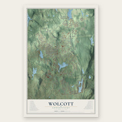
More maps nearby: Naugatuck, Middlebury, Prospect, Watertown and Plymouth.
The art of mapping a place
How This Map Was Made
Real places. Remarkable detail. Discover the layers that turn geographic data into a map of home.

The view from above
Aerial imagery reveals the character of the land: woodland, open fields, and the patterns of a place.

The shape of the land
Elevation data brings hills, valleys, and subtle changes in the landscape into view.

The details of home
Roads, waterways, and building footprints come together to make the map feel unmistakably local.

Geography becomes art
Considered color, shading, and typography bring the layers together in a map made for your wall.


Process illustrated with Mendon, Massachusetts. Aerial imagery: USDA NAIP. Terrain: USGS 3D Elevation Program. Map details and finished artwork: KNOWOL.
The Details
About This Print
Choose an archival matte print, or a black or white Ayous wood frame. The archival matte print is unframed.
Select your size and finish above to see the matching product image and price.
Materials & Craftsmanship
A contemporary map with the character of a classic atlas, printed on archival matte paper. Optional frames are made from Ayous wood.
Your printed map does not include the watermark shown in the full-map preview.
Shipping & Delivery
Free shipping within the United States. Every print is made to order in the USA.
Buying a gift? Add a note in your cart and we'll include it. We never put prices in the package.
Prints ship within 2 to 3 business days. Allow 7 to 10 days total from ordering for delivery. Timing may vary during holidays or periods of high order volume.
Read our shipping policy.
Returns and damaged prints
Each print is made to order. Change-of-mind refunds are not available after production.
If your print arrives damaged, misprinted or incorrect, contact support@knowol.com within 30 days of receiving it. Include your order number, photos and a description of the issue.
Read our full refund and replacement policy. For questions about your order, email support@knowol.com.