
Search for another town





Free U.S. delivery 7 to 10 days after you order
Wolcott, Connecticut Map Art
Building by building, with labeled streets and shaded relief.
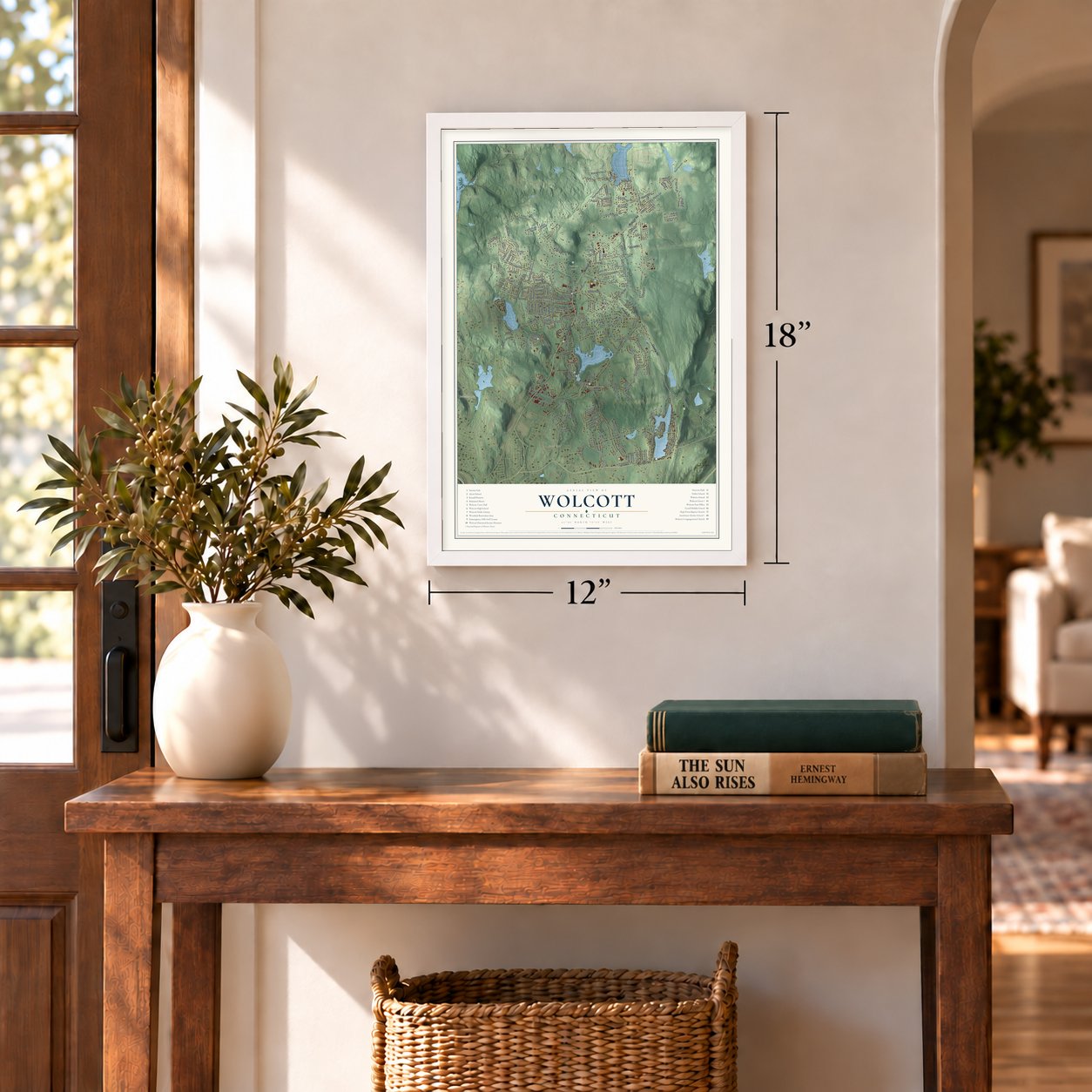
12" x 18" Archival Matte Print
A Map of Home. A Work of Art.
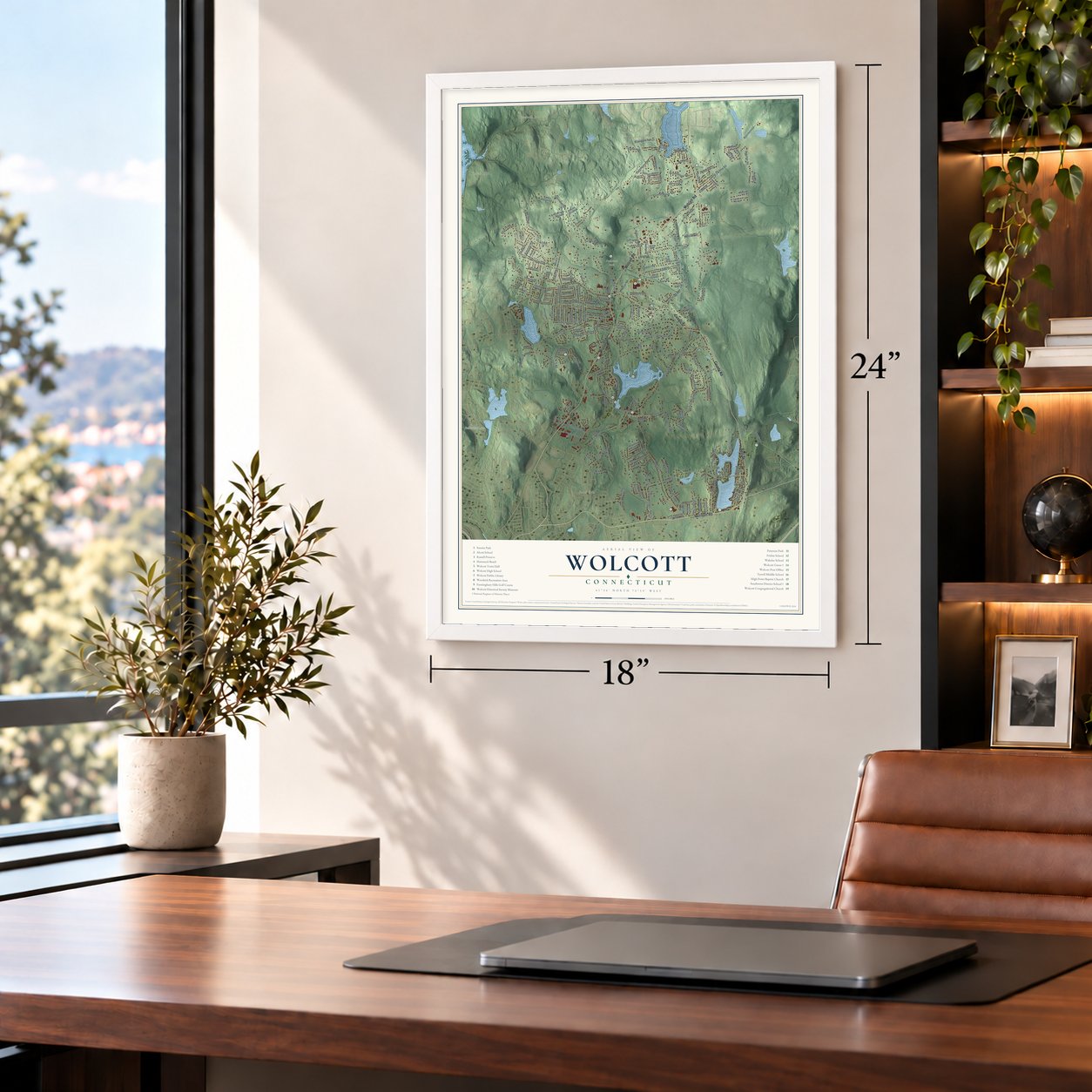
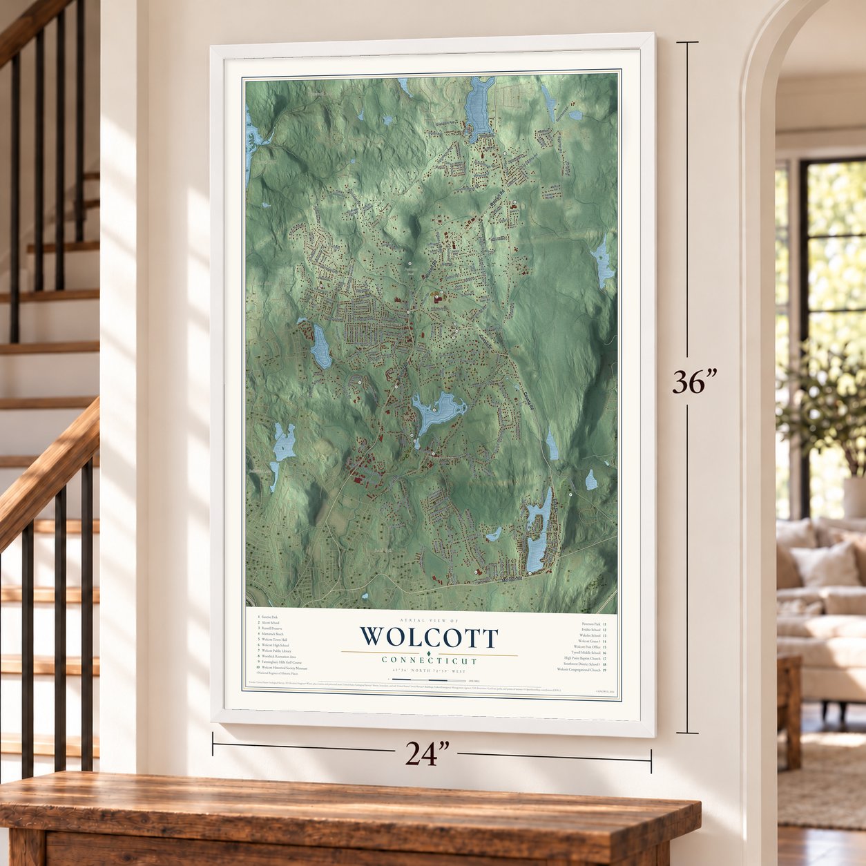
Explore Wolcott, Connecticut from a whole new perspective. Created using aerial imagery and detailed geographic data, this map captures Wolcott building by building, with labeled streets, familiar landmarks, and shaded topographical relief that highlights the natural contours of the landscape.
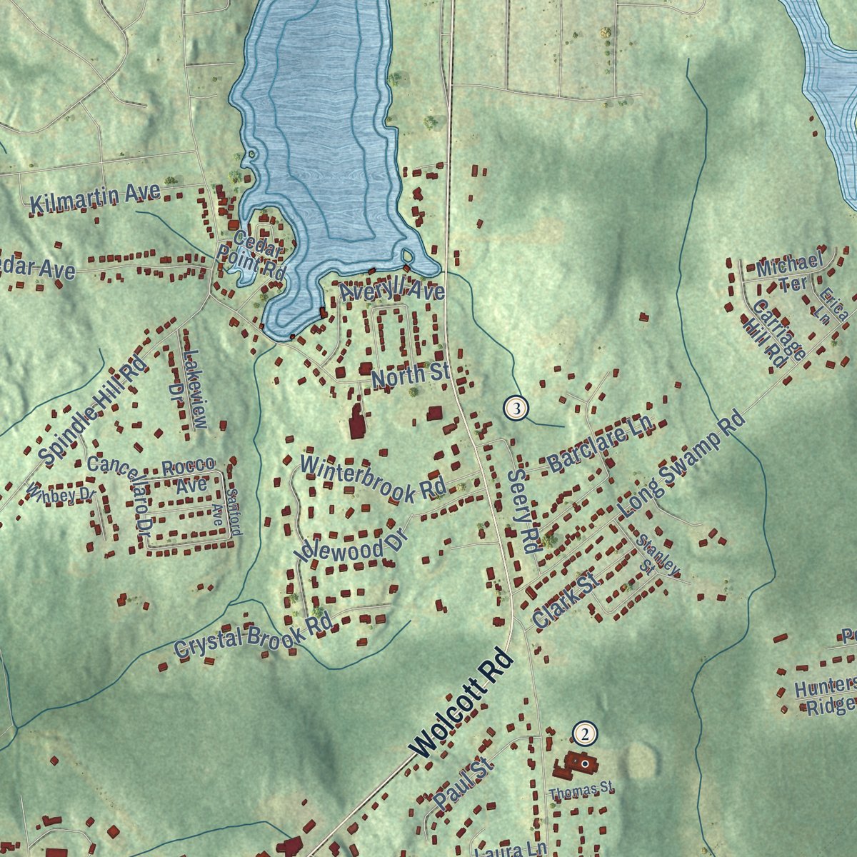
Combining modern data with the timeless character of a vintage atlas, this map is just as interesting up close as it is beautiful on the wall. Whether you grew up in Wolcott, spent memorable years there, or call it home today, this unique map is a great way to celebrate a place that means something to you. Zoom in on the preview to look for your street, and then order a print to put your memories on the wall.

Three ways to hang it
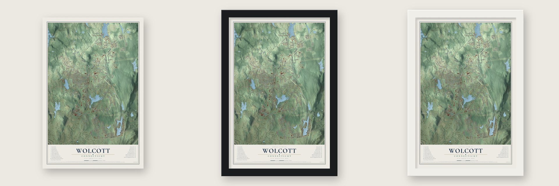
Unframed archival matte, a black wood frame or a white wood frame.
Up close
Geography Worth Displaying
This map was created using accurate cartographic data and authoritative geographic sources, including the U.S. Geological Survey (USGS) and FEMA. The map brings together terrain, waterways, roads, and building detail. The majority of the streets are labeled, houses are accurately depicted, and the topography is derived from government sources. Combining local data with carefully composed color and shading leads to this beautifully detailed Wolcott artwork for your wall.
Rather than simply showing street outlines, we’ve included as many of the street names as we could reasonably fit on the map while keeping their names legible. Zoom in on the high resolution preview to see exactly what’s on the map. We truly set out to create a statement piece for anyone who loves Wolcott. So whether it’s for you, or a gift for someone you love, we hope this map of Wolcott brings back fond memories.
Explore the full map of Wolcott, Connecticut and read about the local places it shows.

Find your street
Names on the Wolcott map
Every name below is printed on this map. Look for your street, your school, the park where you played, or the pond down the road.
Places and landmarks9
- Downtown
- Woodtick
- Bald Hill
- Becar Hill
- Birch Hill
- Bucks Hill
- Belleview Lake
- Buttermilk Falls
- Peterson Park
Streets and roads201
- Meriden Road
- Center Street
- County Road
- East Street
- Wolcott Road
- Woodtick Road
- Laurel Lane
- Todd Road
- Spindle Hill Road
- Bound Line Road
- Beecher Road
- Lyman Road
- Central Avenue
- Andrews Road
- Beach Road
- Longmeadow Drive
- South Colman Road
- Munson Road
- Catering Road
- Long Swamp Road
- Clinton Hill Road
- Nichols Road
- Mad River Road
- Garigus Court
- Midwood Avenue
- Potuccos Ring Road
- Wolf Hill Road
- Allentown Road
- Richard Avenue
- Harrison Drive
Show all 201 streets
- Ransom Hall Road
- Old Bound Line Road
- Brooks Hill Road
- Sunrise Road
- Hemple Drive
- Finch Road
- Forestview Drive
- Bayview Circle
- Farview Avenue
- Coe Road
- Kalko Drive
- Winterbrook Road
- Chasse Road
- Saddle Road
- Cedar Avenue
- August Avenue
- North Street
- Chestnut Hill Road
- Nutmeg Valley Road
- Knollwood Drive
- Minor Road
- Town Line Road
- Arvida Road
- Scovill Road
- Grilley Road
- Pratt Lane
- Crystal Brook Road
- Woodward Drive
- Ridgecrest Drive
- Idlewood Drive
- Chestnut Drive
- Upson Road
- Cambridge Drive
- Woodcrest Avenue
- Deepwood Drive
- Shelton Avenue
- Simon Drive
- Devonshire Road
- Kilmartin Avenue
- Sandy Lane
- Pineridge Drive
- Hickory Lane
- Paul Street
- Beechers Lane
- Kreger Drive
- White Oak Lane
- Church Drive
- Barclare Lane
- Clark Street
- Klan Drive
- Lindsley Drive
- Colman Drive
- Cedar Lane
- Wilson Road
- Seery Road
- Garthwait Road
- Cole Drive
- Charles Drive
- Bolduc Court
- Celia Drive
- Norton Heights
- Orchard Lane
- Tunxis Road
- Ivy Lane
- Evas Terrace
- Averyll Avenue
- Oak Street
- Ferro Road
- Spring Road
- Susan Court
- Val Court
- Lake Street
- Hess Drive
- Dellwood Road
- Lancewood Lane
- Garrigus Court
- Tosun Road
- Chicory Drive
- Cancellaro Drive
- Sky Hill Drive
- Deer Run Drive
- Mountain View Drive
- Dale Avenue
- Diamond Rock Road
- Silver Pond Road
- Juniper Drive
- Tame Buck Road
- Todd Hollow Road
- Brookdale Street
- Jacqueline Drive
- Heritage Court
- Coach Drive
- Pimlico Road
- Carriage Hill Road
- Hunters Ridge
- Ledger Brook Drive
- Beacon Hill Boulevard
- Hillside Drive
- Fenton Avenue
- Jasmine Lane
- Park Avenue
- Steele Avenue
- Lorenz Drive
- Janet Avenue
- Bergen Lane
- Wakelee Road
- Rustic Acres Drive
- Colonial Court
- Michael Terrace
- Manor Lane
- Lakeview Drive
- Oakengate
- Old Farm Road
- Moss Lane
- Sheraton Drive
- Henry Street
- Evergreen Drive
- Hilltop Drive
- Alma Avenue
- Badger Road
- Rocco Avenue
- Waller Avenue
- Porter Road
- Laura Lane
- Rogers Road
- Equinox Avenue
- Cedar Point Road
- Pond Drive
- Village Drive
- Elrae Drive
- Bilby Drive
- Frisbie Circle
- Wagon Trail
- Brook Lane
- Swiss Lane
- Cliff Street
- Old New England Road
- Hemingway Avenue
- Pleasant Street
- Hampshire Drive
- Chesterfield Avenue
- Wihbey Drive
- Kingswood Lane
- Buckland Street
- Alcott Road
- Stanley Street
- Crestwood Drive
- Teresa Drive
- Evers Drive
- Brentwood Drive
- Patricia Lane
- Deanna Lane
- Sunset Lane
- Barbara Drive
- Lewis Avenue
- College Place
- Mohawk Drive
- Red Fox Run
- Grove Avenue
- Erica Lane
- Linda Drive
- Sanford Avenue
- Williams Court
- Homewood Place
- Colby Lane
- Diamond Terrace
- Longview Lane
- Woodland Drive
- Thomas Street
- Ellen Avenue
- Petrie Road
Names are listed as they appear on the printed map. Zoom into the product photos to find them.
About Wolcott, Connecticut
Wolcott began as Farmingbury, a border parish shared by Waterbury and Farmington. A tied legislative vote in 1796 was reportedly decided by Oliver Wolcott, whose name the new town adopted. The community remained largely rural into the twentieth century.
- Incorporated in 1796Farmingbury became a town after a deciding vote credited to Lieutenant Governor Oliver Wolcott.
- 16,142 peopleCounted in the 2020 census.
- Seth ThomasThe clockmaker was born here in 1785 and later gave his name to Thomaston.
- Amos Bronson AlcottThe teacher and reformer was born here in 1799 and was the father of Louisa May Alcott.
- Woodtick ReservoirDamming the Mad River in 1917 created the 121-acre water supply for the Scovill Manufacturing Company.
Keep exploring Connecticut
Wolcott is one of 382 Connecticut towns we've mapped. Every dot on the map is a print of its own.
The search covers every state, Connecticut first.
Near Wolcott
Order 2 or more town maps and save 10%. Shown in the size and finish you picked above, so they hang as a set.
- Plantsville 12" x 18" / Archival Matte Print $39.99
- Waterbury 12" x 18" / Archival Matte Print $39.99
- Hillside 12" x 18" / Archival Matte Print $39.99


More maps nearby: Southington, Plymouth, Terryville, Bristol and Oakville.
The art of mapping a place
How This Map Was Made
Real places. Remarkable detail. Discover the layers that turn geographic data into a map of home.

The view from above
Aerial imagery reveals the character of the land: woodland, open fields, and the patterns of a place.

The shape of the land
Elevation data brings hills, valleys, and subtle changes in the landscape into view.

The details of home
Roads, waterways, and building footprints come together to make the map feel unmistakably local.

Geography becomes art
Considered color, shading, and typography bring the layers together in a map made for your wall.


Process illustrated with Mendon, Massachusetts. Aerial imagery: USDA NAIP. Terrain: USGS 3D Elevation Program. Map details and finished artwork: KNOWOL.
The Details
About This Print
Choose an archival matte print, or a black or white Ayous wood frame. The archival matte print is unframed.
Select your size and finish above to see the matching product image and price.
Materials & Craftsmanship
A contemporary map with the character of a classic atlas, printed on archival matte paper. Optional frames are made from Ayous wood.
Your printed map does not include the watermark shown in the full-map preview.
Shipping & Delivery
Free shipping within the United States. Every print is made to order in the USA.
Buying a gift? Add a note in your cart and we'll include it. We never put prices in the package.
Prints ship within 2 to 3 business days. Allow 7 to 10 days total from ordering for delivery. Timing may vary during holidays or periods of high order volume.
Read our shipping policy.
Returns and damaged prints
Each print is made to order. Change-of-mind refunds are not available after production.
If your print arrives damaged, misprinted or incorrect, contact support@knowol.com within 30 days of receiving it. Include your order number, photos and a description of the issue.
Read our full refund and replacement policy. For questions about your order, email support@knowol.com.