

Search for another town





Free U.S. delivery 7 to 10 days after you order
North Branford, Connecticut Map Art
A beautifully detailed map of North Branford, Connecticut, made from modern sources and satellite imagery, printed to order on archival matte paper.
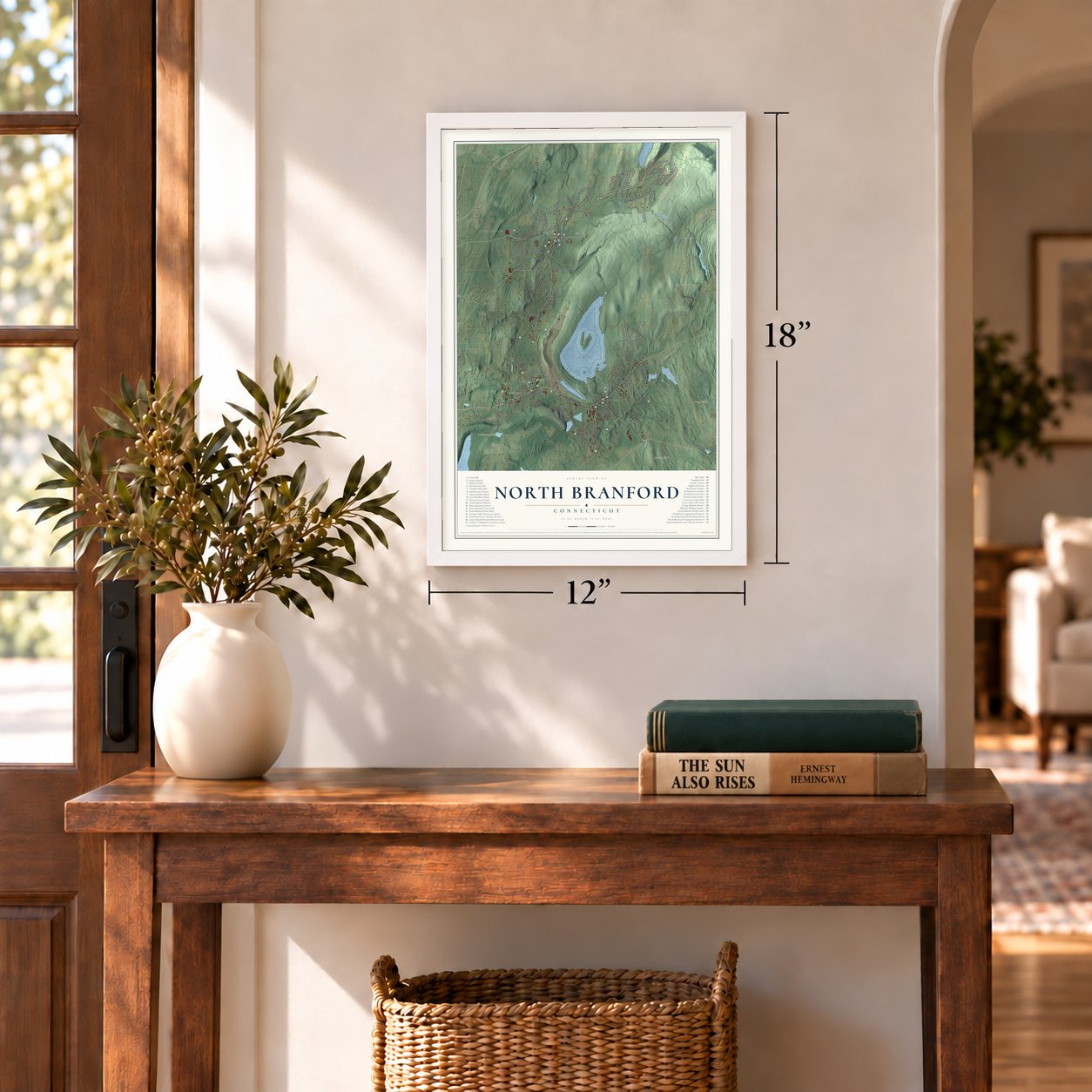
12" x 18" Archival Matte Print
A Map of Home. A Work of Art.
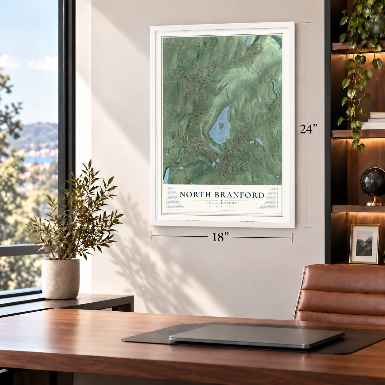
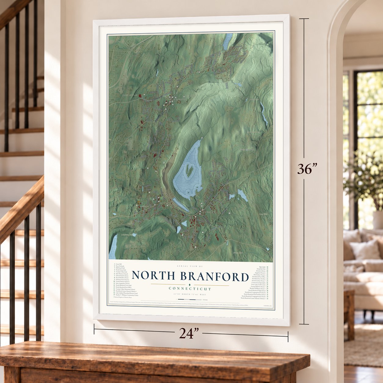
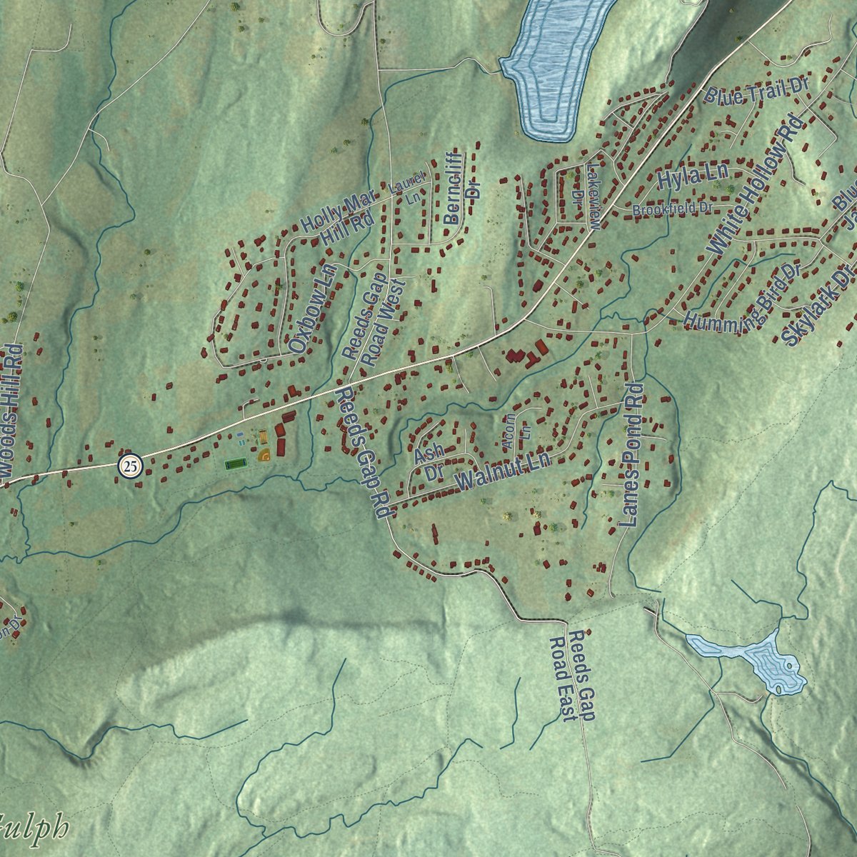
Explore North Branford, Connecticut from a whole new perspective. Created using aerial imagery and detailed geographic data, this map captures North Branford building by building, with labeled streets, familiar landmarks, and shaded topographical relief that highlights the natural contours of the landscape.
Combining modern data with the timeless character of a vintage atlas, this map is just as interesting up close as it is beautiful on the wall. Whether you grew up in North Branford, spent memorable years there, or call it home today, this unique map is a great way to celebrate a place that means something to you. Zoom in on the preview to look for your street, and then order a print to put your memories on the wall.

Three ways to hang it
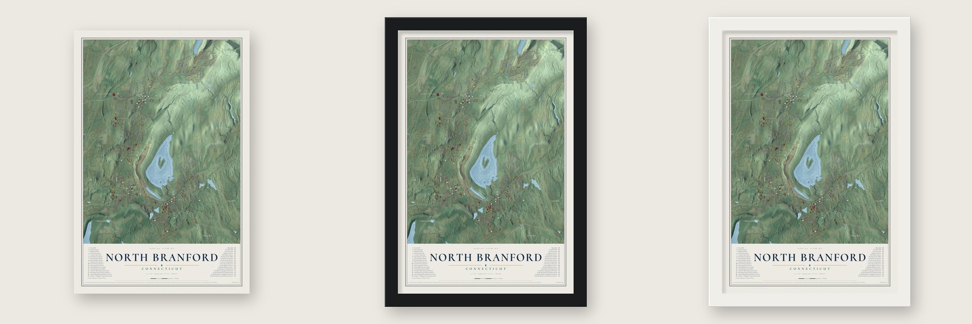
Unframed archival matte, a black wood frame or a white wood frame.
Up close
Geography Worth Displaying
This map was created using accurate cartographic data and authoritative geographic sources, including the U.S. Geological Survey (USGS) and FEMA. The map brings together terrain, waterways, roads, and building detail. The majority of the streets are labeled, houses are accurately depicted, and the topography is derived from government sources. Combining local data with carefully composed color and shading leads to this beautifully detailed North Branford artwork for your wall.
Rather than simply showing street outlines, we’ve included as many of the street names as we could reasonably fit on the map while keeping their names legible. Zoom in on the high resolution preview to see exactly what’s on the map. We truly set out to create a statement piece for anyone who loves North Branford. So whether it’s for you, or a gift for someone you love, we hope this map of North Branford brings back fond memories.
Explore the full map of North Branford, Connecticut and read about the local places it shows.

Find your street
Names on the North Branford map
Every name below is printed on this map. Look for your street, your school, the park where you played, or the pond down the road.
Places and landmarks26
- Clintonville
- Angeloni Preserve
- Atwater Library
- Big Gulph
- Connecticut Sportsplex
- Edward Smith Library
- Fourth District School
- Great Hill
- Harrison Farm Preserve
- Howd--Linsley House
- Lake Gaillard Watershed Reserve Land
- McCluskey Preserve
Show all 26 places
- Mill Road Field
- North Branford Center Historic District
- North Branford High School
- North Branford Intermediate School
- North Branford Post Office
- North Branford Town Hall
- North Farms Park
- Northford Center
- Notch Hill
- Stanley T. Williams Community Center
- Swajchuk Park
- Totoket Valley Elementary School
- Totoket Valley Park
- Twin Lakes Golf Course
Streets and roads12
- Woodvale Dr
- Tommys Path
- Walnut Ln
- Mill Rd
- Totoket Rd
- Pomps Ln
- Briarwood Dr
- Wilford Rd
- Beech St
- Lake Rd
- Hill Rd
- Branford Rd
Names are listed as they appear on the printed map. Zoom into the product photos to find them.
About North Branford, Connecticut
North Branford is a town of 13,544 people in New Haven County, under the traprock ridge of Totoket Mountain. All the land between the coast and the hills once went by the name Totoket, and New Haven's settlers bought it from the Indian sachems in 1638 before settlers from Wethersfield purchased it in 1644 and founded Branford. As families moved north to farm, Branford's northern farms won their own Congregational parish in 1717, organized a church in 1725 and ordained Rev. Jonathan Merrick as their first minister in 1727.
Farther north, at a place the Indians seem to have called Paug, Northford became a parish of its own in 1745. The North Branford green was laid out in 1765, and the militia mustered on it during the Revolution. Colonel William Douglas came home sick from the fighting around New York in 1777 and died at Northford. In 1831 the two parishes were incorporated together as one town, and on April 12, 1866, a Soldiers' Monument of Stony Creek granite was dedicated on the green.
“Northford has furnished more liberally educated men and women for various professions than any other place of equal size in the whole state.”
- 6,000 screws a minuteA 1925 history credits Maltby Fowler with Connecticut's first four-wheel vehicle. Trading barrels for buttons, he opened a Farm River shop in 1830 and ran four peddlers' carts. His machines made buttons, combs, spoons, gimlets and pins, and the pin machine went to Waterbury once it took up pin making. Thaddeus Fowler's pin works left the old Maltby mill for Seymour in 1860. Thaddeus and brother DeGrasse are credited with a screw machine producing 6,000 screws a minute.
- Coconut prize in 1876Around 1850 E. Chapman Maltby made water dippers from West Indies coconut shells, then learned to dry and shred the leftover meat. Northford became America's home of shredded coconut, and his won first prize at Philadelphia's Centennial Exposition in 1876. He employed about forty until the business left for Shelton in 1880. Printers took over the buildings, where David Stevens made popular Christmas cards, and by 1892 cards were a chief town trade. The factory fell about 1935.
- A minister for 38 yearsNorthford's church was organized on June 13, 1750, with Rev. Warham Williams as its pastor. A grandson of the Deerfield minister taken captive to Canada in 1704, he led the Northford church for 38 years. The Warham Williams House was built for him in 1752 just south of the church. In 1978 the house was dismantled and moved to Roxbury.
- A schoolhouse saved in 1928The Fourth District School, a one-room schoolhouse, went up on Forest Road about 1800 and is one of the few Connecticut schools left from that time. In 1928 it was moved into Northford to save it. The Totoket Historical Society, founded in 1958 as the Northford Historical Institute, keeps it as a museum, and it joined the National Register in 1985.
- A saltbox from about 1705The oldest part of the Howd-Linsley House, a saltbox with a massive central chimney, went up about 1705, possibly the oldest building in North Branford. When it was restored in 1928, its 19th-century additions were stripped away. It joined the National Register in 1986.
Keep exploring Connecticut
North Branford is one of 375 Connecticut towns we've mapped. Every dot on the map is a print of its own.
The search covers every state, Connecticut first.
Near North Branford
Order 2 or more town maps and save 10%. Shown in the size and finish you picked above, so they hang as a set.
- Northford 12" x 18" / Archival Matte Print $39.99
- Totoket 12" x 18" / Archival Matte Print $39.99
- North Haven 12" x 18" / Archival Matte Print $39.99


More maps nearby: Guilford, Quinnipiac Meadows, Branford, Branford Center and East Haven.
The art of mapping a place
How This Map Was Made
Real places. Remarkable detail. Discover the layers that turn geographic data into a map of home.

The view from above
Aerial imagery reveals the character of the land: woodland, open fields, and the patterns of a place.

The shape of the land
Elevation data brings hills, valleys, and subtle changes in the landscape into view.

The details of home
Roads, waterways, and building footprints come together to make the map feel unmistakably local.

Geography becomes art
Considered color, shading, and typography bring the layers together in a map made for your wall.


Process illustrated with Mendon, Massachusetts. Aerial imagery: USDA NAIP. Terrain: USGS 3D Elevation Program. Map details and finished artwork: KNOWOL.
The Details
About This Print
Choose an archival matte print, or a black or white Ayous wood frame. The archival matte print is unframed.
Select your size and finish above to see the matching product image and price.
Materials & Craftsmanship
A contemporary map with the character of a classic atlas, printed on archival matte paper. Optional frames are made from Ayous wood.
Your printed map does not include the watermark shown in the full-map preview.
Shipping & Delivery
Free shipping within the United States. Every print is made to order in the USA.
Buying a gift? Add a note in your cart and we'll include it. We never put prices in the package.
Prints ship within 2 to 3 business days. Allow 7 to 10 days total from ordering for delivery. Timing may vary during holidays or periods of high order volume.
Read our shipping policy.
Returns and damaged prints
Each print is made to order. Change-of-mind refunds are not available after production.
If your print arrives damaged, misprinted or incorrect, contact support@knowol.com within 30 days of receiving it. Include your order number, photos and a description of the issue.
Read our full refund and replacement policy. For questions about your order, email support@knowol.com.