
Search for another town





Free U.S. delivery 7 to 10 days after you order
North Decatur, Georgia Map Art
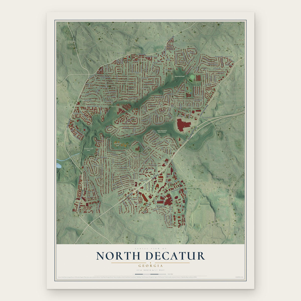
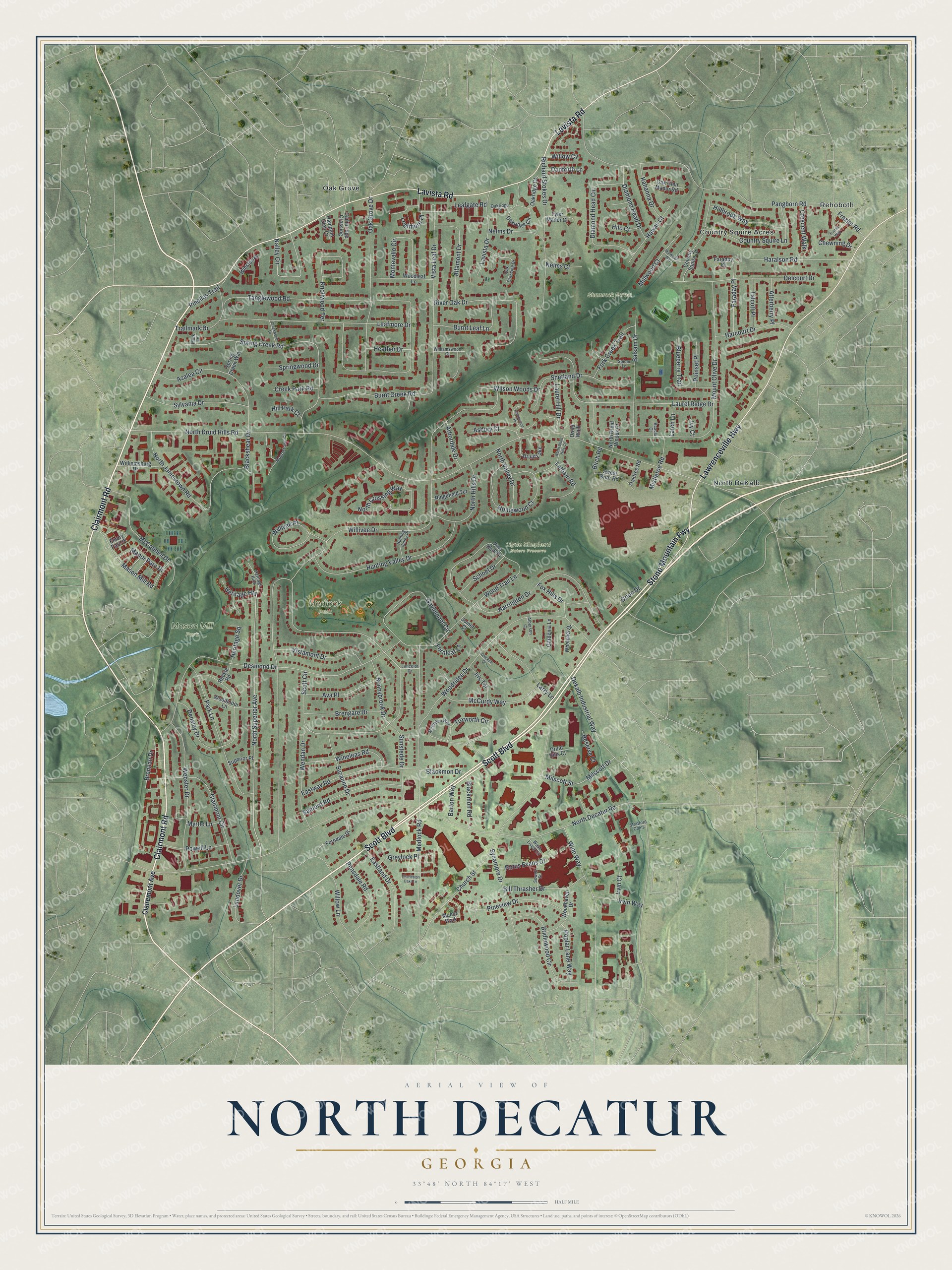
A new map of North Decatur, Georgia, made in 2026 and printed to order on thick archival matte paper.
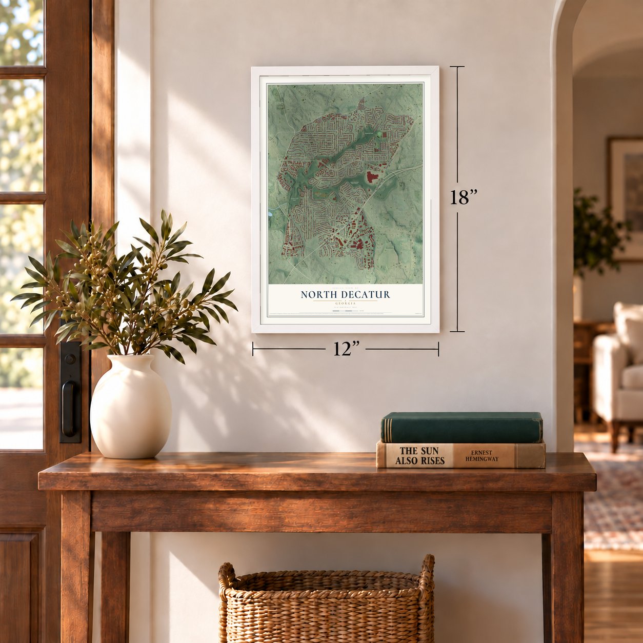
12" x 18" Archival Matte Print
A Map of Home. A Work of Art.
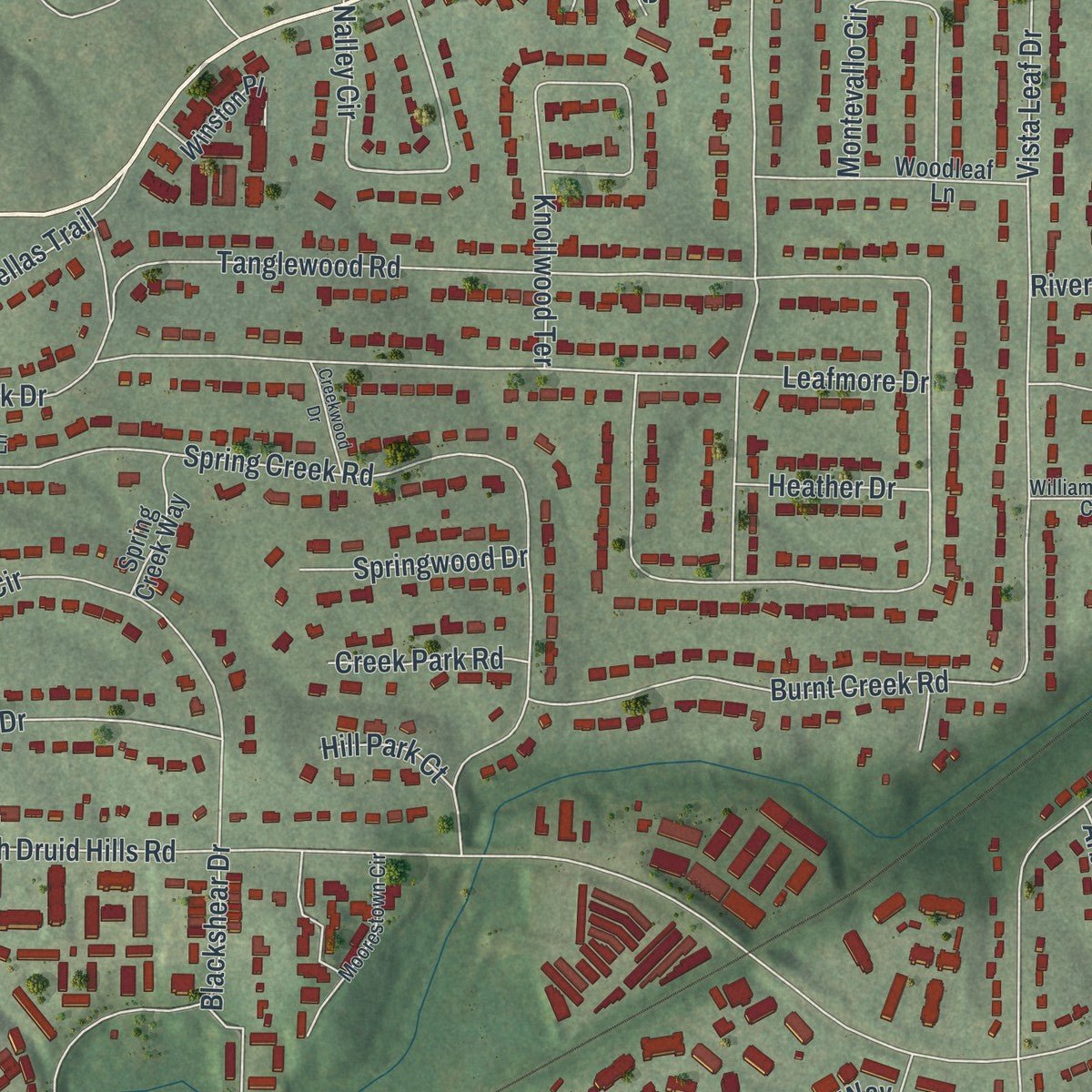
Explore North Decatur, Georgia from a whole new perspective. Created using aerial imagery and detailed geographic data, this map captures North Decatur building by building, with labeled streets, familiar landmarks, and shaded topographical relief that highlights the natural contours of the landscape.
Combining modern data with the timeless character of a vintage atlas, this map is just as interesting up close as it is beautiful on the wall. Whether you grew up in North Decatur, spent memorable years there, or call it home today, this unique map is a great way to celebrate a place that means something to you. Zoom in on the preview to look for your street, and then order a print to put your memories on the wall.
Three ways to hang it
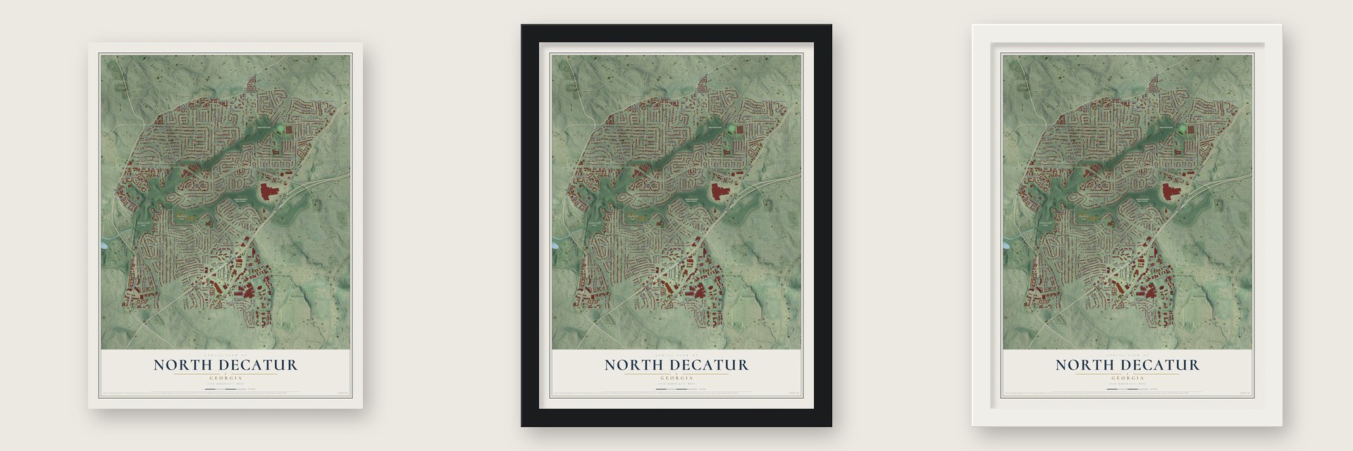
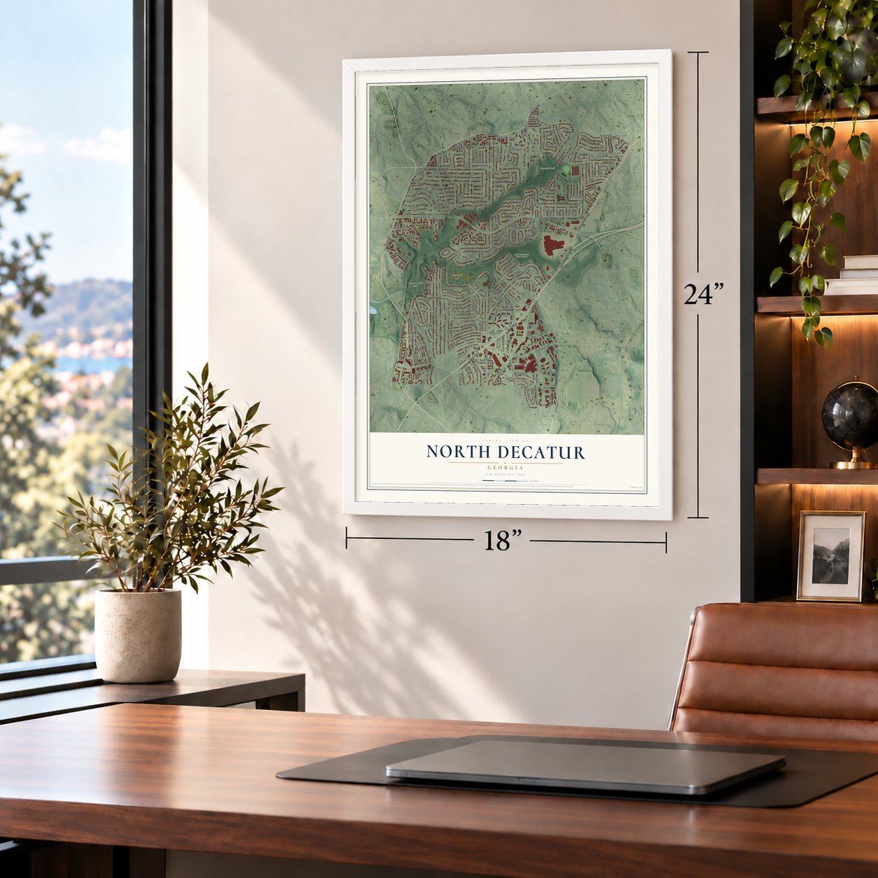
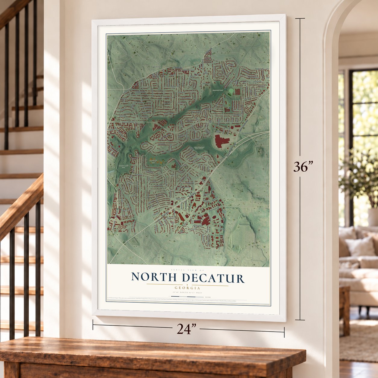
Unframed archival matte, a black wood frame or a white wood frame.
Up close
Geography Worth Displaying
This map was created using accurate cartographic data and authoritative geographic sources, including the U.S. Geological Survey (USGS) and FEMA. The map brings together terrain, waterways, roads, and building detail. The majority of the streets are labeled, houses are accurately depicted, and the topography is derived from government sources. Combining local data with carefully composed color and shading leads to this beautifully detailed North Decatur artwork for your wall.
Rather than simply showing street outlines, we’ve included as many of the street names as we could reasonably fit on the map while keeping their names legible. Zoom in on the high resolution preview to see exactly what’s on the map. We truly set out to create a statement piece for anyone who loves North Decatur. So whether it’s for you, or a gift for someone you love, we hope this map of North Decatur brings back fond memories.
Explore the full map of North Decatur, Georgia and read about the local places it shows.

About North Decatur, Georgia
North Decatur is an unincorporated community of 18,511 people in DeKalb County, on the north side of the city of Decatur. One of its early settlers was Dr. Chapman Powell, who lived from 1798 to 1870 and owned most of the land around Candler Lake and the South Fork of Peachtree Creek. Walter Candler later bought that land. Powell's cabin, called the Medicine House, stood near 1218 Clairmont Road and was later moved to Stone Mountain Park, where it is preserved.
Most of the houses here are ranch homes built in the 1950s and 1960s, when the area was laid out as a suburb. Emory University, Decatur, Midtown and Buckhead are all close by, so people now treat North Decatur as an in-town address. Condominiums have been going up in growing numbers.
- Ezekiel Mason's millEzekiel Mason built a mill on Burnt Fork Creek, on the east side of Clairmont Road. DeKalb County named Mason Mill Park for him, and a local restaurant, Mason Tavern, carries his name as well.
- Decatur's water from 1906Mason Mill Park covers 111 acres and holds the ruins of the Decatur Waterworks, built in 1906. The City of Decatur drew its drinking water from there until the 1940s.
- Toco Hills began with one pumpIn 1950 Toco Hills was nothing more than a country store, warmed by a pot-bellied stove, with one pump out front for gas. It grew into the main shopping area for several communities north of Decatur, and today it holds townhouses, churches and other places of worship, coffee shops and a cluster of shopping centers.
Find your street
Names on the North Decatur map
Every name below is printed on this map. Look for your street, your school, the park where you played, or the pond down the road.
Places and landmarks9
- Clyde Shepherd Nature Preserve
- Mason Mill Park
- Medlock Park
- Shamrock Forest
- Country Squire Acres
- North DeKalb
- Oak Grove
- Rehoboth
- Druid Lake
Streets and roads190
- Scott Boulevard
- Clairmont Road
- Lawrenceville Highway
- Stone Mountain Fwy
- Lavista Road
- North Superior Avenue
- Nalley Circle
- Willivee Drive
- North Druid Hills Road
- North Decatur Road
- Tanglewood Road
- Scott Circle
- Dekalb Industrial Way
- Pangborn Road
- Desmond Drive
- Mount Olive Drive
- Medlock Road
- Harrington Drive
- Church Street
- Woodridge Drive
- Spring Creek Road
- Laurel Ridge Drive
- Leafmore Drive
- Vista Leaf Drive
- Winn Way
- Densley Drive
- Oak Grove Drive
- North Jamestown Road
- Hunting Valley Drive
- Webster Drive
Show all 190 streets
- River Oak Drive
- Park Lane
- Gaylemont Circle
- Delcourt Drive
- Azalea Circle
- Homewood Court
- Tuxworth Circle
- McConnell Drive
- Wood Trail Lane
- Diamond Head Circle
- Clairmont Circle
- Knollwood Terrace
- Nelms Drive
- Eastway Road
- Country Squire Lane
- Shetland Drive
- Balsam Drive
- North Crossing Way
- Willivee Place
- Mason Mill Road
- Brennan Drive
- Bridlewood Circle
- Burnt Creek Road
- Pineview Drive
- Leafgate Road
- Sylvania Drive
- Sanford Road
- McCurdy Way
- Sunnybrook Drive
- Haralson Road
- Altamont Drive
- Montevallo Circle
- Vistamont Drive
- North Hills Drive
- Wendan Drive
- Wineleas Road
- Burnt Leaf Lane
- Eastland Drive
- Lavista Drive
- Bill Thrasher Drive
- Larry Lane
- Richard Stokes Drive
- Milscott Drive
- Milscott Street
- Blueberry Trail
- Trailmark Drive
- Hillbrook Way
- Harcourt Drive
- Sycamore Drive
- Rufus Evans Drive
- Suzanne Drive
- Ava Place
- Brengare Drive
- Diamond Head Drive
- Landover Drive
- Pensdale Road
- Blackshear Drive
- Sunstede Drive
- Hawaii Court
- Willow Lane
- Powell Lane
- Fork Creek Trail
- Millwood Court
- Faraday Place
- North Valley Drive
- Wilson Woods Drive
- Poplar Lane Way
- Latham Road
- Kahanna Drive
- Schoel Drive
- Fox Hills Drive
- Laurel Hill Drive
- Manor Parc Drive
- Mistletoe Road
- Blackmon Road
- Asbury Court
- Springwood Drive
- Leafmore Place
- Talcott Place
- Irvin Way
- Pinellas Trail
- Arbordale Drive
- Irvin Court
- Frazier Road
- Heritage Square
- Blackmon Drive
- Atterberry Place
- Creek Park Road
- Crescent Walk
- Poinset Place
- Heather Drive
- Greylock Place
- Reserve Court
- Heritage Heights
- Iris Terrace
- Barton Way
- Chewning Drive
- Danforth Lane
- Nelms Court
- Myrtle Lane
- Willow Cv
- Hill Park Court
- Orion Drive
- Larch Lane
- Fernleaf Lane
- Hilo Court
- Birch Road
- Ivy Court
- Clairemont Avenue
- Oakridge Circle
- Country Squire Drive
- Woodleaf Lane
- Woodhaven Drive
- Winston Place
- Woodmoor Lane
- Williamsburg Drive
- Pine Bluff Drive
- Ferndale Drive
- Ridgefield Terrace
- Sweet Briar Road
- Oak Glen Manor Road
- Cambridge Crossing
- Manor Walk
- Oakridge Court
- Faraday Court
- Spring Creek Way
- Oaktree Road
- Gardenia Lane
- Emory Parc Place
- Druid Hills Court
- Whelchel Drive
- North Druid Woods Court
- Tyler Manor Court
- Hampton Glen Court
- Superior Place
- Reckle Road
- Joiner Court
- Druid Walk
- Heritage Hills
- Moorestown Circle
- Spicer Lane
- Oak Crossing Drive
- Wash Lively Circle
- McClelen Way
- Stratford Cmns
- Williamswood Court
- Hunting Valley Place
- Sowell Street
- Oakridge Place
- Alberson Court
- Lancelot Drive
- Mark Lane
- Acacia Court
- North Druid Hills Circle
- Gavinwood Place
- Charleston Oaks Lane
- Frazier Way
- Millwood Way
- Creekwood Drive
- Crockett Court
Names are listed as they appear on the printed map. Zoom into the product photos to find them.
The art of mapping a place
How This Map Was Made
Real places. Remarkable detail. Discover the layers that turn geographic data into a map of home.

The view from above
Aerial imagery reveals the character of the land: woodland, open fields, and the patterns of a place.

The shape of the land
Elevation data brings hills, valleys, and subtle changes in the landscape into view.

The details of home
Roads, waterways, and building footprints come together to make the map feel unmistakably local.

Geography becomes art
Considered color, shading, and typography bring the layers together in a map made for your wall.


Process illustrated with Mendon, Massachusetts. Aerial imagery: USDA NAIP. Terrain: USGS 3D Elevation Program. Map details and finished artwork: KNOWOL.
The Details
About This Print
Choose an archival matte print, or a black or white Ayous wood frame. The archival matte print is unframed.
Select your size and finish above to see the matching product image and price.
Materials & Craftsmanship
A contemporary map with the character of a classic atlas, printed on archival matte paper. Optional frames are made from Ayous wood.
Your printed map does not include the watermark shown in the full-map preview.
Shipping & Delivery
Free shipping within the United States. Every print is made to order in the USA.
Buying a gift? Add a note in your cart and we'll include it. We never put prices in the package.
Prints ship within 2 to 3 business days. Allow 7 to 10 days total from ordering for delivery. Timing may vary during holidays or periods of high order volume.
Read our shipping policy.
Returns and damaged prints
Each print is made to order. Change-of-mind refunds are not available after production.
If your print arrives damaged, misprinted or incorrect, contact support@knowol.com within 30 days of receiving it. Include your order number, photos and a description of the issue.
Read our full refund and replacement policy. For questions about your order, email support@knowol.com.
Find your town
Looking for another city?
Find a map of home in our Georgia collection, or any town in the country.
Nearby
Maps of towns near North Decatur
Know someone from one of these towns? Their map makes a great gift.
 Scottdale
, Georgia
From $39.99See the map
 Emory
Emory, Georgia
From $39.99See the map
 North Druid Hills
, Georgia
From $39.99See the map
More maps nearby: Decatur, Clarkston, Druid Hills, Avondale Estates and Edmund Park.